THE BOOK
Some of the ideas discussed in this blog are published in my new book called "The Stonehenge Bluestones" -- available by post and through good bookshops everywhere. Bad bookshops might not have it....
To order, click
HERE

Wednesday 30 November 2022

Kaldalon and Drangajökull


The nunataks of Hrolleifsbjorg and Reydarbunga


 Kaldalon glacier -- spring snow cover.  This photo from 2007 was taken shortly after the 1995-2005 surge, during which the glacier advanced and thickened by about 85m.

There's a nice gallery here -- photos taken on a skiing trip from Kaldalon and up onto Drangajokull in good weather at the end of April 2007.  The snowcover is still quite extensive -- and since 2007 there has been very rapid melting on Kaldalonsjökull and on the ice cap itself.

https://leifur.smugmug.com/Outdoors/2007/Empty-9/


Mountain refuge hut


Hrolleifsbjorg (I think)


Monday 28 November 2022

Basalt dyke, Hornstrandir


How's this for a basalt dyke? Under the cliffs of Hornstrandir, NW Iceland.  Here almost all of the rocks are layered basalts, but every now and then we have to encounter a feeder dyke or a dyke that has simply exploited a long fissure without necessarily reaching the surface .  This is a particularly splendid example.......

The Preseli ice cap


I found the above reconstruction in an old (2014) article in "Current Archaeology" by Tim Darvill and Geoff Wainwright.  They were not, of course, at all interested in the past existence of  Preseli ice cap -- but it happens to show pretty well what its dimensions might have been on several occasions during the Ice Age.  I suspect that there might have been more extensive ice on the north flank of the main upland ridge, and more in Cwm Cerwyn, close to the summit called Foelcwmcerwyn -- but you get the general idea.

Ignore the marked sites -- they simply show archaeological sites that were of interest to the authors of the article.

The small ice cap (which MUST have existed) is still somewhat mysterious -- and I am still trying to work out whether it had a role in carrying spotted and unspotted dolerite erratics NORTHWARDS down towards the valley of the Afon Nyfer.  There are too many of them dotted about in the landscape  -- mostly big irregular shaped boulders of no use as monoliths or gateposts -- to suggest that they have been carried by human beings.  I am still on the case....... and as readers might recall, I have been changing my mind rather often on the matter of the erratic "cluster" near Glan yr Afon!


Sunday 27 November 2022

Kaldalonsjökull and the Drangajökull ice cap


Winter satellite image, showing the ice cap and the main outlet glacier troughs.  The Kaldalon valley runs towards the bottom left corner of the image.  Note that the ice cap is asymmetrical -- the highest part is towards the eastern edge.

My old friend Dave Sugden has produced a little booklet based on his diary of the Oxford Icelandic Expedition 1960, which we jointly led and organized.  (It was not exactly a gigantic undertaking.  There were only 4 of us, but one has to start somewhere.......)  We were in the field for a month, and the total cost was £360!!  Anyway, very pleasant and nostalgic reading.

We worked hard while we were in the field, and our mapping (plane table and no theodolite) and observations led to our first ever publication, in the journal Geografiska Annaler.  It was very descriptive and naive, but as I said, one has to start somewhere.......

https://www.researchgate.net/publication/262414815_The_Morphology_of_Kaldalon_a_Recently_Deglaciated_Valley_in_Iceland

I had forgotten the details of our trip onto the ice cap on 18 July 1960 -- our first experience of working with ropes and ice axes in crevassed terrain.  We encountered no great hazards, but close to one of the summits on the ice cap we encountered a vast crevasse which we were not equipped to deal with. We were in thick cloud and working off compass bearings, with visibility around 20m.   So then we had no option but to turn back.  That was an 18-hour day, and we were all exhausted at the end of it. 


The three nunataks near the eastern edge of the icecap, seen from Reykjarfjordur.


The present extent of the ice cap, showing the outlet glaciers, nunataks and surface contours. The whitish area shown beyond the current ice cap limits shows the extent of the ice during the Little Ice Age.  At that time the three outlet glaciers pushed several km along their troughs towards the coast.


Bing satellite image of Kaldalonsjökull -- early summer, when the upper part of the glacier is 
still snow covered.


Bing satellite image of the Kaldalon Valley, where we worked intensively for a month in 1960.


Our 1960 map of the main features of the valley


Saturday 26 November 2022

Kjove Land and the 134m marine limit


I have been doing a lot of reading recently on the glacial chronology of East Greenland, and I'm staggered to find that the 134 m marine limit in Kjove land (near the exit of Nordvestfjord into the wider gulf of Scoresby Sund) has survived the passage of time and is still accepted as accurate.  As is the 101 m shoreline associated with a short-lived glacier advance.

I've been reading a string of recent articles about the marine features, glacial succession and climate changes in the area, written by researchers with helicopter backup and access to the full range of modern surveying instruments, GPS gadgets and up to date digital maps ---  and all the checks done by them have shown that we were pretty well spot on. When Dave Sugden and I were at work in 1962 all our equipment had to be man-hauled,  and the only equipment at our disposal was a theodolite, a long tape and a surveying measuring staff  -- and a pencil and notebook.  We didn't even have an electronic calculator for working out our measurements.  Neither did we know where msl was located -- we had to do our own tidal observations and work that out for ourselves.

I'm not sure that we can say that "the old ways are best" -- because we spent hundreds of hours just walking and humping heavy gear around the place in very rough terrain -- but in terms of "job satisfaction", looking back on it, it  was not too bad.......

Archaeology, hypocrisy and double standards


The myth makers.  What's good for the goose is good for the gander

This is all quite entertaining. There is a huge fuss going on right now about a charlatan who has been involved in a rather spectacular and controversial TV programme promoting "pseudo-archaeology" and "pseudo-history" in pursuit of personal glory and personal profit. He is accused of the following crimes:

1. Wildly misinterpreting or "over-interpreting" evidence in the field

2. Maintaining a pretence that he is an expert while writing in a field in which he is spectacularly under-qualified

3. Developing a ruling hypothesis and turning it into an over-arching myth

4. Cherry picking his evidence and his sites

5. Withholding or ignoring countervailing data and inconvenient evidence brought to his attention by others

6. Choosing to ignore context

7. Pandering to the public desire to believe in heroic ancestors and lost wisdom

8. Pandering to the media demand for spectacular stories and dramatic headlines

9. Failing to give due respect to the inconvenient opinions of experts in related fields

10. Failing to subject the evidence and the arguments to unbiased scholarly peer review.

11. Misrepresenting the current state of understanding in certain fields

12. Highlighting expert disagreements and using those to "demonstrate" that a certain discipline is of dubious value, being filled with "pseudo-experts"

13. Destroying respect for the truth and for science, by impairing the ability of viewers and readers to discern the true from the biased, and the credible from the false.

14.  Basing a whole narrative on a strictly personal conviction of what reality and the truth are, and framing it in such a way that people think he’s presenting something scientific.

So who are we talking about here?  Well, Graham Hancock, of course, since the newspapers and social media are full of him.  He no doubt thoroughly enjoys the notoriety, and  Netflix enjoys the polarised debate and the extensive press coverage too, because the more furious the archaeologists and historians become, the more viewers they get for their infamous TV series.

But hang on a bit.  The words "hypocrisy" and "double standards" spring to mind, because the very archaeologists who are now getting into a lather about somebody who has the temerity to promote a wildly exotic narrative or myth which is unsupported by the facts are the very same people who have turned their academic discipline into a "story telling" paradise in which facts are of only secondary importance. Post-processualism reigns, does it not?  Well, maybe not everywhere, but it has certainly been behind the development of the extraordinary bluestone myth promoted over the last decade by MPP and his team.   What was a rather sterile and admittedly speculative tale (invented by Herbert Thomas) of some bluestones being moved over a long distance by our Neolithic ancestors has turned into something far more elaborate,  presented as fact. Now we have bluestone quarries, stone trans-shipments and overland transport, lost stone circles, solsticial alignments, ancestor worship, tributes and political unification, and a lot else besides.

And take a look at those 14 criticisms levelled towards Hancock by the outraged archaeological establishment. Most if not all of them can be levelled at Parker Pearson and his team, who have been utterly dedicated to the proving and expansion of a ruling hypothesis which is still, after ten years or more,  unsupported by any evidence that withstands scrutiny.  In the process they have disguised speculations as facts and conflated technology with science.

Metaphors abound.  Red herrings, wild geese, edifices built on sinky sand, black pots and kettles....... just take your pick.  

More to the point, archaeologists should refrain from going after somewhat deranged journalists and their wacky stories without first putting their own house in order.  In other words, since we are enjoying our metaphors today, people in glasshouses shouldn't throw stones.

=======================

PS. Let's end on a positive note.  Academically dodgy narratives and modern myths never survive for very long, since they are eventually undermined by science.  New research relating to Waun Mawn and the "bluestone quarries" has now shown that there never was a "lost bluestone circle" at Waun Mawn, that there are no Neolithic bluestone quarries at Carn Goedog and Rhosyfelin, that there are no links between these sites and Waun Mawn, and that the "lost circle" site has nothing to do with Stonehenge.  It's all in the literature.  The sad thing is that the perpetrators of the myth will probably be the last people to accept that it is dead and buried.


Craig Rhosyfelin -- an interesting site where the archaeologists have done a lot of quarrying.....


Thursday 24 November 2022

Glacial diffluence -- Kjove land, East Greenland


The hilly summits of the Kjove Land Plateau are seen clearly here, to the right of centre.  The five highest summits, including Pythagoras Bjerg, are not seen in this photo -- they are to the right of the right edge. They have altitudes of 1150m, 1335m, 1187m, 1190m, and 1376m. 
For comparison, Snowdon summit is at 1085m asl.

This new oblique image (taken from a helicopter) shows the Kjove Land - Syd Kap area of East Greenland where I worked in 1962 with the members of the OU East Greenland Expedition.  It reminds me that there is one big diffluence trough in the area, occupied by the twin lakes of Holger Danskes Briller, and also another which has previously escaped attention, on the southern flank of the lakes trough.  I'm not sure whether this valley has a name, but it's quite spectacular, showing up particularly well in this image of a snow-covered landscape:


The last occasion on which these troughs were used by glacier ice was during the "Milne Land Stage" at the end of the last glacial episode.  In the lakes trough the ice reached a prominent moraine with a "delta top" which demonstrates that relative sea-level at the time was 101 m higher than it is today.  The smaller trough was used by ice escaping from the lakes trough -- probably "forced" by ice additions to the Nordvestfjord Glacier carried by Oxford Glacier and other glaciers flowing southwards from the Staunings Alps. The high col over which the ice spilled is about 700m asl.  The ice flowed along the east flank of Pythagoras Bjerg and then fanned out across the gently undulating Kjove Land Plateau to terminate at the scattered morainic remnants referred to as "Hjörnemoraene"  (corner moraine) at an altitude of c 100 m.

https://brian-mountainman.blogspot.com/2021/09/on-diffluence-holger-danskes-briller.html

https://brian-mountainman.blogspot.com/2021/09/the-nordvestfjord-threshold.html

https://www.researchgate.net/publication/264811455_Deglaciation_of_the_Scoresby_Sund_fjord_region_north-east_Greenland

https://brian-mountainman.blogspot.com/2019/08/syd-kap-and-bear-islands-east-greenland.html


The Holger Danskes Briller terminal moraine and delta terrace, at an altitude of c 101 m


Some years ago I argued that the Kjove Land Plateau and Pythagoras Bjerg stood up as a nunatak at the time of the Milne Land Stage (c 11,000 years ago) and that the Hjornemoraene remnants were lateral moraine remnants formed on the right flank of glacier ice flowing southwards towards Syd Kap.  I don't think that's supported by the new information, and so I now think there was a local ice cap on this upland area, providing ice that flowed down into Nordvestfjord over very steep precipices in the west and down the small steep valley on the southern edge of the plateau.    The ice was supplemented by the diffluent ice stream overflowing from the lakes trough which terminated at the southern plateau edge.  This means that Hjornemoraene and the related morainic ridges extending over several km must be interpreted as terminal moraines, some of them aooarently marking a calving ice terminus.  The explains the close association with the shoreline traces around 101 m asl which David Sugden and I mapped in 1962.  This must have been a messy situation -- one day somebody will sort it all out........

The marine features and moraine remnants mapped by David Sugden and myself in 1962.

Probable directions of ice movement at the Milne Land Stage, around 11,000 years ago.


See also:

SUGDEN, D. E. and B. S. JOHN (1965) 'The raised marine features of Kjove Land, east Greenland', Geogrl. Jnl. 131, pp 235-47
https://www.researchgate.net/publication/262414669_The_Raised_Marine_Features_of_Kjove_Land_East_Greenland

Goehring, B. M., Kelly, M. A., Schaefer, J. M., Finkel, R. C. and Lowell, T. V. 2010. Dating of raised marine and lacustrine deposits in east Greenland using beryllium-10 depth profiles and implications for estimates of subglacial erosion. J. Quaternary Sci., Vol. 25 pp. 865–874. ISSN 0267-8179.
https://doi.org/10.1002/jqs.13


Funder, S. 1972
Deglaciation of the Scoresby Sund fjordregion, north-east GreenlandSVEND FUNDERInstitute of Historical Geology and Palaeontology, University of CopenhagenDeglaciation of the Scoresby Sund fjord region, north-east Greenland.
https://www.researchgate.net/publication/264811455_Deglaciation_of_the_Scoresby_Sund_fjord_region_north-east_Greenland


Helena Alexanderson & Lena Håkansson (2014) Coastal glaciers advanced onto Jameson Land, East Greenland during the late glacial–early Holocene Milne Land Stade, Polar Research, 33:1, 20313, DOI: 10.3402/polar.v33.20313
https://doi.org/10.3402/polar.v33.20313

Hall, B.L., et al., Relative sea-level changes, Schuchert Dal, East Greenland, with implications for ice..., Quaternary Science Reviews (2010),
https://doi.org/10.1016/j.quascirev.2010.03.013

The three Antiquity papers behind the heroic bluestone myth


These are the three academic journal articles that have been responsible for the promotion of the "heroic bluestone myth" not just involving bluestone transport from Preseli to Stonehenge (that one has been around for a century or so) but incorporating bluestone quarrying, "proto Stonehenge" in the form of a lost stone circle at Waun Mawn, and even stone moving motives associated with the political unification of Neolithic Britain, centred on Stonehenge.  That narrative, which seems to get more convoluted with every year that passes (see below), is assumed to be true and unchallenged, in defiance of many articles in the literature that do indeed challenge its essential components.  The key assumptions made with respect to Rhosyfelin, Carn Goedog and Waun Mawn are all disputed, and yet the disputes are NEVER mentioned in any of the articles.  And yet these articles have been accepted for publication by the Editor of Antiquity Journal.

The Editor was also closely involved in the media promotion of the "lost circle" paper, working closely with the article authors and the BBC to coordinate publication with the first transmission date for the infamous Alice Roberts documentary.  A press embargo prior to that date was strictly enforced, leading to a highly orchestrated "media blitz".  I would have no problem with that, had the research been important, and of top quality.  But it wasn't.  It was unconvincing and unsupported nonsense, as many observers immediately pointed out on social media.


I am not the only earth scientist to say that these three articles are among the worst "scientific" papers I have ever seen.  So there is culpability here, on the part of the journal and its editor.  This sits alongside the culpability of the 15 or more named authors, who are listed in the three articles as co-authors and not as the writers of specific parts of the text or as the providers of technical services.

As noted in this post, all of the co-authors have chosen to share the responsibility for the writing of the text and for all of the interpretations and conclusions drawn.  If they had reservations about anything, they had ample opportunities to leave the project led by MPP and to question the evidence presented and the conclusions drawn.  They chose to bask in the shared glory of media coverage of the publication of each paper in turn, and some of them even appeared in their "expert" roles on the telly -- most recently in the notorious Alice Roberts "Lost Circle" documentary. The geologists, who should have stuck to their good work on the provenancing of the bluestones, have devalued their own research over and again by emphasising (quite gratuitously) its role in the development of the MPP bluestone narrative.   

Now they are all stuck in a quagmire of their own making, as one new piece of research after another demonstrates that all of the key components of the narrative are nonsensical.  Some of us have been telling them that for the past decade or more -- but they have turned their deaf ears to everything while making their central narrative more and more preposterous.  Some of the co-authors have certainly been led astray and exploited by the small team of senior academics who have fashioned the narrative.  But do I feel sorry for any of them?  No way.  What we have been looking at is pretty serious scientific malpractice, and the actions of the key players should now be seriously scrutinized by the relevant university authorities. 
  

=============================

THE THREE ARTICLES

1.  Parker Pearson, M. et al. 2015. Craig Rhos-y-felin: a Welsh bluestone megalith quarry for Stonehenge. Antiquity 89: 1331–52.


2.  Parker Pearson, M. et al. 2019. Megalith quarries for Stonehenge's bluestones. Antiquity 93: 45–62. 

https://doi.org/10.15184/aqy.2018.111  (may be behind a paywall)

3.  Pearson, M. et al. 2021. The original Stonehenge? A dismantled stone circle in the Preseli Hills of west Wales. Antiquity, 95(379), 85-103. 

https://doi.org/10.15184/aqy.2020.239

Multi authors:   

No 1:  Mike Parker Pearson, Richard Bevins, Rob Ixer , Joshua Pollard, Colin Richards Kate Welham, Ben Chan, Kevan Edinborough, Derek Hamilton, Richard Macphail, Duncan Schlee, Jean-Luc Schwenninger,
Ellen Simmons and Martin Smith

No 2:  Mike Parker Pearson, Josh Pollard, Colin Richards, Kate Welham, Chris Casswell, Charles French, Duncan Schlee, Dave Shaw, Ellen Simmons, Adam Stanford, Richard Bevins, Rob Ixer

No 3:  Mike Parker Pearson,  Josh Pollard, Colin Richards, Kate Welham, Timothy Kinnaird,  Dave Shaw, Ellen Simmons, Adam Stanford, Richard Bevins, Rob Ixer, Clive Ruggles, Jim Rylatt and Kevan Edinborough.

==========================

The latest twists in the narrative:

1.  Probably only one monolith was ever quarried from Rhosyfelin. They intended to take lots more, but maybe never got round to it..... so an elaborate quarrying infrastructure was set up, all for no particular reson.

2.  Rock wedges were the key quarrying implements at both Rhosyfelin and Carn Goedog.  But the wedge in one of the two "fracture locations" at Rhosyfelin was probably hammered in as practice for more important things to come...... the wedge in the other location makes no sense either.

3.  Because there are so many rock types in the Stonehenge bluestone assemblage, the rock types themselves were not given great significance.  It's the "lost circles" in which the stones were set that had special status or cultural significance. 

4.  Waun Mawn never did have a full or even partial stone circle.  But the important thing is that the local tribes had the INTENTION to build it.

5.  A great oak tree at the exact (or approximately exact) centre of the Waun Mawn circle, with an associated hearth, was clearly the focal point for the standing stone setting.

6.  The stones used at Waun Mawn were fetched from Cerrig Lladron, so there must have been a quarry there, even though there is no sign of it.

7.  Although Waun Mawn had no demonstrable links with Stonehenge, it was still important in the Stonehenge story, for some reason or other.

8.  There must be other "lost circles" in the area which must have provided the bulk of the stones for the Stonehenge bluestone settings.  One day they will no doubt be found.

9.  The stoneholes supposedly marking the edges of the Waun Mawn "entrance" are 15 m apart. (As accepted by Clive Ruggles, an arc of that width cannot possibly be claimed to be accurately orientated on the midsummer solstice.)

10. The "unfinished" bluestone circle at Waun Mawn is matched by the "unfinished" bluestone Q and R hole settings at Stonehenge, and that demonstrates a relationship.

11.  Quote: "We now know that monuments were erected close to the quarries and subsequently dismantled, at around the same time as the unparalleled transporting of approximately 80 Bluestone monoliths to form two Neolithic stone circles 170 miles away on Salisbury Plain."   (That is garbled nonsense, suggesting functional relationships where none have been demonstrated.)

=========================

If it were not so serious, this has all become rather hilarious.  Which brings me back to a claim I made quite some time ago.  This is really just a gigantic hoax, perpetrated by a group of jolly academics intent on finding out just how far they can go with scientific fraud and the perpetration of a fantastical and ultimately worthless narrative.  So far, they have got away with it, which is rather intriguing!


Wednesday 23 November 2022

Antarctic iceberg tracks map -- a thing of beauty


This is one of the new maps featured in "The Antarctic Atlas".  It shows plotted  iceberg tracks over a number of years, with each year shown in a different colour.  Several things are striking.  

The first is the way in which the bulk of icebergs coming from the ice fronts around the coasts of the east Antarctic ice sheet hug the coast, in spite of the very cold katabatic winds that scream dow from the ice sheet interior which might be expected to carry them far out to sea.  So they are pushed up tight against the coast by ocean currents. The bulk of them are moving anti-clockwise, carried by the Antarctic Coastal Current (ACC). That's in the opposite direction to what we used to think 50 years ago....

The second feature is the extraordinary concentration of bergs in the Weddell Sea, also moving on a broad anti-clockwise spiral.  Many of the big bergs that reach the Weddell Sea are carried on the "conveyor belt" of the ACC, but vast numbers also come from the edges of the Filchner and Ronne Ice Shelves, carrying ice from the West Antarctic Ice Sheet at a rate of c1 km per year.  This is labelled "Iceberg Alley", and it is not surprising that Shackleton and the "Endurance" fell foul of the chaotic and ever changing sea ice enironment in the Weddell Sea during the famous 1915 expedition.

Many of the bergs are carried northwards towards the South Orkney Islands and then South Georgia, but most of them break up and melt away as they encounter warmer and very stormy seas of the middle latitudes.

The Ross Sea is another area of iceberg concentration, again fed by the glaciers and shelves of the West Antarctic Ice Sheet being carries counter-clockwise.  But the Ross Sea is not so tightly enclosed as the Weddell Sea, abd so there are more frequent iceberg breakouts,  with a wide variety of tracks followed, partly influenced by shifting wind patterns.

The Amery Ice Shelf and the Lambert Glacier are feeding so much ice out the the East Antarctic coast that many icebergs break through the ACC and waste away many hundreds of kilometres offshore.


Monday 21 November 2022

Multi authorship, scientific misconduct and corporate responsibility


There has been an interesting discussion on social media about "corporate responsibility" in multi-authored papers where scientific malpractice or fraud is exposed, or where  there has been "interpretative inflation" and an over-claiming of research impact. The interpretation of "impact" is of course somewhat subjective, and the authors of papers will have a tendency to over-estimate the importance of what they have written while their opponents will tend to be more sceptical and maybe even cynical!  Basic scientific fraud is of course easier to expose where it proves that experimental results are impossible for others to replicate or that phenomena described in digs or exposure have been invented or fabricated in a deliberate (or desperate) attempt to prove an hypothesis.  Fraud -- whether in a lab, or in the statistical manipulation of data, or in the field -- is of course a very serious matter, and when it is exposed papers can be retracted and careers are often ruined.

In the discussions on social media the view was expressed by one contributor that in multi-authored publications the blame for fraud or interpretative inflation should be carried by the lead author but that maybe the junior authors or "hired experts" in a group should not be held culpable since they may well just have contributed radiocarbon dates, or geochemical or isotope analyses, or drone mapping to a project and they may not even have seen the text of an article prior to its publication.  My response, in the context of a discussion about the collapse of the bluestone quarrying / lost circle narrative, is that it is invidious to single out one person (the mysterious MPP) as the villain of the piece, and that if authors have agreed to the use of their names on a multi-authored piece because they want a share of the limelight, then they should be prepared to "own" contents which are later shown to be nonsense. 

Digging a bit deeper......

Quote: 

Q: Should every co author be held accountable for the integrity of every aspect of a study or publication?
A: In most cases, authors will be expected to take joint responsibility for the integrity of the research and its reporting. However, if authors take responsibility only for certain aspects of the research and its reporting, this should be specified in the publication.


This is an interesting open access paper:

https://www.ncbi.nlm.nih.gov/pmc/articles/PMC6096512/
Gert Helgesson and Stefan Eriksson (2018)
Responsibility for scientific misconduct in collaborative papers
Med Health Care Philos. 2018; 21(3): 423–430.
Published online 2017. doi: 10.1007/s11019-017-9817-7

Abstract
This paper concerns the responsibility of co-authors in cases of scientific misconduct. Arguments in research integrity guidelines and in the bioethics literature concerning authorship responsibilities are discussed. It is argued that it is unreasonable to claim that for every case where a research paper is found to be fraudulent, each author is morally responsible for all aspects of that paper, or that one particular author has such a responsibility. It is further argued that it is more constructive to specify what task responsibilities come with different roles in a project and describe what kinds of situations or events call for some kind of action, and what the appropriate actions might be.

This is a long and detailed analysis -- just one paper in a huge list of studies on scientific ethics, academic malpractice and individual and corporate responsibility.  The authors are particularly concerned with medical or bio ethics, so one might argue that "special circumstances" might apply.  In pharmaceutical research, for example, fraudulent research (if not exposed) might have life or death consequences.  But Helgesson and Eriksson get themselves into a bit of a tangle by refusing to acknowledge "evil intent" driven by commercial considerations -- something I have direct experience of in the journal Nature Biotechnology.  

Much of the discussion in this paper is about the pros and cons of corporate responsibility in collaborative papers, and H&E suggest that it would be counterproductive for ALL authors to be blamed for the misdemeanours of one of their colleagues.  However, journals nowadays increasingly require the authors of collaborative papers to specify EXACTLY what each author has contributed, eg. writing, text revision, geology, statistical analysis, radiocarbon dating, excavation team management, site surveys, etc. 

Quote:

Co-authors of scientific papers should not be held responsible for misconduct unless they were personally involved in the actions constituting scientific misconduct, or encouraged misconduct, or knew about or suspected it without taking appropriate action.

The reason for this is that responsibility for research misconduct must be on par with the responsibility we assume in other cases of wrongdoing, and thus intention or recklessness needs to be present.
One consequence of this is that you should not be held responsible for your collaborators’ fraudulent behaviour if you were unaware of it and had no indications of what was going on. This can easily be the case in large collaborations where different groups make their contributions independent of one another, while a small group of researchers lead and orchestrate the work. This is not to say that researchers remain without any responsibility as long as they do not commit misconduct themselves, do not encourage others to do it, and remain ignorant of what their collaborators are doing. Every author shares the responsibility to be attentive to signs of misconduct and is under obligation to take some kind of action if they suspect fraudulent or too sloppy behaviour by collaborators in the study in which they participate. Every author also assumes a responsibility when publishing a paper to help rectify situations where their paper’s accuracy is questioned. However, on the whole it is not reasonable, nor ethically required, that collaborators spend time and effort scrutinizing what everyone else is doing to make sure it is scientifically and ethically sound, without any indications that this is needed.

There is another view, namely that there should be at least one researcher, the guarantor, who assumes full responsibility for the paper. This is the researcher who has overall responsibility for the quality of the research findings and integrity of the research methods. 

 This is another piece of guidance: “The primary author assumes responsibility for the publication, making sure that the data are accurate, that all deserving authors have been credited, that all authors have given their approval to the final draft; and handles responses to inquiries after the manuscript is published.”  

And another:  “The guarantor accepts full responsibility for the work and/or the conduct of the study, has access to the data, and controls the decision to publish.” The idea, in short, is to identify someone with responsibility for “the integrity of the work as a whole”.

Helgesson and Eriksson do not much like the idea of the single or lead author taking responsibility for the misdemeanours of members of their team, but their arguments strike me as very feeble.  So if collaborators are not to share responsibility for the contents of a paper, and if the lead author can evade responsibility for the misconduct of assorted team members (by simply saying "I trusted him and I trusted his results.  What a pity that my trust was misplaced.......")  then scientific ethics are effectively abandoned.  Journal editors and lead authors can publish fraudulent nonsense until somebody manages to find the maverick who is responsible for the dodgy piece of work which taints or devalues the quality of the wonderful work done by everybody else........   

Scapegoats come in very handy sometimes!

This brings us back to the guiding principle mentioned at the head of this post.  If co-authors are not identified as having limited or specified roles in the research work and writing of an article, then they must accept ownership of all of it.  In cases of scientific fraud, they must accept joint responsibility for it or else demonstrate that they were not personally involved in the misconduct and did not encourage it.  Further, in the case of a team that has worked together for many years, authors must expect to be challenged with these questions: "As a member of a close team, you must have known about or questioned the work of colleague X, and if so, why did you not take appropriate action to stop it?"

The Helgesson / Eriksson paper is very informative and thoughtful, but it is flawed in three major respects:

1.  It assumes that in cases of serious scientific misconduct the blame lies with a single maverick or corrupt scientist who somehow betrays the trust of his colleagues.

2.  It fails to recognize that many articles are written which are corrupt from start to finish because they are written by teams of scientists who are directly or indirectly controlled by commercial interests such as agri-chemical industries or "Big Pharma".  These vested interests control project funding, choice of personnel, allocation of laboratory space, and the publication process.  They even, in the worst cases, predetermine experimental results. 

3.  It does not take account of situations in which a whole team of maybe 15 people can work closely together, under the leadership of one charismatic figure, to prove a ruling hypothesis by whatever means they can devise, including the fabrication of field evidence, the selective citation of collected data, and the refusal to acknowledge that their ideas are disputed in the peer-reviewed literature by anybody else.  They may also blur the lines between speculation and hard evidence,  to the extent that assumptions are portrayed as facts.

Clearly, in case number three, we are looking at extremely serious or egregious breakdowns of academic standards, with large groups of people involved in conspiracies or scientific frauds. "But surely", I hear you cry, "if things are ever as serious as that, how is it that these people manage to get their papers published in respectable journals?"  

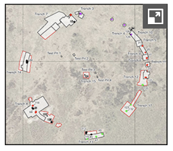
Don't ask me that question.  Address it to the Editor of "Antiquity" journal.............

===================

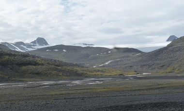
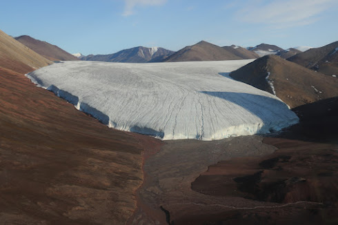
PS.  This is how it should be done if authors wish to take responsibility (and credit!) for their own work but not necessarily for everything else in a multi-authored article.  This new article in the field of glacial geomorphology has 16 co-authors:

PHB and SR designed the research and wrote the manuscript, constructed figures and tables with assistance from JD, IG, MB, GK; PHB, SR, EP, MB, DH, EH undertook fieldwork/sample collection. PHB and SB produced cosmogenic nuclide dating data; while CS provided 10Be exposure dating analytical facilities; PHB, LW, GK, SR, MB undertook radiocarbon dating. Kiteschsee Lake core data and interpretations were undertaken by SR, EP, SD (ITRAX-XRF), JD, VJ (diatom analysis) IG, SB, RM, CH (tephra counting, geochemical identification of tephra layers); PHB, SR, CS, SB, GK, EP, MB, JS edited initial drafts and all authors read and commented on the final version. The authors declare no competing interests.


Friday 18 November 2022

Scottish cattle and pigs driven to Stonehenge? Most improbable.........


Nice picture, but was this really a Scottish pig?

This is an interesting and well-informed short article criticising the "mixed messaging" of Madgwick et al who claimed in 2019 that isotope evidence pointed to animals being driven all the way from Scotland (and West Wales) before being killed and eaten in jolly BBQs at Durrington Walls.  A number of us have pointed out that a close scrutiny of the evidence does not show that at all -- and that the animals killed could well have come from much closer to hand.

This confirms the points made in a recent paper about the isotope levels associated with granites around Dartmoor, which are higher than previously assumed and which fall within the "far travelled" range chosen by the original researchers.

https://brian-mountainman.blogspot.com/2022/10/further-doubts-about-strontium-isotope.html

https://before1066.com/2021/05/23/multi-isotope-analysis-and-animal-movement-in-the-neolithic/

Well worth reading......

Rock mechanics, fractures and "quarrying wedges"


 There has been some discussion on social media recently about "rock wedges" -- following the article by Mike Parker Pearson and colleagues about the so-called "wedges" found in rock fractures at Craig Rhosyfelin.  

https://brian-mountainman.blogspot.com/2022/11/imaginary-wedges-and-useless-lumps-of.html

https://brian-mountainman.blogspot.com/2022/11/bluestone-wedges-and-death-of-science.html


Reconstructing extraction techniques at Stonehenge’s bluestone megalith quarries in the Preseli hills of west Wales,
Mike Parker Pearson, Richard Bevins, Nick Pearce, Rob Ixer, Josh Pollard, Colin Richards, Kate Welham
Journal of Archaeological Science: Reports, Volume 46, 2022, 103697

https://doi.org/10.1016/j.jasrep.2022.103697

Those who follow this blog will appreciate that I was not very impressed by the paper itself or by any of the evidence presented in support of the quarrying hypothesis.

There was a similarly lukewarm reception given (especially by quarrymen and rock mechanics experts) a few years ago when Parker Pearson and the team suggested that shale wedges had been used at the so-called "bluestone monolith quarry" at Carn Goedog.


Rock mechanics is a huge subject, and if you dig into it a little you will discover that fractures in which the void is more than 10 cms across are extremely common, and that almost always the fractures will contain debris.  That may be fine debris (silt, sand and clay) blown or washed into them, or shattered fragments of the parent rock, or -- in glacial and periglacial environments -- stones, cobbles and shards of different rock types derived from denuding till, fluvioglacial sediments or slope breccia.  Nobody should be surprised by the presence of any of these materials in cracks or fissures in any of the bedrock exposures in the British Isles..........


So if anybody wants to convince me that a lump of rock found in a crack or fissure anywhere in Pembrokeshire, either in bedrock or in broken rock debris, involves human beings using bits of stone as "rock splitting" implements, they need to come up with some pretty powerful evidence. The evidence I have seen thus far, in support of such claims, is very thin indeed.

I can accept that flattish stones were collected for use in cromlechs and other stone settings, but so abundant are such stones in the natural rock litter across the landscape that I can see no necessity for quarrying or splitting off slabs or pillars from natural rock outcrops.  For removing slabs that were already split off from adjacent rock outcrops by frost shattering or pressure release, long timber levers would have been the obvious implements to use, maybe with packing stones thrown into the crevice to stop it from closing again when the lever is removed.  I have used precisely that method myself, many times.........

But the use of wedges as envisaged by Parker Pearson and his team -- with lumps of rock in narrow cracks being hit with hand-held hammer stones or antler tools strikes me as rather silly, making a reasonably straightforward task infinitely more difficult.  "Ah yes," they will probably say.  "That was the whole point. The target stone itself was not important, but the act of removing it was invested with symbolism and duty, as an act of reverence for the ancestors.  So they WANTED to make the removal of these stones as difficult as possible."    

Excuse me while I go out and think some beautiful thoughts in the garden.......


Wednesday 16 November 2022

Thores Glacier -- a classic polar glacier


I have been reading this article about Thores Glacier in northern Ellesmere Island -- a classic cold-based glacier in the far north.  It appears very stable at the moment -- which makes a nice change.  The reason for its stability is that the glacier is frozen to its bed, with velocities of between 14 m per year and 26 m per year.  That's very slow.  So there is hardly any basal sliding going on, and all movement is by internal deformation.  The glacier is just 360m thick at its thickest point.  The ice cliffs at the front of the glacier lobe are about 60m high. 

The authors are concerned because they have discovered that the equilibrium line is rising -- this will reduce the accumulation zone surface area and will increase the tendency of surface drainage to find its way into the body of the glacier and maybe down to the bed.

I'm intrigued by the extraordinary cleanliness of the ice -- hardly any surface debris can be seen, and there is very little on the bed.  That means there is hardly any erosion going on.  Note too that the glacier is located in an area of very subdued terrain.  There are no steep slopes overlooking the glacier flanks -- this means that no rockfall debris is finding its way onto the glacier surface.  In any case this is an area of continuous permafrost -- so the freeze-thaw environment is not a very dynamic one.

It's a frozen landscape, and a stark contrast to the dynamism of glacier environments in the uplands of the middle latitudes.


Slow change since the Little Ice Age at a far northern glacier with the potential for system reorganization: Thores Glacier, northern Ellesmere Island, Canada (2022)
Kochtitsky, W. et al   Arctic Science
11 November 2022
https://doi.org/10.1139/as-2022-0012

Monday 14 November 2022

Are you sitting comfortably? Waun Mawn -- a fairy tale for kids (revised)


NB This post has been substantially rewritten to take account of Kiddle's speedy response when text inaccuracies were pointed out to them.

One of the consequences of all this fantasising by MPP and his team is that teachers pick up on their narrative nonsense and then feed it to children as if it is the truth.  To put it mildly, it's cynical and it's irresponsible -- and it's exactly what some of us have been warning about for years.

Anyway, I came across this article, which was originally very dodgy indeed,  based on the New Scientist article of Feb 20th 2021, which was in turn based on the press release issued by UCL with the assistance of the BBC and "Antiquity" journal around the time that the infamous "Lost Circle" TV programme was first broadcast.

I complained to Kiddle about the bias and inaccuracies in the original article, and to their eternal credit, the moderators of the site took my comments on board, checked out the relevant articles and made substantial changes.  So many thanks to them for that speedy action. 

https://kids.kiddle.co/Waun_Mawn

I don't know how long the original article had been out there in the public domain -- but it might already have done quite a lot of damage.  What steps are MPP and his colleagues, and these assorted august bodies, taking in order to ensure that the nation's children are not fed this sort of junk food for a moment longer?  

I hope that many concerned individuals who keep up with the literature will complain to Kiddle and other sites as necessary, and ask them to take posts down when they display unacceptable bias-- but it would be nice to see the initiative coming from those who led them all off on this wild goose chase in the first place.   Hmmm -- fat chance of that happening, I fancy......

In this case, Kiddle just needed to be informed that:

1.  There never was a "lost circle" of bluestones at Waun Mawn

2.  The four stones at Waun Mawn have nothing to do with any bluestone quarries

3.  There are no geological or archaeological links between Waun Mawn and Stonehenge.

==============

PS.  The Rhosyfelin entry is here:

https://kids.kiddle.co/Craig_Rhos-y-felin

"Stonehenge facts for kids" is here:

https://kids.kiddle.co/Stonehenge


Foel Eryr and Cerrig Lladron


A lovely autumnal photo taken up among the rocks of Cerrig Lladron. This is the latest place chosen by the geologists as the likely source of stones used in the imaginary Waun Mawn stone circle.  I don't believe this for a moment.  The geological evidence is not at all convincing, and the geologists failed to sample the obvious source of the few Waun Mawn stones -- in the dolerite outcrops on the common close to the site of the dig.  Very slapdash work altogether.......

The real reason why Cerrig Lladron was chosen for sampling was that according to the belief system of the archaeologists, and their geologist sidekicks,  the stones had to be "fetched" from somewhere rather than just picked up and used more or less where found.  In other words, human agency and human decisions had to be involved at all costs.

On the summit of Foel Eryr there is a viewing position with a panorama plaque mounted on a rather ugly stone plinth -- and also a Bronze Age burial mound.  The Cerrig Lladron tor -- or what is left of it -- is about 300m down the slope towards the NE.


I think all of the stones projecting through the turf are natural, although some think that the smaller ones might be all that is left of an old stone setting.  I examined the area pretty thoroughly, and can see no evidence in support of that assertion. 


Saturday 12 November 2022

Google Photo Archive


The full gallery of photos used on this blog since the day of its inauguration are stored in a special album which can be accessed via this link:

https://get.google.com/albumarchive/112312986974547323674/albums/photos-from-blogger

There are three albums (don't ask me why) accessible via the following links:

https://get.google.com/albumarchive/112312986974547323674/album/AF1QipMJYzO3F9DgmDGyOZHqfxtzpprXVUHZop4sDZA7?authKey=CNG5xcDg7pvwBQ

https://get.google.com/albumarchive/112312986974547323674/album/AF1QipNV5mE3dCft5nRsxbmwbyjAhwFuJGUjZyg7KNin?authKey=COn01qvAu-jVDw

https://get.google.com/albumarchive/112312986974547323674/album/AF1QipMY7RRcW-iVjciiEhc0cYjjI1v_hWxlsINkTNkZ?authKey=COCPz-q3-amrxwE

You are welcome to use any of these pics if you wish, since I am a great believer in the Creative Commons.  But please note -- if you want to use any of the images commercially you should find out who the image owner is, and get clearance, which may involve the payment of a fee.


Friday 11 November 2022

Waun Mawn -- when will we get the control dig?

There are quite a few comments on social media about the "spat" between Tim Darvill and the MPP team regarding the interpretation of the evidence from Waun Mawn.  As readers of this blog will know, there is not much doubt about where my sympathies lie  -- Tim is saying (in a very polite and measured fashion) what I have been saying for years.  But some commentators are claiming that the MPP team has introduced some "interesting new information" which deserves careful consideration.  Well, I have commented on their latest paper here:

https://brian-mountainman.blogspot.com/2022/11/parker-pearson-et-al-we-cannot-possibly.html

One aspect of the excavation work at Waun Mawn that has not been commented on by anybody else is the extraordinary bias involved in the whole dig, over three seasons.  The diggers have only bothered to dig around the circumference of their imaginary circle, and they pride themselves on having dug around quite large segments of it. There have been no control digs anywhere else across the site.  The diggers pride themselves on having found pits, sockets or stoneholes at many different locations in the areas where they have stripped off the turf -- but it's clear from my own examinations of the site that they have cited those that were convenient and ignored plenty of others.  In some areas, especially the SW quadrant, the till surface is so rough and undulating, with boulders scattered everywhere in their original positions, that many other pits could have been identified had the diggers been so inclined.

The ground surface right across this moor is made up of thin turf on top of an intermittent and variable spread of till and slope breccia.  There are pits and undulations everywhere, and there is much evidence of hollows from which stones have probably been taken either in prehistory or more recently.  This is a point made by Tim Darvill.

The same sampling bias surrounds the discovery of the "hearth" and the mysterious imprint of a giant oak tree at the "exact centre" of the circle.  These things might be unique and interesting -- but the chances are that they are not.  There might he hearths and tree remains all over the site, but no other investigations or control digs have been made -- so maybe we will never know.

This is typical of this research team -- they tell us what to believe, but only give us the evidence that they deem to be convenient while failing to accept that there are other things they should have looked at, and other interpretations that they should have considered. In other words, they have not demonstrated to anybody's satisfaction that the features that they have described with such excitement are in any way unique or important.

But truth will out, and the "results" of bad research, once it is scrutinized,  never survive for very long.


Interesting exposures in the SW quadrant.  Nice glacial deposits, and scores of pits 
and hollows........