THE BOOK
Some of the ideas discussed in this blog are published in my new book called "The Stonehenge Bluestones" -- available by post and through good bookshops everywhere. Bad bookshops might not have it....
To order, click
HERE

Monday 31 January 2022

Can a cunning plan be scheduled as an ancient monument?


The Dronescaping Britain reconstruction, showing what a Waun Mawn "lost circle" might 
have looked like, if it ever did exist...

If you are a famous archaeologist who has appeared on the telly with Alice Roberts, and if you convince yourself that 5,000 years ago some chaps in West Wales had a cunning plan to build a lost circle of bluestones out on a wild piece of moorland, but never quite got round to it, can you then apply to the authorities for the whole extent of the imaginary stone circle to be protected as a scheduled Ancient Monument?  That, strange as it may seem, is apparently what MPP has done,  in spite of the fact that some weeks ago he admitted (in his 2021 field report) that after 3 field seasons he and his team had failed to establish that there ever was a partial stone circle at Waun Mawn, let alone a completed one with 50 or more standing stones.  Welcome to the mad-house..........

I do wonder sometimes what all of MPP's co-authors (Joshua Pollard, Colin Richards, Julian Thomas, Chris Tilley, Rob Ixer, Richard Bevins, Dave Shaw, Jim Rylatt, Ellen Simmons, Duncan Schlee, Adam Stanford, Kate Welham and many others) think about this sort of thing?  Theirs are the names that are used as co-authors on one paper after another, so they have to share corporate responsibility for what appears in print.  But do they also share responsibility for the promotional and media activities of the boss?  Were they consulted before a request went in for the scheduling of Waun Mawn not just as a "stone group" but as a full stone circle?  I also suspect that a request also went in some years ago for the scheduling of Craig Rhosyfelin as an Ancient Monument, to be listed as the site of a Neolithic / Bronze Age bluestone quarry.  There was no solid evidence to support the claims of the diggers there either -- but does anybody actually notice that, or care?  (Actually, some people do care, by the look of it, since Rhosyfelin has NOT actually been scheduled -- although it is now given some protection as a RIGS site.)  I wonder if another request has gone in with respect to Carn Goedog, another imaginary quarrying site?

This all comes into sharp focus because it is clear that the project leaders of the Stones of Stonehenge team at UCL are determined to push the postulated Stonehenge / Waun Mawn connection to its limits, and far beyond.  This is in spite of the hugely disappointing (for them) results of the 2017, 2018 and 2021 Waun Mawn digs, and in spite of the fact that not a shred of evidence has been found to link Waun Mawn and that old ruin on Salisbury Plain.  In the BM exhibition about Stonehenge, due to open with great fanfares quite soon, MPP is pushing the line that the Stonehenge bluestones were parked up at Waun Mawn for several centuries, while in the process "acquiring holiness", before being shipped off with due reverence to Stonehenge.

It appears that in this post-processual world, all you have to do as an archaeologist is to dig some holes in the ground, employ some nice scientific techniques,  and then sit quietly and see inside the minds of the people whose creations you are looking at, or not, as the case may be.  Then you tell the world what those good people, all those years ago, believed in and planned to do, even if they never actually got round to doing it.  Motivation and good intentions, camaraderie and loyalty, are in the end the only things that matter. Who needs facts anyway?  Bingo! 

As I said, welcome to the mad-house. 

PS.  Thanks to Dave for pointing out that Waun Mawn was scheduled in 1950 as a "stone group" with the comment "interpretation as a circle seems particularly doubtful."  It's a bit vague as to the size of the protected area, but it's apparent that if Cadw and the other authorities accept the speculation about a vast "lost stone circle" the size of the "scheduled area" would be greatly increased.  The matter is currently under review.  

Sunday 30 January 2022

Not quite dead in the water.....


Make no mistake, dear friends --  Phil's discovery of that large erratic on the foreshore near Mumbles is of massive significance.  No matter what those involved in Stonehenge bluestone research may say, they cannot ignore the fact that for the last decade, Mike Parker Pearson's stock response to questions about the glacial transport of the bluestones has been: "Forget it.  That idea is dead in the water. Let's move on.  Next question?"  At two of his evening lectures I asked this question and received the same arrogant and complacent response -- and others have had the same experience.  With somebody whose mind is as closed as that, there is no great point in even trying to maintain a dialogue -- so for the last few years I have just stayed away from his annual lectures at the Bluestone Brewery, even though it's just a few hundred metres up the road.

All I can assume is that many years ago somebody from a geomorphology or geology background told MPP that "glacial transport of large monoliths from West Wales to Salisbury Plain was impossible"  -- and he chose to believe him,  regardless of the fact that other experts were saying quite the opposite.

Another issue at public lectures is that people just do not want to hear new evidence presented in the course of  "question and answer sessions", or even involve themselves in serious scrutiny or challenge to the points or claims being made by the speaker.  Most of those who attend are fully signed up bluestone cult members, who want to see some nice pictures, hear about the latest exciting discoveries, and want to have their sincerely held beliefs about the Stonehenge bluestones confirmed, by an ebullient and apparently authoritative senior academic. There are others who turn up and listen, and who feel distinctly uncomfortable when fanciful hypotheses and strong opinions are used as cover for a distinct shortage of hard evidence.  They don't want to make a scene either, so they mostly keep quiet.  I fully understand that. We Brits are SO polite!

Anyway, after this latest discovery, if I ever hear Parker Pearson say again that the glacial transport hypothesis is "dead in the water", I might start to get just a little upset with him..........


Some local coverage:

Friday 28 January 2022

Phil's Giant Erratic


Erratic hunter Phil Holden on the very rough and rocky foreshore close to the site of the Mumbles giant erratic. He's a photographer by profession, and he lives not far away from the find site.  He wanders along this coast very frequently, and says that he looked at the erratic several times, on a number of visits, before he realised that it was very different indeed from the Carboniferous Limestone bedrock.  He was attracted by both the colouring of the rock, and its texture,  and realised that it was very similar to a dolerite rock sample he collected many years ago from Foel Eryr, near the western end of Mynydd Preseli.  He took some high definition photos, and asked me to take a look.  I was fairly convinced that he was right in assuming the greenish rock to be unspotted dolerite.  He also asked Dr Katie Preece, an igneous rock specialist working at the Swansea University Geography Dept, to take a look, and on the basis of visual inspection she confirmed the rock as dolerite or micro-gabbro.  It was similar to the Foel Eryr sample, but the crystal sizes were different.  Whether that proves significant, time will tell.    Further work is in the pipeline, so watch this space.......

Last Sunday afternoon there was a low tide, and the weather was dry and calm -- so I hopped into the car and drove over to The Mumbles at high speed.  Phil and I took a good look at the giant erratic and at some of the nearby coastal exposures.  I became even more convinced that the erratic was made of unspotted greenish dolerite, and we compared the boulder surface with a number of unspotted dolerite samples that I just happened to have in my rucksack.  In the photo below the one on the right (from a boulder in my own garden!) looks remarkably similar.  In close-up (sorry about the lack of definition) my garden sample looks a bit greener, and the giant erratic looks a bit bluer -- but that may be a trick of the light.


But I'm not getting over-excited.  This is just the start of a long journey, and clearly samples from this boulder will need to be subjected to a whole range of analytical techniques before we can be sure what the provenance really is.

From the unspotted dolerite studies published thus far by Bevins, Ixer and Pearce, it seems that there are at least four different types of unspotted dolerite in eastern Preseli alone -- almost certainly far more if we include western Preseli and the extensive area between the upland ridge and the north coast.  Every intrusion, sill or dyke might have its own geological signature.  There's a lot of it about -- see my posts on the Preseli tors for further info.


Bear in mind, however, that in the hunt for entrainment sites we should not just concentrate on the tors.  As my friend Dave Sugden and others have shown, tors are sometimes "preferentially protected" during glacial episodes, with erosion and entrainment processes concentrated instead on fractured and damaged rock outcrops in valleys and on hillsides.

Key papers:

"Carn Goedog is the likely major source of Stonehenge doleritic bluestones: evidence based on compatible element geochemistry and Principal Component Analysis"
Journal of Archaeological Science
Richard E. Bevins, Rob A. Ixer, Nick J.G. Pearce
Journal of Archaeological Science, 19 November 2013
http://www.sciencedirect.com/science/article/pii/S0305440313003956#FCANote

Revisiting the provenance of the Stonehenge bluestones: Refining the provenance of the Group 2 non-spotted dolerites using rare earth element geochemistry
Bevins, RE, Pearce, NJG and Ixer, RA
Jnl of Archaeological Science: Reports Vol 38, Aug 2021, No 103083.
https://www.sciencedirect.com/science/article/pii/S2352409X21002959?via%3Dihub

Unfortunately both of these papers are behind paywalls, and the authors have not so far made them available on Researchgate or any other "sharing" website. 

The most accessible paper that has a bearing on the possible origins of  the Mumbles boulder is this one:


Geochemistry, sources and transport of the Stonehenge bluestones, by Olwen Williams-Thorpe and Richard Thorpe.  Proc British Academy 77 (1992), pp 133-161

They present chemical analyses of the spotted and unspotted dolerites sampled at Stonehenge, and also the Boles Barrow bluestone.


Thursday 27 January 2022

The Myth Machine and its monstrous multiplications


Here is an interesting example of how small and rather innocent myths expand and turn into monsters.  The original bluestone human transport myth, invented by Herbert Thomas in 1921, was pretty simple.  But over the years, through the involvement of Richard Atkinson and assorted others, and more recently of Mike Parker Pearson and his merry gang, it has expanded in to a myth involving ancestor worship, quarrying, feasting, political unification, the carrying of bluestones (and I mean CARRYING, not dragging), lost circle building and dismantling, and all sorts of additional details.  The myth has become an all-consuming monster, protected by its slaves who fight off all-comers and who feel that the myth monster enhances their own status and the academic institutions to which they belong.  They have become a powerful tribe of myth worshippers.  The myth has become sacred, and woe betide anybody who steps out of line of questions any of the articles of faith........

For those of us who do not belong to the cult, it all appears more than a little pathetic, and we look on in wonderment at the unquestioning loyalty of the devotees.

Now here is another interesting development.  When the Express published the breaking story of the giant bluestone erratic at Mumbles, and dared to mention that the glacier transport theory was now greatly enhanced, and the human transport theory greatly diminished,  certain of the devotees took to the Comments column and vented their fury.  This was all too predictable.  This is what one of them said, filled withy righteous anger:  

They have found the original quarry and the original stone circle site in Wales. Every blue stone in Stonehenge matches every stone in the Welsh circle site, identified by the unique foot print impression left by the individual stones. None were dropped on the way.

It would appear that at least one person, or maybe many people, think that this is true -- but it is of course complete nonsense.  In fairness to MPP, he has never claimed this or encouraged anyone to believe it.  But here we go.  It's insatiable.  The myth monster multiplies malevolently, and will continue to do so, until somebody gets round to slaying it.........

=====================

PS.  Adding this less that 24 hours later.  Quite Bizarre.  Today, on a Facebook thread, a lady who shall be nameless (but who claims to be quite knowledgeable on archaeological matters) posted this: 

What about the chemical signature of the stones at Craig Rhos-y-felin identical with some in Stonehenge, and those stones can be precisely located in the former quarry?

None of this is true, but I don't doubt the sincerity of her beliefs. For a start, none of the stones at Rhosyfelin have identical chemical signatures with any of the monoliths at Stonehenge.  In fact there are no standing stones at Stonehenge made of foliated rhyolite. The truth of the matter is that some of the debris or debitage at Stonehenge has a signature that is similar (NOT identical) to that of some of the samples taken from the Rhosyfelin area by geologist Richard Bevins.  And not one of the standing or recumbent stones at Stonehenge can be "precisely located" in a former quarry.  The whole idea is nonsensical.  As for the quarry itself, it does not exist, as has been demonstrated by two colleagues and myself in two peer-reviewed papers that geologists Ixer and Bevins choose to ignore -- because they are simply too inconvenient to the myth manufacturing process.

Isn't in intriguing, in this world of Chinese whispers, how people simply hear what they want to hear, and develop their fantasies to an extraordinary degree?  And how often do we hear MPP and geologists Ixer and Bevins telling these fantasists off, and asking them to stick to the facts?  Sadly, the answer to that is "Never."

==================


STONEHENGE: GIANT GLACIAL ERRATIC HAILED AS "MISSING PIECE” OF BLUESTONE PUZZLE


Photo caption: Glacial geomorphologist Dr Brian John examining the Mumbles giant erratic boulder
on the rocky foreshore

===================================
Press Briefing

================

STONEHENGE:   GIANT GLACIAL ERRATIC HAILED AS "MISSING PIECE” OF BLUESTONE PUZZLE
===================

A giant bluestone erratic just found near Mumbles, on the south Gower coast, has been hailed as one of the most important "chance discoveries" of recent times.  It proves beyond doubt that the Irish Sea Glacier was capable of carrying large monoliths of dolerite rock from Pembrokeshire up the Bristol Channel towards Stonehenge.

The huge boulder, measuring 2.2m x 1.3m x 1m and weighing at least 7 tonnes, was found on the rocky foreshore around the mid-tide mark, at a location yet to be revealed, by Mumbles photographer Phil Holden. It’s difficult to know why it had been missed by all previous geologists who have investigated this coast, but from a distance its colour is very similar to that of the native limestone rock, and it might also have been previously covered by sand and beach cobbles.

Phil says: "I must have walked over this boulder a dozen times; lodged in a crevasse, it wasn't until a falling tide revealed its true colours that I realised this was not just another large erratic for me to photograph for my photo-library but something more significant! “

Phil then contacted retired glacial geomorphologist Dr Brian John, who has been collecting evidence relating to the transport of the Stonehenge bluestones for many years. Phil thought that the rock might be dolerite, so he also made contact with igneous geologist Dr Katie Preece at Swansea University with a request for help with identification. She reported that the rock is indeed dolerite (micro-gabbro). There are no rocks of that type anywhere near Gower, and the source area could be North Pembrokeshire.


Photo caption: The elongated 7-tonne dolerite giant erratic boulder nesting in a crevice in the limestone bedrock. At high tide it is completely submerged.

Brian John has now had a chance to examine the boulder on the beach. He says it is a typical large elongated but irregularly shaped glacial erratic, with heavily abraded flanks and facets indicating that slices have been sheared off its flanks during glacial transport. It looks remarkably fresh, indicating a very long history of abrasion by beach materials moved about by the waves. It may originally have been much larger, since there are a number of smaller dolerite boulders on the beach in the vicinity which might have been broken off during storm events. Its colour and texture are very similar to those of samples of unspotted dolerite from some western Preseli tors.

He says: “This discovery is of huge importance to Ice Age research in South Wales and also to the debate about the origins and transport of the Stonehenge bluestones. Archaeologists — and some geologists — have previously assumed that it would have been “impossible” for glacier ice to transport large boulders, pillars and slabs of dolerite from North Pembrokeshire, or anywhere else, up the Bristol Channel towards Somerset and Stonehenge. Many smaller dolerite erratics are known from Gower and other parts of South Wales, but there have been no discoveries to compare with the “giant erratics” that are known from the coasts of Devon and Cornwall. Phil’s very exciting discovery demonstrates that the glacier did indeed transport large blocks of rock south-eastwards from their source areas. There must be other erratics of this size awaiting discovery along the South Wales coast, but unfortunately most of them are likely to be located under the murky waters of the Bristol Channel.”

Dr John adds that this discovery should encourage archaeologists to abandon their long-held belief that the bluestones at Stonehenge were quarried in North Pembrokeshire and transported by Neolithic tribesmen by land or sea on a number of epic expeditions. “Theirs is a nice story,” he says. “But the evidence of quarrying is highly suspect, and there is no solid evidence in support of the human transport hypothesis either.  Most of the Stonehenge bluestones look like ancient glacial erratic boulders, and that is undoubtedly what they are.”


Caption: Erratic transport routes and iceflow directions calculated for the Anglian Glaciation, c 450,000 years ago. (Multiple sources)


ENDS

Note 1: Research is ongoing, and it is hoped that once geological sampling is done, it will be possible to confirm a North Pembrokeshire origin for the boulder and to fix a precise provenance. Even if the rock proves to have come from further afield (from North Wales or Scotland, for example) it still demonstrates that glacier ice has carried giant monoliths over a great distance up the Bristol Channel.

Note 2: This giant erratic could not have been transported into this position by Neolithic seafarers or anybody else. It is far bigger than any of the Stonehenge bluestones.

Note 3: For the moment the precise location of the giant boulder is being kept secret, pending further research. It is in quite a dangerous location.

Note 4: Photos are copyright Phil Holden. Please contact Phil for usage rates and high resolution images.

Contacts:

Phil Holden Photography
Tel: 01792-367571
Email: phil@philholdenphotography.com

Dr Brian John
Tel: 01239-820470
Email: brianjohn4@mac.com

Dr Katie Preece
Tel: 01792-602801
Email: k.j.preece@swansea.ac.uk

=======================================

Grateful thanks to Phil for sharing the news of his discovery and for allowing the use of his photographs on this blog; thanks too to Katie for the initial geological analysis.

PS.  Phil's close-up photo of the sample taken from the erratic can be seen here:

Monday 24 January 2022

The Quaternary sequence west of Mumbles


Slab of concreted raised beach gravels (1) with sandy layers -- now detached from the 
raised beach rock platform.  Probably Ipswichian in age. 

Concreted sandy layers within the raised beach sequence.  Many limestone pebbles but also erratic pebbles derived from pre-existing glacial deposits.

Shell bed of mollusc fragments contained within the concreted raised beach.

On exploring the coast between Limeslade Bay and Rams Tor, to the west of Mumbles, under the guidance of Phil Holden, I came across a classic Quaternary sequence that has probably been described before, but no matter.  The sequence is seen in the cliff face above a heavily eroded raised beach platform -- in fact it is so broken up that it's difficult to see it at all, without standing back a bit in the area submerged at high tide!  The bedrock is all Carboniferous Limestone; above HWM, on the platform, the rock surface of broken up by gullies and chasms, with quite a few caves, while below HWM the limestone surface is pitted with deep and irregular solution hollows and rills separated by very dangerous sharp-edges solution ridges and pinnacles.  Not for the faint-hearted.......

The full stratigraphic sequence:

7.  Sandy loam grading up to modern soil at top of cliff.

6.  Upper slope breccia layer, with sharp limestone fragments mixed with glacial and glaciofluvial materials.  Indistinct -- maybe 50cms thick.

5. Possibly redeposited or remobilised till with signs of glaciofluvial lenses.  Melt-out till?  Up to 1.5m thick.

4.  Apparently fresh till full of erratic cobbles and boulders, mostly derived from outcrops to the north.  Currently inaccessible because of thick vegetation below. About 2m thick

3.  Limestone slope breccia accumulated beneath and old limestone cliff -- from rockfalls and gradual accumulation with some pseudo-stratification.  Up to 3.5m thick.

2.  Concreted sand layer - stained red by iron oxide.  Irregular beds with some interbedding of raised beach gravels.  Up to 2m thick.

1.  Up to 2m of concreted Patella beach gravels with abundant erratics, sand lenses and shelly beds.  There are large rectangular slabs of this concreted material, and they have been separated from the underlying rock platform by solution processes and wave action.


At top of exposure, disturbed meltout till (5) with limestone fragments from slope breccia (6) and at the top, sandy loam c 1m thick (7). Mostly Holocene.

Slope breccia (3) below.  Overlain by fresh till (4) with large boulders and abundant erratics of many shapes, sizes and lithologies. Above that, top right, more mobile till which may represent the meltout layer, with much meltwater influence (5). The till must date from the LGM. 

Red sand layer (2) with rockfall / slope breccia of limestone fragments (3) above.  Around the Ipswichian-Early Devensian transition?

This is a classic Ipswichian - Devensian - Holocene stratigraphic sequence such as we see all around the coasts of Pembrokeshire and also on the Gower coast in multiple localities.  The erratics in the raised beach must have come from pre-existing glacial deposits in the vicinity.

I see no reason to deny that the Mumbles area was overrun by glacier ice during the LGM.  I find the arguments for the "redeposition" or rearrangement of older till deposits at Rotherslade and elsewhere unconvincing, no matter what the fabric analyses may say -- it is common for till to be rearranged and redeposited during the meltout process, and for diamicton layers sometimes tens of metres thick to accumulate over a short space of time -- maybe just a few decades.  I see no reason for any special pleading, and prefer to call a till a till. 


 Erratic boulder in rock rubble very close to the raised beach exposure.  Heavily weathered.  I think it may be a dolerite or gabbro, but care is needed -- Pennant sandstone, assorted quartzites and brownstones from the rocks outcropping to the north look very similar. Petrography needed!


New book on Gower landscape (and water).....


I have recently done a review on this large-format hardback book for a specialist journal, so I won't repeat that here.  But it's very well produced, and packed with excellent maps, diagrams and  detailed info on landscape evolution -- including the events of the Ice Age.  

It's been published privately by Prof Peter Kokelaar, who was at Liverpool University, arising out of his own passion for Gower, the landscape and the origins of groundwater.  The title is rather unfortunate, but there you go......... I'm not sure that all that many people are exercised by the question of whether our water is really ours or somebody else's.

I don't agree with some of the things that he says about the patella beach and aspects of glacial history -- but by and large he has stuck quite closely to the story related in the QRA volume on the Quaternary history of Gower.

Anyway, the book is good value at £20, and I hope it succeeds.  If just a third of the members of the Gower Society buy a copy, he will turn a loss into a profit!  So best of luck to him.

https://kokelaargower.com

Saturday 22 January 2022

"There is no evidence.........."


Over and again, these days, we see this phrase:  "There is no evidence that ....."  or  "There is no evidence of....."

One should be very careful about using that phrase -- though I must admit to using it myself all too easily.  For example, "There is no evidence that there was ever a giant circle at Waun Mawn"  or "There is no evidence of stone sockets in the area examined." 

A well-known QC mentioned the other day that in law, once something is claimed as evidence, it is evidence, whether one likes it or not.  It is then down to those who dislike it to counter with contrary evidence, or to scrutinise it very carefully under cross-examination in order to show that the "evidence" does not in fact show without a shadow of doubt that something is the case.

So evidence is defined in law as "data presented to a court or jury in proof of the facts in issue and which may include the testimony of witnesses, records, documents, or objects."  Or as follows: "any information that is presented with the aim of helping the court decide whether or not a crime has been committed."

https://plato.stanford.edu/entries/evidence-legal/

On the other hand in science, evidence is defined thus:  "......that which tends to prove or disprove something; ground for belief; proof; something that makes plain or clear; an indication or sign."

So when one says "There is no evidence" one actually means "There is nothing that I consider strong enough to be proof!"  

To avoid confusion, we should probably say "There is no evidence that withstands scrutiny" or "There is no convincing or strong evidence to support the claim being made...."

Anyway,  I still think there is nothing at Waun Mawn worthy of being called evidence, in support of the fantastical lost circle hypothesis!


Igneous erratics in the Bristol Channel


Gabbro (?) erratic boulder on the beach at Lydstep, S Pembs


Loveston Farm igneous erratic, probably dolerite, South Pembs.

Following up on some points made by Peter Kokelaar in his new book "All our own Water" (unfortunate title!), I have been checking out the references to igneous erratics on the Bristol Channel coasts.  There are quite a lot of them.  Here are some of the localities:

Flimston Churchyard:  seven erratic boulders in churchyard, and others nearby. A 'brecciated spherulite, albite, trachyte or rhyolite.'  Other volcanic ashes, dolerite and gabbro, from NW Pembs. (Adrian James)

Lydstep, Pembs: gabbro (?) erratic on beach near fresh till outcrop.  BSJ observation.

Loveston Farm: dolerite (?) erratic in farmyard, recorded by Adrian James.

Broughton Bay, Gower: green granophyre boulder from Pembs, and possible Leinster granite. (Campbell and Shakesby, QRA 2015)

Butterslade, Gower:  non-granite igneous erratics from Pembrokeshire, contained in the Patella Beach deposits. (Jenkins et al, 1985)

Ram Grove Beach, Gower: volcanic and dolerite erratics.  (Kokelaar, 2021.)

Hunts Bay, Gower: erratics of quartz dolerite, pink granite and fine grained andesite or basalt of "Irish Sea provenance". (George, 1933)

Reddenhill Farm, nr Pennard, Gower:  a coarse-grained diorite erratic (from northern Britain?).  Grid ref: SS 536 894.  (Kokelaar, 2021)

Western Slade, Gower: several large igneous erratics including a volcanic conglomerate from Skomer Island (?).  Grid ref: SS 484 855.  (Kokelaar, 2021)

Eastern Slade, Gower:  boulders of gabbro and volcanics, probably from Pembrokeshire. (Kokelaar, 2021)

Caswell Bay, Gower:  a dolerite erratic 61m above sea-level, probably from Pembrokeshire.  Grid ref: SS 595 878.  (Kokelaar, 2021)

Pencoed and Ewenny, near Bridgend: igneous erratics in stiff clay.  Storrie collection: more than 20 erratics from the west, including ash flow tuff (Fishguard Volcanics?), basalt from the Skomer Volcanics, rhyolite, Precambrian rhyolitic tuff, gabbro from near St David's Head, ignimbrite from Skomer, volcanic debris flow deposit from Ramsey Island.  Many are striated. (Bevins and Donnelly, 1992) These are sometimes referred to as "boulders" but full size information is missing.

Cardiff, Ely valley: pyroxenic keratophyre possibly from New Inn, Pembs. (Griffiths, 1940)

Cowbridge, Vale of Glamorgan:  3 boulders of ignimbrite, possibly from Ramsey Island (Bevins and Donnelly, 1992).  South of supposed Devensian ice limit. (Are these the same as the 3 blocks of rhyolitic tuff -- up to 30 cms in diameter- found by Briggs in a wall near the cattle market toilets?)

Pentre, near Llantrithyd: tuff from north Pembrokeshire. Vale of Glamorgan - south of Devensian limit (Strahan and Cantrill, 1904)

St Athan:  quartz felsite -- north Pembrokeshire origin. Vale of Glamorgan - south of Devensian limit (Strahan and Cantrill, 1904)

Flat Holm:  large pink granite erratic boulder and many smaller igneous erratics, including  feldspar porphyry, feldspar-rich lava and silicified welded crystal lithic tuff. West Pembrokeshire sources? (John, 2015)

Steepholm: three glacial erratics identified as metamorphic amphibolites (Ixer, letter to Brit Arch 1999)

Lundy Island:  erratics on island plateau, including rhyolite and "miscellaneous igneous erratics" (Rolfe et al, 2012).

Kenn, Court Hill and other sites as far east as Bath: basalt, other igneous and metamorphic rocks from the west. (Campbell et al, 1990)


Some of the locations mentioned

The erratics (giant and otherwise) on the coasts of Devon and Cornwall have not been properly provenanced.  Some of the dolerites and rhyolites may have come from Pembrokeshire,  but they may also come from further afield -- and I am quite attracted to Kellaway's idea that to the south of the dolerite-bearing stream of the Irish Sea Glacier in Bristol Channel, there was another stream on its southern flank, carrying erratics from as far afield as Scotland.


Giant erratics on the coast of Devon and Cornwall.  The Giant's Quoit at Porthleven (above) and the Freshwater Gut boulder near Croyde (below).  Origins unknown...........


The famous Saunton pink granite erratic, now thought to have come from from western Scotland.  According to Kidson (1971) it is cemented onto the rock platform and sealed beneath cemented raised beach sands which are assumed to be of Ipswichian age.  This means that the boulder (weight around 10 tonnes) must have been emplaced during a pre-Ipswichian glacial episode.  There are at least 20 known large erratics along the Devon coast.


Friday 21 January 2022

Guidance on glaciers


 For those who wish they were better informed on how glaciers are created, and waste away, and how glaciers move, these are the guides to look at!  I wrote them on commission some years ago, for the Norwegian Glacier Museum in Fjaerland, and I think they may even still be in print.  But for those who are on the wrong side of the North Sea, the two booklets are also available on Researchgate:

https://www.researchgate.net/publication/262414916_The_Birth_and_Death_of_Glaciers 

https://www.researchgate.net/publication/262414820_How_Glaciers_Move


Tuesday 18 January 2022

Gower, Pencoed and the "Older Drift"


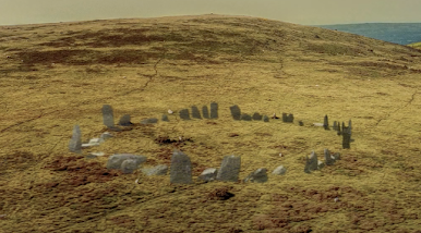
In previous posts I have pondered on the attribution of certain glacial deposits on Gower to the Anglian glaciation -- or to the "Older Drift Glaciation" as it used to be called.  The attributions were dodgy, to put it mildly, because for a period in the 1980's there was an obsession with assigning every deposit to one or another of the "lithostratigraphic" units invented by Prof David Bowen and because of faulty amino acid dating.  I agree with Prof Danny McCarroll and Dr Bethan McCarroll that all of the glacigenic deposits described in the literature on Gower are probably Late Devensian in age -- except maybe for the concreted till in Watch-house Bay and in Foxhole Cove, near Southgate, which could be Anglian.  

I think that the concreted till in that area might be the same age as the concreted till at Black Mixen, Lydstep, and the other concreted deposits at Ceibwr and Witches Cauldron in North Pembrokeshire.

The other South Wales deposit assumed in the past to be of Anglian age is the mysterious glacigenic deposit at Pencoed, not far from Bridgend, which might be linked with the pottery clay worked in the past at Ewenny.  Some of the erratics collected from that area are found in the Storrie Collection, which I have discussed here:

https://brian-mountainman.blogspot.com/2011/09/erratics-and-deposits-in-vale-of.html

In the Geological Conservation Review volume of 1989, Campbell and Bowen were rather circumspect about the evidence from Pencoed and Ewenny, but the authors of the BGS Bridgend memoir of 1990 were more forthcoming, and it is worth recording some of their text here.


Wilson, D, Davies, J R, Fletcher, C J N and Smith,
M. 1990. Geology of the South Wales Coalfield, Part
VI, the country around Bridgend. Memoir of the British
Geological Survey, Sheet 261 and 262 (England and Wales)
Second edition

https://pubs.bgs.ac.uk/publications.html?pubID=B01835

P 47. INTRODUCTION


The major climatic changes that occurred during the
Quaternary resulted in the southward spread of ice over
much of northern Europe. Several glacial events are known
to have occurred, separated by interglacial or interstadial
periods when the climate ameliorated. Two glaciations, with
an intervening warm temperate interglacial perind, have
been recognised in South Wales (Bowen, 1973a, 1973b,
1974). The deposits of the earliest (pre-Ipswichian) glaci-
ation occur south of the limits of the latest (Devensian) glaci-
ation. The Ipswichian interglacial is recognised from raised
beach depesits, mainly on the Gower Peninsula and in
Pembrokeshire.

The glacial deposits of the Bridgend district comprise tills,
morainic and fluvioglecial sand and gravel and laminated
silts and clays. They were mostly deposited during the
Devensian (the ‘Newer Drift’ of Charlesworth, 1929);
however, the occurrence of supposed pre-Ipswichian till at
Ewenny [SS 903 777] and Pencoed [SS 959 817] (Mitchell,
1960; Bowen, 1973a) has been cited as evidence of an earlier
glaciation in the Vale of Glamorgan by ice of Irish Sea origin
(Bowen, 1970, 1973a, 1974). There are no dated Ipswichian
deposits within the district and evidence for the interglacial is
largely circumstantial, being based on the recognition of sup-
posed palaeosols (Crampton, 1964, 1966) of this age
(Bowen, 1970, 1974).

Postglacial deposits and landforms range in age from the
late Devensian, through the Flandrian, to recent times. They
mainly comprise alluvial and head deposits, but also include
the products of contemporaneous coastal processes and man-
made features.

==============

GLACIAL DEPOSITS
Page 47

These deposits cover most of the north-eastern part of the
district, are present within the main river valleys, and occur
on the coastal tract between Kenfig [SS 790 620) and Porth-
cawl [SS 808 782] (Figure 2). The expanse of glacial drift in
the north-east is generally regarded as part of an end-
moraine of “Newer Drift’ (Charlesworth, 1929) deposited by
a Glamorgan piedmont glacier, the glacial drift of Kenfig is
envisaged as being deposited on the flanks of a second pied-
mont glacier which debouched into Swansea Bay (Charles-
worth, 1929; Bowen, 1970). The glacial deposits of the lower
Ewenny valley, hitherto regarded as remnants of an earlier
(pre-Ipswichian} glaciation (Strahan and Cantrill, 1904;
Mitchell, 1960; Bowen, 1973a, 1973b), occur south of the
limits of the Devensian ice.

The glacial deposits generally consist of gravelly tills, con-
taining lenses of sand and gravel. Fluvioglacial outwash
gravels occur within, and beyond, the limits of the former
Devensian ice-front, forming terraces in places and underly-
ing the alluvium of the main valleys. Laminated silts and clays
occur as lenses within the tills and outwash gravels.


================

Correlation of glacial sequences

The earliest glacial deposits in South Wales are undated, but
preeded the Ipswichian interglacial. They are preserved at
several localities (Bowen, 1973a, 1973b, 1974), and it is
generally accepted that they were derived from Irish Sea ice,
which entered the Bristol Channel and impinged on the present
coastline.

Glacial deposits at Pencoed and Ewenny have been
regarded as till of Irish Sea derivation (Mitchell, 1960;
Bowen, 1970, 1975, 1974) from the reputed occurrence of
shelly material and igneous erratics at the former locality
(Howard and Small, 1900; Strahan and Cantrill, 1904).
These deposits have also been cited as evidence that the Vale
of Glamorgan was glaciated during the pre-Ipswichian
period (termed the Pencoed Cold Stage by Bowen, 1970).
The Pencoed deposit, however, has none of the character-
istics of a till, nor is there any indication that it is older than
the Devensian, the laminated sands, silts and clays revealing
evidence of deposition in a temporarily impounded lake that
developed at the margin of the Devensian ice-sheet.

The Ewenny deposit is a complex of till, gravels, silts and
clays. The till contains abundant clasts of Silesian sandstones
and appreciable amounts of weathered chert, probably
derived from Dinantian or Jurassic limestones, but the
occurrence of erratics of undoubted western provenance
(Strahan and Cantrill, 1904) has not heen verified. The till
probably impounded ephemeral lakes, in which the silts and
clays were deposited. The species of foraminifera within the
Ewenny silts and clays are indicators of a temperate, marine
environment. but are probally derived, with the Bristol
Channel as the most obvious source. They may have been
transported and redeposited by westerly derived ice, or
introduced by aeolian reworking of coastal flats exposed dur-
ing a glacial low-stand in sea-level: in the latter case, the
foraminifera give no indication of the source of the ice that
deposited the Ewenny till. The origin of this till is, therefore,
equivocal; it may have been derived from the west during a
pre-Ipswichian glaciation (Mitchell, 1960; Bowen, 1970,
19730, 1974), but equally may have been deposited during
the Devensian, either by ice from the north-east which
penetrated the lower Ewenny valley ahead of the main ice
from, or from westerly devived Devensian ice (Woodland
and Evans, 1964),

There are no further deposits within the district that can
be ascribed to the pre-Ipswichian gliciation, although
circumstantial evidence has previously been cited to suggest
that the Vale of Glamorgan was covered by ice during this
period. It has been suggested that exotic heavy mineral suites
within soil profiles indicated contamination from a relic
cover of glacial material of Irish Sea derivation (Crampton,
1960, 195), but they are more likely to have been intro-
duced by aeolian action. Cobbles of Lower Lias limestone,
within soil profiles overlying Lower Lias bedrock, were
formerly thought to be of glacial origin (Crampton, 1966),
but this is unlikely because they are generally derived by in-
situ weathering of Lower Lias bedrock. The occurrence af
westerly derived erratics in the Ely valley and as far east as
Cardiff (Griffiths, 1939) has not been confirmed (Waters and
Lawrence, 1987), there being a general absence of erratics
south of the Devensian ice front.

There are no proven Ipswichian deposits in the Bridgend
district, but the terra rossa and terra fusca affinities of local soil
profiles have been interpreted as evidence of former warm
temperate climate (Crampton, 1964, 1966), and Bowen
(1970, 1974) has suggested that they are palaeosols of
Ipswichian age. There is, however, no evidence to suggest
that these are anything other than modern soil profiles. The
‘terra rossa’ soils on Newton Down [SS 838 795] are probably
due to the weathering of Triassic bedrock or palaeokarst
horizons within the Oxwich Head Limestone, both of which
commonly impart a characteristic reddening to soil profiles.
The shallow, free-draining “terre fusca" soils on parts of the
Lower Lias outcrop generally reflect the limestone to
mudstone ratios of the bedrock.

It has been suggested (Trenhaile, 1971) that ledges along
the coast, between low tide and 12m above OD, are rem-
nant interglacial shore-platforms. These occur at Sker Point
[SS 786 796], Porthcawl [SS 812 766] and Black Rocks [SS
867 742], but no deposits have been found on them to pro-
vide evidence of their age and, in general, the features
appear to be the result of differential weathering of the Car-
boniferous and Triassic rocks.

The Devensian ice front in the district is broadly similiar to
that previously described (Charlesworth, 1929; Bowen,
1981; Figure 2), In the north-east, ice trom the Glamorgan
piedmont glacier debouched onto the low ground south of
the coalfield, impinging on, and locally overriding, the
Dinantian limestone escarpment on the southern limb of the
Cardiff-Cowbridye Anticline. Devensian ice encroached
onto the low ground north-west of Coity [SS 918 820], but
north of Bridgend was held back by the major escarpment
forming the southern margin of the coalfield. The tills, sands
and gravels in the north-west of the district have been inter-
preted as a complex kamiform morainic belt deposited by
Swansea Bay ice during the Margam Stage of the Devensian
glaciation (Bowen, 1970).

===================================

The above is interesting since the authors argue strongly that the Pencoed and Ewenny deposits (exploited in clay pits to serve at least fifteen local potteries) are late Devensian.  If they are right, this would extend the ice cover of the Late Devensian or LGM -- and this would perhaps reinforce the point I have been making about a complete Devensian ice cover of both Pembrokeshire and Gower.

Sunday 16 January 2022

Granite erratics on Gower


This is an interesting old paper arising from research in Butterslade Bay, Gower, bu a team investigating the contents of the Patella Beach.  The beach is assumed to date from the last interglacial (Ipswichian), which means that any contained erratics must have been carried into the vicinity during the Anglian or Wolstonian Glaciation.

D. G. JENKINS, R. D. BECKINSALE, D. Q. BOWEN, J. A. EVANS, G. T. GEORGE, N. B. W. HARRIS & I. G. MEIGHAN.  The origin of granite erratics in the Pleistocene Patella beach, Gower, South Wales
Geol. Mag. 122 (3), 1985, pp. 297-302.  

Abstract
Rare pebbles of granite have been discovered in the raised Patella beach at Butterslade, Gower, South Wales. Their petrography, trace element geochemistry and the Rb/Sr whole rock ageof 55 ± 5 Ma confirm that they are derived from the Lundy granite which is about 49 km to the southwest of Gower. Amino acid analyses of fossil gastropods in the Patella beach have provided an age of 210,000 years. Various hypotheses of transportation of pebbles from Lundy and Pembrokeshire to Butterslade are considered. Erratics from Pembrokeshire were probably transported by Pleistocene ice into the area while clasts of Lundy granite were moved by progradation of beach deposits northeastwards towards Gower during glacio-eustatic marine transgressions in thePleistocene.

https://www.researchgate.net/publication/231996145_The_origin_of_granite_erratics_in_the_Pleistocene_Patella_beach_Gower_South_Wales

Note:  Butterslade is a small bay in the far west, difficult of access, just to the east of Mewslade. 

Quote:  Of 100 pebbles examined there was a size range of 1.7-8.8 cm and an average of 4.6 cm, and composed of sandstone (50 %), Carboniferous Limestone (23 %),grit (18%), volcanic and igneous rocks (other than granite) (6%), vein quartz (2%) and conglomerate (1 %); the granite pebbles are very rare and less than 1 %. The pebbles of sandstones, grit and conglomerate are mainly derived from local outcrops of Devonian strata, probably from Rhossili  Downs only 1.5 km to the north and the Carboniferous pebbles are from the rocks on which the beach deposit lies. Igneous rocks identified include an ignimbrite (Ordovician: Pem-brokeshire or Powys), feldspar porphyry (Ordovician: West Wales), porphyritic rhyolite (Ordovician: Fish-guard), quartz enstatite gabbro (Ordovician: St David's Head).

This is interesting.  As expected, most erratics are local, and many of the others are from Pembrokeshire, confirming the overall direction of ice travel during glaciation by the Irish Sea Glacier.
The six granite pebbles that were investigated proved to have come from the Lundy Island granite.  Their presence is a bit of a puzzle.  The authors' preferred explanation is that the pebbles come from an old storm beach in the vicinity of Lundy Island which was pushed north-eastwards in the direction of prevailing winds, over many thousands of years at a time of rising sea level following deglaciation.  Hmmm -- possible.  Let's just say that the jury is still out.......


West Gower Geol Soc memoir 246 (part IX) by Strahan (1907):

Strahan and his colleagues failed to notice any erratics in the raised beach, and found nothing that they could identify as "Older Drift".  However, they did confirm that most of Gower was affected by "Coalfield ice" from the north, except for the extreme west (around Rhossili) and the extreme east (around Caswell Bay).  the glacial deposits they were looking at were those now classified as Late Devensian (LGM) in age.  Here is an extract from page 40:


TN George and various others followed with much more sophisticated analyses of the glacial features of Gower.  But there has been great confusion over the "Older Drift" (Anglian till)  and the "Newer Drift" (Late Devensian till) of Gower.   Everybody assumes that the Older Drift exists somewhere, since erratics from it appear in the Ipswichian raised beach, but where is it?

There must be remnants on Gower, as there are in Pembrokeshire,  but the attempts to determine what is what on the Gower were thrown into complete confusion by Prof David Bowen's obsession with putting "lithostratigraphic" labels onto everything, and by his "aminostratigraphy" which produced what are clearly false dates on all sorts of sediments in all sorts of stratigraphic positions.  The Geological Conservation Review for Wales (1989) was edited and heavily influenced by David Bowen, and that made matters even more convoluted.  He contended that the deposits in southern Gower were for the most part "Older Drift" and those in the northern part were for the most part "Newer  Drift"  -- and a further over-simplification contended that any ice coming from the west was associated with an ancient glaciation while ice from the north (local Welsh ice) was associated with the Devensian LGM.  Geomorphologists from Swansea University have been trying to sort out the mess for 30 years..........

Anyway, with regard to erratics, there is a new book by Peter Kokelaar (2021) called "All our Own Waters" which deals with landscape evolution on Gower and includes sections on the Patella beach and on the process of glaciation.  In Chapter 3 he refers to many erratics and often refers to them as "Anglian erratics" simply because they have come from the west.  He also purports to show a Late Devensian till overlying an Anglian till at Llethrid (SS 533 915) -- but provides no evidence to support the contention.  i am not convinced.   He also reports on a coarse-grained diorite erratic (possibly from northern Britain) at Reddenhill (SS 535 893) and a coarse-grained dolerite erratic found at 61m above sea level at Caswell Bay (SS 595 878), assumed to have come from north Pembrokeshire. He mentions "Anglian" erratics at Western Slade on the shore platform that are purported to include volcanic conglomerate from Skomer Island.

As I have mentioned earlier on this blog,  the assumption that most of the Gower south coast glacial deposits are Anglian is very likely to be incorrect.  Most of the recent work by Swansea geomorphologists points to a complete ice cover of Gower during the LGM.  While it does seem that most of the "western" erratics are found in the far west and far east of the peninsula, it's best to assume for the moment that during both the Anglian and Devensian glaciations Irish Sea ice and Welsh ice lobes were confluent, with an ice margin that oscillated in a fashion still to be worked out!


Saturday 15 January 2022

British Museum Stonehenge exhibition: fantasy is more fun than fact


There is now a preview to the big new British Museum exhibition on Stonehenge, and as we all anticipated, the story which they portray as "the truth" is anything but.

https://blog.britishmuseum.org/an-introduction-to-stonehenge/?

In an article on the BM blog, Jennifer Wexler, the curator of the "World of Stonehenge" exhibition, says this:

The first Stonehenge was built around 5,000 years ago and comprised of ‘bluestones’ transported on a remarkable long-distance journey, or more likely a series of journeys, from west Wales. The term ‘bluestones’ refers to a type of blue volcanic rock that were specially quarried in the Preseli Mountains. They were transported on sledges, taking approximately 40–60 days to make the 200km journey from Wales to Wiltshire. The epic journey the stones made enhanced their value, meaning and symbolic significance.

At this time, the monument served as a cremation cemetery and it is estimated that possibly 150–200 people were buried there. Analysis suggests that several lived and died in west Wales before their remains may have moved with bluestones to become part of the monument. Many objects from this period have been found buried with the dead – including a beautifully crafted mace-head made of banded Gneiss (a type of rock with distinctly coloured bands), probably brought from the north of Scotland and symbolising the authority associated with several important religious centres across Britain and Ireland.

And then this:
 
Cremated remains, carried from distant Wales, were placed along with grave goods, such as this macehead, into the foundation pits dug for the bluestones in the first phase of Stonehenge’s development.

That story, as we all know, is not based on established fact, but upon a whole host of assumptions.  It is, however, the established and approved EH story -- or rather the story according to Parker Pearson.  Is there nobody at Stonehenge, or at EH headquarters, or in the British Museum, capable of sorting out facts from fantasies?  Apparently not.  Depressing, isn't it?  


On the preferential survivability of dolerite erratics


Erratics in the vicinity of St Bride's Haven.  One of them is a Devonian quartz conglomerate -- 
the others are dolerite.

Yesterday my wife and I took a walk along the southern shore of St Bride's Bay in beautiful calm and sunny winter weather.  We were on a stretch of coast near St Bride's Haven where the ice came ashore from the NW after crossing the bay. On the clifftops and in the embayments there are erratics everywhere -- and the great majority of them are made of dolerite.  That's interesting, because there are no dolerite outcrops in the vicinity, and the bedrock is for the most part reddish Old Red Sandstone. 

The same general rule applies around all of the coasts of Pembrokeshire.  I haven't done any statistical analysis, but wherever we are, and  whatever the local geology may be, the great majority of big erratics (over 1m in diameter) are made of dolerite -- mostly unspotted, but sometimes spotted. The smaller erratics are much more varied -- sometimes they are made of local rock, and sometimes of far-travelled rocks including some from North Wales or further afield.  Very rarely we find large and very exotic erratics from Scotland or the Lake District -- inevitably these were the ones that attracted most attention from the field geologists of the Geological Survey simply because they were "prominent" and "different."  And they were hugely important too, because they were the erratics that allowed geologists like Hicks, Jehu, OT Jones, HH Thomas and others to determine where the ice that covered Pembrokeshire had come from.

The general rule of erratic transport is that erratics are comminuted or reduced in size with distance from source, and over time.  To appreciate this, we simply have to look at the average pebble beach in Pembrokeshire -  made up largely of cobbles and pebbles derived from glacial deposits.  The smaller the size fraction, the greater the range of rock types represented.  At Abermawr, for example, if you look at pebbles under 5 cm diameter, there is an extraordinary variety of rock types, some local and some far-travelled.  On Flat Holm in the Severn Estuary, the majority of pebbles in the beaches are of limestone and calcareous shale, but some are very far-travelled.  In contrast, large erratics are very rare on the island, as we have noted in previous posts.


Beach pebbles collected from Freshwater West.  Many of these are of igneous origin.  They have to be searched for!  These are mostly the comminuted remains of larger cobbles and boulders.

Comminution happens because of the stresses to which contained rock fragments are subjected during glacial transport. There is high-pressure assault from adjacent rock fragments that are in effect "destructive tools".  Compression is generally more effective than tension when we consider chunks of rock in transport. Gentle pressure results in abrasion or striations;  greater pressure results in crescentic and other gouges; even greater pressure results in the shearing off of rock flakes or chunks, leaving facets on the parent stone; and ever greater pressure results in a rock being splintered, crushed or destroyed.  Where erratics with two different rock types are in contact under or within a glacier, the harder or more resistant of the two will be the tool, and the softer rock will suffer the most damage.  "Hardness" is difficult to measure or define, as all geologists know; rock texture comes into play, as does the mix of mineral crystals, as does the presence of foliations, fractures and bedding planes.  Some hard rocks, if they are heavily fractured,  may be destroyed in transport more easily than "soft" rocks like chalk or shale.  All that having been said, there are always exceptions to the rule, and there are many famous examples of "soft" giant erratics that have been transported more or less intact for tens or hundreds of kilometres when, according to glacial theory, they should have been destroyed.   As described many times on this blog, big erratics carried on an ice surface, or within the body of a glacier, have a much greater chance of survival than equivalent erratics dragged along on a glacier bed.

Now let's move to Stonehenge.  I have done many posts on the bluestone erratic assemblage at Stonehenge, emphasising that the majority of the 43 surviving monoliths are made of dolerite.  They look like heavily abraded and weathered erratics, because that is what they are.

https://brian-mountainman.blogspot.com/2016/08/the-stonehenge-boulders.html

https://brian-mountainman.blogspot.com/2015/02/understanding-bluestone-circle.html

https://brian-mountainman.blogspot.com/2015/12/the-bluestone-circle-erratic-assemblage.html

So where are we headed with all of this?  Well, having pondered long and hard, I am increasingly convinced that there is something about dolerite that makes it uniquely resistant to the forces that operate during glacial transport.  This might have something to do with the internal structure of dolerite -- its mineral composition and the manner in which crystals are arranged or interlocked. I need some geological advice on this! Another factor may be the relatively low frequency of intersecting joints, which causes dolerite to react by breaking down into massive rectangular blocks, slabs or pillars which are then internally very resistant to further breakdown. This is a matter of rock mechanics....... 


Carn Goedog -- a dolerite tor broken up by glacial and periglacial forces and with block shapes determined above all else by the preexisting fracture pattern.

Here is something I found on the web about the "erodability" of diabase or dolerite:

Consider the two other chemical equivalent of diabase: gabbro (coarse-grained) and basalt (glassy and fine-grained), which should potentially be similarly erosion resistant. This is not the case. Both gabbro and basalt erode very easily.
Coarse-grained rocks, in general, erode easily. The large grain size means it is relatively easy to dislodge individual grains out of the rock. You don't need a lot of water, for instance, to percolate between the not-many grain boundaries and release them. To make it worse, gabbros are full of minerals that are easily erodable such as plagioclase and olivine.
On the other hand, basalts also tend to weather easily. Having cooled fast, they are usually glassy which tends to crack during cooling. Glass is general is less resistant to chemical alteration than minerals, under similar conditions. Basalts also contain gas bubbles, which cause weakness spots in which the rock can break, leading to preferred weathering.
Diabase is fine grained, and contains no glass. It does not suffer from these two conditions. It is composed of very fine interlocking crystals that are very hard to dislodge, and is not penetrable by fluids.
That said, remember that it is all relative. A diabase will still weather faster than even the worst type of granite.

I don't agree with that last statement.  Granite erodes quite easily, in my experience, and in the majority of the outcrops I know, the bedrock granite is very rotten indeed, producing this mysterious material called "grus" -- but don't let's get diverted.......

Conclusion?  As I have explained many times before, the bulk of the bluestones at Stonehenge are heavily abraded boulders with rounded edges and facets and with shapes best described as boulders or slabs, with some ( especially the modified ones) worthy of being called pillars.  They look like the glacial erratics of Pembrokeshire, and they look as if they could have been collected from any ice edge anywhere in the world.  There is no way that they are "quarried monoliths" -- that is sheer fantasy.  The bulk of the 43 bluestones are dolerites.  This is not because dolerites were particularly valued or revered by our Neolithic ancestors; indeed, nobody has ever shown that dolerites were especially valued or preferentially used in stone settings in Pembrokeshire.  No -- the answer is simply that dolerites survived glacial transport better than any of the other rock types represented in the erratic assemblage of the Irish Sea Glacier.  In other words, there was a "preferential survivability" which makes good geological sense -- and which is confirmed from observations elsewhere.


Stone 39 at Stonehenge -- made of spotted dolerite.  Acknowledgement to Simon Banton.

Simon's full photographic record of the Stonehenge bluestones and sarsens is here:


Friday 14 January 2022

Lost bluestone circle did not exist, archaeologists now admit


Here is a simple summary of the more recent findings (or lack of them) and the background to the research, for those who may not already be in possession of all the details.

----------------------------------------------------

A supposed giant circle of bluestones in West Wales, referred to in TV programmes and in the media as “The Lost Circle”, never actually existed. This is the conclusion drawn by archaeologists after three seasons of excavations at Waun Mawn, in the western part of the Preseli Hills of Pembrokeshire.

It was postulated by Professor Mike Parker Pearson and his colleagues (1) that the bluestones at Stonehenge once stood in a giant stone circle with a diameter of 110m on a bleak expanse of moorland before it was dismantled, stone by stone, and hauled off to Stonehenge during the Neolithic period. Further, it was postulated that the stones came originally from two “bluestone quarries”, one at Craig Rhosyfelin and the other at Carn Goedog. In a number of articles in the specialist literature, Parker Pearson developed the hypothesis that the bluestones from these sites had some special ritual value which led to their use in a local “venerated stone circle” — which was then uprooted so that the bluestones could be carried as tributes or offerings to the powerful tribe that controlled the territory around Stonehenge. He argued that 80 bluestones were carried or dragged overland approximately along the route of the A40 road, across the Severn estuary and then overland again to Salisbury Plain).

This narrative was heavily criticised in 2015 by geomorphologists Dr Brian John and Dr Dyfed Elis-Gruffydd and geologist John Downes, who studied the evidence from Rhosyfelin and Carn Goedog and argued (2) (3) that there was no trace of Neolithic quarrying at either site. Further, they argued that the rock types involved, namely foliated rhyolite and spotted dolerite, were not used preferentially in any local megalithic structures, indicating that they were not deemed “special” in any way. They pointed out that there were no traces of those rock types at Waun Mawn, and that any stones used there were obtained from glacial erratics in the immediate vicinity (4).

Further criticism of the Parker Pearson hypothesis came in 2020 from archaeologists Gordon Barclay and Kenneth Brophy, when they accused him of “interpretative inflation” with respect to the evidence on the ground and of promoting the idea that Stonehenge was the cultural “beating heart” of Britain (5).

The Lost Circle hypothesis received huge media attention last year through TV programmes and popular media articles, in spite of the fact that at Waun Mawn today there is only one standing stone and three recumbent stones, irregularly spaced and on an approximate NW-SE alignment. It’s not at all obvious that the stones lie on the circumference of a giant circle. Geophysical research in 2011 gave no grounds for any belief that there were any sockets that had genuinely held bluestone monoliths, but during three digging seasons Parker Pearson and his colleagues persisted with their increasingly desperate hunt for recumbent monoliths and stone sockets.

Finally, with the publication of the interim Report on the 2021 digging season (6), Parker Pearson and his colleagues have had to admit that there never was a “lost stone circle” at Waun Mawn. However, they insist on referring to the site as “an unfinished and dismantled stone circle”. They claim to have found at least eight sockets from which stones had been removed, as well as other features pointing to Neolithic occupation, including artefacts, a fire pit and a number of post-holes. However, archaeologist Mike Pitts (7) has pointed out that the supposed stone sockets at Waun Mawn are far too small and too shallow ever to have held bluestone monoliths, and most of them appear to be simple indentations in the natural undulating surface of glacial deposits. Others who have studied the prehistory of western Preseli argue that traces of prehistoric occupation are found everywhere across a landscape which is rich in Neolithic and Bronze Age remains. No rock fragments or artefacts have been found that might link this site in any way with Stonehenge.

Commenting on the latest developments, Dr Brian John said: “I hope that we have now seen the back of TV presenters going on about “astonishing discoveries” at Waun Mawn (8). There never was a giant stone circle at Waun Mawn, either complete or incomplete, that was dismantled and shipped off to Stonehenge. The hypothesis promoted by Mike Parker Pearson (9) is unsupported either by geological or archaeological evidence. There were no Neolithic bluestone quarries. And at Stonehenge the bluestones are now known to have come from around 30 different locations. Most of the 43 remaining monoliths there are heavily abraded and weathered boulders and slabs that look like glacial erratics; the idea that they were quarried and then hauled off to Salisbury Plain is simply a fantasy.” (10)

END

-------------------------------------------------

NOTES 

(1) Mike Parker Pearson, Josh Pollard, Colin Richards, Kate Welham, Timothy Kinnaird, Dave Shaw, Ellen Simmons, Adam Stanford, Richard Bevins, Rob Ixer, Clive Ruggles, Jim Rylatt & Kevan Edinborough. 2021. The original Stonehenge? A dismantled stone circle in the
Preseli Hills of west Wales. Antiquity, Vol 95, No 379, 12 Feb 2021, pp. 85-103.
https://doi.org/10.15184/aqy.2020.239
https://www.researchgate.net/publication/345177590_Waun_Mawn_and_the_search_for_Proto-_Stonehenge [accessed Jan 13 2022].

(2) John, B.S. 2019b. Carn Goedog and the question of the "bluestone megalith quarry”. Researchgate: working paper. April 2019, 25 pp.
DOI: 10.13140/RG.2.2.12677.81121
https://www.researchgate.net/publication/332739336_Carn_Goedog_and_the_question_of_the_bluestone_megalith_quarry

(3) John, B.S., Elis-Gruffydd, D. & Downes, J. 2015b. Observations on the supposed “Neolithic Bluestone Quarry” at Craig Rhosyfelin, Pembrokeshire. Archaeology in Wales 54, pp 139-148. (December 2015)
https://www.researchgate.net/publication/286775899_OBSERVATIONS_ON_THE_SUPPOSED_NEOLITHIC_BLUESTONE_QUARRY_AT_CRAIG_RHOSYFELIN_PEMBROKESHIRE

(4) John, Brian. 2021. Waun Mawn and the search for "Proto- Stonehenge”. Working Paper No 4. Researchgate, updated September 2021.32 pp.
https://www.researchgate.net/publication/345177590_Waun_Mawn_and_the_search_for_Proto-_Stonehenge

(5) Barclay, G. J., and K. Brophy. 2020. “‘A Veritable Chauvinism of Prehistory’: Nationalist Prehistories and the ‘British’ Late Neolithic Mythos.” Archaeological Journal 1–31.
doi:10.1080/00665983.2020.1769399

(6) The Interim Report can be found here: https://www.sarsen.org/2022/01/waun-mawn-and-gernos-fach-welsh-origins.html?showComment=1642027777014#c2520553829533807025

(7) Pitts, M. 2021. Comment thread on Twitter, relating stone socket dimensions.
https://twitter.com/pittsmike/status/1361298920979238915/photo/1

(8) Alice Roberts. 2021. BBC TV. Stonehenge: the Lost Circle Revealed.; 12 February 2021.
https://www.bbc.co.uk/iplayer/episode/m000s5xm/ad/stonehenge-the-lost-circle-revealed

(9) UCL Press Release: Stonehenge may be dismantled Welsh stone circle. 11 February 2021
https://www.ucl.ac.uk/news/2021/feb/stonehenge-may-be-dismantled-welsh-stone-circle

(10) It is well established that on at least one occasion in the Quaternary Ice Age the ice of the Irish Sea Glacier flowed across Pembrokeshire, up the Bristol Channel and into Somerset. It carried with it glacial erratics from areas subjected to ice erosion. What is not currently known is the location of the ice edge further to the east.
Brian John. 2018. The Stonehenge Bluestones. Greencroft Books, Newport. 256 pp. ISBN 97800905559-94-0