THE BOOK
Some of the ideas discussed in this blog are published in my new book called "The Stonehenge Bluestones" -- available by post and through good bookshops everywhere. Bad bookshops might not have it....
To order, click
HERE

Wednesday 31 January 2024

Making geomorphological maps -- then and now.....


I have been looking at Skafti Brynjólfsson's impressive doctorate thesis -- and was struck (not for the first time) by the "then and now" syndrome..........

The upper map is based on the field map made by Dave Sugden and myself in the valley of Kaldalon, NW Iceland, in 1960.   We had no air photos to work with, and everything was done by hand, using a plane table an a telescopic alidade.  Triangulation was the thing, out in the field in all weathers, and hours of painstaking work in the tent when the weather was too miserable to be out and about.  I still have the original plane table map --but it was tidied up and simplified for the purposes of publication in the Geografiska Annaler in 1962.

Nowadays, with high resolution satellite imagery, in order to make a map like the one below, you don't even have to leave the comfort of your office or laboratory -- although every self-respecting glacial geomorphologist will of course get out into the field to confirm that the things you assume to be meltwater deposits, till spreads and scree banks are indeed what you think they are!


At the 1960 snout of the glacier


Modern satellite image of the area upvalley from the big terminal moraine.  There is an extraordinary amount of detail here........ looking north


Google Earth 3D image, converted from verticalto oblique......... looking south


Dave working on the plane table map of the valley


Historic document -- primitive technology, but not at all bad in the circumstances.......


Here is a link to our paper published in 1962:


The pitted outwash area and the sandur, looking up the valley


Multiple raised beach ridges -- Furufjordur, NW Iceland


This is a very spectacular image from Google Earth (using the oblique / 3D tool) showing the strandlines or beach ridges in the bay of Furufjordur, on the east side of Drangajokull.  In the bays which held outlet glaciers from the ice cap, there are no high strandlines because the ice edges were far advanced.  However, Furufjordur did not carry such a glacier, so the sea was avle to affect the coastline at a much earlier stege in the process of isostatic recovery.

The highest strandlines in Vestfirdir (the western fjords) are above 135m, and the traces are scattered and difficult to interpret.  But here things are rather obvious -- and the marine limit is probably closer to 40m.  

The end of Drangajokull?


These are desperately sad images -- the latest satellite imagery from Apple maps. The images show a small ice cap (Drangajokull in NW Iceland) which is now so thin that the "bones" of the landscape beneath the ice are showing through.  The catchments of the various small outlet glaciers are showing through quite clearly.   This is truly shocking -- earlier images showed that there was an ice cap worthy of the name here, with an ice surface which was largely independent of sub-surface topography.  

The top image is particularly striking, showing the string of peaks that are now breaking through the ice surface as it wastes away.  We walked up to the summit on this ice cap back in 1960, when it was still in a relatively healthy state. 

I read in one of the Iceland tourist blurbs that Drangajokull is the only glacier in Iceland that is not retreating.  That does not seem to be confirmed by the satellite images!  The most recent mass balance figures (Belart et al, 2017) suggest that the ice cap had a modest negative balance in 2015 -- but the figures used in the paper are of course now a decade out of date.  And a lot seems to have changed in a decade.


Satellite image showing surface contours.  The whole ice cap lies beneath 900m.  It's easy to pick out the various glacier catchments.  Several nunataks already project through the ice cap surface -- and soon there will be more. 

Another indicator of the poor state of health of the ice cap is the paucity of deep crevasses which indicate activity both above and below the firn line.  This makes the ice cap a relatively safe place for tourists -- and this is reflected in the boom in "jet ski"visits by tourists in the early summer in particular..........  All very sad.  I must check and see what the current ablation rate is here -- but the ice cap surface appears to be dropping by several metres per year.

Yet another manifestation of global warming.  The small ice cap of Ok has already gone.  This one will be next. 

=============

There is much more information about Drangajokull in this impressive doctorate thesis by Skafti Brynjolfson:

https://core.ac.uk/download/pdf/132157379.pdf

Skafti Brynjólfsson
Dynamics and glacial history of the Drangajökull ice cap, Northwest Iceland

Thesis for the degree of Philosophiae Doctor Trondheim, September 2015
Norwegian University of Science and Technology

The core of he thesis is the collection of published papers concentrating on the ice cap and its outlet glacier catchments.

The edge of the Glama Plateau


I found this on a Facebook page -- the Dynjandifoss waterfall on the western edge of the Glama Plateau in NW Iceland.  I have done several posts before on this rather remote plateau, which we examined in 1973-76.  The plateau supported a small ice cap which has now melted away, leaving just a few snowpatches as remnants.  The interesting thing about the plateau is the absence (as far as we could see) of any substantial morainic debris -- suggesting an almost complete lack of ice movement and almost zero erosional effects.  Use the search facility if you are interested in my earlier posts........


Here is another pic showing the nature of the plateau above the waterfall -- culminating in a wide summit.   There are several of these broad summits, which might have been snow covered during an "early glacial" phase and which then might have expanded bit by bit until there was a genuine ice cap here........  in the foreground, the water of Arnafjordur.

Further to the north the plateau surface is higher, with extensive areas over 900m.


Thursday 25 January 2024

Carn Euny prehistoric village


This is a fabulous image of the Carn Euny prehistoric village near Penzance in Cornwall. It strikes me as being very similar in size and layout to the feature I have noted a number of times on this blog -- not far from Tafarn y Bwlch, at Banc Llwydlos:

https://brian-mountainman.blogspot.com/2021/04/the-banc-llwydlos-settlement-site-was.html


Because the latter has never been excavated, we have no idea how old it is.  Carn Euny is dated as Iron Age / Romano British, but because Banc Llwydlos is in a Neolithic / Bronze Age landscape, not quite so well suited to farming and permanent settlement, we might assume it is older.

Time will tell......... and I hope somebody will dig there sooner rather than later.


Tor survival under cold ice


This is reproduced from the QRA members circular -- worth reproducing because it's a great photo and a tidy summary of cosmic bombardment and the dating method.

The photo won 1st prize in the 2020 photography competition run by the QRA.


Wednesday 24 January 2024

Sabellaria colonies -- our local "coral reefs"


After the winter storms, the beach level at the northern end of Traeth Mawr is at least a metre lower than the summer level.  Many thousands of tonnes of sand have been washed out into deeper water.  And the local "coral reef" is better exposed than I can ever remember.  I assume that the great cushion-like Sabellaria colonies are usually beneath the sand........

Honeycomb worms (Sabellaria spp.) are tiny worms that live around the low tide area of the beach. They build tubes, attached to the rock to live in, and the structures we see on the beach are dense colonies made up of thousands of individual worms. Fully grown, each individual worm is around 3-4cm long. The colonies however can often cover large areas of rock, forming solid reefs.  Actually they are not all that solid -- they are quite crumbly, and are easily destroyed.....


See also:


The Limeslade erratic "conspiracy"


As we have noted before, certain people with strong vested interests seem to have convinced themselves that there is some great conspiracy going on, designed to keep "the truth about the Limeslade erratic" away from the eyes of the world.  Perhaps we should rephrase that and say "away from their eyes in particular"...........

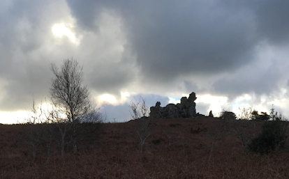
Our old friend Tim Daw has put up another post on his blog about this "large erratic deposited on a rocky coast by an ice floe" -- celebrating the fact that two years have now passed since Phil Holden discovered the erratic in the winter of 2022.  

https://www.sarsen.org/2024/01/the-limeslade-bay-erratic-discovery.html

He has even composed a moving poem in celebration of his paranoia.  Rob Ixer prefers to comment on the Megalithic Portal, and accuses me of suppressing information that should by now be out in the public domain.  "The silence is deafening", he says with glee.

I am touched by their concern and at the same time greatly entertained. Why I should wish to suppress anything is a complete mystery to me, as I explained in a previous post (14 August 2023):

https://brian-mountainman.blogspot.com/2023/08/the-limeslade-erratic-boulder-probably.html

It would be interesting to discover the origin of the boulder, but I have no interest whatsoever in hoping for one source rather than another. It is probably not from Mynydd Preseli, and is most probably from one of the North Pembs dolerite outcrops.  Carn Goedog and Rhosyfelin can be ruled out as source locations.  That's as much as we know, following the pXRF and thin section studies.  They are being incorporated in a short paper, and will be published in due course.

From the outset we have been hamstrung by the lack of access to research funding, and so we have had to depend on offers of help from elsewhere.  Dr Katie Preece of Swansea University originally offered to help with the sample analyses, but in the event was unable to find the time.  Prof Tim Darvill and Dr Steve Parry kindly offered to analyse the samples provided by Phil Holden, but they are both very busy men with other research priorities.  The samples were sent off to them in the spring of 2022.  There were instrument breakdowns, calibration issues and other external factors that led to further delays, but we were in no position to complain since we were entirely dependent on the goodwill of others.  I'm not going to criticise anybody.  But rest assured that Phil and I have, on many occasions, been very frustrated by the delays!   Sometimes life gets in the way of things, and research schedules fall by the wayside.  But to flag up the idea that there is some sort of "conspiracy of silence" is both absurd and disrespectful.


Messrs Ixer and Daw seem to think that the interpretation of the Limeslade Boulder find is much ado about nothing.  Let me assure them that it is important, as we indicated in the original press release.  It shows that during at least one glacial episode, ice from the west (carrying erratics most probably from North Pembrokeshire) was powerful enough to impinge on the Gower coast, as suggested by others including Prof Peter Kokelaar.  On present evidence, it's the biggest Pembrokeshire erratic found on the Bristol Channel coast.  We now know that the ice stream responsible was more powerful than ice issuing from the Welsh Ice cap and through the South Wales valleys.  In turn, this suggests that the Irish Sea ice stream must have progressed far up the Bristol Channel --and confirms previous conclusions based on  the finds of erratics on Flatholm and in the Bristol area.  It shows that the entrainment and transport of large blocks of igneous rock actually happened in West Wales.  And it shows that ice on the bed of the ice stream was capable of entraining blocks of stone from multiple locations, not exactly at random but when the right combinations of circumstances occurred on the glacier bed. 

This boulder has helped us to make significant progress.  But some researchers have their own private agendas and belief systems, and will do whatever it takes to minimise the importance of anything they find inconvenient.  And some of them rush into print on the flimsiest of evidence, and then later have to admit to the world that much of what they said was nonsense........


Monday 22 January 2024

Scoresby Land maps

There are amazing new maps of Greenland on the GEUS web site, allowing landscape analyses on a much more sophisticated scale than before.  Here is the main link:

 https://maps.greenmin.gl/geusmap/?mapname=greenland_portal&lang=en&lang=en#baslay=&optlay=&extent=976300.8908773873,7967687.004161382,1002127.9612935602,7983878.392077183&layers=g250_topographic_map_utm24n,byer_og_bygder,grl_stednavne,grl_multidirectional_hillshade&filter_1=new_greenlandic_name%3D%26danish_name%3D%26ogc_fid%3D


This version has a small amount of shading


You can opt for heavier shading, which brings out relief features much more prominently


This is the satellite image used in the map-making process.

There's enough detail in there to fill a glacial geomorphology textbook! 

In 1962 four of us kayaked up Nordvestfjord, on the left, reputed to be the biggest fjord in the world, and fashioned over many different glaciations.  The cliffs to the left of centre are 1200m high -- that's almost 4,000 ft high, and  500 ft higher than the summit of Snowdon / Yr Wyddfa.  We named the cliffs Hells Bells, and when we paddled beneath them, up the fjord and back again, we were scared to death.  There were occasional boulders crashing down into the sea from enormous height, so we dared not keep too close inshore.  There was nowhere to go ashore if we had got into trouble.  Anyway, we survived.  Happy days........


Saturday 20 January 2024

The survival of fragile landforms


This is a lovely photo posted on Facebook by Sian May -- reminding us of the extraordinary fragility of the rhyolite crags that stand proud in the landscape above Trefgarn Gorge in mid-Pembrokeshire. There are two upstanding tors -- Maiden Castle (called by locals "the family of lions") and the bulky and more solid Lion Rock. They are so delicate that many have speculated that they cannot possibly have been covered by glacier ice during the LGM / Late Devensian.

Well, I think that they must have been, since there are apparently fresh glacial deposits not far away, both to the north and the south of the crags. I have discussed the "survival dilemma" before on this blog, and was convinced that these crags were NOT glaciated around 26,000 years ago. But I have changed my mind, as more and more evidence has accumulated to demonstrate the true extent of LGM glaciation in West Wales and the capacity for fragile landforms to survive under thick ice where certain glaciological conditions are met.  What we don't know (as yet) is the extent to which there has been post-glacial modification of these tors.  Could Maiden Castle, for example, have been seriously damaged by LGM ice, to the extent that parts of it simply fell apart in the long cold spell between 26,000 yrs BP and 10,000 yrs BP?  And could such a disintegration be responsible for the present-day "fragility" of the feature?


The significance of tors in glaciated lands: a view from the British Isles
by ADRIAN M. HALL, DAVID E. SUGDEN
Du continent au bassin versant. h éories et pratiques en géographie physique
(Hommage au Professeur Alain Godard)
2007, Presses Universitaires Blaise-Pascal, 
ISBN - 978-2-84516-335-5

Quote:  

The survival of fragile tors from summits, ridges and lowlands in other formerly glaciated
regions probably requires former covers of cold-based ice throughout the cold stages of the
Middle and Late Pleistocene. The covers maybe localised and equate to "cold-bed patches"
(Kleman et al., 1994), where a carapace of cold ice protects the glacier bed from erosion. Where
tors show no modification then the ice is not only cold-based but also barely deforming across
the tor site. Such locations would be those covered by thin or diverging ice flow (Sugden, 1974,
1978).  The first stages of modification involve the entrainment of blocks from the tor summit
and margin. Modest distances of block transport and the absence of evidence of basal meltwater
in form of plucking on the lee side of the form indicates erosion under cold-based ice (Hall and
Phillips, 2006a), but the degree of modification of the tor remains modest. Only in the later stages
of tor destruction, when the tor is reduced to a plinth or slab, do the processes of lee-side plucking and abrasion become important and this marks the onset of basal sliding (Andre, 2004; Hall and Phillips, 2006a). In an ice-sheet situation basal sliding is favoured by deeper converging ice flow, leading to a general absence of tors from glaciated lowlands and valleys and an inverse relationship between erosion rates and altitude (Briner et al., 2003; Kleman and Stroeven, 1997; Staiger et al., 2004; Sugden et al., 2005).

I like the idea of "cold-bed patches" and will investigate further......


Friday 19 January 2024

Revised Carn Goedog paper


I have published a revised version of my Carn Goedog article onto the Researchgate platform, incorporating the most recent research.  Nothing has been published in the last few years to cause me to revise my views, and I still think the idea of a Neolithic quarry up there, producing spotted dolerite monoliths on an industrial scale, is preposterous.  The evidence just does not stack up, and it never did........

 https://www.researchgate.net/publication/377230821_Carn_Goedog_on_Mynydd_Preseli_was_not_the_site_of_a_bluestone_megalith_quarry

Our old friend Tim Daw has had a go at me on his blog.  I thank him for drawing attention to the article and for providing a link, but find it rather weird that he criticises me for not going to great lengths to argue for the glacial transport of the bluestones.  As I would explain to him if he allowed comments on his blog, that's a different topic.  There would be no great point in criticising the author of an article on the reproductive methods of the tiger moth for not going into great detail on the town planning strategy of Greater Manchester.......

Thursday 18 January 2024

Scoresby Sund -- the mystery of "moraine corner"


Thanks to some amazing snow and light conditions in this satellite image of Kjove land in East Greenland, we can see extraordinary detail.  Dave Sugden and I described the wonderful morainic ridges to the north and west of "moraine corner" in a paper published in 1965, following our fieldwork in this area in 1962.  We were somewhat mystified by the ridges at the time, and as shown in the annotations above we concluded that they were probably marginal or lateral moraines formed on the flanks of a nunatak by two streams of ice, one from the Nordvestfjord flowing eastwards over Syd Kap as the ice spread into Hall Bredning, and the other flowing SE and then S from the Holger Danskes Briller diffluent trough.  

This explanation has been accepted by most subsequent researchers as they tried to unravel the events of the "Milne Land Stage" dated to around 11,000 years ago.  David and I established that when the ice wasted away, sea level was at c 101m above its present level.  This is the level of the planed top of the big terminal (recessional?) moraine at the exit of the Holger Danskes Briller trough.  However, the highest marine traces are at c 134m, as shown on this map:


The bulk of the prominent morainic ridges are around 200m asl and above.  So there has been no further glaciation since the ice retreated from these moraines at the end of the Younger Dryas (Zone III) episode.  Traces of the highest (134m) shoreline are found on the outer or downslope flanks of these moraines. So there was no big regional ice readvance here during the Little Ice Age, as there was in the Schuchert Valley when several of the gl;aciers on the west side seem to have surged and reached advanced positions.   

In a Nov 2022 post, I suggested that the morainic ridges converging on Hjørmemoraene
might not be lateral moraines at all, but terminal moraines associated with diffluent ice spilling over from the Holger Danskes Briller trough and flowing across part of the Pythagoras Bjerg plateau:


This seems to me to be a better fit for the evidence -- but it might mean that the moraines are substantially older than the HDF "terminal moraine, and might have nothing at all to do with the Milne land Stage described by Funder, Denton and other researchers. 

More research needs to be done, but it will have to be by somebody else, since my schedule for the next few years is rather full........


Tuesday 16 January 2024

Perched erratic block in Siberia.....


Is this real?  If so I am really impressed........

PS.  I have been accused (by the usual culprit) of deliberately publishing a fake photo and pretending that it was real.  I was preparing to apologise, but then checked it out by putting this into Google -- sayan mountains hanging stone.   Well,  blow me down, this photo is revealed to be perfectly genuine, and the featured rock turns out to be rather famous among hanging stone enthusiasts.    There are scores of photos of it on the web, and it even has its own Wikipedia entry.  The rock is a very long one, and this photo is taken end-on, which explains the great textural detail seen in the right-hand part of the boulder,  very close to the camera.  So there we are then.  Nature is indeed very wonderful.


Monday 15 January 2024

Ridge remnants in East Greenland


Middle distance, the Bear Islands in Hall Bredning, Scoresby Sund, East Greenland. All that is left of a previous mountain ridge between two parallel troughs.........


I have been looking again at the wonderful East Greenland Place names catalogue, and have discovered that the area we worked in (in 1962) was named Kjove Land because of the notable occurrence of the long-tailed skua (kjove).  Do there we are then.

I was also struck by some of the photos showing the remnants of ancient ridges that once separated parallel glacial troughs, the widening and deepening of which led to the gradual whittling away of the intervening ridges or interfluves.  This is a sign of long-continued or advanced glaciation, and a complete refashioning of the landscape.  A few examples are shown below.

 https://www.geus.dk/media/13648/nr21_p117-368.pdf


Bear Islands again......


One of the old John Haller photos of the Bear Islands


Saturday 13 January 2024

Other Quaternary sediments -- Isles of Scilly


Cemented raised beach on the granite beach platform, Carn Morval (St Mary's).  Photo: Dave Mawer


Carn Morval, St Mary's.  There are abundant far-travelled clasts, some rounded and some sub-rounded and sub-angular.  I would hazard a guess that this is a Late Devensian till incorporating some raised beach material.


Rounded red sandstone erratic pebble in what appears to be a fresh till above granite grus -- Gweal Hill, Bryher.  Photo: Dave Mawer.