THE BOOK
Some of the ideas discussed in this blog are published in my new book called "The Stonehenge Bluestones" -- available by post and through good bookshops everywhere. Bad bookshops might not have it....
To order, click
HERE

Monday 31 October 2022

The end of Kaldalonsjokull


Above: a new (Sept 2022) photo of Kaldalonsjokull, the glacier that I saw for the first time in 1960. Below: a photo which is not dated, but I think it might be from around 2016.  At that time it looked as if the glacier was in poor health, with a single large ice stream tumbling down an icefall (as I remember it) now replaced by two smaller segments of active ice, separated by a patch of thin and apparently dead ice close to the trough head.  About six years later, the trough head is clearly exposed, and it looks as if the ice supply from the left branch is also being cut off.  The Drangajokull ice cap is clearly thinning dramatically, and I suspect that in around ten years time -- since the rate of wastage is accelerating -- no ice at all will be reaching the Kaldalon trough.......


The bottom photo shows the glacier in the early summer, when thick seasonal snow blanks out the glacier surface at the head of the trough.

======================

A 300-year surge history of the Drangajokull ice cap, northwest Iceland, and its maximum during the 'Little Ice Age"
Skafti Brynjólfsson, Anders Schomacker, Esther Ruth Guðmundsdóttir and Ólafur Ingólfsson
The Holocene, Vol. 25(7) 1076–1092
June 2015

Note that the Kaldalon glacier has not just retreated steadily over historic time.  It is a periodically surging glacier, as seen on this diagram from Brynjolfsson et al 2015.  The seven "surge moraines" seen in the valley (only some of which we noticed in 1960!) represent short-lived glacial advances;  these occur irregularly, when conditions are right.  The biggest surge since 1740 occurred between 1994 and 1999, when the glacier advanced about 1 km, down the steep trough head slope.  These are the periodic interruptions in an overall rather catastrophic retreat.  The glacier has thinned by about 250m since 1740.  When we were in Kaldalon in 1960, the glacier edge was down on the flatter valley floor.  In 1994 the snout was high up on the headwall, but then the last surge brought the snout down to approx the 1960 position again.  Since then, retreat has been even more catastrophic, as we can see from the photo at the head of this post.


There is further information in this article:


An extensive area to the NW of the Kaldalon glacier outlet has now become so thin that bedrock shows through occasionally, and it should be treated as a semi-detaches snowfield.  During the surge of 1995 - 2005 Kaldalon Glacier advanced and thickened by about 85m, while in parts of the catchment to the north the ice surface sank by more than 20m.


Sunday 30 October 2022

Lessons from Aubrac


Thanks to Arthur Ancrenaz for sending a fascinating paper about the small ice cap of Aubrac, in the French Massif Central. I was in that region a couple of weeks ago, and was struck by the well-nigh perfect conditions for the formation of small ice caps on the high plateaux, given a substantial drop in temperatures and adequate precipitation.

Last glacial fluctuations in the southwestern Massif Central, Aubrac (France): First direct chronology from cosmogenic 10Be and 26Al exposure dating.
Arthur Ancrenaz et al, 
Quat Science reviews 285 (2022) 107500

ABSTRACT

The chronology of the late Pleistocene glaciation in the Massif Central, France, is not well documented and there are divergent hypotheses regarding the timing of glacial events in this area. This study aims at reconstructing the chronology of late Pleistocene glacial fluctuations in the Aubrac Mountains. We present a new set of Be-10 and Al-26 exposure ages from twenty erratic boulders embedded in six glacial landforms. Glacial landforms were sampled to determine the timing of three glacial stades and the deglaciation of the Aubrac Mountains. These new data allowed us to constrain the timing of: (i) the Local Last Glacial Maximum, which is coeval with the early Marine Isotopic Stage 2 (MIS 2) (28e24 ka), and (ii) the Grandvals and Bouquincan stades, which are both coeval with the late MIS 2 (24e16 ka). Deglaciation occurred during Heinrich Stadial 1 (18e15.6 ka). This new direct glacial chronology is supported by regional paleoenvironmental proxies and it updates the chronostratigraphic framework available for the southwestern Massif Central. Western European atmospheric circulation changes (i.e., a southward shift in North Atlantic storm tracks and Mediterranean influences) during MIS 2 were identified as significant factors controlling glacier growth in the Aubrac Mountains as well as other glaciated mountains within the southwestern Massif Central, such as the Cantal, Margeride and Lozere mountains.


Map of the five local ice cap areas in the Massif Central.  The largest by far was the western plateau and upland area incorporating Monts Dore and Cantal.  Aubrac is a much smaller plateau with few traces of pre-Eemian glaciation but with a substantial moraine around its northern edge dating from the LGM.

There are no spectacular mountain peaks in the Aubrac, but the plateau is impressive -- and the landforms of glaciation are very subtle.  

The uplands extend over 1300 km2 and culminate at the Signal de Mailhebiau at 1467 m above sea level  -- mostly there are rounded summits composed of Miocene volcanic rocks.  To the east the rocks are mostly granitic basement rocks. The main topographic ridge extends along 25 km with an elevation decrease from 1400 m in the SSE to 1200 m in the NNW.  The last ice cap (which covered about 500 km2)  is believed to have been 200m - 300m thick,  with an ice divide running approx along the highland ridge and with a "plateau ice cap" to to the east.  The steeper slopes and river valleys to the west gave rise to at least 8 small outlet glaciers, between 6 km and 8 km long, but to the east ice movement was more sluggish on the granite plateau, giving rise to a scoured topography of rock basins and scattered glacial deposits.  Glacier margins generally terminated where there were constraints such as reverse slopes.  During deglaciation the thin plateau ice cap seems to have disintegrated in situ, giving rise to a number of morainic and fluvioglacial features, most of which have a surface expression of less than 20m.  So interpretations are very subtle indeed.

Cosmogenic exposure dating -- mostly using boulders on small morainic ridges, suggests that the local LGM occurred around 25,000 years ago, and that during deglaciation there were two distinct stades or ice edge stillstands -- which may or may not correlate with stages elsewhere.  By about 18,000 years ago most of the glacier ice had melted, although there is evidence of extensive snowfields and periglacial conditions after that date.


Some of the subtle landscape features associated with the LGM glacial episode.  Also shown:  the locations of three of the cosmogenic exposure samples.

I'm intrigued by the lessons that this small ice cap may have for West Wales and the SW of England.  Think Mynydd Preseli, Dartmoor and Exmoor.  It's interesting that the ice only appears to have been around 250m thick; that in any case there were recognizeable morainic deposits associated with it; and that scattered till and fluvioglacial deposits were thick enough and distinctive enough to be mapped.  Also I'm intrigued by the manner in which the ice edge position -- on the plateau at least -- was determined by the presence of reverse slopes.  

Further doubts about strontium isotope research


One of the more preposterous maps of recent times -- from the 2018 "Nature" article by Snoeck et al, showing Rhosyfelin on a map of strontium isotope values across Great Britain, based only an a string of wildly fanciful assumptions.

As readers of this blog will know, I have been highly critical of the strontium isotope research which seeks to suggest that some of the individuals found in Stonehenge burials or cremations (and their cattle and pigs) came from North Pembrokeshire.  Having scrutinised a number of papers (and absurd bits or press coverage) I have suggested that the claimed North Pembrokeshire - Stonehenge link is fanciful and unscientific, since no decent evidence has been forthcoming to suggest -- on the basis of strontium isotope ratios -- that the individuals came from N Pembs rather than from any other area of Lower Palaeozoic rock outcrops.  The only reason for the claim is that MPP and his colleagues want it to be true, because it would confirm their somewhat wild claims about bluestone origins and long distance transport.


https://brian-mountainman.blogspot.com/2018/08/strontium-levels-in-cremated-bone-what.html

https://brian-mountainman.blogspot.com/2013/03/more-on-durrington-walls-cattle.html

https://brian-mountainman.blogspot.com/2018/08/now-smithsonian-goes-completely-bonkers.html

https://brian-mountainman.blogspot.com/2013/03/strontium-isotope-ratios.html

https://brian-mountainman.blogspot.com/2018/08/the-mythologising-of-west-wales-role-of.html

https://brian-mountainman.blogspot.com/2018/09/does-current-archaeology-actually-read.html

Readers will also be aware of the huge dispute involving Gordon Barclay and Kenny Brophy on the one hand and Mike Parker Pearson, Paul Madgwick et al on the other, relating to the "late Neolithic mythos" that places Stonehenge at the centre of things and seeks to demonstrate how both people and animals were "sucked in" to Stonehenge from distant parts of these islands because it was the centre of power and culture.  


In this paper, Barclay and Brophy argued that the isotope analysis of organic remains at Durrington and Stonehenge had been "over-interpreted" by Madwick, Evans and others in order to flag up the "magnetism" of Stonehenge and its political role in "unifying" the disparate tribal groups of far-flung areas. I agreed with B & B.  They suggested that the isotope evidence could more sensibly be interpreted as showing links with areas much closer to hand than the Scottish Highlands and West Wales, such as Devon and Cornwall.

Anyway, there is a new study by Müldner et al:

Putting South-West England on the (strontium isotope) map: A possible origin for highly radiogenic 87Sr/86Sr values from southern Britain (2022)
Journal of Archaeological Science
Volume 144, August 2022, 105628

Abstract

Reconstructions of ancient mobility based on strontium isotopes are only ever as reliable as estimates for baseline values of bioavailable strontium in the study area. Current biosphere mapping for Britain suggests that there are no sizeable areas hosting 87Sr/86Sr values above 0.714 south of Cumbria. As a result, archaeological humans or animals with such (for Britain) ‘highly radiogenic’ strontium isotope values are commonly interpreted as having moved either from Scotland or abroad. This paper presents the first dedicated strontium isotope map for South-West England based on 98 modern biosphere samples (including 68 new measurements). Numerous samples from the Cornubian granite (Dartmoor) have 87Sr/86Sr values above 0.714 (maximum 0.7287) and, based on their distribution, it is suggested that the previously elusive ‘highly radiogenic’ values are characteristic for areas where the soil has with high rubidium concentrations. These occur at lower elevations which are better suited for agriculture and permanent human settlement than the high moors. Previous interpretations of archaeological samples from southern Britain may need to be revised considering these new results, but they also highlight the continued need for biosphere sampling and the usefulness of geochemical maps as a routine part of strontium isotope investigations in archaeology.

In short, this article suggests that both the human remains and the remains of cattle and pigs in the Stonehenge area that have displayed high radiogenic values in previous studies may not have come from far distant locations at all.  They may have come from the granite areas of the SW Peninsula, or even closer than that.

See also:

Redrawing the strontium isotope map for the south-west of England
K Krakowka
CURRENT ARCHAEOLOGY
OCTOBER 3, 2022

Quote:
Given this new evidence, the team suggests that previous strontium isotope research should be reconsidered. The highly radiogenic livestock remains found at Durrington Walls, for instance, may not have originated from Scotland. Instead, it may be more likely that the animals had come from the south-west of England (or possibly Wales – since more work needs to be done there). There have also been several Romano-British skeletons found to have very high strontium levels, which had been interpreted as people who grew up abroad. However, given the large amount of tin-mining that occurred in the south-west during this period, this might have to be reconsidered, too. In addition to Dartmoor, there are other outcrops across Cornwall and the Isles of Scilly that have similar characteristics.

---------------------------------

As I have mentioned in earlier posts, when a new technique is used in science, its results are almost always exaggerated and over-interpreted.  It happened with radiocarbon dating, amino acid dating and cosmogenic exposure dating as well.  Methinks it is time for some of the wilder claims about the Durrington Walls feasts and the burials of far-travelled Welshmen to be dumped, along with a lot of other Stonehenge-related nonsense. 


Friday 28 October 2022

The inexorable ice front -- fact or fiction?


Beware!  Here comes the Ice Age........

Another myth that seems pretty widespread -- probably as a result of cartoons and disaster movies -- is the myth of the approaching ice age in the form of a vast ice cliff that approaches inexorably from the north and which eventually smashes everything to smithereens. "Glaciers in fiction" would be a nice doctorate thesis for somebody......

Let's get this straight.  At the onset of a glacial episode glaciers do not just form in the north and spread southwards, overtaking everything in their path.  They grow UPWARDS, not outwards, although of course when they have reached a critical thickness and mass, the ice does begin to flow and slide on its bed -- and at that time it can be said to be "advancing".  Not just southwards, but in any direction where there is an ice surface gradient.  You wouldn't believe (or maybe you would) the amount of time I have had to spend over the years explaining to archaeologists that northern hemisphere glaciers do not just flow north to south, and that it is perfectly OK for the Irish Sea Glacier to flow eastwards up the Bristol Channel without breaking any of the laws of physics.  It's also perfectly fine for the ice from the Scottish Highlands to flow northwards across the Orkneys, westwards across Harris and Lewis, and eastwards into the North Sea Basin.

At the beginning of each glacial episode in the British Isles, the process of glaciation is always started on a tundra landscape underpinned by permafrost, with seasonal snowpatches expanding and becoming permanent, so triggering a positive feedback mechanism as surface albedo increases.  The leads in turn to lower heat absorption from incoming solar radiation, with an inexorable thickening of the snowcover until in valleys and hollows it is converted into firn and then into ice.  Then it starts to flow as the landscape becomes covered with more and more small ice caps on plateaux and in the lee of upland ridges.  These ice caps begin to coalesce, and they keep on thickening until eventually we end up with in ice sheet, with its centre located in the area where accumulation rates are highest.  This will often be an area of high mountains or high plateaux.

I'll explore the birth of ice sheets in more detail in another post, but it's worth remembering that your average ice sheet starts off looking something like this:


The landscape of Byers Peninsula Livingston Island, South Shetlands, Antarctica. An undulating plateau, partly covered with semi-permanent snowfields. By the time glacier ice starts to move across a landscape like this, it will already have been covered with ice maybe more than 100m thick for many thousands of years.


Wednesday 26 October 2022

The glacial bulldozer -- fact or fiction?


A landscape of push moraines around the snout of Thompson Glacier.  There's dead ice at the core of each of these strange flat-topped hillocks, and when it all melts away the landscape will look very different.

Ice cap outlet glacier on Bylot Island, Arcic Canada. the caption on Wikipedia refers to a "bulldozed" terminal moraine.  It's not bulldozed at all -- the debris in the moraine is carried forward until the glacier loses its energy through excess melting -- and then it is dropped.  It gradually accumulates to form a ridge.

One of the weird discoveries I have made since the opening of my Bluestone Museum is the number of people who believe that glaciers act like bulldozers, literally pushing rocks and other bits of debris across country and thereby moving them from A to B.  They also seem to think that wherever a glacier halts, it marks the position of its greatest extent by leaving a massive terminal moraine.  Ah -- a little knowledge is a dangerous thing.  Neither of these is true.

1.  Although push moraines are known here and there around the edges of modern glaciers, and around the edges of some areas glaciated in the Wolstonian or Devensian glacial episodes, quite unusual conditions are required.  At the snout of the Thompson Glacier on Axel Heiberg Island, for example, the glacier front has been blocked for many years, causing the ice as it moves forward to shear into more or less parallel slices.  These are called shear planes, and debris from the glacier bed is carried up along them to give rise to a very unusual and somewhat chaotic glacier front landscape.  I have been there, and it's very spectacular.  But generally ice does not move forward in a solid mass, fronted by a steep and bulldozing front edge, but by internal deformation, with sliding on the bed where melting is occurring and with the bed stuck to the bottom is the glacier is cold-based.  Rock debris is sometimes dragged along on the bed, but it is more often lifted off the bottom and moved by internal deformation and sliding on shear planes.  The internal dynamics are very complex. Generally much more material is dumped on the bed, or let down from the interior of the glacier during ice wastage, than is transported to the snout.

2.  Terminal or marginal moraines are very spectacular, especially in association with very active glaciers, but if you look at the current edges of ice sheets in Greenland and Antarctica, big edge moraines are conspicuous by their absence. There are lots of small ones, associated with short-lived edge positions.  Ice edges are in general not very static -- they may advance or retreat for short periods during either a period of overall growth or overall decay.  I suspect that even at the peak of a glacial episode, an ice edge may be located at its most advanced position for just a few years.  If it should be static for centuries or millennia, then big terminal moraines may be created, but again rather peculiar circumstances would be required for this to happen.

If you look at time-lapse photography of valley glaciers in the alps or Himalayas the "conveyor belt" analogy is a good one.  Debris is transported up to the glacier surface below the equilibrium line, and then carried forwards, and it is supplemented by debris falling onto the ice surface from the valley sides.  But there is no "bulldozing" as we would understand that word.

So the messages are these:  ice in general does not bulldoze large ridges of moraine in its most advanced ice edge positions, and under optimal conditions a glacier dumps material under and within the ice body rather than at its snout.


The area which we studied in 1962 -- Kjove Land, East Greenland.  Prominent moraines mark a few locations where the ice edge was static for a considerable length of time -- but across most of this landscape there are no ice edge moraines.


Kaldalon, NW Iceland, where an outlet glacier from Drangajökull has left one prominent terminal moraine marking the greatest ice extent for one advance episode.


Part of the west Greenland ice sheet edge.  Here there is no prominent end moraine, but in other areas there are ice cliffs or large morainic ridges.    Matters are dictated by local circumstances........


Here is another pic of the edge of the ice sheet in West Greenland. Here we can see edge moraines quite clearly.  They have to represent a "stage" (age unknown) from which the ice edge has retreated.


Oblique aerial photo of the ice sheet edge ion West Greenland -- here there are several morainic ridges, marking several stillstands.


Ice sheet edge near Kangerlussuaq -- the prominent edge moraine indicates a prolonged stillstand.


It's interesting that none of the ice edges identified for the various glacial episodes in the British Isles is marked by massive terminal moraines, even where there were known outlet glaciers.  That's why they are so difficult to find in the landscape, and why there is so much controversy.  The words "feather edged" have been used quite often, and they give a much better idea of what most ice limits look like.

Meltwater channels near Fishguard


This is a great picture -- courtesy Hilary Jensen -- of two of the subglacial meltwater channels near Fishguard.  I call them the Criney Channel (on the left) and the Esgyrn Channel (on the right).  The photo was taken from a spot near Scleddau. 

They belong to the Gwaun-Jordanston system of subglacial meltwater channels, which are very old and which have porobably been used by meltwaters during several glacial episodes.  The pattern is very complex, and the channels are "anastomosing" or interconnected. They are steep-sided and flat floored, and most of them are humped in long profile -- a feature indicative of erosion by meltwater under hydrostatic pressure, beneath wasting ice.


The orientation of the meltwater channel system is something of a puzzle, since they suggest an ice surface gradient falling westwards.  Most of the evidence of glacial striations and erratic transport suggests an ice surface gradient falling from NW towards SE.  Clearly topography has something to do with it, since the Preseli upland must have been a barrier to meltwater flow.  I have suggested in the Pembrokeshire Historical Atlas that maybe the channels were cut in the Wolstonian glaciation, at a time when Welsh ice was dominant, flowing broadly westward.  But I'm still open to ideas -- watch this space.......


Through the two million barrier


I haven't been concentrating.  Without me noticing, we have gone through the "two million pageviews" barrier some days ago. We seem to average between 10,000 and 15,000 page views per month.  I have made 3,238 posts on the blog, and we have had 19,350 comments from participants in our discussions.  

In looking at the popularity of posts, the big favourites (with over 1,000 hits) are the ones dealing with the bluestones, quarries, lost circles etc.  That's much as one might expect.  But I'm also heartened by the large number of hits we get on posts about Quaternary events and on glacial geomorphology, and also more general posts about archaeology. We get a lot of reads from academics, school teachers and students -- I know that from some of the comments I get off the record.

Some academics get rather snooty when they talk about blogs, pretending that they are ephemeral and unreliable, because they are unverified and free of objective editing.  Some even refuse to look at them because they are disreputable.  Some journals refuse to accept blog citations. Yes, blogs are almost always opinionated.  That is why they exist.  But I insist that blogs such as mine are no more disreputable than certain academic journals and web sites, given what we know about the corruption that is associated with the peer review process.  Some journals maintain high standards, and operate a very good peer review process -- but some peer reviewed articles are so appalling that they do nothing for the reputations of published authors and bring the journals themselves into disrepute. 

Blogs such as mine are actually rather democratic.  I quite often publish material (including photos) sent to me by other people, and one valuable asset is the ability to illustrate articles rather heavily, making them more appealing to readers than the rather stiff or sterile presentations seen in academic journals.  There is editing too, but that is done post-publication through comments from readers -- and these comments very often lead to me changing the wording of a post, or adding a postscript.  So what's not to like?

The nice thing about a blog such as mine is that it provides a medium for the instant publication of field results, a forum for the discussion of current issues, and a place for rapid reviews of new specialist articles.  Of course there is a degree of subjectivity in what appears on a blog -- but is your average "specialist academic article" free of subjectivity?  Hmmm -- I think not.

Sometimes I encounter full-on abuse and trolling behaviour.  That can be upsetting, but I have learned to live with it -- and those who set out to cause trouble generally end up being banned from the site, with their messages lost without trace in the dustbin.

I like Blogger because it is a very easy platform for the creation of posts and easy for the user to read both new and old articles.   There is also a very good search facility, which I use every day for cross-referencing articles and topics.

So we battle on, in the hope that we can bring hard information to the attention of our faithful blog followers, and a little entertainment as well...... and it's good to know that the National Library of Wales archives the blog, presumably on the basis that it now contains a vast store of original fieldwork records, as well as journal article reviews and information relevant to the fields of Quaternary chronology, glacial geomorphology, scientific ethics and archaeology.

On we go, God willing, towards the next million!

==================

This was my first post, on 25 May 2009:

On this blog I want to take a hard look at the famous and ruinous old collection of stones which we call Stonehenge. English Heritage and most archaeologists seem to think that is all sorted, and that the stones were moved by Neolithic tribesmen from Preseli in West Wales all the way to Salisbury Plain. They cite the theory as if it is established fact. All very well, except that there is not a shred of evidence to support what they say.......

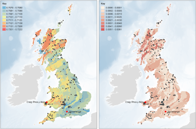
But there is a great deal of evidence which suggests that the bluestones are glacial erratics, picked up from more than 20 sites in West and South Wales, and carried eastwards by the ice of the great Irish Sea Glacier to various locations to the west of Stonehenge -- maybe in the vicinity of the Somerset Levels or the Mendip Hills.

If you read most of the specialist literature, it is simply assumed to be fact that the Neolithic tribes who built Stonehenge were capable of moving more than 80 large stones over a vast distance, over land and sea -- all the way from Carn Meini in Pembrokeshire to Stonehenge on Salisbury Plain. But where is the evidence in support of this? There is none -- but there is a vast amount of unscientific supposition, with assumption piled on assumption, and a great deal of circular reasoning as well. This is bad science, and such is the intolerance of the archaeology establishment to the idea of glacial stone transport that what we have effectively is a conspiracy. Not a conspiracy of silence, but a conspiracy to keep the glacial theory out of sight and out of mind. Why? I'll explore that one of these days.
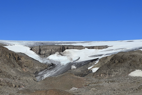
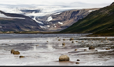
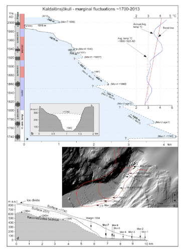
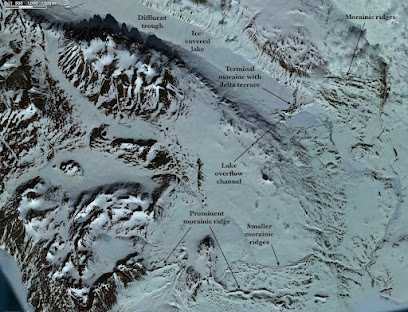
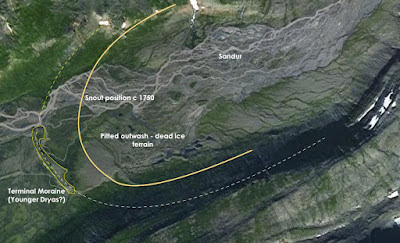
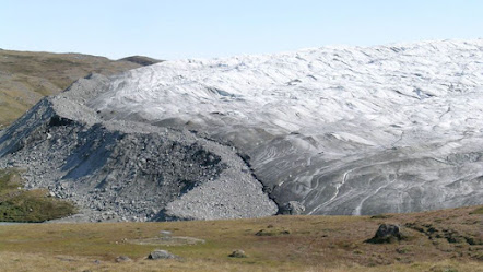
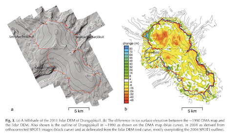


Monday 24 October 2022

Roche moutonnee island, East Greenland


 This is a great photo, picked up from social media, of an island in one of the East Greenland fjords which is a classic roche moutonnee form, with the long moulded rock slope of the stoss (up-glacier) side and the steep cliffs of the lee (downglacier) side. 

If you look carefully you can also see a lot of raised beach ridges, indicating that the island has almost doubled in size because of isostatic recovery since it was initially deglaciated.  I'm not entirely sure of the precise location.......

Oxford Gletscher surge


This is a new image from Google Earthy of the surge features on the Oxford Gletscher in East Greenland. This is the one we worked on in 1962.  It has a much better definition than images I have published previously.   Click to enlarge.

The diagnostic feature is the massive loop of moraine left behind when the eastern tributary glacier surged, almost squeezing out the ice from the western tributary. 

Friday 21 October 2022

The Moreton-in-Marsh terminal moraine


Two phases of glaciation, both during the Wolstonian, as identified by the research team.  In the early stadial it is proposed that there was a shoreline associated with Glacial Lake Harrison just to the north of Moreton-in-March, with an ice edge near Gloucester marking the greatest extent of the Wolstonian Severn Glacier. Then in the late stadial ice filled the Lake Harrison basin, almost reaching Moreton-in-Marsh and leaving behind a distinct terminal moraine and a spread of glaciofluvial sands and gravels.

I have been intrigued for some time by the glacial features around the Jurassic escarpment and the Cotswold Hills, and especially by the sediments near Moreton-in-Marsh.  This new paper takes a fresh look at the evidence, and comes up with some interesting conclusions.

https://royalsocietypublishing.org/doi/10.1098/rsos.220312

Appendix A. The Moreton Stadial Event

As noted in the main text, a glacial moraine forms rising ground (145–137 m OD) around the village of Moreton-in-Marsh, Warwickshire (SP 205 323) (figures 1 and 14b). This moraine complex marks the known maximum extent of glaciation during the Late Wolstonian Substage within the English West Midlands. 

The Moreton moraine ‘drift’ deposit was first mapped by Dines [168] and identified/interpreted by Tomlinson [16]. Bishop [13] subsequently linked the deposits as the maximum southern extension of the glacial sediments which form the Wolston Glacigenic Formation of the Wolstonian Stage [1,6,11]. The Moreton moraine ‘drift’ occurs as a series of ridges for ca 30 km2 around Moreton-in-Marsh and south to Broadwell (figure 14b). The glaciogenic deposits were proven in a borehole to a depth of 21 m [134]. North, at Stretton-on-Fosse (SP 218382) (figure 1 and table 1, 11), Bishop [13] described a series of deposits, exposed locally, where a diamicton unit was correlated with the Oadby Till Member, which locally overlies the Moreton Till Member of Tomlinson [16] and Sumbler [134]. 

In the Moreton-in-Marsh area, two glacial diamicton units are recorded interdigitating with and including the local Paxford Gravel Member [16,134,168]. The stratigraphically lower, Moreton Till of the Wolston Glacigenic Formation, local to Moreton-in-Marsh, was described by Bishop [13] as a locally laminated diamicton deposited at the margin of the pro-glacial Lake Harrison. It is equivalent to the Thrussington Till Member of the Wolston Glacigenic Formation. This diamicton unit, is directly overlain by the regional Oadby Member of the Wolston Glacigenic Formation. At Stretton-on-Fosse, faulting of the upper diamicton was reported, suggesting interpretation of the landform complex as a push moraine complex [13,134]. As discussed above, the pro-glacial Lake Harrison existed through two phases. Meltwaters from the second phase incised a channel down to 128 m OD through the confining Moreton moraine ridge, forming the Moreton Gap. This channel is critical to the regional stratigraphical correlation with the Upper Thames valley fluvial sequence during the Late Wolstonian Substage. 

The Moreton moraine landform complex is representative of the maximum extent of regional glacial deposition (Thrussington Till and Oadby Till members) of the Wolston Glacigenic Formation [1,6,11,13,134]. Its significance in marking the Wolstonian Stage glacial maximum limits, which have been dated herein to the Late Wolstonian Substage, give the Moreton moraine regional importance. Since it represents the glacial maximum extent, the Moreton moraine-ridge complex, and its associated exposure at Stretton-on-Fosse (table 11), are therefore proposed here as the climatostratigraphic stratotype of the Moreton Stadial, the first of two stadials (the latter being that of the Pershore Stadial in Gibson [68]) that can be identified in central Britain in the Late Wolstonian Substage.

Just a reminder of where this all sits in the glacial sequence of the UK:


MIS2 is the Late Devensian or LGM, MIS6 is the Late Wolstonian, and MIS8 is the Early Wolstonian.  there is some confusion about MIS7 -- was there really an interglacial between those two very cold (glacial) phases?  Watch this space....


Cosmogenic dating of Midlands erratics


Timing and dynamics of Late Wolstonian Substage ‘Moreton Stadial’ (MIS 6) glaciation in the English West Midlands, UK
Sebastian M. Gibson,
Mark D. Bateman,
Julian B. Murton,
Timothy T. Barrows,
L. Keith Fifield and
Philip L. Gibbard
Royal Society Open Science: 29 June 2022
https://doi.org/10.1098/rsos.220312

https://royalsocietypublishing.org/doi/10.1098/rsos.220312

There are now 6 cosmogenic dates for erratic boulders in the Midlands. These are reported by Seb Gibson and his colleagues in their big paper on the Wolstonian glaciation of the Midlands.  In the table below, the top 3 dates are new determinations, and the bottom three are corrected from Phillips et al (1994).  There is one anomaly, as yet unexplained:  52,000 yrs BP for sample WAR-01.  The others are strongly suggestive of a substantial glacial episode in the Midlands in the Wolstonian, in which the ice was more extensive than that of the Anglian glaciation.  (The line showing maximum Anglian ice extent has been withdrawn northwards.....)


Gibson, Sebastian M.; Bateman, Mark D.; Murton, Julian B.; Barrows, Timothy T.; Fifield, L. Keith; GIBBARD, Philip L. (2022): Supplementary material from "Timing and dynamics of Late Wolstonian Substage ‘Moreton Stadial’ (MIS 6) glaciation in the English West Midlands, UK". The Royal Society. Collection. 

Quote:
Glaciation during the late Middle Pleistocene is widely recognized across continental northwest Europe, but its extent and palaeoenvironmental significance in the British Isles are disputed. Although glaciogenic sediments at Wolston, Warwickshire, in the English West Midlands, have been used to define the stratotype of the Wolstonian Stage, their age has been variably assigned between marine isotope stages (MIS) 12 and 6. Here we present sedimentological and stratigraphical observations from five sites across the English West Midlands whose chronology is constrained by new luminescence ages from glaciofluvial sediments, supplemented by cosmogenic 36Cl exposure dating of erratic boulders. The ages suggest that between 199 ± 5 ka and 147 ± 2.5 ka the British Ice Sheet advanced into the English West Midlands as far south as Moreton-in-Marsh, Gloucestershire. This advance is assigned to the Moreton Stadial of the Late Wolstonian Substage. Dating of the glaciation to this substage allows correlation of the Moreton Stadial glacial deposits in the English West Midlands with those of the Drenthe Stadial during the Late Saalian Substage across continental northwest Europe.

Quote from main article text:

4.2.2. Exposure dating
The new and revised exposure ages are presented in table 8, ages are presented with internal errors and external errors in brackets. The ages scatter more than expected and suggest that some of the boulders may not be in situ. All but one of the ages fall between 225 and 100 ka. The ages rule out deposition before the Wolstonian Stage and during the Early-to-Middle Wolstonian Substage (ca MIS 10–8). Weathering is unlikely to be the cause of the scatter, but periglacial action during the last glacial cycle could conceivably have heaved boulders. Erratics dated by Phillips et al. were brought in by Wolstonian Stage ice but are only directly related to glacial diamicton at Calcott Hill (Sample GB-B1) 

Three of the dates are corrected from this paper in 1994:
Phillips FM, Bowen DQ, Elmore D. 1994 Surface exposure dating of glacial features in Great Britain using cosmogenic chlorine-36: preliminary results. Mineral. Mag. 58, 722-723. (doi:10.1180/minmag.1994.58A.2.113


This map shows the revised glacial limits across England, the North Sea and the Netherlands.  Note that  the Anglian (MIS-12) ice is shown as less extensive than shown in earlier speculative limits for the Midlands, and Wolstonian ice is shown as more extensive.  Wolstonian ice also pushed much further south across the Netherlands. The reasons for these substantial differences in ice cover are not yet explained.


A Pembrokeshire Treasure Trove of information


This is the entry for Westdale Bay.  The citation makes no mention at all of the fact that this is one of the most important Quaternary sites in West Wales......


Sketch of the spectacular stratified deposits at the head of Westdale bay -- apparently unnoticed by the geologists who wrote the site citation......

I was looking up some sites around the Pembs coast, and I was struck yet again by how valuable this resource is:

https://www.pembrokeshirecoast.wales/wp-content/uploads/2020/08/RIGS-in-Pembrokeshire-SPG-Apr2020.pdf

The list of RIGS sites, and the maps and citations, are immensely valuable to researchers and the public, and the designations provide a degree of planning protection.

Rhosyfelin is the most recently added site, numbered 564.

Many of the key Quaternary sites are listed as RIGS sites, and the information on geology is (as far as I can see) reliable and up to date.  But the citations are very thin on geomorphology and Quaternary sediment sequences.  Here and there the citations need to be corrected and expanded, if our Ice Age features are to be duly respected.  Something for me to do in my spare time.........

--------------

Pembrokeshire Coast National Park Local Development Plan

Regionally Important Geodiversity Sites in Pembrokeshire

Supplementary Planning Guidance to Local Development Plan 1 Adopted 12 October 2011.
Addendum Adopted September 2016

Interim Supplementary Planning Guidance to Local Development Plan 2 (September 2020)

Regionally Important Geodiversity Sites are funded and supported by Natural Resources Wales. They are designated outside the Local Development Plan process by Geoconservation Cymru–Wales. The Authority supports these designations with supplementary planning guidance which is updated when sites are newly designated.

=============================

Here is my post on Westdale, indicating just how important it is:

Thursday 20 October 2022

Alpine glacier disappearance


The literature these days is full of "before and after" images illustrating glacier disappearances all over the world.  It has become an epidemic........ and thank goodness people are taking note.

The above example comes from the Alps, with a reconstruction below showing the assumed glacier extent at the time of the Late Glacial maximum, around 12,500 years ago.

I'm intrigued by the lessons we can learn from close examinations of the deglaciated areas.  If you zoom in on the top photo you can see a vast expanse of "clean rock surfaces" in areas that were at one time the accumulation zones of small glaciers feeding to the Aletsch Gletscher.  These areas do not experience a great deal of erosion, although to the left there are traces of an incipient cirque, cut where ice has been accelerating through an icefall. Ice covering is not the same as ice moulding or ice streaming, and I'm wondering what lessons can be learned here which may be of use in interpreting the glacial features of West Wales........

Wednesday 19 October 2022

The Midlands erratic hunt


Thanks to Richard for drawing my attention to this: 

https://www.theguardian.com/uk-news/2022/oct/19/rock-project-missing-midlands-birmingham-boulders

See also this post from a few years ago:

https://brian-mountainman.blogspot.com/2016/10/erratic-behaviour-in-midlands.html

It's all a bit of fun, of course, but it's nonetheless pleasing to see "Heritage of the Ice Age" being flagged up by Bromsgrove and Birmingham heritage organisations -- and accorded a cultural "value".  There are going to be seven erratic walking trails, which is great news.

I'm not sure who decided that these boulders were dumped 450,000 years ago,  in the light of the most recent evidence, but we'll let that pass......

Anyway, good for the University of Worcester and the National Lottery Heritage Fund for funding this project, and good for the Guardian, the BBC and other media for publicising it.

I think we should now have another "erratic walking trail" at Stonehenge.  It's quite a short walk, around the bluestone circle, or what's left of it.  Perhaps the National Lottery will also fund an erratic search across Salisbury Plain for all of the 40 or so bluestone erratics that have supposedly gone missing?


This is the dedicated web site:


See also:


An 1890 map of the erratic boulders:


Known Welsh erratic boulders in the region:


This is a very useful summary of the geological context:


Update:

I have been making enquiries about the cosmogenic dating of some of the erratics, and I thank Prof Ian Fairchild for reminding me of the work of Seb Gibson and others.  I mentioned the new Midlands work here:

There are actually 6 cosmogenic dates already, and I'll cover those in a separate post.


Tuesday 18 October 2022

The Aubrac ice cap


The LGM / Wurmian / Weichselian / Devensian ice cap at Aubrac, in the SW of the Massif Central.  It was based on a large plateau of Miocene basalt and granite, around 1300 - 1470 m altitude.  At its greatest extent it was only about 20 - 30 km across, and about 200m thick.  The ice divide appears to have been towards the western edge, approx on the crest line of the massif.  The location is shown on the map below.  Three glaciations are known here, and the main glacial landscape features are glacial lakes (these are NOT flooded glacial craters).  The summits, over 1200m, and gentle rather than spectacular; they are the centres of eruptive activity, but the volcanic episodes were marked by "quiet" eruptions of flowing lava, rather than explosive activity accompanied by ashfalls and ignimbrites.

I'm intrigued by the similarities between this and the Dartmoor ice cap -- and maybe some others too.......


There is an interesting new article:

"Last glacial fluctuations in the southwestern Massif Central, Aubrac (France): First direct chronology from cosmogenic 10Be and 26Al exposure dating"

Arthur Ancrenaz,  Régis Braucher, Emmanuelle Defive, Alexandre Poiraud, Johannes Steiger 
Quaternary Science Reviews
Volume 285, 1 June 2022, 107500

Abstract

The chronology of the late Pleistocene glaciation in the Massif Central, France, is not well documented and there are divergent hypotheses regarding the timing of glacial events in this area. This study aims at reconstructing the chronology of late Pleistocene glacial fluctuations in the Aubrac Mountains. We present a new set of Be-10 and Al-26 exposure ages from twenty erratic boulders embedded in six glacial landforms. Glacial landforms were sampled to determine the timing of three glacial stades and the deglaciation of the Aubrac Mountains. These new data allowed us to constrain the timing of: (i) the Local Last Glacial Maximum, which is coeval with the early Marine Isotopic Stage 2 (MIS 2) (28–24 ka), and (ii) the Grandvals and Bouquincan stades, which are both coeval with the late MIS 2 (24–16 ka). Deglaciation occurred during Heinrich Stadial 1 (18–15.6 ka). This new direct glacial chronology is supported by regional paleoenvironmental proxies and it updates the chronostratigraphic framework available for the southwestern Massif Central. Western European atmospheric circulation changes (i.e., a southward shift in North Atlantic storm tracks and Mediterranean influences) during MIS 2 were identified as significant factors controlling glacier growth in the Aubrac Mountains as well as other glaciated mountains within the southwestern Massif Central, such as the Cantal, Margeride and Lozère mountains.


On this map we can see the extent of the plateau and the locations of the main peaks.

It's interesting that this cosmo dating exercise places the LGM at around 26,000 years BP -- as in the West Wales - Celtic Sea arena.  There were some smaller "stades" that interrupted deglaciation, with final deglaciation occurring around 16,000 BP.

See this on Dartmoor: