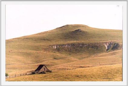

The LGM / Wurmian / Weichselian / Devensian ice cap at Aubrac, in the SW of the Massif Central. It was based on a large plateau of Miocene basalt and granite, around 1300 - 1470 m altitude. At its greatest extent it was only about 20 - 30 km across, and about 200m thick. The ice divide appears to have been towards the western edge, approx on the crest line of the massif. The location is shown on the map below. Three glaciations are known here, and the main glacial landscape features are glacial lakes (these are NOT flooded glacial craters). The summits, over 1200m, and gentle rather than spectacular; they are the centres of eruptive activity, but the volcanic episodes were marked by "quiet" eruptions of flowing lava, rather than explosive activity accompanied by ashfalls and ignimbrites.
I'm intrigued by the similarities between this and the Dartmoor ice cap -- and maybe some others too.......


There is an interesting new article:
"Last glacial fluctuations in the southwestern Massif Central, Aubrac (France): First direct chronology from cosmogenic 10Be and 26Al exposure dating"
Arthur Ancrenaz, Régis Braucher, Emmanuelle Defive, Alexandre Poiraud, Johannes Steiger
Quaternary Science Reviews
Volume 285, 1 June 2022, 107500
Abstract
The chronology of the late Pleistocene glaciation in the Massif Central, France, is not well documented and there are divergent hypotheses regarding the timing of glacial events in this area. This study aims at reconstructing the chronology of late Pleistocene glacial fluctuations in the Aubrac Mountains. We present a new set of Be-10 and Al-26 exposure ages from twenty erratic boulders embedded in six glacial landforms. Glacial landforms were sampled to determine the timing of three glacial stades and the deglaciation of the Aubrac Mountains. These new data allowed us to constrain the timing of: (i) the Local Last Glacial Maximum, which is coeval with the early Marine Isotopic Stage 2 (MIS 2) (28–24 ka), and (ii) the Grandvals and Bouquincan stades, which are both coeval with the late MIS 2 (24–16 ka). Deglaciation occurred during Heinrich Stadial 1 (18–15.6 ka). This new direct glacial chronology is supported by regional paleoenvironmental proxies and it updates the chronostratigraphic framework available for the southwestern Massif Central. Western European atmospheric circulation changes (i.e., a southward shift in North Atlantic storm tracks and Mediterranean influences) during MIS 2 were identified as significant factors controlling glacier growth in the Aubrac Mountains as well as other glaciated mountains within the southwestern Massif Central, such as the Cantal, Margeride and Lozère mountains.

On this map we can see the extent of the plateau and the locations of the main peaks.
It's interesting that this cosmo dating exercise places the LGM at around 26,000 years BP -- as in the West Wales - Celtic Sea arena. There were some smaller "stades" that interrupted deglaciation, with final deglaciation occurring around 16,000 BP.
See this on Dartmoor:
No comments:
Post a Comment
Please leave your message here