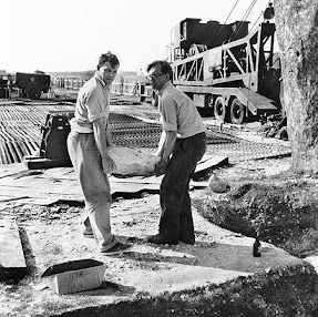
How much do we know about Stonehenge? Less than we think. And what has Stonehenge got to do with the Ice Age? More than we might think. This blog is mostly devoted to the problems of where the Stonehenge bluestones came from, and how they got from their source areas to the monument. Now and then I will muse on related Stonehenge topics which have an Ice Age dimension...
Some of the ideas discussed in this blog are published in my new book called "The Stonehenge Bluestones" -- available by post and through good bookshops everywhere. Bad bookshops might not have it....
To order, click HERE
Monday 29 April 2024
The Ice Age pioneers
Thursday 25 April 2024
The Great Cursus -- the place where the stones were found?
As readers of this blog will know, I'm not a great one for speculations. I spend a lot of my time criticising fantasies and speculations, and people who dress up speculations as the truth.
But every now and then, a spot of speculation can be fun, and in reading up a bit on the Great Cursus, it seems to me that nobody has ever suggested that it might have been the place where stones were found, or the place from which stones were collected for the building of Stonehenge. They must have come from somewhere..........
Sounds crazy? Well, maybe, and my money is still on it being a sort of processional feature, along which people walked for some ceremonial or ritual (ie non-economic or "irrational") purpose currently unknown. It's a better hypothesis than the Roman race track or the spacecraft landing strip hypotheses........ and I'm not all that convinced by the ideas that the enclosed strip was either sacred or cursed, or that it was deliberately enigmatic, built by people for whom the act of building was all that mattered. Built for symbolically keeping things in, or keeping them out? Or was it not an enclosure at all, but a line between a landscape devoted to the living, on one side, and a landscape devoted to the dead, on the other. Or maybe a line between a ceremonial landscape and a "normal" landscape where people just got on with their lives? Or maybe it has an "astronomical" origin, aligned as it is towards the horizon sunrise on the equinox?
I don't like the line idea, because there are two slight embankments, more or less parallel to one another. If the Neolithic builders had wanted to demarcate a boundary or a frontier, surely they would have been happy with one embankment, maybe made even higher and more prominent?
And the processional idea is also somewhat strange, because the ends of the 3 km routeway are closed off -- so there is no entrance and no exit. Which way would people have walked? Westwards or eastwards? Probably westwards, because near the western end there is a cluster of barrows and other features -- but the round barrows are considerably younger than the Cursus embankment, and so they could not have been involved in any funerary processions heading towards the sunset. On the other hand, the long barrow called Amesbury 42 is close to the eastern end, and so maybe they walked towards that........ and that one has the advantage of being more or less the right age.
It's intriguing that the Cursus seems to be unrelated to the landscape in that it drops down across the chalklands into Stonehenge Bottom valley and up again on the other side, so topography does not seem to have determined its location.
So is there anything that might point us towards the Cursus as having something to do with stones -- either bluestones or sarsens? Or both? Well, it may or may not be significant that there are abundant records of bluestone "fragments" being found in association with the Cursus -- especially at the western (Fargo Plantation) end. The finds are mostly from field walking collections; there are only two recorded excavations running across the whole width of the Cursus, one in 1917 and the other in 1959. The other excavations have been on the embankments -- mostly concentrating on the search for materials (such as antler picks) that might permit radiocarbon dating.The researcher who seems to have been most intrigued by the Cursus was Jack Stone in 1949 -- according to some sources he cut a trench across the Cursus and was so impressed by the concentrations of bluestone fragments near Fargo Plantation and between the Cursus and the site of Stonehenge that he thought there might have been a "bluestone monument" at the former site that was dismantled, modified and then reconstructed in the monument we see today. If bluestones were at one time scattered across the landscape as an erratic trail or train aligned with the direction of ice movement, and then collected and used as building materials, we might expect to find occasional extraction pits or hollows, and maybe patches of degraded till. No such things are known -- although it has to be said that nobody has ever looked for them.
This is just a suggestion, and I am not at all sure how seriously to take it. But remember -- you saw it here first.............
Wednesday 24 April 2024
Our ancestors were not as stupid as you might think........
This is quite wonderful. Our old friend Tim Daw, over on his Sarsen.org blog site, is fighting the corner on behalf of our heroic ancestors, and accusing people like me of a lack of respect for their intelligence. He reproduces a press release (presumably from EH at Stonehenge, or from Cardiff University) in which Win Scutt accuses sceptics of the human transport thesis of "insulting our Neolithic ancestors" and urging us to have a greater appreciation of their capabilities.
Not for the first time, Tim completely misunderstands the situation. I have the greatest respect for the intelligence of our Neolithic ancestors, and I should have thought this is pretty obvious to anybody who reads this blog as avidly as Tim does.
After all, they had aspirations to build Stonehenge, and even if they never managed to finish it because they ran out of stones, they did at least try. They moved a lot of rather large monoliths at Stonehenge, Avebury and elsewhere, and used some rather smart building techniques. They shaped some of the stones into rather elegant pillars. They may even have been smart observers of the movement of the sun, the moon and the stars in the sky. But to suggest that they were stupid enough to try and transport 80 big bluestone boulders and slabs all the way from Preseli to Stonehenge, across savage terrain, and then shaped some of them into pillars, thereby reducing their bulk and weight by maybe 50%, is a real insult to their intelligence. I think they did what any smart group of individuals would have done when they saw an opportunity to use relatively abundant stone resources on the rolling chalklands of Salisbury Plain. They decided to build a highly imaginative structure more or less where the stones were found. That was truly exceptional.They were smart enough to know all about cost / benefit analysis, and carried on with the work for as long as they had available stones. They had to go further and further afield to find the stones that they needed, but as they did so their costs (in manpower and effort) increased inexorably, and the benefits diminished. At last, when the costs far outweighed the benefits, and with only about 50% of the desired stones in place, they experimented with various stone settings, decided that none of them were exactly what they wanted, and eventually gave up on the whole thing. Just as any other group of intelligent human beings would have done, they went off and did something else which involved less effort and which brought them more pleasure.......... maybe an orgy or two over at Durrington village........
So three cheers for our Neolithic ancestors. May they continue to thrive!!
===============================
Doubting the overland transportation of the stones is insulting to our Neolithic ancestors.
On Sunday, April 21, Professor Keith Ray achieved his goal, arriving at Stonehenge. Along different sections of his walk, he was joined by numerous academics, archaeologists, and other experts who accompanied him to learn about the terrain first hand. The journey took less than a month, and it provided valuable insights into the ancient landscape.
Win Scutt, senior properties curator for English Heritage, labeled Keith’s trip an “absolutely astonishing, heroic achievement”. At the seminar about the trip it was emphasized that doubting the overland transportation of the stones was insulting to our Neolithic ancestors and researchers were urged to have appreciation for their capabilities.
Keith Ray’s low-tech research method led to an interesting discovery: a route through the hills and mountains between Wales and England that never required more than a 20-degree climb. Along the way, he was joined by over 20 other academics. Keith observed that the lines of travel often followed ancient paths, demonstrating how the ancients navigated the landscape by going with the land and following the path of least resistance.
Kate Churchill, an archaeologist at Churchill Archaeology in Monmouthshire, walked part of the way with Keith. She found the experience comparable to walking during Neolithic times, allowing her to “stop and look at the landscape and be inspired.”
Professor Keith Ray’s remarkable journey sheds light on the historical connections between Wales and Stonehenge, revealing the ancient pathways that once connected these distant lands.
(Press release via Microsoft CoPilot)
==============
In the Salisbury Journal, we see the following: Win Scutt, senior properties curator (west) for English Heritage, who labelled Keith’s trip an “absolutely astonishing, heroic achievement”, said it was insulting, in light of all the evidence, for academics to still doubt the stones’ overland transportation.
Er, excuse me, but "in light of all the evidence" ??? ........and what evidence might that be? Does Win know something that the rest of us don't?
Bluestone lithics from the Stonehenge landscape
Thanks to Tony for a number of comments recently about the bluestone lithics in the Stonehenge landscape. There are -- by common consent -- thousands of them, dug up and revealed in Stonehenge digs, in field walking exercises, and in excavations elsewhere in the Stonehenge landscape. Most of them are ignored or thrown away, and Ixer and Bevins choose not to take them seriously unless they are clearly related to known bluestone orthostats -- so that neatly eliminates anything "inconvenient"............
See Julian Richards, 1990 -- The Stonehenge Environs Project, EH, London
But it isn't that easy. Stone and Richards, in various publications, refer to a "wide distribution" of fragments of dolerite, rhyolite and volcanic ash, and they refer to many rock types that are not represented in the bluestone orthostat assemblage. They refer to "unknown" rhyolites, ashes, dolerites and quartzites. Mostly they label the bluestone finds as flakes, fragments, slabs, hammerstones or tools -- demonstrating an unwillingness to contemplate the presence of bluestone boulders, cobbles or pebbles that might have nothing to do with human activity.
And the things that are all too easily referred to as "tools" may indeed not be tools at all, but perfectly natural small bluestone erratics such as we might find in any degraded glacial deposit:
Here is another old photo from a 1902 excavation at Stonehenge, again assumed to show "sarsen stone and flint implements" -- with no apparent awareness that some might simply be glacial erratics......
https://www.silentearth.org/restorations-at-stonehenge-2/
In the photographic record of the Atkinson and earlier digs at Stonehenge, over and again we see packing stones and small boulders that are simply ignored and thrown onto spoil heaps. Appalling! Watch this space.........
STONEHENGE EXCAVATIONS 2008 Timothy Darvill, VPSA, and Geoffrey Wainwright, PSA
Tuesday 23 April 2024
The new Holocene article
It's one month since publication, and this is the link to my article in The Holocene journal:
https://journals.sagepub.com/doi/10.1177/09596836241236318
https://doi.org/10.1177/09596836241236318
It's flagged up as open access, but as we all know, that does not mean access to all who may wish to read it. If you can't get at it on the journal web site, it is also here on Researchgate:
This is the final accepted version in the format I submitted -- so it appears slightly different from the version published in the journal. But it's all there......... and has over 2,600 reads so far, so people are taking it seriously.
If you want a PDF of the article as published, let me know, and I will get a copy off to you. I am allowed by the publishers to distribute copies to friends and fellow researchers for their personal edification!
Ref:John, B.S. 2024. The Stonehenge bluestones did not come from Waun Mawn in West Wales. The Holocene, March 20, 2024 (published online) 13 pp.
Sunday 21 April 2024
Hooray for the invisible stone carriers!
Today, English Heritage Senior Properties Curator, Win Scutt joined part of a 230-mile walk of one possible route for the transport of bluestones from the Preseli Hills to Stonehenge.
It’s thought that this is the first time that the journey has been made on foot in modern times.
"I would say Neolithic people were very aware of significant communities and that's how they organized it so that they could follow a route linking with particular communities."
Heather Sebire, senior properties curator at English Heritage said: "We've never known exactly how the stones were brought from so many miles away to this ancient landscape 5,000 years ago.
"Professor Ray's endeavours will help keep the discussion around this fresh in the minds of archaeologists and the public.
Friday 19 April 2024
Another computer model
There is a new and rather spectacular computer generated interactive and animated "icemap" showing the expansion and contraction of the BIIS and the SIS during the Late Devensian. It's free for anybody to use, and it has been created by Henry Patton at Tromsø University in Norway.
https://icemap.rhewlif.xyz/?fbclid=IwZXh0bgNhZW0CMTAAAR3Q2Wsw4JAYdL_lyda1ajOdLQNbtwJ8iePNU34H-v__H4qAlL_yK383hTU_aem_ASWAPezhTzxON2vIelI668jcP7phW4y9poLVfj70C2jDTe9HnYeSPFfM1VL010AJ1AuLrKH2LHk726z2Byo50Qfa#
It's visually very attractive and seems to me to be pretty reliable for the most part. However, there is a major issue with dating, and the peak of the LGM is shown here as around 22,500 yrs BP as compared with around 26,000 yrs BP in the BRITICE reconstruction. Who is correct? This is a very substantial difference, no doubt explained by differences in the calibration of radiocarbon and marine isotope dating........
Also, Henry seems to have been using different databases for different parts of this computer programming exercise. On the ice extent map, the Devensian ice edge is shown hitting Salisbury Plain. That will cause quite a lot of discussion, since the BRITICE reconstruction is far different -- and with most researchers suggesting that the inner part of the Bristol Channel was not affected by glacier ice during the LGM, but that ice extent was greater during earlier glacial episodes.
The Lost Circle -- British Open Brass Band Challenge!!
You couldn't make this up. "The Lost Circle" has now been set to music by Belgian composer Jan Van Der Roost as a test piece for the British Open Brass Band competition.
https://www.4barsrest.com/news/60636/british-open-announces-2024-test-piece
This is hilarious on one sense. But it is also a stark reminder of the manner in which wild speculations and dodgy science can turn fantasies into myths and in turn into something seen by others (such as Belgian brass band composers) as established truth. The commissioning sponsors have clearly all been swept up in the media frenzy about Waun Mawn, and probably just loved that famous TV documentary fronted by Alice Roberts. One cannot doubt that in good faith our friend Jan the Composer has accepted that the "Lost Circle" at Waun Mawn did actually exist -- before going on to explore musically what the "how and why" might have been.
So are MPP and his merry men feeling guilty about misleading gullible members of the public so comprehensively? I doubt that very much...........
===================
Here is the blurb:
British Open announces 2024 test-piece
'The Lost Circle' by Jan Van Der Roost will pose questioning musical challenges for bands wishing to construct a British Open winning performance at Symphony Hall this year.The composer explored both why and how the Bluestones of Stonehenge came to their final resting place
A new commission by the critically acclaimed Belgian composer Jan Van Der Roost has been announced as the set-work for the 2024 British Open Championship.
'The Lost Circle' is his fifth major contest composition and has been commissioned through an international consortium of organisations, including the British Open alongside the national bodies of Belgium, The Netherlands, Norway, Switzerland, Germany and Austria.
It will receive its world premiere at the 170th British Open Championship at Symphony Hall, Birmingham on Saturday 7th September.
The work sees the composer return in inspiration to Stonehenge — the ancient site on Salisbury Plain in the UK that has held fascination to humans for millennia. It is, as the composer says, "a monument that has been the subject of questions, guesswork, doubts and speculations from time immemorial."
However, although 'The Lost Circle' is linked thematically in musical inspiration, it is not an "explicit successor" to his earlier 'Stonehenge' composition written in 1992.
Instead, as Jan Van Der Roost writes in his foreword to the 16-minute score, it is a work rich in thematic symbolism. It questions both how and why the inner circle of megalithic Bluestones were brought by ancient people on a 240-kilometre journey from deep in the Preseli hills in West Wales to their final resting place.
Speaking exclusively to 4BR he said: "I am honoured to write 'The Lost Circle' for the British Open and the national associations of Belgium, The Netherlands, Norway, Switzerland, Germany and Austria where it will subsequently be performed at their National Championships.
It follows 'Excalibur', 'Stonehenge', 'Albion' and 'From Ancient Times' in being used at major events, and I will be delighted to hear it performed at the magnificent Symphony Hall in Birmingham for its world premiere."
He added: "It is definitely a challenging and demanding work, but one I hope will be enjoyed by the conductors, performers and audiences alike in the months to come in the UK and Europe."
In making the initial contest announcement, British Open Championship Artistic Advisor, Dr Robert Childs told 4BR: "Jan Van der Roost is rightly regarded as one of the foremost composers writing for the brass band medium.
'The Lost Circle' is a magnificent work — and one which I am sure alongside our colleagues throughout Europe will provide a wonderful musical test for competing bands, and a thoroughly rewarding musical experience for listeners."
British Open Contest organisers Martin and Karyn Mortimer added: "It will be the first time Jan Van Der Roost has written a work to be used at the British Open Championship. We are thrilled to be able to provide the stage for its world premiere. Our thanks got to him and to our consortium friends for making this wonderful piece possible."
Tuesday 16 April 2024
Feedback mechanisms and ice sheet behaviour
This is a very interesting paper on the behaviour of the Scandinavian Ice Sheet. For some time I have been interested in the manner in which feedback mechanisms operate within and on the edges of large ice masses. As readers of this blog will know, I have pondered occasionally on the role played by large troughs (such as Sognefjord in Norway and Nordvestfjord in East Greenland) in the efficient evacuation of ice and the dynamics of the ice mass. Assuming that in each successive glacial cycle these troughs are widened and especially deepened, we can also assume that the efficiency of ice transfer is improved -- but does that mean that ice sheets will get bigger and bigger in each successive glaciation? Not necessarily -- there might be ice edge advances at the trough outlets, but maybe ice edge retreat elsewhere because of ice capture in the trough catchments. In other words, there might be increased ice edge crenellation. This could all get very confusing -- and to their credit Henry Patten and others have already been thinking along these lines with respect to the BIIS.
The influence of glacial landscape evolution on Scandinavian ice-sheet dynamics and dimensions
The Cryosphere, 18, 1517–1532, 2024
https://doi.org/10.5194/tc-18-1517-2024
The Scandinavian topography and bathymetry have been shaped by ice through numerous glacial cycles in the Quaternary. In this study, we investigate how the changing morphology has influenced the Scandinavian ice sheet (SIS) in return. We use a higher-order ice-sheet model to simulate the SIS through a glacial period on three different topographies, representing different stages of glacial landscape evolution in the Quaternary. By forcing the three experiments with the same climate conditions, we isolate the effects of a changing landscape morphology on the evolution and dynamics of the ice sheet. We find that early Quaternary glaciations in Scandinavia were limited in extent and volume by the pre-glacial bathymetry until glacial deposits filled depressions in the North Sea and built out the Norwegian shelf. From middle–late Quaternary ( 0:5 Ma) the bathymetry was sufficiently filled to allow for a faster southward expansion of the ice sheet causing a relative increase in ice-sheet volume and extent. Furthermore, we show that the formation of The Norwegian Channel during recent glacial periods restricted southward ice-sheet expansion, only allowing for the ice sheet to advance into the southern North Sea close to glacial maxima. Finally, our experiments indicate that different stretches of The Norwegian Channel may have formed in distinct stages during glacial periods since 0:5 Ma. These results highlight the importance of accounting for changes in landscape morphology through time when inferring ice-sheet history from ice-volume proxies and when interpreting climate variability from past ice-sheet extents.
Monday 15 April 2024
The extraordinary Mr Croll -- the world's first glaciologist
James Croll (1821-1890) was an extraordinary man with very little formal education who became a janitor at the museum of the Andersonian University in Glasgow in 1859 and who taught himself (because of his insatiable appetite for learning and his open access to the university library) physics, astronomy and geology. He corresponded with Charles Lyell and disagreed with him about the origins of what were then called "drift" deposits, but he was greatly encouraged in his researches by Sir Archibald Geikie, and then obtained a position in the office of the Geological Survey of Scotland.
He is revered in Scotland as one of the country's great scientists and as one of the most original of thinkers, and he stood out from the other "glacialists" of the time, who were mostly geologists who happened to be interested ion the Ice Age. I think we should give him the accolade of being the first genuine glaciologist, because of the manner in which he combined the principles of physics, astronomy, climatology and geology in order to understand how glaciers work and how Ice Ages come and go through geological time.He was, of course, in 1879 too radical and too far ahead of everybody else to have escaped unscathed -- and towards the end of his life there was a backlash from the more conservative members of the scientific establishment. In spite of the fact that he was supported and encouraged by the Geikie brothers, and in spite of his copious and creative correspondence with all the great scientists of his day, he never was a full member of the science elite in Britain, and he was known in some quarters as a "controversialist". The main criticism directed towards him was that his ideas were unsupported by hard evidence and that he strayed too far into the realm of theory or speculation. That was all very sad, because one by one his ideas have been accepted and moved into the mainstream -- and field evidence has supported most of his inspired speculations. Yes, he made mistakes, but that is what happens on the frontiers of science, and the word "extraordinary" is one that will continue to be used for James Croll by those who examine the origins of the science of glaciology.
‘The most remarkable man’: James Croll, Quaternary scientist
Kevin J. Edwards
First published: 04 April 2022
https://doi.org/10.1002/jqs.3420
The year 2021 marked the bicentenary of the birth of James Croll (1821–1890), the self-educated son of a crofter-stonemason, whose life was characterised by a dizzying range of occupations and homes, poor health and financial concerns, and yet he became a pioneer of orbital dynamics and ice age climate change with an impressive record of publication. Drawing upon archival information and recently published observations, this paper explores selected aspects of Croll's biography, his scientific connections and controversies, and that area of his life relevant to Quaternary science. He was a 19th century polymath whose multifaceted contributions have been a catalyst for subsequent systems-based climate science on the grand scale, including the foundations for the seminal work of Milutin Milankovitch on the rhythms of Quaternary environmental change.
Rose J. 2021. Lyell, the Geikies and Croll's observations on terrestrial glacial sediments and landforms. Earth and Environmental Science Transactions of the Royal Society of Edinburgh 112: 261–274.
Sugden DE. 2014. James Croll (1821–1890): ice, ice ages and the Antarctic connection. Antarctic Science 26: 604–613.
Achievements and Key Points
James Croll:
Devised they theory that climate is controlled by solar insolation – the amount of energy reaching the earth from the sun.
Linked our planet’s ice ages to solar insolation variations caused by: Earth’s elliptical orbit around the sun (100,000-year cycle); precession of the equinoxes (23,000-year cycle); and axial tilt (41,000-year cycle).
Noted how the elliptical shape of Earth’s orbit around the sun varies with time – sometimes the ellipse is more eccentric (elongated).
Said ice ages happen when there is a combination of events: the earth’s elliptical orbit around the sun is at its most eccentric and mid-winter takes place when the earth’s orbit is at its farthest point from the sun. These conditions of reduced sunlight result in lower temperatures, leading to a build-up of ice and snow in the oceans and on the ground.
Said the build-up of ice redirects the trade winds and hence ocean currents. Warm currents like the Gulf Stream no longer bring heat from the tropics to the colder regions, enhancing the orbital cooling effect, leading to ice ages.
Advanced the theory of ice-albedo feedback. This says that if ice begins accumulating at a pole because of a decrease in winter sunlight, then the extra ice will reflect more of the sun’s heat back into space, leading to further cooling.
He (incorrectly) said ice ages alternate between the northern and southern hemispheres – the north and south taking it in turns to have moderate climates and ice climates in a cycle lasting 22,000 years in each hemisphere, with each ice age lasting about 10,000 years.
Although today we know Croll did not get all the details correct, his work provided a mechanism that explained the ice ages. It provided a basis for Milutin Milanković to go further the following century and generate the concept of Milankovitch cycles.
Saturday 13 April 2024
Bluestone transport: Edgar Barclay was the originator of the human transport hypothesis -- not HH Thomas
Barclay, 1895. “Stonehenge and its Earth-works”. Nutt, London, 225 pp.
https://archive.org/details/stonehengeandit00barcgoog/page/n64/mode/2up?view=theater
He was advised (somewhat prematurely) by the geologists of the day that the bluestones cannot have come from any British rock outcrops, and so he speculated that they might have come from Brittany, and that they were transported across the Channel by our ancient ancestors. He also suggests in his text that the bluestones must have been deemed as special or valuable -- in order to justify the "prodigious effort" involved in moving them. Barclay was also aware the the chippings and bluestone fragments scattered about across the Stonehenge landscape, and of a link with the abundant round barrows on the chalk downs.
The artist Edgar Barclay was born in 1842 and studied art in Italy and Germany. For several years as a working artist he divided his time between London and Italy, but he returned to England in the 1880s and began painting rural scenes of Wessex, especially of Stonehenge. He exhibited extensively and was known for his skill in handling light and big skies. He was also an accomplished historian, writing and speaking particularly on Stonehenge. He addressed the British Archaeological Association in 1893. He clearly had good contacts, and wrote "Stonehenge and Its Earth-Works” in 1895. He suggested -- because of the weathering crusts on many of the bluestones -- that they were simply collected as boulders rather than being quarried.
p 6
The inner circle and inner horse-shoe are composed of the foreign "Blue-stones", igneous rocks. The locality from which they were originally taken remains undetermined ; experts, after microscopic examination, have affirmed that in "no part of Great Britain is there any stone to be found of the same description." Of these some differ markedly in their nature from others.
p 77
The most arduous operation in connection with the erection of Stonehenge was the transportation of the Blue-stones ; we should, therefore, be forced to believe that although the builders lacked the energy to complete a gap in the Sarsen circle, they nevertheless had the opportunity and energy to fetch and set up the Bluestones. This is a contradiction ; we therefore conclude that stones are missing because the building has suffered from spoliation. Fortunately, ancient records which make mention of Stonehenge inform us how this probably came to pass.
pp 124-126
In conclusion, we take a retrospective glance at the results of our inquiry. To begin, there is the striking fact that Stonehenge consists of stones foreign to the neighbourhood, and belonging to geological formations widely apart ; proof that its construction was a far greater undertaking than the present appearance of the ruin would lead any one to suspect, and of the power of the founders to organize labour on a very considerable scale.
The labour of carrying these stones up from the coast was no mean one, and that they should have been transported across the sea is not merely a conspicuous proof of the resources of the founders, but indicates either that those who controlled the work were themselves moved by a strong sentimental motive, or that they played upon a strong sentimental feeling animating others, otherwise so laborious and unusual a course, and one so uncalled for by any utilitarian purpose, would never have been pursued.
The dictum of petrologists, that the Blue-stones are of foreign origin, is in harmony with the tradition that the stones have been transported hither by sea. The geological formation of Brittany points to that country as their probable source, a probability greatly strengthened by historical considerations. Geoffrey of Monmouth, when giving an account of additions effected by King Aurelius to the monastery at Amesbury, followed a tradition which stated that a stone circle was taken down and utilized for that purpose. We have no reason to believe that Geoffrey had knowledge of Stonehenge, situated a mile distant west of the monastery ; and mystified by another tradition which stated that the stones had been shipped, it appears that he in consequence concluded that the stone circle in question must have been situated in Ireland ; thus he kept to the right direction for their source, whilst considerably exceeding the real distance. It is incredible that Aurelius should have brought his building material from that country; he had not the power, supposing he had the crazy desire to do so ; he had no fleet, and the sea was commanded by piratical Saxons, his deadly enemies. In the introduction of the Irish incident we, therefore, recognize Geoffrey's embellishments ; we here see the old familiar artifice of making an incredible story appear veracious, by the introduction of circumstantial details, thus in the thick of the Irish embroglio he makes his characters orate in the time-honoured classical and biblical manner.
The Altar-stone belongs to a different geological formation to either the Wiltshire Sarsens or the foreign stones, and affords another proof of lavish expenditure of labour ; whilst the shaping of the rocks, and the manner in which the superimposed blocks are securely locked in their places by means of tenon and mortise, evidences the attainment of considerable skill.
Moreover, it is a striking fact that these rocks, collected with prodigal labour from sources so widely apart, should have been set up on a bare and desolate down, the surrounding land for the space of several miles being more thickly studded with barrows than any other district in this country, which produces a strong impression, the correctness of which is fully confirmed by closer scrutiny, that the ruin and the gravemounds are in some way connected. We noted the critical positions of the outlying stones, and that mysterious alignments proceed from the ruin and traverse the barrow-studded plain.
The design has manifestly not been dictated by utilitarian necessities, or by aesthetic sentiment, it shows the temple to have been dedicated to Sun-worship, the stones being so disposed as to form religious symbols ; the meaning of that symbolism we have endeavoured to explain, and in doing so we have followed ideas once current in Gaul.
The unity of the design was proved by the relative proportions of the parts, and that the different parts were raised at the same epoch is further attested, first, by the finding together of pieces of the different sorts of stone used in the construction within a gravemound, and, secondly, by chippings of all the rocks having been found in the concreted substance around the bases of the Bluestones. When thus proving the unity of the design, we proved also that the temple is not of prehistoric antiquity, for we have no reason to believe that the ancient Britons were capable of adjusting their buildings with a knowledge of geometry.
Monday 8 April 2024
What did HH Thomas know about the extent of glaciation?
I have been digging up some more info about what HH Thomas knew or did not know when he presented his controversial views on the transport of the bluestones in 1923. (And in 1921, actually......)
Let's take 1910 as a reasonable date to look at. The "state of play" was determined at the time by such senior geologists and "glacialists" as James Geikie (far more important than his older brother Sir Archibald), Carvill Lewis, Frederick Wright, Thomas Jehu and John Wesley Judd.
============================
Interestingly enough, the great majority of the articles published by Ixer and Bevins in recent years have also been published in archaeological journals -- and presumably they have been refereed for the most part by archaeologists. What a strange coincidence........!!
Saturday 6 April 2024
HH Thomas knowingly misrepresented the glacial erratic transport evidence in the Bristol Channel
I have been looking again at the manner in which, in 1923, HH Thomas informed the world that the glacial transport of bluestones from west to east (up the Bristol Channel) would have been impossible. Here is an earlier post of mine:
https://brian-mountainman.blogspot.com/2019/10/hh-thomas-and-his-glacial-blind-spot.html
Thomas was guilty of over-simplification and selective citation of his samples (there were very few anyway) and his rock identifications, in order to flag up the idea that there were just two main sources for the bluestones. It's interesting that in 2018 Bevins and Ixer attacked Thomas's slapdash methods, his sharp practices and his reputation pretty enthusiastically, but they restricted their scrutiny to his geological analyses, and criticised him for homing in on Carn Meini and Carn Alw as the main source locations for the Stonehenge bluestones.
https://brian-mountainman.blogspot.com/2018/06/herbert-thomas-scrutinized.htmlRetracing the footsteps of H.H. Thomas: a review of his Stonehenge bluestone provenancing study.
Richard Bevins and Rob Ixer
Antiquity, May 2018.
https://doi.org/10.15184/aqy.2018.10
Published online: 31 May 2018
=================
Extract from HH Thomas, 1923 Antiquaries Journal
Having in a great measure solved the problem of the source of the Foreign Stones, we must consider carefully the possible and probable modes of transport of the stones from Pembrokeshire to Salisbury Plain. Two modes of transport have been suggested : one natural, by ice during the great Ice Age ; the other, by human agency at, of course, a later period.
The Hypothesis of Ice-transport.
We have, of late years, considerably advanced our knowledge of the distribution and extent of the British Ice-fields, and also accumulated much information concerning the directions and limits of dispersal of erratic boulders. The geological evidence is such that the idea of a glacial origin for the Foreign Stones will not bear investigation.
Let us consider critically this hypothesis of glacial transport as suggested by Professor Judd. First, there is no evidence of glacial drift on Salisbury Plain such as would of necessity have been left by any ice-sheet capable of transporting the masses of rock in question. Isolated masses of rocks foreign to the district, other than those used in the fabric of Stonehenge are entirely wanting, as also are small pebbles of such rocks from the gravels of the neighbourhood. It has been claimed, without producing any evidence in support of the statement, that such masses did exist but that they have all been collected to make walls, gateposts, millstones, etc. But, as Mr. Stevens of Salisbury has cogently stated, no one can point to a single rock-mass like any of those used at Stonehenge having been put to any such purpose. Mr. Stevens says ' There are many millstones and gateposts in Wiltshire, but where is there one which corresponds in any way to the upright Foreign Stones of Stonehenge ? Unhappily this tangible evidence is wanting ; so, alluring as the Glacial Drift Theory may appear, it must reluctantly be set aside for want of convincing evidence.'
((Comment: It's disingenuous of Thomas to pretend that substantial "rock masses" of exactly the right type on Salisbury Plain are required in order to demonstrate that glacial entrainment and transport might have occurred. There are erratic stones in the records of work prior to 1923, and the Boles Barrow bluestone was already on the record following its discovery by Cunnington in 1801. If you want to wear rose-tinted spectacles rather than dark sunglasses, you might wish to count the Stonehenge bluestone assemblage as quite valid evidence of glacial transport and dumping, and Thomas should have acknowledged this.))
To transport glacially a series of igneous boulders of great size from Pembrokeshire to Wiltshire postulates the existence of an ice-sheet of unbroken character occupying the whole of the intervening country ; and with the ice moving in a direction a little south of east. We have, fortunately, good evidence of the extent of glaciation of Pembrokeshire, and we find that this county was crossed in a south-easterly direction by an ice-sheet that moved down the Irish Sea. This ice-sheet carrying Scottish
boulders, crossed the low plateau of Anglesey and Carnarvon, gathering fresh material as it went, but was kept from passing far inland by the local Welsh ice-sheet that had its centre of dispersal in the highlands of Snowdon, The Arenigs and Cader Idris, and was pressing outwards towards the coast. On reaching the latitude of Pembrokeshire, far removed from the main centre of Welsh glaciation, the Irish Sea ice-sheet was allowed to spread fanwise and to override the plateau-regions of Pembrokeshire and Southern Ireland which offered relatively little opposition. In spite of this there is the clearest evidence, from the distribution of Pembrokeshire and Scottish boulders that the ice-front lay only just south
((Comment: That is not correct. The Pembrokeshire erratics in the Storrie Collection, from the till at Pencoed in Glamorgan, were well known by 1923. Indeed, Thomas himself was one member of the Geological Survey team that described the erratics in the Bridgend GS Memoir of 1904.))
Scottish boulders, however, occur on the north coast of Devon and on the coast of Glamorganshire where their presence, unmixed with Pembrokeshire boulders, indicates that they were not carried by that portion of the ice-sheet which had crossed Pembrokeshire but had been borne by the portion that came down the central region of the Irish Sea. The ice-sheet would probably have a crescentic front and the medial portion would have the furthest southerly extension. It is to be noticed that all the occurrences of Scottish boulders outside Pembrokeshire and its adjacent islands lie at raised-beach level, as at Croyde Bay and in Glamorganshire. There is no evidence of the erratic material mounting the cliffs or extending inland. The inference is, therefore, that these Scottish boulders were deposited from icebergs that had broken away from the central portion of the main ice-front and were stranded on relatively distant shores. The geological evidence proves conclusively that although Pembrokeshire was crossed in a south-easterly direction by a lobe of the Irish Sea ice-sheet the front of this ice-sheet never reached across or far up the Bristol Channel.
Passing to the country intervening between Pembrokeshire and Wiltshire, we find nowhere along the line that an ice-sheet would have to traverse in order to transport Pembrokeshire boulders to Salisbury Plain, any evidence of glaciation of an intense character.
There are no trains of far-travelled boulders, no ice-scratching and polishing of outstanding rocks, and no thick accumulations of boulder-clay. As has been pointed out in a previous communication such a hypothetical ice-sheet, in order to account for the Foreign Stones of Stonehenge would have to gather from Pembrokeshire blocks all of about the same size and mainly of two rock-types. It would have to carry them all that distance without dropping any by the way.
((Comment: Thomas must have known, from his work with the Geological Survey including Cantrill, Strahan, Dixon and Jones, that glacial entrainment, transport and deposition are complex matters which are difficult to predict and which constantly throw up surprises in the field. The apparent absence of erratics from all upglacier outcrops does not (and did not in 1923) demonstrate the absence of glaciation.))
Note: The rocks of the Western Isles, Ailsa Craig, and Galloway are fairly common as erratics. They occur on the Cardigan coast, on the plateau-region of Pembrokeshire and its outlying islands (Skomer, Skokholm, etc.), and on the Glamorganshire coastal regions of the Bristol Channel.