THE BOOK
Some of the ideas discussed in this blog are published in my new book called "The Stonehenge Bluestones" -- available by post and through good bookshops everywhere. Bad bookshops might not have it....
To order, click
HERE

Sunday 28 March 2021

Dunragit -- a non-megalithic cultural centre?


The landscape in which the excavations were concentrated


Location map, showing Dunragit with respect to the Stanraer and Cairnryan ports.
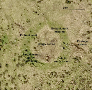

https://www.guard-archaeology.co.uk/DunragitBlog/Dunragit_monograph.pdf


Dunragit
The Prehistoric Heart of Galloway
By Warren Bailie
With Iraia Arabaolaza, Kenneth Brophy, Declan Hurl, Maureen Kilpatrick, Dave McNicol, Christine Rennie, Richard Tipping and Ronan Toolis

There are quite a few comments on social media today in relation to a new report on an archaeological dig at Dunragit, Galloway, Scotland, which has been in progress for over three years.  It's on the site of a new bypass road designed to improve traffic flow to the Cairnryan ferry port.  There were modest expectations before the dig started, but the archaeologists were surprised by the great wealth of material which was uncovered and analysed.  The link above will take you to a very comprehensive and beautifully presented report.

From the Conclusions:

Prior to these works, it was no secret that Dunragit was home to a complex Neolithic palisaded enclosure and cursus complex and an adjacent Bronze Age, ‘Silbury Hill style’ Droughduil Mound, both explored by Julian Thomas 1999-2003 (2015). Not acknowledged at that time was the likely contemporary timber complex and post alignments at Drumflower, around 0.5 km WNW of Dunragit, hinting at an even more widespread ceremonial prehistoric landscape, indicative of a general lack of engagement with crop marks in Scotland’s archaeology (Brophy 2006, 14–17). This assumes the similar layout and scale of Drumflower indicates contemporaneity with the palisades of Dunragit. The construction of these monuments would have required a concerted effort from a community, and represents a considerable investment of time, labour, and resources. Dunragit and the landscape around it had great value to those who resided here and given the scale of the monuments, and the inherent conspicuous nature of the structures, one can imagine a much wider community congregated there for the ceremonial purpose they were built for. But no-one could have predicted the wealth of significant archaeological sites to be found along much of the bypass route.

We discovered a remarkable number of previously unknown archaeological sites within what was a narrow 20 m road corridor. These investigations suggest that this part of the Galloway coastline was at the heart of successive prehistoric occupations over some eight millennia. We discovered evidence of some of Southwest Scotland’s first settlers dating to the Mesolithic period, while a distinctive piece of worked flint at West Challoch suggests that people may have been present at this location even earlier than previously thought, in the Upper Palaeolithic around 14,000 years ago at the end of the last Ice Age. Also discovered were post alignments of Neolithic date and early Bronze Age burial pits with grave goods such as jet jewellery, pottery vessels, and flint tools. This was followed by a complex cremation cemetery with pottery and aceramic cremations within and around two small barrows, and a series of mainly Bronze Age burnt mounds dotted along the lower lying areas of the route. The latest prehistoric site uncovered was an unenclosed Iron Age settlement, at the time of writing unique in Galloway, at least in terms of sites investigated.

The results of the investigations along the Dunragit Bypass have not resolved the full complexity and extent of archaeology present here, but have certainly shed some light on the rich prehistory of this landscape. The route of the bypass provided a linear snapshot of what archaeology survives, but in each case, it has also demonstrated that the true extent of each of the archaeological sites remains unknown. There is therefore yet more to discover of the Mesolithic site, the Neolithic posthole alignments, the Bronze Age cemetery complex and the Iron Age settlement, each site extending beyond the limits of the investigations carried out here. This was by any measure a major archaeological project, but it must be acknowledged here that we have only scratched the surface in terms of the full extent of the prehistoric activity that must be present.

The works carried out at Dunragit highlight the importance of archaeological investigations in the lead up to and during ground breaking works for developments such as this. Although desk-based assessments and records of previous investigations provide a back-drop for expected findings on a project, there can be no substitute for visual inspection by experienced archaeologists in collaboration with relevant specialists to recognise and then address significant archaeology to the appropriate standard. Not least the subsoil presented a phenomenon whereby archaeological deposits not apparent on initial inspection, revealed themselves over subsequent days through weathering out. Although this had been observed by the excavators elsewhere, the extent to which this occurred at Dunragit was notable. It does bring into focus the open and shut nature of trial trench evaluations across the country, where the subsoil barely sees the light of day before being backfilled; this does raise the question: should we be incorporating ‘weathering out’ time into all archaeological investigations? As the work progressed the excavators became more and more familiar with the subsoil and the elusive nature of the archaeology, particularly in the free- draining gravel areas present across much of the route. The team at Dunragit had to adapt and innovate in investigating and recovering, in some cases sensitive, and rare items under the pressures of the construction programme, while recording the archaeology to the level it deserved.

There is a lot to absorb in the Report, but a few of the things one takes from it are as follows:

1.   As lead author Warren Bailie acknowledges, the discovery of this site owed much to serendipity.  There was no massive megalithic structure here to act as a focus for attention, and the finds in this somewhat innocuous landscape can only hint at what is still out there, across the British landscape, waiting to be discovered.

2.  The history of settlement at this locality spans about 14,000 years, from the Palaeolithic through to the present day.  The prehistoric time-span of the features found is around 8,000 years.  This should not surprise anybody, and the intermittent occupation of "favourable" sites is something we should expect, as my colleagues and I have consistently argued with respect to Craig Rhosyfelin, Carn Goedog and Waun Mawn.  This is exactly what is shown in the radiocarbon evidence from these sites, even though MPP pretends that the only noteworthy activities were those going on in the period 5,500 - 5,000 yrs BP -- associated with his "stones for Stonehenge" obsession.

3.  Particularly noteworthy here in this corner of Galloway is the casual disregard for stone monoliths or megalithic structures of any type.  Plenty of pits have been examined, but none of them appear to have been stone holes.  They had all sorts of purposes, but the main one seems to have been the holding of vertical posts.  So at exactly the time when MPP wants people to be obsessed with bluestones and other large monoliths of sarsen, to the extent of dragging them for 200km or more to Stonehenge as the embodied spirits of the ancestors, here in Galloway, where "Scottish" and "Irish" cultural traits must have been familiar, there was complete disinterest.  Cultural preferences went off in another direction, and there must be a lesson in that...........

4.  The discoveries here reinforce what Gordon Barclay and Kenny Brophy wrote last year about "interpretive inflation" and the Stonehenge mythos.  They argue that there were, in the Neolithic and the Bronze Age, other centres and other "cultural crossroads" that developed quite independently of what was going on on Salisbury Plain.  On the basis of what has been uncovered here at Dunragit and its associated sites, we might as well assume that the locals had no idea that Stonehenge even existed.

5.  That having been said, we must beware of attaching "artificial significance" to this new site.  It just happens to have been found, and it happens to be complex and interesting.  That does not necessarily mean that it is important.  It may well be that somewhere else, just a few miles away, is the REALLY important site -- currently under the turf or buried by a peat bog, unrecognised and unloved.


Thursday 25 March 2021

Those three passage graves........


Many thanks to Chris Rees for these three excellent photos of the three related features out on Brynberian Moor, at Penanty-isaf (Pennant Isaf), Banc Llwydlos and Bedd yr Afanc. I'm happy that they should be grouped together, since they have similar forms and dimensions.  Yes, Bedd yr Afanc is better preserved, and the stones are more prominent (most of them can be classified as "standing stones") -- but all three can be described as "wedge shaped" with a long passage widening at one end.  There don't seem to be any galleries along the passage, which would justify the use of the term "gallery grave", although I have used this term myself in the past.  Now I think the term "passage grave" is better, since this describes a long passage with a "bulb shaped chamber" at one end, far from the entrance, where burials will have taken place.  Were the tombs ever finished?  Maybe not, since there do not seem to be any traces of discarded or fallen or collapsed stones or of a mound of earth and rubble that might have been called a "long barrow" if we had seen it today.  Nothing much was found at Bedd yr Afanc when it was excavated bt Prof Grimes and others many years ago.........

The Banc Llwydlos record:

PRN 100700 NAME BANC LLWYDLOS TYPE CHAMBERED TOMB PERIOD Prehistoric NGR SN0875133233 CONDITION Damaged STATUS FORM Earthwork
SUMMARY A sub-rectangular shaped arrangement of stones set on edge and protruding through a similarly shaped low earthen mound. Possible the remains of a former prehistoric 'passage grave' or 'chambered tomb', it is situated to the east of a stream on a gentle NE facing slope of Banc Llwydlos.


Saturday 20 March 2021

More for the Waun Mawn gallery


Pair of leaning stones at SN 08135 33695


Spectacular small hut circle (diameter c 5m) at SN08069 34126


Outcrop of unspotted dolerite to the west of the putative stone circle site on Waun Mawn


Stone extraction pit not far from the small hut circle.  The pit is c 1.20m in diameter and 80 cm - 1m deep. There is a clear ramp on its SE edge -- used for the extraction or dragging away of a large stone.  Was it standing, or recumbent?


The standing stone on Waun Mawn, assumed by MPP to be the last stone standing of the 
putative stone circle.


The "Deer Park" embankment which runs out into the peat bog on the south 
side of the Gernos Fach track.  It contains many massive dolerite boulders.


Large boulders indicating the presence of a small rectangular structure on the flank of the "Deer Park" embankment, not far from the pair of leaning stones.


The large embanked circle at SN07963 34004.  It has a diameter of approx 25m.  For many years it has been overgrown with gorse, and so is difficult to identify.   The ridge with boulders is discernible around the diameter except for the southern quadrant. So maybe it was never completed?


Thursday 18 March 2021

Should we laugh or cry?


In response to my formal complaint about the UCL press release / writeup on the "Lost Circle" affair, itemising the many falsehoods which it contained, I have received this from Jane Bolger, who either wrote it or approved it for publication:

"I'm happy that our news story is a suitable and accurate summary for a general audience and works well to interest them in the topic.
We also offer the audience the opportunity to explore further and access more detailed information by linking to the paper in the journal."

Suitable?  Accurate?  It appears that neither UCL press office nor the Institute of Archaeology is particularly bothered whether something published by a staff member is truthful or not -- and the line seems to be that all the press office has to do is "summarise" what is in the paper and leave the author to fend for himself in the event that what is contained there is shown by others to be a load of nonsense.........

The reputation of the Institute, and the need for honest science, seem to be  matters of no concern.  And this wasn't simply a press office reporting on a news story.  The press office was actively and enthusiastically involved in fashioning a high profile campaign and in PROMOTING the story for all it was worth  -- clearly without bothering to do any checking at all on whether it was reliable.

Should we laugh or cry?

Wednesday 17 March 2021

The Poppit raised beach -- then and now

The exposure as it appeared in 1963.

The exposure as it appears in 2021.

Today I revisited the site which I first described in 1963, very close to the old lifeboat station at Cei-bach, Poppit -- at the mouth of the Teifi estuary.  Grid ref. SN 14355 49124.

Not a lot has changed!  The raised beach deposits, here a little over 1m thick, are still beautifully displayed, cemented by iron oxide and manganese oxide precipitates.  But note that the three large angular boulders that were resting on the beach materials in 1963 have now gone crashing down onto the beach below, and it looks to me as if the whole face here (including the rock face) has retreated by maybe 50 cms, as a result of ongoing coastal erosion by storm waves at times of high tide.

This is a classic example of an unconformity, with the tilted Ordovician shales and mudstones planed across by a beautiful wave-cut platform and with pseudo-stratified raised beach cobbles and gravels resting on it more or less horizontally.

The platform mat be of composite age, but the raised beach is almost certainly Ipswichian in age -- around 100,000 - 70,000 years old.


One press release, 23 lies........


How many lies can you pack into a single press release? As it happens, quite a few. This is the highest achiever  I have ever seen — and I’ve seen quite a few in my time, in many different fields……..

https://www.ucl.ac.uk/news/2021/feb/stonehenge-may-be-dismantled-welsh-stone-circle

There are 23 lies packed into a single press release. That’s quite an achievement.  Here is a little list:

1. The headline is seriously misleading. Not even Mike Parker Pearson claims that Stonehenge was a dismantled stone circle — he claims that SOME of the bluestones in the bluestone settings at Stonehenge have probably come from a stone circle at a a place called Waun Mawn.

2. “The stunning discovery” ? This is not a "discovery” at all. It is a speculation, pure and simple. It is arguable that there ever was a stone circle at Waun Mawn, and there is NO evidence of any sort that links Stonehenge with Waun Mawn.

3. The bluestones are “already known to have come from the Preseli Hills” .    Really?  Some of them probably have, but others have not — and possible sources are still being searched for.

4. The MPP team “has identified megalith quarries” ? No it hasn’t. It has claimed to have done so, but the evidence is hotly disputed in two peer papers published in 2015 which the MPP team has steadfastly refused to acknowledge or cite. That “refusal to cite” has been widely seen as academic malpractice.

5. “The dismantled stone circle nearby” ?  No link of any sort has been established between Waun Mawn and the supposed quarry sites, and the evidence all suggests that if there ever were standing stones at Waun Mawn that have gone missing, they were small monoliths sourced locally.

6. Professor Parker Pearson said: “I have been leading projects at Stonehenge since 2003 and this is the culmination of twenty years of research. It’s one of the most important discoveries I’ve ever made.” Alarm bells should be ringing straight away when the archaeology becomes a minor issue and the main focus becomes a quest in the style of King Arthur and Indiana Jones. I note that the press release makes reference to the TV programme on “the lost circle” — which did not have science or even archaeology as its focus, but the obsessive quest of one man against all the odds, fashioned quite deliberately into a three-act drama. Let's be clear — this is NOT an important discovery.

7. "The find goes a long way to solving the mystery of why the Stonehenge bluestones were brought from so far away…” No it doesn’t. This is not a “find” but a speculation, and it has never been shown through evidence that the bluestones were “brought” from anywhere distant.

8. “………. all other stone circles were erected within a short distance of their quarries.” False. Most stone circles did not need quarries at all — they were made with whatever stones happened to be handy in the neighbourhood.

9. "Only four stones remain at Waun Mawn…”   There are abundant substantial stones lying around, as revealed in the excavations.  Others have simply been ignored by the MPP team.  Some of those are bigger than those postulated to have fitted into sockets.

10. “……...now revealed as having been the third biggest stone circle in Britain, after Avebury in Wiltshire and Stanton Drew in Somerset, and also one of the earliest.”  False. This is a speculation, not a revelation. And the dating is also highly speculative, and unsupported by the evidence.

11. "Archaeological excavations in 2018 revealed empty stoneholes at Waun Mawn…” That again is a highly questionable assumption. I have examined all of the “stoneholes” and think that most of them are simply natural depressions in a till surface, far too small and shallow to have held substantial stone pillars. Mike Pitts and Prof Tim Darvill agree with me on that.

12. "Scientific dating of charcoal and sediments in the holes confirmed that it was put up around 3400 BC.”   That is not true. There was a wide range of dates (as at the two “quarry” sites) and they are across such a wide range that no conclusions can be drawn. You cannot just cherry-pick the dates that suit you, as the MPP team has done.

13. “……..both Waun Mawn and Stonehenge were aligned on the midsummer solstice sunrise.” Not true. The two postulated “sighting stones” at Waun Mawn have been chosen simply because they are "convenient”.   They are widely separated, and the arc between them is so wide that it has no significance in terms of alignment.

14. "One of the bluestones at Stonehenge has an unusual cross-section that matches one of the holes left at Waun Mawn.” That is fanciful in the extreme, and as I see it, having also seen the pit concerned,  there is no match between socket and stone.

15. "Chippings in that hole are of the same rock type as the Stonehenge stone.” That is false. No match has been demonstrated in the “Antiquity” paper. This is yet another rather wild speculation.

16. “……..the Welsh circle had a diameter of 110 metres, the same as that of the ditch that encloses Stonehenge.” False. The proposed diameter of the Waun Mawn “circle” is entirely speculative, and the idea that a ditch diameter in one place has a significant connection with a stone circle diameter somewhere else, and of a different age,  is bizarre.

17. "Waun Mawn is further evidence that the Preseli region of Wales was an important and densely settled place in Neolithic Britain, within a concentration of megalithic tombs, or dolmens, and large enclosures.” This is another unsupported assertion. Certainly there are many prehistoric features in the Preseli region, but maps do not show a greater concentration here than anywhere else, and it is irresponsible to suggest otherwise.

18. “………...evidence of activity in the thousand years after 3000 BC is almost non-existent.” False. Darvill and Wainwright have shown that there were changes going on in West Wales around the Neolithic - Bronze Age transition, but there is abundant evidence of continuity of settlement.

19. Parker Pearson is quoted as saying with respect to a stone-carrying migration: "This extraordinary event may also have served to unite the peoples of east and west Britain…”   There was no extraordinary event. What is extraordinary is the speculation, based upon no evidence.

20. "Recent isotopic analysis of people buried at Stonehenge when the bluestones are thought to have arrived reveals that the first people to be buried there came from western Britain, very possibly west Wales.” This is another falsehood. The isotope evidence does not show this or suggest this at all.

21. “…… the Altar Stone, recently confirmed as sourced from the Brecon Beacons in South Wales.”  This is a lie. It has been suggested that he Altar Stone probably came from somewhere along the eastern outcrop of the Senni Beds in South Wales. The provenancing is no tighter than that.

22. “……...an estimated 80 bluestones put up on Salisbury Plain at Stonehenge and nearby Bluestonehenge…” There is no foundation for that statement. It is speculation that there may have been 80 bluestones on Salisbury Plain, and no evidence has ever been produced to show that “Bluestonehenge” actually contained any monoliths from West Wales.

23. “……..my guess is that Waun Mawn was not the only stone circle that contributed to Stonehenge.” Maybe just a guess, but it is irresponsible and misleading to pretend that any bluestone monoliths found at Stonehenge have come from a single stone circle in West Wales, let alone several.

--------------------------

I’m getting more than a little fed up with the industrial scale of the deceit coming out of the UCL Institute of Archaeology, and I have submitted a formal complaint about this press release / writeup on the UCL web site to Professor Sue Hamiltion, Institute Director. Will she reply? I have my doubts. But it's about time that these people stopped feeding nonsense to the media, dressed up as the truth.


Saturday 13 March 2021

Whatever happened to academic integrity?


If you ever wondered about the role played by University press offices in spreading falsehoods, look no further.  This is what was issued on 11th February, the day before the TV programme on "The Lost Circle" and the publication of the "Antiquity" article.

https://www.ucl.ac.uk/news/2021/feb/stonehenge-may-be-dismantled-welsh-stone-circle 

This is truly astonishing, with lies and outrageous claims in almost every paragraph, and with endless speculations dressed up as facts. When I first read it, I could hardly credit the fact that this had come from one of the leading academic institutions in the country-- namely University College London.

It's bad enough for evidence manipulation and misinformation to be published and publicised by the local Bluestone Brewery (as happened with the 2018 field report), but it's infinitely worse when the publisher and promoter is a respected academic institution.  

God help us all, if this is the level to which academia has sunk.  Who wrote it?  I think we can guess that all right..........

But what is also deeply depressing is that there are apparently no checks and balances in the system, which allows unmitigated nonsense to get into print without anybody apparently having the knowledge or the editorial power to intervene and stop it.

Friday 12 March 2021

There's none so blind...........


As the old saying has it:  There's none so blind as those who will not see....... 

I have just done another update on my Researchgate "working paper" on Waun Mawn and the so-called "lost circle",  and in doing so I was struck again at the extraordinary omissions in the much-hyped 2021 "Antiquity" paper written by Mike Parker Pearson .  (There are lots of co-authors, but I suspect they had nothing to do with the paper -- they were just contributors to the research......)

Just to summarise:

1.  The paper misrepresents the local geology by pretending that the nearest rhyolite and spotted dolerite outcrops are located at Rhosyfelin and Carn Goedog, where (purely by chance) there are assumed to be bluestone quarries.  Most seriously, the paper ignores the unspotted dolerite outcrops and scatter of erratics in the immediate vicinity of the excavated site.

2.  The paper ignores other recumbent and standing stones in the neighbourhood that must be related culturally and chronologically to the one standing stone and three recumbent stones approximately on the circumference of the putative stone circle.

3.  The paper pretends that the land surface at Waun Mawn is or was covered by blanket peat bog, presumably as an explanation for the paucity of artefacts or organic remains turned up during the dig.  This is misleading. The vegetation nowadays is dry acid heath, and in the past it was probably well wooded since it was used as a deer park.

4.  The paper ignores at least a dozen other significant prehistoric features in the vicinity, including two large circular embanked features, two smaller "ring cairns", four prominent standing stones, at least one quarry that must have been used in prehistoric times for the extraction of meta mudstone rubble,  two rectangular structures, one large stone-walled enclosure on Waun Maes,  several prominent embankments, at least three "stone settings", and various extraction pits or empty stone sockets.

Without taking these features into account it is impossible to assess the cultural context of the features excavated in 2017 and 2918.  The excavation teams have been so obsessed with finding their "lost circle" and with the Stonehenge connection that they have paid no attention whatsoever to the surrounding landscape.  Whoever did the refereeing of the "Antiquity" article, it is pretty obvious that he or she had never been anywhere near the site being investigated.

https://www.researchgate.net/publication/345177590_Waun_Mawn_and_the_search_for_Proto-_Stonehenge


Thursday 11 March 2021

Irresponsible archaeology and tourism marketing


I knew it wouldn't take long. Following the publication of the "lost circle" article and the Alice Roberts / MPP double act on the telly, the tourist industry is gearing up to capitalise on all the excitement in the rush to promote the wonders of Britain, post-pandemic lockdown.  With a predicted boom in "staycations" this summer, every part of the UK will be jostling to attract as many tourists as possible, flagging up whatever they can find in the way of "special places" and exciting narratives..........

The National Geographic is quick off the mark, in conjunction with English Heritage:

https://www.nationalgeographic.co.uk/travel/2021/03/uk-archaeology
TRAVEL

Seven of the best archaeological sites in the UK

New discoveries surrounding the origins of Stonehenge have piqued the nation’s interest in all things archaeological. Here are seven hands-on destinations to visit to dig a little deeper into the UK’s ancient history.

On Stonehenge specifically:

3. Stonehenge, Wiltshire

There’s always something big being unearthed in Stonehenge country. The latest discovery reveals that the origins of its mysterious bluestones lay in a quarry deep in the Welsh Preseli Hills, and that they first stood in a stone circle that predates Stonehenge, before likely being carried overland to the then developing site on Salisbury Plains.

Try your arm at dragging a massive stone monolith at the site’s smartly curated visitor centre. Or book in advance for a dawn tour of the stone circle itself, before the site opens to the public; led by an expert guide, the tour will get you within look-but-don’t-touch proximity.

Stonehenge country has numerous options for further exploration, including the many archaeological treasures on show at Salisbury Cathedral Museum. And within sight of the stones is the UK’s biggest prehistoric monument, which is around 4,500 years old. Uncovered in 2020, the Neolithic find includes 20 vast holes that suggest the boundaries of an earlier enclosure circle. The site is so large that is contains Durrington Walls, the UK’s largest henge, and Woodhenge too.

This is of course perfectly cynical and irresponsible on the part of EH and the National Geographic, since the evidence for "the bluestone quarry",  proto-Stonehenge and the "vast holes" at Durrington Walls is so shaky as to border on the absurd --  but who cares?  Get the people moving, and get the cash registers ringing....!!

I predict that Visit Wales and the Pembs Coast National Park will be in on the case very shortly as well, and that there will be further breathless documentaries and videos hitting the TV screens before long, filmed on location at Rhosyfelin and Waun Mawn (Carn Goedog is too difficult to get to, so will probably be ignored).  I'm surprised that we haven't had a National Geographic documentary already.

This is what happens when irresponsible archaeology is allowed to run unchecked, and when the "Parker Pearson quest" narrative is used as a part of a commercial promotion exercise.  Far from doing archaeology a service, it will actually do immense harm, as the "lost circle" obsession turns into something best described as a hoax.

There were some interesting lessons about celebrity status, nationalism and integrity in those three TV programmes called "Raiders of the Lost Past" -- but sadly some people and institutions are very slow learners.........


Wednesday 10 March 2021

Raiders of the Lost Past -- interpretative inflation and fraud


It's been interesting to watch the three programmes in this new series, presented by Janina Ramirez.  The first one, about Sir Arthur Evans and his work on the island of Crete, pulled no punches.  It was first broadcast on 19 February, just a week after the media feeding frenzy relating to the "Lost Circle" of Waun Mawn.  Coincidence?  No chance.  But was it really suggesting, between the lines,  that Mike Parker Pearson is an opportunist and a rogue in the mould of Sir Arthur Evans?  I wonder.........

The programme showed that Evans was a powerful and well-connected (and very wealthy) archaeologist who started off on a great quest with the best of intentions but who then became so obsessed with his ruling hypothesis on a Minoan civilisation that he started to force evidence into it despite what common sense might dictate.  He had his narrative (of a unique non-Greek civilisation) and he was determined to show that it explained all of the facts -- even when it patently did not. As time went on, and his work at Knossos became more and more famous, he started to fabricate evidence -- at first, probably, without realising himself what he was doing.  Well-intentioned over-interpretation, we might call it.   But then he started to over-interpret the "evidence" to such a degree that he was actually committing scientific fraud -- as some of the commentators in the programme were prepared to demonstrate, quite frankly.  The story became far more important than the facts.  His "reconstructions" of statues and artwork were so fanciful that they were blatantly fraudulent -- and he got away with it because he was surrounded by sychophants and because he had personally become so famous that his ego became larger than the project.  He was certainly guilty of transposing modern values (for example relating to royalty and hierarchy) into an ancient people.  But he could say more or less what he liked, without fear of contradiction.  He saw everything through a Christian monarchist lens, as somebody brought up to relish and celebrate the idea of "empire" and its civilising effects.  After all, he was the world's leading EXPERT..........He was a darling of the media, and also a national hero, demonstrating that British archaeology was better than anybody else's archaeology............ Indiana Evans was not quite as eccentric and heroic as Indiana Jones, but you get the general idea.

Evans was also so self-obsessed and so famous by the time that he wrote up all his research results that he could afford to ignore those who preceded him or said anything he considered to be "inconvenient."  For example, his records entirely omit the fact that he had been shown the findings of excavations at Knossos 20 years earlier by Minos Kalokairinos, who had hoped to use them to improve the vexed relations between Crete and mainland Greece.  Sounds familiar?>Nowadays, of course, people see Evans as over-enthusiastic and misguided, but reckon that on balance his work was of huge importance, as a "father figure" of archaeological research and cultural reconstructions.  He certainly did wonders for the Cretan tourist industry! But he was also partly responsible for "post processualism" in archaeology, in which facts are deemed to be somewhat boring and in which the telling of a compelling narrative becomes the driving force behind field research.  Science is thus pushed into the background and replaced by a narrative in which the teller of the tale seeks to get inside the mind of the people being studied -- their beliefs, their priorities and their motives.  Psychology becomes more important than evidence on the ground, and the "popularisation" of the subject among non-specialists becomes an objective in its own right. The irrational becomes more appealing than the rational.


So what is the relevance of all this for the present day?  Well, not much has changed.  Technology has moved on by leaps and bounds over the last 100 years, and by and large archaeological investigative methods are much tighter and more rigorous than they used to be.  But still it is possible for ruling hypotheses to distort thinking and for obsessed individuals to falsify their research results. It is still possible for contradictory evidence to be misinterpreted and for inconvenient evidence to be ignored.  It is still possible for archaeological digs to be opened up and then closed again without any effective independent scrutiny or peer review of the evidence collected. It is still possible for interpretations and speculations to be published in learned journals without any proper presentation of the evidence.  This must all all sound very familiar indeed to readers of this blog.........

One other thing that Janina Ramirez flagged up in her TV programme was the idea of the "archaeological quest".  Arthur Evans was not the first or the last to have such a quest, but I wouldn't mind betting that he saw himself as another King Arthur in a quest for another Holy Grail in the form of a "lost civilization".  Today Mike Parker Pearson is doing exactly the same thing -- as Barclay and Brophy have pointed out -- in seeking to demonstrate that Stonehenge was the centre of the Late Neolithic universe, and the place to which all good men and true needed to travel in order to pay homage.  That's the quest, and he will stick to it, come hell or high water.  And we cannot avoid mentioning him by name, because after that TV programme about "The Lost Circle" it is now HIS quest.  What was a supposed quest or heroic act (the transport of the bluestones) involving our Neolithic ancestors has now been transposed into MPP's single-minded quest to find a lost circle:

https://brian-mountainman.blogspot.com/2021/02/the-mythologisation-of-parker-pearson.html

Charlotte Higgins puts her finger on it perfectly in identifying the motives of the film's producer.  He did not want to make an archaeological programme, but a human drama involving one iconic hero, namely MPP.  She referred to "a recognisable and satisfying three-act narrative structure". 

It ran like this:  "Act one: the archaeologists – the hero being Parker Pearson himself, a hirsute figure straight from central casting – set off in hope and with an ambitious plan. Act two: an important new discovery is made, pinning down the stones to a particular pair of quarries. But then the stakes get higher: the archaeologists set out to find the place where the bluestones were once erected before being moved to Salisbury Plain. In short, a stone circle that isn’t there any more, hasn’t been there for 5,000 years. They investigate one spot, then another – in vain.  And then, Act three: the last throw of the dice, the last site to be considered. No one holds out much hope. But still, digging commences, in unpropitious circumstances. A hillside is pummelled by horizontal rain. Water is baled out of trenches. The student volunteers are becoming rebellious. All seems lost. Until: a discovery. A trace of a hole in the ground is so similar in shape to a bluestone erected at  Stonehenge that the two would fit together “like a key in a lock”. From here, the resolution rolls out satisfyingly – the dating turns out to fit. A little bit of the mystery of the circle has been chipped away at. The impossible quest has been fulfilled."

So now the person (and his reputation) is far more important than the story.  Dangerous territory indeed.

==============


Tuesday 9 March 2021

Another twist in the Waun Mawn narrative


Well, this is fun!  There has been quite a protracted discussion on a Facebook group page on the subject of Eglwys Fair -- shown on assorted old maps at grid ref SN07871 34816.  The Church or chapel was dedicated to St Mary.  The latest manifestation of St Mary's Church is in Cilgwyn, down in the valley and on the road from Tafarn y Bwlch to Newport.  It's a Victorian structure (built in 1884), now deconsecrated and used as a family home.  It's not clear when the original church was built on this site, but it was, like its predecessor and several others, built as a "chapel-of-ease" connected with the parish church in Nevern.  George Owen (in 1603) said that the church in Cilgwyn was consecrated "within the memory of men now living" -- which probably means around 1550.  Before the Victorian rebuilding, it is reputed to have been derelict and unused.

Nevern parish is a huge one, stretching from Nevern and all the way up to the Preseli watershed,  and the site of "Eglwys Fair" on the side of the bare hill called Banc Du, could well be the original church assessed with Nevern in the taxation documents of 1291.  It would certainly be more suitable for the use of parishioners from the Preseli Hills who would otherwise have had a trek of more than four miles just to get to church on a Sunday.  It must have had a wealthy patron, but we have no idea who that might have been.  Might it have been associated with the families of Gelli Fawr or Tregynon?  Who looked after it?  And was the church built of wood, or of stone?  Whatever it was, there is no trace of it today, and of course it may have been destroyed and rebuilt several times between 1200 and 1500 during the ongoing conflicts between the Welsh princes and the Anglo-Norman invaders who were seeking to maintain their hold over the barony of Cemais.  It's also interesting to speculate that whoever was the patron of the church might also have managed the "deer park" on Waun Mawn and might have built the stone walls and straight embankments that are still prominent in the landscape near the Gernos Fach farm track.

Now let''s get on with some serious fantasising.  It's known from the ancient records that when Henry Tudor landed near Dale in August 1485 he marched northwards and spent his first night in the farmhouse of Fagwr Lwyd.  It's now in ruins, and its grid reference is SN08272 35171. It's very close to Waun Mawn.  There is a tradition that Henry worshipped in "Eglwys Fair" before marching on the next day towards Aberystwyth  -- and we now know that this church must have been the one on the side of Banc Du. And another tradition is that the army (which was at that stage quite small) camped on Cnwc yr Hydd.  That would make a lot of sense, since the "dolerite plateau" and the lower shelf on which the putative Waun Mawn stone circle might have been located, were both well drained and safe from any attack, given their domination of the surrounding landscape.

So here is my fantasy.  The Waun Mawn stone circle (if there ever was one) was dismantled and taken away by Henry Tudor's army, who carried it with them to Bosworth Field because it embodied the spirits of the ancestors. And it was because they were accompanied by the stones that the knights and their followers enjoyed divine intervention, so becoming triumphant over wicked King Richard and leading to the establishment of the very Welsh Tudor dynasty.  That's my story, and I'm sticking with it............


PS.  I say above that there is "no trace" of the old church on the side of Banc Du, having searched on the common, outside the fence.  But Vanya suggests that the location shown on the map is inaccurate, and that the church was below the old quarry, inside the area new enclosed.  And sure enough, there is a faint trace on the satellite image of a rectangular feature measuring c 15m x 5m, aligned more or less N-S.  She tells me that this church orientation was common in the Celtic Church, although later church building used the E-W tradition.  She says that there was a trace of stone footings here prior to 1912, and that this was recorded in some RCAHMW document as yet unidentified........ 


Those damaged ring cairns


The Gernos Fach circular feature.  Is it a very large ring cairn, or some sort of henge?

 Thanks to Dave Maynard for supplying these drone images.  They are great!  The annotations are mine.......  As we mentioned in the last post, they are puzzling -- and not just because of the removal of material from parts of the embankments.  It will be interesting to compare these features in more detail with other circular features in the area -- of which there are several, even when we ignore the postulated "giant stone circle" so greatly beloved of MPP and his friends.

I am beginning to wonder whether they might be seriously old -- by which I mean early Neolithic.  But we must not get into the realms of speculation -- or we might get into trouble with serious archaeologists........


The Cnwc yr Hydd feature, showing the bank and the disturbed area on the 
northern section.

Monday 8 March 2021

The damaged ring cairns at Waun Mawn


It's intriguing that the two ring cairns on Waun Mawn are either unfinished or else seriously damaged -- and maybe both........

The biggest one, which I call the Gernos Fach ring cairn, at SN 07708 34535, is not a very spectacular feature, since the embankment is generally only about 50 cms high.  That may be, of course, because it is very old and degraded.  But it's about 30m in diameter, and is very easy to spot on satellite images. The embankment is grassy and dry, and the centre is boggy with reeds here and there.  It may be that only two thirds of the embankment was completed, since there is no trace of it in the NW segment.  It's made of dolerite bloulders and stones, as distinct from the Cnwc yr Hydd ring cairn which is made largely of meta-mudstone and shale rubble.

There is a clear entrance on the eastern edge of the feature, with one stumpy standing stone apparently in position and another much larger stone that has almost fallen over.  There may be an entrance "passage" to the east of these stones, with a further six boulders roughly in two lines, and with a seventh stone -- probably fallen -- in the centre of the "passageway".  

The southern and south-western sections of the embankment have clearly been excavated and partly removed.  Why, and when?


The two entrance stones of the Gernos Fach ring cairn.

The ring cairn to the SE of the Cnwc yr Hydd summit cairn (at SN08321 34446) is a smaller feature, only about 11m in diameter, with an embankment made of meta-mudstone and shale fragments and an embankment that varies between 50 cms and 1m high.  There is a distinct hollow in the centre.  Most of the ring is complete, but in the northern segment there are traces of two overlapping circular features, each with a diameter of c 4m.  One of these is quite prominent, and may be a remnant of a hut circle.  But there has been a lot of debris removal from this northern segment, and the cutting shows up quite clearly on the satellite image.


The smaller Cnwc-yr-Hydd circle, with disturbance on its northern flank.

So why have both of these features been cannibalised rather than revered?    The cuttings appear quite fresh, so they may even have been created in historical time, within the last 200 years.

The impression gained from these features, and from many other prehistoric features in the neighbourhood, is that in Neolithic and Bronze Age times there was an active working community in this area, who used local stones in ritual stone settings.  But none of these settings (apart from the Pentre Ifan cromlech) is particularly impressive, and unfinished or poorly made monuments appear to be quite common.  So there was a megalithic culture here, characterised by enthusiasm rather than technological mastery.  There is no sign of any great preference for particular stone types or provenances; all of the monuments are built from stones which have been locally sourced.  There was never any need for quarrying;  stones could simply be picked up and used where found.   Parker Pearson's claim that “this was one of the great religious and political centres of Neolithic Britain” is not supported by any evidence on the ground. As I have said elsewhere, it follows that there is still no evidence of any connection between this site and Stonehenge.

PS.  I'm quite intrigued by the fact that neither of these ring cairns / circular enclosures is mentioned in the RCAHMW or Coflein records.  Other features on Waun Mawn and Banc Du are mentioned, but not these......... in spite of them being quite prominent and easy to spot on satellite imagery.

Friday 5 March 2021

More rockfalls on the Newport cliffs


There has been another big rockfall on the cliffs at the northern end of Newport (Traeth Mawr) beach.  It's not as big as the last one I reported, but it has left a distinct cone about 5m high against the foot of the cliff face, where it now rests on part of the wave-cut platform.  The debris consists entirely of slabs and smaller fragments of local shale and mudstone, from high on the cliff face.

Not sure of the date of the fall, but it was probably in the first half of February 2021 during a spell of stormy weather.

So what's going on here?  there seem to be two main factors in th apparent acceleration of cliff face "events", both associated with global warming and climate change.

1.  There is now much more variability in wind directions than there was fifty years ago.  That means that northerly or north-westerly gales are much more common, with storm waves battering the cliff base and triggering collapse events.  Previously, these cliffs were rather well protected, and there was a barrier of broken debris at the head of the beach at around HWM.  This protective barrier has now been dissipated.

2.  Because of increased rainfall totals, and increased wetness in the winter months, the water table in the rock behind the cliff face is higher.  This means there is increased pore water pressure and also greater lubrication in fissures and fractures -- so that when storm waves are sending vibrations into the cliff,  and when air under pressure is forced into caves, cliff collapse becomes more likely.

In addition to this latest large-scale collapse, there are a number of smaller ones along the cliffline in the vicinity.


Wednesday 3 March 2021

Waun Mawn and the search for "Proto-Stonehenge"


This is just a notification that I have today updated my article on Researchgate to incorporate some of my latest observations on the site of the imaginary "giant stone circle".  The article continues to attract a lot of reading traffic -- the number of reads has now reached 2,477.  That's gratifying, and it shows that not everybody is being swept along by the media hype and by the extraordinary claims being made by MPP and his team, on the telly and on the internet.

https://www.researchgate.net/publication/345177590_Waun_Mawn_and_the_search_for_Proto-_Stonehenge


Monday 1 March 2021

Parc Mawr hut circle


Satellite image of the hut circle
 

Every time I go for a walk up on the mountain (or one of the mountains) I seem to find something new.  I don't know whether this one has been recorded before, but at Grid Ref SN03461 36952 there is a beautiful little hut circle on the south side of a prominent small tor.  It's quite easy to pick up on the satellite imagery, and it's located about 150m west of the prominent "flat" tor just outside the enclosed farming area.  It's about 500m from the Bedd Morris standing stone, and is best approached from the Bedd Morris road by the footpath across the common.

There is a prominent circular bank made of large boulders and cobbles and now almost completely covered with turf.  It's about 1m high, and the diameter of the circle is about 7m.  There is no obvious entrance, but there are signs of a gap (currently plugged with boulders) on the west flank of the rock outcrop, and on the north side of the circle circumference.

There is another enclosure on the eastern side of the "big flat tor" a little closer to the Bedd Morris road.  So this part of the Carningli - Mynydd Dinas upland was occupied in prehistoric times; virtually no part seems to have escaped the attention of these early settlers........


The hut circle tucked up against the flank of a small dolerite tor.


Waun Mawn -- the monoliths that got away


The western "recumbent monolith" at Waun Mawn, surrounded by disturbed turf from the archaeological dig.  A huge pit would have been required to stabilise this stone in an upright position.


The eastern "recumbent monolith" at Waun Mawn, which would also have required a massive stone socket  if it ever was a standing stone.....


I'm sure I'm not the only one to have noticed that in the recent 'Antiquity" article about Waun Mawn, Parker Pearson and his colleagues provide no evidence whatsoever that the two big "recumbent stones" reputed to lie in the "surviving" portion of the "giant stone circle" were ever standing.  They are big and bulky stones, each one weighing in at around 6 tonnes -- and far bigger than any of the standing or fallen unspotted dolerite bluestones at Stonehenge.  I think it can be argued that both stones are simply lying where they were at the end of the last glacial episode.  I shall continue to believe this, so long as nobody comes up with any evidence to convince me otherwise.......


The large recumbent stone on the dolerite plateau to the west of the Cnwc yr Hydd summit.  It's difficult to assess the precise dimensions, but it appears to be about 3m long, and almost 2m wide on one face.  It probably weighs about 6 tonnes.

On the dolerite plateau to the west of the Cnwc yr Hydd summit there is an extensive area of dolerite boulders and stone settings, with some rock outcrops, and a number of deep pits and small mounds and ridges.  It's difficult to assess what might be natural and what might be fashioned by Neolithic or Bronze Age tribal groups.  But one stone stands out -- a very large recumbent stone deeply embedded in the turf which is strikingly similar to the two large recumbent stones at the "circle" site about 450m away.  If the people who supposedly had grand designs for building a giant stone circle using unspotted dolerite pillars, and if they were supposedly capable of carrying stones from 4 km away, why did they ignore this one, which could easily have been transported 450m downhill across a relatively dry surface?  

And since the supposed stone-holes or sockets at Waun Mawn look as if they might have held stones no taller than 2m,  why did they also ignore the two small pillar stones that still lie in the turf no more than 50m away from the "circle"?  Nothing about this site makes any sense at all.......


The two small monoliths which would surely have been used in a stone circle at Waun Mawn 
if ever there had been one........ 

Finally, when I was up in "them thar hills" yesterday, I took a close look at the "slight mound" that is assumed by MPP and his colleagues to have some significance, associated with the western of the two recumbent stones.  I am convinced that this "mound" is entirely natural, since it is no more prominent and no more extensive than innumerable other small grassy mounds or undulations across the local landscape.  As I have mentioned before, the landscape of Waun Mawn and Cnwc yr Hydd is also pitted with innumerable hollows, some holding water and rushes, which are much more prominent that those at the "circle" site thatv are supposed to have held standing stones.


Current Archaeology joins the media circus

This supposed stone hole does not even have a pentagonal base -- and any comparison with 
stone 62 at Stonehenge is entirely fanciful.

Here we go again.  Current Archaeology joins the media blitz by simply regurgitating the press releases and repeating all the Waun Mawn speculations without offering a shred of independent scrutiny.  Have the people in charge of magazines like this simply lost the capacity to analyse for themselves anything that is presented to them?  Have they no way of identifying archaeologists who are in pursuit of their ruling hyopotheses?  It can't be that difficult.  After all, all you have to do is to apply the standards of common sense to the reading of an article in a journal..........but maybe nobody actually reads articles any longer?  The scale of the gullibility within the archaeology community in the UK seems to me to be quite staggering.......

https://archaeology.co.uk/articles/news/stonehenge-a-recycled-welsh-monument.htm

Here is just one of the bits of nonsense in the "Current Archaeology" write-up:

"...........the project also revealed that one of the empty holes at Waun Mawn had a pentagonal base, very similar in size and shape to Stone 62 at Stonehenge. Subsequent analysis of stone flakes recovered from the bottom of this stonehole suggests that its former occupant was made of unspotted dolerite, very likely quarried from the same location as Stone 62 and the other two unspotted dolerites that have been identified at Stonehenge."

When looking at this supposed stone hole, the average primary school pupil would probably ask why one particular stone at Stonehenge is supposed to have fitted into it, when many thousands of other stones scattered all over the UK would probably have fitted better.  Stone flakes recovered from the bottom of the stone hole are no different from the broken dolerite fragments scattered right across this landscape -- any speculation about quarrying and distant "shared sources" just does not make any sense.

And so it goes on.

I wonder if all of the articles in this journal are equally unreliable?