THE BOOK
Some of the ideas discussed in this blog are published in my new book called "The Stonehenge Bluestones" -- available by post and through good bookshops everywhere. Bad bookshops might not have it....
To order, click
HERE

Monday 27 April 2020

Sarsen provenancing talks cancelled


Another coronavirus casualty........ David Nash was planning a series of talks next month to coincide with the publication of the sarsen stone provenancing paper -- but I suspect that all will now be cancelled.  A pity........

Durham University Geography Department event:
Physical Geography Seminars: 'Geochemical Fingerprinting the Sarsen Stones at Stonehenge' - EVENT CANCELLED
7th May 2020, 14:00 to 15:30, W007, Main Geography Building, Professor David Nash, University of Brighton

Friday 17 April 2020

Coming soon -- if you can afford it


I'm not sure if this is published yet -- volume one of the four-volume series in which will be reported all the research of the Stonehenge Riverside Project.  The paperback is a snip for £64.99.  I can't afford it, so somebody will probably send me a copy.......

https://www.sidestone.com/books/stonehenge-for-the-ancestors-part-1

Publication date was planned as 30th March 2020.

On the web site it appears that there is not much in Volume One that we do not know already -- and I am intrigued that "Bluestonehenge" features quite prominently -- in spite of the criticism directed at the name and the lack of evidence in support of it.  But MPP and his research colleagues are nothing if not determined that their hypotheses, once proposed, are bound to be correct......

Wednesday 15 April 2020

Now here's a fine thing........


Have you heard the one about this great gang of archaeologists who turned up at this remote spot in west Wales, did a lot of quarrying, at vast expense, and then proudly announced to the world that they had found a quarry?

Tuesday 7 April 2020

The ice edge on the Scilly Nunatak


In the literature, much attention has been devoted to the problem of nunataks close to ice accumulation centres, to mountain top trimlines, and to ice-free enclaves or plant refugia.  But there is relatively little in the literature about low-level nunataks close to ice margins.

The above illustrations, showing two nunataks of very similar size, one in the Isles of Scilly at the time of the LGM, and the other near the eastern edge of the Greenland Icesheet today, prompt me to wonder what the nature of glacial deposits might be on up-glacier and down-glacier edges of the nunatak, and on its flanks.  

For a start, we have to say that the nature of the glacial and other deposits will be very different on a rounded or gently undulating nunatak such as those shown above, and on a pinnacle or mountain peak projecting through the ice.  In the former case, glacier ice in contact with the nunatak will be capable of re-working or incorporating pre-existing brecciated slope deposits on steeper surfaces, weathered bedrock and materials such as old beach deposits (in the case of islands or coastlines that have experienced oscillating sea-levels and shoreline processes).  In the latter case, there will be a continuous supply of frost-shattered debris down onto the ice surface during the course of a glacial episode, and some of this -- or maybe all of it -- will be incorporated into glacial deposits.  Quite prominent moraines may be the result.  


A cluster of nunataks near the edge of the ice sheet in West Greenland.  These are not very spectacular nunataks, but a great deal of debris has been eroded and picked up by the ice flowing around them.  The alignments and details of the morainic ridges are very confusing, showing that the pattern and history of ice-flow have been very complex.  Glacier ice is adept at filling in depressions, with minor ice streams sometimes flowing opposite to the regional direction of ice flow.


An isolated nunatak acting as a "blocking ridge" near the edge of the Greenland ice sheet, SW Greenland, inland of Nuuk. The ice from the ice sheet is flowing broadly from NE to SW here, and the ridge is more or less transverse to this direction of flow -- and is thus acting as a barrier. The pattern of crevasses is highly complex, but it is almost certain that the moraine on the northern side of the ridge is supplied by thrusting within the ice and the upward carriage of debris. If you look at the western end of the ridge, and then at the ice surface to the north, you can see a series of long linear crevasses transverse to the direction of ice flow -- almost inevitably these will be the surface expression of thrust planes within the ice.


Another small nunatak near the western edge of the Greenland Ice Sheet, showing massive arcuate or looped moraines on the up-glacier side and a single medial moraine on the down-glacier side separating the ice streams that have diverged and then converged again.  Note the meltwater ponds sealed within the nunatak's bounding morainic ridges.


Another west Greenland nunatak, showing the typical down-glacier medial moraine and huge morainic ridges that cover almost the whole of the nunatak.  Note the large impounded meltwater lake.


A group of four nunataks near the coast of SW Greenland.  Here there is a good vegetation cover on the largest nunatak, which measures approx 4 kms x 5 kms.  The moraines indicate very clearly what the ice movement directions are.  Here the ice is streaming between the nunataks, and the regional ice movement direction (east-west)  is disrupted by ice movement from SE towards NW, between the two largest nunataks.  Movement is maintained, although the ice thickness may well be less than 100m.


So what can we learn about nunataks close to existing ice edges?

1.  Where possible, if the ice surface level is high enough, flowing glacier ice will find its way into depressions between the landscape high points -- for example old river valleys or the straits between islands -- even if that means that it will be flowing in a direction vastly different from the regional ice flow direction.

2.  If the ice is too thin or sluggish to overwhelm a nunatak, some valleys and depressions on its surface will remain ice-free, and may be occupied by perennial or seasonal snowfields, or by meltwater lakes.

3.  On the up-glacier or proximal flank of a nunatak, one or more ridge of frontal moraine may be formed (we will not call these terminal moraines because the glacier terminus may actually be many kilometres away, down-glacier).

4.  Because there is no other source of debris supply, all of the material in the frontal moraine will have been entrained from the up-glacier bed and then brought to the surface by shearing and other processes.  Some of the till associated may be lodgement till laid down under thin ice, and we would expect to find evidence of glacitectonics and rearrangement or redeposition of diamictons. 

5.  It would not be surprising, in a situation like the Isles of Scilly, to find ancient raised beach deposits incorporated into till or morainic materials as ice has moved onshore.

6.  Neither would it be surprising to find glaciofluvial or lacustrine materials laid down on the nunatak, especially in valleys and other depressions.

7.  Further marginal moraines may be formed on the flanks of the nunatak, including some material eroded from the nunatak itself, if the flowing ice has sufficient power.

8.  The formation of moraines, and the deposition of till, on the down-glacier flank will depend partly on sediment supply and partly on the extent to which a dead -ice zone provides some protection.  In the ice, complex shear structures and crevassed zones may be found some distance away from the nunatak itself.

9.  The up-glacier glacial deposits will always be at a higher level than those in down-glacier locations.    The gradient of the deposits on the nunatak flanks may however not be regular, and there may be icefalls or sudden changes in ice gradient in response to underlying topography or changes in iceflow characteristics.

10.  The time factor.  It is clear from looking at the morainic ridges on current nunataks that some are very prominent and abundant, suggesting that the nunatak has existed in its current configuration for a long period of time.  Nunataks that are effectively covered with moraine ridges suggest a gradual lowering of the ice surface and a rather dynamic glacier regime with an abundant sediment supply.  A nunatak almost devoid of prominent moraine ridges may indicate a very rapid lowering of the ice surface and / or a surrounding ice mass that is sluggish or even dead.  If moraines are absent or poorly developed on the up-glacier flank, this may indicate that the nunatak was affected by glacier ice for just a few centuries or decades. 

It should be emphasised that there is no prominent moraine ridge anywhere on the Isles of Scilly today; the established (or disputed!) ice limit has been fixed by reference to glacial and glaciofluvial deposits found at many locations around the northern and western coasts.  This suggests that the ice was present for a relatively short period of time -- measurable in decades or centuries rather than millennia.

Virtually all of the geomorphology research on the Isles of Scilly in the last 20 years has been underpinned by the assumption that the ice edge recorded on the northern coasts marked the maximum extent of Late Devensian ice in this part of the Celtic Sea.   There has been much discussion on the nature of the deposits, the mechanisms of emplacement and deformation, the Quaternary stratigraphy and the classification and naming of the various deposits.  As explained in my 2018 paper, I am not entirely happy with the nomenclature proposed by Scourse, on the basis that it is unnecessarily prescriptive and too complex.  Be that as it may, there is nothing in any of the papers cited below which suggests that the Nunatak hypothesis is at fault.

From an examination of the modern analogies mentioned above, we would expect to find the highest glacial traces (around 40m above sea-level) along the northern coasts, with traces reducing in altitude southwards.  On the west coasts of St Marys and St Agnes the traces are close to sea-level.  There might still be undiscovered traces around sea-level on the east coasts as well.  On the south coasts of the southern islands I would expect all traces of the Devensian ice cover to be located below present sea-level. 

========================= 


Key references:

Brian John, 2018. EVIDENCE FOR EXTENSIVE ICE COVER ON THE ISLES OF SCILLY. Quaternary Newsletter Vol. 146, October 2018, pp 3-27. 


Late Pleistocene Stratigraphy and Palaeobotany of the Isles of Scilly
J. D. Scourse
Phil Trans Roy Soc B, December 1991
Volume: 334 Issue: 1271
Published 30 December 1991.


Glacial sculpting and post-glacial drowning of the Celtic Sea.
Thesis submitted in accordance with the requirements of Bangor University for the degree of Doctor of Philosophy 
By Edward Alan Lockhart
School of Ocean Sciences Bangor University, Wales 
August 2019(PDF)

New age constraints for the limit of the British–Irish Ice Sheet on the Isles of Scilly
R. K. SMEDLEY, J. D. SCOURSE, D. SMALL, J. F. HIEMSTRA, G. A. T. DULLER, M. D. BATEMAN, M. J. BURKE, R. C. CHIVERRELL, C. D. CLARK, S. M. DAVIES, D. FABEL, D. M. GHEORGHIU, D. MCCARROLL, A. MEDIALDEA and S. XU 
JOURNAL OF QUATERNARY SCIENCE (2017) 32(1) 48–62 
DOI: 10.1002/jqs.29224
November 2016

Trimline Trauma: The Wider Implications of a Paradigm Shift in Recognising and Interpreting Glacial Limits
Danny McCarroll
Scottish Geographical Journal, 2016
Published 27 Feb 2016 

James Scourse et al. 2019. Advance and retreat of the marine-terminating Irish Sea Ice Stream into the Celtic Sea during the Last Glacial: Timing and maximum extent. Marine Geology, Volume 412, June 2019, pp 53-68


Advance and retreat of the marine-terminating Irish Sea Ice Stream into the Celtic Sea during the Last Glacial: Timing and maximum extent
James Scourse et al, Marine Geology, Vol 412, June 2019, pp 53-68


Ice sheet extension to the Celtic Sea shelf edge at the Last Glacial Maximum (2015)
by Daniel Praeg, Stephen McCarron, Dayton Dove, Colm O Cofaigh, Gill Scott, Xavier Monteys,
Lorenzo Facchin, Roberto Romeo, Peter Coxon
Quaternary Science Reviews 111 (2015) 107e112 


Scourse, J.D. (1998) The Quaternary History of the Isles of Scilly (Chapter 8 in "Quaternary of South-West England", edited by S. Campbell et al.) Joint Nature Conservation Committee; Springer Science.
 
McCarroll, D. and others (2010).  Exposure-age constraints on the extent, timing and rate of retreat of the last Irish Sea ice stream. Quaternary Science Reviews, Volume 29, Pages 1844-1852.

Hiemstra, J.F. and others (2006) New evidence for a grounded Irish Sea glaciation of the Isles of Scilly, UK. Quaternary Science Reviews, Volume 25, Pages 299-309.


Friday 3 April 2020

The Celtic Sea piedmont glacier lobe: the eastern terminus


Following on from previous posts inspired by Ed Lockhart's doctorate thesis and some other recent articles by James Scourse and others, I have modified Ed's final map of ice directions (with many thanks!) to bring it more into line with the field evidence on the coasts of Pembrokeshire, Devon, Cornwall and the Isles of Scilly.  See my previous post on the Scilly Nunatak.

I am now convinced that the ice edge along much of this eastern terminus (I refuse to call it a lateral ice margin) was buttressed agains the cliffed coasts of south Pembrokeshire, Devon and Cornwall and was nowhere quite powerful enough or thick enough to surmount them and press inland -- except in a few estuaries.

On the above map I have left most of Ed's  ice direction arrows in place, and added my own in the east.  I have also left in place Ed's suggested eastern ice limit (the white line running NE from the Isles of Scilly) -- but as already explained, I now think that this line has no significance.

The Scilly Nunatak


Satellite image of the Isles of Scilly.  Maybe at the time of the Last Glacial Maximum (LGM) the scene did not look so different?  Just replace the blue with white........ 

Enough of intellectual contortions.  For the last few years all of the geomorphologists (including me!) who have been mulling over the significance of the Late Devensian ice limit on the north coast of the Isles of Scilly have been trying to work out how an ISIS  terminus (or lateral ice edge) at this position could be squared with an ice edge far to the south, on the continental shelf edge.  Most people have shrugged their shoulders and tried to explain that on the eastern flank of the ice stream the ice really did stop here; and some have become so wedded to this idea that they have become really rather angry that I should have had the temerity to say that there was evidence of active ice further south, on the coasts of St Agnes and St Mary's islands.

My map of proposed ice extent, published in Quaternary Newsletter, caused considerable anger in some quarters..........

Well, in the last few days I have been reading Ed Lockhart's excellent PhD thesis, and have once again been involved in intellectual convolutions as I tried to work out whether his evidence really does support his own conclusions about the "eastern ice edge".........  

This morning, while having my morning shower, I realised that the only way out of this impasse is to propose that the Scilly island group was a single nunatak at the time of the LGM, completely surrounded by flowing glacier ice; and that the "eastern ice edge" was some distance to the south and east.  If there were any moraines associated with this limit, they are on the sea bed.

I propose that the ice edge on the northern islands, on the up-glacier nunatak flank, was above present sea-level; as suggested by Scourse, Hiemstra and others, active ice affected the islands up to an altitude of c 40m.  Further south, on St Mary's and St Agnes, the "glaciation limit" was around present sea-level.  And on the SE or down-glacier flank it was below present sea-level, explaining why there appear to be no fresh glacial deposits on the SE-facing coasts.

The map below updates the map published with my QN article (2018) by adding an ice edge along the eastern and south-eastern margins of the archipelago.


A reconstruction of what the Scilly nunatak might have looked like.  The areas coloured green and blue on the bathymetric chart are the shallows -- probably, at the LGM, these areas were covered by extensive snowfields, while the island summits were exposed and would have been visible as rocky hill masses during the summer season.

Here are some "nunatak analogies" -- many illustrations show very spectacular nunataks with steep cliffs and rocky pinnacles -- but most of them are in reality rather boring in appearance......


I have been taking a look at some of the ice sheet fringes (on Google Earth) to find analogies, and this one hit me between the eyes.  It's an image from East Greenland, not far from the ice sheet edge.  These are not jagged mountain summits projecting through the ice, but a series of broad and gentle hill summits which must have been overridden by the ice sheet in the past but which are now in the ablation zone -- the ice is not thick enough or active enough to overtop the summits.   The scale is very similar to that of the Scilly Nunatak -- the up-glacier nunatak edge is between 6 km and 8 km long.  Along this edge the ice is blocked, and we can see that a sinuous frontal moraine has been formed -- just as happened in the Scilly Isles in the Late Devensian.  The unimpeded ice to left and right of the nunatak continues out towards the coast.  There are no traces of moraines above the ice surface on the nunatak flanks, or on the down-glacier edge, which will be at a lower altitude than the up-glacier edge.  This is a rather spectacular analogy.........


It's interesting that some of the models by the BRITICE group and others have also shown the Scilly archipelago as a nunatak, surrounded by streaming ice.  Another factor that feeds into the discussion is the "accepted wisdom" that the ISIS terminated at the northern coast of the archipelago, meaning that sea-bed studies of sediments and bedforms have been largely ignored to the south and east of the islands, with effort (quite understandably) concentrated further to the west and south-west, in the centre of the perceived ice stream.

So if evidence is missing, it is because hardly anybody has tried to collect it......

I believe that there is nothing in the literature re sea floor sediments and bedforms to contradict this "nunatak" hypothesis.  As ever, comments and additional information are welcome.

Bourbonhenge


Thanks to Dave Maynard for drawing our attention to this important development.  From a Twitter feed by Reading Museum, purportedly from 1921.  April 1st, 1921, I dare say.

Not very good science in the text, but we'll let that pass.

Anyway, as I said to Dave, I have happy memories of making trilithons from these exotic biscuits when I was a kid.  Now that we are all in lockdown because of the Corona virus, we can all while away the hours by building models of Stonehenge and then eating them.

Thursday 2 April 2020

The Fremington enigma

Map of the Fremington - Barnstaple area, from Stephens (1970) in the Glaciations of Wales volume edited by Colin Lewis, Ch 11.  It shows the outcrops of the clay-rich "Irish Sea till".

Brannams Claypit as it appeared in 1963.

§§§

The Brannams Claypit section, from Stephens (1966)

In my previous post on the positioning of the Late Devensian "eastern terminus" of the Celtic Sea piedmont ice lobe, I mentioned the occurrences of till on the coasts of Devon and Cornwall.  In his chapter in the "Glaciations of Wales and Adjoining Regions" he devotes some space to a discussion of these deposits, and further evidence is contained in a paper called "Some Pleistocene deposits in North Devon" published in Biuletyn Peryglacjalny Vol 15 (1966).

Evidence relating to the other occurrences around Croyde and Saunton is also presented in those publications.

It's fair to say that in the 50 years since the publication of the "Glaciations of Wales" volume, there have been many other attempts to assess the origin and significance of the "till deposits".  Prof Clarence Kidson, in the 1977 volume on "The Quaternary History of the Irish Sea", in the context of a somewhat confused analysis, accepted that there is some till in North Devon, but agued that much of it was soliflucted and redistributed, and that most of the in situ till that remains dates from the Wolstonian glaciation.  Stephens, Synge, Mitchell and other also found difficulty in assigning the till to the last glaciation -- and they thought it was emplaced in the Riss /Saalian glaciation.  In their chapter on South-west England in the later volume called "The Glaciations of Wales and Adjacent Areas" (2005) Harrison and Keen accepted the presence of till at Fremington and elsewhere, and cited some (notoriously unreliable) amino acid dating on contained shell fragments in assigning an Anglian age to the glacial episode responsible.

The most detailed analysis of the Fremington, Croyde and Saunton deposits is in the GCR volume for SW England (1998), in which Croot and others suggest that some of the deposits interpreted as till may be something else, simply laid down in the vicinity of glacier ice. Their arguments are not very convincing, and seem to be driven by the desire to show that the South-West Peninsula was not actually glacieted!  At any rate, they suggest that any till that is present probably dates from the Anglian Glaciation, and not the Wolstonian / Riss / Saalian.  However, they provide no evidence other than saying "recent work suggests........".    So I think that conclusion can safely be ignored.


The modern geological map of the Fremington - Yelland - Bickington area, showing (in blue) the extent of the Fremington till and related deposits.

Conclusion

We can safely accept that there is genuine clay-rich till at Fremington and elsewhere.  However, because of a reluctance prior to 2000 to  accept that Late Devensian ice really was rather extensive in the Celtic Sea arena,  nearly all authors have assigned the till to the Wolstonian or the Anglian glaciation.  Some have gone through considerable intellectual contortions in the process. However, stratigraphically there is little justification for this, and above the till there really is not sufficient accumulated periglacial and colluvial material to justify any designation older than Devensian.  The Late Quaternary stratigraphy in North Devon has clear similarities with that of West Wales and Eastern Ireland, and if Late Devensian ice extended all the way out to the shelf edge, it could easily have reached the coasts of North Devon as well.

So I suggest that the Fremington till is Late Devensian, and I invite anybody who has evidence to suggest that this dating is incorrect to produce the goods for us to look at........


The Devensian Celtic Sea piedmont lobe: the eastern terminus

On this map, Ed Lockhart places the eastern terminus (the dashed line) some distance to the west of the coasts of Devon and Cornwall, and somewhere in the vicinity of the Isles of Scilly.  The acceptance of a "terminal moraine" on the north coast of the archipelago is difficult to accommodate in any scheme that might be devised!

Further to my previous post, let's give some more consideration to what happened in the Late Devensian to the eastern terminus of the Celtic Sea piedmont ice lobe.

Reference:
https://www.researchgate.net/publication/339106826_Glacial_sculpting_and_post-glacial_drowning_of_the_Celtic_Sea_2019_PhD_Thesis?channel=doi&linkId=5e3dae0892851c7f7f25f0c1&showFulltext=true

Glacial sculpting and post-glacial drowning of the Celtic Sea.
Thesis submitted in accordance with the requirements of Bangor University for the degree of Doctor of Philosophy
By Edward Alan Lockhart
School of Ocean Sciences Bangor University, Wales
August 2019(PDF)

-----------------------------

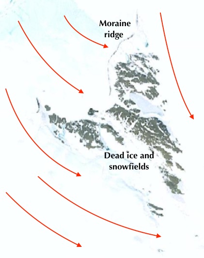
This rather complex image shows both satellite imagery (for the archipelago) and bathymetric and slope data. It seems to show NE-SW streamlining both to the NW and SE of the islands; these might be inherited features from an earlier glaciation.

This is what the author says:

Isles of Scilly & Cornwall

Ice advance northeast-southwest across the shelf was interpreted to have achieved a lateral limit along the northwest coastline of the Isles of Scilly (Scourse, 1991; Scourse et al., 1990), but the extent of ice towards the coastline of Cornwall is currently unknown. Subglacially smoothed bedrock with a consistent southwest orientation exists to the northwest of the Isles of Scilly and Land’s End (Figure 3.7 and Image G in Table 4.2), suggesting that ice flowed southwest past the western Isles of Scilly with ice originating in the northeast. While the orientation of the smoothed bedrock features may be inherited from the structure of the parent geology, their smooth appearance is indicative of erosion by ice (Krabbendam et al., 2016). When the pre-existing bedrock structure is coincidently orientated with ice flow direction, the elongation ratio of streamlined features may not represent a proxy for ice flow speed (Phillips et al., 2010), however the ice flow direction can still be inferred (Krabbendam et al., 2016). As these features appear to comprise sculpted bedrock, they may have been formed by an earlier glaciation and preserved. However, the recovery of Late Pleistocene sediments from the Isles of Scilly suggests that these features formed during the last glaciation as ice was grounded in this area. On the southeast side of the Isles of Scilly, bedrock outcrops also have a southwest orientation while appearing more prominent and irregular compared to subglacially smoothed bedrock to the northwest (Figure 5.1). Additionally, outcropping bedrock 10-20 km offshore of Cornwall has a similar character to bedrock exposed at the seafloor southeast of the Isles of Scilly, appearing sharp and irregular with no glacial signatures (Figure 5.2). This suggests that glacial sculpting of outcropping bedrock only occurred on the northwest side of the Isles of Scilly, coincident with the islands being interpreted as the lateral limit of the ISIS (Scourse, 1991; Scourse et al., 1990), as opposed to a terminal limit as suggested by John (2018). Therefore, these observations suggest that warm-based and grounded ice dominated the northwest side of the Isles of Scilly, flowing to the southwest, and did not reach the coastline of Cornwall.

Glacial sculpting of outcropping Devonian and Carboniferous rock adjacent to the Isles of Scilly and offshore of the coastline of Cornwall requires sediment-laden warm-based ice to abrade bedrock 4 km away from the islands yet did not result in them being overridden based on terrestrial observations. Such a configuration can be most simply accommodated by ice flow from the northeast to the southwest past the northwest coastline of the islands, abrading the bedrock further offshore (Figure 5.1) consistent with the southwest orientation of the rock drumlins (Plot I in Table 3.1). Therefore, ice on the eastern lateral periphery of the main ice stream trunk was in contact with the northwest coastline of the Isles of Scilly but did not advance beyond this. This configuration suggests that ice flowed parallel to the coastline of Cornwall from the Lundy Platform channels which must have been occupied during the LGM.

The water depth range of 70-90 m over which smoothed bedrock drumlins are found in this area (Table 3.1) suggests that sediment-laden warm-based ice dominated below the present-day -70 m isobath on the eastern inner-shelf. Therefore, an ice margin bordering the contemporary coastline of Cornwall seems unlikely, as there is no bathymetric expression of a glacial influence within 10-20 km offshore (Figure 5.2), nor any onshore evidence of glacial erosion and/or sedimentation. The Lundy Platform channels also occur below 70 m water depth (Table 3.1), similar to the shallowest occurrence of smoothed bedrock. Therefore, the eastern ice margin for this region previously suggested by Sejrup et al. (2005) appears to best fit these observations which delineate a lateral ice margin position at the present-day -70 m isobath (Figure 5.3).


-------------------------

This is all a bit convoluted, and involves a number of dodgy assumptions and connections which are not entirely logical -- but I sympathise!  It is not an easy scenario to interpret.

1.  At present, the apparent streamlining features to NW and SE of the islands might be Devensian features, or might be inherited features from a previous glaciation.  I don't have a problem with the features being of Devensian age, since I think there is evidence of glacier ice "wrapping around the archipelago" and affecting the western and southern islands.  The author of this thesis ignores my published evidence on this.   I  would not be at all surprised if evidence is found of glacier ice affecting the east coasts as well.

 
Red line:  the maximum extent of Devensian glaciation in the Isles of Scilly, after Scourse and others.  Black line:  revised limit, taking into account all known fresh glacigenic deposits.  It is quite possible that the ice pushed southwards on the eastern flank of the archipelago as well.  It may even be helpful to envisage the archipelago as a series of nunatak summits projecting above the surface of an enveloping ice mass.


Did the Isles of Scilly look something like this at the time of the LGM?

2.  The author of this thesis has not provided any evidence that contradicts the ice movement directions shown on the above map.  If glacier ice reached the west coast of St Mary's, it must have been flowing eastwards, even if that was just for a short period.

3.  If the streamlined features to the east of the islands are accepted as Devensian, then there must have been a substantial thickness of glacier ice off Land's End.  So the author's suggested ice edge position off Cornwall must be at fault.

The suggested Devensian ice limit on the eastern flank of the piedmont ice lobe.  The line seems to be positioned so as to "enclose" known features such as channels and submerged drumlin fields, but it ignores a good deal of other evidence.  For example, in the box labelled (1) there are streamlines running NW-SE, ie directly towards the coast.  Do they have no significance?

4.  The author says, with respect to Cornwall, that there is "no onshore evidence of glacial erosion and/or sedimentation."  That is incorrect.  There are deposits on the coast at Trebetherick that have been interpreted by Francis Synge and others as Irish Sea till or "remanie deposits" derived from a till layer.  Ed may not be convinced by the evidence, but he should at least have considered it.  Much more convincing is the evidence of Irish Sea till (with the same characteristics as that of eastern Ireland and Pembrokeshire) at Middleborough House, Fremington, Croyde, and other localities near Barnstaple in Devon.  The evidence enumerated by Nick Stephens and others may be disputed, but I have seen some of it, and am in no doubt that the till is real, and stratigraphically equivalent to that seen on the north and west coasts of Pembrokeshire.  Again, Ed might not like the evidence, but he should have considered it.  

5.  The map shown above shows Lundy Island far to the east of the Devensian ice edge.  As discussed on this blog, there is a jolly dispute going on regarding the glaciation of Lundy.  But some researchers think that the island was affected by overriding Devensian ice, and their work should at least have been considered.


6.  Finally, we come to the evidence from the west and south coasts of Pembrokeshire.  In his maps, Ed shows (over and again) Devensian ice flowing from NNE to SSW:

Synthesis of ice flow directions and piedmont glacier extent, based on the accumulated evidence presented in the thesis.

This is not what happened.  The evidence collected by me and many other researchers over the years is that the ice that affected the Pembrokeshire coast came in from the NW, flowing broadly towards the SE.  Leaving aside for the moment the extent of Devensian ice cover in Pembrokeshire, ice from this direction affected the coasts of the St Davids Peninsula and the Dale Peninsula, the inner reaches of St Bride's Bay, and the mouth of Milford Haven.  Ice travelling eastwards affected virtually the whole coastline as far east as Caldey Island and Saundersfoot Bay.  So the ice of the Celtic Sea piedmont lobe pushed far into the Bristol Channel, and is highly likely to have affected, if not overtopped, Lundy Island.  The author of this thesis should have shown his awareness of the accumulated evidence, and he should have placed his line of easternmost ice extent tight up against the coasts of Devon and Cornwall.

=======================

PS.  Just to show how much disagreement there is among specialists, here is a map published by Prof David Evans -- supposedly based on work by Colm O'Cofaigh and others:

https://brian-mountainman.blogspot.com/2019/01/nice-map-not-much-evidence.html


This is supposed to represent the Devensian LGM iceflow scenario following research that shows that the whole of Southern Ireland was inundated by thick Devensian glacier ice and that there was no large ice-free enclave.  The flow of the Irish Sea ice stream across NW Pembs is completely wrong, but as mentioned in my many posts on the Celtic Sea piedmont glacier, I have some sympathy with the portrayal of ice flow south-eastwards from the Midlands of Ireland......

Dave Evans and Ed Lockhart cannot both be right.  I think it's fair to say that we can anticipate further arguments.......

Ref:


Late Pleistocene chronostratigraphy and ice sheet limits, southern Ireland
Colm Ó Cofaigh et al
Quaternary Science Reviews, Volume 44, 21 June 2012, Pages 160-179
The morpho-stratigraphic subdivision of the surficial glacial drifts of Ireland into ‘Older Drift’ and ‘Younger Drift’ is a long-standing convention in Irish Quaternary studies. Across southern Ireland a broad swath of terrain has traditionally been interpreted as Munsterian (penultimate glaciation) in age and large end moraine complexes bordering this zone of ‘Older Drift’ such as the ‘South Ireland End Moraine’ have long been regarded as marking the limit of the Late Midlandian (last glaciation) ice sheet. Sedimentary sequences exposed along the south coast of Ireland provide a window into the stratigraphy of the ‘Older Drift’ and have been studied for over a century. The present paper supports a fundamental revision of the traditional interpretation of ice sheet limits in southern Ireland and argues for an extensive last Irish Ice Sheet which covered much of the area of the Older Drift at the Last Glacial Maximum. The basis for this revision is threefold. Firstly, nineteen new optically stimulated luminescence (OSL) dates on the Courtmacsherry Raised Beach and overlying shallow marine sands demonstrate that on the south coast the beach and shallow marine sands formed during marine isotope stages 4–3. Secondly, AMS radiocarbon dates on reworked shells from the ‘Irish Sea Till’, demonstrate that this till and overlying ‘inland’ tills from central and SW Ireland were formed after ∼24 cal ka BP. Thirdly, new OSL dates of 24–21 ka BP from deglacial outwash overlying the Irish Sea Till. Collectively these data are consistent with a last glaciation age for the glacigenic sequence along the south coast of Ireland, thus supporting a fundamental revision of the age of the Older (Munsterian) Drifts of southern Ireland. Most of southern Ireland was glaciated during the LGM and the moraine belts which have traditionally been interpreted as marking the last glacial limit such as the South Ireland End Moraine are reinterpreted here as recessional features formed during ice sheet retreat.


Wednesday 1 April 2020

Late Devensian glaciation of the Celtic Sea: Lockhart thesis

One of Ed's maps showing the Celtic Sea arena -- bathymetry, named zones and coastlines

Ed Lockhart's doctorate thesis on the glaciation of the Celtic Sea is freely available on Researchgate.  Very interesting! It's long and detailed, as befits a doctorate thesis, and there is no point in trying to summarise it, but there are a number of points of relevance to our discussions on this blog about glaciation and its role in the transport of the bluestones of Stonehenge.

Here is the link:

https://www.researchgate.net/publication/339106826_Glacial_sculpting_and_post-glacial_drowning_of_the_Celtic_Sea_2019_PhD_Thesis?channel=doi&linkId=5e3dae0892851c7f7f25f0c1&showFulltext=true


Glacial sculpting and post-glacial drowning of the Celtic Sea.
Thesis submitted in accordance with the requirements of Bangor University for the degree of Doctor of Philosophy
By Edward Alan Lockhart
School of Ocean Sciences Bangor University, Wales
August 2019(PDF)

Abstract

Concerns as to the stability of present-day ice sheets and their future contribution to sea-level rise have prompted the investigation of palaeo ice sheets in order to study ice dynamics and evolution through deglaciation. Such observations of ice sheet behaviour are essential in the process of constraining and validating numerical ice sheet models in order to forecast the future response of Greenland and Antarctic ice sheets to warming and sea level rise which can rapidly destabilise marine-terminating margins and contribute to global sea-level rise. Therefore, a palaeo ice sheet of similar characteristics to Greenland and Antarctica is required in order to accurately capture the occurrence of marine ice sheet instability. A suitable analogue is the last British-Irish Ice sheet, which was drained by numerous marine-terminating ice streams. The largest of these was the Irish Sea Ice Steam (ISIS), which terminated on the continental shelf of the Celtic Sea. New modern geophysical and sediment core data collected during numerous scientific cruises of the Celtic Sea provide a unique opportunity to determine the stratigraphic position of glacial sediments and the origin of the ridges from which these sediments were recovered, and to investigate the imprint of glaciation and thus reconstruct deglacial dynamics.

Seismic data of the mid- and outer-shelf show that the largest shelf ridges in the west comprise two vertically stacked units which are draped by superficial deposits. The upper sandy bulk of these megaridges is correlative to the Melville Formation (MFm), comprising truncated and dipping bedding planes, which overlies mounds of the Upper Little Sole Formation (ULSFm) comprising Last Glacial Maximum glacigenic sediments that are exposed on the lower megaridge flanks. Stiff and deformed glacigenic sediments comprising the ULSFm record their overriding by the ice margin during its oscillatory retreat across the shelf before being partially eroded during marine transgression by megatidal conditions which fuelled the development of overlying sand ridges comprising the MFm. This updated stratigraphy suggests the presence of a glacigenic core under the MFm on the western shelf. In the east, channels of the ULSFm contain undisturbed seismic facies of unknown lithology, with implications for the ice margin extent in the French sector. Multi-beam bathymetric data reveal a large assemblage of seafloor glacial features preserved on the inner-shelf, including terminal and ribbed moraines, streamlined bedrock, iceberg grounding pits, meltwater channels and tunnel valleys. These features record the southwest advance of a grounded warm-based ice lobe and its northeast marine deglaciation in response to rising relative sea level into St. George’s Channel and towards the southern coastline of Ireland.

These findings provide new palaeo observations of ice stream instability, whereby the ISIS rapidly broke up through calving in response to fracturing and thinning due to instability induced by ice margin flotation and deformable proglacial sediments in a rising relative sea level environment. Such factors need to be considered in the stability of present-day marine-terminating ice sheets. The maximum extent and subsequent northwest retreat of the ice margin across the mid- and outer-shelf, followed by more-complex retreat patterns on the inner-shelf, provide a framework against which numerical whole ice sheet models can be tested. Combined, these observations have implications for the study of ice stream stability and the validation of numerical ice sheet models.


================

The bulk of the thesis is made up of detailed analyses of the sediments and sea-bed glacial landforms of many types spread across virtually the whole of the Celtic Sea basin, out to the shelf edge.

Let's just home in on some issues relating to the Devensian glacial history of the Celtic Sea.  This builds, in the thesis, on much prior work bt James Scourse and many others -- some of this already discussed on this blog.

Of particular interest is the material relating to the eastern edge of the Irish Sea Ice Stream (ISIS).
P 36  Quote:

In the east of the Celtic Sea, observations from the Isles of Scilly suggest that the eastern ice margin impinged on the north coast of the islands at 25.5 ka BP (Scourse, 1991; Smedley et al., 2017) but did not overtop them. North and south of the Isles of Scilly, the extent of ice to the east towards Cornwall and onto the eastern shelf is undetermined (Scourse et al., 1990). The previous grounded extent of the ice lobe in the Celtic Sea was proposed based on the southern limit of cored over-consolidated diamict, Melville Till (MT), at a boundary -135 m Ordnance Datum at the recovery site of core 49/-09/44 (Figure 1.4), south of which only Melville Laminated Clay (MLC) was found (Scourse et al., 1990). This spatial distribution of glacigenic facies across the shelf suggests that the ISIS was grounded out to this boundary on the mid-shelf, before terminating in a tidewater setting beyond which glacimarine deposition occurred (Scourse et al., 1990). The provenance of clasts within the MT was suggested to have been as a result of the southwest flow of grounded ice across the shelf, eroding the corresponding clast lithology which exists as bedrock to the northeast of the core locations (Scourse et al., 1990; Scourse and Furze, 2001). However, an alternative ice flow direction has been suggested adjacent to the Isles of Scilly which contradicts this southwest flow direction. John (2018) suggests that the Isles of Scilly were in contact with a terminal limit of the ISIS as opposed to a lateral limit, as suggested by Scourse et al. (1990), inferring that ice flow was from the northwest to the southeast adjacent to the Isles of Scilly. 

The author correctly states my conviction that the last ice that affected the western coasts of the Isles of Scilly came in from the north-west and flowed towards the south-east. It cannot have done anything other than that -- since the ice near an ice margin always flows perpendicularly to the alignment of the ice edge.  On the edges of an ice sheet there is no such thing as a "lateral" limit -- every ice edge is a terminal limit.  Ed has, I think, been swept along by the prevailing belief that the Irish Sea Glacier was long and narrow, as portrayed by Roberts and many others -- ignoring the fact that low profile lobes will always spread laterally if they are not topographically constrained.  So if it reached the shelf edge (and the evidence is very convincing) it must also have spread eastwards into the Bristol Channel and the English Channel.

The Irish Sea Ice Stream (ISIS) as portrayed by Roberts et al 2007, and by many other authors.  It portrays a situation which is in my view glaciologically vanishingly unlikely........

If, as now seems to be established, the ice extended all the way out to the shelf edge, the WHOLE of the Celtic Sea as shown on the Roberts et al map MUST have been filled with glacier ice.  No evidence, as far as I am aware, has ever been produced to contradict this conclusion.  Indeed, towards the end of the thesis Ed does indeed conclude that this is what happened:


The extent of ice in the Celtic Sea piedmont glacier is, in this reconstruction, three or four times greater than that shown by other researchers.  It seems to me to be eminently sensible, and well supported by the bulk of the evidence presented in the thesis -- except for the eastern flank, where I am unconvinced by the suggestions relating to the Isles of Scilly and Cornwall.  I'll do another post on this.

Overall, a good thesis, although I have to say that if I had been the examiner I would have asked for much more detail on the interactions between the ISIS and Irish and Welsh ice and on how the marine evidence relates to the evidence from coastal sections in Pembrokeshire, Cornwall and Southern Ireland.  Much of that evidence just does not fit with Lockhart's central hypothesis -- so something is wrong somewhere.  But as with all theses, this one answers some questions but raises a whole host of others.........