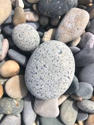
THE BOOK
Some of the ideas discussed in this blog are published in my new book called "The Stonehenge Bluestones" -- available by post and through good bookshops everywhere. Bad bookshops might not have it....
To order, click
HERE

Saturday 13 July 2024

Economy of effort in Neolithic Portugal

Middle States Geographer, 1999, 32: 110- 124

A GEOMORPHOLOGY OF MEGALITHS: NEOLITHIC LANDSCAPES IN THE ALTO ALENTEJO, PORTUGAL

Gregory A. Pope and Vera C. Miranda


Many thanks to Greg Pope for drawing my attention to this influential paper from 25 years ago, which had escaped my attention.  It reports on a fascinating piece of work which demonstrates that in the Portuguese megalithic monuments in this area of grantic rocks, the rocks used were almost entirely local -- used more or less where found.  Schmidt Hammer investigations revealed that there were no major differences in weathering characteristics between "used" megaliths and slabs and corestones which were lying about in the landscape.  Used stones and naturally occurring stones near rock ourcrops showed similar weathering characteristics, lichen cover and "buried" and "exposed" surfaces.  There was no reason to believe that any of the "used" stones had been quarried or transported across great distances.

This is exactly the point I have been making for years regarding the stones at Craig Rhosyfelin, Carn Goedog and Waun Mawn -- and indeed at Stonehenge.  The stones do NOT show any signs of quarrying or long distance transport -- and indeed if they are examined (as I have done with the Newall Boulder and the infamous big slab at Rhosyfelin) we can see weathered and unweathered faces and signs of different exposure ages, related to orientation or positioning in or on the ground surface.  When cosmogenic exposure ages are worked out for all these rock and boulder faces (as they will be) this quarrying fantasy will be thrown out once and for all........

To their credit, Ixer, Bevins and Pearce have already started to make measurements on dolerite and other rock surfaces in order to assess what geochemical changes are down to weathering processes; this is really interesting work, and I look forward to seeing the results when they are all drawn together. As far as I can see, none of the work so far has allowed them to differentiate between a "quarried" monolith and a naturally occurring one transported by ice!

The other relevant point here is the claim by MPP and others that the stone transporting expeditions which they love so much were done not because they were easy, but because they were difficult.  I have argued (as have many others) that the builders of Stonehenge were sensible enough to preferentially use stones found locally, as did the builders of all the other megalithic structures in Britain.  To have carried 80 megaliths all the way from West Wales would have been stupid, I reckon.  No no, say MPP and his friends, it would have neen stupendous, and highly sophisticated.  Well, if Portugal is anything to go by, the old residents of Alto Alentejo knew a bit about cost-benefit analysis and economy of effort.....

==================

ABSTRACT: 

The Alentejo region of Portugal is known for a high concentration of Neolithic-aged megalithic monuments: tombs (dolmens or antas) and ceremonial features such as standing stones (menhirs) and stone circles (cromleques). Concentrations of these monuments tend to be found on or near weathered granite terrains.  Unloading slabs and remnant corestones appear to be the stones ofpreference for megalith makers in the Alentejo district of Portugal. Some of the stones may have been imported from distant sources, but most appear to be of local origin. In general, most stones do not appear to have been altered much from their original state as field stones. Weathering tests demonstrate that menhirs are essentially identical to native corestones.  Many menhirs still exhibit a soil line. The former subaerial side of the stone usually retains a thick growth of lichen, while the soil side remains oxidized. Newly exposed antas and menhirs now suffer from enhanced weathering and erosion from atmospheric and biological agents. This deterioration is often difficult to discern from the inherited decomposition of pre-megalithic time.

CONCLUSIONS

The granitic megalith stones of the Alto Alentejo are interesting for what they reveal about weathering rates. From this information, we can speculate about their origin and construction, and recommend practices for their conservation. The exposures results are summarized below. 

1) Naturally weathered outcrops provided material for these early megalith monuments, a practice possibly used in megalith construction across western Europe. Lack of damage to superficial weathering features suggests that megalith stones were not transported long distances, or alternately, were transported with great care.

2) Weathering processes active on the megaliths included biotic, mechanical, and microclimate-intluenced dissolution processes.  While there is evidence of some human alteration (in the form of engravings or dressing) that removes original surfaces, most megaliths in the Alentejo region have superficial weathering features similar to the local field stones. Schmidt hammer data on rock hardness corroborate these results. Except where altered, megalith stones are statistically identical in weathering-controlled rock hardness to natural field stones. Stone dressing and polishing remain relatively clear, and engravings, while muted, are visible after more than 5000 years of exposure.

3) Visually, megalith stones still retain former subaerial and buried sides, despite their current placement. Lichens grow on surfaces formerly situated on the subaerial side of the stone, while oxidation staining prevails on the former buried side of the stone. Areas with lichen are more weathered, with softer rock. Lichen colonization is an obvious concern for conservators, but eradication can be a problem if doing so damages the stone surface and any engravings. Where lichens are not present, there is no difference in weathering (as detected through rock hardness) between former subaerial and former buried sides, counter to what might be expected (and what appears on recently unearthed non-megalith field stones).

4) Post-emplacement exposure may be a factor in the degree of weathering. There is a preference for softer rock in a quadrant from southwest to northwest, independent of the presence of lichens or former subaerial or buried characteristics. This exposure factor cannot have existed prior to megalith construction, and suggests that post-megalith weathering overrides characteristics inherited over a much longer premegalith weathering interval. Conservators can anticipate areas of concern on certain exposures, particularly after ruined monuments have been excavated and reconstructed.

As "the first public monuments of humankind" (M. Gomes, 1997a), megaliths provide unique opportunities to extend geomorphic theory and conservation practice. Both geomorphic and built, megaliths exist at an age that promotes translation between studies of more recent building stone and more ancient natural landscapes. Further investigations in different climates (e.g. Brittany and Cornwall or Malta) and with different types of stone (sandstone, slate, etc.) can expand on the results presented in this initial investigation.

My three 2024 published papers


These are the three papers published so far in 2024. All of them have been received very well by the specialist group of researchers whose opionions I respect.........


Refs:


1. John, B.S. 2024. The Stonehenge bluestones did not come from Waun Mawn in West Wales. The Holocene, 20 March 2024 (published online), 13 pp.

https://www.researchgate.net/publication/379121966_The_Stonehenge_bluestones_did_not_come_from_Waun_Mawn_in_West_Wales

2. John, B. S. 2024. A bluestone boulder at Stonehenge: implications for the glacial transport theory. E&G Quaternary Sci. Journal 73, 5 June 2024, pp 117–134,

https://www.researchgate.net/publication/381205542_A_bluestone_boulder_at_Stonehenge_implications_for_the_glacial_transport_theory

3. John, B.S. 2024. An Igneous Erratic at Limeslade, Gower & the Glaciation of the Bristol Channel. Quaternary Newsletter 162, 28 June 2024, pp 4 - 14.

https://www.researchgate.net/publication/381775577_Quaternary_Newsletter_Article_AN_IGNEOUS_ERRATIC_AT_LIMESLADE_GOWER_AND_THE_GLACIATION_OF_THE_BRISTOL_CHANNEL

These three articles, published in quality peer-reviewed publications for an international readership, have had good media coverage and abundant hits, especially on Researchgate. The Waun Mawn article, which was published in March, has had more than 2,800 hits already, in addition to the 7,000 hits on the pre-publication version. The members of the "archaeology establishment" are undoubtedly reading my articles published over the last decade, even though those who are responsible for the promotion of the human transport myth refuse to cite anything written by me, since my ideas are far too disruptive. That's rather sad, and also rather pathetic, involving a betrayal of the ancient academic tradition that you must cite and deal with your opponents. So I am portrayed (behind the scenes) as a maverick and an incompetent old fool, drawing conclusions which are unworthy of consideration by those who like to think of themselves as "experts". It's a strange old world......

Alongside the thunderous silence of the Bluestone transport gang, we have the thunderous blogging of one Timothy Daw, who presumably thinks of himself as an expert because he shared the authorship of a "learned article" some months ago with Messrs Ixer, Bevins, Pearce and Scourse. Tim posts a stream of articles in which he seeks to rubbish my ideas and quesstion my competence, while demonstrating over and again that he knows nothing of glaciology or glacial geomorphology and has no particular wish to learn. Of course, he refuses to allow comments on his blog, so all of his preposterous claims about bluestones and earth surface processes, and about my hard evidence, go completely unchallenged. It's a strange old world..........

But there is no point in getting too upset about all this palaver, and I continue to be reassured by messages such as the following:
    
Quotes:

I have been sent a link to your paper. Thank you. It is a wonderful deconstruction of much of the hyperbole that surrounds SH.

........so good to see these arguments in print Brian!

Enjoyed the paper, but to be honest found it a bit ridiculous that it had to be written. There is clearly a problem in archaeology at the moment, it should not be possible to publish these nonsense papers.

Thank you so much for sending me your article. Such impressive scholarship and a cracking good read. Really questions the current narrative in a persuasive way. 

...........good media cover. extremely welcome!

.......very many thanks for the article. Congratulations once more -- great stuff.

..........thanks! it was great to see your previous article get a lot of attention in the media online, look forward to reading the new one

Well done, Brian. Good to get this published. Pity that a 100% provenance match was not yet possible.. Nevertheless, an important record. Enjoyed reading it.

Interesting article indeed and I think the gentle tone provides a convincing case for a discovery that bolsters your overall case....

Amazing what a lot of information can be derived from a piece of rock!

I believe you, for what that is worth! A wonderfully researched and presented paper. Congratulations!

Interesting read!

Thanks for this Brian. You are very restrained on the antics of the MPP myth factory.

Brilliant Brian.

Thanks Brian, great paper.

Good stuff - many thanks for the pdf. You are on roll!

I felt privileged to have an early sight of your latest 'offering'. I can see that you have put a lot of effort into producing it. Keep up the good work!

Excellent! I am a firm believer in the glacial theory of course. Seems obvious to me, and supported by evidence........

Your paper provides a compelling and thorough presentation.

Friday 28 June 2024

Limeslade Erratic article published


My new article on the Limeslade erratic is published today in the journal Quaternary Newsletter.

Details:

Brian John, 2024.  An Igneous Erratic at Limeslade, Gower & the Glaciation of the Bristol Channel.  Quaternary Newsletter 162, June 2024.  pp 4 - 14.

The article is freely accessible, and can be downloaded here:

https://www.qra.org.uk/quaternary-newsletter/quaternary-newsletter-current/

It is also on Researchgate, and can be accessed here:

https://www.researchgate.net/publication/381775577_Quaternary_Newsletter_Article_AN_IGNEOUS_ERRATIC_AT_LIMESLADE_GOWER_AND_THE_GLACIATION_OF_THE_BRISTOL_CHANNEL

Thanks are due to Phil Morgan, Prof Tim Darvill and Dr Steve Parry for their help on the technical front, and to Prof Peter Kokelaar and Dr Katie Preece for their notes on the petrology and surface characteristics of the boulder. The biggest thanks of all go to Phil Holden, who found the boulder while scrambling about on Limeslade beach!  Other very helpful comments came from Prof John Hiemstra, Prof Danny McCarroll, Olwen Williams-Thorpe, my late friend Dr Dyfed Elis-Gruffydd, editor Dr Ed Garrett and the anonymous referees.

ABSTRACT

A large unspotted dolerite erratic boulder was discovered in 2022 on the rocky foreshore in Limeslade Bay near the SE tip of the Gower Peninsula. It is about 2.2m long, weighs about 5 tonnes and rests in a gully where it is subjected to wave action at every rise and fall of the tide. Its surface is heavily abraded and it may have been substantially reduced in size since its original emplacement. It has a greenish colour and is described as a metamorphosed coarse dolerite or ophitic microgabbro. Thin section analysis and pXRF analysis suggest that it is not related to the spotted and unspotted dolerites of Mynydd Preseli, and that it is most likely to have come from one of the Ordovician igneous outcrops near the north Pembrokeshire coast between St Davids and Fishguard. It is not known whether the rock type is precisely matched in any of the bluestones (monoliths or rock fragments) in the Stonehenge landscape. It is unlikely that this erratic was transported by floating ice, since near the peak of a glacial episode sea-level must have been at least 80m lower than it is today. Further, of the scores of known glacial erratics on the shores of the Bristol Channel, many are found at altitudes in excess of 100m, indicating that during at least one glacial episode the ice of the Irish Sea Ice Stream was thick enough and dynamic enough to press inland across the coasts of Devon and Cornwall. It is therefore probable that glacier ice also reached Salisbury Plain, and that the bluestone boulders and smaller fragments at Stonehenge — from more than 30 different sources — were glacially transported.

On the QRA web site the article does not have a URL of its own, but I will also place it on Researchgate where it will attract an additional readership.

These are early days in the analysis of the boulder, and I look forward to seeing further research which might enable a more accurate provenancing of the boulder.  That, I think, is of less importance than the key point made in this paper -- namely that if the Irish Sea Ice Stream responsible for the carriage and dumping of the boulder was strong enough to impinge upon the Gower coast, it was also strong enough to reach Somerset and even Wiltshire.

==================

This is my third article about the glaciation of the Bristol Channel and the Celtic Sea to be published in Quaternary Newsletter, and it should be read in conjunction with the other two:

https://www.researchgate.net/publication/ 328413421_Evidence_for_extensive_ice_cover_on_the_Isles_of_Scilly/figures?lo=1

Brian John, 2018. EVIDENCE FOR EXTENSIVE ICE COVER ON THE ISLES OF SCILLY. Quaternary Newsletter Vol. 146, October 2018, pp 3-27.

ABSTRACT

Previous studies of the Quaternary sediments on the Isles of Scilly have suggested that the ice of the Late Devensian Irish Sea Glacier impinged upon the north coasts of the islands but that it did not extend much further south. There is also disagreement in the literature about whether any earlier glacial episode affected the islands, although a number of researchers have noted the presence of erratic cobbles in pre-Devensian raised beaches. The new field research, based in part upon examinations of exposures that might not have been available to earlier researchers, shows that erratic cobbles and pebbles are common in raised beaches and in early and middle Devensian brecciated slope deposits around all of the island coasts. The most parsimonious explanation is that they have come from disaggregated glacial deposits dating from at least one glacial episode (Anglian?) during which the islands were completely inundated by ice. Furthermore, coherent diamictons similar to those found on the north coasts of the islands, and in western and southern Pembrokeshire, are also found on the coasts of St Mary’s and St Agnes islands, indicating that the Devensian ice cover was more extensive than previously suggested. It appears that ice from the Celtic Sea pressed into the archipelago from the north-west and west, with lobes fingering into sounds and straits which are currently below sea-level. The diamictons, rich in striated and faceted erratic cobbles and pebbles from many different lithologies, do not appear to be primary tills; they are suggestive of an ice-margin environment in which disaggregation and redistribution of glacial and glaciofluvial sediments has occurred. The new interpretation of Late Glacial Maximum ice extent is consistent with other recent work which places the limit of the Irish Sea / Celtic Sea ice lobe around 250 km south-west of the Isles of Scilly, near the Celtic Sea shelf edge.


https://www.qra.org.uk/mp-files/qn158_1_late-devensian-ice-free-corridor-in-pembrokshire.pdf/

Citation:
John, B.S. 2023. Was there a Late Devensian ice-free corridor in Pembrokeshire? Quaternary Newsletter 158, pp 5-16.

ABSTRACT

An ice-free enclave or corridor covering most of Pembrokeshire has featured in many of the recent reconstructions of glacial activity in western Britain during the LGM. This appears to be a hangover from the days when the terms "Older Drift" and "Newer Drift" were frequently used in the literature. However, the supposed ice-free corridor is not well supported in published studies, and it causes difficulty for those involved in ice-sheet modelling. With the aid of new field observations from scores of sites across West Wales, it is suggested that there is no convincing evidence in support of the ice-free hypothesis. The regional Quaternary stratigraphy in Central and South Pembrokeshire matches that of North Pembrokeshire and the St Brides Bay coast, and it is suggested that the whole of the peninsula was inundated by the ice of the Irish Sea Ice Stream travelling broadly NW to SE at the time of peak glaciation, around 26,000 years ago. 

Quaternary Newsletter Vol. 158 February 2023. pp 5-16


==================

PS.  First press coverage, in Heritage Daily:

Friday 21 June 2024

More Millennium Stone photos


Photos: courtesy Martin Cavaney

In conjunction with their report on my recent QSJ article, the Pembrokeshire Herald has published two more splendid photos by Martin Cavaney -- featuring episodes from the Millennium Stone pull in the year 2000.  The top photo was taken on Day One of the pull, showing the pushing harnesses which were preferred to pulling harnesses on the grounds that they were less likely to result in injuries.  Notice the low-friction netting.  In the background is the Waldo Williams Memorial Stone.

The lower photo shows the "deck" that was built across the two curraghs to support the stone on its sea voyage.  This was tried out at Blackpool Mill and rapidly abandoned because the connected vessels behaved very unpredictably.  The intrepid boatmen decided that a sling holding the stone beneath the water line would be a better bet -- but that was a complete disaster, and the stone ended up on the bed of Milford Haven............

Wednesday 19 June 2024

Just another local folk tale...........


It's nice to see a journalist who has a sense of humour.  In one of the local papers here in Pembrokeshire, the coverage of my latest article in QSJ was straightforward enough, but when the editor hunted through the archive for a suitable photo of me, he chose this one, taken many years ago by Martin Cavaney.  It was first published in connection with my "Pembrokeshire Folk Tales" trilogy, which resulted in four hardcover books containing, in all, around 500 stories.  

Anyway, one of the tales told in Volume 2 of the four-volume trilogy was the heroic tale of the "bluestone expeditions"as narrated by HH Thomas and many others since then..........

I included the story because it is an archetypal myth, invented by somebody with a fertile mind to explain something strange and spectacular (like Stonehenge) which science, at the time, could not cope with.  That is what myths are -- stories used to express respect or admiration for wondrous things -- night and day, the sun, the moon, the seasons, storms, tides, epidemics or plagues, birth and death. And so forth.  This is one definition:

Myth, a story of the gods, a religious account of the beginning of the world, the creation, fundamental events, the exemplary deeds of the gods as a result of which the world, nature and culture were created together with all parts thereof and given their order, which still obtains. A myth expresses and confirms society's religious values and norms, it provides a pattern of behavior to be imitated, testifies to the efficacy of ritual with its practical ends and establishes the sanctity of cult.

You don't have to have gods in myths, but it helps.  And mythology does not have to be associated with religious beliefs or rituals.  But heroes and heroic deeds commonly feature, and indeed the heroic deeds of our Neolithic ancestors are central to the bluestone myth.  HH Thomas was fully aware of that, and artists like Alan Sorrell quite deliberately flagged up the "heroic" element just to hammer home how extraordinary and wonderful the transport of the bluestones really was.  Really?  In other words, truthfully, as a matter of fact?   Yes -- and this is where the danger lies, because the bluestone myth is now quite cynically sold to the nation and the world as if it is a matter of fact --  regardless of the fact that mythology is ALWAYS overtaken by events, as the most enquiring of minds in  any society make observations, make deductions and assemble hard evidence to show that the sun was not created by a giant and that nighttime does not occur because a great god is covering the sun with a blanket.

But certain archaeologists and geologists -- and the top brass of English Heritage -- persist in trying to convince the world that the myth is TRUE.  There is certainly a cult that insists on it, and there is a never-ending flood of pseudo-science devoted to demonstrating that there were bluestone quarries, that stones were parked up in a "giant lost circle", and that Neolithic tribesmen had the technical and geographical knowledge required to move 80 bluestones from West Wales to Stonehenge.  They also of course believe in the parallel myth of sarsen transport, over somewhat shorted distances.  And they all get furious when people like me gently point out that there is a vast data deficit -- and that science has moved on very considerably from the time when HH Thomas started the myth off in 1923, demonstrating in the process a very inadequate understanding of the British Quaternary.

There is something rather pathetic about people like MPP, Ixer and Bevins trying at every turn to demonstrate the truth of the bluestone transport myth,  and dreaming up brand new mythological components every time the facts get in the way of one or another of the elements of their narrative.  They might just as well try to prove that the universe really is held up in the branches of a giant ash tree called Yggdrasil, or that there is an "otherworld" called Annwn, or that somewhere underground in Wales a red dragon fights against a white one, or that the sun is really a great god called Ra, riding across the sky..........


In short, it's high time that the Bluestone Transport Myth is recognised for what it is, and for those involved in the worship of the bluestone cult to accept that science has moved on rather impressively since 1923.  Can we, in the circumstances, expect a statement from English Heritage on the matter?


Friday 14 June 2024

Credit where credit is due


In the midst of all the fun and games relating to my latest published article, it's worth reminding ourselves that almost all of the points which I make have been made before by assorted geologists and geomorphologists, and -- strange to relate -- by certain respectable archaeologists.  One of the key articles, heavily cited, is Geoffrey Kellaway's article in "Nature" journal in 1971, and the other is the big article published by Richard Thorpe et al in 1991 in the Proceedings of the Prehistoric Society.  The latter is hugely detailed, and over 50 pages long.  Unfortunately, it is still behind a paywall, so it is not as widely read aa it should be.  Kellaway's article is also behind a paywall, and that too tends to distort the perceptions of the people who enjoy reading things about Stonehenge........... very few of them will have actually read it.

But here is another immensely valuable article by Olwen Williams-Thorpe and Richard Thorpe -- sadly, Richard died in 1991 before the article was published in 1992.  This one is NOT behind a paywall, and I hope it will be widely read by a new generation, perhaps stimulated by my own modest contributions to the debate........

https://www.thebritishacademy.ac.uk/documents/4040/77p133.pdf


Thursday 13 June 2024

Nothing new under the sun......


Courtesy David Field and English Heritage.  Too many stones?  Who knows?

I have had a number of recent comments from people who are greatly exercised by the ideas that (a) Stonehenge might have been built where it is because that is where the stones were; and (b) that Stonehenge was never completed, and went through lots or rebuilding and rearranging phases because the builders had simply run out of stones.

These ideas have been around for well over a hundred years, as others have pointed out with detailed citations.  They have been articulated most clearly by David Field and Trevor Pearson in 2010 -- as mentioned several times on this blog, in previous posts.

http://services.english-heritage.org.uk/ResearchReportsPdfs/109_2010WEB.pdf
http://heritageaction.wordpress.com

RESEARCH DEPARTMENT REPORT SERIES no. 109-2010
ISSN 1749-8775
STONEHENGE WORLD HERITAGE SITE LANDSCAPE PROJECT STONEHENGE, AMESBURY, WILTSHIRE ARCHAEOLOGICAL SURVEY REPORT 
by David Field and Trevor Pearson

If you have not read it, please do.   The following things stand out from the pages:

1. An admission that the sarsen stones might well have come from the immediate locality of Stonehenge, and that the idea of sarsen-collecting expeditions to the Marlborough Downs is dubious and probably unnecessary.

2. An acceptance that the bluestones MIGHT be glacial erratics (although the authors don't want to stray too far from the party line on this.....)

3. An acceptance of the idea that the Stonehenge stone monument was probably unfinished, and that the builders went through many changes of plans.

 4.  The builders of Stonehenge, who must have had great aspirations,  probably ran out of stones before their vision could be turned into reality.

It is often claimed by Stonehenge experts that there is a consensus on the broad outlines of the Stonehenge narrative -- and they have tried, especially in recent years, to reinforce this narrative while trying to discredit others. The "immaculate Stonehenge" as portrayed by Anthony Johnson, figures prominently.   But there is no consensus, and there never was.

By the way, back in 2012 David had a very interesting conversation with Edward Pegler, as reported here:
http://armchairprehistory.com/2012/05/22/the-sarsens-of-salisbury-plain-a-conversation-with-david-field/

He talks of the attempts to portray a sarsen litter in the Stonehenge area, and was concerned that the artist involved had perhaps been over-generous with the stoniness of the landscape! He was also concerned that the bluestones were missing from the artists impression -- suggesting to me that he thought it possible that the bluestones were also in the landscape before anybody started collecting stones and building a monument.........

This is an interesting comment from David: "Today the Imber to Chittern valley has many small boulders and cobbles on the slopes and in the stream and presumably many more were once visible when the area was cultivated."  

Was he talking just about sarsens, or about stones of all types?


Wednesday 12 June 2024

At last -- a reasonably reliable press report........


Stonehenge, The Prehistoric Megalithic Structure on Salisbury Plain. (Photo by Sonia Bonet on Shutterstock) 

Thanks to StudyFinds for this report on my new paper. At last -- an article from somebody who has actually read the paper and who is prepared to report honestly on what it says.........

===============================

Boulder discovery suggests Stonehenge bluestones weren’t moved by humans


JUNE 11, 2024
by StudyFinds Staff 

For over a century, the question of how the famous bluestones of Stonehenge made their way from their source in Wales to the ancient monument in England has been a topic of heated debate. The bluestones are the smaller boulders that form the site’s inner circle and inner horseshoe. Most archaeologists have long believed that Neolithic people transported these massive stones, each weighing several tons, over 200 kilometers to the site. But a recently rediscovered boulder found during excavations at Stonehenge in 1924 may finally provide the key to solving this age-old mystery.

Geomorphologist Brian John argues that this small, unassuming stone, known as the Newall Boulder, shows clear signs of having been transported and shaped by glaciers. This suggests that ice, not humans, may have been responsible for moving Stonehenge’s giant megaliths. “The simplest explanation of the presence of the bluestones at Stonehenge is that they are glacial erratics from the west, emplaced by ice at some site still to be discovered, on or near Salisbury Plain, where they were later collected up and used by the builders of the stone monument,” John writes in his paper, published in the open-access E&G Quaternary Science Journal.


A much-discussed photograph of the Newall Boulder, annotated by the author. The shape and surface features are widely interpreted as indicators of sub-glacial transport, in spite of heavy damage by humans. (Credit: The Institute of Geological Sciences/British Geological Survey)

Methodology: Newall Boulder analysis


To unravel the Newall Boulder’s complex history at Stonehenge, John subjected it to detailed visual analysis, carefully examining its shape, facets, and surface features. The boulder, measuring about 22 x 15 x 10 cm, has a distinctive bullet-like shape with a pointed end and a blunt end. It sports at least five major facets and several smaller ones, with abraded surfaces and edges. Intriguingly, there are also fracture scars, faint scratches, and what appear to be crescentic gouges — all potential indicators of glacial transport and erosion.

A much-discussed photograph of the Newall Boulder, annotated by the author. The shape and surface features are widely interpreted as indicators of sub-glacial transport, in spite of heavy damage by humans. (Credit: The Institute of Geological Sciences/British Geological Survey)

John also examined evidence of human modification, including apparent percussion scars from when someone in prehistoric times seemed to have unsuccessfully tried to shape the boulder into a tool such as an axe. More recent damage from geological sampling was also evident. To establish the boulder’s provenance, John compared its petrology and geochemistry to potential source rocks in Wales, though a precise origin remains elusive.

Results

The cumulative evidence from the Newall Boulder’s shape and surface features makes a compelling case for glacial transport to Stonehenge. Its bullet-like morphology with a distinct “stoss” (upstream) and “lee” (downstream) end is classic for clasts that have been subglacially dragged, rolled and lodged in flowing ice. The facets, striations, and chatter marks are also highly consistent with the boulder having been scraped and crushed at the base of a glacier.

Curiously, the boulder has a weathering rind up to 5 millimeters thick on its upper surface, but fresh, unweathered facets on its flanks and underside. This suggests it once lay partially buried for an extended period, with its top exposed to the elements. Subsequent human modification left percussion scars on this weathered surface, hinting that Stonehenge’s builders found the boulder as a loose, pre-weathered erratic at the site – not as freshly quarried stone.


Six of the Stonehenge bluestones belonging to the bluestone circle, in the NE quadrant of the stone monument. They are overlooked by the larger sarsens of the outer circle. For scale, stone 47 is 1.45 m tall. For the most part the bluestones are not elegant pillars but heavily abraded and weathered erratic boulders and slabs. (Credit: Brian John)

‘Shortcomings’ Of Human Transport Theory

Despite the prevailing belief that Neolithic people transported the bluestones to Stonehenge, John highlights numerous studies showing why there are numerous problems with this theory. First and foremost, there is no evidence from any other British Neolithic site of megaliths being moved such vast distances. In fact, the builders of other monuments consistently used whatever large stones were locally available. If Stonehenge’s stones were specifically selected and brought from Wales, it’s odd that they come from at least 30 different rock sources — a geological diversity more consistent with the random “sampling” of glacial action than deliberate human choice.

The sheer variety of stone types at Stonehenge also argues against the idea of a special connection to Wales or the “sacredness” of the bluestones, as does the lack of any evidence that these particular rocks were prized or venerated in their homeland. If acquiring the bluestones was a major driver of Stonehenge’s construction, it’s puzzling that no Neolithic quarries, stone-moving equipment, or infrastructure have been found. Experimental archaeology has also highlighted the immense practical challenges of transporting multi-ton monoliths across the boggy, densely forested Neolithic landscape using only Stone Age technology.

Perhaps most damningly, there is no evidence of the kind of sophisticated stone-moving culture that should have existed if Neolithic Britons had undertaken such a massive feat of megalith transport. The skill, planning, and organization needed to move Stonehenge’s monoliths is curiously absent from the archaeological record before and after the monument’s construction. If the builders had such advanced capabilities, why did they not use them at other sites or pass them down to their descendants? The lack of any corroborating evidence for large-scale human stone transport suggests that this theory, while entrenched, rests on shaky foundations.

Discussion & Takeaways: Stonehenge bluestones a ‘gift’ from Mother Nature?


The implications of the Newall Boulder’s glacial origins are profound. If this diminutive “reject” found in the monument’s debitage is an ice-rafted erratic, then it’s probable that Stonehenge’s giant standing stones — many of which are also faceted, abraded boulders geologically out of place on Salisbury Plain — were likewise delivered by glaciers. Rather than being purposefully selected and heroically transported by Neolithic builders, they may simply have been fortuitously lying around the site, gifts left behind by ice age glaciers.

This “glacial theory” elegantly explains many puzzling aspects of Stonehenge’s megaliths, from their sheer diversity of rock types to the lack of any evidence for stone-moving infrastructure. It suggests that the monument’s location may have been chosen precisely because of the convenient scattering of giant boulders, not the other way around. And it would overturn the orthodox archaeological narrative of long-distance human transport in favor of a simpler story of our ancestors opportunistically making use of an “erratic quarry” created by nature.

Whether the bluestones were moved by human hands or by the irresistible momentum of glaciers, Stonehenge remains a testament to the ingenuity, adaptability, and sheer ambition of our Neolithic ancestors – and a source of enduring wonder for us today.


Tuesday 11 June 2024

Daily Mail gets in on the act


Following a long interview with the Daily Mail reporter, here is the press coverage.  It gets all sorts of things spectacularly wrong, but I guess that is par for the course.......... 

https://www.dailymail.co.uk/sciencetech/article-13518357/Stonehenge-Lost-boulder-proves-not-human.html


I find it quite instructive to see that national newspapers like this one work to such tight deadlines that there is virtually no fact checking or editing of content. The reporter interviewed me after lunch, and an hour later the article was out there on the web, attracting comments of the nonsensical sort from readers who seem to know very little about anything.  You know the sort of thing..........

 So abundant mistakes just creep in and nobody tries to correct them.  I suppose there is an Editor, but where is he?   "Get it out there, as fast and as BIG as possible.......If there are mistakes and misunderstandings, never mind -- by tomorrow this story will be dead, and replaced by another one......"

Sarsen.org drags the debate into the gutter


With a little help from his friends, Tim Daw (over on Sarsen.org) has decided to drag the debate about bluestone transport into the gutter.  In a series of posts he makes a serious attack on my integrity, concentrating on citations and protocols -- while ignoring the fact that my latest article is carefully considered and respectful to previous authors and publications.  I have tried to respond through comments on his blog, but that is effectively impossible, and one just ends up going round in circles.  So I have to respond here.

In one post he refers to the old article written by Lionel Jackson and myself (in Earth magazine in 2009) as "sensational".  In fact, in 2009 the Earth magazine was a perfectly respectable "popular science" journal, carefully edited, reporting on developments in the earth sciences.  It was certainly no more sensationalist than "Current Archaeology", "British Archaeology" or a number of other popular journals used over and again by Ixer, Bevins and Parker Pearson for the perpetration of their theories to non-specialists.  What's good for the goose is good for the gander.

Here are his headlines:

Bibliographic Negligence in John's 2024 Paper


In his garbled piece on "bibliographic negligence" Tim criticises me for failing to mention the OU work on samples from the boulder in the late 1980's.  I do cite their work and thought I had made it clear that I was referring to examinations of the boulder rather than to the laboratory examinations of geochemistry and petrology.  With reference to text citations, one is constantly making judgements about where to place them; you just cannot overload a paper with multiple citations of the same source.  And then he has the cheek to accuse me of disregarding antecedent research, while simultaneously trying to defend the reputations of the likes of Ixer, Bevins and Parker Pearson who have cynically and deliberately ignored the two 2015 papers written by Dyfed Elis-Gruffydd, John Downes and myself in peer-reviewed journals simply because what we say is extremely inconvenient.  That's almost a decade of selective amnesia and bibliographic negligence.  What's good for the goose is good for the gander.

I'm accused of egregiously failing to cite the 2023 paper by Bevins et al.  Because the paper was published in 2023 (and was therefore a late addition to the literature) I had to add it to my article at a relatively late stage in the editing of the manuscript -- but it's petty in the extreme to pretend that it should have been cited here rather than there, or there rather than here.  Life is too short for such nonsense.  The article is cited in several places in the text.  Tim complains that the authors of the 2023 paper made a "complete detailed examination of the boulder".  They did nothing of the sort.  Their examination was superficial and misleading, and missed many key features.

In his piece on "misrepresentations and omission" Tim makes similarly absurd claims.  Referring to my discussion of the idea that Stonehenge was built "where the stones were found", he takes issue with my cited sources.  He claims that the opinion of Judd in 1901 or 1903 was "near worthless."  I happen to disagree;  Judd was an astute observer who made many valuable contributions to the debate and who had a number of impressive insights. As for the views of Field et al, it is disingenuous to quote their conclusions and ignore what went before.  Maybe I could have cited other sources, some involving David Field -- but over and again in a paper of this sort one makes judgments about which of multiple sources one should cite and which one should leave to one side.

Then I am criticised for not citing the paper by Nash et al on sarsen sources. Of course I was fully aware of that paper, which I found interesting but unconvincing.   My paper was about the bluestones, and not about the sarsens.  But to pretend that Nash et al (2020) were infallible ("Nash et al provide evidence that the sarsen stones of Stonehenge were not found where the monument was built") is more than a little foolish.  Nash et al did NOT demonstrate that all or most of the stones were carried from West Woods, and subsequent work (reported faithfully in this blog) by Ixer, Bevins and others across the Atlantic suggests that the sarsens came from multiple sources.  And this work has done nothing to eliminate the possibility of the local use of locally derived stones.

This attack from Tim is all very petty and ill-judged, and does nobody any credit.


On glacial erratic transport


It's not easy, being an geomorphologist trying to communicate relatively straightforward concepts to people who have no background in the earth sciences.  One has to communicate with members of the public in language which is understandable and yet tight enough to pass muster with the referees and editors of scientific journals.  So I must be patient with those who have a problem in understanding the text of my latest article (on the Newall Boulder) around pp 8 and 9 where I explain why I think the boulder was transported by ice.

https://www.researchgate.net/publication/381205542_A_bluestone_boulder_at_Stonehenge_implications_for_the_glacial_transport_theory

Our old friend Tim Daw, on his blog and on Twitter, seems to be suggesting that if the boulder found at Stonehenge has indeed been glacially transported over a great distance, it must look demonstrably different from similar boulders (of many sizes) that are found at Rhosyfelin.  He says that unless I can demonstrate that to his satisfaction, my research and my conclusions are meaningless.  Sadly, that demonstrates a misunderstanding of how natural processes operate.  Transport distance is indeed one of the factors that influences clast shape and surface characteristics, but as I explain in my text, it all depends on where and how a clast is being transported.  Clasts carried supraglacially or englacially (ie either on or within a glacier) may not be affected at all by abrasion or crushing, even after hundreds of kilometres of transport.  On the other hand clasts carried subglacially may be dramatically modified -- if bed conditions are right -- over a transport distance of just tens of metres. Clasts may become trapped or stuck on the basal ice-sediment interface, or they may be rolled over or broken, leaving abraded facets or percussion scars such as those described on the surfaces of the Newall Boulder.

If you look at the clasts featured in my Figure 7,  you will see that each one has a unique combination of features and a different history.

And as indicated in my paper, far-travelled clasts tend to follow zig-zag paths over hundreds of thousands of years, as a result "re-entrainment" and "re-mobilisation" in successive glacial episodes.

There is no way you can look at one clast at Rhosyfelin and another at Stonehenge and say "This one has been subjected to glacial transport and this one has not".........

That having been said, there are certainly abundant glacially-transported clasts at Rhosyfelin that do display typical "diagnostic" surface features, as described in earlier blog posts.

My new paper makes a very simple point:  namely that the Newall Boulder displays a number of features that are characteristic of glacially transported clasts.  I cannot understand why that should be such a problem for some people......

And by the way, we do not know that the Newall Boulder has come from Rhosyfelin.  I am pretty convinced that it has not.  It's all explained in the text.


Saturday 8 June 2024

"Lost Bluestone Boulder" -- Quaternary Science Journal article now available on Researchgate


Some of the features of the boulder (courtesy BGS)

Here it is -- open access and issued under a Creative Commons license. So it is easy to get at, I hope.  No paywalls here, thank goodness.........

The article, published in Germany in a long-established journal which is part of the Copernicus Group, has a very tight publishing process.  The article took a year to get into print, partly because of the heavy involvement of two referees who raised quite different issues and who sometimes gave conflicting advice, which I and the editor had to negotiate as tactfully as we could. There were several rounds of consultations and manuscript drafts, so the input of the peer reviewers was considerable. There was heavy involvement from the editorial team as well.    Anyway, I tried to take all the advice offered -- and what started as a short note expanded inexorably into something far more substantial at the request of the referees.  

So I hope that this paper will have a role in opening up the bluestone debate and showing interested parties that there are several sides to every question.....

Enjoy!

https://www.researchgate.net/publication/381205542_A_bluestone_boulder_at_Stonehenge_implications_for_the_glacial_transport_theory

Salisbury Journal -- first with the news


All credit to the Salisbury Journal for getting out of the blocks quickly with their coverage of the new article in QSJ.  

 https://www.salisburyjournal.co.uk/news/24370069.lost-bluestone-provides-vital-clues-stonehenge-history/


Millennium Stone project 2000: the pole bearers


Somebody posted this photo on Facebook, from the great stone pull in which I participated in the year 2000.  It shows the importance of the pole bearers, who are marching along behind the sledge with the stone on it.  Phil Bowen, the organizer of the whole thing (and the slave driver who kept us all hard at work in a vaguely coordinated fashion) realised right from Day One that even on asphalt roads in perfect weather conditions the sledge kept on sticking or stalling, making it impossible to move even with considerable pulling power ahead of it.  Over and again levers had to be used to get the sledge moving again -- and so that is what the poles were for.  The friction on the road surface was an almost insurmountable problem, and as described before, low friction "netlon" netting had to be used, with a special team rolling it out between the pullers and the sledge.  And then, on hills, the friction was too little, and the sledge (and its precious load) kept on sliding sideways off-course.

A nightmare.  And that was on asphalt roads -- in areas of boggy woodland (which would have been the prevailing landscape type at the time) the movement of a sledge with a two-tonne boulder on it would have been virtually impossible.  It's sad that the human transport believers are in a permanent state of denial about the realities of the exercise which they so loudly trumpet.....


The Stonehenge sarsens probably did NOT come from West Woods


Stonehenge revisited: A geochemical approach to interpreting the geographical source of sarsen stone #58
Archaeometry, June 2024
DOI:  10.1111/arcm.12999
by Ronald G V Hancock,  Michael P Gorton,  William C Mahaney, Suzanne Aufreiter and Kostalena Michelaki

ABSTRACT


It is tempting in material sourcing analyses to treat chemical data primarily as numbers to be sorted, while disregarding their interlinked geochemistries. Consideration of geochemistry, however, often leads to the drawing of more nuanced and reliable conclusions. In this paper we re-examine data published in 2020, related to the sourcing of stone #58 at Stonehenge, paying attention to geochemistry. We question the potential single-source interpretation of these data and suggest instead that three to six sources cannot be ruled out.

========================


Well well -- this is a surprise.  I knew that some new research was under way involving the Altar Stone, but I was unaware that new geochemistry work was also going on with regard to Sarsen 58 and the West Woods connection.  Readers of this blog will recall that I had a vigorous spat with David Nash a few years ago, in 2020, on the grounds that I was not convinced that his analytical plots did actually show a strong connection between West Woods and Stonehenge.  I thought that there was "over interpretation" going on, particularly with regard to the visual messages coming out of scatter diagrams etc.


See also:

Quote from the new article:


........the Nash et al. (2020) proposal of West Woods as a possible source for stone #58 from Stonehenge was taken to be more certain by Ixer and Bevins (2021) and Worsley (2021), and by 2024 it was treated as a given by Ciborowski et al. (2024).


In fairness to all concerned, the original stark proposition which got the full media treatment in 2020 ("Stonehenge sarsen mystery solved" and so forth)  has subsequently been abandoned and replaced by something more nuanced, with multiple sarsen sources for Stonehenge now broadly accepted.  Unfortunately, the media do not do subtlety and truth -- they just want spectacular discoveries and banner headlines -- and so the developments since 2020 have been largely ignored.  That's the way of the world, and those who rush into print should perhaps be more mindful of the fact.....

Anyway, the other thing that is interesting about this article is that it cites Lionel Jackson and myself (2009) as the authorities on glacial transport, ignoring the fact that there has been a vast literature since then.  As authors based in North America, I am not sure that they are up to speed on the different arguments involving sarsen origins and bluestone origins, but they say:

"........... two samples (MD2 and TF2) severely question the assumption that all three chosen stones are always geochemically similar at each geographic location. Their presence at their find-spots may contribute to the idea of John and Jackson (2009), and others (e.g., Briggs, 2009; Burl, 2006; Kellaway, 1971), that the huge stones of Stonehenge were moved naturally over long distances and were deposited by ice during the last glacial maximum (LGM),  20 ka ago. This does not preclude them from being removed from their find-spots at Lenham Quarry and Totterdown Wood and taken to Stonehenge."

and also:

"Given the range of chemistries from the limited sample selection available, the data reveal a broad sweep of source rocks. Some of the data may support the importation of rock to southern England by glacial transport, an idea first proposed by Kellaway (1971) and later fine-tuned by John and Jackson (2009). Sarsen stone #58 does not closely correlate well with the sampled sarsens. If the current sampling of sarsens from southern England is representative of the total geochemical variability to be found in southern sarsens, then stone #58 may have come into southern England by glacial transport. This would make it a megalith erratic derived from glacial plucking of bedrock or derived from a nunatak upstream all the way to Scandinavia. Glacial plucking is often related to regelation, a process causing mechanically induced melting and refreezing at the base of the ice, producing joint blocks up to 3–4 m that can be “plucked” and deposited or thrust to the surface of the ice. Glacial plucking both exploits pre-existing fractures in the bedrock and is most proficient where rock surfaces are well jointed or fractured or where exposed bedding planes allow meltwater to penetrate more easily. For an example of such glacial transport, see Stalker (1956, 1975). A similar situation may have occurred in southern
England as the last Pleistocene ice melted, as documented by John and Jackson (2009). While the sources of sarsen stones remain controversial, glacial transportation should be considered seriously in the explanation of the source of silicified sandstones used to form Stonehenge."

So it's good to see the glacial theory applied to both sarsens and bluestones, although many of their statements relating to dating and ice movement directions are rather unreliable.


Friday 7 June 2024

Tim and the identical boulders


Annotated photo of the Rhosyfelin dig from Sarsen.org

Over on Sarsen.org Tim Daw is having another go at my research work, this time concentrating on boulder shape and seeking to rewrite the fundamentals of glacial geomorphology.........

Quote:
Worthless claims of glacial transport.

"A reminder that any claim that a boulder at Stonehenge shows signs of being glacially transported is worthless unless it explains how it differs from identical boulders found at the source. If that is what they look like in Wales then if they are the same in Wiltshire then their transport hasn't left any evidence on them."  

He has also take to Twitter to make the same point.......

I have not got a clue about what he is trying to say. The boulders circled in his photo may or may not be "identical" with the Newall Boulder, but who cares anyway?  The boulders contained in till and in fluvioglacial deposits at Craig Rhosyfelin are in some cases far-travelled, and in other cases not.  Some are striated, and some are not.  Some are larger than the Newall Boulder, and some are not.  Does Tim want the Pembs boulders to be the "same" as the one at Stonehenge, or does he want them to be different?  And what is it anyway that makes my claim of glacial transport "worthless"?  Oh dear oh dear......... who put him up to all this nonsense?

Another puff for the human transport myth


The Carn Goedog dig, at the site of an imaginary quarry. Photo acknowledgement: Adam Stanford.

Here we go again.  Another plug for the human transport theory, this time from Chris Catling, on the website called "The Past" -- linked to Current Archaeology magazine.  The feature article is called "Rolling Stones"....... and it reports on Chris's involvement in the long walk undertaken by Prof Keith Ray in April.  The walk took about two weeks, and the energetic professor was accompanied on different days by different people who had an interest in Stonehenge and the bluestones.

https://the-past.com/feature/rolling-stones/

We know where the author is coming from very early in the article: "Disappointingly, many people find it hard to accept that the bluestones were deliberately quarried in west Wales, preferring to believe that they were carried by glaciers."   Outrageous!! Whatever next???

While he does at least acknowledge that there is a glacial transport theory, and while he does give it some space in the article, his assumption is that it is deeply flawed and that the evidence of bluestone quarrying and monolith provenancing is so strong as to be incontrovertible.  He refers to the "hard science" of Ixer and Bevins, and fails to mention that the precision of their provenancing was seriously questioned in 2015 by Dyfed Elis-Gruffydd, John Downes and myself.  He also refers to "archaeological excavations at several quarry sites in the Preseli Hills" by Prof MPP and his colleagues, and fails to recognise that the "quarry sites" are hotly disputed.    So his bias is obvious and disappointing.....

Chris also claims that in his 2012 book on Stonehenge, MPP "tries to do justice to the critics on their own terms" by acknowledging that glacial deposits do exist in the Bristol - Bath area -- but then he contradicts himself by stating that Chris Clark of Sheffield University claims that the last glacial ice sheet "did not extend beyond Wales."  To the best of my knowledge, Chris has never claimed that -- and neither has anybody with access to modern data claimed that the Solent was created by glacial activity.  Then we get confusion about the ability of ice to flow uphill.  

It's all a bit of a mess, and the article descends into just another puff for the human transport hypothesis, with the author simply assuming that the "bluestone expeditions" were established as actually having happened.  He even cites MPP's latest view that we should abandon the use of Occam's Razor in Stonehenge studies: ‘we have to fight an innate prejudice that often makes us try to explain prehistoric activities in terms of what we see as “common sense”’ because this ignores the role played by symbolism. From the earliest times, particular stones have been invested with meanings over and above their utility."

Quote:  "Being part of the great enterprise of bringing the stones to Stonehenge would have appealed to Neolithic people for any number of reasons: satisfying curiosity, seeking novelty, pursuing self-realisation, seeking freedom from constraint, meeting new people and experiencing new ideas – not to mention any ritual or religious motivations. Taking part was transformative for the individuals concerned, not unlike taking part in an archaeological excavation. All the hard work would have been mitigated by a similar sociability and camaraderie, and enough memories made to furnish participants with a lifetime of anecdotes."

This is all very well, but neither MPP nor Chris Catling has yet come up with a shred of hard evidence supporting the long-distanc human transport of the bluestones for either symbolic or utilitarian reasons.  It is all speculation, assumption, and assertion, dressed up when it is deemed appropriate, as science.


Thursday 6 June 2024

Lost in Salisbury Museum -- the Newall boulder emerges into the sun


At last, my article about the Newall boulder (examined in June 2022 when Tony and I paid a visit to Salisbury Museum) has been published in the international Quaternary Science Journal.  It was submitted a year ago, and has been through a rigorous and extended peer review process in which the reviewers were given the chance to check over and approve my responses to their comments.  Frustrating, but ultimately rewarding since one reviewer in particular kept on asking for expansions and extra detail -- which in the end turned a short note into a paper of rather wider significance. 

Anyway, here it is.  Enjoy!!

John, B. S.: A bluestone boulder at Stonehenge: implications for the glacial transport theory, 
E&G  Quaternary Sci. Journal 73, 117–134, 
https://doi.org/10.5194/egqsj-73-117-2024, 2024

ABSTRACT

There has been considerable dispute over the mode of transport of the Stonehenge bluestones from their multiple sources in West Wales. For a century most archaeologists have accepted that the stoneswere transported by humans, but a number of earth scientists have taken the view that they were entrained and transported to Salisbury Plain by glacier ice. There is remarkably little evidence in support of either theory, and for this reason any new description of a possible glacial clast found at or near the stone monument is of potentially great importance. A small bullet-shaped boulder of welded tuff was found in a Stonehenge excavation in 1924, and apart from a brief examination by geologists from the Institute of Geological Sciences (IGS) around 1970, it has been stored out of sight and out of mind. Its geological source is uncertain. Following a detailed examination of its shape and surface characteristics it is now proposed that it has been subjected to glacial transport and that it has had a long and complex history. It is also proposed that the abundant weathered and abraded bluestone boulders and slabs at Stonehenge were also glacially transported, along with many of the cobbles and stone fragments found in the sediments of the local landscape. The elaborate archaeological narrative of bluestone quarrying and human transport to Stonehenge must now be re-examined.

As you will see, I take this boulder far more seriously that Bevins et al in their article published last year, in which they were intent on showing that it was just an insignificant "joint block" or bit of rocky debris left lying around at Stonehenge.  They claimed it was just the broken off top of a rhyolite standing stone of which there is no no trace.........


Richard Bevins, Rob Ixer, Nick Pearce, James Scourse, Tim Daw. 2023.
Lithological description and provenancing of a collection of bluestones from excavations at Stonehenge by William Hawley in 1924 with implications for the human versus ice transport debate of the monument's bluestone megaliths. Geoarchaeology 2023: 1-15
DOI:10.1002/gea.21971
https://onlinelibrary.wiley.com/share/author/YUUAUVRWBNTZTPSQVBGM?target=10.1002/gea.21971

https://the-past.com/feature/victorian-gifts-new-insights-into-the-stonehenge-bluestones/

Victorian gifts: new insights into the Stonehenge bluestones
Rob Ixer, Richard Bevins, Nick Pearce, and David Dawson explain more.
CURRENT ARCHAEOLOGY, AUGUST 29, 2022, 5 pp

Our old friend Tim Daw is so enraged by my new article that he has accused the editors of QSJ of "letting through" a highly defective paper -- which has understandably left them feeling pretty furious, given the meticulous review and rewriting process which I was forced to go though prior to publication.

Truth will out, regardless of the attempts being made by certain people to shut me up or claim that I am a doddery and incompetent old fool.


Thursday 16 May 2024

West Angle interglacial site


Thanks to Nick Cleary for publishing the top two splendid drone photos on Facebook.  The lower photo is an annotated satellite image from Google Earth.  I'm publishing these here because together they show the setting for the interglacial deposits which I have described in other posts.  I am now pretty well convinced that during the last interglacial, at a time of higher relative sea level, there was an extensive boggy area in this through valley that runs across the peninsula to Angle Bay, and that at the western end there was a dune slack in which the interglacial sediments accumulated, to be later overrun byDevensian Irish Sea ice as the glacier came in from the NW.


Wednesday 8 May 2024

Gurreholmsdal ice retreat stages and advances


Moraine ridges and other morainic features in Gurreholmsdal, identified by Kelly et al.


Moraines and sample locations

"A 10 Be chronology of lateglacial and Holocene mountain glaciation in the Scoresby Sund region, East Greenland: implications for seasonality during lateglacial time." 
Meredith A. Kelly et al, 2007.
Quaternary Science Reviews xxx (2008) 1–10

https://www.academia.edu/18196712/A_10Be_chronology_of_lateglacial_and_Holocene_mountain_glaciation_in_the_Scoresby_Sund_region_east_Greenland_implications_for_seasonality_during_lateglacial_time


Abstract

Thirty-eight new cosmogenic ( 10 Be) exposure ages from the Scoresby Sund region of east Greenland indicate that prominent moraine sets deposited by mountain glaciers date from 780 to 310 yr, approx- imately during the Little Ice Age, from 11660 to 10 630 yr, at the end of the Younger Dryas cold interval or during Preboreal time, and from 13010 to 11630 yr, during lateglacial time. Equilibrium line altitudes (ELAs) interpreted from lateglacial to Early Holocene moraines indicate summertime cooling between 3.9 and 6.6 deg C relative to today’s value, much less than the extreme Younger Dryas cooling registered by Greenland ice cores (mean-annual temperatures of w15 deg C colder than today’s value). This apparent discrepancy between paleotemperature records supports the contention that Younger Dryas cooling was primarily a wintertime phenomenon. 10 Be ages of lateglacial and Holocene moraines show that mountain glaciers during the Little Ice Age were more extensive than at any other time since the Early Holocene Epoch. In addition, 10 Be ages of lateglacial moraines show extensive reworking of boulders with cosmogenic nuclides inherited from prior periods of exposure, consistent with our geomorphic obser- vations and cosmogenic-exposure dating studies in other Arctic regions.


The moraine ridges on the flanks of the Gurreholm Valley, to the south of the Little Ice Age features, suggest three late glacial stages: one at around 12,000 BP, another around 11,500 BP, and a final one around 11,000 BP.  The last one might be referred to as Early Holocene, from the Preboreal phase -- but it might be more appropriate to think in terms of the Older Dryas and Younger Dryas cold episodes, given the spread of dates presented by the authors.  There are also some anomalous dates  from the oldest moraine ridges, suggesting "inherited ages" and some recycling of materials.

So how do these ridges relate to those of Schuchertdal and Kjove Land.?  It would be logical to relate the higher ridges on the south side of Pythagoras Bjerg to the two older phases in Gurreholmsdal -- when rsl might have been at or above 134 m -- implying in turn that the most recent moraine ridges were formed at the time of the 101m stillstand.

Our colleagues Jimmy Cruickshank and Eric Colhoun noticed in 1962 that the pingos in the middle section of the Schuchert Valley were formed on a substrate of shelly silt and clay beds of marine origin, and that these deposits extended at least as far inland as the Little Ice Age moraine of the Roslin Glacier.  The 100m contour crosses the Schuchert sandur between the Roslin Glacier moraine and the Storgletscher moraine, and  Jimmy and Eric suspected that marine beds run up-valley at least as far as that contour -- again suggesting an association between a 101m stillstand and a significant glacier snout position / retreat stage / advance limit.  The associated moraines are yet to be described.

No doubt further work in the area will confirm the full sequence of events.........