THE BOOK
Some of the ideas discussed in this blog are published in my new book called "The Stonehenge Bluestones" -- available by post and through good bookshops everywhere. Bad bookshops might not have it....
To order, click
HERE

Wednesday 26 September 2018

The extent of the Late Devensian Celtic Sea Ice Lobe


One of the nice things about a blog such as this is that I can report on new research, praise it, question it, or just raise interesting questions that it throws up.  I have reported on several occasions over the past few months on the excellent papers now appearing from the BRITICE-Chrono team and others; their work is transforming our knowledge of both Late Devensian chronology and ice extent.

And I can play about, free of constraints, in suggesting new models that seem to me to fit newly reported evidence and emerging scenarios.  These models may not last long, but who cares anyway?  If they help others to crystallise out their own ideas and evolve more accurate models that fit more closely with evidence on the ground (and on the sea bed), that's fine by me.......

As the geomorphologists who read this blog will know, I have had concerns for a long time about the strange ice lobe shown in many Devensian ice edge reconstructions as flowing southwards past the Isles of Scilly, but with no constraints on either its western or eastern edges.  This lobe is shown by the thin red line on the map above.

The new research work suggests that the ice of the Irish Sea Ice Stream probably extended c 500 km to the SSW of St George's Channel, with a grounding line very close to the continental platform edge.   Praeg and other authors have been rather cautious in portraying the full extent of the ice, so on the map above I have done it for them,  with the outermost thick red line on the map.  I have also added likely flowlines for the glacier.  I cannot accept the flowlines of some other authors, who have shown ice flowing parallel to the ice edge;  ice always flows perpendicular to the ice edge, except in constrained environments like troughs.   There are no troughs on this seafloor platform, and thus no constraints.

So there we are then.  This is a very big ice lobe, approx 500 km x 300 km in extent.  On its eastern flank, it must have come into contact with the west-facing cliffs of Cornwall and Devon.  It brushed the northern and western coasts of the Isles of Scilly, and I think there is a fair chance that it also extended well to the SE of Scilly towards the tip of Brittany, maybe pushing a little way into the English Channel.  A lot of adjustments may well be needed on this south-eastern flank of the lobe, because the sand ridges described by Scourse, Praeg and others do not seem to align with the proposed directions of ice flow.  Wouldn't it be fun is somebody was to find traces of till on the outer coast to the west of Brest?  I have walked that coast and have seen nothing, but one never knows........  Watch this space..............

Tuesday 25 September 2018

Scilly and South Pembrokeshire -- two of a kind


Fresh till at Ballum's Bay, Caldey


Fresh till near the Caldey Island jetty


Fresh till near Stackpole Head


I'm more and more struck by the extraordinary similarity of  the clifftop tills of the south Pembrokeshire coast and those of the western and northern coasts of the Isles of Scilly.  Take a look at the images here:

https://brian-mountainman.blogspot.com/2018/04/even-more-south-pembrokeshire-till.html

and here:

https://brian-mountainman.blogspot.com/2011/08/devensian-till-at-bullums-bay-caldey.html

and here:

https://brian-mountainman.blogspot.com/2018/04/strange-till-near-stackpole-head.html

Now then -- a few pics from the Isles of Scilly:


Fresh till from Tregarthen Hill, Tresco


Fresh till at Carn Morval, St Mary's Island


Fresh till at Popplestones, Bryher


Fresh till at Gimble Point, Tresco

The most relevant page on this blog:


The similarities are extraordinary, and though I would not go so far as to claim that all these deposits are of precisely the same age, they must have originated in similar ways.  I won't go into too many technical details, but all of these are matrix-supported diamictons containing striated, faceted and rounded pebbles and cobbles from many different source areas.  The matrixes are not particularly clay-rich, and indeed the coarse sand and gravel fractions are well represented.  The deposits are uncemented, even in limestone areas.  Some deposits are iron-stained.  They contain debris from overridden raised beaches and -- in the case of the Stackpole Head deposit -- from what may be Oligocene (?) quartz pebble beds. There are differences, of course -- the Scilly tills have an admixture of loess-like materials indicative of windy and rather arid environments, and the Pembrokeshire tills have more old slope deposits incorporated. 

I would hazard a guess that these deposits were laid down as flowtills very close to an ice edge, and that some of them -- maybe all of them -- have been "paraglacially" redistributed or redeposited in a chaotic ice wastage environment. 

Check out the other photos on the site, and you will -- I hope -- see what I am getting at.......  

Topographic controls on glaciation in the Isles of Scilly

This map shows the Scilly Islands Archipelago as it was around 5,000 years ago, at the transition between the Neolithic and the Bronze Age.  The solid green area shows the land area and the lime green area is the intertidal zone.   People could walk with ease between all of the islands except for St Agnes

Fed up with Waun Mawn today. Time for a change of topic.  Been thinking about this:  if a surging glacier with a low surface gradient, at a time of low sea-level, approached the Isles of Scilly from the NW, what would be the shape of the ice front?  (This is more or less what happened, maybe around 27,000 years ago, so the question is not just theoretical...........)

Glaciological controls would be hugely important, of course, but  the other thing that would be of vast importance would be the shape and nature of the bed over which the ice was flowing. Sea-level was low at the time, and the coast was far away.  So the buoyancy of ice was not a factor here.  We can see from the map where the topographic obstacles to ice flow are, and we can assume that the ice would have preferentially flowed across the uncoloured areas on the map, other things being equal.  But they were of course not equal, and because the ice was flowing broadly from the NW towards the SE the contours on the ice surface would have been running approx NE to SW.  So you would expect the NW coasts of the islands to be more heavily inundated than the SE coasts of St Agnes, Gugh and St Mary's.  You can pick up more details of the low-level terrain on this marine chart.


The lower of these two maps is easier to read, but for some reason the western edge has been chopped off it.  

Because the ice edge in the Devensian was more than 250km away, out towards the edge of the Celtic Sea shelf, there must have been a massive glacier to the west and very close to the archipelago.  At one time it reached the island coastlines, and because ice always flows perpendicular to the ice edge, the ice (as indicated above) must have flowed broadly from NW towards SE.

So here's a question:  would the ice only have affected the extreme northern coasts of the archipelago?   No way -- it must have flowed into St Mary's Sound and it must have affected the coasts of St Agnes and St Mary's.  It's almost certain that it would also have affected the islands of Annet and Samson -- so they need to be examined carefully for glacial traces.

As I have shown in previous posts, there are indeed glacial traces (in the form of thin patches of till, maybe redistributed by slope and ice melt processes) on the north and west coasts of St Agnes, and at Cape Morval on the island of St Mary's.


On the above map the red line shows the Devensian ice limit as agreed by lots of other field workers, striking the north coasts and located well offshore further south.  If the ice had behaved like this it would have been a major aberration -- so it is much more in line with glacier behaviour to envisage a crenulated glacier edge, with tongues of ice pressing into all of the low-lying areas in the north and maybe leaving some of the higher parts of the islands ice-free.  Ice must have flowed into St Mary's Sound broadly from the west.

Lo and behold, that is exactly what the field evidence shows -- see the distribution of glacigenic deposits.  Maybe over-cautiously, I have left Samson outside the glaciated area -- must go back and check!  Annet must, I am sure, have been glaciated. And it is not beyond the bounds of possibility that the  north coasts of the Eastern Isles were also affected by ice.  

Anyway, here is the map with the black line showing my proposed ice edge somewhere around 27,000 years ago.  Theory and ground truthing coincide, as indeed they should, if the theory is sound.......


Monday 24 September 2018

M'Lud, I rest my case


Following my post on the death and burial of Proto-Stonehenge (provocative?  who?  me?) and the posting of a link on assorted Facebook group pages, I have had to cope with the consequences -- having to deal with multiple missiles (and damp squibs) directed at me from many different directions, all at the same time.  Not surprisingly, one of the discussions in particular became so convoluted and aggressive that in the end I got fed up with it and went off to bed.  After my departure they were still at it........ accusing me of all sorts of things.  I hope that they are feeling better on this pleasant sunny morning.

It all reminded me that there are various people out there who feel quite threatened when their fondly-held beliefs are questioned.  But by exposing myself to all this fury, I achieved what I wanted to achieve, in that I was able to confirm that there is no new evidence from Waun Mawn which has a bearing on Proto-Stonehenge  -- either on the ground, or presented verbally.  If there had been, I would have heard about it by now.

The spat also clarified for me what my central argument actually is.  It's all about scrutiny -- or the lack of it.  Let me put it as clearly as I can, M'Lud.

---------------------------------

Since 2011 a group of researchers led by Prof Mike Parker Pearson has claimed that they have discovered two Neolithic quarries in North Pembrokeshire which were used for the extraction of bluestones intended for export to Stonehenge.  They have also claimed that around 80 monoliths were  transported by Neolithic tribesmen from Pembrokeshire to Stonehenge.  In the last three years, because of problems associated with "non-aligned" radiocarbon dating at Rhosyfelin and Carn Goedog, an additional claim has been made -- namely that the quarried monoliths were placed temporarily in a giant stone circle (popularly labelled "proto-Stonehenge") somewhere in north Pembrokeshire, and left there for around 400 years prior to being exported.  A complex narrative has been developed around these three central hypotheses -- quarrying, temporary placement and human transport.  So far, so good, one might think.

But since 2011 not a single excavation report has been published by the research team,  and they have published just two peer-reviewed papers, both in the journal "Antiquity."  In neither of those papers is the evidence presented in a manner which allows independent expert scrutiny.  Both papers are in effect components in a "quarry marketing strategy" which has extended to various other papers in glossy popular magazines. The excavation sites at Rhosyfelin and Carn Goedog have been filled in -- again making independent scrutiny impossible.

In addition, the search for Proto-Stonehenge and for "quarrying settlements" has taken the research team to Castell Mawr, Bayvil, Felindre Farchog, Pensarn (three sites), Crosswell, Brynberian Moor at the base of Carn Goedog, and Waun Mawn (twice).  Some interesting material has emerged from these investigations, although none of it is yet published in academic journals. No confirmatory evidence relating to the three hypotheses has come from any of these sites. No links have been found with Neolithic quarrying activity or with Stonehenge.   All of the opened excavations  have been filled in.

One of the fundamental principles of scientific research is that evidence should be presented honestly in a form which permits analysis by others, prior to interpretation and discussion.  (Many of us have been pulled up on that, by referees, in our own papers.)  Another principle (Occam's Razor) is that the most parsimonious explanations for recorded features should always be used.  Carl Sagan  noted that in all scientific endeavour extraordinary claims need to be backed up by extraordinary evidence.  Another principle (Hitchens's Razor) is that what is proposed without evidence may be dismissed without evidence.  Because the quarrying hypothesis is unsupported by properly presented evidence that withstands scrutiny, it can be rejected.  Because the human transport hypothesis is unsupported by any evidence at all (as acknowledged by archaeologists) it can also be rejected.  If they want us to take it seriously, let those who wish to prove it provide their own supporting data.

As for Proto-Stonehenge, the claim that it exists at Waun Mawn is so extraordinary that truly spectacular evidence must be produced if it is not to be laughed out of court.  At the very least, the tests which I published the other day have to be satisfied.  Here they are again.

https://brian-mountainman.blogspot.com/2018/09/proto-stonehenge-waun-mawn-and-burden.html

1. Prove that around 80 bluestone monoliths were arranged in a giant circle here, and that they were later taken away in a concerted fashion over a short period of time.
2. Prove that the putative stone circle was Neolithic, not Bronze age.
3. Prove that the stones were all placed here around 5,600 yrs BP and all taken away around 5,000 yrs BP.
4. Prove that the stone circle was not made of dolerite and meta-mudstone monoliths picked up in the neighbourhood, but of spotted dolerite monoliths from Carn Goedog, foliated rhyolite from Rhosyfelin, sandstones from the Afon Nyfer headwaters near Pontglasier, and unspotted dolerite from Cerrigmarchogion.
5. Prove that any "sockets" discovered really did hold monoliths, and that they are not simply extraction pits marking places from which stones have been collected for use elsewhere on Waun Mawn. They must also prove that they are not simply natural hollows in the surface of the broken bedrock / till layer that lies beneath the thin surface peat and soil layer.
6. Prove that any so-called traces of human activity on this site really do relate to settlement and "engineering work" and are not simply natural phenomena related to glacial and periglacial processes.
7. Prove via control digs that any features exposed during this dig really are exceptional and significant, and that they are not just typical of what occurs beneath the peat across a wide swathe of countryside.

As yet, none of these tests is met -- and so the hypothesis is rejected, and there is no requirement for me or anybody else to seek to justify that rejection.

The development and exposition of the quarrying / human transport hypothesis is one of the most serious corruptions of the scientific process that I can ever remember, in rather a long lifetime of writing and reading journal articles, examining theses and dissertations, looking at evidence in the field and assessing written evidence.  And this corruption has all happened because a small group of senior academics have somehow managed to avoid proper scrutiny.

I respectfully submit, M'Lud, that the defendants in the dock are guilty as charged.

Sunday 23 September 2018

Some Stonehenge sarsens came from Kent?


Thanks to Philip for alerting me to this.  In Andy Burnham's new book, on page 94, there is a statement to the effect that "petrographic analysis of some of the sarsen stone at Stonehenge has shown that it was brought west from Kent."

If true, this would of course be of immense interest.  The only work currently going on in the field of sarsen study is the project at the University of Brighton, which I flagged up earlier this year:

https://brian-mountainman.blogspot.com/2018/05/geochemical-fingerprinting-of.html

The key researchers are Professor David Nash and Dr Jake Ciborowski, and Tim Darvill and Mike Parker Pearson have assisted in the provision of samples from assorted digs.

Here is the project description:

Geochemical fingerprinting the sarsen stones at Stonehenge
The sources of the stone used to construct Stonehenge have been debated by archaeologists and geologists for over a century. The smaller Bluestones, derived from west Wales, have attracted most attention. In comparison, virtually no work has been done on the sources of the larger sarsen stones (silcretes) used to construct the central Trilithon Horseshoe, outer Circle and peripheral settings. Conventional wisdom suggests that, given their size, the sarsens were all sourced from the Marlborough Downs. However, petrological, mineralogical and laser-scanning analyses indicate considerable variability among the Stonehenge sarsens, making this assumption questionable.

The most accurate means of determining the provenance of any stone artefact is geochemical fingerprinting, whereby the elemental chemistry of the artefact is matched against that of potential source areas. For Stonehenge, this would require two stages:  an initial analysis of the sarsen stones at the monument,followed by equivalent analyses of sarsen boulders across their range of natural occurrence (i.e. south of a line from Devon to Suffolk).

This project, funded by British Academy/Leverhulme Small Research Grant SG170610, aims to address the first of these stages.

Project timeframe

This project commenced in October 2017 and will end in March 2019.

Project aims

The primary aim of this project is to determine, for the first time, the chemical variability of the sarsen stones at Stonehenge. This will allow us to assess whether, as appears likely from laser scanning data, there are stones with differing chemistries (and hence potentially different sources) at the monument.

Our second aim is to undertake pilot chemical analyses of sarsen boulders from selected areas of southern England, including clusters close to Stonehenge (Salisbury Plain, Marlborough Downs) and more distant (e.g. Hants, Sussex, Kent, Suffolk). This will allow us to scope, for the first time, the chemical variability in natural sarsen occurrences, and more efficiently target areas for intensive investigation in the future.

To avoid the need to core at the monument, we plan to analyse samples from two collections of sarsen fragments from Stonehenge. These derive from two sets of excavations in 2008 (led by project partners Tim Darvill and Mike Parker-Pearson) and represent a selection of sarsens from the monument. The first, between the sarsen Circle and Trilithon Horseshoe, uncovered sarsen debris from stone-breaking, possibly used as packing materials. The second, to the north of Stonehenge, revealed extensive working debris from two areas where sarsens were dressed prior to erection.

We will analyse each sarsen fragment in these collections using non-invasive pXRF, to identify broad chemical groupings. Based on this, we will select 100 samples from across these groups for combined ICP-MS and ICP-AES analyses. A similar approach will be used to select 40 samples for pilot analysis from the extensive collection of sarsens from southern England held at the University of Brighton. ICP-MS/AES data will be assessed using standard geochemical provenancing approaches to define any chemical groups within the Stonehenge samples, and provisionally match these groups against source areas. Following these analyses we will select samples for further investigation, including via a novel combination of petrological, cathodoluminescence and Qemscan analyses of polished thin-sections, to crosscheck any potential geochemical match.

Project findings and impact

The project is in progress, with a completion date of March 2019. Key results and links to publications will be added here as the project progresses.

====================

So far as we know, there have not as yet been any publications.  Will try to find out more.

PS.  False alarm!  Andy has somehow got this wrong.  Prof David Nash assures me that they have never made this claim.  Sampling and analysis is still going on -- the work will be published next March, all being well.

How many Occam's Razors are there?


I was intrigued, a few weeks ago, with a Facebook conversation I had with a senior archaeologist who is fully aware of the information and arguments contained in the two papers on Rhosyfelin written by Dyfed Elis-Gruffydd, John-Downes and myself.  The subject of our exchange of views was the mechanism by which bluestones were transported from West Wales to Stonehenge.   She signed off in the conversation by saying "I still think that Occam's Razor points to the human transport hypothesis......"  I have no way of telling whether she was just using a throwaway phrase and showing solidarity with the archaeological establishment, or whether she used those words very carefully, after due consideration.

Anyway, I found that rather enlightening, since I have always assumed that the most parsimonious explanation for something which has expression in the natural world is that it is natural.  To invoke human involvement in the transport of the bluestones (especially when there is no actual evidence to support it) seems to me to be adding a layer of complexity and even fantasy, and in those circumstances Occam's Razor cannot apply.  I have explained my thinking here:

https://brian-mountainman.blogspot.com/2018/05/why-human-agency-thesis-cannot-be.html

But it's a nice illustration of the gulf that exists between archaeologists and earth scientists.  The latter know about earth surface processes and tend to recognize their effects, whereas the former instinctively look for artifacts and traces of human activity -- that is what they do, for hours on end,when they are scraping away in the wind and rain on some remote archaeological dig.  Part of the problem is that there appears to be remarkably little communication between geomorphologists, geologists and soil scientists on the one side and archaeologists on the other.  Probably the fault lies on both sides -- but what is to be done?

Friday 21 September 2018

Waun Mawn 2018 -- is Proto-Stonehenge dead and buried?


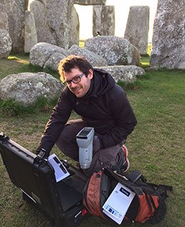
They are a tough lot, these diggers.  I admire their fortitude -- the last few days of the dig threw very challenging conditions at them in this exposed location, with driving rain and very strong winds.  The famous "Turdis" was apparently blown over at least twice, and one hopes that nobody was inconvenienced or harmed while sitting on the throne.

Since the digging team involved in Waun Mawn 2018 is having to deal with a close shave from Hitchens's Razor, we are not going to take very seriously anything that is said -- or reported to have been said -- in popular evening talks. After all, an experienced lecturer can spin his talk any way he likes, and probably get away with it, since members of an audience are generally reluctant to question things that they have not seen for themselves.  Furthermore, hardly any of them will have read the "learned papers" on which the talk is based.

So the only evidence that really matters is that which is presented in field reports (which we will probably never see in this case) or in peer-reviewed journals, where scrutiny can properly be applied. We probably won't see anything in print in a serious journal for at least a year -- although I suppose there is still a possibility that there might be press releases, banner headlines and spectacular claims made within the next few weeks.  They have done it before, and will they do it again?  Maybe not this time, and I'll explain why.

There are seven conditions that have to be satisfied if  Proto-Stonehenge is to be proved at Waun Mawn:

https://brian-mountainman.blogspot.com/2018/09/proto-stonehenge-waun-mawn-and-burden.html

1. Prove that around 80 bluestone monoliths were arranged in a giant circle here, and that they were later taken away in a concerted fashion over a short period of time.
2. Prove that the putative stone circle was Neolithic, not Bronze age.
3. Prove that the stones were all placed here around 5,600 yrs BP and all taken away around 5,000 yrs BP.
4. Prove that the stone circle was not made of dolerite and meta-mudstone monoliths picked up in the neighbourhood, but of spotted dolerite monoliths from Carn Goedog, foliated rhyolite from Rhosyfelin, sandstones from the Afon Nyfer headwaters near Pontglasier, and unspotted dolerite from Cerrigmarchogion.
5. Prove that any "sockets" discovered really did hold monoliths, and that they are not simply extraction pits marking places from which stones have been collected for use elsewhere on Waun Mawn. They must also prove that they are not simply natural hollows in the surface of the broken bedrock / till layer that lies beneath the thin surface peat and soil layer.
6. Prove that any so-called traces of human activity on this site really do relate to settlement and "engineering work" and are not simply natural phenomena related to glacial and periglacial processes.
7. Prove via control digs that any features exposed during this dig really are exceptional and significant, and that they are not just typical of what occurs beneath the peat across a wide swathe of countryside.

Rumour has it that there was much despondency among the diggers this year since -- after all that hype -- nobody found anything that was remotely exciting or spectacular, in spite of herculean efforts.    As I have pointed out in a previous post, about 1000 sq metres of turf were stripped away and the ground beneath minutely examined.  There will have been detailed surveys, and many samples will have been taken away for radiocarbon and other analyses.  We hope to carry a report from somebody who attended one of MPP's Castell Henllys talks, but it seems that the key points from the recent talk at Bluestone Brewery are as follows:

1.  The bluestone "quarries" at Rhosyfelin and Carn Goedog are established as fact, and are not disputed by anybody.
2.  No mention of the fact that there are two very "inconvenient " papers relating to the quarrying hypothesis in learned journals that he chooses to ignore.  No mention of the glacial transport hypothesis. (Correction; apologies.  I am informed that MPP did mention both the human and glacial transport theories in one of his talks.) No mention of the complete lack of evidence relating to the human transport hypothesis.
3.  The strontium isotope work on cremated bone fragments gathered in that Aubrey Hole at Stonehenge "is consistent" with at least some of the Neolithic people at Stonehenge having come from West Wales.
4.  The radiocarbon evidence from the "quarry sites" points to a multitude of quarried bluestones being parked up somewhere for maybe 400 years before being carted off to Stonehenge.
5.  A few empty stone sockets with packing stones in them have been found on Waun Mawn, from near the existing standing stone and recumbent stones, and one from the southern part of a possible circle.
6.  It is likely that there was a large stone circle here, similar to other elsewhere in the UK but substantially larger, with a diameter of c 112m (my correspondent was a bit uncertain on this) (this is now confirmed by others).

That's all very fine.  Let's forget about the first four points (we have dealt with them before) and try to check points 5 and 6 against the things which I observed when I visited the site one peaceful evening.


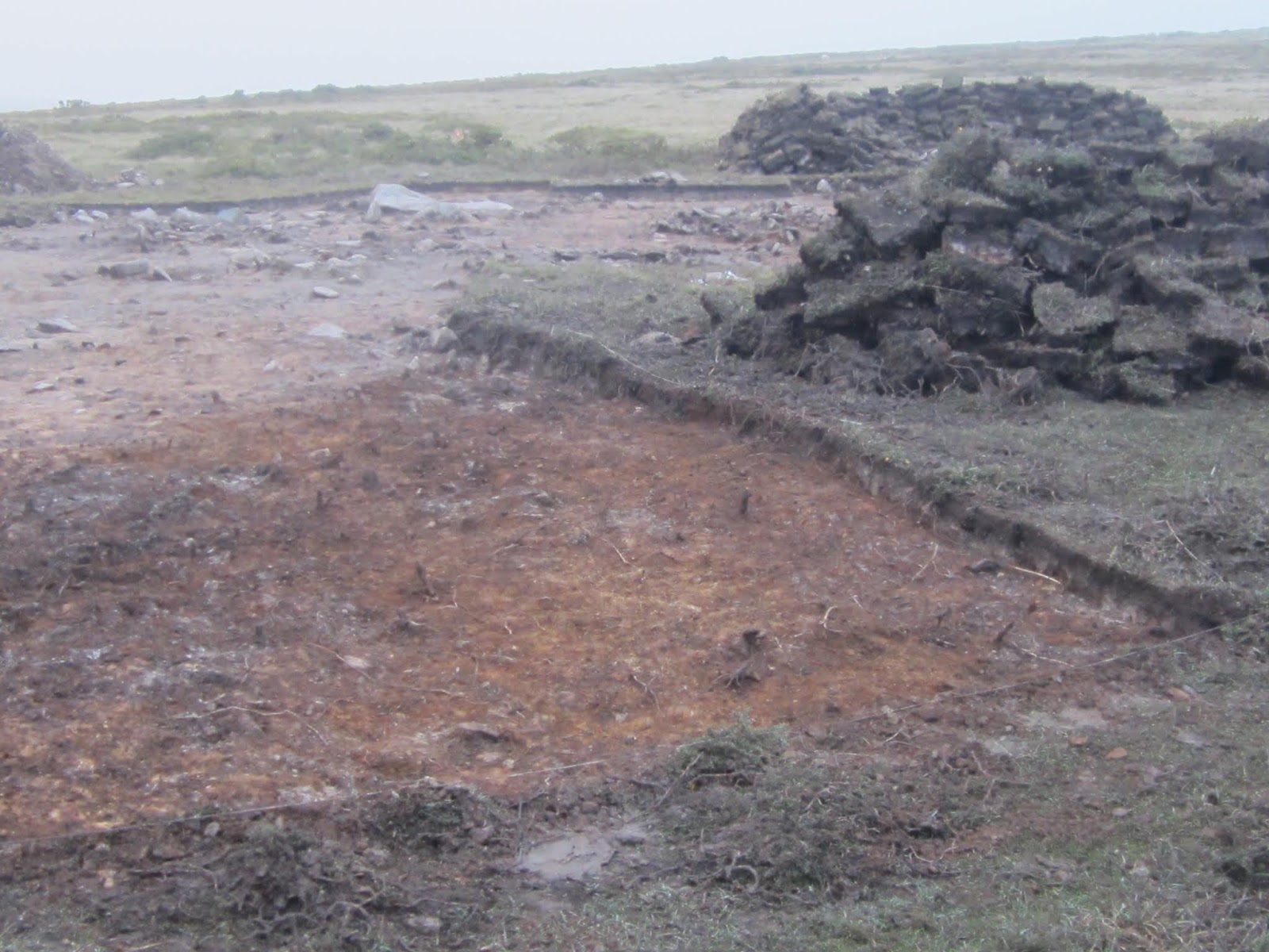
1.  One correspondent told me that MPP presented FULL scientific evidence confirming the presence of bluestone monolith sockets.  Forgive me, but I will take that with a pinch of salt.  They are not at all convincing.  The ones that I saw (there may be others, but I doubt it) are relatively shallow hollows up to 30 cms deep with irregular shapes, no contained packing stones (I admit that they might have been removed by the diggers), and jagged stone edges projecting out from the pit sides.  This does not happen in proper stone sockets;  such sharp projections would be broken off either in placing the stone into the socket, in forcing down packing stones, or in removing the stone for use elsewhere.  (This was, I suspect, why the proposed big stone socket at Rhosyfelin, initially flagged up as important, was quietly forgotten about when the "final story" was being put together.)  My impression is that most of the "sockets" are artifices created by the diggers, who find a soft surface more or less where they would like it to be, and who then happily scrape away with their trowels until they have a nice little pit -- at which point they say "How splendid!  I have found another stone socket!" and are rewarded with an extra Mars bar.  Too cynical?  Maybe, maybe not...... and of course, some of the pits I observed may simply have been created by the diggers in order to obtain soil samples or in search of charcoal fragments for radiocarbon dating.

2.  I can't be certain of this without access to the full site survey, but it seemed to me that the "sockets" are not located with any degree of accuracy in the places where they should be.  They seemed to be away from the circumference of the proposed giant circle, irregularly spaced, and separated in places by very large gaps.  If somebody tried to convince me that this was once a carefully measured and constructed Neolithic stone circle, set up for ritual or astronomical purposes,  I would not be impressed.  I might be similarly unimpressed if somebody was to try and convince me that something way off the circumference was deliberately placed as a significant "outlier".


3.  The stones (and there are many of them) exposed in the open pits are of all shapes and sizes, as one would expect in this area of glacial deposits and periglacial slope accumulations.  They are mostly made of local dolerite (maybe 85%), meta-mudstones (maybe 10%), and ashes, rhyolites and some sedimentaries of local origin.  In spite of quite a careful search, I did not find a single fragment of spotted dolerite, foliated rhyolite, or Palaeozoic sandstone.  If this had been a "parking place" for monoliths quarried at Rhosyfelin, Carn Goedog and Pontyglasier there must have been fragments left behind in or around the so-called stone sockets.  In my mind this spells instant death for the "proto-Stonehenge" hypothesis.


This deeply embedded dolerite boulder in the eastern quadrant is still where it always has been, at least since the last glaciation......

4.  The archaeologists need around 80 monoliths to have been parked here and then taken away to Stonehenge if their theory is to have any credibility.  On my visit to the site I saw maybe half a dozen shallow pits that might be interpreted by some as sockets -- and even allowing for the presence of some hollows in dig pits that have already been reinstated, there is no way that the evidence on the ground provides support for the hypothesis.  (The one part of the circle that has not been investigated this year is the SE quadrant; but even if there are another dozen little pits there, still under the turf, the evidence would be far, far short of what is needed for hypothesis confirmation.)


Above:  These are all views of "big pit" -- an extensive area stripped of turf and clearly subject to intensive investigation.

5.  I predict that there will be some emphasis, in descriptions of the dig by MPP and his colleagues, on a large excavation just beyond the SW quadrant of the putative giant stone circle.  The diggers have stripped away the turf from an irregular area which is at least 10m x 25m in extent, revealing a very typical surface of what I suspect is Devensian till, full of rounded, sub-rounded, faceted and subangular boulders and cobbles of all shapes, sizes and lithologies.  Oh, for the time to examine it properly, in the company of a few experienced glacial geomorphologists...........  the surface of the till is gleyed, with a typical red, buff and bluish colouring, and in places there is a distinct foxy-red crust or ironpan where minerals have been precipitated out.  This is all  typical of soils in the Preseli region -- we saw the same thing at Rhosyfelin. In places there appear to be traces of ash and bits of charcoal -- so this looks as if it might be a human occupation site where there have been camp fires.  That's very interesting -- I look forward to seeing the evidence from the archaeologists, when it has been analysed.  Should we be surprised and even amazed by this discovery?  Not really -- we already know that Waun Mawn has signs of human occupation -- including ring cairns, hut circles and stone settings -- so we know that people lived here, lit fires here, killed animals (and maybe each other) here, ate meals here, and undertook all of the other activities typical of our jolly Neolithic ancestors.  All that having been said, I might risk a few quid on a bet that MPP will be flagging this up to the world as the camp site or settlement place of the proto-Stonehenge builders, or the guardians of the sacred stones, or as an entrance to a sacred site, or some such thing.  Look what happened with Vince Gaffney and Durrington Walls............


I predict that there will be much debate about whether these are man-made, organized features associated with a settlement site, or just random assortments of boulders and cobbles typical of glacial deposits.  This is reminiscent of the so-called "hollow way" or "export trackway" which featured heavily in the latter stages of the Rhosyfelin dig.   There, as here, I see nothing which looks like human interference.  Some people keep on seeing faces in tree trunks and elephants and angels in the clouds....... 

6.  If this was a sacred giant stone circle which was dismantled and hauled off to Stonehenge, why were so many stones left behind?  We already know about the three recumbent stones which make an arc or a rough alignment with the one remaining standing stone, but there are others too, still embedded in the ground and apparently left behind.  Were they the wrong shapes or the wrong sizes to be "desirable" for the builders of Stonehenge?  That doesn't hold water, since the bluestones that are still standing or are embedded in the turf at Stonehenge are of all shapes and sizes, including many that are boulders just like those still embedded in the turf at Waun Mawn.

7.  It looks as if no control digs were conducted away from the Waun Mawn "mega-circle" site -- and so there will be nothing on the record which relates to how unique -- or how ordinary -- the revealed features from the 2018 dig actually are.

Apparently, at the talk MPP said that he and his diggers hope to be back again next year, if funding can be obtained.  But for how much longer can he maintain the pretence that something big relating to the Stonehenge "Welsh Connection" has been discovered and just has to be confirmed by one more dig?  He has been saying that for the last six years.  And at what point will the funders of the work (and the editors of glossy magazines) finally run out of patience and say "Enough is enough"?

=============================

Sorry, chaps, but the Proto-Stonehenge thesis is rejected.  Not one of the seven conditions outlined above is satisfied.  Surely it's not too much to ask that MPP and his colleagues should now admit that they got the story all wrong, and that there is no Stonehenge link here on Waun Mawn -- or anywhere else -- after all.  While they are about it, it would be nice if they were to admit that not everybody accepts their story about "bluestone quarries" at Rhosyfelin and Carn Goedog.

Instead of all this grandiose story-telling, perhaps they could just concentrate on showing us that they are competent archaeologists who have uncovered some interesting things up on this bleak mountain side, and who can now tell us a bit more than we knew before about settlement history and landscape change in this fascinating prehistoric landscape?  Then we can all be friends and concentrate on picking the last of the blackberry crop.

====================

PS.  In deference to Hugh and various others who feel that the original heading to this article was too provocative, in retrospect I agree that it probably was.  I did ponder on it before I posted it.  It certainly got a few people worked up!  Anyway, I have changed it to a question and hope that this will be more appropriate in the circumstances.  I have also made a few other tweaks in response to info received.  My opinions are unchanged, and I am very happy to see vigorous debate on this site, so long as it remains civilised........

The Old Stones -- now officially published


It was a pleasure to meet Andy yesterday, and to have a chat about his new book.  There wasn't any elaborate launch, but the book is now officially published, and available from now on in all good bookshops and via Amazon (the enemy -- but we all have to use it since its marketing / promotion work is so effective).

Here's hoping it sells well.  As I mentioned earlier, the "catalogue entries" for UK megalithic sites are mercifully free of speculation,  and can be accepted as pretty authoritative and reliable. But the little one-page articles on a vast range of different topics will no doubt lead to many lively debates.  Each of these articles has a name attached to it, so the contents do not imply editorial approval!  The topics include dowsing, alignments, the Neolithic cosmos, archaeoastronomy, healing stones, phenomenology, archaeoaccoustics, rock art, and stone balls. There is even an article by Jon on the geocentric universe.  There is nothing, as far as I can see, on aliens, spacecraft, giants, fairies or Merlin the Wizard.  Inevitably, opinions occasionally take precedence in these articles over cold facts....... and some readers will no doubt roll their eyes, sigh or weep as they read.  But hey, cheer up  -- this is all good fun, and there's plenty there for us all to get our teeth into!

Thursday 20 September 2018

The whale in the forest


The strange tale of the whale found in the submerged forest at Freshwater West

I have mentioned this before, but the story becomes more and more intriguing, and I am doing some research.  All we know at the moment is that in the Geological Memoir for Pembroke and Tenby (Dixon et al, 1921, p 202), there is a section on the submerged forest at Freshwater West, in which "the forest growth appears to have been ended by an invasion of the sea."    Dixon reports that an old high-water mark of this episode can be seen not far from the present HWM, where a line or ridge of tumbled tree trunks and other forest debris was (around the time of the First World War) still buried by the modern sandy beach. On the seaward side of this ridge there is a record of submerged forest peaty beds and overlying sandy and silty sediments including unbroken mussel shells -- so this is a record of a terrestrial environment being replaced by a coastal maritime environment.  These later sediments "also yielded remains of a whale-skull, probably the common rorqual (Balaenoptera musculus)."  That is the blue whale, one of the biggest creatures in the ocean.  The skull of an adult blue whale can be around 10m long.  A footnote refers to the fact that the remains are "now preserved in the National Museum of Wales in Cardiff."

That's all we know.  I have written to the National Museum to see whether they still have the remains down in the basement, and it will be quite splendid if they do -- they should be on display in Pembrokeshire, especially since this is Visit Wales's "Year of the Sea."

Because the stratigraphy is not sorted out, we should be cautious about speculating -- but the ridge of tumbled forest debris does suggest a really catastrophic event (a tsunami?) at the culmination of a long sea-level rise during which the coastal forest was overwhelmed bit by bit, in the period 7,000 - 4,000 years BP.  If Dixon is right, and if the whale skull remnants really did come from a  blue whale, it must have been washed onto a beach and rolled inland before rotting and then being broken up by waves, ending up buried in the accumulating sediments.

There are plenty of records of land animals in the submerged forest, including pigs, deer, giant elks and aurochs -- but I am not aware of any record of a marine animal being found in association with peat beds and forest remains.  I'm asking Dr Martin Bates of Lampeter if he knows anything more.......


Aurochs find from the submerged forest at Whitesands, lovingly nursed by Phil Bennett


Aurochs horn from the submerged forest near Eastbourne


A note on the deposits buried beneath the sand at Freshwater West:

https://brian-mountainman.blogspot.com/2016/02/devensian-till-at-freshwater-west.html


The submerged forest is only rarely visible here -- this photo was taken around New Year's Day in 2014.  (Courtesy Pembs Coastal Photography)


Tuesday 18 September 2018

The Waun Mawn Metaphor competition


Sometimes I get too serious on this blog, on things that seem to me to be important.  OK -- I admit it! So now and then it's good to be a bit more frivolous.

A well-known author of official Stonehenge guide books -- who shall be nameless -- recently referred to those of us who know something about glacial processes as "ludicrous glacial transport cobblers".  That was a very jolly jest, and of course he didn't really mean it........ so let us continue in a similarly frivolous vein........

 Here is a light-hearted competition -- what is the best metaphor for what is going on up on the windswept slopes of Waun Mawn?  Our jolly jesting archaeologist may even be up there as we speak.    Who knows?  They stick together, these guys.

Anyway, all entries will be given due consideration.  The prize for the winner is still to be decided -- maybe Simon up at the brewery will donate a free pint of Bluestone ale?  No -- that's an outrageous suggestion -- he has to earn a living, like the rest of us.......


............ and here are some more.  The English language is well blessed.......


Monday 17 September 2018

Proto-Stonehenge, Waun Mawn and the burden of proof


Further to my previous post, rumour has it that the dig is now complete, and that the diggers will be filling in, tidying up, and moving on within the next couple of days. The Pembrokeshire Historical Society members visited the site of Sunday for a guided tour;  maybe other groups have also visited.  This week MPP will be giving his latest talk three times in the local area.

https://brian-mountainman.blogspot.com/2018/09/waun-mawn-unfinished-business.html 

Since it was announced even before the 2018 dig commenced, and since Waun Mawn has been widely flagged up as Proto-Stonehenge on the basis of no evidence and much speculation, it's worth reminding ourselves what a task MPP and his team have on their hands.   We are not just dealing with Occam's Razor here, but with Hitchens's Razor too.

Wikipedia:
"Hitchens's razor is an epistemological razor asserting that the burden of proof regarding the truthfulness of a claim lies with the one who makes the claim; if this burden is not met, the claim is unfounded and its opponents need not argue further in order to dismiss it. It is named, echoing Occam's razor, for the journalist and writer Christopher Hitchens, who, in a 2003 Slate article, formulated it thus: "What can be asserted without evidence can be dismissed without evidence."

And as Carl Sagan said: "Extraordinary claims require extraordinary evidence":
https://rationalwiki.org/wiki/Extraordinary_claims_require_extraordinary_evidence

See these posts:

https://brian-mountainman.blogspot.com/2017/05/hitchenss-razor-and-century-of.html  
https://brian-mountainman.blogspot.com/2017/08/bluestone-transport-how-archaeologists.html
https://brian-mountainman.blogspot.com/2018/08/the-artificial-significance-of-waun-mawn.html

I don't want to go over all that again, but let's remind ourselves of a quite extraordinary claim: namely that the stones used in the  bluestone settings at Stonehenge were brought, lock, stock and barrel, from an older (Neolithic) stone setting at Waun Mawn, in the form of a giant venerated stone circle which used stones quarried from Rhosyfelin (foliated rhyolite), Carn Goedog (spotted dolerite), Cerrigmarchogion (dolerite) and Pontyglasier (Palaeozoic sandstone).  In the light of what has already been claimed in print by MPP and his team, the burden of proof rests squarely on their shoulders, and they will look extremely foolish if this all proves to have been a classic wild goose chase.

This is what they now have to do:

1.  Prove that around 80 bluestone monoliths were arranged in a giant circle here, and that they were later taken away in a concerted fashion over a short period of time.

2. Prove that the putative stone circle was Neolithic, not Bronze age.

3.  Prove that the stones were all placed here around 5,600 yrs BP and all taken away around 5,000 yrs BP.

4.  Prove that the stone circle was not made of dolerite and meta-mudstone monoliths picked up in the neighbourhood, but of spotted dolerite monoliths from Carn Goedog, foliated rhyolite from Rhosyfelin, sandstones from the Afon Nyfer headwaters near Pontglasier, and unspotted dolerite from Cerrigmarchogion.

5.  Prove that any "sockets" discovered really did hold monoliths, and that they are not simply extraction pits marking places from which stones have been collected for use elsewhere on Waun Mawn.  They must also prove that they are not simply natural hollows in the surface of the broken bedrock / till layer that lies beneath the thin surface peat and soil layer.

6.  Prove that any so-called traces of human activity on this site really do relate to settlement and "engineering work" and are not simply natural phenomena related to glacial and periglacial processes.

7.  Prove via control digs that any features exposed during this dig really are exceptional and significant, and that they are not just typical of what occurs beneath the peat across a wide swathe of countryside.

That is a pretty onerous set of requirements, but you make your bed, and you lie in it.  We can be quite sure that there will be meticulous surveying and recording of data, enthusiastic collection of organic materials for C14 dating and species identifications, collection of rock samples for the "pet rock boys" to look at, and much overflying and photography from Adam Stanford's drone.  The word is that the dig has been huge, spreading across more than a thousand square metres of moorland.

As Hitchens reminds us, there is no obligation on any of us to believe a single word that these diggers utter in support of their extravagant hypothesis, and certainly no obligation for us to believe what people say simply because they are "experts" or senior academics.

So we await their evidence, with interest.........

Where is the Carn Goedog spotted dolerite?


This is one of my better images of spotted dolerite from Carn Meini or one of the other eastern tors.  At least, that's where I think it came from -- it's actually the surface of a dressed stone (hence the fresh appearance) in the front wall of the nonconformist chapel in Mynachlog-ddu.  Many of these stones were taken down from the mountain and dressed for the front (posh) face of the chapel.  Whether they were quarried is another matter -- perhaps "collected" would be the best word.

Click to enlarge.  The texture of the stone shows up rather well.

Just a reminder -- if the idea of proto-Stonehenge is to have any credibility at all, stones with a surface like this will have to be found in abundance by MPP and his fellow workers during their current dig at Waun Mawn.  (It is a central part of their thesis that scores of monoliths were carried from the supposed Carn Goedog "Neolithic quarry" and were parked up in a giant Waun Mawn stone circle prior to being transported to Stonehenge.)  When I looked quite intensively at the dig site, I did not find a single piece of spotted dolerite..........

Digging up Waun Mawn -- the costs and the benefits


I try, quite often on this blog, to explore issues raised by assorted faithful readers -- and today I have been giving some thought to something raised by Chris and others -- namely the damage done by MPP and his team of diggers to what is a very valuable and sensitive habitat.

Waun Mawn lies within the Preseli Special Area of Conservation, incorporating the Mynydd Preseli SSSI.  It's inside the National Park.  So it's valuable, and it is heavily protected by law.  The details are here:

https://www.naturalresources.wales/media/673203/Preseli%20SAC%20management%20plan.pdf 

http://jncc.defra.gov.uk/ProtectedSites/SACselection/sac.asp?EUCode=UK0012598

http://jncc.defra.gov.uk/ProtectedSites/SACselection/habitat.asp?FeatureIntCode=H4030

http://naturenet.net/status/sac.html

http://ec.europa.eu/environment/legal/liability/pdf/eld_guidance/ireland.pdf

In the area where the digs of last year and this year have taken place, there is thin peat and soil resting on a substrate of till and frost-shattered bedrock made of dolerite and meta-mudstones.  The vegetation in the vicinity of the proposed "proto-Stonehenge giant stone circle" is dry heath and wet heath -- it is not, as claimed by MPP, blanket bog.  The Pembrokeshire Coast National Park is charged with looking after it.  As we see on the web sites listed above, there are strict rules about damage to valuable habitats including SACs, and requirements relating to remediation and to penalties to be paid by offenders.  So we need to ask this question:  how much damage has been done, and is being done, by the archaeologists?

Well, last year the damage was quite considerable, since heavy machinery was used on the dig site and since the trackways up and down from the standing stone area were seriously churned up.  As we have seen in my posts from a year ago, the turf that was dug up from the half dozen or so rectangular dig sites was plopped back again in a rather haphazard fashion and in quite a hurry.  This is bound to have had a negative effect on the habitat and it is bound to have affected drainage characteristics.  Now here is a question:  did the National Park insist on minimal standards of habitat interference in advance of the work being done, and did they assess the damage afterwards?


As for this year, the scale of the work up on Waun Mawn is truly spectacular.  I haven't measured, but by a conservative estimate, no less than a thousand square metres of turf have been removed  -- and presumably put back again.  The archaeologists have done their best to be organized and tidy, but this is an exposed and very wet area, and conditions have not always been conducive to minimising environmental impact.   It would be rather too much to say that the area resembles the battlefield of the Somme, but it most certainly does not look very nice........


So here are some questions for the diggers and the National Park:

1.  Who signed off this digging programme?  In other words, what was the application procedure and what form did the consents take?

2.  What requirements were placed on the diggers relating to the protection of the SAC habitat?

3.  What assessment has been made, now that the dig is almost over,  relating to the restoration and remediation work undertaken?

4.  If the diggers have actually done damage on an unacceptable scale, what action does the PCNPA propose to take against them?  (Bear in mind that in present-day Pembrokeshire, we can get a Fixed Penalty Notice for £150 from a "Uniformed Enforcement Officer", for dropping a crisp packet in the street........)

This brings me to the question of costs and benefits.  Has anybody in the PCNPA actually asked whether the benefits perceived to flow from this dig actually do outweigh the cost of the environmental damage done?  How important was it to determine whether there really was a stone circle on Waun Mawn in the Neolithic or the Bronze Age?  Did Dyfed Archaeological Trust, Coflein, Natural Resources Wales and RCAMW express a view on this and have an input into the consent process?

Or was this large and expensive -- and damaging -- dig allowed to go ahead just to indulge the fantasies and the ambitions of one rather charismatic project leader?

Sunday 16 September 2018

The way to do things.....


With ref to some of the comments coming in to my "inbox" recently, one must either laugh or cry.  One might as well laugh, and suggest that the average respectable student of archaeology is probably given guidance somewhat along these lines........

Note the box which says "Share the credit, which will ensure that you don't get all the blame".

This is of course pinched and adapted from some obscure source......  I posted it a couple of weeks ago,