THE BOOK
Some of the ideas discussed in this blog are published in my new book called "The Stonehenge Bluestones" -- available by post and through good bookshops everywhere. Bad bookshops might not have it....
To order, click
HERE

Friday 30 August 2019

Another milestone -- 1.5 million page views


Just spotted the meter clicking up to the 1.5 million mark.  Thank you, good people, for your interest and encouragement!

Apparently the members of the archaeological establishment are blissfully unaware of the existence of this blog, and ignorant of all the things I have been saying about Stonehenge and the bluestones. They are slow learners...... and perhaps they only read and cite those articles that are approved by the thought police as being non-subversive.

Thursday 29 August 2019

The bluestone hoax gets ever more elaborate

This is an updated version of an earlier post from last November:


The Waun Mawn developments now need to be highlighted as fitting neatly into the modus operandi of the research team.

===========================

Waun Mawn. If you try really hard, and mark out your 110m circle circumference, you can "find" a standing stone socket in the middle of this lot, and say that a bluestone 
monolith once stood in it.......

Rhosyfelin.  Does anybody else see a loading platform and a revetment here?  No?  Neither do I.


Carn Goedog.  Does anybody else see a stone-filled ditch, a platform and a pillar extraction point when they look closely?  No?  Neither do I.

Rhosyfelin.  Does anybody else see the "exact extraction point" from which a bluestone monolith pillar has been extracted?  No?  Neither do I.

Carn Goedog.  Does anybody else see evidence of a Neolithic quarry from which bluestone monoliths have been extracted?  No?  Neither do I.


Rhosyfelin.  Does anybody else see a quarrying forecourt and working surface here?  
No?  Neither do I.


Waun Mawn standing stone.  You can always pretend that this has been imported from a dolerite bluestone quarry some miles away -- and fail to mention that there are dolerite outcrops just 100m away, and dolerite erratics all over the place.

((I have another 50 or more photos showing natural features interpreted as having "engineering significance"  -- you'll find them in other posts on this blog.   I have resisted the temptation to put them all in here, since you would simply get bored..........))

The Art of the Scientific Hoax

I have done various posts on hoaxes before, including the following:

https://brian-mountainman.blogspot.com/2018/04/the-bluestone-quarries-great.html

Anyway, having observed the antics of various archaeologists (and geologists) over the last nine years, I am now completely convinced that the claimed “discovery” of Neolithic bluestone quarries in Wales is the most imaginative and professional hoax since Charles Dawson “discovered” Piltdown Man in 1912. (1)  The supposed "discovery" of the remains of a giant stone circle at Waun Mawn --designated as "proto-Stonehenge" -- has made the hoax even more elaborate (2).  What is possibly most impressive about it is that it has been built up systematically now over a period of nine years without any of the conspirators spilling the beans.........

Charles Dawson (sitting) at the site of his "earth-shattering" discovery........


It's a pity that scientific hoaxes have gone out of fashion, since they cause much embarrassment to the experts who are fooled by them and much innocent amusement for everybody else. Mind you, they don't do much for the reputations of the perpetrators -- although, if you are lucky, like Charles Dawson, you might be dead before you get rumbled.

As followers of this blog will know, year after year I have conducted — in all seriousness — a forensic examination of all of the evidence placed into the public domain by the archaeologists who claim that there are bluestone monolith quarries at Rhosyfelin and Carn Goedog in the Preseli uplands of Pembrokeshire and traces of a giant stone circle at Waun Mawn; and time and again I find that the evidence just does not withstand even superficial scrutiny (3). So I'm sure that the archaeologists, led by Professor Mike Parker Pearson of University College London, have pulled a fast one and have joyfully fooled the media, the public and a large part of the archaeological establishment.

For a scientific hoax to be successful, it requires four preconditions:

1. A gullible public predisposed to believe in “new discoveries” — in this case, stories about the great skills of our prehistoric ancestors and the meaning of Stonehenge.  In these days of alternative facts and false news, almost anything will grab the attention of the public.  The mere use of the word "Stonehenge" in a press release guarantees wide media coverage.

2. A colourful and swashbuckling lead character who has a respectable past and a strong media presence.  MPP is a popular figure who has been called the “Indiana Jones” of British archaeology, with a reputation for an endless stream of controversial theories.

3. A body of “evidence” cited in support of the hoax which cannot be checked or replicated by anybody else.  As far as I am aware, there was no independent scrutiny or peer review of the dig sites at Rhosyfelin, Carn Goedog and Waun Mawn while MPP and his team were at work between 2011 and 2018.   And the excavations have now been filled in, so that nobody can go back to them to check the cited “evidence”.  Wonderful!  That's a perfect scenario for a successful hoax……….

4. The ability to suppress or "drown out" anything inconvenient that might show up the hoax for what it is.  This can be achieved by doing deals with big business or grant-giving bodies which see that there would be large negative impacts for them should the hoax be exposed.  They will help you to promote the hoax and to suppress independent scientific research and conclusions.  You can also "drown out" inconvenient expressions of concern by using your contacts to repeat the hoax in print as often as possible and to develop it bit by bit in a way that can be represented as "hypothesis confirmation."   And of course you can vilify your opponents behind the scenes and use your establishment contacts to ensure that anything they write has little chance of being published.   This is all very jolly as long as you are not concerned about scientific ethics.

All four preconditions are amply fulfilled in this case.    

There has been extensive media coverage of the “bluestone quarries” and "proto-Stonehenge" since 2011, and this has ensured a considerable flow of research funding to finance eight digging seasons at the “quarrying” sites and elsewhere, as the archaeologists claim to have found “proto-Stonehenge” in the North Pembrokeshire landscape.  Interestingly enough, the breathless and uncritical coverage has come not just in the tabloid press but also in popular archaeological and historical magazines.  Even science journals which -- presumably -- have some respect for the scientific method, have been swept along in the torrent of fake news coming from the digging team and their university press offices.

https://www.manchester.ac.uk/discover/news/stonehenge-bluestone-quarries-confirmed-140-miles-away-in-wales/
https://www.telegraph.co.uk/science/2016/06/05/original-stonehenge-was-dismantled-in-wales-and-moved-to-wiltshi/
https://www.dailymail.co.uk/sciencetech/article-6018799/Ancient-WELSHMEN-helped-build-Stonehenge-5-000-years-ago-using-vast-bluestones.html
https://www.archaeology.org/issues/208-1603/trenches/4162-trenches-wales-stonehenge-bluestones
https://www.pourlascience.fr/sd/archeologie/lorigine-de-certaines-pierres-de-stonehenge-identifiee-au-pays-de-galle-12225.php

But clues as to what was going on were picked up at an early stage. The archaeologists who started digging at Rhosyfelin in 2011 announced before they broke the turf that they were investigating a quarry — which raised a few eyebrows. (Scientists do not normally announce their results before their research has started…..) At all stages of the dig, when I examined the open excavations in the company of other geologists and geomorphologists, we became more and more certain that all of the claimed “quarrying” or engineering features were entirely natural. Three of us published two peer-reviewed papers in 2015 containing our findings, but the archaeologists refused to acknowledge the existence of the papers, and even now, four years later, they will not admit that there is a dispute going on (4).  This is not just bad manners; it is scientific malpractice.

It gets worse.  After eight years of digging, not a single detailed field report has been published. There have only been two peer-reviewed journal articles, the first described by a senior academic as “one of the worst papers I have ever read” and the second equally suspect (5).  The radiocarbon dating evidence from the two "quarry" excavation sites does nothing to support the idea of quarrying, and has indeed been claimed to comprehensively falsify the quarrying hypothesis (6). No earth scientists have been systematically involved on-site in the annual excavations, which means that no serious questions have been asked when features have been interpreted as man-made. There have been no “control digs” at similar sites which migh demonstrate that the “quarrying" features are distinct or unique. And finally, not one of the many sites examined thus far for traces of “proto-Stonehenge” has proved to have anything to do with the iconic monument on Salisbury Plain (7).   The evidence for a ruinous stone circle at Waun Mawn is so thin that it should be dismissed.  Yet at every setback, the archaeologists have refused to back off,  have simply made their story more elaborate, and announced their next anticipated big discovery………..

So do the archaeologists still have any credibility? No.  Has the hoax finally run out of steam? Let us just hope so.

Here is a suggestion to the six senior members of the “bluestone quarries” project.  You've been rumbled.  Come clean, and admit that you have been enjoying a jolly prank with a serious intent in the background — namely to demonstrate how easy it is to promote a hypothesis that is underpinned by zero evidence.  Job done.  You should now, with smiles on your faces,  remind the public and the media that they should not necessarily believe things simply because they are repeated over and again, with apparent conviction, by senior academics.


NOTES

(1)
 Charles Dawson’s “Piltdown Man” hoax, perpetrated in 1912, is one of the most famous scientific hoaxes of all time. Dawson (with the aid of other persons unknown) fabricated bits of two human skulls and claimed that he had discovered, near the village of Piltdown, the “missing link” between apes and human beings. There were concerns about his “discoveries” but the hoax was not proven until 1953, many years after Dawson’s death in 1916.

(2)
Parker Pearson, M. et al. Waun Mawn 2018 interim report lite, Bluestone Brewery, 29 May 2019, 15 pp.

(3)
https://www.academia.edu/19788792/Quaternary_Events_at_Craig_Rhosyfelin_Pembrokeshire

https://www.academia.edu/19788912/Observations_on_the_supposed_Neolithic_Bluestone_Quarry_at_Craig_Rhosyfelin_Pembrokeshire

“The Stonehenge Bluestones”, 2018, Greencroft Books, 256 pp. ISBN: 978-0905559-94-0
http://www.brianjohn.co.uk/the-new-book.html

(4)
Parker Pearson, M., Pollard, J., Richards, C. and Welham, K., 2017. The origins of Stonehenge: on the track of the bluestones. Archaeology International, 20, pp.52–57. DOI: http://doi.org/10.5334/ai.353

(5)
 Mike Parker Pearson, Richard Bevins, Rob Ixer, Joshua Pollard, Colin Richards, Kate Welham, Ben Chan, Kevan Edinborough, Derek Hamilton, Richard Macphail, Duncan Schlee, Jean-Luc Schwenninger, Ellen Simmons and Martin Smith (2015). Craig Rhos-y-felin: a Welsh bluestone megalith quarry for Stonehenge. Antiquity, 89 (348) (Dec 2015), pp 1331-1352.
https://eprints.soton.ac.uk/421631/1/Megalith_quarries_Antiquity_REVISED.pdf

Mike Parker Pearson , Josh Pollard , Colin Richards , Kate Welham , Chris Casswell, Charles French, Duncan Schlee, Dave Shaw, Ellen Simmons, Adam Stanford, Richard Bevins and Rob Ixer.
Megalith quarries for Stonehenge's bluestones.
Antiquity, Volume 93, Issue 367
February 2019, pp. 45-62
https://www.cambridge.org/core/journals/antiquity/article/megalith-quarries-for-stonehenges-bluestones/AAF715CC586231FFFCC18ACB871C9F5E

MPP, National Geographic and Bluestone Brewery


We are all very familiar with the links between MPP and his team and the National Geographic -- one of a small group of "mega sponsors" who put in large sums of cash into archaeological projects (including digs) in exchange for certain exclusive rights.

What is rather more interesting is the link established in recent years between the MPP team and the local micro brewery, just up the road. Our good friends Simon and Kerry (and their family) are making a great success of it, expanding their range of beers all the time, and organizing a vast range of convivial events as well, much to the delight of both visitors and locals.  Their web site is here:

https://www.bluestonebrewing.co.uk

The brand name says it all, and I suppose it was always inevitable that the link between bluestones and Stonehenge would feature prominently in their marketing.  All credit to them for that.  Their brews go under such names as Hammer Stone, Bedrock Blonde, Rocketeer, Rock Hopper, Cave Dweller and Summer Rocks -- and the label graphics always flag up the craggy, rock-hard, angular and rather macho nature of the brews -- apart from some specifically aimed at the ladies!

 So rocks, cave men and prehistoric monuments are in --  but instead of concentrating on geology and  good solid evidence as part of the marketing campaign, the Brewery has gone for archaeological fantasies instead, and has more or less adopted MPP and his jolly gang, who of course enjoy a jar or two of ale after a hard day of digging just up the road.  All of the dig sites -- and in particular Craig Rhosyfelin, Carn Goedog and Waun Mawn -- are just a few miles away.  Mike has given at least one talk per year at the Brewery since the diggers first arrived in the neighbourhood in 2011.  To his credit, he gives the talks for free, to raise money for charity --so that is entirely admirable.

But of course there is two-way traffic here -- the Brewery benefits from the drinking expenditures of the diggers, and from the crowds attracted to his talks (the most recent one was on July 27th this year)  and Mike benefits from enhanced exposure to the public, via the Brewery's very effective PR and marketing campaigns.  Win / win scenario........

What is more intriguing is that the Brewery has in effect become the publisher for the "interim research findings" of the 2018 Waun Mawn digging season.  The "2018 Interim Report Lite" is, as far as I can make out, ONLY available to the public, for scrutiny, via the Brewery web site.  And if this is the "Lite" version, where is the heavy one?  Has anybody seen it?  Does it exist?

This is all very entertaining, in a bizarre sort of way.  But I wonder whether the Brewery has ever paused for a moment, in its zealous promotion of MPP and his ideas, to consider the possibility that all of this bluestone quarrying stuff, not to mention the speculations about the Waun Mawn "giant circle", is nothing more substantial than a hoax?  History is sadly full of examples of heroic celebrities being adopted or signed up by popular brands before proving to be, for one reason or another, more than a little toxic.

The Brewery knows that Mike's ideas are controversial and that they are hotly disputed -- but the current preference is to pretend that he is uniquely in possession of the truth.  Good marketing?  Maybe.  But bad science.

Anyway, I'm very happy to promote the Brewery via this blog, even though I cannot stand the taste of ale!  

Monday 26 August 2019

New review: "a superb piece of original research"


The book is now stocked by Geo Supplies.  Order online at www.geosupplies.co.uk or ring us on 0114 245 5746 Geo Supplies Ltd 49 Station Road, Chapeltown, Sheffield S35 2XE

BOOK REVIEW

The origin and formation of the stones that make up the iconic ancient monument that is Stonehenge, is one of those mysteries that has run for many, many years. In this book Brian John seeks to nail the mysteries of the Stonehenge stones, once and for all. As to whether he succeeds in that task, is down to you, the reader and I’m not going to spoil the tale!

What I will say is that this is a superb piece of original research from someone who knows his subject extremely well. Brian John comes from Pembrokeshire and his background is as a geographer who gained his D Phil studying the ice age of his home county. All of this is very appropriate for someone with a long term interest in Stonehenge and the origin of its stones.

Two distinct rock types make up Stonehenge. Firstly, there are the ‘sarsen stones’, blocks of hard quartz sandstone or silcrete. Secondly, there are the ‘bluestones’, which aren’t blue, but are different from the sarsens. As early as 1921, the geologist Herbert Thomas identified them as being the igneous rock, dolerite.

So, the rock types that make up Stonehenge had been identified, but where had they come from and how had they arrived on Salisbury Plain? The sarsen stones were the easiest, they can be found on and around the chalk downs and are hence fairly local in origin. The bluestones were more of a challenge. Petrologically, they match dolerite that outcrops at the eastern end of Preseli, around Carn Meini, Carnalw and Foel Drygarn, all in Pembrokeshire. In addition, there are four blocks of rhyolite and the Alter Stone is made of a micaceous sandstone. Once again, they can be matched to known outcrops in Pembrokeshire.

The fundamental question the was, how had these rocks got to the site of Stonehenge? In particular, had they been quarried in Pembrokeshire and then somehow transported to the site? For years, archaeologists had suggested that this was indeed the case and the stones had been moved by sledges or rafts. But was this correct?

Brian John uses his Earth science knowledge to test this and other false beliefs and comes to the very firm conclusion that they are all glacial erratics. Quite simply they arrived on Salisbury Plain on the easterly moving Irish Sea Glacier around half a million years ago. The Neolithic people were then able to gather them up and work them quite close to the site of Stonehenge.

This is a fascinating story. It’s a detective story with a difference. This book is suitable for a wide audience and will make you think!

Down to Earth 108

Friday 23 August 2019

MPPs's flight of fancy re Stonehenge stone 62


From Simon Banton's "Stones of Stonehenge" web site:

In the interim report of the excavations of 2018 at Waun Mawn (a partial stone circle located a few km west of the Preseli Hill outcrops that are the sources of the bluestones), Prof. Mike Parker Pearson reports that stonehole 091 at Waun Mawn shows the imprint of a pentagonal-based stone (long since removed).
He points out that the size and shape of this imprint are a close match for that of Stone 62 at Stonehenge, that a detached fragment of bluestone found in stonehole 091 is the same rock type as Stone 62, and suggests that Stone 62 may once have stood at Waun Mawn.


http://www.stonesofstonehenge.org.uk/2015/01/stone-62.html

Well, this is a nice pillar of unspotted dolerite, with many traces of damage -- some apparently very old, and some attributed to "stone hunters" in recent centuries.  So how reliable is the speculation that it might once have stood in "stonehole 91" at Waun Mawn?  We can forget about the geological connection, because EVERY hole that anybody digs in the ground at Waun Mawn contains fragments of unspotted dolerite -- it is ubiquitous, and outcrops just a short distance from the putative Waun Mawn stone circle -- a fact that the MPP team conveniently forgets.

So what about the "pentagonal" shape of the supposed stonehole being just right for the shape of stone 62 at Stonehenge??

Here is the text description from the Bluestone Brewery Report (you couldn't make this up -- but don't blame me......):

Stonehole 091 on the southwest side of the stone circle

"Stonehole 091 (1.7m north–south x 1.2m east–west x 0.3m deep) was large enough to be visible as a slight circular hollow on the ground surface prior to excavation. On excavation, it was found to be teardrop-shaped in plan with a long, shallow ramp on the south side widening as it leads to a circular pit. In its initial form, it was 1.33m north–south x 0.82m east–west, later enlarged when the standing stone was removed.

The primary fill of mottled orange and yellow-brown silt surrounds a central area in which the imprint of a standing stone has survived. This is a pentagonal impression with each of its five sides between 0.38m–0.47m long, giving the standing stone a diameter of over 0.6m.

Two narrow slots just beyond the northeast side of the pentagonal impression, one east– west and the other north–south, could be voids left by packing stones removed when the stone was dismantled. However, a more satisfying possibility is that these are marks left by wooden levers inserted against the base of the stone to help topple it southwards.

The standing stone was removed along a ramp to the south, the same direction from which it was erected. Its extraction hole was then filled with a sequence of secondary fills containing over 40 struck dolerite flakes. One of these was a large stone flake (22.9cm x 8.4cm) aligned longitudinally along the eastern side of the extraction ramp. With its weathered cortex on its exterior face, it may have been an unintentional removal, detached from the standing stone as it was pulled out of the hole. As with all the other flakes from stonehole 091, it is of unspotted dolerite.

Artefacts found in close proximity (within 2–3m) of stonehole 091 consist of a flint scraper (SF40), a piece of worked flint (SF1) and a trimmed circular mudstone disc (SF3). The mudstone disc is very similar to three such artefacts found in Neolithic levels at Carn Goedog megalith quarry."


End of quote.


This is the rather fuzzy published photo, purporting to show stone socket 091 (supposedly of just the right dimensions) with a ramp used for setting the stone and taking it away again at bottom centre, and at top centre two "slots" which might have held packing stones, or might have been the imprints left from the use of wooden levers for the extraction of the stone before carting it off to Stonehenge.......


OK -- time for a dose of scepticism, based on what we already know about the working methods of this team.

Why should we believe that this is a stone hole?  There are scores of slight hollows and pits across the area excavated in 2018 -- and as I have said before, and shown through my photographs, not one of them is a convincing stone hole.  

Secondary fill?  What is the evidence for that?  What are the features that make it distinguishable from a primary fill?  The 40 "struck dolerite flakes"?  What is it that distinguishes these flakes from the abundant flakes of dolerite -- and indeed fragments of many sizes -- that are scattered across this landscape and throughout all the superficial deposits? What is it that demonstrates human involvement in their creation?  The largest stone flake with a weathered cortex? Why is this not an entirely natural and normal broken piece of dolerite sitting in a glacial deposit and derived from the adjacent dolerite outcrops? 

And then this bit:  Artefacts found in close proximity (within 2–3m) of stonehole 091 consist of a flint scraper (SF40), a piece of worked flint (SF1) and a trimmed circular mudstone disc (SF3). The mudstone disc is very similar to three such artefacts found in Neolithic levels at Carn Goedog megalith quarry.  Do we know that this "close proximity" is unusual or noteworthy?  And how do we know that any of these mentioned things are actually artefacts?  Why should we believe that, having examined the so-called "artefacts" from Rhosyfelin and Carn Goedog and having found that they are all entirely natural?  "Artifices" might be a better word.  A mudstone disc?  What on earth is all that about?  Is it demonstrably an ornament, or is it just a roundish piece of mudstone like thousands of others on the site?

Sorry to be nit-picking, but I for one am fed up with being told what things are rather then being shown them, alongside a reasoned discussion as to origins.

There is NOTHING here that demonstrates any connection between so-called "stone socket" 091 at Waun Mawn and bluestone number 62 at Stonehenge.

=======================


PS.  The report labelled   "Waun Mawn stone circle: the Welsh origins of Stonehenge . Interim report of the 2018 season" and published by Bluestone Brewery with the URL
now appears to have disappeared from the web.  At least, I can't get at it.  Can anybody else?

PPS.  The report does seem to be available still.  There was a settings issue on my computer, which had decided, without any involvement from me, to switch on parental controls.   All sorted now, with the help of BT.  Weird that this was the only URL which was deemed to be inappropriate for children to see....... 


Thursday 22 August 2019

Parker Pearson, unification and Neolithic Brexit


Stonehenge, a ramshackle and ruinous aberration, or a glorious symbol of a "Brexit Golden Age" in which high culture flourished in a peaceful and independent environment, free of "foreign" interference?


Did Dutch hordes kill off the early Britons who started Stonehenge?

A gene study has shown that incomers could have ousted Stone Age Britons

(Observer, May 2017)

That was a typical headline.  Talking to the BBC in 2018 about the Beaker folk, Mike Parker Pearson commented: "They're the people who bring Britain out of the Stone Age. Up until then, the people of Britain had cut themselves off from the continent - 'Neolithic Brexit'. This is the moment when Britain re-joins the continent after 1,000 years of isolation - most of the rest of Europe was well out of the Stone Age by this point."

This is an MPP quote that Jon found some time ago:
""All the architectural influences for Stonehenge can be found in previous monuments and buildings within Britain, with origins in Wales and Scotland. In fact, Britain’s Neolithic people were isolated from the rest of Europe for centuries. Britain may have become unified but there was no interest in interacting with people across the Channel. Stonehenge appears to have been the last gasp of this Stone Age culture, which was isolated from Europe and from the new technologies of metal tools and the wheel."

He should choose his words more carefully. On many occasions on this blog since 2012,  we have slammed his obsession with Stonehenge as a sort of symbol -- or manifestation -- of a grand Neolithic unification project, bringing together people from all over the British Isles with a common purpose and a common set of beliefs.   He argued, in his 2012 book, and has repeated often since then, that  there was a "political" imperative which brought the disparate tribes of Great Britain together.  That meant there were people with vast ambitions and an ability to conduct wide-ranging  diplomacy in order to convince the people of northern Scotland, Cornwall and North Wales (for example) that it was in their best interests to think of unity and unification rather than simply getting on with life on their own local territories.

Without this political / military / economic / cultural backgound, argues MPP,  Stonehenge could not have been built, and neither could the great bluestone-collecting and carrying exercise have been completed.   It's all based on circular reasoning, of course, but MPP is not the sort of fellow who bothers about such niceties.

======================
Stonehenge Built as Symbol of Unity
Analysis by Rossella Lorenzi
Fri Jun 22, 2012
Stonehenge was built as a monument to unify the peoples of Britain, researchers have concluded after 10 years of archaeological investigations.
Dismissing all previous theories, scientists working on the Stonehenge Riverside Project (SRP) believe the enigmatic stone circle was built as a grand act of union after a long period of conflict between east and west Britain.
Coming from southern England and from west Wales, the stones may have been used to represent the ancestors of some of Britain's earliest farming communities.
According study leader Mike Parker Pearson of the University of Sheffield, Britain's Neolithic people became increasingly unified during the monument's main construction around 3000 B.C. to 2500 B.C.
"There was a growing island-wide culture -- the same styles of houses, pottery and other material forms were used from Orkney to the south coast," Parker Pearson said.
"Stonehenge itself was a massive undertaking, requiring the labour of thousands to move stones from as far away as west Wales, shaping them and erecting them. Just the work itself, requiring everyone literally to pull together, would have been an act of unification," Parker Pearson said.
According to the researcher, who has detailed the new theory in the book Stonehenge: Exploring the Greatest Stone Age Mystery, the place in the county of Wiltshire where the iconic stones were erected was not chosen by chance.
On the contrary, it already had special significance for prehistoric Britons.

http://news.discovery.com/history/stonehenge-unify-britain-120622.htmlhttp://www.bbc.co.uk/news/uk-england-wiltshire-18550513


================


I have no idea how this has all gone down in academic departments across the land, but as far as I am concerned it is nonsense, and I have said as much on many blog posts.


As I have said before, the idea of sophisticated "political" thinking in the Neolithic tribes of Britain is not new, and it has been with us ever since people decided, for whatever reason, to promote the idea that our ancestors were remarkably clever chaps who were in possession of some "ancient wisdom."  Gordon Childe pushed this sort of idea:


... and as we have seen, HH Thomas must have been influenced by the patriotic fervour after the end of the First World War in which it was necessary to demonstrate that "British" Neolithic tribes were smarter and more technically advanced than the tribes living at that time in Germany.   I have argued that this "cultural context " (or shall we call it a cultural spin?) was partly responsible for the lack of scrutiny from his peers of his ideas on human bluestone transport, and for the media and public acclaim that followed the publication of his 1923 article.  


Within the last two years MPP has ramped up the rhetoric in inverse proportion to the strength of the evidence on bluestone quarrying and human transport.  He is now in so deep with the quarrying fantasy that it has to be explained or justified by ever more lavish claims about the political context of Neolithic Britain.  The Waun Mawn fiasco -- the proto-Stonehenge hypothesis -- also has a part to play. Hence the media blitz  which accompanied the publication of the latest Antiquity paper on Carn Goedog.

https://brian-mountainman.blogspot.com/2019/02/yet-more-on-quarries-scientific.html
https://brian-mountainman.blogspot.com/2018/08/the-carn-goedog-files.html
https://brian-mountainman.blogspot.com/2018/08/more-from-megalithic-quarrymen-4.htmlhttps://brian-mountainman.blogspot.com/2018/08/more-from-megalithic-quarrymen-3.htmlhttps://brian-mountainman.blogspot.com/2018/08/more-from-megalithic-quarrymen-2.htmlhttps://brian-mountainman.blogspot.com/2018/08/more-from-megalithic-quarrymen.html

In addition to the Waun Mawn / Carn Goedog work reported in the media, we have had several papers on bones, teeth, feasts and burials relating to peaceful and warlike links with the continent in the Neolithic and the Bronze Age.  We have devoted much space to these papers on this blog.  There has been vast media coverage of these papers, and in the febrile atmosphere of "Brexit Britain" it is perhaps not surprising that "Neolithic Brexit" has figured large, especially in the right-wing press.  MPP should have been more careful before opening Pandora's Box........


Although I am sure this was not MPP's intention, certain sections of the media have interpreted his press releases in two ways:
1.  articles in which it is suggested that a "unified" Britain -- free of continental influences -- existed in the Neolithic, and that there was  peace and harmony among tribes who lived a simple and fulfilling life;  and
2.  articles in which it is claimed that invading hordes from the continent during the Bronze Age overran the "British" tribes and first diluted and then dominated the gene pool, signalling an end to an imagined "national purity" in which racial characteristics were shared across the country.

MPP mentions in his press releases that the immigrations from the continent signalled the end of the Stone Age and led to huge technological and social advances -- but it's easy to see how certain sections of the media, looking for modern parallels and easy and attention-grabbing headlines, should start making hints about Neolithic racial purity and British supremacy on the one hand and immigrations, invasions and interference from the continent on the other.

The implications -- as we have seen from certain headlines -- are deeply unpleasant.  MPP should, as I have said above, be more careful about what he says and how he says it.


Tuesday 20 August 2019

Where is the highest post-glacial raised beach in the world?


A geomorphologist's paradise.  A whole  landscape of raised marine  features -- mostly old storm beaches -- on the west side of Richmond Gulf, Hudson Bay. Here the highest beaches are at an altitude of c 235m, but further to the south the highest beach traces are more than
 310m above sea-level.........
(adjusted image -- exposure increased....)


In the Rivière Nastapoka area, eastern Hudson Bay (Quebec) the marine limit is at 248m, and there are abundant signs in the landscape of a dramatic inundation by the sea particularly beneath an altitude of 205m. See this paper:

Géographie physique et QuaternaireVolume 57, numéro 1, 2003, p. 65-83
Late Quaternary Deglaciation, Glaciomarine Sedimentation and Glacioisostatic Recovery in the Rivière Nastapoka Area, Eastern Hudson Bay, Northern Québec
Patrick Lajeunesse et Michel Allard
http://www.erudit.org/revue/gpq/2003/v57/n1/010331ar.html?vue=figtab&origine=integral&imID=im17&formatimg=imPlGr

But this is the paper that seems to describe the highest raised beaches -- as distinct from the highest washed surface or marine limit:

La déglaciation et le relèvement isostatique sur la côte est de la baie d’Hudson
Claude Hillaire-Marcel
Cahiers de géographie du Québec, Volume 20, Number 50, 1976

URI: https://id.erudit.org/iderudit/021319ar 

Article abstract

On the eastern coast of Hudson Bay, in the area between Great-Whale-River and the Richmond Gulf, the last wisconsinian ices flowed westward. The deglaciation took place between 8.100 l*C yr BP (Great-Whale-River) and 7.600 1 4 C yr BP (Richmond Gulf). The maximum limit of the Tyrrell Sea rises toward the south-east, from 230 m (north of Richmond Gulf) to 315 m (north of Manitounuk sound). In the Richmond Gulf, 185 successive raised beaches were built during the emergence of the land which followed the deglaciation. A 45 yr periodicity appears in their construction. Correlation between ï 4 C and sideral ages are in agreement with Suess' curve (1970). The emergence curve, established from the raised beaches, indicate a multiple component isostatic uplift. The land, first tilted toward NNE, is uplifted in relation to the main wisconsinian ice load on south-eastern Hudson Bay at the beginning, and later in relation to the more recent ice center of New Québec. The isostatic rate of uplift decreases from the 6,5 cm/yr at 6.000 14C yr BP, to a present rate of 1,1 cm/yr. A 20 m eustatic rise is observed between the deglaciation and 6.000 14C yr BP, when the sea level seemed similar to the present one. Variations in the rate of sea level changes indicate secondary eustatic oscillations of metric amplitude, which correspond to the main climatic events of that period of the Holocene.

The article is impressive, recording many locations where old strandlines, beach ridges and washing surfaces may be found.  The highest features, on the Hudson Bay coast to the south of Richmomd Gulf, are at about 315m above sea-level.    I have not come across any records of post-glacial beaches higher than this.   nHere are three of the illustrations from the paper:


In the Antarctic,  David Sugden and I found a disturbed raised beach at an altitude of 275m (over 900 ft) not far from the summit of Noel Hill on King George Island.  We werenconcerned since this was far higher than any other raised beaches ever found in Antarctica. Our initial conclusion was that beach dated from the last interglacial, and that the extraordinary high altitude had something to do with the isostatic forebulge effect, with this and other sites around the South Shetlands lifted by a considerable amount as the ice mass over the Antarctic Peninsula and West Antarctica expanded and depressed the crust further south.  I now think that this is not a satisfactory explanation, and that Eemian / Ipswichian raised beaches would have been destroyed during the course of a whole glacial episode.  I now think that the 275m raised beach is Holocene, and that it was apparently disturbed but not destroyed by a small glacial advance, in which the ice ran over it.

https://www.researchgate.net/publication/329656084_Raised_marine_features_and_phases_of_glaciation_in_the_South_Shetland_Islands

https://www.researchgate.net/publication/262414644_The_ages_of_glacier_fluctuations_in_the_South_Shetland_Islands_Antarctica

https://www.researchgate.net/publication/262414489_Evidence_from_the_South_Shetland_Islands_towards_a_glacial_history_of_West_Antarctica

In Sweden the greatest thickness of ice in the Devensian Scandinavian Ice Sheet was over the inner reaches of the Gulf of Bothnia.  In the district known as Höga Kusten (with high cliffs and steep slopes adjacent to the sea -- very unusual for the Baltic.....) we find the highest recorded isostatically lifted shoreline in Scandinavia, at 285 m above sea-level. The beach features at this altitude, on Skuleberget, are not very spectacular, but the hill summits are capped with unwashed till (and woodland) whereas the lower slopes are washed. Hence the word "Kalottberg."

Quote from Wikipedia:

At the height of the last ice age, 20,000 years ago, the ice sheet, which covered all of Northern Europe, had its center in the sea near the Swedish High Coast (Höga Kusten). The ice's thickness attained 3 kilometres (1.9 mi), exerting significant pressure on the ground surface, which was thus situated 800 metres (2,600 ft) below the current level of the High Coast. When the ice melted, the land surface rose progressively, a phenomenon called the post-glacial rebound, at a speed of 8 mm (0.31 in) per year. The zone was only freed of ice 9,600 years ago. As the land emerged from Lake Ancylus (ancestor of the Baltic Sea), the waves affected the terrain of today's park. The coastline of that era can now be found at an altitude of 285 metres (935 ft), measured from Skuleberget, southwest of the national park, which constitutes an absolute record. The peaks of the park were islands at that time.

The ancient coastline is notably made visible by vegetation caps, which cover the areas not submerged after the retreat of the glaciers, explaining the name Kalottberg ("mountain cap") given to certain mountains of the region and the park. These vegetation caps had been able to install themselves since, at these places, the moraines were not eroded by waves, and they thus constituted a place where vegetation could attach.


Monday 19 August 2019

Ernst Hofer photos of inner Scoresbysund


One of my favourite books is "Arctic Riiera" by Ernst Hofer -- a loving portrayal of NE Greeland published in 1957.  Here are three of the images......
The image above shows the outer part of Nordvestfjord, looking westwards.  In 1962 we stood on these rocks assessing the chances of crossing the fjord with our flimsy kayaks to work on the glacier on the far shore.  We decided that the risks were too great, on a fjord of this size (10 km wide), and decided instead to paddle up the fjord to the outlet of the Oxford Gletscher.


Low-level aerial photo of the Bear Islands.  Note the moraine looping across the island in the foreground.  This will have been formed during one of the retreat / readvance stages following the end of the last glaciation.


Flyver Fjord, one of the arms of Nordvestfjord which is unusual in that it has no large glacier of its own.  Nonetheless, it is very deep, and it's become famous as a "graveyard" of vast icebergs which are carried in by tides and winds.

Sunday 18 August 2019

Stonehenge -- the Dawson narrative


Thanks to Tony for drawing attention to this -- OK, this is one of a multitude of lectures being given here, there and everywhere by "eminent archaeologists"  -- but the good people of Kansas have been treated to a lecture by David Dawson, Director of the Wiltshire Museum.  What was in it?  Well, if you go to this site you can listen to a podcast.  Oh dear -- the Dawson narrative is that it's all sorted out and established as fact as a result of the wonderful work of assorted experts -- and all he has to do now is tell the world about it.  Not a mention of any dispute over bluestone transport, but much excitement over how clever those old stone hauliers were.  And when it got to the bit about "teeth evidence" showing that the people who lived around Stonehenge came from Wales, I began to wonder whether he and I have been reading the same articles and looking at the same evidence.

At that point I decided that I could use my time more effectively in the garden, and turned the podcast off........

http://northeastnews.net/pages/northeast-newscast-episode-101-look-mysteries-stonehenge-british-archaeologist-david-dawson/?fbclid=IwAR3PK3oMibbWpubQx82ZrJphloY7aPosXJzx6FeTU6rJG1ptD1_lseW0ol8

Why is it that these people just cannot bring themselves to accept that the narratives that they hold so dear are actually DISPUTED?

Bluestones: after the invented evidence, the imaginary scientific papers


What on earth is going on?  Twice in recent weeks I have received Email notifications from Academia.edu (the web site which makes accessible academic publications which may be behind paywalls) relating to scientific papers by Rob Ixer and Richard Bevins.  The notifications are reproduced above.  In both cases, I am encouraged to believe that new publications have entered the public domain......... and to click on download links.

In fact, there are NO published peer-reviewed publications with the titles given at the top of the posts.  Google searches for papers entitled "Stonehenge debitage.  Volcanics B Orthostat 38 knock-offs" and "Primary description of Stonehenge orthostats SH38,40,46, 48 and two dolerites" reveal that they do not exist, and when you click on the links you simply arrive at old papers that have been kicking about for some years.  No new evidence, no new papers.

I have heard of recycled evidence before, presented over and again in a series of articles on the basis that if you repeat a fantasy often enough -- in print -- it eventually turns into the truth -- but this is ridiculous and completely unacceptable from a scientific standpoint.

I cannot for a moment believe that Ixer and Bevins are themselves responsible for this deceit -- but maybe I should suspect it, given the somewhat dodgy practices in the past of the MPP bluestone quarrymen?

But if I was one of the cited authors I would be onto Academia.edu with one hell of a broadside, telling them in no uncertain fashion to maintain academic standards and stop inventing articles which distort the extent of academic work and which can result in great damage to academic reputations.

PS.  Academia.edu is now doing this all the time, on all sorts of topics, sending notifications to academics relating to "topics" which they might be interested in.  This involves trawling through old papers, giving them new and catchy titles, and assuming -- from their reading and writing history -- that they will want to look at them.  As far as I am concerned, this is unwelcome marketing and an abuse of personal information held on their database.  I have complained to them in writing and have now unsubscribed from their Email list -- not that I ever subscribed in the first place.  (25 Aug 2019)

Saturday 17 August 2019

Sukkertoppen ice wastage 1935 - 2013


I thought there was something fishy about the upper image being labelled as a photo of the Catalina Lake area of Renland -- the glaciers did not seem to fit........  Authors should be more careful.

This is in fact from a NASA website, showing how the outlet glaciers in a flanking trough of the Sukertoppen Ice Cap of W Greenland have retreated between 1935 and 2013.  Impressive -- and depressing.


Sukertoppen Ice Cap is to the left -- the camera view is along the trough towards the NE

Catalina Lake catastrophic drainage


Now you see it, now you don't.  Foreground: the western end of Catalina Lake.  Sometimes this section of the lake is just not there.  When a drainage "event" happens, the lake level falls by over 150m, leaving this area high and not exactly dry....... (PS -- this is a replacement image for one mistakenly labelled by the article authors........) 


Map extract showing Catalina Lake (to the right) at its "filled" size......


How did I miss this?  A report of periodic spectacular lake drainage from Catalina Lake in Renland, East Greenland.   The lake occupies a section of Catalina Dal, a through valley that runs across the island of Renland.


Periodic outburst floods from an ice-dammed lake in East Greenland
Aslak Grinsted,  Christine S. Hvidberg, Néstor Campos & Dorthe Dahl-Jensen

Nature  Scientific Reports volume 7, Article number: 9966 (2017)
https://www.nature.com/articles/s41598-017-07960-9

Abstract

We report evidence of four cycles of outburst floods from Catalina Lake, an ice-dammed lake in East Greenland, identified in satellite imagery between 1966–2016. The lake measures 20–25 km2, and lake level drops 130–150 m in each event, corresponding to a water volume of 2.6–3.4 Gt, and a release of potential energy of 1016 J, among the largest outburst floods reported in historical times. The drainage cycle has shortened systematically, and the lake filling rate has increased over each cycle, suggesting that the drainage pattern is changing due to climate warming with possible implications for environmental conditions in Scoresbysund fjord.


If you compare these two images carefully, you can see that the lake area has been reduced by around 50% between 2003 and 2004.  The western part has just disappeared, leaving behind a somewhat chaotic arrangement of dissected lake-floor sediments and jumbled ice fragments.  The ice has not drained westwards, but northwards beneath the tongue of the Edward Bailey Glacier.    The shelf area or floating section of the glacier has been lifted to allow the water from the lake to drain in the direction of the arrow.  The drainage event took place during the winter.  


Water and ice elevation changes between 1986 and 2007.  We do not know how these changes relate to the drainage cycle.......


Model illustrating how the expanding lake lifts the floating glacier snout and then escapes over the high subglacial col to the right of the diagram.

It is assumed by the authors that another drainage event is due before long, accelerated as a result of enhanced melting of ice caps and glaciers which are contributing meltwater to the lake.  The water level is currently building up inexorably...........

Watch this space.......

Then it gets more complicated.  Here is another article that suggests that in the past the Edward Bailey Glacier has been more extensive and has been solidly grounded, forcing the Catalina Lake to overflow or spill westwards!  In through valleys like this, occupied by assorted glacier snouts and meltwater lakes, anything can happen......

Changes in glacial meltwater alter algal communities in lakes of Scoresby Sund, Renland, East Greenland throughout the Holocene: Abrupt reorganizations began 1000 years before present.

by Krista E H Slemmons, Aaron Medford, Brenda L. Hall, Jasmine Saros et al

November 2016
The Holocene 27(7)
https://journals.sagepub.com/doi/abs/10.1177/0959683616678468

DOI:   10.1177/0959683616678468


I think this is a spring / early summer image from 2019.  The mottled surface looks like a frozen lake just in the process of melting.  I interpret this as showing the the lake is full -- and ready to go at any moment.......

Friday 16 August 2019

Seen from space: Schuchertdal dust storm, East Greenland


This is really very unusual -- on Sept 29th 2018,  NASA staff picked up this strange phenomenon on satellite imagery -- a gigantic dust-storm in East Greenland, caused by very strong north-westerly winds blowing across the dry and dusty sediments of the lower Schuchert Valley.  You can see that some dust is also blowing across the Landtungen peninsula  from the extensive delta at the mouth of Gurreholmsdal.

The Schuchert Valley holds what is probably the biggest sandur in Greenland, fed by the meltwater streams from no less than seven glaciers.  When we were in this area in 1962 it was so ferocious that it was uncrossable in its lower reaches- even at night when flow rates were somewhat reduced.

There is a vast expanse of exposed sands and gravels in the area, and the braided streams that deposit them are so mobile that vegetation has no chance of establishing itself.  And the climate can get very hot and dry during the summer and autumn -- this is the only place where I have ever experienced heatstroke........


The wider context.  This is what the satellite imagery normally looks like in late summer.....


Schuchert Flod sandur -- here the sandur is about 4 km wide.  It's incredibly difficult and dangerous to cross.  In the summer there are so many channels with waist-deep cloudy water (with boulders rolling on the bed) that ropes and back-up are essential.  You may get across some channels, but once you are out in the middle, you are very vulnerable -- water levels can rise very quickly with unexpected melt events upstream -- and if you are exhausted and stranded on  a "dry patch" this is not a good place to be.  One of our expedition members was knocked off his feet and carried downstream for almost 100m before he could be rescued.


Schuchert Flod sandur (low-level aerial photo of a very small area) with considerable meltwater flow in the main channels.

East Greenland topographic maps


It's not easy to find Greenland topographic maps online, but here is one source:

http://www.nunagis.gl/en/kort/347-greenlandtopograficmaps

http://www.kms.dk/NR/rdonlyres/C7476F85-1408-47C8-8417-588853070396/0/GTK_prod.pdf

The viewer box is small and a bit cumbersome, but you can at least move about and zoom in on the things you want in detail.  Of the things you can choose to look at, the Danish topographic maps are the most useful.  The 1:250,000 series is easy to read, but rather dated.  Sadly, there is no bathymetric data on this series, but the topographic map is a nice example of the mapmaker's art, and I really do like its appearance...... clean, nicely coloured, and uncluttered.

On both sides of the Nordvestfjord entrance are the polynya areas referred to in the last post.  One of the daftest things I ever did was to kayak -- in wood-framed collapsible canvas kayaks -- along the coast from Syd Kap to the bay at the western exit of the Holger Danskes Briller through valley.  We had no wet suits (they had probably not been invented in 1962) and the kayaks were so heavily laden that we could not have escaped from them if we had tipped over.  We were (all 4 of us) seriously scared whenever we entered a field of brash ice -- and the cliffs were so steep as we kayaked beneath the edge of Pythagoras Bjerg that we called the cliffs "Hell's Bells".  There was literally nowhere we could have gone ashore...........

Anyway, we all lived to tell the tale........


Syd Kap Bay - looking east


On the water -- Syd Kap Island in the middle distance


En route to Oxford Gletscher


Waiting for the wind to drop.  The view across Nordvestfjord


View across Nordvestfjord from the bay to the west of Syd Kap


On Oxford Glacier -- the one which we worked on and named.  Our ice temperature measurements showed various anomalies which we put down to faulty equipment.  But without realising it we had discovered one of the essential characteristics of a surging glacier.......

Nordvestfjord and the polynyas


The coast of Renland, seen from near the Bear Islands:  high plateau and deep incisions.


The inner reaches of the fjord.  The flanks of the fjord are heavily scoured and gently sloping.  Here, at some stages, areal scouring has affected the whole landscape during heavy ice inundation, whereas further down the fjord linear erosion and trough deepening have been the dominant processes.


Daugaard Jensens Gletscher, one of the most productive glaciers of the world, feeding into the head of Nordvestfjord


This prominent bench (with a small glacier decanting onto it) dates from a time when the fjord was wider and maybe not so deep.......

Lately I have been looking at some new satellite images of the inner reaches of Nordvestfjord. Something interesting has been going on up there. Just a reminder of the basic info:

The fjords stretch for hundreds of kilometres along the east coast, having been carved out of the landscape over millions of years by vast glaciers draining the Greenland Ice Sheet. The pattern of glacier flow has been by no means simple -- we see not just troughts carved out on the most direct routes to the coast, but highly complicated "rectilinear" patterns, with many connecting or cross-fjords running in unexpected directions. For about ten months of the year the fjords are choked with sea ice, and the only effective means of travel is by dog sled or (nowadays) by skidoos. In addition to the sea ice, vast numbers of icebergs move inexorably out towards the coast, having been calved off the big glaciers that still drain the ice sheet. 


Nordvest Fjord is really the mother and father of all the fjords on Planet Earth. If you go to any of the fjord sites on the web, you will find copious amounts of information about Sognefjord, Milford Sound, the fjords of Chile and even Antarctica, but very little about this one. Strange, given that it is now well known from satellite imagery, even if not very frequently visited. That's because access is very difficult. The fjord extends c 217 miles (350 km) inland from the outer coast. It's in two sections -- the outer (very broad) part is called Scoresby Sund, which is about 20 miles wide and 120 miles long, with Jameson land to the north and Milne Land and Knud Rasmussens land to the south and west, and then Nordvest Fjord proper, which pushes inland for a further 95 miles or so. In this section the fjord is mostly less than 5 miles wide, and in places as narrow as 3.5 miles from shore to shore. Access into the fjord system is often very difficult, even for ice-strengthened ships in the summer, because of the thick pack ice which congests the Scoresby Sund entrance; in some years no vessels manage to get through it, and even when access is possible, the fjord is effectively shut off again early in September.

The Nordvest Fjord - Scoresby Sund system has clearly been one of the major outlet routes for ice from the Greenland Ice Sheet, during the whole of the Pleistocene and maybe for much longer than that. Even today the Daugaard Jensens Gletscher, near the head of the fjord, is possibly the most productive glacier in the whole of Greenland. Because the ice here has been streaming so effectively in a narrow and constrained trough, the rate of downcutting has been impressive indeed. There are no proper bathymetric charts, but from the scattered soundings that have been made we see depths of 1372m, 1459m, 1372m, 1150m, 1237m, and 1290m between Eskimo Bugt and Syd Kap. The deepest sounding of all is 1508m (4,947 ft). These soundings show that the fjord is substantially deeper than Sognefjord in Norway (maximum known depth 1308m), which has just one short stretch deeper than 1200m. But here on the flanks of Nordvest Fjord the plateau ice caps and mountain summits are almost all over 2000m (6561 ft), whereas there is little land over 1600m on the flanks of Sognefjord. So the full depth of Nordvest Fjord over a distance of about 80 miles is approx 3300m or 11,000 feet. I'll let somebody else work out how much material has been eroded and removed by ice from a trough of this size....... but it is indisputable that this is the deepest, longest and most dramatic fjord system on earth.

We don't know enough about the long profile to know whether it conforms to the "ideal" long profile of Sognefjord, where we can see an incremental deepening of the trough wherever there have been supplements to the ice discharge via tributary glaciers.


The Sognefjord long profile, showing how deepening is associated with discharge supplements

I would expect something similar in the case of Nordvest Fjord.  Some very useful information is found in this publication, showing a series of connected basis separated by sills:

The deepest section of the fjord begins about 20 km from the GJ Glacier snout, and continues for about 30 km with depths around 1400m before shallowing to around 1200m; this may reflect erosive power or capacity, but it may well be that sediments are much thicker in the middle and outer sections of the fjord, with the bedrock floor maybe several hundreds of metres below the "sediment floor".  Near the exit into Hall Bredning the sediments are at least 100m thick.

What we do know is that where the narrow Nordvest Fjord opens out in the vicinity of Syd Kap and the Bear Islands, there is a sudden shallowing of the water, as the bedrock floor rises to approx 400-500m below sea level. This is very similar to the situation at the mouth of Sognefjord, where ice diffluence has been associated with a reduction in erosive capacity, as we can see on the diagram above. We don't exactly see skerries at the junction between the deep fjord and the shallow fjord, but there are some grounds and small islets which make navigation difficult and dangerous, and as in the case of Sognefjord the fjord bed rises from c 1200m to just a few tens of metres over a distance of just 4 miles. This is called the threshold, and it explains why there is relatively little water exchange in the murky depths of the fjord; vast quantities of water are simply trapped in what is in effect a gigantic elongated basin.


One interesting feature of the local geography is the occurrence of polynyas (areas of open water encircled by solid pack ice) in the Hall Bredning area -- with one which is intermittently open near the Bear Islands and another around Nordostbugt and around the mouth of the Schuchert River.  


The polynyas (horizontal bars) shown for the Syd Kap / Nordostbugt area and to the north of the Bear Islands


Ice-free water can occur here even in the depths of winter, partly because of the "ice breaking" effects of vast icebergs driven by the wind and currents, and partly because of upwellings of warmer water which occur in the neighbourhood of shallow sills -- such as that of Hall Bredning.  In the autumn and spring the polynyas can be  havens for wildlife, including narwhal, walrus, ring seals, harp seals and a vast array of seabirds.


King eiders in the early spring, in the polynya near Syd Kap


A vast concentration of narwhals, in a small polynya surrounded by sea ice.

Naturally enough, where food supplies are concentrated in this way, the polar bears will follow.  And in the past  this is where they were found in large numbers.  Hence the name of the little archipelago of islands off the coast of Renland.  And where there are polar bears there are Inuit hunters -- there are traces of ancient settlements near Syd Kap and elsewhere. When the adventurer Tristan Jones overwintered at Syd Kap he was hunted by a polar bear and had a number of close shaves.  Luckily, when we were in this area in 1962 we did not see a sign of polar bears.  Just as well, since we had no weapons with which we might have protected ourselves.......


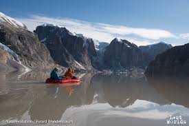
Tourist sailing ship near the Renland coast -- this is where the polynya is located in the winter.


From the same area -- a jumble of sea ice, icebergs and mountains