THE BOOK
Some of the ideas discussed in this blog are published in my new book called "The Stonehenge Bluestones" -- available by post and through good bookshops everywhere. Bad bookshops might not have it....
To order, click
HERE

Thursday 25 February 2021

Stonehenge for the Ancestors -- Sidestone Press


 I'm happy to give a bit of promotion for this book, which I have of course mentioned before. It's a big new update on Stonehenge from MPP and his team, incorporating a lot of recent research.  The text is split up into quite short sections written by the authors and others who were invited contributors.  I haven't read everything carefully, but notice that MPP is on his usual ebullient form, throwing out hypotheses like confetti -- but hey, at least it's in print in a place where people can see what he has to say, and can disagree vehemently if they like......

It's a well presented and beautifully illustrated tome, clearly intended for libraries and museums and academic establishments -- and the price tags for the hardback and paperback versions are a bit daunting.  But I really approve of the publisher's policy of making an online PDF version available free of charge for anybody who wants to read it.  All you have to do is click on the link on the web site.........

So that's to be applauded.  Well done, Sidestone Press!


===========================

ABSTRACT

For many centuries, scholars and enthusiasts have been fascinated by Stonehenge, the world’s most famous stone circle. In 2003 a team of archaeologists commenced a long-term fieldwork project there for the first time in decades. The Stonehenge Riverside Project (2003-2009) aimed to investigate the purpose of this unique prehistoric monument by considering it within its wider archaeological context.

This is the first of four volumes which present the results of that campaign. It includes investigations of the monuments and landscape that pre-dated Stonehenge on Salisbury Plain as well as excavation at Stonehenge itself. The main discovery at Stonehenge was of cremated human remains from many individuals, allowing their demography, health and dating to be established. With a revised radiocarbon-dated chronology for Stonehenge’s five stages of construction, these burials can now be considered within the context of the monument’s development. The different types of stone from which Stonehenge is formed – bluestones from Wales and sarsen silcretes from more local sources – are investigated both at Stonehenge and in its surroundings. These surrounding monuments include single standing stones, the Cuckoo Stone and the Tor Stone, as well as the newly discovered circle of Bluestonehenge at West Amesbury beside the River Avon. The ceremonial Stonehenge Avenue, linking Stonehenge to Bluestonehenge, is also included, with a series of excavations along its length.

The working hypothesis behind the Stonehenge Riverside Project links Stonehenge with a complex of timber monuments upstream at the great henge of Durrington Walls and neighbouring Woodhenge. Whilst these other sites are covered in a later volume (Volume 3), this volume explores the role of the River Avon and its topographic and environmental evidence.
With contributions by:

Umberto Albarella, Michael Allen, Olaf Bayer, Wayne Bennett, Richard Bevins, Christopher Bronk Ramsey, Chris Casswell, Andrew Chamberlain, Benjamin Chan, Rosamund Cleal, Gordon Cook, Glyn Davies, David Field, Charles French, Robert Ixer, Neil Linford, Peter Marshall, Louise Martin, Claudia Minniti, Doug Mitcham, Bob Nunn, Andy Payne, Mike Pitts, Rebecca Pullen, Julian Richards, David Robinson, Clive Ruggles, Jim Rylatt, Rob Scaife, Ellen Simmons, Charlene Steele, James Sugrue, Anne Teather, Sarah Viner, Tony Waldron, Katy Whitaker and Christie Willis

https://www.sidestone.com/books/stonehenge-for-the-ancestors-part-1

Irish Sea till and peat bed on Traeth Mawr, Newport

Surface of clay-rich sticky Irish Sea Till exposed within 5m of the northern slipway after
the removal of c 50 cms of beach sand during recent storms.

Broken, striated and gouged sandstone erratic, just a few m from the slipway.  
Embedded in clay-rich till.

Surface of peat bed exposed near the end of the southern slipway at the top of the sandy beach. The peat exposure covers an area of approx 100 sq m.

Irregular peat bed surface projecting above the sand near the southern slipway.   The peat appears to rest directly on Irish Sea till.


I think we'll count this as another exposure of the submerged forest, although there is no sign here of treestumps, branches or root systems. There are some bits of woody material lying around, but I'm not certain they have come from the newly exposed peaty surface.

The other exposure of submerged forest material on Traeth Mawr is further out on the beach, in association with a cemented exposure of Irish Sea till.  It is always submerged at high tide, and is sometimes buried beneath the beach sand as well.

PS.  1st March 2021
Had another look at the peat exposure, and there is now a piece of a tree sticking out of the peat.  Confirms that this is indeed the submerged forest.


Wednesday 24 February 2021

Enhancing the glacial transport theory

Ice flow reconstructions for the Anglian Glaciation of the Bristol Channel region. 
 After Williams-Thorpe, Kellaway and others.

The other day, on one of those endless social media discussion threads, somebody complained that I was a miserable old git unable to come to terms with the "fact" that the glacial transport theory has been comprehensively dismissed.  Assorted senior professors keep on saying the same thing:  and they have been saying it for the last 20 years.  Anyway, I asked said complainant who had done the dismissing, and he failed to reply.  Have I missed something?  The last serious attempt to dismiss the glacial transport theory, as far as I know, was in 1997, when James Scourse was having a go at Geoffrey Kellaway and citing glaciological theory.  That was 24 years ago.  Since then, nothing.  I suppose the principle is that if you keep on saying "the glacial transport theory has been comprehensively dismissed or disproven" enough times, people will come to think it's true, and you don't even have to cite any sources.

https://brian-mountainman.blogspot.com/2019/05/salisbury-plain-and-impossible-glacial.html

The unfortunate thing about James Scourse's 1997 book chapter was that he was seeking first and foremost to dissect Geoffrey Kellaway's ideas in detail -- some of which were unconventional to say the least. But with respect to glaciation as far east as Salisbury Plain, he did use the word "impossible" -- and that is never a good idea, as Olwen Williams-Thorpe and others have pointed out. 

Since the turning of the century a lot has changed, and a vast amount of research has been published, to transform our knowledge of what went on in the Ice Age.  I have summarised and analysed scores of important articles in this blog, dealing with the geology, geomorphology and glaciology of western Britain and its glaciers.  So what's the state of play?

1.  Evidence of erratics and coherent deposits from Flatholm, the Bristol area, the hills around Bath, the Mendip fringes and the Somerset Levels confirms that ice from the west has penetrated far inland from the Bristol Channel on at least one occasion -- and probably several times. None of this was disputed by Scourse in 1997, although he argued that all of the glacial traces to the east of the Bristol Channel coast were "ice-marginal".   We still do not know where the eastern limit of the greatest glaciation was, but glaciological theory suggests it might be somewhere near the chalk escarpment on the western edge of Salisbury Plain.

2.  Computer modelling by Alan Hubbard and colleagues, James Patton and others have indicated that it is perfectly feasible that ice from the Irish Sea Ice Stream (ISIS) actually reached the Stonehenge area.  They do NOT support Scourse's contention that this was "impossible".  

One of the glaciation models -- this is from Edwards et al, 2017.  Patton et al (2016) ran a whole series of models for the growth and decay of the LGM ice sheet.  Modelling work is still in progress.

3.  The size of the Celtic Sea ice lobe is now known to have been far greater than previously appreciated.  Not so long ago, it was thought that the ice edge rested on the Isles of Scilly, but my own fieldwork chimes with that of the BRITICE team to show that it extended far to the south at the time of maximum glaciation -- all the way out to the shelf edge.  If the ice flowed further to the south than previously thought, it must also have spread further to the east.  Again, that chimes with my own recent work in south Pembrokeshire.

My attempt to portray the LGM extent of ice in the SW part of the British Isles.  In a previous glaciation, we know from the distribution of glacial deposits that the ice was more extensive than this in the inner reaches of the Bristol Channel and elsewhere.

4.  From the work of Prof Dave Evans and others, we now know that Dartmoor supported its own ice cap on at least one occasion during the Ice Age, and if there was glacier ice there, climatic conditions must have been quite suitable for glacier ice to reach Salisbury Plain.  There are abundant erratics (which must be glacial in origin) across SW England, and especially on the coasts of Devon and Cornwall, as itemised in my book "The Stonehenge Bluestones".

5.  There can be little doubt that the bulk of the 43 Stonehenge bluestones have most of the characteristics of glacial erratic boulders and slabs.  Only a few of them can be described as pillars. Apart from a few that have been worked, they are faceted and heavily abraded, and carry thick weathering crusts. They have none of the characteristics of quarried stone.  This matter was not considered by Scourse (1997) when he argued for the human transport of the bluestones.


6.  The fact that most of the Stonehenge bluestones have come from the north slope of Mynydd Preseli in Pembrokeshire chimes with glaciological theory, which predicts that there must have been a "zone of enhanced erosion and entrainment" just in those areas where bluestone provenances have been established by Ixer and Bevins. Research in northern Finland also shows that where overriding ice encounters a hill barrier such as Ounastunturi (or indeed Preseli) erosive capacity is enhanced on the up-glacier side.

7.  It is still true that no "free boulders" or monoliths classified as bluestones have been found across the Stonehenge landscape, except at Stonehenge.  However, there is the Boles Barrow bluestone anomaly which suggests that at least one bluestone boulder was present on Salisbury Plain  long before Stonehenge was built.  There are also thousands of bluestone "fragments" scattered across the landscape, and as pointed out by Olwen Williams-Thorpe and others, it is perhaps too convenient to refer to all of these as "fragments of destroyed monoliths".  Some of the fragments deserve to be referred to as pebbles, and some appear to be in Mesolithic or early Neolithic contexts.  Analyses of these fragments in the past have been bedevilled by assumptions that there was a "bluestone arrival date" ( if not several), and by dubious assignments of fragments to secondary or tertiary sediments or fills, for example in the Stonehenge ditch and in the Aubrey Holes.

8.  Ongoing research into the "clay-with-flints" and other sediments on Salisbury Plain suggests the incorporation of several different  materials, some of which have the characteristics of degraded glacial tills.

9.  Recent work on the glaciation of the Celtic Sea shelf by the Irish Sea Ice Stream has shown that the Devensian ice surface gradient was exceptionally shallow, dropping from +750m in the Irish Channel to +400m in St Georges Channel to -200m at the southernmost ice edge about 500 km away. There must have been substantial lateral spreading and gradient reduction on the ice surface once it was clear of the constriction between North Pembrokeshire and the coast of SE Ireland.  It was proposed by Prof Geoff Boulton many years ago that this was because of the soft and saturated sediment bed on what had been the sea floor, facilitating a high rate of bed deformation, lubrication and basal sliding.  This has been confirmed by subsequent work by James Scourse and the BRITICE team.  So could the ice from the west have surmounted the chalk escarpment on the edge of Salisbury Plain? Since the Plain has a surface altitude of 200m-250m, an ice front capable of surmounting the chalk scarp must have had a surface altitude of c 300m.  That could not have happened in the late Devensian glaciation, but it would have been perfectly feasible in the Anglian, at a time when the whole of Preseli must have been deeply inundated by ice, with a glacier surface at c 750m. The soft sediments of the Somerset Levels would have facilitated ice movement eastwards from the Bristol Channel.

I am not aware of any research (published or unpublished) within the last 24 years that conteracts or contradicts the above points, and I believe that the case for a glacial incursion onto Salisbury Plain (by ice carrying North Pembrokeshire erratics) is stronger now than it ever has been. 

Reproduced from "Stonehenge for the Ancestors" (2020).  The Boles Barrow boulder (or piece of it) now stored in Salisbury Museum.  The argument rages on about whether it ever was at Stonehenge, or ever was in a Neolithic long barrow near the western edge of the chalklands..........


The rhyolite pebble that may or may not have come from a Mesolithic context at Durrington

Links:

https://en-gb.topographic-map.com/maps/ddp/

https://brian-mountainman.blogspot.com/2020/10/on-lateral-spreading.html

Tuesday 23 February 2021

Enhanced erosion by ice sheets on obstructive hill masses


Ounastunturi in Finland -- a hill mass which was in the way of the streaming ice of the Scandinavian ice sheet as it flowed eastwards from its source area. The hills look very much like those of Preseli --  moulded by a long history of glaciations.


Written in 1975 by David Sugden and myself, this book remained in print for 20 years between 1976 and 1996.  That's an extraordinary length of time for a university text, given the speed at which science moves.........

I have always had an instinctive feeling that the northern flank of Preseli is a perfect place for enhanced erosion beneath an ice sheet or ice stream coming from the NW and heading off to the SE.   Actually that is more than just instinctive -- it's something that can be predicted in glaciological theory as well -- and it has a lot to do with ice thickness and thermal regime.  When David Sugden and I wrote our text called "Glaciers and Landscapes" we tried to work out why glaciers erode in some places and protect in others, and we formulated a series of models which served to encourage a lot of other researchers, in the years following publication, to delve deeper into the theory and to apply it to their own field observations in different parts of the world. Hundreds of papers have appeared since then, many of them touching on the pointe we raised -- and the science has moved on by leaps and bounds. I have mentioned many of these papers in this blog.......

Here is a page from the article I wrote with Lionel Jackson in 2009, explaining why we thought that under an active Irish Sea Ice Stream, erosion and block entrainment would be enhanced on the northern flank of Preseli:


I don't think we were right in all respects, especially on the matter of shearing and / or internal deformation -- but the principles stand.  I still think that if the ice was to come again, there would be more erosion on the north (upglacier) slope than on the summit of the ridge or on the southern (downglacier) slope.

I was looking today at a paper that was published five years ago and which I had not taken all that seriously, but on re-reading it, I realised it is making a rather interesting and important point.

Unequal ice-sheet erosional impacts across low-relief shield terrain in northern Fennoscandia

Karin Ebert, Adrian M. Hall, Johan Kleman, Jannike Andersson
Geomorphology 233, 2015, pp 64-74

ABSTRACT
Much previous work on Late Cenozoic glacial erosion patterns in bedrock has focussed on mountain areas. Here we identify varying impacts of ice sheet erosion on the low-relief bedrock surface of the Fennoscandian shield,and examine the geological, topographical and glaciological controls on these patterns. We combine GIS-mapping of topographical, hydrological and weathering data with field observations. We identify and investigate areas with similar geology and general low relief that show different degrees of ice sheet erosional impact, despite similar ice cover histories. On two transects with a total area of ~84 000 km across the northern Fennoscandian shield, we first establish patterns of glacial erosion and then examine why glacially streamlined areas exist adjacent to areas of negligible glacial erosion. The northern transect includes two areas of exceptional glacial preservation, the Parkajoki area in Sweden and the so-called ice divide zone in Finland, each of which preserve tors and deep saprolite covers. The southern transect, overlapping in the northern part with the first transect, includes areas of well developed glacial streamlining, with bedrock areas stripped of loose material and barely any weathering remnants. For both areas, we firstly present contrasting indicators for ice sheet erosional impact: streamlined and non-streamlined inselbergs; parallel and dendritic/rectangular drainage patterns; and the absence and presence of Neogene weathering remnants. This is followed by an investigation of factors that possibly influence ice sheet erosional impact: ice cover history, ice cover duration and thickness, bedrock type and structure, and topography. We find that the erosional impact of the Fennoscandian ice sheet has varied across the study area. Distinct zones of ice sheet erosion are identified in which indicators of either low or high erosion coexist in the same parts of the transects. No direct impact of rock type on glacial erosion patterns was found, but an indirect control appears clear. Bedrock geology and long-term differential weathering and tectonic evolution determined the topography of the pre-glacial landscape, and these topographic differences subsequently influenced ice sheet dynamics and thereby partly controlled patterns of ice sheet erosion. Ice cover duration and former ice thickness were not significant controls on glacial erosion patterns. Extensive preservation of pre-glacial relief through low glacial erosion is attributed to the maintenance throughout the Pleistocene of divergent flow and frozen-bed conditions in the Fennoscandian ice sheet. In contrast, glacial streamlining and strong glacial erosion were caused mainly by acceleration of flow around major obstacles and flow towards major depressions on the ice sheet bed. The relatively strong ice sheet erosion towards the Gulf of Bothnia is the result of a combination of favourable factors: bedrock structure and river valleys aligned sub-parallel to ice sheet flow and convergent ice flow towards the Baltic

Of course there were many differences between the various manifestations of the Irish Sea Ice Stream and its equivalents in northern Fennoscandia, but ice behaves in the same way wherever it is, and one of the most interesting points in this paper describes how an ice sheet behaves when it is flowing from its upland accumulation area out towards its peripheries maybe 1000 km away.  In the transects studied in northern Sweden and Finland, the authors noted differences in the long bed profile of the ice from source to snout, and the roughness or bed obstacles encountered.  To bring things to their simplest conclusion:  where there was a continuous gradient, as in profile A-B, velocity accelerates and erosion is enhanced in the outer part of the glacier.  On the other hand, where ground surface slope decreases, and the ice is flowing over flattish or undulating terrain in its outer parts, ice flow decelerates and land surfaces are protected under cold-based ice conditions.  But the most interesting thing is that where the ice encounters an obstacle -- in the form of a hill mass or ridge perpendicular to the ice flow direction, there is a sudden shift from low glacial erosion (shown yellow on the diagram) to ice deformation and enhanced erosion (coloured brown).  Streamlined erosional features and enhanced entrainment of a bedrock load are inevitable, and have been observed empirically by the authors of the article.


The conclusion?  My little model, based on glaciological theory, is seen through empirical observation in northern Scandinavia to be correct.  During a big glaciation, with ice covering the whole of the West Wales landscape, where would erosion and entrainment be most powerful?  Answer: on the north slope of Preseli,  in locations such as Rhosyfelin, Carn Goedog, Carnedd Meibion Owen, Ty Canol and Carn Alw.  

Who needs quarries when ice can do the job far more effectively?

We may also have an explanation here for the relatively few traces of glaciation in South Pembrokehire -- in the lee of the mountains.  I must give that some further thought.


The Mesolithic post-hole and the bluestone fragment


"Modern Antiquarian" reconsteuction of what the post holes might have
supported in the Mesolithic.

I have been hunting down some more information about post-hole WA9580 in the old Stonehenge car-park that was supposed to have a rhyolite fragment in part of the fill. It's written up in the vast Stonehenge volume edited by Ros Cleal in 1995.  I did a post about this here:

https://brian-mountainman.blogspot.com/2018/06/stonehenge-rhyolite-in-mesolithic.html

As I mentioned at the time, Michael Allen spoils his description by simply assuming that the rhyolite fragment could not have been in the Stonehenge area during the Mesolithic, and that it could not have arrived before the assumed "bluestone monolith arrival date".  That sort of thinking bedevils nearly all of the work on the Stonehenge debitage and sediment fills -- and matters are made worse when workers use the presence of bluestone fragments in particular context as a means of dating the deposits to the late Neolithic.  And so circular reasoning kicks in -- authors assume that because a bit of bluestone is found in a late Neolithic deposit (which might actually be older) it could not possibly have been present in the landscape any earlier than that.

In the same time we see records of bluestone fragments in all of the Aubrey Holes, so it is instantly assumed that the fills are "post bluestone arrival".  I know that most dating is done through the use of other methods as well -- and in particular radiocarbon dating -- but nonetheless, I wonder how many drastic errors have crept into the literature because of this one simple and probably erroneous assumption?  

In a recent blog post, Robert John Langdon picks up on the strong possibility of erroneous interpretations, and casts further doubt on the assumption that the bit of rhyolite in the post hole cannot have been present here more than 6,000 years ago.  Here is his post:

Robert John Langdon
Prehistoric Britain web site
http://prehistoric-britain.co.uk/contact
6 Feb 2021 post
CASE STUDY – An Inconvenient TRUTH (Craig Rhos Y Felin)
February 6, 2021 Robert John Langdon Craig-Rhos-Y-Felin, River Avon, Stonehenge
Extract from the book : The Stonehenge Enigma

The report from the 1966 excavation reads: “It is unfortunate that no dating evidence was obtainable from the three holes in the form of pottery. Certainly, the holes themselves would appear to be Neolithic in character, very similar to others excavated of this period….. comparable traces of posts have been found in a Neolithic context… such as King Barrow Wood” Lance and Faith Vatcher. 3

Moreover, the charcoal deposits were sent to their laboratory, and the results were: “It is surprising, in the view of the chalkland environment, that most of the charcoal should be pine. Pine has, however, been found at other sites where it would not be expected, notably Woodhenge” – but even so, these samples were not requested to be carbon dated.

Fortunately, some years later an inquisitive PhD student writing a thesis on the Stonehenge environment found these samples and concluded that they could not be Neolithic, as claimed by the archaeological community, as they were from pine trees which pollen analysis had concluded were ‘extinct’ in this area at this time of Stonehenge’s supposed construction.

The officials (of the Historic Buildings and Monuments Commission, which was later renamed English Heritage) were dismayed when they found out that their ‘experts’ were wrong, and the student was absolutely correct (yet sadly, never gave her a deserved job!!) in her assumption as the carbon dating placed them at the start of the Mesolithic of 8860 to 6590 BCE just after the last ice age. Furthermore, what happened to the pine Woodhenge samples as indicated in the lab report of 1966 – which to date have not been carbon dated, are they also Mesolithic and not Neolithic as their original unscientific estimation, if so, what is the real age of Woodhenge?

Consequently, rather than then admitting their fundamental error and re-opening the site to look for more holes and dates to get to the bottom of this unique mystery (which would have been the case for most credible scientific disciplines) they came up with a remarkable and unproven story that these were random ‘totem poles’ placed by wandering ‘hunter-gatherers’ which did not relate to the Stonehenge site just 50m away. But was a sheer coincidence, which should be totally ignored.

If the missed carbon dating of these Mesolithic posts didn’t spark an enquiry into the dating of Stonehenge, then another similar discovery three years later in 1988-89 should have done, as Wessex Archaeology, were employed to undertake an investigation of the area next to the Old Car Park and the construction of the Visitors Centre, opposite Stonehenge. They reported a series of stripes under the surface (they thought was periglacial) and a single pit WA 9580 which was on the line of the other posts found in 1966, in the area of the old ticket office.

Within the pit they found (no doubt to the dismay of EH) yet another Mesolithic post hole that match the dates of the 1966 findings. Moreover, what they also found should have transformed the current dating of the Stonehenge site. 40cm below the top of the pit they found ‘a single piece of rhyolite (62g) within context layer 9581 at the same stratification level of 9585 carbon dated at 7737 – 7454 BCE.

Again EH attempted to supress this finding by suggesting that ‘this layer was not earlier than, and was probably contemporary with, the dressing of the Bluestone’ – which might be so if the bluestone was not BELOW context layer 9582 which was dated 7595 – 7178 BCE.

====================

I don't know all the details here, and am more inclined to cockup theory than conspiracy theory  -- but I think Robert has got his contexts wrong.  The little bluestone fragment was in context 9581, at a depth of just 20 cms -- not 40 cms as stated by Robert.  Also, it was in the "upper tertiary fill"  and not context in 9584.  But I agree with him that there is something strange about the pinus remains found here, and I agree that just because the rhyolite flaks was in a "tertiary fill layer,  it cannot be assumed that it was not present in or near the hole when it was initially dug, possibly more than 8,000 years ago.


Geology sampling progress


Many thanks to Tim Daw for publishing this map on his blog and on Twitter and putting it in the public domain.  Excellent -- congratulations to MPP and his team for getting on with this at long last!  I have been urging them for the last five years to do much more extensive sampling of the Fishguard Volcanics rhyolites, ashes and welded tuffs in the Brynberian Valley, in the hope of either confirming the presence of a "bluestone quarry"at Rhosyfelin, or disproving it.  There are lots of outcrops, as I have pointed out.  I don't know what the star colours indicate, but  there seems to be quite intensive sampling up and down the Brynberian Valley between Brynberian, Crosswell and the deep gorge-like section of the Afon Nyfer near Felin y Gigfran.  I hope they will sample the foliated rhyolites, where they find them, both along fracture planes and perpendicular to them -- so as to pick up depth or age-related variations in the foliated layers.   From a purely geological point of view (forgetting about quarries for a moment) the results are likely to be fascinating.  It looks as if there is much more intensive sampling of Rhosyfelin and Pont Saeson as well.  All good.

The other sampling areas chosen are to the NW of Carnedd Meibion Owen (dolerite on the tors but not elsewhere) and in the country running through Ty Canol Wood and towards Pentre Ifan cromlech.  I have some thesis maps from Daniel Lowman for that area -- the geology is really complex, including ashes, lavas and welded tuffs. I think the rocks are mostly ashes around the Pentre Ifan cromlech, in the stone walls and the big slabs of rock lying about in that area.  It will be interesting to see what turns up.

In setting up this new research exercise, it's good to see an unspoken acknowledgement from the geologists (Rob Ixer and Richard Bevins) that their "spot provenancing" claim for the Rhosyfelin rock face is not adequately supported by the data collected and presented.  They need more information, and they need it soon........ and that's a point made not just by me.

As I have also stated often on this blog, MPP and his team also need new digs in the Brynberian and Nyfer valleys at "control sites" in order to support their claim that the history of occupation at Rhosyfelin (as indicated by the wide spread of radiocarbon dates) is unique, and specifically associated with Neolithic quarrying activity. i hope they have taken that on board, and that it will play into their decision as to where to dig next.

I'm intrigued that there seems to be no sampling in the Waun Mawn area, and no sampling indicated for the areas of dolerite or spotted dolerite.  That work is as badly needed as the work on rhyolites -- but let's wait and see.  Maybe Tim has another map that he will show us in due course, officially released from Project HQ......

Pentre Ifan cromlech, made from rocks (volcanic ashes) used where found.....

Something igneous and complicated, on one of the tors at the top end of Ty Canol wood.  I wouldn't like to hazard a guess as to what this rock is called...... maybe a welded volcanic agglomerate?


Monday 22 February 2021

The geology of Waun Mawn


I spent a delightful day in the sun today, hoofing about up there and checking out the local geology. Somebody has to do it, and since MPP and his team are gloriously disinterested, it had better be me.  


The geological map, downloaded from the BGS Geology Viewer, tells only part of the story.  It shows that the bedrock in the area (across most of the Waun Mawn hillside) is the Abermawr Shale Formation of Ordovician (Arenig) age, with grey mudstones predominating.  Other sedimentaries belonging to the Penmaen Dewi Formation (also of Arenig age) are found south of the farm track and in the floor of the valley. This is the valley that can be referred to as the headwaters or catchment of the Afon Gwaun, which reaches the sea in lower Town Fishguard.  To the east of Tafarn y Bwlch all of the drainage flows the other way, into the Afon Nyfen river system. 

There are many faults in the sedimentary rocks, and  they are are steeply dipping and heavily contorted.  In places these soft rocks gave been consumed or replaced by igneous intrusions of the Fishguard Volcanic Series;  on the map three "prongs" or dykes are shown, with links towards the north and north-west, but I am convinced that the geology is more complex than that.  I think there is a big pluton or igneous mass here, underlying the hill summit of Cnwc yr Hydd and outcropping on the shelf on which MPPs putative "giant stone circle" rests.  When the archaeological digs were open in 2017 and 29018, the predominant rock type exposed was dolerite, shattered and broken and partly incorporated into periglacial and glacial deposits. At the northern end of this wide shelf, the dolerite appears to pass under a "cap" of  deformed mudstones which are largely baked or metamorphosed into "meta-mudstones."  This is common across Preseli in the contact zone between sedimentary rocks and igneous intrusions or lavas and tuffs. The summit cairn rests on this sedimentary / meta-mudstone mass. 

The meta-mudstone quarries which I have described in a number of posts run from the summit of Cnwc yr Hydd both southwards and northwards.  They have been interpreted by the BGS mapmakers as occupying the terrain between the "prongs" or igneous intrusions shown on the map, but I think the local farmers might have exploited small outliers of meta-mudstones which are underlain by dolerite. It's difficult to tell, because there are no vertical exposures or sections through the dolerite.  In contrast, we can see the steeply-dipping meta-mudstones in several of the quarry pits. As we would expect, some of the meta- mudstones are so heavily metamorphosed that they have become very much like rhyolites -- with a bluish colour and a flinty texture.  At the other end of the spectrum are mudstones that are hardly altered at all -- these are soft, flaky and crumbly to the touch.  All types are widespread across the landscape. 

Not all of the igneous rocks here are unspotted dolerites or micro-gabbros.  From the scattered erratic boulders across the landscape, it appears that there is some coarse gabbro outcropping in the neighbourhood, some bluish rhyolite, and some welded tuff or vesicular lava. These outcrops will be difficult to find without excavations.

There are no surface exposures of dolerite in the area investigated by the archaeologists, but to the west of the hill summit there is an extensive area of dolerite outcrops (over 1000 sq m)  incorporating a number of stone settings and stone removal pits.  To the east of the bench or platform there are many dolerite boulders and stones incorporated into the wall that defines the edge of the common, and many small dolerite pillars have been used as gateposts and as "base stones" for the wall. (For obvious reasons the biggest boulders are always placed at the base, with smaller ones built up layer by layer.)   In the small abandoned quarry on the other side of the road at Penlan Tafarn there are two recumbent dolerite "monoliths" c 1.5m long, and another is seen lying in the turf near the boundary wall.

Finally, there are at least two other dolerite slabs or monoliths exposed through the turf c 50m from the "last standing stone" of the putative circle (ie well outside the circle), and another about 150m away.  These have not been excavated, but they are made of unspotted dolerite which appears to be the same as that of the four stones deemed to be set into an arc on the platform.

All in all, there can be no doubt that the dominant rock type on and around the "giant circle" platform or  bench is unspotted dolerite.  There is a lot of it about. Some of it is in situ, and other large erratics have been moved by overriding ice, broadly from NW towards SE.

So it is quite extraordinary that Parker Pearson, with the full support of his geologists Rob Ixer and Richard Bevins, has not even bothered to check whether the one standing stone and three recumbent stones at Waun Mawn are made of local unspotted dolerite. That should have been his first, and most obvious, line of investigation.   Instead, he has ignored the local geology altogether and has suggested (without any supporting petrography or geochemistry) that the stones have come from Cerrigmarchogion, about 4 km away! 

What on earth are these people playing at? 


Steeply-dipping meta mudstones in the quarry near the summit of Cnwc yr Hydd


Outcrop of welded tuff (?) with quartz veining on the dolerite plateau west of the hill summit


One of the apparent stone extraction pits on the dolerite plateau


Two recumbent dolerite monoliths 50m NE of the "stone circle" site


Small recumbent monolith near the eastern boundary wall of the common

One last point. MPP and his excavation team have referred to the single standing stone and three recumbent stones in their "giant stone circle" but they have made no reference to the other recumbent stones in the neighbourhood that lie OUTSIDE their proposed circle.  As pointed out above, the closest stones are just 50m away, to the NE, but there are others on the common to the NW, and several others along the edge of the common and along the roadway leading to Cilgwyn.  Some of these have holes drilled in them, and have been used as gateposts. If there ever was a stone circle of smallish monoliths erected in shallow pits at Waun Mawn, it is possible that at least some of the local gateposts have been "stolen" from one or more stone settings. Again this possibility has been completely ignored by the excavation team -- they have been so preoccupied with Stonehenge that they have not even looked for anything of interest in the local landscape.

=============

PS.  To avoid confusion, the meta-mudstone quarries shown here (and discussed in the blog in a number of posts) are MODERN features, probably dating from the period 1750 to the present day.  They were used for the extraction of slabs or flagstones suitable for building (but not roofing) purposes -- nearly all the buildings in the neighbourhood incorporate stones from these quarries. It was a simple matter to carry the stone slabs downhill, using horses and carts, on this relatively dry moorland.  That having been said, there must have been some prehistoric exploitation of shale and meta-mudstone from at least the summit quarry, since the embankment of the ring cairn at SN 08319 34445 is made of this material.


Sunday 21 February 2021

The Larkhill bluestone pebble


The Durrington bluestone pebble, with a slice taken off it for analysis.  The facets are very well weathered, and I do not think  they are a result of human working......

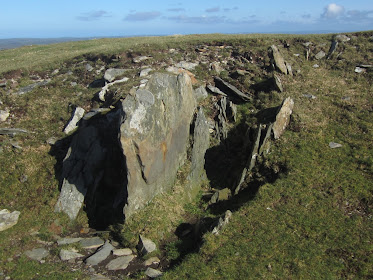
Enough of Waun Mawn for the moment.  I picked up on a comment on one of the discussion threads which mentioned a piece of bluestone found in a posthole numbered WA 95.  Apparently, it was found between two radiocarbon dated layers and was therefore shown to have been in position around 7,000 yrs BC -- which places it solidly back in the Mesolithic.  In other words, it was in position at a time when the archaeologists insist that there were no bluestones present on Salisbury Plain........... very inconvenient.

I have tried to track down the evidence, and have found a Wessex Archaeology Report on Durrington and Larkhill, which places posthole WA 95 near the Larkhill Medical Centre, at grid ref 412600 144900.  There is a reference to 1999 WA research, and in one of the frelevent reports Matt Leivers of Wessex Archaeology is mentioned.

See also:

https://brian-mountainman.blogspot.com/2016/11/understanding-of-stonehenge-transformed.html

https://sketchfab.com/3d-models/durrington-bluestone-object-3457e4b573914410a63e05d0df7b1f30

This may or may not be the same bluestone pebble which I referred to in a past post:

https://brian-mountainman.blogspot.com/search?q=+Bluestone+pebble+Durrington

Front and back faces and profile view of the pebble.  It is about 7 cm across, with 4 sides.  Note the heavily abraded surface and the facets -- it I had picked this up near a glacier front, I would have found it to be a perfectly normal component of a glacial deposit........

When I first featured this pebble Rob Ixer told us that it was made of foliated rhyolite, similar to the rhyolite of the Pont Saeson / Rhosyfelin area.   I'm not aware of any more accurate provenancing than that.........

In the descriptions, it is said to have come from the vicinity of two postholes -- but it is not recorded as having been actually embedded in either of those holes.  It may of course have just turned up in the debris being thrown out of one of the pits.  It's dated in the literature as either Neolithic or Romano-British, but I do not know whether that is simply "assumptive" dating -- based on the fallacious reasoning that the stone could not possibly have been in either of these pits earlier than "the arrival of the bluestones."  In "Stonehenge for the Ancestors", Vol 1, p 177, there is a reference to a "discoidal tool of group C rhyolite from a Romano-British ditch".  If that is the same pebble, it is a pretty strange way to describe it..........  There is a reference to a WA publication by Thompson and Powell in 2018.

I'd like to know more about this rather interesting pebble.  Does anybody have more information from Wessex Archaeology, or elsewhere?  Where is it now?

It's worth reminding ourselves that there are bluestone pebbles and fragments scattered all over the Stonehenge landscape.  See this map, which has appeared in a number of publications:


Source -- Stonehenge for the Ancestors, Part 1, free digital download.  It's very detailed, and does not reproduce well at a small scale.


Bearing in mind that this map shows only the bluestone fragments that have been found and recorded in placed where digging has gone on, we can safely assume that no part of the Stonehenge landscape is free of bluestone pebbles and / or fragments.   On almost all occasions I can recall, the "fragments" (they are never referred to as pebbles or stones) are assumed to be in secondary  positions, and assumed to be no older that Neolithic -- with no evidence cited.  They are also assumed ALWAYS to be chips broken off  Stonehenge bluestone monoliths that have been used for tool-making or otherwise destroyed.  What I would like to know is "How do these bluestone bits and pieces relate to superficial deposits such as the clay-with-flints?"  

There are lots of research projects needed on Salisbury Plain, and one of them is a systematic survey of the bluestone debris, with rigorous recording of field data and assumption-free interpretation. Until that work is complete, I think that when people say "There are no bluestones on Salisbury Plain, and therefore the glacial transport thesis is dead",  I think I will reply "There are lots of bluestones on Salisbury Plain, and they look as if they might belong to a very old and degraded glacial deposit."

PS.  More and more intriguing. There is a number on the base of the pebble, which looks like 74411 --5653 --36.  Presumably the pebble is in the Wessex Archaeology collection.

This is the WA description:

The ‘bluestone’ object is a bifacial lithic with polishing and flaking. It was found in a possibly Romano-British feature, next to two Late Neolithic posthole alignments at MOD Durrington. It resembles objects made out of ‘bluestone’, the same as some of the Stonehenge stones. A number of ‘bluestone’ objects have been found across the Stonehenge Landscape, even though not local to the geology.
It is unknown when the object was created, or how it came to be buried at Durrington. Its proximity to the Neolithic posthole alignments could suggest a similar prehistoric date. However, the association with the Romano-British feature could suggest a later curation of the artefact, taken as a memento or trophy.
A section was taken to identify the geology of the rock and shows its original midnight blue colour when it was freshly made. The exterior surface is the result of 4500 years of weathering and wear.

The presumption is that this is a man-made "object"  -- and that seems to me to be a very strange characterisation, given its surface characteristics. Polishing and flaking?  Artefact?  A memento or trophy?  Yet more interpretative inflation, based on the unsupportable assumption that the pebble could not have been here before the Neolithic. From a careful look at that nice 3D animation, this is a perfectly ordinary small glacial erratic.

-------------------

PS.   Tim Daw has done a post on this pebble on his blog, and seems fairly certain this came from Durrington.. He has cited the following from WA:

"A discoidal 'bluestone' object with heavily ground and flattened edges was found in the tertiary fill of the northern terminal of Romano British ditch 6256 (slot 5145), 7 m from the intersection of the two Late Neolithic posthole alignments (at posthole 5047). The object, which has a rounded trapezoid shape, is 64 mm wide, 67 mm long and 18 mm thick. It is made from a slab of stone that has developed a light grey surface patina, although a fresh break in one corner suggests a poorly developed conchoidal fracture and is a dark grey colour when freshly worked.

Further, thin section petrography shows the artefact to be manufactured from rhyolite with a 'sub- jovian' texture, texturally one of the most extreme (and hence characteristic) of the Craig Rhosyfelin rhyolitic rocks. In hand specimen, this rock-type would be very distinctive.

Relict flake scars confirm that the blank was subjected to rudimentary bifacial flaking around the edges, although it is less certain by how much the sides of the object result from flaking or are products of natural fracture. The edges of the object are all heavily ground, with a distinct flattened facet around the circumference. This flattened facet is a sufficiently recurring feature of similar objects of the type to indicate that it was an original feature and not a subsequent alteration to the edge. Grinding also extended across both sides of the object by as much as 11 mm from the edges. The function of the object remains unknown. 

"Elsewhere at Durrington in another Romao-British context there were found: "18 pottery disks clipped into roughly circular shapes. Suggestions for their use include spindlewhorl production, gaming counters or even ‘pessoi’ for cleaning after defecation." 


That description is rather disappointing, with all those references to "an object" rather than a pebble, and an underpinning assumption that it is worked or fashioned either as a "pessoi" of for some other wholesome purpose.  As I said above, I have seen thousands of similar pebbles close to glaciers, and I suppose I could have described them in a similar fashion if had been minded to.  People seem unaware of how glaciers affect and "fashion" the stones that are transported and dumped by ice.........


Saturday 20 February 2021

Do you believe in scrutiny?


I keep on coming back to this question, and am reminded of it once again by the current debate in the social media on the merits of the recent TV programme on "the Lost Circle."  On Facebook and Twitter, and on discussions associated with YouTube videos, the debate rages on, with some people prepared to express their concerns about the contents of the programme and others defending it to the hilt, on the grounds that Prof Alice Roberts and Prof Mike Parker Pearson "must know what they are talking about."  Well, thank goodness we live in a world where such debate is possible, even if a great deal of it is ill-informed!

https://brian-mountainman.blogspot.com/2020/07/sagan-scrutiny-and-baloney.html

One of my heroes, Carl Sagan, wrote a great deal about science and scientific scrutiny, and argued that without careful peer-review and assessment, science is effectively dead.  He bewailed the apparent loss -- in the population at large -- of "the ability to knowledgeably question."  He of course was a passionate advocate of more science and less mythology in all fields of research.......

Back to Prof Alice Roberts, who said just the other day in one of her tweets:

"Genuine scientific discourse is being shut down and the media are all presenting a highly-politicised, one-sided view -- ignoring evidence."

She is a Professor of Public Engagement with Science at Birmingham University, so we would expect her to say things like this.  But maybe she regrets saying it, because in her recent TV programme with Prof Mike Parker Pearson she did exactly what she was complaining about, presenting a myth as the truth, presenting one interpretation of some features on the ground to the exclusion of all other perfectly valid interpretations, and indeed encouraging a socio-political gloss to be placed onto some extremely fanciful theories.  Oh yes -- and ignoring all evidence that was deemed to be inconvenient.

I suppose some will criticise me for pointing that out -- and they will go on to say "It was just a TV show, designed to stimulate interest in archaeology!  We shouldn't take it seriously! What really matters is the article in "Antiquity"  -- that is where we find the sound science......"

Except, of course, that that is not where we find the sound science at all.  That is where we find another egregious attempt to sell a ruling hypothesis, with no acknowledgement that any of the interpretations are disputed in the literature, without any citation of "inconvenient" field evidence or publications, and without any respect for the normal academic protocols of research presentation.

So when I have to put up with people who attack me personally and who question my qualifications and my credentials, I am of course somewhat disappointed.  But when they attack me for not publishing in "reputable journals" and for criticising articles by others which are published in those very same journals, I get just a little bit angry.  I have been a journal editor myself, and I know that if you want to publish any old rubbish, it can be arranged -- simply through choosing a couple of tame referees who will give said rubbish an easy ride.  Peer review is not a guarantee of quality.   I like publishing on Researchgate and Academia, as long as there is no pretence involved.  It is democratic, and it is immediate. (If I submit to a high-ranked journal, it may well take 2 years for an article to see the light of day -- and two years in "bluestone archaeology" is a very long time.)   I refer to my web publications as "working papers", "commentaries" or "pre-prints" and invite open debate either through the comments or letters facility, or on open channels like this one, on Blogger.   I'm not trying to bamboozle anybody.  If something is rubbish, it will be rubbished by knowledgeable critics, and I welcome that.

On the other side of the coin, we have a research team of quite senior academics who have, since 2010, published frequently, used high pressure media campaigns very successfully, steadfastly refused to engage in debate or discussion,  refused to cite "inconvenient" but highly relevant research (yes, including papers published in peer-reviewed journals and carefully edited books), and  continued to develop an extraordinary narrative based upon highly suspect evidence.

So next time somebody has a go at me for daring to question the research methods or the results of some learned professor or other,  I will ask them to look not at the press releases or the media coverage but at the article which is being being cited and lauded.  Never mind what it says on the tin -- does it deliver? Do you believe in scrutiny?  And if so (let us assume that your answer is "Yes") who should do it?  People who have never been within a hundred miles of the sites being researched, or people who know the territory and the context?  What should be done with the results of the scrutiny?  And finally, what should we do with researchers who steadfastly refuse to accept or acknowledge the scrutiny of other experts?


Friday 19 February 2021

The Prehistory Guys are somewhat underwhelmed


The Lost Circle at Waun Mawn: a commentary


I'm aware that my initial review of the recent "Antiquity" article on the "Lost Circle of Waun Mawn" was rather undercooked, so I have been through the article again and have elaborated on some of the points made. (One can do such things during a lockdown when there is a monsoonal gale going on just outside my window......)  I am no more impressed by the article on this second reading than I was on the first -- and in many ways I am now even more surprised by its manifold shortcomings.

Here is a link to Researchgate:

https://www.researchgate.net/publication/349439694_The_Lost_Circle_at_Waun_Mawn_a_commentary

... and also on Academia:

https://www.academia.edu/45153660/The_Lost_Circle_at_Waun_Mawn_a_commentary

It's interesting that there is some feedback from Prof Tim Darvill on the new work:

“They’ve got a ragbag of stones and I’m rather sceptical of it being a stone circle,” says Tim Darvill at Bournemouth University, UK, who has carried out many studies of Stonehenge.

Read more: https://www.newscientist.com/article/2267537-stonehenge-was-built-with-bits-of-an-older-welsh-stone-age-monument/#ixzz6mvvKCPmC

On another site:

"There’s reason to be skeptical about the new study", says archaeologist Timothy Darvill of Bournemouth University in Poole, England. “Whether the discoveries at Waun Mawn are really the remains of a stone circle needs further work, including more extensive excavations to sample a wider area,” he says.

There are several problems with the new report, says Darvill. Known stone circles typically consist of evenly spaced stones, whereas the four stones discovered at Waun Mawn are irregularly spaced. Most large stone circles in western England and Wales have clearly defined entrances, but it’s not clear that the proposed entryway at Waun Mawn served that purpose. And some earthen sockets at the Welsh site might have been created by farmers clearing fields.

I don't often agree with Tim but on this we are as one........


Where next for the "lost circle" hunters?


Now that the focus at Waun Mawn (and indeed in the Preseli area more generally) has changed from trying to understand our Neolithic ancestors to trying to understand MPP and the Quest for the Holy Grail,  one wonders what will come next.

I think we can make some educated guesses....

1. MPP has said on several occasions that he wants to complete further work at Waun Maun, but I have doubts about that for several reasons.  First, since virtually nothing of interest has come out of the digs of 2017 and 2018, he is probably very worried that nothing of interest will come out of a 2021 or 2022 dig either -- and that might make a further dent in his ruling hypothesis.  Second, in view of the paucity of results from the earlier digs, will anybody really want to fund any further works up there? (If I was in charge of the Rust Family  Foundation or any other funding body, I would say that two years of grant aid is quite enough to be going on with, and give my money to somebody else.   And third, it's not an easy place to dig, partly because of the exposure.  In 2018 the digging volunteers and professionals had to brave horrendous weather, and at times the mood was close to revolutionary, as the TV programme confirmed (I had picked up on that too, from some of the diggers themselves.)

2.  If they have got any sense at all, I hope the excavation team will move on and look at some of the other fascinating features at Waun Mawn, Waun Maes, Tafarn y Bwlch and Banc Llwydlos.  At the latter place, in particular, with a settlement site that looks as if it might be Wales's Skara Brae, that should be the priority if funding and volunteers are available.  

3.  I predict that the research team will concentrate initially on investigating as many dolerite and rhyolite outcrops as possible, in the hope of finding further "matches" with samples from the  Stonehenge bluestone monoliths and debitage.  I get a sense, from reading the geology papers from Rob Ixer and Richard Bevins, that they are moving towards an acceptance that there are indeed as many as 30 different provenances included in the assemblage of rock types, and that means, according to the prevailing hypothesis, as many as 30 different quarries in the Preseli region. (Don't ask me why everything has to be quarried instead of picked up off the ground -- but ask the geologists that......). That all sounds rather absurd, but there is a lot of absurdity about these days.

4.  Since MPP has stated in print on several occasions (because he desperately needs evidence of some sort, and there wasn't any at Waun Mawn) that he now thinks that stones were taken from N Pembs to Stonehenge from SEVERAL dismantled circles. I suspect that he secretly hopes that nobody will ever get to look for them, because then he can continue to assert that they are out there somewhere, just waiting to be discovered.  He has looked at no less than ten "candidate sites" already, and found nothing....... 

So watch this space........ I will report any developments just as soon as I get news of them.

My most educated guess is that the quarrying / Proto-Stonehenge-Stonehenge - dismantling - stone shifting narrative has now become so convoluted and ludicrous that it cannot possibly withstand any further elaboration.  So the MPP team will sit tight until the 3 new Stonehenge books are published, this year and next, hope that nobody much will read them, and then move on quietly to other things.  That would leave the field open to Dyfed Archaeology or Cadw to get on with some impartial and objective research on the prehistoric remains of the area, allowing things to get back to normal.

Ref: https://www.sidestone.com/books/stonehenge-for-the-ancestors-part-1

STONEHENGE FOR THE ANCESTORS: PART 1
Landscape and Monuments
Mike Parker Pearson, Joshua Pollard, Colin Richards, Julian Thomas, Chris Tilley & Kate Welham | 2020

Paperback ISBN: 9789088907029 | Hardback ISBN: 9789088907036 | Imprint: Sidestone Press | Format: 210x280mm | 606 pp. | The Stonehenge Riverside Project Volume 1 | Language: English | 202 illus. (bw) | 190 illus.

(By the way, Vol 1 of this series can be read online for free -- that is an excellent initiative by the publishers, given the very high cost of the books in paperback and hardback.)

Part 2 of this series will be published in 2022, with contributions from Bevins, Ixer and others.

The "Lost Circle" fiasco -- underpinned by dodgy geology


The geology of the Waun Mawn area, from the Geology of Britain viewer. Note that 
there are strips of unspotted dolerite within 400m of the Waun Mawn dig site. 
The closest outcrop is around 200m away.  This map does not appear to have been looked 
at by the geologists.  And could it be that they just never got round to doing any fieldwork in the area prior to the writing of the "Antiquity" article?

Careless geology?  We could be a lot tougher than that, and call it incompetent, or fraudulent, but let's just go with the cockup theory instead of the conspiracy theory, because we are in a good mood today.  And as Sue Greaney says, we don't want to offend anybody, do we?

So what am I on about? Well, it is clear that the whole Waun Mawn project -- the search for the giant stone circle, or Proto-Stonehenge,  or the Holy Grail, or whatever you want to call it, is based upon the idea that monoliths were quarried or extracted from at least two locations (Rhosyfelin and Carn Goedog) and were "parked up" somewhere before being shipped off to Stonehenge.  The idea that stones were carried a long way seems to be essential. The quarrying / stone haulage theory is based upon the fact that the radiocarbon dates from the various digs are completely confusing, suggesting that people were pottering about in this landscape much earlier than they should have been.  Very inconsiderate of them,  Don't ask me to explain what the convoluted logic behind that may be, but there you go.....

The geologists in the MPP team, Richard Bevins and Rob Ixer, have played a pivotal role in developing the quarrying hypothesis -- and they still promote it, quite gratuitously, in papers that have nothing to do with quarrying or quarries at all.  That's a pity, because it devalues what might otherwise be useful academic geology contributions to our knowledge of the Preseli region.  So they have fed the idea that monoliths of spotted dolerite from Carn Goedog and monoliths of foliated rhyolite from Rhosyfelin were "desirable" or valuable to Neolithic man -- and so special that they would be moved about over considerable distances, ending up at Stonehenge.  I have always disputed that idea, not just because there is no sound evidence of quarrying activity at either site, but because the geologists have never demonstrated satisfactorily that the fragments of rock that they have examined could not have come from anywhere else.  In the provenancing work, there has been a lot of over-egging of the pudding, if you will excuse the expression. And I'm not the only one saying that -- many senior earth scientists who have looked at the sites have said the same thing.

So Ixer and Bevins are in there, embedded in the team, and sharing responsibility for everything that MPP says on the record, in print.  And they have actively contributed to the development of the myth, in print, in their own specialised papers.

So to Waun Mawn.  And this is where it gets even more serious. As soon as MPP and his diggers started to look at Waun Mawn in 2017, I warned the geologists that they were ignoring the local geology and geomorphology at their peril.  I told them, on this blog and in correspondence, that they needed to front up and explain that there are unspotted dolerite dykes very close to the site of the putative "giant stone circle" and that there are so many dolerite erratics lying around on Waun Mawn that if the megalith builders had wanted stones for their projects, they were all there, on the front doorstep.  I pointed this out in my critiques of the "interim field reports" relating to the 2017 and 2018 digs, and I hoped that my comments might have borne fruit in the eagerly-awaited "Antiquity" paper, when it came.


Hillside near Tafarn y Bwlch.  A landscape of stones.  Nearly all unspotted dolerite. 
No quarrying necessary.

So now we have the paper, in print and all over the media. And what does it say about the local geology? Nothing at all, although there is a heading that says "The geology of the Waun Mawn stones." But it's worse than that, because it has a map (Fig 1) that purports to show "the bluestone sources" but which is actually fraudulent, suggesting wrongly that spotted dolerite, rhyolite and unspotted dolerite megaliths have definitively come from Carn Goedog, Rhosyfelin and Cerrigmarchogion and could not have come from anywhere else. That's extraordinary. And it gets worse. 

One of the two "geology" paragraphs consists of a somewhat ludicrous attempt to demonstrate that the unspotted dolerite stones "left behind" at Waun Mawn "compare well" with the unspotted dolerite stones at Stonehenge, which are actually of different sizes.  And the Waun Mawn stones are of different sizes too.  So there we are then. And it's argued that stone hole 91 at Waun Mawn probably held Stonehenge stone 62 in an earlier incarnation, in spite of the fact that the stone profile is not actually the same as the "imprint" left in pit 91. (Stone 62 is four-sided and symmetrical, and imprint 91 is five-sided and unsymmetrical.)

Now to the ultimate absurdity.  To quote: "The four surviving stones at Waun Mawn are of unspotted dolerite, and possibly derive from outcrops 3km to the south-east at Cerrigmarchogion on the Preseli ridge (Bevins et al. 2014). The only indication of the geology of the monoliths removed from the six other stoneholes was provided by a stone flake left by the standing stone with the pentagonal base (Figure 8). This flake of unspotted dolerite lay on the edge of the ramp, having become detached either during the erection or removal of the monolith. The monolith probably came from the same source on the ridge to the south-east as the unspotted dolerite pillars at both Stonehenge and Waun Mawn."

Not to put too fine a point on it, that is utter tosh.  No evidence has ever been provided that there is any link with Cerrigmarchogion or with the "ridge to the south-east".  And, to my amazement,  there is not the slightest indication that the authors of this paper (including two professional geologists) were aware that there are outcrops of unspotted dolerite in the immediate vicinity of Waun Mawn, and that boulders, slabs and pillars of unspotted dolerite litter the landscape. Could it be that the two geologists have never examined the area themselves?  Could it be that they have not even looked at the publicly-available geology map? (I can't believe that, since Richard Bevins knows the geology of this area better than anybody else.)   What does that say about their professional competence?  Why did they allow this paragraph to appear in the published article?  I'll be generous, and  suggest that they were dealing with a senior author who simply over-rode any objections or comments that his co-authors might have raised during the exchange of drafts........... Anyway, if I was one of the two geologists involved in this fiasco, I would be pretty furious with the boss.

So I assert here, on the record, that the four unspotted dolerite "monoliths" found at Waun Mawn (one standing and the other three recumbent) were in all probability simply used where they were found.  I also assert that any other smaller stones that might have been used in past settings were also derived locally, and that if they were taken away they were probably used in the other stone settings on the neighbouring moorland.  If anybody has a scrap of evidence that might contradict these assertions,  I would be only too pleased to hear of it, and of course I will publish it.  


Wednesday 17 February 2021

The bluestone pillar myth


 "Listen carefully!  I shall say this only once!!"  If only it was that easy.  The famous catch-phrase doesn't apply when it comes to the mythology of Stonehenge.  I have been saying for the past 20 years that only about half a dozen of the Stonehenge bluestones are slim and elegant pillars. They are in the bluestone oval, or horseshoe, or whatever you want to call it.  All the other 37 bluestones are boulders, stumps, slabs and rough or rectilinear stones with a recognisable long axis.  The great majority have rounded off edges, abraded and heavily weathered surfaces, with some facets which look like the facets we see on glacial erratics in all parts of the world where glaciers have been at work.   I don't think there are any glacial striations, but it would not surprise me if some were to turn up on the underside of come of the recumbent stones lying in the turf.  I have done post after post on this, as here:

https://brian-mountainman.blogspot.com/2016/01/bluestone-shapes-stonehenge-builders.html

https://brian-mountainman.blogspot.com/2013/03/more-on-bluestone-shapes.html

https://brian-mountainman.blogspot.com/2016/08/the-stonehenge-boulders.html

https://brian-mountainman.blogspot.com/2015/02/understanding-bluestone-circle.html

https://brian-mountainman.blogspot.com/2015/02/the-43-stonehenge-bluestones.html

https://brian-mountainman.blogspot.com/2013/03/another-bluestone-myth.html

But no matter how hard I try to educate the Great British public -- or the global audience -- about what the bluestones actually look like, people stick resolutely to the myth that the bluestones are pillars like the sarsens, but just a bit smaller.  Very irritating. 

We have seen this myth again in all its gory glory, in the latest TV docu-drama featuring Alice Roberts and Mike Parker Pearson, on the "lost Circle" of Waun Mawn.  It's full of wacky reconstructions of Waun Mawn and Stonehenge, showing bluestone pillars zooming into position and then being removed or rearranged.  Pillars, pillars and more pillars -- all 82 of them, and to hell with reality, which suggests to us that they only ever had around 43 stones and that they moved them about quite a bit because their aspirations were greater than their stone resources. The "pillar obsession" infects all the artists who work for EH as well -- and in almost every artist's impression of the stages of Stonehenge the myth is perpetrated.  Just one myth out of many.

Never mind -- one day we will get the message through........


Nineteen stones in the Bluestone Circle:

31 -- damaged and heavily worn slab. Standing. Recent damage close to ground level
32 -- heavily worn slightly elongated boulder. Fallen -- resting on another stone
33 -- well worn short and stumpy pillar. Standing. Signs of shaping -- meant as a lintel?
34 -- well rounded small boulder, placed on end
35 a and 35 b -- irregular and well worn boulder, embedded in the ground and only just visible
36 -- an irregular and heavily worn boulder, slightly elongated. Modern damage on one edge. Recumbent
37 -- smallish well-rounded boulder, slightly slab-shaped and set on end
38 -- smallish irregular boulder, well worn, fallen and under another stone
39 -- another smallish boulder, well worn, slightly slab-shaped, with some later damage. Leaning, almost recumbent
40g -- below ground stump -- irregular shape
41 -- recumbent elongated boulder with heavy wear -- very well rounded edges
42 -- recumbent wedge-shaped stone with heavy wear on edges
43 -- recumbent slightly flattened boulder with heavy wear on edges
44 -- heavily worn boulder just visible in the turf -- recumbent
45 -- recumbent elongated boulder with heavy wear on edges
46 -- slightly slab-shaped boulder set on edge. Flaky -- considerable recent surface damage
47 -- slab with heavy wear on edges -- set on end
48 -- small recumbent boulder with heavy wear -- just projecting through the turf
49 -- small irregular slab with quite sharp edges. Upright. Signs of dressing? Intended as a lintel?


The myth of the bluestone pillars is perpetrated through constant repetition and reference to images such as these.......