THE BOOK
Some of the ideas discussed in this blog are published in my new book called "The Stonehenge Bluestones" -- available by post and through good bookshops everywhere. Bad bookshops might not have it....
To order, click
HERE

Saturday 30 November 2019

New paper on the Stonehenge sandstones: significant support for the glacial transport hypothesis


First of all, let's remind ourselves of the current glacial transport hypothesis:  The non-sarsen boulders, slabs, pillars, stumps, stones and "debitage" found in the Stonehenge area come from an assemblage of glacial erratics transported from West and South Wales towards Salisbury Plain by a powerful ice stream, and were later discovered and exploited by the builders of the stone monument.

Now, to the latest paper by Ixer, Bevins, Pirie, Turner and Power, and published in the Wiltshire Archaeological and Natural History Magazine with a 2020 date.    Here are the details:

‘No provenance is better than wrong provenance’: Milford Haven and the Stonehenge sandstones

by Rob A. Ixer, Richard E. Bevins, Duncan Pirrie, Peter Turner and Matthew Power.
Wiltshire Archaeological and Natural History Magazine 113, 20220, pp 1-15.


ABSTRACT

For over 70 years there has been confusion within the archaeological literature between the Stonehenge ‘Old Red Sandstone’ Altar Stone, the Stonehenge Ordovician-Silurian Lower Palaeozoic Sandstone debitage, and the previously postulated source rocks, the Old Red Sandstone (Devonian) Cosheston Group sandstones. However, petrographic data show that all three are very different lithologies with separate geographical origins. The Altar Stone is most likely to be from eastern Wales and the Lower Palaeozoic Sandstone from west or central Wales, north and east of the Mynydd Preseli; neither of these two Stonehenge-related sandstones is from Mill Bay, Milford Haven as has been suggested. The revised provenance determinations do not support the theory that the Stonehenge bluestones were shipped over sea from the Milford Haven area along the Bristol Channel.


This is a real curate's egg of a paper, containing some meticulous and interesting research, summarising a great deal of material already published, but demonstrating a singular lack of awareness of earth surface processes. It's also very convoluted,  and much more elaborate than it needed to be.  Like a number of other papers from Ixer, Bevins and others on the subject of the bluestones, I cannot imagine that there was even a cursory peer review process prior to publication.  If the Editor had asked me to look at this in its manuscript stage, I would willingly have given him quite a lot of help........ 

However, here it is in print, and in spite of its glaring defects as a scientific paper I have to say that I am rather delighted to see it, because it provides substantial evidence for the glacial transport of the Stonehenge bluestones.

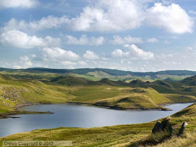
Relevant sandstone outcrops investigated by the authors

In essence, the paper homes in on the Altar Stone (assumed to be Devonian) and the Lower Palaeozoic debitage in the Stonehenge landscape, and the question of whether any or all of the samples analysed actually came from the Cosheston Sandstones outcropping on the shore of Mill Bay. The research is framed as being necessary in order to decide whether the bluestones at Stonehenge were moved by sea or overland;  this is a completely ludicrous piece of research justification since all it does is to demonstrate the tunnel vision of the authors.  More of that anon.

In an extended analysis of the 3 sandstone groups (Altar Stone, debitage and Mill Bay) in the archaeological literature, the researchers focus on the famous thin section 277 (which may or may not have actually come from the big recumbent slab) and suggest that it is more likely to have come from the Senni Beds than from the Cosheston Beds -- although they are equivalent in the Devonian time sequence.  In their discussion of the "Lower Palaeozoic sandstone debitage" the authors point out that most of the samples obtained thus far do not come from within the original stone settings but from the Heelstone ditch, the Greater Cursus ditch and from Roman disturbed sites.  But there also appear to be four samples of the same rock type from genuine Stonehenge contexts.

The research core of the paper is a discussion of past work on sandstone samples from Mill Bay, and new analyses undertaken on fresh samples collected by me (duly acknowledged, with thanks!) and other fieldworkers.  The conclusion is that the mineral composition / petrography revealed in the samples is so different from that of the Stonehenge debitage fragments that Mill Bay can effectively be ruled out as a source area.  The authors say that Mill Bay sandstone fragments are "now considered not to be present within the Stonehenge landscape"  -- in my view they cannot say that, since thus far they only know about a small fraction of what lies beneath the ground surface.  However, it is sufficient -- and quite reliable -- to say that the known samples of Devonian sandstone at Stonehenge appear not to have come from Mill Bay or the Cosheston Beds, and that source areas within the Senni Beds - further to the east -- are much more likely.  That is an important advance.

Quote:
re the 3 sandstone groups:  Each sandstone is distinctive in term of its minor accessory/heavy minerals (reflecting its source area), diagenetic history as determined by its authigenic cements and clay minerals, and its tectonic and metamorphic history as seen by its clay mineralogy and presence/absence of any tectonic fabric. (p 12)

With respect to the Senni Beds, the authors show a map of their distribution (reproduced above), and say this:

"........for much of this area the outcrop is thin, only widening towards eastern Wales and the Welsh Marches. The composition and relative abundances of the clay minerals in Devonian sandstones systematically varies from east to west Wales (reflecting a change in the metamorphic grade) (Hillier et al. 2006) and preliminary work on the Altar Stone clay mineralogy suggest that the sandstone may be from the east of Wales."

This is interesting, and it will be good to see where this leads -- but a word of caution.  In due course, geologists may well show that some of the Stonehenge fragments analysed may have come from the Senni Beds in eastern Wales.  But that does not mean that that is where the Altar Stone came from. We still do not have absolute certainty that any of the samples examined really did come from the Altar Stone (see also "The Stonehenge Bluestones", pp 172-176 for a more detailed discussion).

See also:
IXER, R. A., BEVINS, R. E., TURNER, P., POWER, M. and PIRRIE, D., 2019. Alternative Altar Stones? Carbonate-cemented micaceous sandstones from the Stonehenge Landscape. WANHM 112, 1–13.

Other posts:


https://brian-mountainman.blogspot.com/2016/12/could-altar-stone-have-come-from.html

https://brian-mountainman.blogspot.com/2017/10/altar-stone-thin-section-277-and-senni.html

https://brian-mountainman.blogspot.com/2012/06/possible-source-for-altar-stone.html

https://brian-mountainman.blogspot.com/2012/04/stonehenge-sandstone-mystery-1.html

https://brian-mountainman.blogspot.com/2012/04/skulduggery-in-glasgow.html

https://brian-mountainman.blogspot.com/2016/12/dylan-thomas-and-altar-stone.html

----------------------------

In summary:

What does the paper do?  Well, it provides quite convincing evidence that the sandstone samples reputed to have come from the Altar Stone (stone 80) did not come from the Mill Bay area on the Daugleddau Estuary in mid-Pembrokeshire.

What does the paper NOT do?  Well, here goes:

1.  It does not prove that any of the analysed samples purported to have come from the Altar Stone did actually come from that source.  It follows that the Altar Stone might still be made of Cosheston Beds sandstone.

2.  It does not prove that the "sandstone stumps" numbered 40g and 42c are made of Devonian or Lower Palaeozoic sandstones.

3.  It does not prove the absence of Devonian sandstones from the Stonehenge environs, since the sampled fragments discussed in this and other papers have all come from the 50% or so of the land within the stone settings that happens to have been excavated, and from other sites in the wider landscape.

4.  It does not prove that any of the sandstone debitage has come from stumps 40g and 42c (just as the geologists have not proved that any of the foliated rhyolite debitage at Stonehenge has come from stumps 32d and 32e).  Some of the debitage might well have come from sandstone lumps that were too small to be used in the stone settings.

=====================

Entrainment and Transport

In their conclusions the authors wind things up by suggesting that all this somehow has a bearing on the arguments about whether the bluestones were "shipped out" from Milford Haven and along the Bristol Channel or by land along the "A40" route.  They say:  "The new studies instead strongly indicate a number of inland geographical origins for the bluestones; hence a land route is now firmly preferred over a sea route."

There is no mention whatsoever, even from this group of practising geologists, of the glacial transport theory -- even though people like them are supposed to know something about earth surface processes.  There are no citations of the work of Judd, Jehu, Geikie, Williams-Thorpe,  Elis-Gruffudd, Downes or myself, or anybody else who has proposed, with much supporting evidence, that glacier ice could have moved the bluestones.  Geoffrey Kellaway is mentioned, but only in the context of his rather weird idea of a Pliocene glaciation.  That is a strange citation -- but we can understand it as an attempt by the authors to suggest that the "glacial theorists" are fantasists who have lost contact with the real world.  But we are rather more grounded than they may think -- and it is completely indefensible for any serious authors dealing with bluestone provenance to pretend that their ideas are not disputed, and to refuse to consider or even cite a serious literature in the public domain which shows that there is abundant evidence that points to the glacial transport of the bluestones.

So the authors -- not for the first time -- are behaving, in this paper, in an academically reprehensible fashion, and I am amazed that the Editor of WANH magazine has allowed them to get away with it.  He is culpable too.

But hey -- life is too short to spend one's whole time being furious, and the silver lining in this case is that the article in question provides very substantial support for the glacial transport thesis. We know already that the bluestones at Stonehenge (of many different shapes and sizes) have come from around 30 different provenances, mostly in west Wales.  We also know that the "quarrying hypothesis", with respect to Rhosyfelin and Carn Goedog, does not withstand careful scrutiny.  The bluestones at Stonehenge (both orthostats and fragments) have come from a wide scatter of locations, and that in itself is an argument against quarrying for favoured rock types in special locations. Could there really have been 30 bluestone quarries?   Why quarry for a rubbish stone like foliated rhyolite down in a deep valley when better stones could have been picked up from the higher land surfaces round about?  Why quarry for spotted dolerite at the exposed and craggy tor of Carn Goedog, when there were boulders of all shapes and sizes dotted about all over the Preseli hill slopes?

Indeed, why would Neolithic tribesmen have bothered to quarry for monoliths at all, since there is no evidence of any preferential use of specific rock types (eg spotted dolerite, foliated rhyolite, Devonian sandstone, or Lower Palaeozoic sandstone) anywhere in the British Neolithic.  In Wales, cromlechs and standing stone settings were always made of whatever handy lumps of stone happened to be lying around in the vicinity.  It is entirely logical to assume that the same principle of monolith collection and use applied at Stonehenge.


Carreg SamsonSamson, Abercastle.  Just one principle of megalith construction:  use 
whatever stone you've got.  


As indicated in my book "The Stonehenge Bluestones",  entrainment in the compression zone of ice flowing up and over Preseli sits easily with glaciological theory.

Generalised erratic transport routes in South Wales, after many authors.  Note the crossing of arrows. Many erratics carried southwards from the Welsh ice cap were later incorporated into the east-flowing Irish Sea Glacier.

If -- as now appears likely -- the stones at Stonehenge included Lower Palaeozoic sandstones from somewhere in West Wales and Devonian sandstones from somewhere in South Wales, that again militates against targetted quarrying and supports the idea of ice entrainment and transport towards Stonehenge.  There is no problem at all with ice from the Welsh ice cap picking up large blocks of sandstone (or any other rock, for that matter) and transporting these blocks southwards prior to entrainment in the eastward-flowing Irish Sea Glacier at a later stage in a glaciation.  This was realized and commented on more than a century ago by the officers of the Geological Survey (including, ironically, HH Thomas).

https://brian-mountainman.blogspot.com/2012/02/south-wales-glacier-battleground.html  

Finally, I am not in the least bothered about where the Altar Stone or the sandstone debitage at Stonehenge actually came from within the outcrops shown on the map of "possible source sandstones".  I am confident that ice did all of the heavy lifting and transportation, and that all our heroic ancestors needed to do, around 5,000 years ago,  was to collect them up from somewhere far to the east, with a view to turning them into an enigmatic monument.  As I have suggested many times, that monument was never finished because the builders ran out of steam and ran out of stones.

==========

PS.  Thanks to Rob Ixer for correcting a slip of the pen.  Duly corrected.


Thursday 21 November 2019

Teifi Pools


While checking out some iceflow directions I came across a splendid collection of photos taken in the Teifi Pools area, right at the head of the Teifi Valley in Mid-Wales.  Pontrhydfendigaid is the nearest village.  Many of the best photos are from the Coflein collection -- including oblique air photos taken by Toby Driver.


This location lies -- every now and then -- right at the heart of the Welsh Ice Cap, and the ice cal has waxed and waned here on many occasions during the Quaternary Ice Age.  The altitude here is only about 450m, but there is an extensive plateau which is perfect for the buildup of snow and ice.  There are many signs of areal (not aerial!) scouring by overriding ice that was not concentrated into channels.  But the "grain" of the country as seen above on the satellite image (aligned NNE - SSW) has more to do with the bedrock outcrops of Silurian shales and sandstones than it has to do with ice directions.  It is thought that the last direction of ice flow here was broadly NE - SW as ice streamed down towards the Teifi Valley where it was concentrated into a vast outlet glacier.

By the look of it, there are very few depositional features here -- either made of till or fluvioglacial materials.  (I need to get over there to check this assumption.)  That would not be surprising; these things tend to become more and more frequent out towards the ice cap edges.

If I was to be shown some of these photos without any locational information, I might think that they were from Hardangervidda in Norway or the Glama Plateau in NW Iceland.  Those two were areas of ice accumulation and outflow on many occasions during the Ice Age.  Right at the core of accumulation areas like these there may not be many signs of streamlining, since the ice is largely static or stagnant, or maybe frozen to its bed beneath the highest point on an ice dome.  As one moves out from the central dome, ice velocities increase, as do the frequency of the resultant streamlining features.  It's all in the text called "Glaciers and Landscape" by David Sugden and myself.

It's now thought that the Late Devensian Welsh Ice cap reached its maximum extent around 24,000 years ago, and that this area remained ice-covered until around 16,000 years ago.  The ice edge retreated northwards towards the higher summits of Plynlymon, Cader Idris and the highlands of North Wales.

Here are some more fabulous images of this area.  It is immediately apparent how different this landscape is from the mountainous area to the north, which is packed with glacial troughs, cirques (cwms), roches moutonnees,  and many other classic glacial landforms.


And for comparison, here are two satellite images from Google showing part of the Glama Plateau in NW Iceland.  There used to be an ice cap here too, not so long ago........


Sunday 10 November 2019

Cemented till, Traeth Mawr, Newport


Two exposures of cemented till on Traeth Mawr beach, Newport.  To some degree the exposure is masked by limpets and other marine creatures including seaweeds and the casts made by the honeycomb worm.

Traeth Mawr, Newport, there is a little patch of cemented till, broken up into a number of small outcrops, sticking up through the sand directly in front of the car park.  It is only visible at low tide, and sometimes, when the sand beach has been aggrading (as in the summer months) it may not be visible at all.  It is clearly a till, with rounded and faceted stones up to 30 cm in diameter visible in small cuttings and on the upper surface of the outcrop -- but there is a crust of what look like corals or large barnacles which attracts the immediate attention.  They are in fact worm casts --created in certain conditions on beaches in western Britain by colonies of the worm called Sabellaria.

In the vicinity of the outcrops I have in the past seen fragments of the submerged forest, and I have assumed (because of the apparent association between the two) that the till is late Devensian in age, and that the submerged forest is Holocene.  Now I am not so sure.  In recent months I have been finding cemented till in a number of locations (as at Lydstep, Ceibwr and Witches Cauldron), and I am becoming more convinced that it is possibly Anglian in age -- partly because in those locations there is also nearby fresh till with no trace of cementation.  There is fresh Devensian till at the head of the main beach, occasionally exposed and overlain by blown sand, and on the adjacent clifftops.  It is also seen in the Nevern Estuary, behind the protective promontory of sand dunes, on the shore where it is covered at high tide -- and it is slippery, mucky and soft enough to dig out with ease. Conditions inside the estuary are not dissimilar to those on the outer beach -- apart maybe for reduced salinity in the water that covers the deposits twice a day.

For the moment, I shall go with the thesis that there are TWO tills in Pembrokeshire -- the older one cemented (maybe not everywhere?) and the younger one fresh and soft.

Watch this space........

=======================

A colony of Sabellaria worms on the outcrop

Note:
Honeycomb worms (Sabellaria spp.) are tiny worms that live around the low tide area of the beach. They build tubes, attached to the rock to live in and the structures we see on the beach are dense colonies made up of thousands of individual worms. Fully grown, each individual worm is around 3-4cm. The colonies however can often cover large areas of rock, forming solid reefs.

And down came the cliff...... Traeth Mawr, Newport

The rockfall scar and, beneath it, a cone of thousands of tonnes of debris.

You don't often see evidence of major cliff-falls and realignments of the coast in Pembrokeshire, but when you are least expecting it, catastrophic rockfalls happen.  When we went for a walk in the winter sunshine on Newport beach this morning, we discovered this huge rockfall.  It's  just a few days old, since the soil and vegetation brought down is sitting low on the debris cone where it would have been washed away by waves if the fall had occurred before the last spring tide.  The scar is clearly visible on the cliff face, and the cone has a height of c 10m and a front edge on a semicircle, about 30m from one cliff contact to the other.

The rockfall is near the northern extremity of Newport Sands -- Traeth Mawr. Approx grid reference: SN054408.   The rocks are Ordcovician shales and sandstones, severely folded, faulted and smashed up -- so it is no surprise that the cliffs here are notoriously unstable. The reddish / ochre colour of the rocks now exposed on the scar shows that that there has been severe water penetration and weathering some metres in from the old cliff face. I suspect that the rockfall occurred during recent very wet weather, maybe with waves pounding the base of the cliff providing adequate percussion and vibrations in the rock mass for the surface layers to detach themselves and crash down onto the beach.

It will be interesting to keep an eye on this rockfall and to see just how long it will take for the cone to be altered, reduced in size and eventually removed altogether -- which it will be.

Another view of the rockfall cone

Contact between the edge of the cone and the old cliffline

Turf and scrub vegetation which has fallen from the clifftop onto the surface of the new cone.  If there had been any spring tides since the rockfall, this material would have had all the fines washed out and may well have been removed entirely.


Saturday 9 November 2019

Blogger and the publication of field research


Blog sites are generally thought of as somewhat narcissistic places where people who enjoy communicating with the world (or maybe with a few of their friends) can burble on at length whenever have a minute or two to spare -- sometimes ranting, sometimes sharing something quirky or special, sometimes baring their souls or even seeking advice or consolation.  Each blogger has a tribe or an extra family -- sometimes very small and sometimes enormous, with subscribers numbered in the millions.

Many blogs nowadays have an unabashed commercial objective -- they are marketing sites associated with products or ideas.

But there is a deeper purpose too, if a blogger chooses to take advantage of the fact that Blogger (and the other blogging platforms) offer instant publication without external constraints -- that is, as long as you keep clear of obscene or terror-related content or vile attacks on individuals.


And for those of us who consider ourselves serious bloggers, a blog like this one is a fantastic place for passing on news of new research papers or other developments, scrutinizing articles written by others (some of whom you agree with, and others deemed to be unreliable, unscientific and even dangerous), and bouncing around hypotheses of all shapes and sizes.  Over the years since the blog started I have tried to do all of these things, and have enjoyed the other great feature of a blog -- namely the facility that exists for readers to bang in their comments and to participate in debates which can be, as we all know, sometimes long and acrimonious.  Sometimes things get so aggressive or so repetitive that discussions have to be halted -- so the blogger, in those cases, becomes the ultimate arbiter of what is allowed into print.  Sometimes people use somebody else's blog as a platform for their own theories and obsessions -- with those,  I am sometimes tolerant and at other times not.

Thus far, on this blog, there are 1,534,586 page reads, 2,590 posts from me, and goodness knows how many comments.  Google does not appear to count those...... So there is a lot of activity.

But another thing that is very much undervalued in the blogosphere is the ability for the instant publication of field research.  Research outside of academia is not easy, as we all know -- especially since the big journals started to charge authors (sometimes £3,000 or more per illustrated article) for their original peer-reviewed work.  And it is not uncommon for articles to take 18 months to get into print. Even then, there is no guarantee that the expensively-published article has been properly peer-reviewed and is actually worthy of publication.  We have seen plenty of examples on this blog of articles in "learned journals" that should never have seen the light of day.  In my humble opinion.......

Even though I have no research funding available, and no laboratory facilities, I reckon that I am a reasonably competent field scientist who knows a thing or two about glacial geomorphology and glaciology.  I enjoy observing things, describing them in an orderly fashion, and publishing what I have found for the interest (enjoyment?!!) of others.  If I find something interesting in my wanderings across West Wales, it can be in print, in this blog, within a few hours -- available for others to scrutinise and criticise if they wish.  I am not claiming that my observations and conclusions are any more reliable than anybody else's  -- but at least I am prepared to be scrutinized and attacked.  And that is, I think, part of the necessary democratization of science.

Ceibwr -- an exposure of cemented Quaternary deposits never adequately described before

One advantage -- or is it a defect -- of "instant publication" is that it may be a bit garbled, and in need of tighter editing. I would accept that in many cases I might have described things more carefully, and not drawn such hasty conclusions -- but unknown to many readers of the blog, I do go back to old blog posts quite frequently, add new observations, make corrections, add new photos and stick on postscripts.  I doubt that blog followers get notified of those changes, but never mind.  Another problem -- which will be identified immediately by academic geomorphologists -- is that when I describe deposits I tend to say what I think I am looking at -- be it till, glaciofluvial gravel or a  brecciated slope deposit -- instead of describing it simply as a "diamicton"  and then going into a long analytical discourse before eventually coming to a conclusion as to what it is.  With all due respect, a blog post is what it is, and one has space limitations -- and the base knowledge of the reader -- to think about.  So I say to my professional colleagues that I am unrepentant!  In any case, I know a till when I look at one..........

Because of my wanderings and scribblings, there is now a vast amount on this blog, especially relating to Quaternary sites, their deposits and their related landforms, that is not available anywhere else.  Many of my favourite sites have never been described by any other geomorphologist, anywhere in the specialist literature.  So the site is, in its own modest way, a little treasure trove.  That's why I'm pleased that the National Library of Wales is archiving it -- so that it will still be available when I am dead and gone.

Here are just some of my favourite sites which I have studied and described.  Many of them have multiple posts, and they can all be found thanks to the excellent search facility which, as far as I know, works very well indeed.

Abermawr
Black Mixen, Lydstep
Broad Haven
Broad Haven South
Caldey Island
Carningli
Carn Goedog
Ceibwr
Craig Rhosyfelin
Druidston
Freshwater West
Gwbert
Isles of Scilly
Landshipping
Llangolman
Lydstep
Madoc's Haven
Mullock Bridge
Newport Parrog
Picton Point
Poppit
Waun Mawn
Whitesands
West Angle
West Dale
Witches Cauldron

..... and many more


Thursday 7 November 2019

Ice eggs -- Gulf of Bothnia


Another in our series of photos of strange snow and ice phenomena.  Ice eggs on the coast of an island in the Gulf of Bothnia, near the coast of Finland.  Very rare -- they are formed when fragments of snow or ice on a freezing shore are detached and roll around on the beach under the influence of strong wind and waves.  Once the sea freezes over completely, this process becomes impossible.  So it's an autumnal phenomenon -- but it may not happen again for several decades, anywhere in the world.......

Glacial deposits at Landshipping (Daugleddau Estuary)


I have been intrigued by Landshipping for quite some time, and today my wife and I went down there for a walk and a picnic in the winter sunshine........

As mentioned in a previous post, there is a reference, in the Geological Survey Haverfordwest Memoir, p 215,  to an interesting section on the shore of the Cleddau confluence, immediately to the east of Oxhouse Farm. The location lies between Landshipping Ferry and Landshipping Quay. Grid ref SN007113. The section at the time of the original survey, a century or more ago, showed:

Gravelly "boulder-clay" with igneous and other erratics
Blue clay with plant remains and quartz pebbles -- related to the raised beach?
Gravelly rubble becoming more angular downwards
Rock platform?

However, on the geological map a spread of sands and gravels is shown, but no till.  A section of the map is reproduced above -- see the pink area to the east of the confluence.  So is there an extensive spread of sands and gravels overlying till?

After my intrepid expedition I can confirm that there is no spread of fluvioglacial materials here, but quite an extensive spread of till.  So the patch on the map has the wrong colour! 

 
The shoreline between Landshipping Quay and Landshipping Ferry.  The low cliff is partly masked by vegetation.

If one follows the shoreline from Landshipping Quay round the point and ending at Landshipping Ferry, one finds a gently sloping and undulating sheet of till ending at a low west-facing cliff around 3m high.  Bedrock Coal Measures are exposed almost everywhere along the high tide line, although there is much masking vegetation.  The sandstones and shales (and some coal layers) are thoroughly rotten.  But there are many rounded pebbles and cobbles and larger erratic boulders on the beach, and for a distance of more than 100m there are excellent exposures of sticky clay-rich till (which may be a lodgement till) made up for the most part of old estuarine materials over-ridden and incorporated by ice, and a more silty till packed with pebbles and cobbles up to 10 cm in diameter, with occasional larger boulders.  The till is not coloured grey or blue like the fresh Irish Sea till, but it is a buff or reddish colour indicative of considerable weathering.  But the pebbles contained are quite fresh in appearance, and there is no sign of rotting.  Nowhere does the till appear to be cemented.  

The till is seen to be up to 3m thick, with occasional signs of "churning".  In the northern part of the exposure, where the till has a lower clay content, there are signs of crude stratification; and in one section we can see a layer of buff-coloured and relatively stoneless "sandloess" up to 15 cm thick. In turn this is overlain by about 30 cms of dark grey loamy soil. 

I have to say that in none of the current exposures can we see "blue clay with plant remains" under the till.  And neither did I record any "gravelly rubble coarsening downwards".   in spite of searching, I found no deposits that I would refer to as slope breccia, either under or above the till.  This is not surprising, because there are no steep slopes in the vicinity, and  no substantial rock cliffs which could have introduced a ready supply of debris either under a periglacial or temperate climatic regime.


Two exposures of clay-rich till located around grid ref SN007113.  The matrix is sticky and weathered to an orange or foxy-red colour.  There are some erratic (far-travelled) pebbles, but most are made of Coal Measures sandstones or Millstone Grit.

From the nature of these deposits I suggest that some of them may be lodgement tills and others are more likely to be flowtills.  There are close similarities in texture and other characteristics with other tills found around the coasts of west and south Pembrokeshire.

One feature of particular interest is the nature of the terrain to the east of the cliff exposures.   On both sides of the road the fields are subject to waterlogging, and this suggests the presence of clay-rich till at the surface.  There are small ridges, hollows and swells in the terrain, and this is unusual for south and mid Pembrokeshire.  I am tempted to suggest that there is real morainic topography here, indicative of dead-ice terrain.  Similar terrain is seen in parts of NW Pembrokeshire, inside the Late Devensian ice limit.  So is the Landshipping till sheet of Late Devensian age?  I am very tempted to say so, although the location is right in the middle of the "South Pembrokeshire ice-free enclave" about which we have speculated so much in the past.........


The proposed area of Anglian glacial deposits in central and southern Pembrokeshire, thought to have been a Late Devensian ice-free enclave.  The deposits described in this post are at the confluence of the two Cleddau rivers, right in the heart of this enigmatic tract of country.

I'm still very puzzled......


Monday 4 November 2019

Log boats and boulders in the Boyne?

Two cutmarks on a piece of wood do not make it a part of a sea-going stone transport vessel.......

There is quite a bit of media coverage today for this story.  Interesting, but a degree of caution is needed.  Some old bits of timber with "cut marks" on them may or may not indicate the presence of log boats.  They may just be bits and pieces of trunk or branches associated with forest clearance, that have found their way into the river and its sediments.  More evidence required on that front....  what degree of strangeness is required for something to be classed as "an anomaly"?

And the "16 items which appear to be large boulders or rocks" found in the sediments -- how anomalous are they?  How big are they? And what makes them different in kind or origin from the boulders inevitably sitting in sea-bed or estuary-bed sediments as a result of the area's very substantial glacial legacy?  Do the archaeologists recognize Irish till when they see it?

So there are echoes here of the wild media frenzy of several decades ago, when some boulders were found on the bed of Milford Haven?  one of them, at the time, was instantly deemed bu museum curator Robert Kennedy (and many others) to be "the missing bluestone" from Stonehenge, which was lost from a raft and had to be replaced with a chunk of Cosheston sandstone from the seashore of the Daugleddau estuary.  Some people apparently still take this fantasy seriously........

Anyway, the Boyne research is interesting, and we await further publications.  At the moment, there is nothing in print which suggests that these pieces of wood are the remnabts of log boats or rafts, nothing to suggest that the timber bits and the boulders are related, and nothing to show that the boulders or the bits of wood have anything to do with either Newgrange or any other prehistoric site.

================

Archaeologists say they've discovered what could be Neolithic log boats near Newgrange


The river bed of the Boyne is being searched by archaeologists.

ARCHAEOLOGISTS HAVE IDENTIFIED what could be Neolithic log boats as well as boulders, perhaps intended to be used in the building of Newgrange or Knowth, in the river bed of the Boyne, near to the famous monuments.

The survey of the river, believed to be the first of its kind, is the work of a team of researchers from UCD’s School of Archaeology and Ulster University’s School of Geography and Environmental Science, funded by the Royal Irish Academy.
They are focused on the river bed where it runs through the Brú na Bóinne World Heritage Site and are part of a project to focus on role of the Boyne which is at the heart of the ‘Bend in the Boyne’.

The research is led by Dr Stephen Davis, UCD School of Archaeology, who said that despite being a key thoroughfare and trade route over millennia “our understanding of the river was identified in the 2009 Brú na Bóinne Research Framework as a major knowledge gap”.
“This work is very valuable and like so much of the non-invasive work we have been doing in Brú na Bóinne over the last decade it helps us build the foundations from which we can really begin to understand the landscape,” he said about this latest research.
“The project had three main aims: to undertake new mapping of the river channel and to potentially identify new archaeological features, to explore the landscape of the river at Brú na Bóinne using Geographic Information Systems and to collate local folklore relating to the Boyne from the Schools’ Collection to better understand the Boyne in its local context,” David said.
The results of the surveys have not disappointed and come just months after other non-invasive work discovered 40 previously unknown monuments close to Newgrange.
In addition to learning more about the structure of the river, this latest research has so far identified 100 items of interest in a 10km stretch.

“These items may or may not be archaeological, but we can say for certainty that they don’t belong there, they are things that are out of the ordinary and would benefit from further analysis,” Davis said.
Ten of them appear to be “log boat type anomalies and there have been log boats, including one that dated from the Neolithic era, found in the Boyne before”.
There are also 16 items which appear to be large boulders or rocks and Davis said that “if we are thinking of somewhere where people were potentially moving large stones up and down to build monuments with then it is almost certain that some of these were lost in the Boyne on their way to being used in construction”.
It is highly unlikely that one of the log boats could have transported large rocks or boulders, but archaeologists think that rafts may have been used.
The surveys also found weirs, accumulations of debris that could have an archaeological importance and some 31 very modern tyres.
The team also explored the relationship of the Boyne to the monument location using data gathered over a number of seasons of large-scale survey and existing airborne laser scanning surveys.
“These analyses highlight the importance of visibility from the river for site placement, especially in regard to the Neolithic passage tombs and timber monuments,” Davis said.
“The Neolithic landscape is very much constructed around the river. For an observer from the river, the ridge on which Newgrange, Knowth and Dowth are located would have formed a northern barrier beyond which there was no visibility. To the south the steep slopes again block the observer’s views,” he added.
Davis was also involved in the 2017 research which uncovered what he described as a “spectacular” monument beside Newgrange – it also appears aligned with the Winter Solstice sunrise.
The research findings will be part of a temporary exhibition, featuring key project results, to be housed in the newly redeveloped OPW Brú na Bóinne visitor centre.

Sunday 3 November 2019

The Stonehenge Bluestones -- Kindle edition now available


Up until quite recently it was very complex to get heavily illustrated books converted to the right "Ebook" format for reading on the Kindle and other devices.  Now, however, Amazon has introduced a new app (not available across all platforms) called "Kindle Create", which allows PDF versions of illustrated books with complex layouts to be uploaded and re-formatted.  It takes a bit of getting used to, and is not free of glitsches, but as far as I can see it works quite well when downloaded onto a Kindle.  This is where the book may be found:

https://www.amazon.co.uk/dp/B07ZXLLF34

Please note that because this Kindle book is created to a special format, when reading you can flick forwards and backwards, from one page to another, but you cannot change font, page brightness or print size as you can with Kindle novels.  That may be a bit of a limitation for some readers.

Anyway, there it is, priced at £6.99 (a big saving on the paperback price of £15.00) -- and I hope people will invest in it and give me some feedback.  Weirdly, Amazon does not give publishers a method of previewing the uploaded book and seeing it exactly as an Amazon customer would see it!  And they are as vicious as ever on their fees and royalty arrangements -- if I am lucky, I will get around £2.40 for every copy sold.  Amazon always claims to encourage authors and expand our literary heritage -- in fact, because they control the market, they screw the life out of everybody in the supply chain.

I would appreciate feedback on three things:

1.  Overall print and illustration quality;
2.  Contents table -- do the links to individual chapters work OK?
3.  Do the hyperlinks to web sites and videos work as they should?

Thank you!

Friday 1 November 2019

UCL contempt for students -- never a good idea


I have been thinking further on the content of my last post -- and need to stress that I am not seeking to go after students here.  On the contrary, my whole point relates to the teachers who apparently show so little respect for the next generation of archaeologists that they think they cannot cope with disputes -- unless those disputes are of course "historical" and deemed worthy of distant and detached analysis.

Students may not want to bury their heads in the sand -- but if they are forced to, what is their room for manoevre?

I recently did a Facebook post in which I explained that when I was a student, I had a fantastic tutor called Ted Paget whose teaching philosophy was quite simple: "I know quite a lot, but not enough. It's my job to make sure you end up being smarter than me." I tried to carry that on into my own teaching career in Durham University.

Ted Paget, geography tutor and Fellow of Jesus College Oxford -- a man who published hardly anything, but a great teacher.......

Now, it appears, UCL students reading Archaeology are being told by certain senior academics that everything they are taught is "the truth" and that anybody who disputes the conclusions of their own research must simply be ignored. I thought that sort of thing went out over a century ago with the demise of powerful professors who looked on themselves as intellectual giants and "formers of opinion" -- but apparently that old style of thinking is still alive and kicking, in some remote backwaters......

I wonder how widespread this is?  If it is, we as a society are in serious trouble.