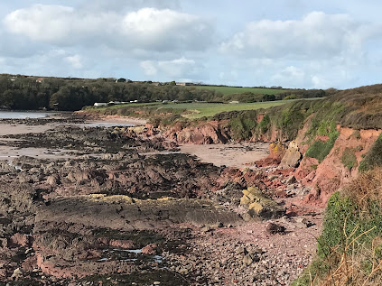
Looking west along the eastern part of Sandy Haven, some 5 km in from the mouth of the waterway. Red marls and other rocks belonging to the ORS series dominate -- and the clifftop sediments are also predominantly red in colour.
The glaciation of Milford Haven is one of the great neglected topics. The geological maps show plenty of glacial and fluvioglacial deposits scattered in patches across the landscape, but I am not aware of any comprehensive study. And it is widely assumed that the glacial deposits that have been mapped are all pre-Devensian and pre-Ipswichian, originally designated "Older Drtift" and more recently assigned to the Wolstonian or Anglian glacial episodes.
In the BGS Memoir relating to "The Country around Milford" (1916) TC Cantrill and his colleagues (including HH Thomas) mention many locations where isolated erratic boulders and Quaternary deposits may be found, but they were not very consistent with their labelling; they used the term "boulder clay" for clay-rich glacial deposits, but many other exposures of till were simply referred to as "gravel", and they did not distinguish between water-lain or fluvioglacial gravels and fine-grained gravelly slope deposits. We should not be too critical -- the BGS surveyors were working under great pressure, and not one of them was a glacial geomorphologist. Nonetheless, the Memoirs are invaluable resources, summarising a multitude of field notes.
The Momoir is here:
227 Milford
http://pubs.bgs.ac.uk/publications.html?pubID=B01813
We already know that the LGM Irish Sea Glacier or ice stream entered Milford Haven, since there is fresh till above interglacial sediments at West Angle and till and thick fluvioglacial deposits at Mullock Bridge, not far from Dale. It's amazing that this evidence is ignored by so many Quaternary scientists even though it is well documented. They insist on portraying an LGM ice edge somewhere out to the west, sometimes 20 km or more out into St George's Channel.
https://brian-mountainman.blogspot.com/2020/08/the-interglacial-glacial-sequence-at.html
https://brian-mountainman.blogspot.com/2017/02/the-west-angle-enigma.html
https://brian-mountainman.blogspot.com/2017/03/the-west-angle-enigma-2-silt-and-clay.html
https://brian-mountainman.blogspot.com/2017/03/the-west-angle-enigma-3-two-tills-or-one.html
https://brian-mountainman.blogspot.com/2020/08/the-west-angle-sediment-sequence-moreys.html
https://brian-mountainman.blogspot.com/2017/03/west-angle-gallery.html
https://brian-mountainman.blogspot.com/2017/03/west-angle-bay-classic-coastal-section.html
https://brian-mountainman.blogspot.com/2018/08/mullock-bridge-looks-important-again.html
https://www.researchgate.net/publication/229120558_A_Late_Weichselian_kame_terrace_at_Mullock_Bridge_Pembrokeshire
There are also classic exposures of glacial and other sediments at St Bride's Haven, Marloes, and Westdale Bay -- all tying the late Quaternary sediment sequence in with that of St Brides Bay and the coast of North Pembrokeshire.
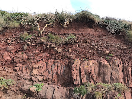
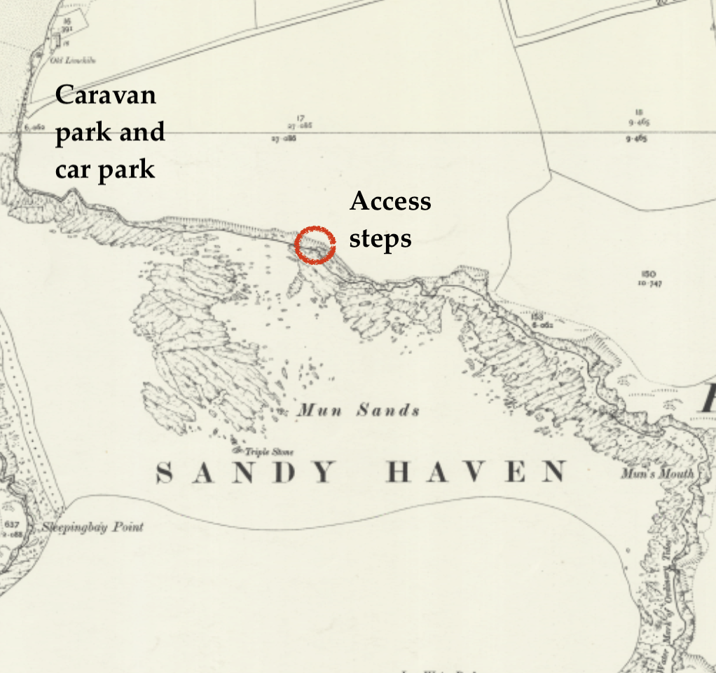
If Irish Sea ice pressed into the Haven, how far to the east did it extend? Today I managed to get over to Sandy Haven (SM860070) while the sun was shining and the tide was low! It's "the one that got away" -- for a variety of reasons I have never examined it properly before, in spite of having walked past it on the Coast Path on many occasions. The rocks (belonging to the Devonian Milford Haven Group) are predominantly bright red marls and sandstones, but there are also greenish and buff-coloured sandstones and conglomerates exposed along the shoreline. There are complex structures too, making the 1 km of cliffline somewhat chaotic and interesting, with abundant faults and crossing fractures and little anticlines and gullies everywhere -- but hardly any caves. The cliffs here are seldom more than 20m high, and rockfalls and slope processes are more significant than shoreline processes associated with wave action. This is a much more sheltered coastline than that of the open Atlantic coast to the west.
On the clifftops between Ferry Cottage and the eastern end of the bay, two patches of Devensian sand and gravel are shown, but I think these are periglacial rather than fluvioglacial in origin -- and in a close examination of the cliff exposures I only found one small patch of gravel that I would link with the presence of glacial meltwater.
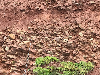
The Quaternary sequence in Sandy Haven is dominated by rockfall debris and slope breccia with so much internal variety that generalisations are hazardous! The sequence in one place seems to bear no relation to the sequence 20 m away, just around the next corner; I conclude therefore that the relatively steep slope inland of the cliffs has generated complex rockfalls and debris flows over many thousands of years, with the details of downslope stratigraphy determined by the nature of the rock outctops rather than by changes of climate. I may be wrong, but currently I can see nothing consistent in the stratigraphies of the exposures from west to east. Here are a few glimpses of what can be seen:
To the west of the steps:


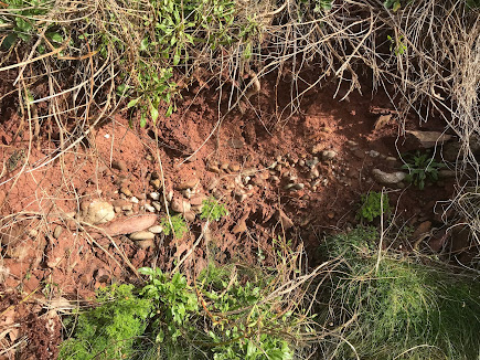
Next, the Devensian till.
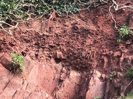
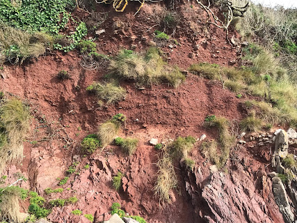
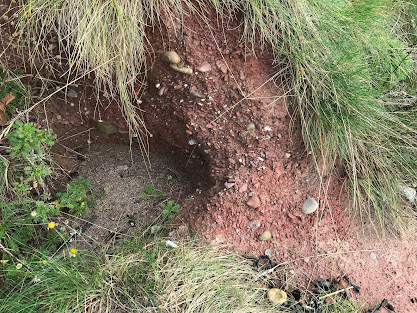
The till exposures are very varied and discontinuous. The base is not seen in the main exposure, but in one locality 1m of till incorporating many slope breccia fragments is seen resting directly on bedrock. The till grades up into about 2m of red flaky gravels, with colluvium and soil above. In the main exposure the till is overlain by a layer of fine red colluvium about 30 cm thick, with about 1m of stony slope breccia above that.
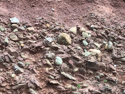
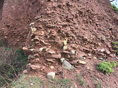
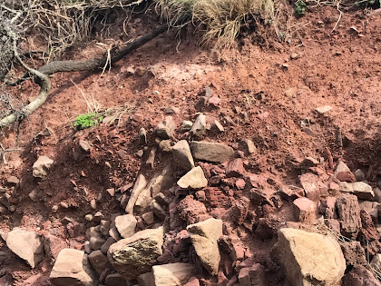
Two exposures of the red stony till at Sandy Haven. Igneous rocks are included in the erratic assemblage, and there are some large igneous boulders on the beach below.
Stony till with abundant local fragments of slope breccia, with a layer of sandy and silty colluvium above, and a layer of slope breccia (upper head) above that.
No comments:
Post a Comment
Please leave your message here