THE BOOK
Some of the ideas discussed in this blog are published in my new book called "The Stonehenge Bluestones" -- available by post and through good bookshops everywhere. Bad bookshops might not have it....
To order, click
HERE

Wednesday 4 January 2023

Glacierized landscapes and the advance of the ice


This is how it starts --Byers Peninsula, Livingston Island, South Shetlands. Barren tundra with permafrost, perennial snowpatches, and thicker accumulations of snow and firn in favourable locations where there are hollows and deep shadow.........


If you look at glacierized regions of today, in the polar regions, it is often very difficult to work out which areas are affected by active ice (capable of erosion, transport and deposition) and which are simply snow-covered, covered by layers of inactive or immobile layers of firn, or covered by thin cold-based ice which may be frozen to its bed. It's a bit easier if you look at a photo taken at the height of summer, when ephemeral snow has been melted off the landscape......

It's also a characteristic of the glacial geomorphology literature that there are thousands of papers, reports and books devoted to ice wastage and decay -- and the associated landforms and sediments -- but very little indeed to glacier growth by thickening and spreading. That's because there are no situations in which that is currently happening, so observations are impossible. Also, intensely glacierized regions are far more difficult to study than landscapes on which ice is melting away. Remote sensing techniques are available, of course, as are drilling and ice coring down to the glacier bed -- but spot sampling has its limitations.

So the net result of all this is that we actually know very little about how glaciers grow. This is why the myth of the "glacial bulldozer" still exists, with people imagining a vertical ice front creeping ever closer and eventually overwhelming green and fertile pastures or pre-exising tundra landscapes. Surging glaciers do that -- and have done -- in the valleys of Iceland and Norway, for example, but that sort of behaviour seems to have been very rare in the case of ice caps and ice sheets except where there are ice streams and highly deformable and well lubricated beds.

When we think of models, as created by various groups of glaciologists over the years (most recently the BRITICE-CHRONO team) the picture of an expanding and then shrinking ice sheet in some ways does a disservice since it reinforces the bulldozer image.

So what happens in reality at the end of an interglacial, when a glacial episode kicks in?

Well, the first thing that happens is that temperatures drop, with the mixed deciduous forest replaced by a boreal forest and then by tundra. Then we see the growth of seasonal and then continuous permafrost. That creates conditions where seasonal snow-melt is reduced and eventually eliminated. So where snowfall is substantial (fed by moisture-bearing winds) snowfields develop in the highlands and then in the lowlands, with seasonal melting having less and less of an effect until the whole landscape is covered with snowfields and firn. In favourable locations -- on the highest plateaux and in mountainous areas where there are substantial snow-collecting hollows facing north or north-east the firn might thicken substantially until we see the creation of glacier ice. Where there are convenient slopes or discharge routes, glaciers may start to flow and expand, pushing into areas which are otherwise covered with perennial snowfields.

What needs to be emphasised is that this happens over a very long timespan. From the peak of the last (Ipswichian) interglacial -- around 120,000 years ago -- the global records show an intermittent sea-level fall over something like 90,000 years, associated with climatic cooling and increased glacierisation in high latitudes and high mountain regions during MIS5, MIS4 and MIS3. Ice core and other records indicate up to 25 interstadials, but the records are difficult to interpret and some of the "warmer episodes" might have been local or regional rather than being of global significance.


Quote:
During the Devensian, periglaciation took place beyond the ice limits, as demonstrated by regional patterned ground and involutions dated to 60–55 ka (MIS 3), 35–31 ka (MIS 3), 22–20 ka (MIS 2) and 12–11 ka in eastern England. The Devensian cold periods were interspersed with warmer interstadials, most notably the Chelford Interstadial (MIS 5c, approx. 108–92 ka), the Brimpton (MIS 5a, approx. 86–72 ka) and the Upton Warren (early during MIS 3; possibly approx. 42.5–38.5 ka, according to Catt et al). However, the chronologies, environments and climatic conditions associated with these interstadials remain not well understood.

Mid-Devensian climate and landscape in England: new data from Finningley, South Yorkshire
Philip I. Buckland et al, Royal Society Open Science 6 (7),
Published:10 July 2019

Quote:
...........the evidence indicates that the last BIIS expanded after a period of, at most, very restricted glaciation. A spin-up point for the model experiments was therefore set at 38.3 ka BP, coinciding with a period of major climate amelioration within the GISP2 ice-core record. 

Patton, H., Hubbard, A., Glasser, N. F., Bradwell, T. & Golledge, N. R. 2013 (July): The last Welsh Ice Cap: Part 1 – Modelling its evolution, sensitivity and associated climate. Boreas, Vol. 42, pp. 471–490.
The last Welsh Ice Cap: Part 1 – Modelling its evolution, sensitivity and associated climate.  

https://www.researchgate.net/publication/248381136_The_last_Welsh_Ice_Cap_Part_1_-_Modelling_its_evolution_sensitivity_and_associated_climate

But at what point does streaming ice from far afield start to affect an area like West Wales, where there may be lowlands, upstanding hill masses and plateaux which might support local ice caps?  It's clear that this happens very late in the day, towards the back end of a full glacial cycle. The glacierization build-up phase (with extensive snow and ice cover on the landscape) may last for 70,000 years or more, interrupted by short-lived cooling and warming phases or by changes in precipitation and other types of "climatic forcing".  But eventually, when the whole land surface has become deeply buried by locally-generated ice, maybe 500m or more in thickness, the big brute from the north begins to dominate -- in this case with the arrival of the Irish Sea Ice Stream - as cold-based ice is replaced by ice that is capable of sliding on its bed.  Streaming ice then begins to do serious damage, eroding bedrock, picking up erratics and incorporating pre-existing periglacial and other deposits, and modifying a previously protected landscape in a multitude of different ways.  The direction of ice flow is now determined not by the details of local topography but by the surface gradient of the ice stream; in the case of Pembrokeshire ice movement seems to have swung through an arc of maybe 60 degrees, but with a dominant flow from NW towards SE.   It appears that the Welsh ice cap did not greatly affect Pembrokeshire, but ice from the Welsh uplands may well have filled Cardigan Bay, creating a constriction that affected Irish Sea ice flow directions.  From the BRITICE-CHRONO modelling, Irish Sea ice affects the area for maybe 3,000 years.  

https://www.science.org/content/article/watch-ice-sheet-melt-and-great-britain-and-ireland-emerge#.Y2DUPaCmHNI.twitter

Then, after maybe less than 1,000 years of "peak glaciation" the ice sheet starts to collapse, and the ice stream power is dramatically reduced. Forward flow is stopped, and catastrophic ice wastage sets in -- so that a landscape deeply inundated beneath glacier ice is gradually revealed, with an intermittent cover of glacial and fluvioglacial deposits which are remobilised and redistributed as the last remnants of buried ice melt away.

On a glacial cycle timeline this is all very asymmetrical, with (1) a long period of "increasing glacierisation" with minimal landscape effects followed by (2) a period of intense activity involving streaming ice and then (3) by a short period of catastrophic ice wastage and sediment redistribution.  That's the simplest situation imaginable.  Of course, in reality it is always more complex.  Climatic oscillations occur on a variety of different scales, and long-term cooling is sometimes interrupted by intermittent warmer phases, just as long-term warming is interrupted by "cold snaps" such as the Younger Dryas phase of c 12,000 years ago and the Little Ice Age that set in during the Middle Ages. Changes in oceanic and atmospheric circulation can also have the effect of changing wind direction and strength, and changing patterns of precipitation.  These are all things that are built into the increasingly sophisticated  modelling of ice sheet growth and decay by the BRITICE-CHRONO group and others.

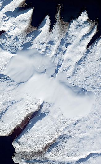
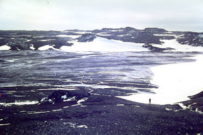
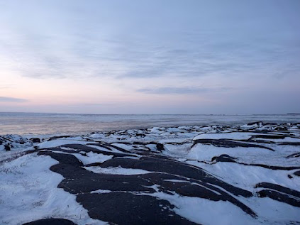
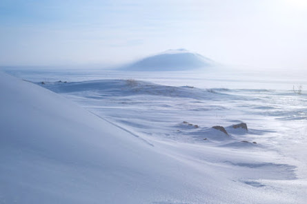
So just as the idea of a spectacular ice front marching across the landscape is an image that has no basis in reality, the idea of a later ice front retreating across a landscape during deglaciation is equally misleading.   Ice stops moving forward -- it does not RETREAT.  It simply wastes away where it lies, mostly from the top down. So just as the local ice caps of Aubrac in France and Glamajökull in Iceland melted away completely, leaving but a few traces of their former existence,  the same thing is happening at the moment to Drangajökull, leaving very few traces up on the high plateau where ice movement was minimal, but complex associations of glacial and fluvioglacial deposits and landforms in the valleys affected by streaming ice.

And we should be careful about using the term "ice limits" as well.  I have to admit to using the term far too frequently myself, as a shorthand expression which is easily understood.  On Quaternary maps we see "ice limits" portrayed all too often as straight lines, even across mountainous terrain -- but in reality ice edges are generally "fingered" or crenellated in sympathy with the landscape, and beyond an ice sheet edge there are generally scores if not hundreds of smaller icefields,  ice caps and snowfields -- again in sympathy with the lie of the land and the patterns of snowfall. So the real ice edge is not just crenellated but also fragmented.........

https://brian-mountainman.blogspot.com/2022/10/the-inexorable-ice-front-fact-or-fiction.html

https://brian-mountainman.blogspot.com/2022/10/the-aubrac-ice-sheet.html

https://brian-mountainman.blogspot.com/2022/10/lessons-from-aubrac.html

https://brian-mountainman.blogspot.com/2012/08/the-ice-sheet-ice-cap-snowfield.html

https://brian-mountainman.blogspot.com/2009/12/lessons-from-jameson-land.html

https://brian-mountainman.blogspot.com/2011/01/last-glaciation-protective-ice-cover-in.html

So how does all this relate to the evidence on the ground in West Wales and elsewhere?  Watch this space.......


A depression filled with highly mobile waterlogged sediments fed by summer snowmelt -- 
Byers Peninsula, Livingston Island


Another summer photo from Byers Peninsula -- a periglacial landscape with some waterlogged areas and others which are relatively dry, dominated by frost processes and slope breccia accumulations.


For 70,000 years or more, in the Early and Middle Devensian, the landscape across much of Pembrokeshire might have looked like this......

One of the biggest problems with all of this is the claim by Rolfe et al that Lundy Island was affected by glacier ice during the Early Devensian:

https://brian-mountainman.blogspot.com/2015/03/a-lundy-island-spat.html
Rolfe, C.J., Hughes, P.D., Fenton, C.R., Schnabel, C., Xu, S., Brown, A.G., 2012. Paired 10Be and 26Al exposure ages from Lundy: new evidence for the extent and timing of Devensian glaciation in the southern British Isles. Quaternary Science Reviews 43(2012): 61-73.

This research really is an outlier, as far as I know quite unsupported by any other research results from the Celtic Sea arena.  The problem with it is that it is based very largely on cosmogenic exposure ages obtained more than a decade ago -- and as pointed out by others, that was a time when our understanding of "exposure age inheritance" was not very great.  So the "Early Devensian glaciation" of the Bristol Channel arena is still speculative and unproven. 


Carr, Simon, Hiemstra, John F. and Owen, Geraint (2017) Landscape evolution of Lundy Island: challenging the proposed MIS 3 glaciation of SW Britain. Proceedings of the Geologists' Association, 128 (5-6). 722 - 741

But I don't go along with Simon Carr, John Hiemstra and Geraint Owen either.  They claim that there is no evidence of any Late Devensian glacial activity in the Bristol Channel -- I think there is quite strong evidence which needs to be considered carefully.

No comments: