
........... and when the waves came, the trees were probably already dead......
Cantre'r Gwaelod might just be a myth!
https://brian-mountainman.blogspot.com/2015/01/folk-memories-of-holocene-sea-level-rise.html
https://brian-mountainman.blogspot.com/2011/04/inundation-of-cardigan-bay-oldest-story.html
==============================

SHOCK!!! HORROR!!!
Cantre'r Gwaelod might just be a myth!
The submerged forest was not destroyed by huge waves rolling in from the Atlantic, but by waterlogging and sphagnum moss.
===================
https://brian-mountainman.blogspot.com/2015/01/folk-memories-of-holocene-sea-level-rise.html
https://brian-mountainman.blogspot.com/2011/04/inundation-of-cardigan-bay-oldest-story.html
==============================


Above -- fresh exposures at Marros (Photos: Cherry-Ann Ballantyne)
The recent storms appear to have exposed the submerged forest and its associated peat beds all over the place. Above and below are a few pics posted on Facebook.


Above -- fresh exposures at Borth (Ynyslas) (Photos: Amber Holloway)
Now then -- back to the blue clay which lies beneath the peat beds and the submerged forest in many different locations. In my previous post I explored some of the possible ways in which it might have been formed, and suggested that at Amroth it appears to pass without a stratigraphic break or unconformity downwards into the Irish Sea till and upwards into the peat beds, it must have been formed as part of a continuum -- possibly in the "missing millennia" between the wastage of the Late Devensian ice and the onset of the warmer conditions of the Holocene around 10,000 years ago.
I have been chasing down the literature, and find that there are three submerged forest sites from which we can obtain guidance. Before looking at the notes below, here is the "pollen zone sequence" which is frequently referred to by scientists who are studying post-glacial environmental change. Note that the dates are BC dates -- add 2,000 years to all dates to convert them to BP (before present).

Click to enlarge
======================================
THREE SITES

Marros Bay -- an extensive sandy beach backed by a storm beach against a low cliffline. Unusual because there is no sizeable river or stream reaching the coast here.
Marros
The first is at Marros, where the submerged forest extends for more than a km along the foreshire. In 1918 AL Leach described the stratigraphic sequence thus:
5. Modern overlying sand
4. Peat and submerged forest
3. Peaty soil with roots and leaves of aquatic plants
2. Blue "slime" (this is the blue clay layer)
1. Unstratified rubble (head)
Leach suggested that the upper layers (3-5) were of Holocene age and assumed that the blue slime and the rubble were somehow related to the last glacial / periglacial episode. The "blue slime" must have existed to a considerable thickness -- and thanks to Cherry-Ann Ballantyne for pointing out that it was once considered suitable for digging up as a pottery clay.
Heyworth (1985) says that the Marros exposures are very complex and very unusual, partly because the blue clay is NOT very thick here, especially close to the storm beach at the head of the bay. He says that the peaty layer rests in some places on brecciated bedrock or head, and elsewhere he describes a beach slope cut in till, which extends inland:

Now this is very interesting, since according to Prof David Bowen and others, there is not supposed to be any till here at all......... watch this space!
============================

Clarach (Janet Baxter) -- a broad valley which looks like a glacial feature -- with a very small misfit stream breaching the storm beach and reaching the coast in the centre of the bay.
Clarach
The second site is at Clarach on Cardigan Bay (SN588830), described by Jim Taylor and other researchers over the years. A trench on the foreshore showed the following sequence:
4. Shingle storm beach and modern beach sand
3. Submerged forest
2. Grey clay
1. Gravel
Borings a little way inland showed this sequence:
7. Silt and clay
6. Peats and peaty clays
5. Silt and clay -- the equivalent of the "grey or blue clay" beneath the submerged forest
4. Limnic peat and organic mud
3. Gravel
2. Silt and clay
1. Gravel

Jim Taylor thought that the grey clay (blue clay) corresponded with the clay found beneath the submerged forest at Ynyslas and Borth Bog. This has been labelled "Scrobicularia clay" because it contains traces of the peppery furrow shell (Scrobicularia plana), a marine indicator species. It is found in estuarine and intertidal conditions and is able to tolerate low salinities in thick mud or muddy sand. It burrows up to 20 cm deep in sediments and can be identified when buried by the characteristic star-shaped markings made at the surface by its inhalant siphon. If all of the blue or grey clay deposits found beneath the submerged forest in West Wales contain fragments of Scrobicularia, that means they must all have been laid down is salt water or brackish water conditions, and that also means they cannot have been laid down much before 6,000 BP (around 7,000 BP sea-level was probably still c 4m below that of the present day).

This graph of global eustatic sea-level change over the last 9,000 years shows that the rate of rise slowed dramatically around 7,000 years ago when sea-level was around 4m lower than at present. Coasts subject to isostatic loading or rebound will of course have experienced sea-levels higher or lower than the "mean position".
Further studies by Heyworth and others in 1985 showed that the earliest organic sediments on the landward side of the storm ridge (below -6 m) were not organic, and that the earliest organic sediments were c 13,600 years old. Pollen analysis of these sediments showed a rapid warming of climate at this time, with an increase in tree and shrub pollen although most of the species recorded were aquatic species, sedges and grasses. After that, there was a distinct cold event culminating around 10,550 yrs BP, coinciding with the widely documented Younger Dryas cold snap. After that, between 10,000 and 7,000 years ago, freshwater fluviatile gravels were laid down, and then silts and clays and organic lacustrine deposits. On the landward side of the storm ridge, these peats and peaty clays are radiocarbon dated to between 5,400 and 1,140 years old. There was no trace of marine influence in any of these deposits. So the Clarach Valley both before and after the marine incursion was occupied by shallow freshwater lagoons and gently flowing meandering streams and a gradual colonisation by alder, hazel and other tree species including oak.
There was a major event around 5,400 yrs BP as sea-level rose and salt water flooded across the peat beds and wooded areas on the open coast, giving rise to the story of Cantre'r Gwaelod and creating the "derelict landscape" of stumps and fallen timbers and peat beds that we see today -- when the sand layer is occasionally cleared away by winter storms. On the landward side of the storm beach the marsh and alluvial sediments continued to develop in a state of "dynamic equilibrium" -- as we see also at Abermawr.
So there are signs of two phases -- one involving freshwater sedimentation both inside and outside the storm ridge prior to 5,400 yrs BP, and the second following the flooding in of the sea which only directly affected the area west of the ridge.
But I am confused -- if the grey or blue clay beneath the submerged forest beds on the foreshore at Clarach is really a Scrobicularia clay, that means it was laid down in a marine shoreline environment. If that was the case, the peat beds and associated woodland could not have formed on top of it, since there was a marine transgression going on. All very confusing.........unless, of course, the Scrobicularia population of the clay is a modern one, simply taking advantage of a habitat that happens to be available to it following the overwhelming of the forest by the sea.
============================

Ynyslas beach, close to the village of Borth, and just a couple of km from the Dyfi Estuary.
Ynyslas
Ynyslas (SN 604927) and Borth Bog (SN 630910) lie on the Cardigan Bay coast to the south of the Dyfi Estuary. The sedimentary sequence in the bog has been intensively studied, and is justly famous, but here we will concentrate on the Ynyslas foreshore, where we find one of the most famous submerged forests in the world.
There is a vast literature, but the points below are summarised from the GCR volume called "Quaternary of Wales."
Godwin and Newton in 1938 described the foreshore sequence as follows:
6. Modern beach sand
5. Sphagnum peat
4. Fenwood peat containing a sequence of alder - birch - pine pollen
3. Alder-carr peat
2. Phragmites peat
1. Intertidal (Scrobicularia) clay (the grey - blue sticky stoneless clay)
Beneath the clay layer, there is "glacial outwash" - in other words, fluvioglacial sands and gravels -- in places, but elsewhere Heyworth (1985) says that the clay is very thick, representing remarkably stable salt-marsh conditions over a long period during which se-level rose by 20m.

Dr Martin Bates and a colleague augering into the sequence on the Ynyslas foreshore
A number of authors have interpreted the clay as a sign of a marine transgression ending in mid Pollen Zone VIIa, followed by a long period of woodland and bog development that was unaffected by rising sea-level. Indeed, there may have been a shoreline retreat, or regression, as isostatic uplift of the coast continued at a slightly greater rate than the continuing -- but much slower -- eustatic sea level rise. (Indeed, at Ynyslas, relatively close to the heart of the Devensian Welsh ice cap, it would make sense for some isostatic uplift to have continued through the late-glacial and part of the Holocene.....) Later on, clay within the upper part of the Borth Bog stratigraphic sequence (on the landward side of the storm beach) -- dated to early pollen zone VIII -- suggests a SECOND marine transgression. This was the one that caused the destruction and the "submerging" of the forest. This episode is represented by the sphagnum peat layer (numbered 5) near the top of the foreshore sequence.
Radiocarbon dating evidence appears to support this interpretation of events. It shows an important change from marine to terrestrial conditions around 6,000 yrs BP. Dating of the base of the clay in the upper part of the peat sequence showed that the second transgression occurred around 2,900 years ago.
Studies of the foraminifera in the "Scrobicularia clay" show that they are similar to those currently occurring in the Dyfi estuary muds and clays. The assemblage shows a passage upwards from estuarine deposition through an open tidal flat, leading to saltmarsh and then freshwater conditions. That's typical of a "retreating coast". So the blue clay just beneath the peaty forest layer was believed to be the final deposit of the main Holocene transgression that ended 6,000 years ago.
Around 7,000 - 6,000 yrs BP the rate of eustatic sea level rise suddenly slowed. Prior to that, sea-level was rising at around 1m per century, but then it slowed to around 8 cm per century or 80 cm per thousand years. If isostatic readjustment was still going on after 6,000 BP, then the "wider context" was certainly favourable for a relative sea-level FALL over a few thousand years.

Isostatic rebound map for the British Isles following the Devensian LGM. Note that the Dyfi estuary, Borth, Ynyslas and Clarach lie just on the edge of the "rising coast" -- so it is reasonable to assume that isostatic uplift was for a time faster than the rate of eustatic sea level rise.
Assuming that there was a very delicate balance between land uplift and sea-level rise at around the time that the blue clay layer was being formed, was there some extraneous factor which caused a marine shoreline environment to change to a forested wetland unaffected by the sea? It has been speculated that a shingle spit developed around 6,500 years ago, extending northwards from the cliffs near Borth. It was maintained by a sediment supply from cliff erosion and by longshore drift. It may have been about 1 km seaward of the present shoreline. Inside this protective barrier, there were relatively sheltered and stable conditions, giving rise to a reed swamp, then more sedimentation and drier conditions, culminating in alder carr, then a birch scrub woodland, then finally a pine and oak forest. This is the story portrayed in the sediment sequence. Essentially, sediment supply exceeded any relative sea level rise that there might have been.
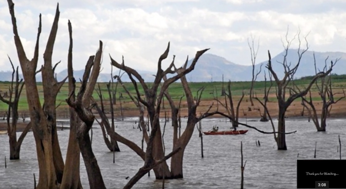
So what caused the destruction of the forest? Modern research suggests that there was not a single catastrophic event (as told in the tale of Cantre'r Gwaelod) or even a series of storm surges breaking through the coastal barrier -- but something more subtle. Between 6,000 BP and 4,700 PB there was a gradually rising water table in the forest, partly due to changing climate and increased rainfall and partly due to a decline in the isostatic uplift rate. the reasons are complex, and difficult to isolate. At any rate, there was impeded drainage and increased waterlogging, and the wetland forest was gradually overwhelmed by a sphagnum peat bog. This is what caused the death of the trees. Later on, when there were storm surges, the barrier was breached and gradually driven inland (in much the same way as the Newgale storm beach ridge), passing over the peat beds and a spectral woodland of dead and ghostly trees........... Many of the bigger trees may have been knocked over not by hurricanes and storm waves but by the migration of the storm bach ridge. Much less romantic than we would like to think, but that's what the evidence strongly suggests........


This is what it might have looked like BEFORE the sea came crashing in...... imagine lots of pools and sphagnum moss......


This is what it might have looked like BEFORE the sea came crashing in...... imagine lots of pools and sphagnum moss......
So we have another theory for the sticky grey or blue clay beneath the submerged forest. From the evidence presented above, it would appear that the clay was not formed in a period of sparse vegetation in the "ten lost millennia" between 20,000 and 10,000 years ago -- but that it is much more recent, formed on a marine foreshore at the culmination of the rapid post-glacial rise of sea-level, as recently as 6,000 yrs BP. I have to say that the evidence, at least from the Borth - Ynyslas - Clarach area, is quite persuasive.
But along this part of the Cardigan Bay coast there were some quite unusual circumstances, including residual isostatic uplift of the shoreline, a vast sediment supply of silt and clay from the Dyfi estuary, and a sheltering offshore bar. To what extent can the "Ynyslas story" be transferred across to the submerged forest sites further south, like Newport, Whitesands, Newgale, Freshwater West, Lydstep, Amroth, and Marros?
I'll do another post exploring this issue.
============================
Key publications:
THE EVOLUTION OF THE BRISTOL CHANNEL, WITH SPECIAL REFERENCE TO THE COAST OF SOUTH WALES. Paperback – 1929. 3rd edition revised and enlarged 1964. 110 pp.
by F. J. North, published by National Museum of Wales
QUATERNARY OF WALES (Geological Conservation Review), edited byS Campbell and DQ Bowen, NCC, 238 pp.
New insights into the Quaternary evolution of the Bristol Channel, UK. Philip L. Gibbard, Philip D. Hughes, Christopher J. Rolfe
Journal of Quaternary ScienceVolume 32, Issue 5Research Article
First published: 21 May 2017
https://doi.org/10.1002/jqs.2951
The most detailed study of all is the 1985 doctorate thesis (Univ of Wales) by Alan Heyworth entitled "Submerged Forests: a dendrochronological and palynological investigation.
These are his conclusions for Ynyslas:
Heyworth, p 160
At c. 6000 B.P. the whole of the area was fen or salt marsh, and accumulation of clayey silt was still occurring. although at a rate much less than previously. amongst the marsh vegetation.
The River Leri probably discharged into an area of fen, excluding brackish water, and reaching the sea through mobile creeks and channels. Direct tidal flooding from the west was probably largely prevented by a spit, growing out from the Sarn, rather than from the present coastline (Sarn Cynfelyn is, even now, exposed at L.W.S.T.). The composition of the spit at this time is uncertain, but a plentiful supply of both boulders and sand was undoubtedly available. Brackish water tidal flooding would take place from the main channel of the Dovey, occupying much the same position as now (at some earlier period the channel probably followed a course further to the south).
By c. 5200 B.P., the marsh surface had built up to such a height that, apart frpm an area at the south end of Borth, it was above all but the highest flood levels. It is probable that, at c. 5500 B.P., the Leri, its previous exits blocked by accumulating sediments, broke through the spit, and established a more direct route to the sea.
The water table in the area to the north would thus be lowered, and the site would become suitable for trees. Pines were able to colon-ise some parts of ,the previous marsh with no intermediate carr stage. Some oaks were present at the northern margin, where conditions were wetter and more brackish. The spit appears to have consisted in part, at of since layers of wind-blown sand are present in and below the peats at Ynyslas.
Although sea level rise was, by this time, very gradual, the spit was, throughout this period, being pushed eastwards by the sea.
From c. 5200 B.P. to c. 4800 B.P., the pine forest flourished, and extended its area.
Between c. 4800 B.P. and c. 4000 B.P., however, the continued eastward movement'of spit, and the probable northward movement of the mouth of the Leri, combined with sea-level rise, caused the water-table in the forest to rise, killing the pines, which were replaced by carr and fen vegetation. These conditions persisted for a long period, and a considerable thickness of peat grew up around the tree stumps, as the rise in water level continued. At around 4000 B.P. oaks were growing, in very wet conditions, at the southern end of the even these were killed by increased waterlogging at c. 3100 BP.
Heyworth supplies multiple radiocarbon dates for the tree remains at Ynyslas -- they range in age from 5,900 BP to 3,700BP.
In his consideration of Ynyslas and other sites Heyworth is reluctant to accept that there was any stage a shoreline regression during which marine clays were covered as a result of the expansion of freshwater lagoons, peat beds and then drier woodland seawards. All of his explanations of stratigraphic relationships involve biological processes and changes in coastal geomorphology. In some cases this seems like special pleading -- and if I had examined this thesis I would certainly have raised questions of isostatic rebound rates in the areas studies. But overall, a very interesting thesis
Very interesting indeed, thank you. Abermawr is the one I have known best over the years and this year there has certainly been more exposure than I have seen before. Has any work been done on identifying the tree species from what remains? It appears to me to be oak but that is purely conjecture and I would love to know the expert opinion.
ReplyDeleteThank you for that very interesting and informative read. I have a couple of small pieces of tree from the peat bogs on Marros, if they are of any use to anyone (re: above comment about tree identification). They are currently drying out on my windowsill from our walk last Sunday 1st March.
ReplyDeleteThere are many published lists of the trees identified. Alder, birch, pine, oak, and hazel seem to be the most common, with some willow, lime, bog myrtle, holly, ash and elm. No sycamore or beech, as far as I can see...... but otherwise very similar to modern deciduous woodlands.
ReplyDelete