THE BOOK
Some of the ideas discussed in this blog are published in my new book called "The Stonehenge Bluestones" -- available by post and through good bookshops everywhere. Bad bookshops might not have it....
To order, click
HERE

Wednesday, 6 April 2022

The fantasy of Glacial Lake Nevern

The glacial lakes assumed (by the BRITICE team) to have existed in NE Pembrokeshire and the Teifi Valley.  There is good evidence for "Glacial Lake Teifi" in the published literature, even though its outlines may not have coincided with those shown here -- but "Glacial Lake Nevern" is pure fantasy, dreamed up almost a century ago, and it should have no place in a supposedly scientific research document.


Last night I was checking out some of the features mapped on the BRITICE Chrono map of Devensian features in the British Isles -- which is flagged up as THE definitive map.   I was amazed to find that the version currently available on the web still shows "Glacial Lake Nevern" -- a feature that has not a scrap of evidence in support of it, as many of us have been pointing out for half a century or more. There are no shorelines, no rafted deposits, no varved lake clays or other sediments, no moraines marking the position of an ice dam, and no evidence of any sort relating even to a short-lived body of standing water that covered the area proposed.  In short, Glacial Lake Nevern was a fantasy from the beginning, dreamed up by Charlesworth because he was obsessed with glacial lakes and overflow channels..........

On the map, the lake is shown as covering Cilgwyn, Felindre Farchog, Crosswell, Brynberian, Penygroes and the whole of the low-lying area on the north flank of Mynydd Preseli, with an outlet or "overflow" into Cwm Gwaun.  

This is quite extraordinary.  How is it that Chris Clark and his colleagues in the supposedly high powered BRITICE team have simply perpetrated a myth that is a century old in a publication that is supposed to represent all the latest sophisticated science?  Don't ask me what the answer is -- ask them! 

It's rather sad, after all my criticisms of archaeologists for the perpetration of assorted bluestone myths including the human transport myth, the quarrying myth and the lost circle myth, that I now have to accept that in my own field -- glacial geomorphology -- there are other myths almost a century old that are still being flagged up in spite of the vast accumulation of evidence showing that they are speculative and even nonsensical.

All that having been said, there is limited evidence for meltwater lake clays on Brynberian Moor, and I have discussed the likely extent of "Glacial Lake Brynberian" as a short-lived feature associated with ice wastage and ice edge retreat northwards down a reverse slope.  There might have been one lake a few kilometres long, or a series of short-lived smaller lakes impounded by detached masses of wasting glacier ice.  Such short-lived lakes might have existed in multiple locations during the catastrophic melting of the LGM ice in West Wales.

====================

See this:

Sunday, 26 November 2017

BRITICE Glacial Map 2 -- a mixed blessing


This is what I said:

The outlines of Glacial Lake Teifi more or less coincide with what we see in assorted published papers, but the other information shown on the map is very scanty indeed for the Cardigan - Moylgrove area. That must disappoint many of the authors who have published their research findings, with considerable local detail on the record. When we zoom in on Preseli and the hypothetical area of "Lake Nevern" we find even more problems. Why is "Lake Nevern" shown at all? So far as I am aware, nobody since Charlesworth in 1929 has taken it at all seriously, and many papers by a variety of authors have shown that the "evidence" for it does not withstand scrutiny. The paper authors site "George 1970"as their source of information, but George was simply citing (very uncritically) Charlesworth, and provided no evidence for this so-called lake. Careless. As readers of this blog will know, there are a few places where thin laminated (lake?) sediments appear to be present on the northern flank of Preseli, but they are better explained by short-lived ponding of meltwaters in complex terrain in a dead-ice environment. I have called this "Lake Brynberian" -- a possible small lake of limited duration and extent. There are other fluvioglacial landforms and moraines in this area which are in the literature. They should have been mapped, but have not been. And where did that impounded lake at Pontfaen come from? I am aware of no evidence in support of it.

https://brian-mountainman.blogspot.co.uk/2015/05/lake-brynberian-further-thoughts.html

The impression is gained that this map has been produced by researchers accessing satellite and bibliographic data and sitting in front of computer screens, unlike the BGS bedrock and sedimentary map for the UK which has been based largely upon the field notes of surveyors working in the field. Black mark for BRITICE, and glowing praise for the BGS. In the abstract to the paper, the authors state: "All published geomorphological evidence pertinent to the behaviour of the ice sheet is included, up to the census date of December 2015." That is patently not true. There are abundant references in the literature (just a few of them by me, and many others as well) that have clearly not been consulted.

The explanation of how the "glacial lake" information was added to the map:


BRITICE Glacial Map, version 2: a map and GIS database of glacial landforms of the last British–Irish Ice Sheet
Chris D. Clark, Jeremy C. Ely, Sarah L. Greenwood, et al
Boreas: 29 August 2017
https://doi.org/10.1111/bor.12273

The cited lake evidence used by the BRITICE researchers is said to have come from this source:

https://www.sciencedirect.com/science/article/abs/pii/S1040618211004320?via%3Dihub

Quaternary International
Volume 260, 18 May 2012, Pages 115-142

Middle and Late Pleistocene glacial lakes of lowland Britain and the southern North Sea Basin

Della K.Murton and Julian B.Murton

........ and their source was TN George, in the British Regional Geology of 1970, who in turn cited Charlesworth's 1929 paper on the South Wales End-moraine.  At no stage in this process of citations of older work was any critical scrutiny applied, as I noted in the following blog post:

Tunnel valleys in the Celtic Sea


Tunnel valleys and other features showing a Late Devensian radiating ice flow in the Celtic Sea arena

This is another interesting article relating to the wastage phase of the Celtic Sea ice lobe -- or that part of the Irish Sea Ice Stream that occupied the Celtic Sea out as far as the shelf edge around 27,000 years ago.  This study of fluvioglacial features supports the concept of a catastrophic ice melt episode across the whole extent of the area shown on the above map in just a few thousand years.

I have considered the position of the eastern edge of the wasting "ice lobe" before:


https://brian-mountainman.blogspot.com/2020/04/the-devensian-celtic-sea-piedmont-lobe.html


......but there still seems to be a reluctance on the part of those involved in the BRITICE Chrono project to accept that ice flows according to a rather basic set of glaciological principles, including the principle that ice lobes will always spread laterally unless they are constrained by topography or by an adjacent ice mass.  Do here, once again, we see a reluctance to accept that the Isles of Scilly were effectively a nunatak with ice flowing broadly southwards on both the western and eastern flanks -- in spite of rather clear evidence of seafloor streamlining between Scilly and the tip of Cornwall.  Why should there be a problem with this?

Associated with this is the assumption that the outer part of the Bristol Channel was not affected by LGM ice.  Where did this idea come from?  Well, it came from some very old articles purporting to show that only the north coast of Pembrokeshire was affected by Late Devensian ice, in spite of the fact that I showed many years ago that the ice of the Irish Sea Glacier affected the mouth of Milford Haven at the same time.  If it did that, the ice must also have pressed into the outer reaches of the Bristol Channel, if not into the area to the south of the Gower Peninsula.  This is of course confirmed by all the evidence which I have collected over the last few years relating to glacial sediments around the south Pembrokeshire coast, including the published evidence from Ballum's Bay on Caldey Island.


If you look at the alignments of the tunnel valleys and other channels on the map above, the pattern is indubitably one that shows a radiation pattern of ice flow -- exactly what one would expect, and exactly what I have been arguing for the last 50 years or more............

With regard to the black line on the map purporting to show the ice edge at 25,000 years ago, it is not supported by any field evidence, and I suspect that the eassetrn part of the line is in quite the wrong place -- it should be much further to the east.  The purported ice edges for 24.7 ka and 24.3 ka might be more accurate,  and are supported to some extent by cosmogenic dating work.  

--------------------------


A Late Pleistocene channelized subglacial meltwater system on the Atlantic continental shelf south of Ireland.

Giglio, C., Benetti, S., Sacchetti, F., Lockhart, E., Hughes Clarke, Giglio, C., Benetti, S., Sacchetti, F., Lockhart, E., Hughes Clarke, J., Plets, R., Van Landeghem, K., O Cofaigh, C., Scourse, J. & Dunlop, P.  

Boreas, 2022 (January), Vol. 51, pp. 118–135.

https://doi.org/10.1111/bor.12536

ABSTRACT

The studyof palaeo-glacial landforms and sediments can give insights into the nature and dynamics of ice sheets. This is particularly the case with regards to the subglacial record, which is challenging to observe in contemporary glaciated settings and hence remains only partially understood. The subglacial hydrological system is an essential component of ice dynamics, where increased water pressure enhances ice motion and sediment deformation, thus reducing ice-bed contact. Tunnel valleys are large, sinuous, steep-sided incisions that, together with smaller scale meltwater channels, indicate subglacial meltwater discharge beneath large ice sheets. Through the use of high-resolution marine geophysical data, a system of buried and exposed tunnel valleys, possible subglacial or proglacial meltwater channels and palaeo-fluvial valleys have been identified across the shelf of the Celtic Sea between Ireland and Britain. The presence of steep-sided and overdeepened tunnel valleys is indicative of a large channelized meltwater drainage system beneath the former Irish Sea Ice Stream, the most extensive ice stream to drain the last British–Irish Ice Sheet. After the rapid ice expansion across the Celtic Sea shelf around 28–26 ka, the tunnel valleys were carved into both bedrock and glacigenic sediments and are associated with rapid ice stream retreat northwards into the Irish Sea Basin between 25.6and 24.3 ka. The presence of a major subglacial meltwater system on the relatively shallow shelf suggests that significant erosive meltwater discharge occurred during the last deglaciation and highlights the important contribution of meltwater to the retreat of the British–Irish Ice Sheet on the continental shelf. 

Tuesday, 5 April 2022

Was there a late Welsh Ice cap advance following the LGM?


The study area on the SE coast of Ireland

This is an interesting and rather specialised paper which describes a late expansion of the Irish Ice Cap on the coast of southern Ireland, following the wastage and ice-edge retreat of the Irish Sea Glacier.  On the coast of Ardmore Bay, at the time of the LGM, Irish Sea ice travelled from the east towards the west.  However, following ice retreat into what is now the offshore zone, Irish ice expanded, with some of it flowing in precisely the opposite direction.  A little further to the east, there was a 90 degree change in the direction of ice flow, with Irish ice from the Midlands flowing southwards towards a snout position more than 20 km offshore. 

What happened on the west side of St George's Channel may well also have happened on the east side......

 There is evidence of a late Welsh ice advance in North Wales, but the evidence from Cardigan Bay and the South Wales coast is more equivocal.  Indeed, the evidence from New Quay and elsewhere suggests that there might have been a "Welsh" glacial phase, with ice from the Welsh ice cap flowing out across the coastline, BEFORE the maximum extent of the Irish Sea Glacier, but not afterwards.  All very confusing.  Watch this space.......

 ==========================

Geomorphological and seismostratigraphic evidence for multidirectional polyphase glaciation of the northern Celtic Sea

Zsuzsanna Tóth, Stephen Gerard McCarron, Andrew James Wheeler, Volkhard Spiess et al

February 2020

JOURNAL OF QUATERNARY SCIENCE (2020) 1–14JOURNAL OF ,e of the LGFM a=SCIENCE (2020) 1–JOURNAL OF QUATERNARY SCIENCE (2020) 1–14

DOI:
10.1002/jqs.3189


Abstract

High‐resolution seismic and bathymetric data offshore southeast Ireland and LIDaR data in County Waterford are presented that partially overlap previous studies. The observed Quaternary stratigraphic succession offshore southeast Ireland (between Dungarvan and Kilmore Quay) records a sequence of depositional and erosional events that supports regional glacial models derived from nearby coastal sediment stratigraphies and landforms. A regionally widespread, acoustically massive facies interpreted as the ‘Irish Sea Till’ infills an uneven, channelized bedrock surface overlying irregular mounds and deposits in bedrock lows that are probably earlier Pleistocene diamicts. The till is truncated and overlain by a thin, stratified facies, suggesting the development of a regional palaeolake following ice recession of the Irish Sea Ice Stream. A north–south oriented seabed ridge to the north is interpreted as an esker, representing southward flowing subglacial drainage associated with a restricted ice sheet advance of the Irish Ice Sheet onto the Celtic Sea shelf. Onshore topographic data reveal streamlined bedforms that corroborate a southerly advance of ice onto the shelf across County Waterford. The combined evidence supports previous palaeoglaciological models. Significantly, for the first time, this study defines a southern limit for a Late Midlandian Irish Ice Sheet advance onto the Celtic Sea shelf.

Monday, 4 April 2022

The Late Devensian glaciation of Carmarthen Bay


Ragwen Point, near Pendine.  Blue-grey diamicton made predominantly of clay and silt, with small fragments of shales and mudstones and sandstone blocks derived from pre-existing slope breccia. It's at beach level, and it is clearly in a secondary position, having flowed / slid downslope from its original position.   Interpreted as a local Late Devensian till laid down by Irish Sea ice flowing west to east along the old cliffline at Ragwen Point.


Multiple opinions about the extent of Late Devensian ice across South Wales

Having been collection field evidence from here and there over past weeks, I am now convinced that I have got it all wrong in the past with regard to the LGM in west Wales. Everybody else has got it wrong too. A reminder of the multitude of suggestions in the specialist literature, arising out of a too-easy acceptance of the Older Drift - Younger Drift ruling hypothesis and out of the sheer difficulty of interpreting the field evidence in central and southern Pembrokeshire. The evidence is not that easy to interpret in north Pembrokeshire either!!

Having argued for years in favour of a substantial unglaciated enclave across much of southern Pembrokeshire, I am having to confront the fact that every time I visit the South Pembs coast, I come away with evidence of quite recent glaciation, or at the very least, evidence that shows the same stratigraphy -- and hence the same sequence of events -- as the coasts of north Pembrokeshire and St Bride's Bay.

South Pembrokeshire

So now we have evidence of sticky blue clay with faceted and abraded erratic pebbles beneath the offshore peat beds and submerged forest at Freshwater West, Amroth, Marros and Pendine. There are blocky slope breccia materials in the clay as well, but I cannot think of any better explanation for it, other than to say that it is a till carried and deposited by glacier ice travelling from the west towards the east. We have fresh clifftop till at scores of locations along the south Pembrokeshire cliffline. The erratics at Flimston, Loveston and many other sites on the south Pembrokeshire coastal plateau are suggestive of ice that has travelled overland broadly from the NW towards the SE (but admittedly these erratics might have been carried and emplaced in an earlier glaciation). We have the red uncemented till at Ballum's Bay on Caldey Island which I insist must be of LGM age. (In this I differ from Prof John Hiemstra and colleagues at Swansea University, who claim that it is a redistributed ancient till.) Inland, we have apparently fresh fluvio-glacial gravels at Picton Point, at the confluence of the two Cleddau branches, and sticky clay till at Landshipping. We have scattered till patches and fluvio-glacial materials in many locations across south Pembrokeshire, as confirmed by the field geologists of the Geological Survey. And my recent discovery of sticky blue-grey till in the exposures at Ragwen Point again suggests eastwards-travelling ice, and pushes the Late Devensian ice limit much further east than any other worker has ever suggested.

To summarise the Pembrokeshire evidence:

1. There are far too many spreads of glacial and fluvio-glacial deposits in those parts of Pembs deemed to be outside the LGM limit. Some of them, at least, appear quite fresh, and some even have surface expression. They are by mo means all "degraded or denuded" and are by no means restricted to hilltops or interfluves, as claimed by some.

2. The glacial deposits in the valleys and on the clifftops of South Pembrokeshire are so abundant and so fresh that they have to be Devensian. The exposures are itemised on this blog. I now think that there are glacial deposits around  Marros and Pendine as well; and these are best explained by ice pushing in from the west and the north, and not from the south.

3. The glacial and fluvioglacial deposits around Picton Point and Landshipping, right in the centre of the county at the confluence of the two Cleddau rivers, cannot adequately be explained without invoking a complete ice cover across Pembrokeshire. I have another report of fresh till near Haverfordwest.

4. Over and again I have described on this blog glacial deposits and apparent trimlines at a variety of altitudes on the northern side of Preseli, up to an altitude of 340m. It looks to me as if that was the altitude of the highest Devensian ice surface associated with Irish Sea ice. If the ice covered Carn Ingli and pressed onto the northern flank of the Preseli ridge at that altitude, it would make no sense for the ice edge to be at or near present sea level around the mid and south Pembrokeshire coast. Ice must have filled the Cwm Gwaun depression, and indeed I have described apparent morainic features above and on the south side of the meltwater channel, and at Cilgwyn and Tafarn y Bwlch. Nor does it make any sense for an ice edge to be parked around the 200m contour in the vicinity of Wolfscastle and Letterston, as suggested by the BGS. If the ice was coming in from the NW, it MUST have inundated the whole of Pembrokeshire to the south of Preseli, according to the laws of ice physics. The ice edge might have been slightly lower on the southern flank of the Preseli ridge. I now think that the assorted morainic ridges and glaciofluvial mounds in and around the Preseli uplands may be associated with retreat stages or short-lived readvances -- still to be defined.

None of this eliminates the possibility that there are Anglian or Wolstonian glacial and meltwater deposits in the area previously designated as an ice-free enclave. As indicated on this blog, I think there are ancient glacial deposits at Ceibwr, Witches Cauldron and Black Mixen, Lydstep; and Prof Danny McCarroll and I are rather convinced that glaciofluvial gravels exposed at Llangolman may well be very old indeed.

https://brian-mountainman.blogspot.com/2019/07/caldey-island-till-must-be-late.html

The South Pembrokeshire Quaternary regional stratigraphy (based on my own observations and those of Dixon and Leach) is as follows:

8. Sandy loam and blown sand
7. Upper head (uncemented)
6. Fluvioglacial sands and gravels -- traces
5. Till from Dewisland (Devensian) glaciation -- many coastal exposures
4c. Lower head (cemented in some localities)
4b. Cemented sands (sandrock)
4a. Head incorporating raised beach cobbles (cemented)
3. Cemented raised beach
2. Older glacial deposits -- mostly destroyed, but exposed at Lydstep (Black Mixen)
1. Raised beach platform (complex modifications over several interglacials?)

The Gower Peninsula

What of the other evidence from Carmarthen Bay and the Gower?   There seems to be an emerging consensus:

https://brian-mountainman.blogspot.com/2018/11/the-glaciations-of-gower.html

1. There are not multiple interglacial raised beaches on Gower, as suggested by DQ Bowen, but one raised beach which is sometimes cemented and sometimes not, and which occurs at a range of different altitudes depending on precise locations on peninsulas, in bayheads etc. The beach always contains well rounded pebbles and in some places it is very rich in shell fragments and even complete shells. It's dated to the last (Ipswichian) interglacial.  

2. There is plenty of evidence of a prolonged periglacial episode following the formation of the interglacial raised beach, since here and there we see many metres of pseudo-stratified slope deposits or "head" above the raised beach and beneath the glacial and fluvioglacial materials. (This is exactly the sequence we see in Pembrokeshire.) Sometimes the head is cemented, and sometimes not.  The slope breccia must have accumulated during the Early and Middle Devensian.

3. The glacial sediments exposed in the cliffs at Rotherslade, Horton and elsewhere are not ancient deposits moved into place by periglacial and slope deposits, but fresh materials emplaced at or very near a Late Devensian ice edge, with chaotic and even catastrophic flowing and emplacement of till and mixed fluvioglacial materials at a time of rapid ice wastage.

4. The Paviland Moraine near Horton, which was interpreted by DQ Bowen as well beyond the Devensian ice margin (and hence a very ancient glacial feature) contains material which is no more ancient than any of the other glacial and fluvioglacial materials exposed in the cliffs. It should therefore be re-interpreted as a Late Devensian feature -- deposited maybe during a long ice edge stillstand at this position, on a ridge not far from the southernmost tip of Gower.

Traces of terminal moraine loops in Swansea Bay, interpreted as evidence of very powerful ice from confluent valley glaciers or ice streams pushing out into the Bristol Channel lowlands during the Late Devensian


The West Glamorgan coast

As far as the east coast of Swansea Bay and the Vale of Glamorgan are concerned, there has been a consensus over many years that there was a Late Devensian ice edge near Porthcawl.  It has been assumed that this ice edge was associated with Welsh ice flowing southwards from the Welsh Ice Cap; but this has been called into question by Wilson et al in the new Geological Survey Memoir following a re-examination of the evidence from Ewenny and Pencoed, and the erratics of the Storrie Collection.


The authors of the new Memoir suggest that the deposits around Ewenny might well be Late Devensian rather than Anglian in age -- and if this is accepted, then the famous erratics from the west might have been emplaced by the eastward-flowing ice of the Irish Sea Glacier.  The recent discovery of a giant erratic at Limeslade, near Mumbles, and the discoveries of granite and other far-travelled erratics on the south coast of Gower tends to reinforce the idea that the ice of the Devensian Irish Sea Glacier was powerful enough to intermittently affect the south Wales coast in multiple locations.  How the junction between Welsh ice and Irish Sea ice oscillated over time still has to be worked out........... 

Discussion:  was there an ice-free enclave?

I have published versions of this map several times.  If we now accept that there are fresh glacial deposits in the Amroth - Marros - Pendine area, we are left with in ice-free enclave (completely surrounded by glacier ice) which is glaciologically vanishingly unlikely. this is not, after all, an area of complex high relief --mid and south Pembrokeshire is an undulating lowland with incised river valleys that slopes gradually southwards from the Mynydd Preseli foothills.  Ice must maintain a sloping profile in an area like this from source area towards snout.  For Irish Sea ice to have affected the coast of Carmarthen Bay, the WHOLE of Pembrokeshire must have been inundated.


Note the suggested ice-free enclave.  I no longer think
 that this idea is tenable......
 
There are still many questions to be answered, but it seems to me that the time is ripe for a reappraisal of how extensive the ice cover of South Wales was in Late Devensian time, and which areas might have been affected by Irish Sea ice.  My main suggestion (as of today) is that there was no ice-free enclave in Pembrokeshire. There is just not enough evidence to support it.

By removing the ice-free enclave and accepting that all of Pembrokeshire was covered by glacier ice (which may not have been very thick) we come to a map that looks something like this:


One recent attempt to portray the extent of Late Devensian glacier ice across South Wales.  New evidence suggests that this meeds to be modified further..... 

So, to move on.......

The map below represents my latest hypothesis.  It seems to me to be based on quite sound evidence.  I hope that others may now be willing to join the discussion!


Suggested Late Devensian relationship between Irish Sea ice and Welsh ice.  In the contact zone between the two ice masses there must have been a southwards diversion of ice streams.  There must also have been considerable shifts in the ice contact position, associated with sharp changes in the ice movement directions.  Most of the South Pembrokeshire coast is shown as being affected by Irish Sea ice, which must at some stages have flowed more or less west to east.  The ice cover over central and south Pembrokeshire might have been rather thin.  Swansea Bay was affected mostly by a powerful ice stream made up of ice flowing in the Nedd and Tawe valleys -- but at one time Irish Sea Ice might have dominated, possibly reaching Pencoed and Porthcawl.  Gower is shown as completely submerged beneath Welsh ice, but at some stages the south coast might have been affected by Irish Sea Ice.  Mynydd Presely might have had its own local ice cap in the waxing and waning phases of the glaciation.  In Carmarthen Bay there was a conflict between Irish Sea ice coming from the west and Welsh ice flowing via the Tywi and other valleys.   


Sunday, 3 April 2022

Raised beach and sandrock exposure at Ragwen Point


The Ragwen Point cemented raised beach -- grid ref SN 21874 07188

I have seen various passing references in the literature to the raised beach and sandrock exposure at Ragwen Point, but it was quite exciting to come across it quite by accident during yesterday's visit to the Pendine area.  The officers of the Geological Survey mentioned it in 1909, and David Bowen published a simplified section from the site in 1970.  DQB referred to TWO raised beaches in the exposure, which made things rather confusing -- so it was good to be able to check that out.........


The exposure is tucked into the western corner of the little bay to the west of Ragwen Point proper, and is very well protected from storm waves except when they are rolling in from due south.  There is a sandy beach and a storm beach, and the slopes at the back of the embayment are chaotic, with cliff collapses and debris movement so frequent that except at the top of the cliff, almost nothing is in its original stratigraphic position. 


Accumulated rockfall / cliff collapse / slope breccia near Ragwen Point.  The local rocks are highly fractured Namurian (Marros Group) sandstones, shales and mudstones, overlain by Lower Coal Measures.  Rockfalls and debris flows are frequent.

The cemented raised beach has a somewhat sandy matrix and consists of well-rounded pebbles of many different sizes, mostly of local rock types, resting on small small and irregular rock platform remnants and ledges and plastered against the cliff face.  Some huge boulders are incorporated, all with smoothed corners and apparently much affected by wave action.


The cemented beach is up to 2m thick, and it incorporates patches of sandrock and also some relatively unmodified rockfall debris.  It is overlain by buff-coloured sandrock, but in one exposure reddish sandrock is seen to be overlain by another "raised beach layer" about 50 cm thick and made of well-rounded pebbles in a sandy matrix.  David Bowen wondered whether there might be two "raised beach episodes" or interglacials represented here -- but I think all these deposits belong to the same episode, with the upper pebble bed simply representing an exceptional stormy episode in which pebbles were flung up onto pre-existing sandy beach or dune material.  


Above this layer there are about 2m of buff coloured sandrock with occasional beach pebbles or rockfall fragments, with traces of stratification. There are many irregular cavities, presumably caused by the washing out of weathered material.   This grades up to a 1m thick layer of foxy-red sandrock that looks as if it contains colluvium or slopewash material.  This contains fewer rockfall fragments than the layer below.  

Above that is a disturbed dark-coloured layer that cannot be reached -- is it an organic-rich layer, and is it in its "correct" stratigraphic position?  Somebody younger and fitter than I needs to climb up and check it out........  However, it's interesting that in 1970 DQ Bowen described a "sandy silty mud"  with abundant organic remains above the raised beach and beneath brecciated slope deposits at Marros, just around the headland to the west.  The organic remains which were identified were listed on P 223 of "The Glaciations of Wales" and were interpreted as typical of a largely treeless environment from the end of the Ipswichian Interglacial.  This deposit at Ragwen Point is in a stratigraphically identical situation.......

At the top of the colluvial layer is another layer about 50 cms thick and which is clearly stratified -- with some flat-lying slabs of rock and with what appear from below to be bands of iron-rich hardpan. Again this layer needs to be examined.

Above this level the slopes at the head of the embayment have been so mobile, with rockfalls and debris flowage all over the place, that it is very difficult to see what material is in its correct stratigraphic position and what is rearranged or redistributed.  In the slump scar we can see up to 4m thickness of brecciated slope deposits that have clearly accumulated on the coastal slope.


In some places these slope deposits appear to have no stratigraphic junctions within them, but elsewhere there appear to be interbedded grey-blue deposits with a high percentage of clay and silt, and containing abundant fragments of shale and mudstone that appear to have come from the Coal Measures to the west.  There are also some foreign erratics with abraded edges, and I interpret this deposit as Irish Sea Till.  Very little of it is in its original (primary) position, and in places masses of it have slumped or flowed down to beach level.


Brecciated slope deposits (partly periglacial?) exposed in the slump scar.  Here there is no trace of till. 


A patch of blue-grey till in a secondary position, but still as a coherent mass.  Note the staining where material has been washing down over the exposure of colluvium and sandrock.

Near the top of the slope in the photo above, we can see material of this colour in the sediment exposure, overlain by some slope breccia and underlain by similar material.  My interpretation is that patchy till has been deposited here in an environment dominated by frost shattering and slope breccia accumulation.  Was there a complete ice cover?  Quite possibly.  Where did the ice come from?  My best guess is that it was flowing eastwards along the coast, since the till consists almost entirely of silts and clays from the floor of Carmarthen Bay, with comminuted fragments of  Coal Measures mudstones, shales and even coal-bearing beds.  There are a few sub-rounded boulders as well, unfortunately in inaccessible positions on the cliff face.  

In a number of publications DQ Bowen insisted that there was a complete lack of glacial deposits and a complete lack of foreign erratics at Ragwen Point -- but he was wrong on both counts.  I found as very distinctive cobble of red granite on the beach, which could have come from any one of the glaciations that have affected this area.  There are other small igneous erratics on the beach which I did not recognise. And the till in the exposures and on the coastal slope is uncemented and therefore almost certainly of Late Devensian Age. In any case it is in the "right" stratigraphic situation as compared with Abermawr, Druidston, Porthclais, Whitesands and a host of other locations around the Pembrokeshire coast. 

So the stratigraphy at Ragwen Point is as follows:

Modern soil and "slopewash"  30 cms
Upper slope breccia -- up to 2m
Patchy blue-grey clay till -- c 2m?
Lower slope breccia and rockfall debris -- up to 4m
Hardpan / cemented silty layers c 40 cm
Dark organic silts 30 cm
Iron-stained sandy layer (cemented)  1m
Buff coloured sandrock with cavities and rockfall inclusions  2m
Raised beach with large embedded boulders and sandrock layers  2m

Further work is needed both here and around the corner in Marros Bay -- but this section confirms that the Ipswichian / Devensian history here at the SE extremity of Pembrokeshire is exactly the same as that  of the Cardigan Bay coast.  


Saturday, 2 April 2022

Morfa Bychan -- giant blocks of cemented slope breccia


Blocks of concreted slope breccia close to the cliffline (Photo courtesy John Downes)


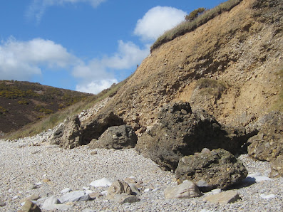
This has to be one of the strangest coastal landscapes I have seen anywhere in Wales.  At the east end of the Morfa Bychan storm beach, where the cliffline extends out to Gilman Point, there are huge blocks of cemented slope breccia (made of shattered blocks and shards of sandstone and shale) resting on the storm beach.  It's difficult to get a sense of scale when you look at them from a distance, but up close they are rather impressive -- up the the size of caravans.  I estimate that some of them weigh upwards of 200 tonnes.  This is a carbonate-rich environment, with Carboniferous Limestone outcropping at beach level -- so that's where most of the cement has come from.  But there also seems to be iron oxide and manganese oxide cement in places. There are some cemented breccia layers outcropping at the base of the breccia cliff face around HWM, but others can be seen more than 10m above HWM in the vast scar that has been cut into the valley slope.  The slope breccias are chaotic, formed more through occasional cliff falls and slope collapses than through the slow accumulation of layer after layer.  It's difficult to work out any history of sedimentation here, apart from saying that these slope materials have accumulated over many thousands of years.  There is no way that this cliff exposure can be tied in to any glacial sequence.

Most of these vast blocks are resting on the beach cobbles, and some have travelled more than 50m from the cliff face.  Those most distant from the cliff face have been subjected to some modification by storm waves, and are grey in colour instead of grey-brown to black.

One of the freshest "breccia boulders" (bottom photo) rests on the undulating upper surface of the Carboniferous Limestone beds at the foot of an overhanging sandstone cliff; it has clearly come crashing down from a height of at least 15m.


The Llan erratic cluster


The three boulders in the field, on a slight mound.  The quartzite boulder is smaller, 
and is barely visible.

Plan of the stones still visible at the Llan site.  (Annotated from the plan drawn by Chris Barker in 1989)

Erratic cluster or Neolithic cemetery?  I went over to the Llan, near the old primary school in Lampeter Velfrey, yesterday, and found the site rather interesting.  One ruined burial chamber, or several?  The whole site is so comprehensively destroyed that it's difficult to work out what has been going on -- and the archaeologists are in disagreement about whether there were one, two or three burial chambers here.  My money is on three, because there are three large recumbent stones that look large enough to have been capstones.  

All of the stones are clearly glacial erratics -- they are heavily abraded and weathered, and have highly irregular shapes.  They have clearly just been used because they were lying around in the neighbourhood.  The burial chambers must have been very crude.  In the assortment of ten stones there are three spotted dolerites (maybe from different sources) and -- lost in the brambles in a mayflower thicket -- three very coarse blue-grey quartz conglomerates.  Where have these come from?  I'm no expert, but the only extensive conglomerate supposedly found within ten km of this site is the Early Devonian Ridgeway Conglomerate which often has a dark red (ORS) colouring.  And that is only exposed to the south of the Ritec Fault.   More research needed......


Above:  the three spotted dolerites


The dark grey conglomerate, packed with quartz pebbles.  Something of a mystery....... Ordovician, Silurian, or Devonian?

PS.  I think there may be outcrops of Lower Old Red Sandstone conglomerates not very far away from this site.  According to the lexicon, there are localised fan deposits in some strata, incorporating conglomerates.........