THE BOOK
Some of the ideas discussed in this blog are published in my new book called "The Stonehenge Bluestones" -- available by post and through good bookshops everywhere. Bad bookshops might not have it....
To order, click
HERE
Showing posts sorted by relevance for query Thomas ice edge. Sort by date Show all posts

Monday, 8 April 2024

What did HH Thomas know about the extent of glaciation?

I have been digging up some more info about what HH Thomas knew or did not know when he presented his controversial views on the transport of the bluestones in 1923.  (And in 1921, actually......)  

Let's take 1910 as a reasonable date to look at.  The "state of play" was determined at the time by such senior geologists and "glacialists" as James Geikie (far more important than his older brother Sir Archibald), Carvill Lewis, Frederick Wright,  Thomas Jehu and John Wesley Judd. 


Henry Carvill Lewis (1853-1888) , an American who did much fieldwork in the British Isles.  He proposed that the edge of the great Ice Age glaciation in Britain  coincided with a line of prominent moraines and other features which could be traces across country.  At first he found it difficult to accept that traces (such as erratic boulders) south of his limit were genuinely related to the presence of glacier ice, and he initially assigned them to some great Ice Age Flood. But later in his all-too-short life he fell into line with Geikie and others and did accept that the maximum position of the ice edge in the Ice Age was well to the south of his hypothetical line. 


Prof James Geikie (1839-1915), a Scottish geologist who was convinced that there was very extensive glaciation in the Ice Age, and that the ice limit in SW England lay somewhere off the Cornish coast. he was also active in promoting the idea that there had been several glaciations, separated by warmer intervals or interglacials.


Frederick Wright’s map of 1895, showing a strange ice limit across South Wales, based in part on Carvill Lewis’s identification of assumed terminal moraines. Wright ignored the abundant records of far-travelled erratics to the south of this line.


Europe and the greatest extent of glaciation during the Ice Age. From “Prehistoric Europe - A Geological Sketch”, by James Geikie (Edward Stanford, London, 1881). Note that Geikie incorporates the whole of the Bristol Channel area into the glaciated area, with an ice edge on or near Salisbury Plain……..


In this map, also from Wright (1895) a highly generalised line, based on the work of James Geikie, is drawn well to the south of the “moraines” identified by Carvill Lewis. Geikie recognised that the abundance of glacial erratics around the Bristol Channel coasts indicated extensive glaciation, at least as far south as the Cornish coast.


Extract from Harmer’s “erratic map” of 1928, showing erratic boulders and ”drift” exposures in abundant locations including South Pembrokeshire, Gower, Glamorgan and the Ilfracombe district — all to the south of the “moraines” mapped by Carvill Lewis. The work on this map was done between 1902 and 1913, and it must have been known to HH Thomas.
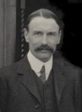


Prof Thomas Jehu (1871-1943) was born in Wales and later spent most of his working career in Scotland. As a young man he studied the glacial deposits of North Pembrokeshire, and published his findings in a highly regarded article in 1904. He recognized a tripartite succession in the drift sequence of Pembrokeshire -- namely Lower boulder clay, Middle sands and gravels, and Upper boulder-clay.  He characterised the latter deposit as a "rubbly drift" -- this is now recognized as a mixed deposit of melt-out till, flowtill and ablation till, rearranged and redeposited in a chaotic ice wastage environment.  Jehu agreed with Hicks that the Irish Sea ice that affected North Pembrokeshire flowed across the county from NW towards SE -- thus contradicting Geikie who had earlier portrayed the ice as having travelled from NE towards SW,


 Prof John Wesley Judd (1940-1916) was a prominent geologist who specialised in petrology.  He was Professor of Geology in the Royal College of Science and at Imperial College, and also President of the Geological Society.  Because he was London-based, he was right at the centre of things, and knew all about what was going on in assorted disputes and areas of progress.  He participated actively in the Stonehenge bluestone debate, and provided comments or additional material to some of the prominent archaeologists includingGowland and Hawley.  In 1901, Judd suggested that the bluestones at Stonehenge were erratics of glacial origin. He argued that the debris at Stonehenge had come from North Pembrokeshire or North Wales. He also observed that in areas affected by very ancient glaciations, most of the till had been eroded away by natural processes, leaving only a thin scatter of erratics here and there. Further, he observed that hard stones (including bluestones) left behind on Salisbury Plain would have been targetted down through the centuries for building purposes simply because neither chalk nor flint makes good building material.  Intriguingly, Judd concentrated not on the 43 known bluestone monoliths or orthostats themselves, but on the Stonehenge debitage. He found an extraordinary assortment of soft or fragile stones.  He made the point specifically that this material did not seem to be very closely related to the remaining standing bluestones -- so he concluded that only the hardest stones had survived, with all the other material breaking down and becoming incorporated into the soil layer over many thousands of years.  Judd suggested the presence of a “Stonehenge moraine” incorporating an abundance of foreign stones which would have been readily available to the builders of Stonehenge. He also argued -- perfectly plausibly -- that “stone availability” (of both bluestones and the larger sarsens) might have actually determined the precise position of the monument. 

============================

All things considered, the accumulated evidence shows that by 1910 the broad outlines of glaciation in the Bristol Channel / Celtic Sea arena were already established, involving thick and active ice carrying erratics and other glacial materials from the NW across Pembrokeshire and up the Bristol Channel, affecting the coasts of South Wales and the South-West Peninsula. In making his claims about the impossibility of bluestone transport towards Stonehenge HH Thomas wilfully ignored a great amount of evidence in the printed literature, and wilfully misrepresented the opinions of senior "glacialists". It is quite extraordinary that he got away with it -- but that, maybe, was because he was a geologist talking to archaeologists or antiquarians. If he had been a geologist talking to other geologists, he would certainly not have got away with it.  They would have had his guts for garters. 

Interestingly enough, the great majority of the articles published by Ixer and Bevins in recent years have also been published in archaeological journals -- and presumably they have been refereed for the most part by archaeologists. What a strange coincidence........!!


Tuesday, 27 October 2020

The Irish Sea Ice Stream footprint


This is my latest attempt to define the footprint of the Irish Sea Ice Stream as it might have appeared around 27,000 years ago.  It's bound to be wildly incorrect, but I still think it's more reliable than any of the other maps that have appeared in print.  I have tried to build into it the work by Scourse, Praeg, Lockhart and many others on the sedimentary record of the Celtic Sea and the increasing conviction on the part of many that the ice did indeed reach the shelf edge,  around 500 km SW of St Georges Channel.  I think this also fits the field evidence and most of the dating evidence -- but there are some seriously misleading (and incorrect) dates out there in the literature......  (The dates cannot all be right, because there are huge discrepancies.)

Note that there were two lobes which were parts of the Ice Stream -- one pushing into the Cheshire Plain to the east of the Welsh Ice Cap, and the other pushing through St George's Channel and extending (and spreading) southwards into the Celtic Sea.  It should really be called a piedmont lobe -- but at the moment there is no agreement on terminology.

The white lines and arrows relate to the Irish Ice Cap and the Welsh Ice Cap. Both of those fed ice into the ice stream, and there must have been interesting dynamics along the contact zone, with fracturing and shearing, serious thrusting on sediments, and many shifts of position of the ice margins.

We can refer to the ISIS as marine terminating (unlike the Baltic Sea Ice Stream) but parts of the terminus were land-based because at the time sea-level was around 140m lower than it is now.  i'm now rather convinced that both the Isles of Scilly and the summit of Lundy Island were nunataks projecting through rather thin glacier ice.

Work is needed on the differences between the "ice contact" margins, the "dry land" ice edges, and the marine terminating ice edges near the edge of the shelf.

One of the reasons why I have shown the ice piedmont spanning the whole extent between the south coast of Ireland and the coast of Cornwall is that the narrow lobe shown by other researchers does not make glaciological sense since they want it to flow across terrain in which there are no topographic constraints.  There must have been much more lateral spreading than they have been prepared to admit.

The other issue which still confuses me is the placing of the ice surface contours.  Ice in a vast ice stream / piedmont glacier like this can only flow forward all the way to the terminus if a constant surface gradient is maintained.  I made suggestions on this many years ago, and am prepared to admit that my surface gradient was steeper than it needed to be, given factors like basal sediments, bed lubrication, basal ice temperatures and shear stress.  This needs further thought......

Anyway, here is the hypothesis -- let's see what others think.

==========================

PS.  And this is interesting!  this is a summary of a 2020 conference presentation.   New data fixing maximum ISIS extent as around 26.5 ka, and catastrophic retreat between 25.3 ka and 20.6 ka.  Clearly this does not fit all that well with other dating, but no doubt it will all be sorted out in due course.......

I'm interested in the "opportunistic Welsh glacier advance" at around 19.7 ka -- that makes good sense to me.

Chiverrell, R., Thomas, G., Burke, M., Medialdea, A., Smedley, R., Bateman, M., Clark, C., Duller, G., Fabel, D., Jenkins, G., Ou, X., Roberts, H., and Scourse, J.: The evolution of the terrestrial-terminating Irish Sea glacier during the last glaciation, 
EGU General Assembly 2020, Online, 4–8 May 2020, EGU2020-9438, 


ABSTRACT
Comprehensive mapping and the Briticechrono geochronology provides a reconstruction of the last advance and retreat of the only land-terminating ice lobe of the western British Irish Ice Sheet. The Irish Sea Glacier was fed by ice from Lake District, Irish Sea and Wales, and extended to maximum limits in the English Midlands. During ice retreat after 27 kyrs, a series of reverse bedrock slopes rendered proglacial lakes endemic in the land-system. Not resembling the more extensive definitions of the classical ‘Glacial Lake Lapworth’, these ice contact lakes were smaller time transgressive moraine- and bedrock-dammed basins that evolved with ice marginal retreat. Combining, for the first time on glacial sediments, OSL bleaching profiles for cobbles with single grain and small aliquot OSL measurements on sands, has produced a coherent chronology from these heterogeneously bleached samples, and constrained for the Irish Sea Glacier a post 30ka ice maximum advance, 26.5±1.8ka maximum extent, and 25.3±1.6 to 20.6±2.2ka retreat vacating the region. With retreat of the Irish Sea Glacier an opportunistic Welsh re-advance 19.7±2.5ka took advantage of the vacated space and rode over Irish Sea Glacier moraines. Our geomorphological chronosequence shows a glacial system forced by climate, but mediated by piracy of ice sources shared with the larger and marine terminating Irish Sea Ice Stream to the west. The Irish Sea Glacier underwent changes flow regime and fronting environments driven by stagnation and decline as the primary impetus to advance was diverted. Ultimately, the glacier of the English Midlands display complex uncoupling and realignment during deglaciation and ice margin retreat towards upland hinterlands ~17.8 kyrs (Lake District and Pennines) and asynchronous behaviour as individual adjacent ice lobes became increasingly important in driving the landform record.

(The last point here matches what has happened in Svalbard.......)

The full paper is here:
The evolution of the terrestrial‐terminating Irish Sea glacier during the last glaciation
Richard Christopher Chiverrell , Geoff Stephen Powell Thomas, Matthew Burke et al
JQS Special edition, 07 July 2020
https://doi.org/10.1002/jqs.3229
https://onlinelibrary.wiley.com/doi/full/10.1002/jqs.3229

==================

PS.  There is another  new article which looks rather relevant..... I'll take a look...

Bed erosion during fast ice streaming regulated the retreat dynamics of the Irish Sea Ice Stream
Katrien J.J.Van Landeghem and Richard C. Chiverrell
Quaternary Science Reviews
Volume 245, 1 October 2020, 106526

https://doi.org/10.1016/j.quascirev.2020.106526

Friday, 1 July 2016

Ice in the Celtic Sea -- piedmont glacier or ice stream?


 These maps (which I published in 2011) show the alternative hypotheses for the glacier ice affecting the Celtic Sea.  There are inaccuracies on both maps, as recent publications have shown.

Below I reproduce the latest info from the BRITICE-CHRONO site, reporting on the ongoing programme of work.  Fascinating stuff!  As we can see, as the ice edge adjustments are being made,  there is a recognition that the ice that affected the Scilly Isles came from the NW and not from the NE (as would be required if an Irish Sea ice stream had affected the islands.  That accords with my observations on the islands, which I hope will be published before too long.

I have discussed this issue several time before, for example here:

http://brian-mountainman.blogspot.se/2011/04/whats-in-name.html 

If the ice really did flow from Ireland as a piedmont lobe, one might expect to find southern Irish erratics in the glacial deposits left behind.  I begin to suspect that there is truth in both scenarios.  Maybe there was a piedmont lobe during the early part of each glaciation, followed by a dominant ice stream towards the glacial maximum?

The other thing that I still have difficulties with is the idea of that long lobe projecting soith-westwards, where there should have been a calving bay.  I have not seen anything convincing in the literature to show that the ice that pushed further south than the Isles of Scilly was genuinely grounded.  The glacial deposits in that area are more probably dumped from glacier ice floating free, beyond a calving ice edge.  In other words, they are glacio-marine deposits with dropstones, rather than deposits of true glacial till.  we look forward to seeing further info on this from the Britice-Chrono team.

==============

Britice-Chrono

Transect 4 – Irish Sea West

http://www.britice-chrono.org/transect-4-irish-sea-west/

Team:  James Scourse (leader), Colm O'Cofaigh, Danny McCarroll, Geoff Duller, Dave Evans, Siwan Davies, L Yorke, Matt Burke, Katrien Van Landeghem, G Thomas

The Irish Sea Ice Stream (ISIS), the largest drainage conduit for the MIS2 British-Irish Ice Sheet  (BIIS; Fig. 1), was fed by ice flowing southwards from southern Scotland, northern Ireland and the English Lake District. It divided around the uplands of North Wales into two discrete sectors, the EIS flowing into the Cheshire-Shropshire lowlands and the western ISIS (here denoted as WIS) flowing southwards through the central Irish Sea and into the Celtic Sea. Glaciers emanating radially from the Welsh Ice Cap contributed to WIS north and west of of Wales, and from the Wicklow Mountains on the eastern side of the Irish Sea. On entering the Celtic Sea through the topographic constraint of St George’s Channel, WIS ice extended westwards along the south coast of Ireland west of Cork and southwards as far as the Isles of Scilly. WIS was grounded 100 km SW of Scilly where a palaeo-grounding line marks an LGM transition to a marine margin. Glacimarine sediments are found on the continental shelf south and west of this position.

Current understanding

The WIS is the best dated sector of the BIIS, but this database is populated entirely from 14C, OSL and cosmogenic data from onshore samples. The age and maximum southern limit of the WIS has been established in a series of papers, both onshore in the Isles of Scilly (Scourse, 1991; Hiemstra et al., 2006; McCarroll et al., 2010) and offshore (Scourse et al., 1990; Scourse & Furze, 2001) and correlated with the deep-sea IRD record (Scourse et al., 2000, 2009a;  Haapaniemi et al., 2010).

Timing and extent of WIS advance along the south coast of Ireland has been established by O’Cofaigh & Evans (2007). Reworking of proximal glacial and glacimarine sediments by strong tidal currents along the ice margin into tidal sand ridges has been established (Scourse et al., 2009b); this reworking has had the effect of removing or masking much of the glacial sedimentary record across the Celtic shelf. The BGS has an extensive archive of core material and seismic data from across the shelf but much of this remains uninvestigated, particularly in the northern Celtic Sea including the Celtic Deep Basin.

There are significant uncertainties in our understanding of the dynamics of the WIS. Whilst ice streaming has been assumed (e.g. Stokes & Clark, 2001; Roberts et al., 2007; Chiverrell et al. in prep.) an alternative hypothesis is that a piedmont lobe extended south of Ireland, driving ice southeastwards towards Scilly. Ice-flow indicators on Scilly and Lundy (Rolfe et al., 2011) suggest ice flow from the NW.

The eastern margin of the LGM WIS south of Wales is very uncertain. Lundy was overridden by LGM ice (Rolfe et al., 2011) and it is possible that the Fremington Till of North Devon represents a  glacilacustrine sequence of LGM age deposited in a lake body dammed by offshore ice. There is no convincing evidence that the WIS impinged on the north coast of Devon or Cornwall anywhere between Fremington and Scilly.

Recent compilation and Bayesian analysis of the WIS geochronological database constrains the advance and retreat phases of WIS (Chiverrell et al. in prep.), demonstrating rapid advance and collapse of this sector of the ice sheet (Fig. 2). This analysis, the first to be applied to glacial landsystems, identifies a prior sequence based on landform/sediment relationships to reduce uncertainty in the probability distribution for individual dates. This can be used as a model for the analysis of other sectors of the BIIS.

Thursday, 27 August 2026

Salisbury Plain: serene landscape but lethal geochemistry


Almost all of the textbooks and archaeological papers that devote space to the Stonehenge bluestones make three claims:  (1) that there is no till or any other glacial deposit on Salisbury Plain; (2) that glacial erratics are entirely absent; and (3) that Salisbury Plain was beyond the reach of any known British glacier or ice stream.  

The latter claim was of course made by HH Thomas back in 1923, and has been taken as an article of faith ever since then, even by certain geomorphologists who should know better.  We now know that Thomas misrepresented the evidence by falsely claiming that the outermost ice edge in the Celtic Sea / Bristol Channel arena lay just to the south of the south Pembrokeshire coast, flying in the face of evidence from many of his peers that the ice had on occasions extended much further southwards and eastwards.  We now know that there are abundant traces of glaciation on the coasts of Somerset, Devon and Cornwall -- although evidence of the inland incursion of glacier ice is still hotly debated.  Nonetheless, we know from field research and from modelling studies that it was perfectly possible for glacier ice to have extended well to the east of the chalk escarpment.  Many of these studies have been cited on this blog.


An attempt to portray the extent of the "Greatet British Glaciation", based on computer modelling by various authors and on field evidence.  This is a cautious reconstruction in that the ice margin is shown at the western edge of Salisbury Plain.  Some models show the chalk downs and Salisbury Plain WITHIN the glaciated area.


One of a multitude of computer models showing a somewhat greater ice extent.  This is from Edwards et al, 2017.  Models like this are not "evidence" of past glaciations -- they are mathematical models based on an author's understanding of glaciological theory and an interpretation of field evidence.  As with all modelss of this type, rubbish in, rubbish out.......

As far as erratics are concerned, it is disingenuous to pretend that they do not exist on Salisbury Plain.  As pointed out by Kellaway, Olwen Williams-Thorpe and many others, they are abundant -- with at least 40 different rock types represented in the bluestone monolith / cobble / packing stone assemblage and in the debitage at Stonehenge and further afield.  Whether these erratic materials can be labelled as "glacial erratics" is another question entirely.  But as I have repeated many times, bluestone shapes and surface characteristics point unequivocally towards glacial entrainment and transport -- and if things look like glacial erratics, that is probably what they are. Why is that such a big deal?

Then we come to the claimed absence of glacial deposits on Salisbury Plain. Well, absence of evidence is not evidence of absence -- and the great majority of the sediments on Salisbury Plain are of course unexplored and unknown.  Even within the Stonenge stone setting, 50% of the surface sediments have never been investigated.  With the "impossibility of glaciation" accepted as an article of faith, we see confirmation bias in almost every study in the literature.  Over and again we see that sediments containing foreign erratic material are immediately dated as younger than the supposed known date of bluestone arrival; it does not seem to have occurred to the establishment faithful that "date of first use" is not at all the same as "date of arrival", and that erratics might well have been lying around in the Stonehenge area for hundreds of thousands of years before people arrived and started messing about with monumental ambitions.

So could there be glacial deposits lying around on Salisbury Plain, undiscovered?  Of course that is a possibility.  We see various clues in the strange and intriguing deposits lumped together under the "clay-with-flints" label.  But then we come to a point that is hardly ever made by archaeologists, geologists or anybody else: namely that the chalk downs of Salisbury Plain and adjacent areas are geochemically lethal, and are perfect places for the efficient degradation and destruction of any scattered patches of till and glaciofluvial deposits that might once have existed

If glacial ice did once extend across the chalk downs, what might the  traces of this glaciation have looked like?  Well, there will probably not have been any massive terminal moraines located at ice edges.  Prior to ice arrival near the peak of a glacial episode, we can assume that the ground surface would have been deeply frozen or locked in permafrost.  That points in turn towards cold-based ice, moving slowly and not affecting much basal erosion -- and in turn not depositing vast thicknesses of till and other materials such as we see in parts of Eastern England where chalk bedrock underlies Late Devensian and other till sheets.

Lee and Roberson (2025) contains an interesting discussion on the types of glacial features that occur in the ice marginal zone, dependent upon thermal regime, bedrock characteristics etc.  They make the point that the edge of a till sheet rarely marks the maximum extent of ice in a landscape.

https://www.sciencedirect.com/science/article/pii/S0016787824000683

So, around 450,000 years ago, if the chronology of ancient glaciations is correct, there may well have been a patchy spread of glacial and glacio-fluvial deposits on the chalklands of Salisbury Plain.  So should they not still be there, available to be mapped and examined?  The short answer to that is "No".  The long answer is that the geochemical environment on Salisbury Plain is far too aggressive -- and even lethal -- for ancient glacial deposits to have survived.  The deposits -- however extensive they might have been -- would have been quite calcareous, as demonstrated by the Devensian Irish Sea till of the west Wales coasts and by the Fremington Till on the coast of Devon.  It must have been composed for the most part of clay and silt deposits dredged from the floor of the Bristol Channel, with other calcareous additions coming (for example)  from the Mendips and from the Black Rock limestone beds around Frome.  Gilbertson and Hawkins, and other workers, have described the till deposits of Somerset and their associations with marine shell fragments, suggesting a shared chemistry.  

So the Salisbury Plain till was probably calcareous -- meaning that its chances of long-term survival were virtually zero.  Because the chalk is highly porous and lacks cementing minerals, rainwater mixed with soil acids percolates straight down, soaking the landscape. Any loose calcareous sediments dropped onto the plain (such as limestone erratics or older shelly sands) are subjected to continuous, downward leaching by acidic water. Without the specific point-source degassing or coastal evaporation seen in Wales to precipitate cements, the carbonate is entirely dissolved and flushed deep into the aquifer, leaving no physical trace.  This aggressive leaching is so intense that even relatively resilient detrital minerals (like apatite) are chemically dissolved and structurally stripped from Salisbury Plain's surficial layers over hundreds of thousands of years.

However, in this broadly very destructive scenario, the chemistry also shows that erratic boulder survivals are not just possible but probable.  Sarsen stones derived from an ancient duricrust layer were eminently survivable, being composed of almost 100% silica.  The "bluestone" lithologies from Pembrokeshire—primarily spotted dolerite (diabase) and various rhyolites/tuffs—are composed of highly resilient silicate minerals like quartz, plagioclase feldspar, and pyroxene. Unlike calcium carbonate, these minerals are resistant to weak carbonic acid.  Even if small carbonate grains dissolve, un-weatherable microscopic minerals do not disappear.  Igneous rocks like the Pembrokeshire igneous bluestones are packed with ultra-durable heavy trace minerals, such as zircon, rutile, tourmaline, and apatite.  Placed on Salisbury Plain, a large dolerite block would be expected to survive hundreds of thousands of years of chemical weathering, whereas a limestone or chalk pebble in a surrounding till matrix would dissolve completely.

In addition to the "chemical hostility" of the Salisbury Plain environment, we have to consider the physical weathering effects of climate change over almost half a million years -- with  multiple oscillations in wetting and drying, heating and cooling.  Chalk absorbs a lot of water.  During past permafrost freeze-thaw cycles, the surface layer of chalk must have shattered into a fine, paste-like slurry.  Any glacial till, erratic boulders, or paleosols caught in this zone would also have been violently churned up by cryoturbation and washed down valleys as mobile gravelly solifluction deposits (historically termed "coombe rock" or "head"). Because these redeposited sediments could not cement together, they remained loose, soft, and completely vulnerable to being wiped away by subsequent fluvial and colluvial processes during warmer episodes.


So the scenario is one of widespread sediment destruction with some survivals.  What of the residues and lag deposits that must remain when calcium carbonate rich rocks are dissolved away?  This is where we return to some of the enigmatic sediments on Salisbury Plain -- and in particular the "clay with flints" that we have discussed on many occasions.  The physical and mineralogical composition of this material strongly proves that it contains a large amount of detritus that did not come from the underlying chalk.  Pure chalk contains very little clay and sand. To produce a one-metre-thick layer of clay-with-flints purely from chalk dissolution, you would have to dissolve hundreds of metres of bedrock. Mineralogical analyses show that much of the matrix clay (like illite and kaolinite) and quartz sand actually comes from reworked, younger overlying formations (like the Paleogene Reading and Thanet Formations) and unknown exotic surficial inputs.  In many areas of the downlands, the clay-with-flints loses its classic red-clay appearance and grades into poorly sorted, unstratified, gravelly deposits packed with sub-angular flints and erratic quartzites. This structural signature is virtually indistinguishable from a highly weathered, decalcified, cryoturbed periglacial "head" or an ancient, deeply rotted till or fluvioglacial accumulation.

Despite the heavy dilution, geologists have occasionally confirmed a persistent presence of exotic "foreign" stones. Round, exotic quartzite pebbles (often historically lumped together as part of the "Northern Drift" or derived from old Triassic Pebble Beds) are well-documented across the downlands. These are classic indicators of far-travelled, non-local glacial, fluvioglacial or fluvial transport.  Over the decades, independent Quaternary geologists (most notably our old friend Geoffrey Kellaway) reported finding small, erratic pebbles of igneous and metamorphic material—including fragments resembling southwestern and Welsh lithologies—in deep solution features and surficial deposits across the wider Wessex region.

Ah -- solution features.  Now we are getting serious, and feel another comment about Parker Pearson's "periglacial stripes" coming on.  Watch this space.........


Monday, 20 August 2018

Topographic controls over ice stream behaviour


They are coming thick and fast.  Yet another paper relating to the deglacial phase of the Devensian Irish Sea Ice Stream.  This is a very technical paper, somewhat difficult to penetrate, but again there is very useful information in it.  Underpinning the conclusions of the authors are more luminescence and cosmogenic age determinations, particularly from the SE coast of Ireland.  I remember visiting those sites almost 60 years ago in the company of Francis Synge and Frank Mitchell..........

The new work is very relevant to West Wales because whatever went on here was mirrored pretty closely on the other side of St George's Channel.  So the sequence of glaciation and deglaciation over there will give us more than a few guidelines......

The model now looks like this:  Maximum extent into the Celtic Sea around 27,000n years ago.  Then extremely rapid (300–600 m per year) retreat from maximum extent, a slowing of retreat (26 m per year) during the period 25.9–24.2 ka, ice margin stabilization (3 m per year; 24.2–22.1 ka), rapid retreat (152 m per year; 22.1–21.6 ka), and finally a return to slower retreat rates (21 m per year; 21.6–19.5 ka).  The right-hand diagram reproduced above shows the assumed ice edge positions looping across St George's Channel towards Pembrokeshire in phases 1-7, each one tied to a specific Irish location.  Quote:  "Our Bayesian age model indicates that initial ice marginal retreat onto the southern Irish coast occurred at 25.9 ± 1.4 ka (Boundary 2). Retreat of the ISIS from the southern coast of Ireland is constrained by the modeled age (Boundary 3) of 25.1 ± 1.2 ka. Deglaciation to the Wexford coast, and associated deposition of the Screen Hills complex, occurred between 24.2 ± 1.2 ka and 22.1 ± 0.7 ka (Boundaries 4–7)."   So this must have been the critical period for the wastage of ice from western Pembrokeshire.  Let's hope that dating work is planned for some of the key Pembrokeshire sites...........

Now I'm going to have another gripe about the flowlines on the left-hand and middle maps.  The easternmost flowlines in the area under scrutiny cannot be correct; and it is ironic that in a paper devoted to topographic controls and trough geometry the authors are showing ice flowing from NNE towards SSW where there appears to be no topographic control whatsoever, and where the laws of ice physics say that flow must have been from NW towards SE,or perpendicular to the ice edge.  I will keep on banging on about this until somebody shows me some evidence that I am wrong.  Heyho -- all good fun!

On balance, another great contribution from members of the BRITICE-CHRONO research team.
--------------------------

https://pubs.geoscienceworld.org/gsa/gsabulletin/article/531364/Trough-geometry-was-a-greater-influence-than


Trough geometry was a greater influence than climate-ocean forcing in regulating retreat of the marine-based Irish-Sea Ice Stream (2018)
by David Small, Rachel K. Smedley, Richard C. Chiverrell, James D. Scourse, Colm Ó Cofaigh, Geoff A.T. Duller, Stephen McCarron, Matthew J. Burke, David J.A. Evans, Derek Fabel, Delia M. Gheorghiu, Geoff S.P. Thomas, Sheng Xu, Chris D. Clark

GSA Bulletin (2018) May 28, 2018
https://doi.org/10.1130/B31852.1

ABSTRACT
Marine terminating ice streams are a major component of contemporary ice sheets and are likely to have a fundamental influence on their future evolution and concomitant contribution to sea-level rise. To accurately predict this evolution requires that modern day observations can be placed into a longer-term context and that numerical ice sheet models used for making predictions are validated against known evolution of former ice masses. New geochronological data document a stepped retreat of the paleo−Irish Sea Ice Stream from its Last Glacial Maximum limits, constraining changes in the time-averaged retreat rates between well-defined ice marginal positions. The timing and pace of this retreat is compatible with the sediment-landform record and suggests that ice marginal retreat was primarily conditioned by trough geometry and that its pacing was independent of ocean-climate forcing. We present and integrate new luminescence and cosmogenic exposure ages in a spatial Bayesian sequence model for a north-south (173km) transect of the largest marine-terminating ice stream draining the last British−Irish Ice Sheet. From the south and east coasts of Ireland, initial rates of ice margin retreat were as high as 300−600 m a−1, but retreat slowed to 26 m a−1 as the ice stream became topographically constricted within St George’s Channel, a sea channel between Ireland to the west and Great Britain to the east, and then stabilized (retreating at only 3 m a−1) at the narrowest point of the trough during the climatic warming of Greenland Interstadial 2 (GI-2: 23.3−22.9 ka). Later retreat across a normal bed-slope during the cooler conditions of Greenland Stadial 2 was unexpectedly rapid (152 m a−1). We demonstrate that trough geometry had a profound influence on ice margin retreat and suggest that the final rapid retreat was conditioned by ice sheet drawdown (dynamic thinning) during stabilization at the trough constriction, which was exacerbated by increased calving due to warmer ocean waters during GI-2.

CONCLUSIONS

The geochronological data presented here allow us to test a conceptual model of ISIS deglaciation in south and east Ireland inferred from the sediment-landform assemblage record. Integration of new geochronological data using Bayesian age modeling produces a conformable age model that supports the conceptual model of deglaciation, with extremely rapid (300–600 m a–1) retreat from maximum extent, a slowing of retreat (26 m a–1) during the period 25.9–24.2 ka, ice margin stabilization (3 m a–1; 24.2–22.1 ka), rapid retreat (152 m a–1; 22.1–21.6 ka), and finally a return to slower retreat rates (21 m a–1; 21.6–19.5 ka).

This timescale strongly suggests that aspects of ISIS behavior during deglaciation displayed a complex relationship to external climatic forcing. Extremely rapid advance of the ISIS to its maximum extent, and its subsequent retreat at 26–25 ka is not directly correlated with distinct climate forcing in the North Atlantic region. Such behavior may be explained as a dynamic instability in response to overextension of the ice stream to the maximum limit that rendered it vulnerable to rapid retreat. Similarly, the stabilization of the ice margin at the Screen Hills spans a time of distinct warming (GI-2) with the subsequent rapid retreat occurring during colder conditions of GS-2. The stabilization at the Screen Hills is the most distinct change in pace of ISIS retreat evidenced by the data presented here and it occurs where there is a step-change in the con ning trough geometry highlighting the important role that this plays in condition- ing ice margin retreat. However, contrary to this, the ISIS subsequently underwent rapid retreat without major changes in trough geometry. We speculate that this represents a delayed response of the ice margin to the climate forcing of GI-2. Overall, changing trough geometry and internal feedbacks related to the overextension, retreat, and stabilization of the ISIS appear to obscure the role of external drivers such as climatic forcing.

The conceptual model and geochronological data presented here provide evidence for specific ice margin behavior during overall deglaciation that provides a testing ground for numerical models that likely require high resolution representations of grounding line dynamics. As contemporary ice streams in Greenland and Antarctica evolve in response to anthropogenic climate change they will undergo retreat that is conditioned both by climatic forcing and their internal dynamics. Our data highlight the potential for the evolution of rapid ice margin retreat to be highly nonlinear and conditioned strongly by trough geometry.

Saturday, 5 June 2021

Outwash gravel sheets in Central Pembrokeshire


Did a braided river like this once flow from the Trefgarn Gorge exit and then southwards across the site of Haverfordwest?

Extract from the geology map showing the main gravel occurrences in pink.  The present course of the Western Cleddau river can be picked out by the yellow band on the image, showing where the present flood plain is located.

I have long been intrigued by the extensive sheets of glaciofluvial gravel found in the Haverfordwest area, especially on the "plateau" incorporating Prendergast, on the NE edge of the town, and running up through the site of the Withybush Aerodrome (where of course they are massively disturbed) towards Rudbaxton and thence towards the southern exit of the Trefgarn Gorge.

There was an outcrop of these gravels on the bank that dropped away beneath Cherry Grove, where I lived as a child, and I was intrigued by them even at that tender age! 

But why does this "gravel sheet" not run along the present route of the Western Cleddau river and to the west of the A40 road?  Was there a braided outwash river to the east of the road?  That would have been a strange situation, since much of the land to the east of the road is above the 50m contour whereas much of the land to the west of the road is below 50m.  Or might the river have migrated westwards and removed vast quantities of glaciofluvial material in the process?

Various attempts have been made to recognize river terraces in the Haverfordwest area, but they have never been very successful, partly because of the extent of the built-up area and partly because terrace remnants are small and difficult to identify.  Traditionally, the gravels in the Haverfordwest area have been interpreted either as pre-glacial river gravels laid down at a time of higher sea-level, or as glaciofluvial gravels associated with one of the earlier glaciations (Anglian?).  This would make sense, if the Gwaun-Jordanston channels are assumed to have been formed by vast torrents of meltwater flowing under the ice and flowing first westwards and then southwards, through Trefgarn Gorge and towards Milford Haven.  This too makes sense, with an ice surface gradient sloping down from NW towards SE.   If the gravels are stained and even rotten -- and hence very old -- this would support the Anglian glacial hypothesis........ and the assumption that Devensian or LGM ice could not have affected central Pembrokeshire.

On the other hand, I have been thinking for some time that Devensian ice did not simply skid to a halt along the coast of St Bride's Bay, but pushed well inland.  To his credit, Prof Dai Bowen was the only person to have suggested this in his Devensian / Weichselian ice limits maps:


Recently some big exposures have been opened up in association with the building of a new Haverfordwest High School on the site of the old Sir Thomas Picton School.  Near Prendergast Cemetery and the County Archives building there is a huge mound of excavated gravels, incorporating large boulders which suggest to me either a very powerful meltwater torrent or the close proximity of glacier ice.  Sadly, I have not been able to examine any in situ gravels which might indicate the direction of meltwater flow.........

Another braided river plain (sandur), showing the complexity of anastomosing channels and suggesting the frequent lateral displacement of the dominant water routes.  We should not strictly refer to this as a "flood plain" since the "flooding" is going on for much of the time during the melting season, here, there and almost everywhere........  Multi-channel rivers like this are a nightmare to cross on foot with a heavy pack!


Kaldalon braided river and sandur in NW Iceland.  We crossed this one many times in 1960, usually in the middle of the "night" when the water level was low.

When I examined the apparently fresh glaciofluvial gravels at Picton Point, I became convinced that they were Devensian in age, and that they were laid down nor far from an ice edge:


It would be logical for the gravel sheet north of Haverfordwest to be the same age, and to have formed in similar circumstances.

If we look at the topographic map of north Pembrokeshire we can see where the main drainage routes are.  The Gwaun-Jordanston meltwater channel system has flummoxed researchers for well over a hundred years, but most people nowadays accept that they are very old, having been cut (and then modified) by sublgacial meltwater during several glacial episodes.  But they must have been used by huge torrents of meltwater at the end of the Devensian (LGM) glaciation as well.  If Lake Teifi and the other features in the Teifi Valley were created in the WAXING phase of the LGM ice advance, that makes it quite likely that meltwater escaped westwards through Cwm Gwaun and the other big rock-cut channels prior to the LGM and after it as well.  All very confusing.  That means a complex history of meltwater flow and landform development, between 30,000 and 20,000 years ago.


Main meltwater routes used during the Late Devensian.  It is assumed that meltwater flowed westwards and then southwards through Trefgarn Gorge when the ice was far advanced, and then escaped northwards into Cardigan Bay once the ice edge had retreated to the north of the present coastline.

So where should we draw the Devensian ice edge at the time of the LGM?  I am inclined to think we are talking of retreat phases here, rather than a terminal of "end moraine" position.  Watch this space.......


Wednesday, 2 September 2026

Herbert Thomas and the German erratics


I have been doing more research on the origins of the human transport hypothesis (I won't call it a theory today, since it is not supported by enough evidence) and have discovered a delicious irony.  

The inventor of the human transport idea was of course geologist Herbert Thomas, around 1918-1921 -- formulating his ideas in the years after the end of the Great War.  Anyway, in 1921—just three years after the armistice -- Thomas wrote his famous paper tracing the bluestones to the Preseli Hills. At that moment in history, British archaeology was deeply entangled with national identity. The devastating loss of life in the Great War left a fractured national psyche that desperately needed a narrative of ancient British exceptionalism, organization, and cultural supremacy to counter the dominant German archaeological schools of the era and the exciting Neolithic discoveries made in Germany.

To restore national pride, British academic institutions desperately sought narratives of ancient domestic superiority.  Emphasizing that British Neolithic tribes possessed great enough intelligence, social cohesion, and engineering genius to manually haul multi-tonne monoliths across hundreds of miles of wilderness served as a powerful cultural balm. It explicitly positioned ancient British society as far more "civilized" and sophisticated than its continental German contemporaries.  I have dealt with this issue before on this blog, with thanks to Stephen Briggs and David Keys of the Independent newspaper:

In don't for  moment believe that Thomas was an independent and objective scientist simply reporting on his findings and drawing sensible conclusions from his evidence.  He knew exactly what he was doing.


This is what I have said earler about Thomas's deliberate distortion /manipulation of the evidence of glaciation:

All things considered, the accumulated evidence shows that by 1910 the broad outlines of glaciation in the Bristol Channel / Celtic Sea arena were already established, involving thick and active ice carrying erratics and other glacial materials from the NW across Pembrokeshire and up the Bristol Channel, affecting the coasts of South Wales and the South-West Peninsula. In making his claims about the impossibility of bluestone transport towards Stonehenge HH Thomas wilfully ignored a great amount of evidence in the printed literature, and wilfully misrepresented the opinions of senior "glacialists". It is quite extraordinary that he got away with it -- but that, maybe, was because he was a geologist talking to archaeologists or antiquarians. If he had been a geologist talking to other geologists, he would certainly not have got away with it. They would have had his guts for garters.

Ixer and Bevins have also questioned his competence as a field geologist and petrologist..........
http://www.sciencedirect.com/science/article/pii/S0305440313001076
https://doi.org/10.15184/aqy.2018.10

Anyway, leaving aside Thomas's professionalism and his integrity, he has had pretty much a free ride from the academic community, since most archaeologists and even most geologists seem to have accepted the reliability of what he had to say.  The narrative that he outlined was warmly accepted and then eagerly developed by the likes of Atkinson, Wainwright and Parker Pearson -- and even initially by other geologists.

Now, more than a hundred years later, we come full circle.  We now know that Salisbury Plain behaves identically to  continental equivalents over deep time, where older glacial tills on Cretaceous chalk undergo geomorphological erasure through chemical weathering and periglacial activity. This absence of coherent till reflects the defining characteristics of parts of the North European Old Drift Landscape (Altmoränenlandschaft) created in the Anglian glaciation but unaffected by later ice incursions.


Nobbin megalithic tomb, North Germany


Hünenbett on Riesenberg, near Nobbin, North Germany
 
A century later, standard European geomorphology reveals that German and Danish contemporaneous tribes were simply harvesting natural, large glacial lag erratics left on chalk downlands subject to quite rapid surface lowering.  They had no need to go hunting for rock outcrops or to open monolith quarries.  They used erratic boulders more or less where found, to create structures thet were sometimes quite complex.  By defending the human transport model as an immutable truth, modern orthodoxy is not defending robust field data; it is inadvertently protecting a piece of post-WWI anti-German political propaganda from 1921.

It will be a beautifiul irony if a deepeer understanding of megalithic structures made of glacial erratics on a chalk bedrock base in Northern Germany demonstrates once and for all that the Stonehenge "human transport" scenario is altogether unnecessary, and that the promotion of a wildly fanciful bluestone narrative by HH Thomas and his successors has been a complete waste of time.

-------------------

See also:

on the perceived value or significance of glacial erratics.

Saturday, 6 May 2017

Hitchens's Razor and a century of scientific fraud


Today I came across a rather interesting piece in Wikipedia, about Hitchens's Razor:

Hitchens's razor is an epistemological razor asserting that the burden of proof regarding the truthfulness of a claim lies with the one who makes the claim; if this burden is not met, the claim is unfounded and its opponents need not argue further in order to dismiss it. It is named, echoing Occam's razor, for the journalist and writer Christopher Hitchens, who, in a 2003 Slate article, formulated it thus: "What can be asserted without evidence can be dismissed without evidence."

This is rather timely, since it is exactly 100 years since HH Thomas invented one of the great British myths -- namely the human transport of bluestones from Preseli to Stonehenge.  (I reckon he formulated his idea during the First World War, prior to publication in 1923.)

If you put "Herbert Thomas" into the search box you will find a string of previous posts on HHT and his theory,  which was essentially an assertion without evidence.  Evidence concerning the Preseli sources of "bluestones" found at Stonehenge is simply evidence of provenance -- it has nothing whatsoever to do with mode of transport.

I'm still rather convinced that Thomas was involved in a hoax which has fooled the archaeology establishment (and the British public) for the last century.  Because his mad theory is now treated as orthodoxy, the people who are currently treated as heretics are Geoffrey Kellaway, Olwen Williams-Thorpe and others (including me) who have dared to argue the case for glacial transport and who have questioned some of the assumptions underpinning the human transport hypothesis.

But hang on a moment.  Isn't this a grotesque distortion of something that should be amenable to scientific testing and debate? 

What do we know?  There are many different rock types represented in the "foreign stone assemblage" at Stonehenge.  Many of the rhyolites, and maybe all of the spotted dolerites, come from the eastern end of the Preseli Hills and from the outcrops of Fishguard Volcanics between there and the north Pembrokeshire coast. The stones are heavily abraded and weathered, and they come in all shapes and sizes.  Most of them are boulders and slabs -- not pillars.   From abundant evidence from many different disciplines, we know that during the Ice Age the great Irish Sea Glacier flowed across Pembrokeshire approximately from NW towards SE, and that on at least one occasion the ice pressed all the way up the Bristol Channel to the coasts of Devon and Cornwall and into the low-lying depression of the Somerset Levels.  The bluestone assemblage at Stonehenge seems to have come for the most part (probably including the Altar Stone) from a very narrow band of countryside, where glaciological theory tells us that entrainment of erratics should have occurred, maybe between parallel-flowing streams of Irish Sea and Welsh ice, as argued by Lionel Jackson and myself in an article in EARTH magazine.

The inevitable conclusion from all of this must be that the Stonehenge bluestone assemblage is an assemblage of glacial erratics, maybe deposited in conjunction with other glacial deposits, and maybe not.  If one uses the principle of Occam's Razor, there is simply no need for any other theory, and geologists, glaciologists and geomorphologists simply need to concentrate on finding the solutions to two crucial questions: exactly when did this event occur?  and exactly where was the ice edge located when the erratics were dumped? (There are other questions as well, relating to glacial dynamics and sedimentation processes, but don't let's complicate the issue.....)

Seen in this context, and given the recent geological findings by Rob Ixer, Richard Bevins and their colleagues, if anybody was to come along today and suggest, out of the blue, what HH Thomas suggested in 1923, he or she would simply be laughed out of court.

Back to the Bluestone Heresy.  The real heretics are not Geoffrey Kellaway and Olwen Williams-Thorpe, but Herbert Thomas, Richard Atkinson, Tim Darvill, Geoffrey Wainwright, Mike Parker Pearson, Richard Bevins, Rob Ixer and a myriad of others who have led the world off on a wild goose chase, based upon the entirely false premise that glacial transport of the bluestones was and is impossible.  This heresy has even been perpetrated by geomorphologists including James Scourse, Chris Green and David Bowen, who should have known better.

The real heresy is the story of the human transport of the bluestones, as a result of which the scientific community has wasted many years of research effort and dressed up a crazy myth as an article of faith.  Much of the recent effort has to do with the search for non-existent bluestone quarries.

Back to Hitchens's Razor.  The HH Thomas human transport myth was asserted without evidence.  It can therefore be dismissed without evidence.  The burden of proof regarding the claim rested initially with HH Thomas.  It was not met, and it should therefore have been dismissed in 1923.  After a century of naive acceptance and elaboration by several generations of myth-makers, the claim is STILL unfounded and its opponents (people like Olwen Williams-Thorpe, Dyfed Elis-Gruffydd and I) are under no obligation whatsoever to argue further in order to dismiss it.

POSTSCRIPT

I have been thinking further about the "other" part of the quote from Hitchens featured at the top of the post:  "... extraordinary claims require extraordinary evidence...."....... on the basis that this is an elementary rule of logic.  Well, from every possible angle, Thomas's idea about the human transport of the bluestones was "extraordinary", since there was and is no evidence from Wales that the bluestones (of many different types) were considered special in any way; since there are no other records of the long-distance transport of megaliths for use in ritual or other settings anywhere in the British Isles; since there are no radiocarbon or other dates which can verify the haulage of the stones at the time required by the archaeologists; and since no ropes, sledges or rafts have ever been found which might demonstrate that the haulage project was technically feasible.

From the very beginning, this has been a hoax or a scientific fraud, and it is truly amazing that the archaeological establishment and even a section of the science community has gone along with it for so many years.  We don't even have any "ordinary"evidence in support of it, let alone the "extraordinary" evidence demanded by logic.


Monday, 28 February 2011

Herbert Thomas and the Bluestone Heresy


Some of the points made in our recent discussions on this site got me thinking today (as I took a pleasant walk on Carningli in bright spring sunshine) about the nature and origins of the Bluestone Heresy. 

This is from a post dating from 27 march 2010:

"So what about HH Thomas and the bluestones? Well, I have suspected for some time that Thomas might have been guilty of simplification and selective citation of his samples and his rock identifications, in order to flag up the Carn Meini area as the source of the bluestones. I have also expressed my amazement in earlier posts that he "got away with murder" in that NOBODY seems to have seriously examined his evidence or questioned his wacky idea that the stones had been hauled by tribesmen all the way from Presely to Stonehenge in a totally unique feat of Stone Age long-distance transport. And why did people not scrutinize his theory more closely? Why, because there had been great discoveries about megalithic structures in Germany, and because British archaeologists were desperate to show that in these islands we had even more advanced prehistoric civilisations and even cleverer engineers and technicians.

Sounds absurd? I don't think so -- and a number of other authors have suggested that Thomas's idea was carefully put together around the time of the First World War as part of a national "feel good" strategy, and that the whole nation (and not just the archaeologists) just loved the idea when he announced it, and were disinclined to examine it carefully.

So Thomas became famous, then the bluestones became famous, and the "bluestone transport story" entered the mythology of Britain. It is still trotted out ad infinitum, even though there is even less evidence for it now than there was in 1920. And anybody who dares to question it, or to undermine our cosy assumptions about the extraordinary skills of our Neolithic ancestors, is likely to get short shrift from the archaeology establishment. Look at what happened to poor Geoffrey Kellaway......."


I was arguing at the time that Thomas might have been involved in a hoax which has fooled the archaeology establishment (and the British public) for about 90 years.  I'm not sure any longer that he deliberately conned his gullible audience or fabricated his petrography -- but we should certainly ask ourselves about the nature of the Bluestone Heresy.  The people who are currently treated as heretics are Geoffrey Kellaway, Olwen Williams-Thorpe and others (and, I suppose, myself!) who have dared to argue the case for glacial transport and who have questioned some of the assumptions underpinning the human transport hypothesis.

But hang on a moment.  Isn't this a grotesque distortion of something that should be amenable to scientific testing and debate? 

Let's imagine for a moment that Herbert Thomas had never existed.  (That is not to belittle him in any way.  He was probably a very pleasant fellow, and he was certainly a very good geologist who played a crucial role in the geological mapping of South Wales, and in other areas of geology as well).  But if he had not existed, and written that famous paper of 1923, it is perfectly likely that nobody, to this day, would be giving a moment's thought to the idea that Neolithic tribesmen went all the way to Wales to collect 80 bluestone monoliths of various shapes and sizes for use in the monument at Stonehenge.  How would we then be interpreting the current evidence that we have in the public domain? 

Well, we would be aware that there are about 30 different rock types represented in the "foreign stone assemblage" at Stonehenge.  We would also be aware that many of the rhyolites, and maybe all of the spotted dolerites, come from the eastern end of the Preseli Hills and from the outcrops of Fishguard Volcanics between there and the north Pembrokeshire coast.  We would also be aware (from abundant evidence from many different disciplines) that during the Ice Age the great Irish Sea Glacier flowed across Pembrokeshire approximately from NW towards SE, and that on at least one occasion the ice pressed all the way up the Bristol Channel to the coasts of Devon and Cornwall and into the low-lying depression of the Somerset Levels.  We would also be aware that the bluestone assemblage at Stonehenge seems to have come for the most part (with the great exception of the Altar Stone) from a very narrow band of countryside, where glaciological theory tells us that entrainment of erratics should have occurred, maybe between parallel-flowing streams of Irish sea and Welsh ice. 

The inevitable conclusion from all of that would have to be that the Stonehenge bluestone assemblage is an assemblage of glacial erratics, maybe deposited in conjunction with other glacial deposits, and maybe not.  Again, if one uses the principle of Occam's Razor, there is simply no need for any other theory, and geologists, glaciologists and geomorphologists simply need to concentrate on finding the solutions to two crucial questions: exactly when did this event occur?  and exactly where was the ice edge located when the erratics were dumped? (There are other questions as well, relating to glacial dynamics and sedimentation processes, but don't let's complicate the issue.....)

Seen in this context, and given the recent geological findings by Rob Ixer, Richard Bevins and their colleagues, if anybody was to come along today and suggest what HH Thomas suggested in 1923, he or she would simply be laughed out of court.

Back to the Bluestone Heresy.  The real heretics are not Geoffrey Kellaway and Olwen Williams-Thorpe, but Herbert Thomas, Richard Atkinson, Tim Darvill, Geoffrey Wainwright and a myriad of others who have led the world off on a wild goose chase, based upon the entirely false premise that glacial transport of the bluestones was and is impossible.  This heresy has even been perpetrated by geomorphologists including James Scourse, Chris Green and David Bowen, who should have known better. 

The real heresy is the story of the human transport of the bluestones, as a result of which the scientific community has wasted 90 years of research effort and dressed up a crazy myth as an article of faith.

Saturday, 27 August 2011

The Glaciation of South Pembrokeshire

I have been digging around in some of the old records of the Geological Survey -- from about 1905-1938 -- and have found that the old geologists  responsible for the fieldwork in west Wales (Strahan, Cantrill, Dixon, Thomas and Jones) knew all about the glacial deposits scattered across South Pembrokeshire.  In their publications they describe many locations where thin till and glacial erratics are to be seen -- including Bullum's Bay on Caldey Island.  So I'm not the first to describe this till, by any means.  In 1905 EL Dixon wrote of Bullum's Bay:  "..... the glacial deposit appears to overlie the raised beach, although the exposure is obscure, and the evidence of superposition is not so conclusive as in Gower." (Summary of Progress for 1905, Mem Geol Surv, p 70).  He and his colleagues described glacial deposits at Landshipping, in the inner reaches of Milford Haven; till about 7 ft thick at St Florence; glacial sands and gravels at Bubbleton; gravel and sand at Norchard; sandy loam with erratics at Lamphey; and glacial deposits in many pipes and solution hollows at Catshole Quarry, Pembroke, Sandtop Bay on Caldey, and in other places where Carboniferous Limestone is found.  Generally the till in such places is coloured red or pink -- with an obvious association with ORS rocks, and striated sandstone pebbles are also recorded in the deposits, as are pebbles and larger stones of greenstone and felsite.

The Geological Survey maps for the Tenby districts show patches of glacial deposits, as do the maps for the Pembroke and Carmarthen areas.  Some of them are shown on this map, from one of the papers by Prof David Q Bowen:
You can see the deposits on the map in the area  (bottom left corner) that was supposedly ice-free during the Devensian.  Somehow or other, in all the research work that was going on in the 1960's and 1970's, we all slipped into accepting that south Pembrokeshire simply had a few patches of very old till left here and there, and that these were by definition "Older Drift" in comparison with the "Younger Drift" deposits found in North Pembrokeshire.  Nobody worked in South Pembrokeshire, maybe because it was deemed to be not very interesting -- and we all took our eyes off the ball.  Before we realised what was happening, this idea of "new" Devensian deposits in N Pembs and older deposits in S Pembs turned from a working hypothesis into a ruling hypothesis.  I criticise archaeologists often enough for allowing their thinking to be determined by a foolish adherence to a ruling hypothesis -- but exactly the same thing happens in other sciences too, including geomorphology.  With respect to the "old" glacial deposits of South Pembs, none of us took the trouble to re-examine the evidence on the ground as originally recorded by Dixon, Cantrill et al -- and none of us gave their descriptions the respect that they deserved. Mea culpa!

Then we all became obsessed with lines.  If you look at the scores of learned papers written on ice limits in West Wales over the past 20 years, they have all been based on the ruling hypothesis that the Devensian ice limit lay somewhere across Pembrokeshire -- maybe a bit to the north or a bit to the south of the line shown on the map above.


 Three maps -- top, by DQ Bowen; middle, by Jansson and Glasser; bottom, from my blog.  the differences are not all that great.  Note that on my map Caldey Island is shown, slap in the middle of the supposed ice-free area during the Devensian.

There has never been any strong stratigraphic or dating evidence to support the positioning of this line, and I am increasingly convinced that we have all been wrong about this ice limit, and that the glacial deposits of the supposed "ice free" area on the map above are actually the same age as those of the St David's Peninsula and North Pembrokeshire.  They are thin and patchy, and have very little or no surface expression (ie there are no mounds or hillocks or obvious moraines, drumlins or eskers) but I think that might be because the glaciation of this area was short-lived and that the ice was thin.  Maybe it was flowing very slowly over frozen ground, and carried very little debris.

I once wrote a short paper called "Ice Age events in South Pembrokeshire" in which I argued that the animal and human remains in the Caldey and other caves dating from approximately the Devensian maximum showed that all these inhabitants were there while the ice edge lay somewhere to the north and west.  In retrospect, that was not a very sensible argument -- and I think we now have to accept that the ice did cross this tundra area, flowing from west towards east, maybe just for a few centuries, forcing an evacuation of all living things -- which then moved westwards again when the ice began to melt, re-colonising their old hunting grounds (or rather, the hunting grounds of their ancestors.)

Back to the drawing-board, chaps.......


Sunday, 28 November 2021

Breaking news: another igneous erratic (or several) on the Wiltshire chalklands


One of the lumps of granidiorite found in the West Kennet excavation.  From Josh Pollard's talk.

https://www.wiltshiremuseum.org.uk/?event=online-event-connections-avebury-and-orkney&event_date=2021-11-26&platform=hootsuite&utm_campaign=Castle&fbclid=IwAR0tfR0Wtlt_dIA086d9VTMkan7bHy9lgRCt-RbuT1c5ug3kD6t1SrZHFaw

According to some posts on Facebook, quite a few people have known about this for quite a while, but now Josh Pollard has formally announced the finding of erratic material (a lot of it) from "Structure Five" at West Kennet, not far from Avebury.  The material appears to be a very distinctive form of granidiorite from the eastern edge of Cheviot.  According to Josh, the geologists (Ixer and Bevins) have provenanced the rock type to Cunyan Crags, near Dunmore.  It's very crumbly and heavily weathered, and from the lumps of rock collected from various parts of the excavation, there are at least 130 kg of it -- and probably a lot more.  Did the lumps of rock all come from a single erratic, or could there have been several in the vicinity?   Josh -- of course -- assumes that the boulder or boulders might have been "direct or indirect" imports, but then he's an archaeologist who has an established preference for the human transport of large lumps of rock, and a reluctance to believe that ice is capable of carrying large stones over great distances and dumping them anywhere near Salisbury Plain or elsewhere in Wiltshire.   The suggestion in the talk is that these lumps of rock (found  mostly in post holes) are from a destroyed standing stone -- but there is currently no evidence to support that.  He does note that no lumps of the granidiorite have been found on the surface -- and he assumes that any that did exist have simply been weathered away.  Even the lumps that have been examined are more or less reduced to "grus" (the crumbly residue left when granitic rocks rot away) -- and that all suggests great age.

But we can rest assured that the southward transport of igneous material from the far north was not just possible but probable, during the Anglian and earlier glacial episodes.  In 1999 Olwen Williams-Thorpe and others described the occurrence of Whin sill quartz dolerite and many other far-travelled northern erratics in the glacial deposits of Hertfordshire and Buckinghamshire:

Note that this map from 1999 is now somewhat dated.  The outer ice limit as shown is very inaccurate; ice extended at least as far to the SW as the letter (a) on the map.

"Geochemical provenancing of igneous glacial erratics from Southern Britain, and implications for prehistoric stone implement distributions" by Olwen Williams-Thorpe, Don Aldiss, Ian J. Rigby, Richard S. Thorpe, 22 FEB 1999, Geoarchaeology, Volume 14, Issue 3, pages 209–246, March 1999

http://onlinelibrary.wiley.com/doi/10.1002/%28SICI%291520-6548%28199903%2914:3%3C209::AID-GEA1%3E3.0.CO;2-7/abstract

Abstract

Sixteen basic and intermediate composition igneous glacial erratics from Anglian (pre-423,000 years) deposits in Hertfordshire and Buckinghamshire, southern Britain, were selected for chemical and petrographic analysis in order to determine their original source outcrops. Major and trace element compositions suggest that seven samples (plus two uncertain) originated in the Lower Carboniferous volcanics of the Scottish Midland Valley (SMV), four came from the Upper Carboniferous quartz dolerite association which crops out in Scotland, northern England (Whin Sill) and extends to Norway, and one came from the northern England Cleveland Dyke. One sample of altered dolerite is ambiguous but has some similarity to the Old Red Sandstone (Devonian) age lavas of the SMV, and one meta-basalt sample may be from southwest Scotland or Scandinavia. These results identify specific outcrops which provided glacial erratics within currently accepted ice trails in the United Kingdom, and provide the first supporting evidence based on geochemistry, rather than petrography, for these ice movements. The distribution and provenance of glacial erratics are of importance in archaeological studies, because erratics provided a potential source of raw material for stone implement production. There is a marked geographical correlation between the distribution of prehistoric stone implements of quartz dolerite in the United Kingdom, and directions of ice movements from quartz dolerite outcrops within Britain. This correlation lends support to the hypothesis that prehistoric man made extensive use of glacial erratics for implement manufacture, as an alternative to quarrying at outcrops and subsequent long-distance trade.

In other papers Olwen and her colleagues have also noted the presence of other "inconvenient" erratics in archaeological contexts:

The Geological Sources and Transport of the Bluestones of Stonehenge, Wiltshire, UK
Proceedings of the Prehistoric Society , Volume 57 , Issue 2 , 1991, pp. 103 - 157
DOI: https://doi.org/10.1017/S0079497X00004527

Published online by Cambridge University Press: 18 February 2014
Richard S. Thorpe , Olwen Williams-Thorpe , D. Graham Jenkins , J. S. Watson , R. A. Ixer and R. G. Thomas

From the Abstract:

‘Bluestone’ fragments are frequently reported on and near Salisbury Plain in archaeological literature, and include a wide range of rock types from monuments of widely differing types and dates, and pieces not directly associated with archaeological structures. Examination of prehistoric stone monuments in south Wales shows no preference for bluestones in this area. The monoliths at Stonehenge include some structurally poor rock types, now completely eroded above ground. We conclude that the builders of the bluestone structures at Stonehenge utilized a heterogeneous deposit of glacial boulders readily available on Salisbury Plain. Remaining erratics are now seen as small fragments sometimes incorporated in a variety of archaeological sites, while others were destroyed and removed in the 18th century. The bluestones were transported to Salisbury Plain from varied sources in south Wales by a glacier rather than human activity.

This map shows Cheviot and the directions of ice movement during the Late Devensian glacial episode:


Was it possible that the erratic(s) from Cheviot were carried by ice all the way (c 480 km) from Cheviot to West Kennet and Avebury?  I wouldn't rule anything out.  The Anglian ice edge is most frequently shown as lying some distance north of Salisbury Plain,  but clearly much more research is needed, particularly on some of the deposits conveniently lumped into the "clay-with-flints" category -- and the discovery of this new erratic occurrence keeps the debate bubbling along nicely.