
The recent storms have carried out vast quantities of sand from many of the beaches of Pembrokeshire -- dumped temporarily in deeper water, and no doubt due to be carried back in again during the coming summer. These two pictures were taken yesterday on Traeth Mawr (Big Beach) in Newport Bay. Pembs.
One benefit is that with the beach lowered by up to a metre in some places, one gets to see what's underneath. The top photo shows an exposure of cemented Devensian till full of erratic pebbles -- this till underlies much of the beach, I suspect, and it also shows up in the estuary. I have posted previously on the rather strange erratic boulders to be seen between the tide marks.
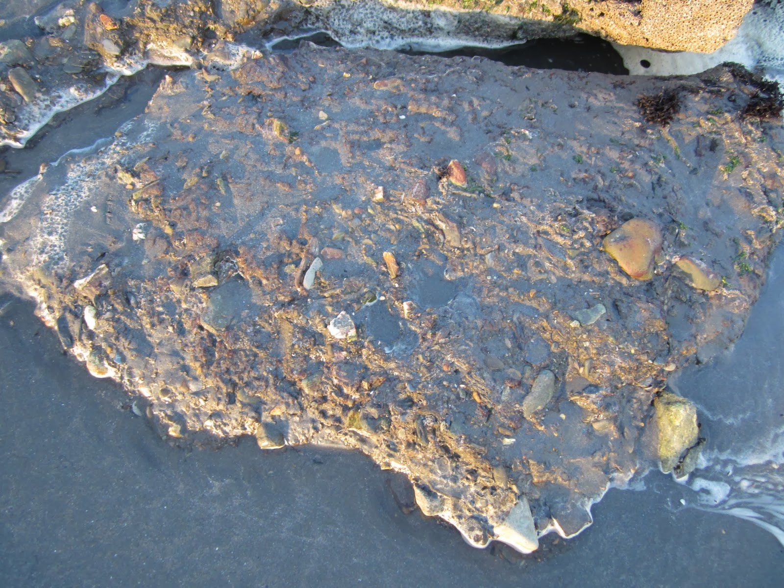
The bottom photo shows an extent of wave-cut platform that I have never seen before -- probably covering an area of c 1000 sq m. It's beautifully planed off, with only minor undulations on the surface. The bedrock here, by the way, is Upper Ordovician or Lower Silurian shales -- still seems to be some doubt about the dating.
I shall have to encourage my brother and his wife to drive up soon to Newport and take a look. They are extremely fond of the estuary at Newport, even though they live the other side of Fishguard, towards St David's, near Trefin.
ReplyDeleteSome New Year benefits of this awful weather we are having.
ReplyDeleteMore questions...
Were there any signs of the submerged forest on the beach?
I nipped down this morning before high tide, but the water was too high. I did see patches of peat on the beach in front of the car park, so it looks like I'll have to come back when conditions are easier.
How does this wave cut platform compare to the one at Poppit? That seems to be higher, or is it the upper portions of a beach that can be seen there. I guess the platform you are describing is to the end end of the beach.
Dave
Hi Dave
ReplyDeleteYou need to go to the beach at or around low tide -- the current exposures are straight in front of the Surf Lifesaving Club / car park.
Most of the exposures are present are of till / rubble -- fairly well cemented, with some patches of peaty material (submerged forest) above it -- but there has been a huge growth of "cushions" of barnacles since I last saw these exposures -- looks a bit like the Great Barrier reef!!
The new exposures of the wave cut platform are to the right of the car park -- in front of the nearest cliffs. There are lots of exposures of wave-cut platforms round about current sea-level -- especially in the bays to the west of Newport. I think they are probably very old -- freshened up during every interglacial.....
Interesting pictures, Brian. That storm damage is far worse than I have seen before. Have the cliffs sustained much damage?
ReplyDeleteCliff damage? Not much as far as I can see -- but Newport has escaped the brunt of the waves, since the wind has been mostly from the W and SW. So Newport Bay has effectively been in the lee of Dinas Head.
ReplyDeleteElsewhere -- as in St Bride's Bat -- there will be much more damage on the cliffs.
Wonder if there will be any further Mesolithic finds on the Newport beach now? Perhaps locally - based Geoffrey Wainwright will be taking a look, since his PhD subject all those years ago was the Mesolithic of West Wales [Current Archaeology, Issue 287, Feb 2014].
ReplyDelete