Thanks to Phil Morgan for drawing this to my attention. It's an article by Mike Pitts in the latest edition of "British Archaeology" (Sept-Oct 2013, p 6) in which he draws attention to the find by Tim Daw that during the UK summer drought there were dried-out patches showing up in the Stonehenge turf. There were lots of them, of all shapes and sizes -- some revealing the locations of old excavation pits, trenches, and paths. But some of them seemed to coincide with the places where sarsens 17-20 might -- or might not -- have been located. The illustrations below show the locations of these 'burnt opatches' on the Stonehenge map, and on the ground during July 2013.
Photos: acknowledgement to British Archaeology. Please go to the magazine for the full article. In the photo, the patch in the foreground coincides with the supposed location of sarsen 17.
This of course brings up the great debate about the completion (or otherwise) of the stone monument -- a matter argued about since Inigo Jones in 1655 assumed it WAS complete, and Wood in 1747 argued that it wasn't. I have personally argued that the monument was never completed, since I could not see any sound evidence that it was -- and many others have agreed with me on that, including a number of current archaeologists. Well, in the light of this latest evidence I don't think I would go so far as Mike Pitts does, with the headline "STONEHENGE DISPUTE SOLVED AFTER 260 YEARS." But the evidence IS quite persuasive. So one must keep an open mind.
However........ There are still a number of issues to be sorted before this matter really is resolved. The "burnt patches" are quite large -- much larger than the "footprints" of the assumed sarsens. They are also rather irregular, not being in PRECISELY the right places. Rather large pits might have been dug by the Stonehenge builders in preparation for some big sarsens -- but that does not mean that the sarsens ever were found and installed. Also, we have the widely-cited evidence from geophysical surveys that shows no pits or sockets here -- how does that evidence square with what has shown up during the 2013 summer drought? (See the chapter by David and Payne in "Science and Stonehenge.") Again, the marks shown on the photo may simply show where past excavations have taken place, conducted by people who were looking for fallen and buried stones, or simply for the sockets -- and naturally they would have dug and searched in the places where the sockets were assumed to have been located.
Interesting debate coming up, I suspect....
How much do we know about Stonehenge? Less than we think. And what has Stonehenge got to do with the Ice Age? More than we might think. This blog is mostly devoted to the problems of where the Stonehenge bluestones came from, and how they got from their source areas to the monument. Now and then I will muse on related Stonehenge topics which have an Ice Age dimension...
THE BOOK
Some of the ideas discussed in this blog are published in my new book called "The Stonehenge Bluestones" -- available by post and through good bookshops everywhere. Bad bookshops might not have it....
To order, click HERE
Some of the ideas discussed in this blog are published in my new book called "The Stonehenge Bluestones" -- available by post and through good bookshops everywhere. Bad bookshops might not have it....
To order, click HERE
Saturday, 10 August 2013
Thursday, 8 August 2013
Not a bad little cliff......
Acknowledgements to Joshua Lavigne and Grant Dixon for these two photos -- go to their web sites for more images. These show Mount Asgard on Baffin Island -- famous in the climbing fraternity but also in glacial geomorphology circles -- showing how vertical downcutting can occur in certain circumstances by a combination of frost-shattering and glacial trough deepening (and transport away of lots of debris) by glaciers in close proximity.
Monday, 5 August 2013
Another nice erratic
I came across this rather nice photo of a large erratic on a glaciated surface near Syd Kap, in Scoresby Sund, East Greenland. It's good to have the human being for scale....... this will have been carried in the Devensian Glaciation by the huge glacier coming out of Nordvest Fjord. The human being would not have been there at the time......
Saturday, 3 August 2013
Glaciers, protection and erosion in the uplands
It's not very often that you get a straight piece of glacial geomorphology making it onto the prime news pages on the BBC web site -- but here is something from today. The report is quite interesting, and the paper presents some neat observations which back up glaciological theory quite nicely -- showing that cold ice protects the landscape, that temperate or warm ice erodes, and that even more erosion and downcutting occurs on the mountain slopes above and at the edges of the ice -- with the glacier acting as a conveyor belt for transporting away shattered rock debris. We see this very often in ice fronts, where ridges of terminal and lateral moraine are shown to be very thin indeed -- we might even call them superficial, with dark rock material extending to a depth of just a few metres, and with clean ice lower down.
Not sure I would agree with the suggestion that cold ice in Alpine snowfields protects the landscape so much that this helps to explain the height of the Alps (which are still being lifted tectonically)...... but this is nonetheless a very welcome contribution to the literature.
http://www.bbc.co.uk/news/science-environment-23553094
Alpine glaciers 'protect mountain peaks from erosion'
By Simon Redfern Reporter, BBC News
Instead of wearing mountains down, evidence from Europe's high Alps shows that glaciers shield summits from erosion, acting as a protective lid. French scientists studied erosion on Mont Blanc, western Europe's highest peak, below and around its glaciers. Cold ice at the highest points froze to the mountain rock and played little part in erosion, the team said. In contrast, water and rain eroded glacier-free areas 10 times faster than areas protected by the glacier.
"Mountains don't grow to infinity, so there must be another mechanism which has lowered the summit of Europe” -- Prof Fritz Schlunegger Bern University
The research was part of Cécile Godon's doctoral research at Université de Savoie, located on the edge of the French Alps, and appeared in the journal Earth and Planetary Sciences Letters. The study focused on the Bossons glacier, which flows down the northern face of Mont Blanc towards the French town of Chamonix. Rock debris, carved from the mountain at the toe of the Bossons glacier and sediments washed out in high mountain streams were compared with erosion in nearby glacier-free areas. The researchers found that the cold glacial ice protected the mountain from erosion, rather than promoting it.
Rising ice
These results may explain the high altitude of the Alps. Driven by the tectonic collision of Europe with Africa, the high alpine bedrock is rising about one millimetre each year. Glacier-free areas of the Alps erode at a similar rate but where the mountains are protected by ice, the peaks wear away at one tenth that rate.
Fritz Schlunegger, from Bern University, Switzerland, was not involved in the work and commented: "This group has used sediments at the end of Bossons glacier to determine where erosion is happening beneath the ice. "Most material has been derived from the non-frozen part the glacier, while higher up towards (the summit of) Mont Blanc - where the glacier is frozen to the ground - erosion is much less," he told BBC News. "This is really the first time, according to my knowledge, where this has been convincingly shown in a quantitative way and using a natural example.
"However, mountains don't grow to infinity, so there must be another mechanism which has lowered the summit of Europe. According to (Dr) Godon's findings, this erosion is not related to glaciers, so we still have to think about other possibilities."
Around the globe, mountain glaciers - especially those at low latitudes - are retreating in response to climate change, scientists say. Reports earlier this year indicated that glaciers around Mount Everest had lost more than one eighth of their area in the past 50 years, and the snowline had retreated 180 metres up the mountain sides. Dr Godon's results suggest that changes like these could change the shapes of the world's highest mountains, and that climate and mountain landscape are intimately linked.
==========================
The Bossons glacier protects Europe's summit from erosion
by C. Godon, J.L. Mugnier, R. Fallourd, J.L. Paquette, A. Pohl, J.F. Buoncristiani
Available online 28 June 2013
Abstract
The
contrasting efficiency of erosion beneath cold glacier ice, beneath
temperate glacier ice, and on ice-free mountain slopes is one of the key
parameters in the development of relief during glacial periods.
Detrital geochronology has been applied to the subglacial streams of the
north face of the Mont-Blanc massif in order to estimate the efficiency
of erosional processes there. Lithologically this area is composed of
granite intruded at ~303 Ma within an older polymetamorphic complex. We
use macroscopic features (on ~10,000 clasts) and U–Pb dating of zircon
(~500 grains) to establish the provenance of the sediment transported by
the glacier and its subglacial streams. The lithology of sediment
collected from the surface and the base of the glacier is compared with
the distribution of bedrock sources. The analysis of this distribution
takes into account the glacier's surface flow lines, the surface areas
beneath temperate and cold ice above and below the Equilibrium Line
Altitude (ELA), and the extent of the watersheds of the three subglacial
meltwater stream outlets located at altitudes of 2300 m, 1760 m and
1450 m.
Comparison of the proportions of granite and
metamorphics in these samples indicates that (1) glacial transport does
not mix the clasts derived from subglacial erosion with the clasts
derived from supraglacial deposition, except in the lower part of the
ice tongue where supraglacial streams and moulins transfer the
supraglacial load to the base of the glacier; (2) the glacial erosion
rate beneath the tongue is lower than the erosion rate in adjacent
non-glaciated areas; and (3) glacial erosion beneath cold ice is at
least 16 times less efficient than erosion beneath temperate ice. The
low rates of subglacial erosion on the north face of the Mont-Blanc
massif mean that its glaciers are protecting “the roof of Europe” from
erosion. A long-term effect of this might be a rise in the maximum
altitude of the Alps.
Thursday, 1 August 2013
Ploughing in West Kennet Avenue?
More thanks to Pete G for yet another pic -- this time a painting from 1895, showing plouging furrows running along the line of the Avenue. According to Pete, the alignments exposed in the current dig run across the Avenue at an angle -- so this might rule out the ploughing hypothesis, unless these deep marks date from medieval or even earlier ploughing...... after all, many parts of rural Britain were transformed by ridge and furrow farming practices in the Middle Ages.
A veritable cornucopia of spotted dolerites
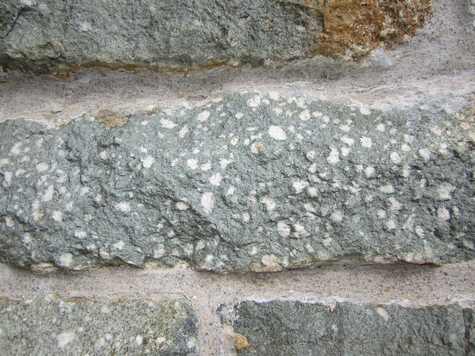
I drove past Bethel Chapel in Mynachlogddu today, and was forcefully reminded of the way in which spotted dolerites from the nearby outcrops of Carn Meini etc have been used in local architecture. The whole of the chapel facade (finished in 1875) is built of shaped blocks of spotted dolerite -- many different types. Big spots, little spots, scattered spots, dense spots, white ones and cream ones, and so on and so on.
This stone must have been incredibly difficult to work, but somehow or other the faithful builders of the chapel have managed to make most of the blocks rectangular. The only stones that are NOT spotted dolerite are the window cills and lintels, and those curved window surrounds -- those are all, I think, made from soft grey local slate which is very easy to work and shape.
I dare say that Rob or Richard could give a comprehensive geology lesson on spotted dolerites without having to move away from the churchyard. I don't know enough about these different types to know which outcrops they were taken from -- but there are historical records of decisions being made by the chapel deacons to go up onto Preseli to collect stone, and of horses and carts coming down with loads specifically for the chapel restoration.
Here are some close-ups. In some cases the weathered surface has been left, giving a nice rusty or buff colouring, and in other cases the blue-grey of the fresh worked surface is quite striking:
You can click to enlarge any of these photos. What interests me here is the question of WHY, in or around 1870 -75, the congregation here chose local spotted dolerite for their chapel facade. Did it have any particular religious or spiritual significance for them? I doubt that very much -- chapels were generally built with stone that was cheap and durable, and attractive -- they obviously wanted their chapel to be striking, as an offering to the glory of God. But if sandstone or limestone had been the local rock, they would have used that instead. And it WAS cheap -- they needed to pay nothing for it, for there it was, within a mile or two, up on the common, ready to be carted away.
Interestingly enough, in the years 1946-48, during the famous local episode called "The Battle of Preseli", local ministers and political leaders created a great campaign to resist the efforts by the MOD to turn the whole of Preseli into a military training range, by building on HH Thomas's thesis of "the sacred stones." It suited their campaign strategy very well to claim that the spotted dolerites were sacred, and always had been, and that it would be an outrage and an insult to the sensitivities of the Welsh if the MOD had gone ahead with its plans. Shock! Horror! Military firing range planned for sacred Welsh mountains......!!
Anyway, it worked. Churchill and the rest of the Government of the day were swayed by this emotional and pseudo-spiritual argument, and chose Castlemartin and the Brecon Beacons instead. That doesn't alter the fact that the campaign to save Preseli was based on spiritual mumbo-jumbo, conjured out of thin air by the bards and religious leaders of the day....... all credit to them, for in reality there never was any great feeling in history that either the spotted dolerite or Preseli had anything sacred about them. They had MYTHOLOGICAL connections, of course, since the uplands figure prominently in the Mabinogion -- but so do many other places in Pembrokeshire, and you could argue that Cwm Cych, Narberth and the Pembrokeshire Islands were much more "special" than Preseli in the minds of the medieval storytellers.
Periglacial -- or something else?
Many thanks to Pete G for a new photo of the site at West Kennet. As he suggests, this shows the "stripes" far better. On the basis of this visual evidence, I'm prepared to accept that they MIGHT be periglacial in origin. The high concentrations of flints are striking -- something that doesn't occur in the ridges in the Stonehenge Avenue? One question -- do they run straight downslope? If not, there may be a problem with this interpretation.
Are they ploughing marks, as one contributor has suggested?
As I said in reply to Pete's comment, they may also be hollows and ridges attributable to solutional activity on the bedrock surface beneath the regolith -- or they could be the outcropping strike planes of flint-rich layers in the chalk -- and therefore structurtally controlled bedrock features rather than down to any unique cold-climate environment.
Hopefully more evidence will be forthcoming.
Subscribe to:
Posts (Atom)