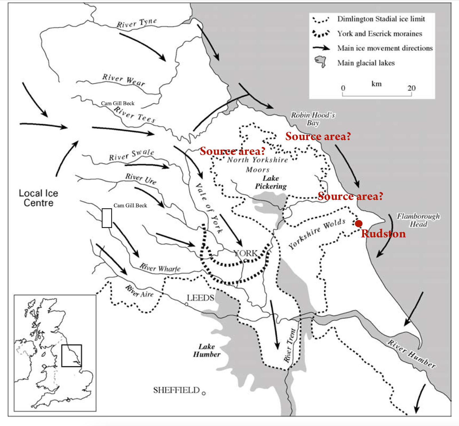
Thanks to Tony for drawing my attention to some recent coverage of the Rudston Monolith in Yorkshire, with the usual guff about human transport..........
This is what Wikipedia says:
The stone is slender, with two large flat faces. It is approximately 5 feet 9 inches (1.75 m) wide and just under 3 feet 3 inches (1 m) thick. The top appears to have broken off the stone. If pointed, the stone would originally have stood about 28 feet (8.5 m). In 1773 the stone was capped in lead; this was later removed, though the stone is currently capped.The weight is estimated at 40 tonnes.The monolith is made of gritstone. The nearest source for the stone (Cayton or Cornelian Bay) is 9.9 miles (16 km) north of the site, although it may have been brought naturally to the site as a glacial erratic. The monument dates to the Late Neolithic or Early Bronze Age. A possible fossilised dinosaur footprint is said to be on one side of the stone, though a study by English Heritage in 2015 concluded that the claim was unsubstantiated. There is one other smaller stone, of the same type, in the churchyard, which was once situated near the large stone.I don't know of any detailed provenancing work on the monolith, but it is apparently a gritstone similar to that outcropping in Cayton Bay and Cornelian Bay to the north. Southward transport of erratics by the flowing ice on the eastern flank of the British and Irish Ice Sheet would be entirely in line with what we know about ice movement directions:
Many people have remarked on the slender and delicate shape of the monolith, and have speculated that it cannot possibly have been transported by ice without being broken into smaller blocks. That's a fair point -- and of course there are similarities with some of the slim elongated spotted dolerite bluestone monoliths at Stonehenge.
Bluestone 69 at Stonehenge. Very delicate -- and greatly modified by dressing.....


1 comment:
The River Ure, before being forced South by a glacier in the Vale of York, flowed eastwards. It flowed down the Great Wold Valley before turning South down to Rudston and then heading eastwards again and entering the sea just South of Bridlington. Lidar shows the course of the river quite clearly with the church now standing on what was some high ground on the bend in the river.
Post a Comment