THE BOOK
Some of the ideas discussed in this blog are published in my new book called "The Stonehenge Bluestones" -- available by post and through good bookshops everywhere. Bad bookshops might not have it....
To order, click
HERE

Sunday, 29 September 2013

Rhosyfelin Blitzkrieg


There are some rumbles doing the rounds about the smashed-up mess made by the diggers at Rhosyfelin this year, upslope of the main archaeological dig site.  It almost looks as if a JCB has gone on a mad spree, having lost its driver........

What is the purpose of this mayhem?  Is it simply an attempt to gain access to the upper part of the site so that some more geological samples can be taken?  Can't imagine that being the reason for all the damage -- after all, these crags were perfectly accessible as it was, to any geologist worth his/her salt.  Is it an attempt to open up a new part of the site for 2014 excavations?  Can't imagine that being the reason either, since following the depradations of the big machine nothing that we can see in this photo will be of any value whatsoever to an archaeologist trying to check out what is there.

Very mysterious.  Does anybody know what is going on?

Thursday, 26 September 2013

The Rhosyfelin Fracture Pattern

This is probably all very familiar to the geologists, but let's look at the Rhosyfelin fracture pattern exposed on the rock face.  Here are two versions of the same photo, one in its pristine condition, and the other annotated:


On the annotated photo, the orange lines show the dominant fracture pattern which causes the rock face to break up into elongated slabs or columns.  The blue lines show another fracture trend, running along the face from one end to the other.  One very long fracture can be followed for 50m or more -- others are shorter.  But here we have an explanation for the manner in which the rock face breaks up into "upper slabs" and "lower slabs".  The lower ones, when they break off the face, won't travel very far, but the higher ones, pushed off by physical and biological processes, will fall with considerable momentum, and can travel some way from the rock face.

Rhosyfelin -- the rockfalls continue.......

I have been trying to argue that there is a long history of rockfalls at Rhosyfelin -- but keep on coming up against the buffers -- at least in the minds of those who think that all the debris uncovered in the digs over the last 3 years has got there because of Neolithic quarrying.  Just take a look at these photos:


Look at the big "proto-orthostat" in the foreground of this photo, taken of the inner part of the crag, where a digger has been clearing the vegetation this year, and making a right old mess.  The location is close to the bend in the little channel, not far from the col between this and the main Brynberian river channel.  This big stone was very close to the ground surface.  No way is this a Neolithic feature -- I would hazard a guess and say that it may have fallen off the rock face withing the last few centuries.

This was taken a bit lower down the channel, not far from the highest point reached in last year's dig.  Note that this particular "proto-orthostat" has a good cover of lichen and moss on it -- it has been exposed at the ground surface.  Almost certainly, this one dates from a rockfall from the face within the last few decades..


And now for the "coup de grace".  This is the 2013 dig site, looking at the famous "monolith" and a few of the large stones on the bank above it.  Look at the cliff face to top right of the photo.  Look at the crack half-way up the face.  Look at the manner in which roots and other vegetation are insinuating themselves behind the slab.  Click on the photo to view in more detail.  A bit more root expansion, maybe some frost and maybe some nice wet conditions over the winter, and hey presto -- down comes the next proto-orthostat.......... and not a Neolithic quarryman in sight.

The Dreamtime Pedestal

One of the more interesting ideas to come out of the MPP talk in Moylgrove recently is the one about the "pedestal" on which the big "proto-orthostat" is supposed to rest.  According to Mike, the monolith is "propped up" on a pile of stones, and shows signs of having been "jacked up" into its present position by quarrymen using long levers -- presumably made of timber or else of elongated stones such as we see all over the dig site. 

This is all very interesting, because we can see how the pedestal has evolved and appeared over the past three digs on the site.  Here are three photos, the first from 2011, the second from 2012, and the third from 2013.


You can see the manner in which the stone was originally embedded in sediments which were themselves rich in rhyolite blocks and smaller stones.  In the first year the dig went down to the base of the big stone.  In the second year much more of the finer material was taken away, and many of the big blocks surrounding the big stone were removed.  In the third year even more sediment and stones were taken away, leaving the big stone apparently in a "raised" position and exposing the stones beneath it.  Obviously they couldn't take away too much of the material beneath the stone, for fear of disturbing it and squashing a few diggers. 

Hey presto!  It's quite wonderful what you can do by removing all the stones except the ones you want to leave in place, thereby creating a wonderful pedestal with a big stone perched on top of it.  And you can then invest the pedestal with great significance, and use it to help to demonstrate to the world what a smart bunch the Rhosyfelin quarrymen were.........

Excuse me, all you guys and gals who have spent vast amounts of time recording and digging and humping away stones, but do you seriously expect people the BELIEVE any of this jacking up business?  In any case, why would your Neolithic quarrymen want to LIFT a very heavy stone which you are trying to take away downhill?


Wednesday, 25 September 2013

Deja vu all over again

I've been reflecting on all this Neolithic quarry mania, and thinking to myself:  "Haven't we heard all this before?"  Well, of course we have, but last time it was in relation the the famous Carn Meini Neolithic Quarry, which now seems to have been given the push........

Let's remind ourselves.

Two craggy outcrops -- two quarries? 

The Carn Meini "Quarry"

The prsence of a quarry at Carn Meini was hinted at by HH Thomas and promoted with even more enthusiasm by Richard Atkinson in his 1956 book on Stonehenge.  Since that time it has been more or less accepted as fact, on the following grounds:

1.  The stone is very special, since the whitish spots in the local dolerite made it appealing to our ancestors, since maybe it reminded them of the starry night sky.

2.  The stone breaks naturally into tubular columns which are ideal for use as orthostats at Stonehenge.

3.  There are several stones in the bluestone assemblage that appear to match geologically the outcrop at Carn Meini.

4.  The site is an easy one from which to extract elongated blocks of stone and to trundle them off towards Stonehenge.

5.  There are traces of prehistoric activity in the immediate vicinity -- cf the "enclosure" described in the last few years by Darvill and Wainwright.  Perhaps the enclosure was to protect the quarry or to provide shelter and protection to the quarrymen who lived inside it?

6.  There is a splendid stone lying right in the middle of the supposed quarrying area which is just perfect for use at Stonehenge.  This is "the one they left behind" for some unknown reason.

7.  There is a nearby ancient trackway which shows that the area was a centre of Neolithic activity  -- there is also a small burial site nearby, assumed to be Neolithic.

8.  There is a "broken stone" not far away -- damaged during transport and subsequently rejected.

9.  According to Roger Worsley, there is a length of "hidden track" leading downslope from Carn Meini towards the "stone stream" where resistivity and other measurements show heavy compaction of the soil, consistent with heavy loads passing across it.

10. There are occasional small sub-angular or rounded stones in the area -- assumed to be hammer stones used in working the rocks taken from the quarry.

 The ones that got away -- or rather, that didn't get away, and stayed where they were.......

The Craig Rhosyfelin "Quarry"

1.  The stone is very special, since the bluish colour in the local rhyolite made it appealing to our ancestors.  Maybe its sharp edges also made it desirable for cutting or slicing tasks.

2.  The stone breaks naturally into elongated columns which are ideal for use as orthostats at Stonehenge.

3.  There are many fragments in the bluestone debitage that appear to match geologically the outcrop at Craig Rhosyfelin.

4.  The site is an easy one from which to extract elongated blocks of stone and to trundle them off towards Stonehenge (according to MPP).

5.  There are traces of prehistoric activity in the immediate vicinity -- cf the "hearth" described recently by Prof MPP.  Perhaps the hearth was used by many generations of quarry workers?

6.  There is a splendid stone lying right in the middle of the supposed quarrying area which is just perfect for use at Stonehenge.  This is "the one they left behind" for some unknown reason.

7.  There is assumed to be a nearby ancient trackway which shows that the area was a centre of Neolithic activity  -- there are also burial site nearby, including Bedd yr Afanc.

8.  There are abundant "broken stones" in the quarry -- damaged during quarrying operations and subsequently rejected.

9.  According to MPP, damage to smaller stones beneath and downslope of the "proto-orthostat"  is consistent with heavy loads passing across it.

10. There are occasional small sub-angular or rounded stones in the area -- assumed to be hammer stones used in working the rocks taken from the quarry.

 Broken stones galore -- not good enough for Stonehenge?

It's almost spooky how similar the "case for Carn Meini" is to the "case for Rhosyfelin."  It's also rather entertaining that the case for the former is now dismissed as unreliable, while the case for the latter is being trumpeted from the rooftops as the latest great archaeological discovery.  

Tuesday, 24 September 2013

Craig Rhosyfelin -- where are the restraining voices?


One thing that interests me about the ongoing Rhosyfelin debate is that there seem to be virtually no restraining voices which might temper Prof Mike Parker Pearson's obvious enthusiasm for the "most perfectly preserved Neolithic quarry in Europe" or "the Pompeii of Neolithic stone quarries."  That's been his view since the unearthing of the big "proto-orthostat" in 2011, and every utterance since then has been devoted to the confirmation of the ruling hypothesis.  I'm clearly not the only one who thinks that we have here a situation in which marketing has taken the place of science.  But why have others involved in this dig not intervened to point out that the "evidence of quarrying" is equivocal to say the least, and is open to a number of interpretations?

Richard Bevins and Rob Ixer are petrologists who have done a fantastic job in provenancing some of the rhyolite fragments at Stonehenge to the rock face at Rhosyfelin or to the immediate vicinity; but they are not geomorphologists, and it would be unfair to expect them to have looked in detail at some of the geomorphological subtleties of this site.  I have no idea how this project is being run.  But we know that there are those in MPP's team who do have expertise in geomorphology -- Charly French and Mike Allen to name but two -- and there are many bright young geomorphologists in the universities of the UK who could have brought a cold and dispassionate eye to some of the interpretations about which I have been complaining for the last couple of years. 

The things I pointed out in my last past on this blog should have been pointed out by others working on the dig, or others pulled in to advise on certain aspects of the work.  Because there have not apparently been any researchers pointing out natural phenomena, looking for alternative explanations of "exciting discoveries" and urging caution, what we now have is a runaway bandwaggon with a lot of clever researchers stuck on board........ 

...........continue the metaphor in whatever manner you wish!

Monday, 23 September 2013

Rhosyfelin -- some inconvenient truths

A few days ago I sent a message to MPP asking if I could meet him and the team down at Rhosyfelin to have a chat about the sediments appearing in the current digging stage.  I didn't get a reply -- not complaining, since he is probably incommunicado just now, being somewhat involved in two big digs in Pembrokeshire..........  So after tea I ambled down to Rhosyfelin to see if there was still any action down there, and the guys and gals had all gone home.  So I had a mooch about, taking great care not to disturb anything.  Very interesting.  Here are some inconvenient truths:

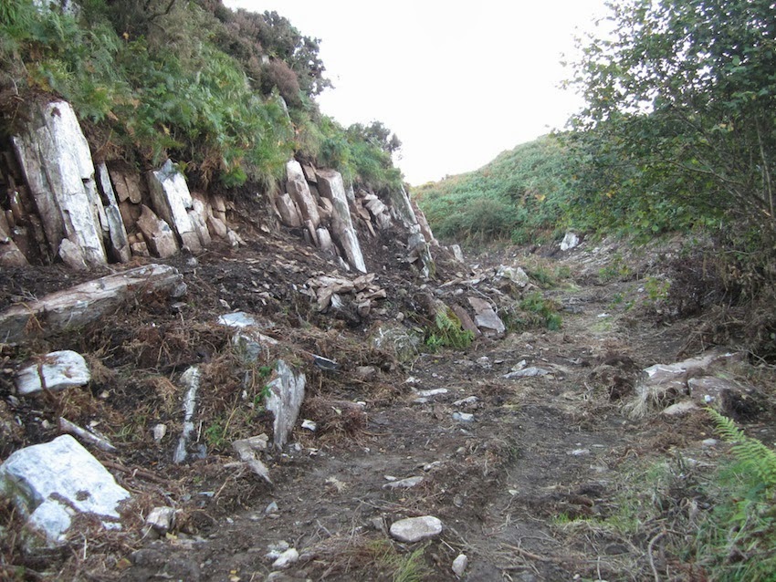
1.  Now that the dig has been extended for 70m or more, right to the inner end of the rocky spur, we can see that the dig site is on the floor of a small meltwater channel, similar to many of the features we can see on the flanks of the Gwaun-Jordanston meltwater channel system.  It's difficult to assess how many times this channel might have been used, but its use by meltwater (probably subglacial, under very high pressure) might go some way towards explaining the long, smooth, regular wall which others tend to refer to as "the quarry face."  It's probable that the channel was used both in the Anglian and Devensian Glaciations.

 View of the dig site, looking along the rock face of the spur towards the top end of the meltwater channel.  In the far distance the channel loops round to the left and rejoins the main meltwater channel now occupied by the Brynberian River.

2.  If you look carefully at the photo above you can see that the big "orthostat" resting just to the right of centre in the photo has fallen from the highest pinnacle on the ridge.  I see no problem at all with a slab of this size crashing down the rock face, either in the Late Glacial or at some stage during the Holocene, and ending up exactly where it is today, some distance from the rock face.  It might have slid, might have tumbled down end over end, or might have rolled.  No human agency required in the process.

3.  In his Moylgrove lecture, MPP placed great emphasis on the "killer fact" that a big transverse stone just downslope of the "proto-orthostat" has striations or erosional grooves on it, proving beyond doubt that other large stones have been hauled across it during earlier stone removal operations.  It's lucky that I managed to have a look at it today, or this myth might have been perpetrated until the end of time -- and there would have been no way of checking, since the spoil is about to be thrown back into the dig location at any moment now..............  Anyway, they are not striations, scratches or erosional grooves.  They are outcropping foliations on the rock surface, no different from those on scores of other stones to be found throughout the dig site.  They follow the strike of these micro-structures.  If you look at the side of the rock you can see how the foliations or "pseudo-layers" run within the rock, downwards towards the bottom left of the photo.  I am 100% confident that any geologist or geomorphologist who looks at this rock would agree with me on this.  Here are some pictures:


Above:  Close-up of the "grooves" supposedly caused by heavy orthostats being dragged across the stone in question.  There are indeed grooves, but they coincide exactly with the outcropping foliations on the stone surface.  They are perfectly normal weathering phenomena, of no significance whatsoever to the quarrying debate.


Above:  Another grooved block of rhyolite embedded in till in the lower part of the dig site.  The grooves on this one are seriously interesting, since they are slightly curving and since they don't seem to be related to the pattern of outcropping foliations.  This one has "glacial erosion" written all over it.


Above:  More grooves on the end of another slab of local rhyolite, not far from the "proto-orthostat."  These grooves are very prominent, and are clearly related to the pattern of outcropping foliations.


Even more interesting -- and something you don't see very often in Pembrokeshire.  This is a heavily glaciated slab of rock on the lower part of the dig site - look at all the smoothed off corners.  But look even more carefully at the crescentic gouges or fractures.  If you are a geologist you might call them conchoidal fractures.  They show that a glacier with very hard tools has been at work on this surface.


4.  In the Moylgrove lecture, MPP also dismissed the idea that the excavation had reached a layer of till. He said that if there was till present, it must be much deeper down.  I have news for him.  In the lower part of the dig at the moment we can see some of the best till I have seen in a long time.  In fact, they hit it last year, as I mentioned on this blog.  (Why don't these people listen when they are given solid information?)  It is probably Devensian, around 20,000 years old.  Its upper surface -- as always in Pembrokeshire -- is a foxy red colour.  When I saw that I was pretty convinced that I would see a rather sticky clay-rich or silty till underneath the reddish layer, and indeed, there it is for all to see:


The lower part of the dig site.  In the foreground we see a cluster of rhyolite boulders which have been embedded in the Devensian till.   The foxy red colour is typical of the weathered upper surface of the till everywhere in Pembrokeshire.  Deeper down, the colour changes, and there are signs of gleying, with streaks of buff, grey and black colouration.  I'm not sure whether the black colouring is due to manganese oxide or organic material.  We can see this if we look carefully at the section beneath the white labels -- bottom left.  There is not a huge amount of clay in this till -- it is more sandy and gravelly.  Again that is typical of the inland tills in Pembrokeshire.  On the north coast, where the ice has come in from the sea, the clay percentage in the Irish Sea till is substantially higher.

5.  I may be wrong, but I get the impression that when archaeologists look at erratics, they see hammer stones.  I'm not denying that there may be the odd hammer stone lying about on this site, but what is indisputable is that we have a splendid collection of rounded, sub-rounded and shaped glacial erratics representing many different lithologies.  I counted five or six different rock types very quickly, but did not wish to disturb any of them for fear of messing up the survey work.  The most prominent are the blocks of quartz (very rough and jagged, since quartz is almost impossible to smooth off nicely except on a beach or in a very turbulent river), several types of dolerite, and several types of volcanic ash.  Probably they have all come from the NW, where the rocks of the Fishguard Volcanics are exposed at the surface.  Some of these are small enough to use as hammer stones, if you were determined enough to bash something, but many of the boulders are far too large to be lifted, let alone used for percussion or stone shaping.  You can see some of these stones in the photos posted by Chris:  http://chrisjohnsonnl.smugmug.com/Rhosyfelin-2013-dig
Many of them are still embedded in the till, and others have been lifted by the digging team and slung onto the spoil heaps.  Here are a few of them:

Large erratic boulder embedded in the till in the lower part of the dig site.  This is probably a dolerite.


Another erratic boulder resting on the surface of the till.  This also appears to be a dolerite.


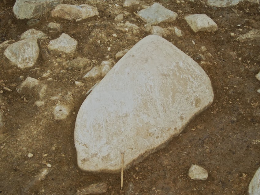
A large quartz erratic boulder, upslope of the "proto-orthostat."  This one could have come from almost anywhere in North Pembrokeshire........


How many more erratics do you want to see?  I won't bore you with any more close-ups, but here are a few that the diggers have extracted and pushed to one side.

So there we are then.  If anybody tells you that there are no traces of glacial action at Rhosyfelin, do not believe them.  Trust me.  I know what I am talking about.  Always happy to help.  And by the way, I'm still waiting to see some evidence that this site was used as a quarry.