THE BOOK
Some of the ideas discussed in this blog are published in my new book called "The Stonehenge Bluestones" -- available by post and through good bookshops everywhere. Bad bookshops might not have it....
To order, click
HERE

Tuesday, 30 August 2016

Pensarn -- what will the diggers find?

With the quarrymen about to start digging at Pensarn (if the rumours are correct) any day now, it's fun to speculate a bit on what they might find.  I have done one post on this before:

http://brian-mountainman.blogspot.co.uk/2016/08/the-pensarn-mound.html

As I suggested in that post, the slight mound in the field at SN 124358 is most likely to be a heavily degraded Bronze Age burial mound.  It is approx 25m across, and appears roughly circular, and it sits on the highest part of a little plateau, with glorious views in all directions.  The field is well drained, and here and there one finds fragments of foliated rhyolite on the surface.  If the field was to be freshly ploughed, broken fragments of this rock would predominate, together with bits of dolerite.  Both rock types are seen in the hedgerows round about.  The geological maps suggest that foliated rhyolite is the bedrock type here, just as it is a short distance away at Rhosyfelin.

There are many other Bronze Age burial mounds in the area, especially on the summit ridge of Preseli -- for example at Foelfeddau, on Foel Cwmcerwyn, and on Foel Drygarn.  There is another one at Carn Briw, not far from Carningli.  They seem to be preferentially located on hill summits or plateaux.  Should we call these features round barrows?  Possibly not -- they are generally too small, although some of them contained cist graves before they were vandalised by ancient antiquarians.

As I suggested earlier, the mound in the field near Pensarn might well have been much more prominent originally, but after many  centuries of erosion and maybe deliberate and accidental destruction by animals, ploughing etc, there is nothing much left.  A guess is that it was maybe 10m in diameter and maybe 3m high originally, and that it has now degraded down to this very low feature with stones and soil spread out to a diameter of c 25m.  Another guess is that it is made of smallish rhyolite and dolerite stones collected locally -- although there may be larger slabs in the core.

Kate Welham has suggested that "something big" might be discovered here.  What might that be?  Well, the hope is that proto-Stonehenge will be found here, either in the form of a circle of monolith sockets or maybe in the form of some monoliths still embedded in the ground which can conveniently be labelled as "the ones they left behind."  How likely is any of this?  Plenty of foliated rhyolites and dolerites will be found, either as small slabs or cobbles or as larger boulders, pillars or slabs.  The archaeologists will want to call any of the latter larger lumps of rock orthostats or monoliths, but they will have to be very careful indeed about that, since the landscape was, and is, littered with very large stones as a consequence of glacial and periglacial action during the Devensian cold period.   Large numbers of such stones have already been removed -- you can see them where they have been "liberated" and relocated into hedge banks or used as gateposts in farms including Rhostwarch, just down the track:


Some of the standing stones / gateposts located within a few hundred metres of the Pensarn mound.  Most are made of dolerite -- some are foliated rhyolite.  There is no reason to assume that any of them have been transported to their present positions from a long way away.  The most parsimonious explanation is that all have been used more or less where found. (Thanks to Chris Johnson for being such a colourful and exotic model!)


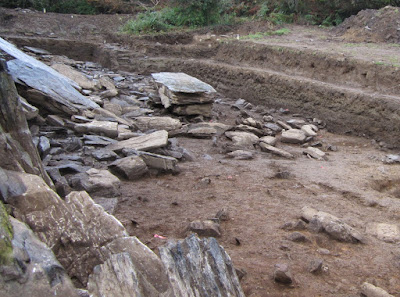
It is also to be expected that during the course of the dig a number of extraction pits might be found, from which stones have been taken either for the building of the mound or later for field clearance purposes.  Stone take pits  are known over a radius of up to 50m away from similar circular or conical mounds in North Pembrokeshire, well away from farmland -- as at Carn Briw:


In addition to the man-made features at this site, it is to be expected that the archaeologists will find a base of broken rhyolite fragments beneath the Holocene soil layer, and also a scatter of Devensian till containing local rhyolite, dolerite and other cobbles and boulders.  This till is found across the landscape hereabouts -- sometimes very thin, sometimes over 4m thick, and sometimes almost absent, depending on the processes that operated on the glacier bed.   The diggers might even find some fluvioglacial deposits.

Could there have been standing stones around or near the burial mound?  It's possible -- the Bronze Age was the time when mounds were being built in this area, and it was also the time when standing stones were erected all over the place.  But I'm not aware of any sites where there is a close association between the one and the other.

I suspect that there will be an interesting dig, but that nothing will be found to link it with either Rhosyfelin or Stonehenge..........


Rhosyfelin -- bad news from the rock face


I recently put up a post with the title "Rhosyfelin -- good news from the rock face", and congratulated the archaeologists on the imminent publication of another paper about the site which would give us a detailed stratigraphy and chronology for the episodes of human occupation.  This is the paper that should have come before the one published in "Antiquity" last year, which we have slammed on the basis that it is nothing better than an extended exercise in ruling hypothesis confirmation.  So something more measured and more scientific is what we all need.......

But I am now informed by one of my tweeting sparrows that I have misunderstood or misinterpreted my messages.  There is no such paper in the pipeline.  Apparently the forthcoming paper is not about the Rhosyfelin sedimentary stratigraphy at all, but about the bedrock geology, concentrating on the dating of the Fishguard Volcanic Series.  Should we laugh or cry?

So is that it?  Is the Rhosyfelin paper already published the definitive last word on the matter from the archaeologists?  Maybe they would just like to forget all about it and move on to the next exciting episode in the saga of the bluestone quarrymen........

Rhosyfelin spot provenancing and the "few square metres" myth


 An illustration of the manner in which the "Locality 8" foliation layer and fracture plane can be exposed at multiple locations across the Rhosyfelin rock face, not to mention at other multiple locations in the neighbourhood.

 Quote from Ixer and Bevins 2011:
"This is the first time that any lithics from Stonehenge have been unequivocally assigned to an area of a few square metres, namely to within a very small single outcrop or couple of outcrops......"
Article: "CRAIG RHOS-Y-FELIN, PONT SAESON IS THE DOMINANT SOURCE OF THE STONEHENGE RHYOLITIC ‘DEBITAGE’
Rob Ixer and Richard Bevins, Archaeology in Wales 50, 2011, pp 21-31
 
How many times have we heard the claim that geologists Richard Bevins and Rob Ixer have identified the source of certain foliated rhyolites in the Stonehenge debitage to "within a few square metres" on the Rhosyfelin rock face?  Too many -- and as we have pointed out very often, the claim was unreliable when it was first made, and it remains unreliable today since no new evidence has been published to support it.  Other geomorphologists who have visited Rhosyfelin are just as sceptical as the three of us who wrote the papers questioning the reliability of the "bluestone quarry" hypothesis:

Brian John, Dyfed Elis-Gruffydd and John Downes. 2015. OBSERVATIONS ON THE SUPPOSED “NEOLITHIC BLUESTONE QUARRY” AT CRAIG RHOSYFELIN, PEMBROKESHIRE". Archaeology in Wales 54, pp 139-148. (Publication 14th December 2015)
https://www.researchgate.net/publication/286775899_
https://www.researchgate.net/publication/286927485_Photo_Gallery

Brian John, Dyfed Elis-Gruffydd and John Downes (2015a).  "Quaternary Events at Craig Rhosyfelin, Pembrokeshire."  Quaternary Newsletter, October 2015 (No 137), pp 16-32.
https://www.researchgate.net/publication/283643851_QUATERNARY_EVENTS_AT_CRAIG_RHOSYFELIN_PEMBROKESHIRE

There have been a number of posts on this blog on this subject, including the following:

https://brian-mountainman.blogspot.co.uk/2016/02/that-jovian-fabric-how-accurate-can.html

http://brian-mountainman.blogspot.co.uk/2014/04/on-significance-of-rhosyfelin-locality-8.html

http://brian-mountainman.blogspot.co.uk/2015/09/rhosyfelin-some-geological-questions.html

http://brian-mountainman.blogspot.co.uk/search?q=+Rhosyfelin+fracture+planes

http://brian-mountainman.blogspot.co.uk/2014/04/rhosyfelin-foliation-plane.html

http://brian-mountainman.blogspot.co.uk/2016/05/rhosyfelin-more-on-monolith-extraction.html

The trouble is that the claim, having been prematurely and incautiously made, has been accepted as the truth by archaeologists who cannot realistically be expected to know any better -- and so the myth, having been manufactured, continues to roll.  One of the most absurd byproducts  of it is the claim by Prof MPP that he now has the precise location of an "extraction point" from which one of the Stonehenge bluestone monoliths was taken.  He says that he knows this because the geologists have told him it is true....... it's always a good trick to avoid responsibility for a statement by pretending that you have it on the good authority of somebody who is more expert than you are.......

So why is the "few square metres" claim unreliable?

Firstly, none of the thin sections from the foliated rhyolite debitage at Stonehenge precisely matches the published thin section from locality 8 near the tip of the Rhosyfelin spur.  There is quite a lot of variation in the "jovian fabric" of the samples from Stonehenge and in the samples from the Rhosyfelin - Pont Saeson area. It's all very well for the geologists to say "We are the experts.  trust us. We know what we are talking about."  In that case, show us the colour of your evidence, and we might believe you.

Secondly, we have received no answer to this point:  if the jovian fabric shown in the Location 8 thin section is typical of one particular foliation layer on one particular fracture plane, surely that "signature" will also exist wherever else that foliation / fracture plane relationship occurs?  By my reckoning, similar if not identical samples might also have been taken from approximately 40 sq metres of the currently exposed rock face, and also from any number of outcrops within and outside the Brynberian river valley, and also from parts of the crag subsequently removed by glacial erosion and other processes.  The geologists cannot prove that the "similar" or "related" samples found in the Stonehenge rhyolitic debitage have not come from hundreds of metres or even kilometres away.  It is no argument to say that all of the other samples taken in the Pont Season / Rhosyfelin area are different from that taken from Location 8.  Of course they are different, since they came from different positions in the rhyolitic sequence, some from above the "special" foliation plane and some from below it.  You would expect them to be different -- some very different indeed, and others just slightly so............

Thirdly, we must question the claim by Ixer and Bevins that in excess of 99.9% of of the Stonehenge rhyolitic ‘debitage’ can be petrographically matched to the rhyolitic rocks found around Craig Rhosyfelin and Pont Saeson.  It is largely because of that statement that the media have become obsessed with the idea that the source of at least some of the bluestones has now been found.  However, as I have pointed out before on this blog, the 99.9% figure is meaningless, since we have no idea how many rhyolite  fragments have been examined, how they were distributed in the Stonehenge Layer,  how close together the collection points were, and what degree of selection was employed in the collection of samples during the respective digs.  Percentage figures like this should never be used without a full presentation of the numerical data from which they are supposedly derived.   In any case, we have no idea which rhyolites occur in the Stonehenge Layer in those large segments of Stonehenge that have not been excavated, and in the soils of the area around Stonehenge, and what their frequency may be.

Abundant over-egging of the pudding going on here.  I'm not questioning for a moment the competence of the geologists concerned.  Just their tendency to go off-topic.  They have a lot to answer for, since they are the ones who set this whole quarrying wild goose chase going when they would have been far wiser to simply present their evidence without seeking to over-emphasise its archaeological importance.

Will the geologists now please retract the "few square metres" claim, and allow common sense to prevail?  


Sunday, 28 August 2016

Cerrig Marchogion and the Giant Boar


King Arthur and the Giant Boar

One of the ancient stories related in The Mabinogion concerns a heroic running battle between King Arthur and his knights and a Monstrous Boar called Twrch Trwyth. The unwitting cause of a the trouble was a young prince called Kilhwch or Culhwch, who was madly in love with a young lady called Olwen, whom he had never met. The girl’s father was a wicked giant called Yspaddaden Penkawr, who set all suitors an assortment of seemingly impossible tasks in order to win her hand in marriage. Anyway, to cut a very long story short, King Arthur had agreed to help this young prince in the performance of a number of terrible tasks, which they achieved by means of guile and not a little magic. At last only one task remained - that of stealing a comb, razor and scissors from between the ears of the great boar, a bad-tempered beast who had once been a wicked Irish King. (This task was all down to the fact that Culhwch was a scruffy young man, who needed to tidy himself up a bit if he was to deserve the hand of the fair princess.)

When King Arthur travelled to Ireland to ask politely for the comb, razor and scissors Twrch Trwyth refused to speak to him, let alone make him a present of the desired objects, and instead he swam across to Wales, accompanied by seven young ferocious boars, to ravage Arthur's territory.

The boars landed at Porthclais near St David’s and laid waste the districts around Milford Haven before Arthur and his knights caught up with them and pursued them to the Presely Hills. They fought one battle in the Nevern Valley and then another great and bloody battle in Cwm Cerwyn, the deep depression beneath the summit of Preseli. Here four of Arthur’s knights were killed. Turning at bay a second time the beast slew four more knights and was wounded himself, while several of the young boars were also killed. The chase continued to Llandissilio, then into Cardiganshire, then all over South Wales, with many local people falling victim to the boars and with four more knights slain.

At last only Twrch was left. He was forced to swim out into the Severn estuary, where Arthur managed to grab the razor and scissors from between his ears. The comb was not obtained until the chase reached Cornwall, and then the great boar leaped into the sea and was never seen again.

Armed with the razor, scissors and comb, Arthur cut and combed Culhwch’s hair and gave him a shave. Then he helped him to kill the savage giant called Yspaddaden Penkawr (who was, you may recall, Olwen’s dad), thereby enabling the handsome prince and the beautiful girl to get married and to live happily ever after.

According to the legend, the scattered rocky crags of Cerrig Marchogion (the rocks of the knights), up on the crest of the Preseli ridge, are the petrified remains of the knights who fell in battle. These rocks are made of spotted dolerite, and it is possible that some of the spotted dolerite debris at Stonehenge has come from these crags.

---------------------------------

This is from my book of "Pembrokeshire Folk Tales."  More here, via Dropbox:


Pembrokeshire Folk Tales
https://www.dropbox.com/s/zg5pp6dfchitqca/Brian%20John%20-%20Pembrokeshire%20Folk%20Tales.pdf?dl=0

Mike's Magical Mystery Tours


The Rhosyfelin narrative becomes more psychedelic  with every day that passes......

Came upon this purely by chance this morning -- had to share it!  It's a nice illustration of the manner in which myths develop.  Starting from one of Mike's enthusiastic talks to visitors at the Rhosyfelin dig site, and building on the myth that stone SH48 came from here,  we now have a giant white sleeping boar that apparently had roasted hazelnuts for breakfast before being turned into solid rock.

It's a nice story, and it's quite charming to think that some people are enchanted by it,  but it also demonstrates the universal charm of the fantastical narrative -- much more appealing that boring old science.......

No point in getting upset.  We all have our own realities, some more colourful than others!

Saturday, 27 August 2016

Rhosyfelin -- more good news from the rock face


 How old are these and other rock faces at Rhosyfelin?  My guess is that this one has been exposed to cosmic bombardment for around 18,000 years.

Last year I suggested to Rob Ixer and many other visitors to the Rhosyfelin dig site that what we all really need is a programme of cosmogenic 36Cl dating on the rock face, so as to work out how fresh, or how old, parts of it actually are.  If dated surfaces show that large parts of the rock face were exposed for the first time in the Neolithic, that might support the thesis of Neolithic quarrying.  If the supposedly "quarried" face proves to be a great deal older, bang goes the quarrying theory.  If parts of the rock face prove to have been exposed at different times, that would support the thesis that there have been intermittent rockfalls going on here ever since the Devensian ice melted away, around 18,000 years ago.

When this was put to Prof MPP and his colleagues, to their credit they agreed, on the basis that anything which brings us closer to the truth has to be a good thing.

Now, assorted little birds tell us that money has been found and that 36Cl sampling on the rock face will be done within the next couple of weeks, by Derek Fabel from East Kilbride, in the company of Prof MPP.  Derek is a cosmogenic dating specialist who has been working with the exciting BRITICE  Chrono project, which I have mentioned many times on this blog.  The leader of that project is Prof Chris Clark of Sheffield University, who has been cited a couple of times by Prof MPP as an authority on the glaciation of the British Isles who doubts that the Irish Sea Glacier could have reached anywhere near Wiltshire.  (You will recall that MPP was based in Sheffield before he moved to UCL.)   Well, Chris is indeed an authority, who says some things that I agree with and others that I think are somewhat dubious.  Geomorphologists hardly ever agree with one another on very much anyway......

So Derek will visit the site, take samples and do the dating.  His sample collecting will of course be determined to some degree by the hypothesis being tested -- and we do not know what that is.  We can be sure that the testing of the so-called "bluestone extraction point" will be in the mix.  The sampling programme will also be constrained by the amount of money in the kitty, and on the accessibility of quartz-rich veins liable to give sound results.  In my view the site could do with around 20 samples, across the face, on some of the fallen stones (including the 8 tonne "picnic table"), at the foot of the face, and on the ridge summit and the col which appears to have been influenced by overflowing meltwater.

Given that Derek is involved with BRITICE, I hope he will take the opportunity of investigating some of the suggestions made by my colleagues and myself concerning the age and pattern of glaciation here on the north flank of Mynydd Preseli.

BRITICE-Chrono sampling map.  Sampling finished 12 months ago.

Rhosyfelin -- good news from the rock face

 Let's see how the stratigraphy described in the new paper matches with this simplified scheme, worked out by Dyfed Elis-Gruffydd, John Downes and myself.  We expect a much more complex identification of layers, almost entirely within the strata labelled 4 and 5 above.  That's something we applaud.  The task is rendered difficult by the fact that many of these layers with occupation traces are discontinuous.

We hear on the grapevine that another paper on Rhosyfelin is on the way -- this time dealing with the detailed chronostratigraphy.  This is what we wanted originally, but never got -- a detailed record of the stratigraphy (hopefully free of all those assumptions and speculations about quarrying activity), with due consideration given to natural processes and sediments, and with detailed information regarding environmental change and human occupation phases.  There is a fascinating settlement history here, and a lot of radiocarbon and other dates, so the site is vastly important on that basis.  There are not many sites in Wales where an intermittent occupation story can be followed from the Mesolithic right through to the Middle Ages, and we look forward to reading the paper when it appears.

We don't expect to discover anything new about the supposed history of quarrying and stone extraction;  if there had been anything convincing in the record, it would already have been given to us.  So let's hope for a nice solid piece of archaeological reporting, with a high standard of scholarship.  And no unsupported assumptions.

One million hits -- and counting........


Purely by chance, when I switched on at 0810 this morning!  What interests me about the fact of a million page views is that rather a lot of people -- in addition to the regulars -- are actually interested in the topics covered on the blog.  It pops up all the time when people search for things on Google.  I don't do all this search engine optimisation stuff, but the site comes high up on the page rankings simply because it is popular -- and in the algorithm popularity enhances popularity.

This means that on some issues (such as the bluestone quarrying debate) opinion can only be influenced to a limited extent by the high profile press releases put out by UCL, Cardiff and Leicester Universities and by the obsession with storytelling and "impact ratings".  Put on one side the people who read gullible newspapers and who believe whatever the BBC chooses to tell them, and we have rather a lot of people who are capable of thinking for themselves, and who seem to enjoy a forum in which EVIDENCE is honestly debated and in which scientific methods are accorded some respect.

Raise a glass!

Friday, 26 August 2016

The Giant's Quoit at Porthleven


Thanks to Rob Ixer for forwarding this one -- photo kindly taken by Nick Moore.  It shows how enormous the Gant's Quoit (at Porthleven in Cornwall) really us.  As fine a chunk of bluestone as we are likely to see anywhere.  (By "bluestone" I mean a chunk of rock in SW England which is obviously an erratic, having got to where it is by some process that we still do not fully understand........)

Wednesday, 24 August 2016

Children of Nature


This is wildly off-topic, so please forgive me.  I have just discovered that my all-time favourite film, called Children of Nature (1991), is now available on YouTube  for viewing in full.  You will need reasonably fast broadband.  Here is the link:

https://youtu.be/wBv0iBzH4hc

The film has a special resonance for me, since the focal point in the latter part of the film is the Vestfirdir region of NW Iceland, to which I led my first university expedition in 1960.  Then I went back to the area for several summer research trips in the 1970's.  We visited Hesteyri, where the final scene is set -- deserted and indescribably beautiful.

So I am a child of nature myself, as you might have gathered.....

The opening sequence of the film, in which the old man leaves his house, is very slow, but is an exquisite piece of film-making -- poignant, and so full of human dignity. I defy anybody to watch it without getting a lump in the throat or a tear in the eye.  I think the whole film, at 1 hr and 22 mins, is a masterpiece.  Enjoy!

Gelli-fawr menhir


This is a splendid standing stone -- one of the biggest in the area.  It's in a field not far from the Gelli-fawr hotel, looking down into the Gwaun Valley.  It's dolerite,  clearly collected from a huge litter of dolerite boulders in this area, and less than 20m away there is another massive lump of dolerite, this time recumbent and with just a part of it sticking through the turf.  I reckon the weight of this one must be about 6 tonnes......

Gelli-fawr morainic debris

I have been trying to track down the precise location of the "source area" for all those massive stones which have been used in the landscaping of the new visitor centre at Tafarn y Bwlch.   A successful mission.  They have all come from the uncultivated fields above the Gelli-fawr hotel, mostly upslope of a little shale quarry (used for roadstone) at grid ref SN065347.   The altitude is c 240m.  Thousands of tonnes of mostly dolerite boulders have been taken from here, with a double purpose as planned by landowner Llew Rees: he has helped to clear the land of large stones here, while creating some very effective landscaping at Tafarn y Bwlch.

The landscape features in the fields around the quarry are very subtle, but there are traces of elongated morainic ridges that might be associated with an ice edge.  The face of the quarry is interesting:


W can see that the top 3m of the shale bedrock is broken and shattered, and that the strata have been "bent over" by slope processes over a great length if time.  This is one of the most spectacular examples of downslope broken rock transport I have seen in a long time. 

If you look carefully, you can see that there are erratic boulders embedded in the upper layers of these slope deposits.  This is the base of an overlying layer, about 4m thick, of stony and gravelly till packed full of abraded and faceted boulders of all shapes and sizes.  Nearly all of them are made of locally derived dolerite.

Above the quarry Llew has now made a depot of stones which may still be intended for Tafarn y Bwlch.  A very nice collection of glacially shaped boulders -- they could easily have come from Stonehenge!


This is interesting, since the obvious occurrence of glacial deposits here matches with the observations I have made from elsewhere in the vicinity -- for example at Cilgwyn, Gernos Fawr and Tafarn y Bwlch.  It's quite possible that ice lobes pushed into the col occupied by Gernos Fawr smallholding from both the west and the east.  Watch this space for further developments.....


An interesting "fact" from Stonehenge


Looks as if BBC Countryfile will have a report on the latest Durrington dig next Sunday, 28th August.

Still on the BBC web site.  Countryfile from Stonehenge from Sept 2015: This is one of the "seven facts" presented in connection with the advance publicity -- "5. The largest stone, which weighs over 40 tonnes, is thought to have travelled as far as 140 miles from the Preseli Hills in Pembrokeshire, which may have taken place following the melting of a glacier. In 2000, a group of volunteers attempted to test the feat in the modern day, but the bulk fell into the Bristol Channel on the ancient replica boats used to transport it." This is one of the worst pieces of garbled nonsense it has ever been my misfortune to encounter. Almost everything about it is wrong..... who on earth wrote this crap?

http://www.countryfile.com/explore-countryside/history/7-stonehenge-facts-you-probably-didnt-know#.V72299AJkPg.facebook

Bang goes the Carngoedog Neolithic quarryman's row........


 Carn Goedog.  The postulated quarrying settlement is right at the base of the long rocky slope, at the right hand edge of the photo.

A couple of years ago there was considerable speculation from Prof MPP and others that the workforce of the fanciful and fantastical Carn Goedog Neolithic bluestone quarry was housed in the "row of huts" located at the foot of the crags, on the north side. It was speculated that because there were clear rectangular patterns visible on the ground the huts were not likely to have been Bronze Age, but maybe Neolithic instead. A quarry plus accommodation for the workers -- a very pleasing scenario.......

Then it went all quiet, and we now know why. I get sent information (including unpublished reports) all the time, and I really don't know where this one came from. It's a draft or unpublished report with the following title:

Carn Goedog medieval house and settlement

By Rhiannon Comeau, Rob Ixer, Mike Parker Pearson, Duncan Schlee and Kate Welham

The fieldwork might be part of an unpublished thesis by Rhiannon Comeau. She and the others examined the settlement site, and the discussion is appended below, with acknowledgement.

The result of the work? The settlement is essentially medieval, and has nothing to do with the Neolithic and nothing to do with quarrying. Some of the traces of older settlements might go back to the Bronze Age, but not earlier.

See also:

========================

Discussion

All of the artefacts from the excavation of House C derive from layers immediately outside it and are presumably the remains of refuse discarded from its interior. They point to the house being occupied in the high and/or late medieval period and subsequently abandoned. However, earlier occupation cannot be ruled out given the aceramic character of the local area before the 12th century, and the notoriously poor survival of pre-Conquest material culture. There were no artefacts that could be considered to be either earlier or later in date, and no evidence of multiple periods of occupation, suggesting that House C was built, used and abandoned within the medieval period rather than being reoccupied at different periods in the past. A radiocarbon date from the floor deposit could establish the date of occupation of the building. 

Similarities in the form of the neighbouring buildings suggest that Houses A-B and D-J are likely also to date to the medieval period. The group perhaps represents a havod (a small seasonally occupied dwelling associated with exploitation of the upland pastures). The curvilinear houses I, K, L, M, N (and perhaps O) are undated but the more denuded appearance of their stone walls may well reflect their greater antiquity as pre-medieval structures. Remains of field walls forming a north-south coaxial pattern leading northwards onto the lower ground north of Carn Goedog could be associated with either or both of these settlement clusters.

In summary, then, we have here a group of nine sub-rectangular buildings and ancillary structures. Their lengths, when surveyed before excavation, ranged from 4.4m to 7m externally, with most having unexcavated internal dimensions of around 4m x 2-3m. All have their long axis at right angles to the contours. House C, whose pre-excavation survey measurements were 5m x 4.6m externally and 3.6m x 3m internally, was revealed by excavation to have external measurements (at maximum) of 6.2m x 4.4m and internal measurements of 4.5m x 2.2m. Dating evidence – pottery – suggests occupation in the medieval period, but not later.
 

Similar groups of single-celled habitations (described both as ‘platform houses’ and as ‘long huts’ – definitions vary) are recorded elsewhere in many upland locations in Wales (Roberts 2006: 172–5, 207). Entrances are usually on the long sides and are often – as in House C – opposed, which may be linked with occasional suggestions of internal partitions (Leighton 2012: 120; Locock 2006: 45; Silvester 2006: 34). They are commonly associated with medieval and early post-medieval occupation, although few have been excavated and even fewer are dated (Leighton 2012: 127). A cross-contour placement, at right angles to the slope, is typical of medieval examples (Roberts 2006: 177). Sizes vary considerably: the Carn Goedog long huts fall into the 4m–7m length range noted for many long huts in central Wales, but much larger examples exist, like those at Gelligaer in Glamorgan which are dated to the late 13th or early 14th century (Fox 1939: 173; Silvester 2006: 34). They are generally thought to be linked to the use of seasonal pasturage, although interpretation of evidence for the seasonal or permanent occupation of excavated dwellings is contested (Silvester 2006: 33-4). It is these seasonal pastures that are referred to as the ‘hafod’ in medieval sources; the term transfers to dwellings from the 16th century onwards (Davies 1980: 3–7; Sambrook 2006: 95–9). Thirteenth-century Welsh law uses the term ‘haf ty’ (‘summer house’) for the dwellings on the hafod, and their relatively insubstantial nature can be seen in the low compensation values attached to them (Davies 1980: 7; Jenkins 1990: 190, 353). The same law code indicates that it was expected practice for the bondsmen and animals of farming settlements to relocate to seasonal pastures from the beginning of May until the harvest was in (Jenkins 1990: 40, 236).

The location itself is also characteristic of ‘hafod’ sites, and is typified elsewhere in south Wales as ‘along a track running diagonally up a slope, in a sheltered position below the summit area’ (Locock 2006: 45). The track next to the Carn Geodog dwellings is shown on a map of Pembrokeshire of 1602 in which it links the farmland of Whitchurch to the north with the parishes of Mynachlogddu and Maenclochog on the southern flanks of the Preseli hills (Owen 1602).

As a building type, House C can thus be seen as typical of many undated upland structures, and its occupation evidence is therefore valuable, both for the unequivocal medieval date of its pottery and for the hints of gendered occupation provided by the spindle whorl. If this is a seasonal structure, this evidence is particularly interesting since the social composition of seasonal occupation could, in principle, range from whole families (the interpretation often surmised from medieval Welsh law) to the teenage boys mentioned locally c.1600 and the hired herdsmen known elsewhere in the post-medieval period (Miles 1994: 44–5; Ward 1997: 104–6; cf Fox 2012: 47ff)

There is, however, little in the site’s excavated evidence that indicates its annual pattern of occupation, whether seasonal or all-year round. The presence of pottery cannot in itself be taken as an indicator, since the site lies on the edge of what appears to have been a well-used medieval track and less than an hour’s walk from areas of permanent settlement. Seasonal land usage is suggested by the nature of the surrounding terrain as well as by its longstanding common land identity and seasonal pasture rights still exercised by farms around the common edge. These rights are thought to derive from a mid-13th century charter, granted to an aristocratic Welsh kin-group who owned much of the arable land to the north in the medieval period (Jones 1979: 28; Owen 1862: 48). Carn Goedog lies within the area defined by the 13th-century charter, and its habitations were presumably occupied by these aristocrats’ bondsmen or tenants. 


The medieval occupation indicated by the pottery is paralleled by documentary indications that any family-based seasonal movements must have ceased by the late 16th century, since they are not mentioned in contemporary descriptions of local agricultural practices (Miles 1994: 62–77, 175). The late 16th-century records of ‘hafod’ place-names for nearby permanently occupied farmsteads at Hafod Wynog (1598) and Hafod Tydfil (1585) – the latter an enclosed island of fields amidst the moors to the northwest of the site – chart accompanying changes in farming practices which see the enclosure of some areas of seasonal pasture for all-year farms (Charles 1992: 105). Other – undated – enclosures can be identified on the moorland to the north and northeast of the site in areas that are now waterlogged and, whilst these may be prehistoric, it is possible that these may also represent intensified exploitation in benign climatic intervals during the medieval period.

Where did the Boles Barrow bluestone come from?


 One of the old photos of the Boles Barrow bluestone in position in the garden of Heytesbury House.  Here we can see the fractured part of the stone, which is most often hidden from view.  It is a reasonable hypothesis that this is a chunk of rock that might have broken off a larger pillar or monolith.


In the light of all the current interest in the Boles Barrow bluestone, let's forget for the moment the arguments about whether it was originally stolen from Stonehenge or was genuinely found within the core of a particular long barrow. (Parker Pearson currently seems to believe that the stone did NOT come from Stonehenge, and that it was put into the long barrow at least 5,500 years ago.)  Let's concentrate instead on what its geological provenance might be.

Parker Pearson et al (2015) refer to it as a "broken but un-dressed bluestone pillar fragment" -- so the assumption is that somewhere or other, the rest of this mysterious pillar remains to be found. 

It is generally assumed that it came -- like most of the other spotted dolerite bluestones -- from the Preseli area of North Pembrokeshire. Ixer and Bevins have stated that it is a "group 3" spotted dolerite, with characteristics different from the Carn Goedog spotted dolerites.  They have speculated that it most closely matches the spotted dolerites outcropping in Carn Breseb, Carn Gyfrwy, Carn Alw and an unnamed outcrop west of Carn Ddafad-las.  These outcrops are associated with doleritic intrusions up to 2km east of Carn Goedog, whose precise details are still not known, although the geologists think that they may all be components of the same elongated dolerite sill.

I have examined the evidence here:

http://brian-mountainman.blogspot.co.uk/2013/11/carn-goedog-and-stonehenge-new-work.html

Then it gets a bit confusing, because the geologists suggest in their paper that although the "group 3" spotted dolerite samples are different from those at Carn Goedog, they might have come from there after all, because the dolerites contain a lot of lateral internal variation.  Confused?  So am I............. and that is probably because the density of sampling points on the Preseli outcrops is far from adequate for really sound conclusions to be drawn.

So might the supposed "Boles Barrow pillar" which has fallen into bits have come from Carn Goedog after all?  That seems to be where the opinion (but not necessarily the evidence) is taking certain people who have a quarrying hypothesis to uphold.......

We can shortly expect a new paper on the Boles Barrow bluestone.  Various little birds have tweeted that it was taken from its perch in Salisbury Museum out into the fresh air in May, so that a detailed laser scan could be completed.  So it has by now been subjected to the full 3D treatment, which will be revealed in all its glory.  That's great -- I look forward to seeing the results.  While they were about it, did the investigators take some samples from the surface for cosmogenic dating?  Is the "old" part of the boulder (or pillar fragment, if you want to call it that) demonstrably older and more weathered than the "broken" or fractured face?  If so, what are the dates?

One of the little tweeting birds tells me that the close examination of the underside of the stone supposedly provides evidence of how it was extracted from its bedrock position.  So the latest hypothesis is that the Boles Barrow stone is not just a piece of a lost pillar, but that the pillar itself can be shown to have been taken from a particular location on a particular outcrop.  Rumour has it that Prof MPP is on the trail, and that he is excavating a specific quarry site.   That has to be Carn Goedog, since he cannot possibly have hunted across several square kilometres of terrain looking for a space from which an imaginary spotted dolerite pillar of unknown dimensions might have come from!  He has already laid out the trail by referring (in his CA article) to precise spots on the Carn Goedog tumbledown tor from which monoliths have been extracted.  I couldn't see them, and I'm not sure anybody else could either, but he has the eye of faith.......

The last question is this.  If the Boles Barrow boulder (or pillar remnant) belongs to spotted dolerite group 3, could one of the other known group 3 stones at Stonehenge actually be the larger part of the same stone?  The candidates are bluestones 34, 42, 43 and 61.  All of these are spotted dolerite, and all are sampled.

34 -- well rounded small boulder or squat pillar, placed on end.  Spotted dolerite with pinkish spots -- in the bluestone circle.
42 -- recumbent wedge-shaped stone with heavy wear on edges.  Densely spotted dolerite?  Projecting through the turf, in the bluestone circle.
43 -- recumbent slightly flattened boulder with heavy wear on edges.  Densely spotted dolerite? Projecting through the turf, in the bluestone circle.
61 -- a slab-like small pillar in the bluestone horseshoe.

The only one of these that looks remotely like a pillar is SH61.  Could that be the rest of the Boles Barrow stone?  Watch this space........


Bluestone SH61 -- courtesy the Stones of Stonehenge web site

Postscript:  I have checked the details for whole-rock analysis in table 1a of the Carngoedog paper by Bevins,  Ixer and Pearce.  The geochemical makeup of SH 61 is NOT the same as that of the Boles Barrow boulder.  In fact the sample from the boulder does not match up precisely with any of the other samples -- if anything, the closest match appears to be with stone SH42. But I can see why the Group 3 spotted dolerites are grouped together, and that the assumption is that they have all come from roughly the same area.  But spot provenancing on the basis of the current evidence?  Frankly, impossible.   Maybe Myris will give us an opinion on this?

Carn Goedog is the likely major source of Stonehenge doleritic bluestones: evidence based on compatible element geochemistry and Principal Component Analysis (2013),
Richard E. Bevins, Rob A. Ixer, Nick J.G. Pearce


Monday, 22 August 2016

Cwm Gwaun subglacial meltwater channel


I came across this excellent photo on a local B+B site.  Many thanks to Deirdre Edwards.  It's one of the best photos I have seen of the subglacial meltwater channel which runs for over 10 kms from Cilgwyn to the sea at Fishguard --  as featured in many textbooks.

The alignment of the channel is still something of a mystery, since it appears to have been cut by meltwater flowing westwards or north-westwards -- against the gradient of the Irish Sea Glacier.  That's why I have suggested on a number of occasions that it might have been cut originally by meltwater flowing beneath an expanded Welsh ice cap, and then modified under the influence of ice flowing in other directions.

Are archaeologists especially prone to premature ejaculation?


 Source:  Darren Dalcher


There now.  I knew you would read this post.  The power of the seductive headline.......

Anyway, this is a serious matter.  From my very limited knowledge of the matter in hand, I have gathered a certain amount of evidence, and all I can do is to present it for public perusal, and we shall see where it all leads.  Much of what follows is based upon the content of public lectures by famous archaeologists who must remain anonymous -- other information has come from their publications.

In a previous post I dealt with the premature ejaculations of the archaeologists who told the world, very loudly, that there was a giant row of  monoliths at Durrington Walls. Which, as it now seems, there was not......

So they have all slipped rapidly into damage limitation mode, with gushing reports about the wondrous things found in the recent Durrington dig.  Interestingly, they seem to be not at all concerned about the fact that they have lost most of their credibility as serious researchers.......... and that in itself tells us quite a lot about the bizarre world of archaeology.

But let's concentrate on the hunt for the Welsh Neolithic bluestone quarries, since this is something I know rather too much about.    When the geologists announced in 2011 that they had narrowed down the provenance of a certain foliated rhyolite found in the Stonehenge "debitage" to the Pont Saeson - Rhosyfelin area in the Brynberian Valley, the archaeologists decided, with rather too much enthusiasm, that there had to be a Neolithic bluestone quarry there, just waiting to be explored.  So off they rushed, and lo and behold, they found a rather large (8 tonne) block of foliated rhyolite which was immediately labelled as a "proto-orthostat."

"Woohoo!" ejaculated a famous archaeologist, somewhat prematurely.  "We have found the Pompeii of prehistoric quarries!"  After that, he and his digging colleagues got REALLY excited, and said famous archaeologist, in the year 2012, started to develop the bluestone quarrying story.  Others did the same. They were completely unfazed by the fact that there was no sustainable evidence of quarrying, and they have carried on digging to this day, at considerable expense to the taxpayer, developing their Rhosyfelin quarrying narrative with every passing year.  We won't repeat our criticisms of that process, or the findings of the archaeologists; we have covered it all before.

Then the geologists Richard Bevins and Rob Ixer told the world that the spotted dolerite monoliths at Stonehenge -- and some of the dolerite debitage -- had probably come from Carn Goedog.  "Woohoo!" ejaculated the archaeologists, rushing off up the hill with their tools in hand.  "Another bluestone quarry!  There was clearly a fantastic Neolithic quarrying industry going on in these parts!"  So they dug there too, and pontificated that they had found clear evidence of quarrying, in spite of assorted party-poopers commenting that they had done nothing of the sort.  They have maintained the Carn Goedog quarrying story to this day, unwisely supported by geologists Bevins and Ixer, but unfortunately there is not a single excavation report or peer-reviewed paper about Carn Goedog that others can scrutinize.

There have been other premature ejaculations too, enumerated as follows:

1.  It was announced that Castell Mawr, not very far from Rhosyfelin, was possibly the Neolithic tribal centre from which the quarrymen came.  After a couple of years of digging in the site, the idea was quietly dropped.

2.  It was announced that there must have been a great circle of bluestones somewhere in the vicinity of Rhosyfelin and Carn Goedog (I still fail to see any logic in that), and that there were promising signs of this spectacular feature on Waun Mawn, near Tafarn y Bwlch.  After some preliminary work, that idea was dropped too.

3.  Then it was suggested that a site down in the Nevern Valley near Felindre Farchog needed to be investigated, since it was a likely candidate for the missing village of Neolithic quarrymen.  After a short dig, that one was abandoned too.

4.  It was also flagged up to the eager followers of this fantastical myth that there was a village of Neolithic quarrymen beneath the north-facing slope of Carn Goedog.  I'm not sure that there has been any actual excavation work there, but that idea has also been quietly dropped.

They don't give up.  The latest premature ejaculation relates to another mysterious site where there are supposedly indications of "something big" -- to be announced to the world during and after the September dig -- presumably at the site called Pensarn, near Crosswell.

It's almost too much, what with all this excitement.  Why don't the quarrying archaeologists follow the much more prosaic and mundane practice followed by many of their peers -- such as the professionals working for the Dyfed Archaeological Trust -- by quietly going about their work and quietly reporting on it afterwards either in published reports or in peer-reviewed journals? Instead, we see an obsession with "impact" and public relations, to the extent that it all becomes somewhat embarrassing.

Don't let's forget that after five years expended on this crazy quarry hunt in Pembrokeshire, there are no published excavation reports and only one peer-reviewed paper. (I don't count articles in "British Archaeology" and "Current Archaeology" since those are clearly not refereed and are aimed at a general readership.)  The published paper, in "Antiquity", should never have been published in its present form.  I'm not the only one saying that.  A senior geomorphologist who has visited Rhosyfelin has read it too, and says it is one of the worst papers it has ever been his misfortune to read, since it is simply made up of a string of unsupported assertions which do nothing to demonstrate any quarrying activity in prehistoric times.

What other metaphors shall we use here?  Wild goose chase, red herrings, damp squibs, snake oil, cash cows........?  I grow weary.  I must go out and do some more work in the garden.

Sunday, 21 August 2016

The Stonehenge boulders


We have touched on this issue many times before, in making the point that most of the 43 bluestones found at Stonehenge (visible stones or buried stumps) are not beautiful elongated pillars, but common or garden lumps of rock best described as boulders.  This point is conveniently forgotten in almost all of the texts and papers on Stonehenge, which pretend that long columns of rock which would look impressive when planted vertically in their sockets were somehow"preferred" and were preferentially collected.

There are only six of these "ideal" pillars or slabs which might fit the bill as standing stones, monoliths or orthostats.   These have all been incorporated into the bluestone horseshoe.   That is a degree of selection that we can probably all agree about......

See the following:

http://brian-mountainman.blogspot.co.uk/2016/01/bluestone-shapes-stonehenge-builders.html

http://brian-mountainman.blogspot.co.uk/2013/03/more-on-bluestone-shapes.html 

http://brian-mountainman.blogspot.co.uk/2015/02/the-43-stonehenge-bluestones.html

http://brian-mountainman.blogspot.co.uk/2015/02/understanding-bluestone-circle.html

http://brian-mountainman.blogspot.co.uk/2015/02/the-erratic-bluestone-circle.html

Here again is the full list of the 19 bluestones in the bluestone circle and some buried stumps, from the excellent "Stones of Stonehenge" web site.  The list also refers to to stone shapes, surface characteristics and petrology:


http://www.stonesofstonehenge.org.uk

31 -- damaged and heavily worn slab.  Standing.  Recent damage close to ground level.  Spotted dolerite with few spots.
32 -- heavily worn slightly elongated boulder.  Fallen -- resting on stone 150.  Spotted dolerite with pinkish spots -- like stones 150, 34, 35A, 35B (one stone), 39 (?), 47, 49, 64, 67, 69, 70
32c -- altered volcanic ash.  Like 33d.  Foliated rhyolite related to Rhosyfelin debitage?
32d -- another foliated rhyolite stump?  Related to Rhosyfelin material?
32e -- Dolerite stump -- characteristics unknown
33 -- well worn short and stumpy pillar.  Standing.  Signs of shaping -- meant as a lintel?  Spotted dolerite with whitish spots.
33e -- altered volcanic ash (stump).  Like 32c
33f -- altered volcanic ash (stump).  Laminated -- like 40c and 41d
34 -- well rounded small boulder, placed on end.  Spotted dolerite with pinkish spots -- like 32?
35 a and 35 b -- irregular and well worn boulder, embedded in the ground and only just visible.  Spotted dolerite with pinkish spots -- like 32?
36 -- an irregular and heavily worn boulder, slightly elongated.  Modern damage on one edge.  Recumbent
37 -- smallish well-rounded boulder, slightly slab-shaped and set on end.  Spotted dolerite with moderate spots.
38 --  smallish irregular boulder, well worn, fallen and under another stone.  Rhyolite, ignimbrite. Dacitic ash-flow tuff.
39 -- another smallish boulder, well worn, slightly slab-shaped, with some later damage.  Leaning, almost recumbent.  Spotted dolerite with pinkish spots -- like 32?
40 -- Rhyolite, ignimbrite. Dacitic ash-flow tuff. Stump beneath ground? Laminated --  like 33f and 41d?
40c -- stump. Laminated calcareous ash
40g -- below ground stump -- irregular shape. Micaceous andstone. Lower Palaeozoic?
41 --  recumbent elongated boulder with heavy wear -- very well rounded edges
41d -- stump.  Altered volcanic ash.  Laminated -- like 33f and 40c
42 -- recumbent wedge-shaped stone with heavy wear on edges.  Densely spotted dolerite?
42c -- stump.  Sandstone (micaceous).  Lower Palaeozoic?
43 -- recumbent slightly flattened boulder with heavy wear on edges.  Densely spotted dolerite?
44 -- heavily worn boulder just visible in the turf -- recumbent.  Spotted dolerite?  Similar to Boles Barrow dolerite?
45 -- recumbent elongated boulder with heavy wear on edges.  Unspotted dolerite? Different from 44.
46 -- slightly slab-shaped boulder set on edge.  Flaky -- considerable recent surface damage.  Rhyolitic ash-flow tuff like stone 48? Or is it a lava?
47 -- slab with heavy wear on edges -- set on end.  Spotted dolerite with pinkish spots -- like 32?
48 -- small recumbent boulder with heavy wear --  just projecting through the turf.  Rhyolitic ash-flow tuff (flinty blue) but not like stone 46?
49 -- small irregular slab with quite sharp edges.  Upright.  Signs of dressing? Intended as a lintel?  Spotted dolerite with pinkish spots -- like 32?

Many of them probably weigh between 1 tonne and 2 tonnes, and the great majority are heavily abraded, with rounded off edges and apparently a considerable weathering crust or patina.    The Boles Barrow bluestone boulder, recently figured on this blog with the help of new photos from Tony, fits into this pattern remarkably well.

If I was to see this assemblage of battered and abraded bluestone erratics in a modern pro-glacial or ice wastage environment, I would not bat an eyelid.  To repeat what I have often said before, this is as perfect an assemblage of glacially transported erratics as you are ever likely to find gathered together into one place -- with one outlier at Boles Barrow!

The human transport ruling hypothesis: the key issues


I keep on coming back to these, because they are fundamental points, consistently and conveniently ignored by those who are intent -- for a variety of reasons -- on promoting the bluestone quarrying and human transport hypothesis.

1.  There is no sound evidence from anywhere in the British Neolithic / Bronze Age record of large stones being hauled over long distances (more than 5 km or so) for incorporation in a megalithic monument.  The builders of Neolithic monuments across the UK simply used whatever large stones were at hand.

2. If ancestor or tribute stones were being transported to Stonehenge, why have all of the known bluestones come from the west, and not from any other points of the compass?  Were belief systems and "local politics" quite different to the north, east and south?

3.  There is no evidence either from West Wales or from anywhere else of bluestones (or spotted dolerite or Rhosyfelin rhyolite in particular) being used preferentially in megalithic monuments, or revered in any way.  The builders always used whatever was available to them in the vicinity, and it can be argued that stone availability was a prime locational determinant for stone settings.

4.  If long-distance stone haulage was "the great thing" for the builders of Stonehenge, why is there no evidence of the development of the appropriate haulage technology leading up to the late Neolithic, and a decline afterwards?  It is a complete technological aberration.

5. The evidence for Neolithic quarrying activity in key locations is questionable.  No physical evidence has ever been found of ropes, rollers, trackways, sledges, abandoned stones, quarrymen's camps, or anything else that might bolster the hypothesis. 

6.  The sheer variety of bluestone types  (near 30 when one includes packing stones and debris) argues against selection and human transport.  There cannot possibly have been ten or more "bluestone quarries" scattered across West Wales.

7.  Bits and pieces of experimental archaeology on stone haulage techniques (normally in "ideal" conditions) have done nothing to show that our ancestors could cope with the sheer physical difficulty of stone haulage across the heavily-wooded Neolithic terrain of West Wales (characterised by bogs, cataracts, steep slopes and very few clearings) or around the rocky coast.

8.  Neither has it been shown that the Stonehenge builders had the geographical awareness,the social organization or the navigational ability to undertake long and highly complex journeys with 80 very heavy loads. 

9.  And if there was a "proto-Stonehenge" somewhere, built of assorted local stones and then dismantled and taken off to Stonehenge, where was it?   The mooted "Preselite" axe factory has never been found, and neither has the mythical Stonehenge precursor.

10.  Analyses of bluestone monolith stone shapes does not suggest that elongated “pillars” were preferred.  Slabs, stumps and boulders of all shapes and sizes are highly suggestive of a glacial erratic assemblage.

Extraction pits, solution hollows, post holes and stone monolith sockets


 One of the excellent photos from the recent Durrington Dig which found no fallen monoliths but lots of holes and a very irregular surface beneath the broken chalk regolith.  Which features on this exposed surface are natural, and which ones are man-made?  There is no great logic in assuming that ALL of the hollows and undulations are man-made......... (Acknowledgement: Dr Nick Snashall)


I have touched on this often before, but I'm intrigued by the manner in which (at Stonehenge, "Bluestonehenge" and Durrington Walls, for example) all indentations in a buried ground surface tend to be interpreted as standing stone sockets or post holes.  The default position seems to be that anything that looks like a pit is probably man made.  We have argued about the "honeycomb" chalk surface within the stone settings of Stonehenge -- almost invariably interpreted in the literature as a complex of intersecting stone holes indicating a history of uncertainty or changed priorities, with one stone arrangement at a time dismantled and then replaced by another. Another interpretation might be that the taking down of standing stones and their re-positioning elsewhere represents an increasingly sophisticated knowledge of stone alignments as related to the movements of the sun, moon or stars.  So the moves are seen as moves towards perfection in the matter of astronomical observations.  Others do of course dispute that.  My own interpretation is that there was a shortage of stones, so that one setting was replaced by another as the builders of Stonehenge sought to make the best of a rather poor job.  But what if some of the pits in the midst of all this chaos are actually extraction pits from which embedded erratic boulders and pillars were taken?  Is there any way of telling?

I had an interesting exchange with Nick Snashall on her blog, when I wondered about whether the pits and hollows revealed in the recent Durrington Walls dig might be natural rather than man-made:

Me:
Nick — how do you know that these elongated pits are not extraction pits from which elongated large sarsens have been taken, rather than being assumed to be pits dug to receive either standing stones or large posts? When you are removing a large recumbent stone from a field (as I have done) the first thing you do is dig a pit at one end, deep enough to get beneath the stone, so that you can get your levers in. Once you have done that, you can start levering the stone up and out of the recess in which it sits…….. and as you raise the “monolith” bit by bit, you chuck in packing stones or rubble beneath it so that it does not settle back into its original position. You then use your levers wherever you can along the length of the stone, inserting packing stones all the time, until it is clear of the ground. Then you roll it or drag it away.

Nick:
Hi Brian -- the sequence is very clear in the stratigraphy on site and there are no natural sarsen hollows present (unlike for instance what was found in the excavation of the Cuckoo Stone in 2007). Its also clear that there were never stones in the pits or the ramps (which are both very definitely cut features i.e. dug) as the removal of large stones leaves very distinctive crushing in the surrounding areas (in this case that would mean on the side of the pits and the ramps). And this is entirely absent both here and in the (earlier) midden deposits which surround the features.  I hope this helps......

 https://ntarchaeostonehengeaveburywhs.wordpress.com/2016/08/04/durrington-dig-2016-thursday-4-august/#comment-1109

There is a considerable degree of confidence and certainty in this reply, and I have no way of telling whether this is borne out by the evidence or not.  I did have other questions I wanted to raise, but I was too busy with other things.  For example, what is this "very distinctive crushing" associated with the removal of large stones from the ground?  I have removed large stones with great delicacy, and am not aware that I did any great crushing of the areas on the flanks of the extraction pits.......

Feeding into this discussion is the interesting info from Steve Marshall in his excellent Avebury book, on page 104 -- relating to hollows and crop marks in a field close to North Kennet spring.  There are more than a dozen of them,  quite prominent, but Steve reports that they have not been excavated.    There is a possibility that these "marked sites" still contain buried sarsens -- or they may indeed mark extraction sites from which sarsens have been taken for use in the Avebury stone settings, or more recently for other purposes by the local community.

There has also been speculation about a large "mystery pit" at the centre of Stonehenge, shown up in various excavations.  Prof MPP says it is very mysterious, but Tim Daw thinks it is an extraction pit, used for taking away the Lake House meteorite, which he speculates was found here.  Why could it not have been an extraction pit once occupied by one of the larger sarsens or even by one or more bluestones?

I agree that a deep hole with vertical sides and maybe less than a metre across is most likely to be a post hole,  but exactly what are the criteria used by the archaeologists to distinguish a solution hollow or rill from a monolith socket, or a natural extraction pit from something man-made?  I am singularly unimpressed by all this talk about "compressed chalk debris" in a pit being an indicator of a previous standing stone.  A natural erratic boulder dumped by a glacier could have very similar compressed material beneath it, although if we find crushed or compressed bone or cremated material in the bed of a pit that would be a different matter.......

Any expert opinions on all of this?