THE BOOK
Some of the ideas discussed in this blog are published in my new book called "The Stonehenge Bluestones" -- available by post and through good bookshops everywhere. Bad bookshops might not have it....
To order, click
HERE

Thursday 30 November 2023

The big BRITICE model is more accurate than the ground "truthing".........


I have been looking again at the gigantic multi-authored paper that rounded off the work of the BRITICE team about a year ago.  Great work!  Reference:

Growth and retreat of the last British–Irish Ice Sheet, 31 000 to 15 000 years ago: the BRITICE-CHRONO reconstruction.  Chris D. Clark et al, Boreas Volume 51, Issue 4, October 2022, pp 699-758
First published: 07 September 2022
https://doi.org/10.1111/bor.12594

I wanted to check it again, because I recalled that the authors had all sorts of problems in reconciling the models of "maximum Devensian glaciation" (the LGM) around 26,000 years ago with the evidence on the ground. In several places in the text they express their frustration at the mismatch, and I now realise that the problems lay not with the computer modelling but with the unreliable field data contained within the published studies on which they had to depend.  (They did relatively little new fieldwork in the Bristol Channel and South Wales, so that did not help either......)

If we look at this map we see the predicted maximum and minimum ice front positions at the LGM. Quote: "The empirical ice-sheet reconstruction at 26 thousand years ago. The optimum ice limits (white with blue boundary) represent the favoured interpretation of the underlying data incorporating all geological, geomorphological and glaciological soft knowledge. From these optimum positions, limits were advanced and shrunk as far they could go without contradicting an age constraint to build the maximum and minimum ice limits (see inset key). These define the uncertainty around the optimum position, with the true ice limit likely to lie within this zone. Note that changes in palaeotopography and coastline position are also reconstructed."


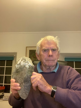
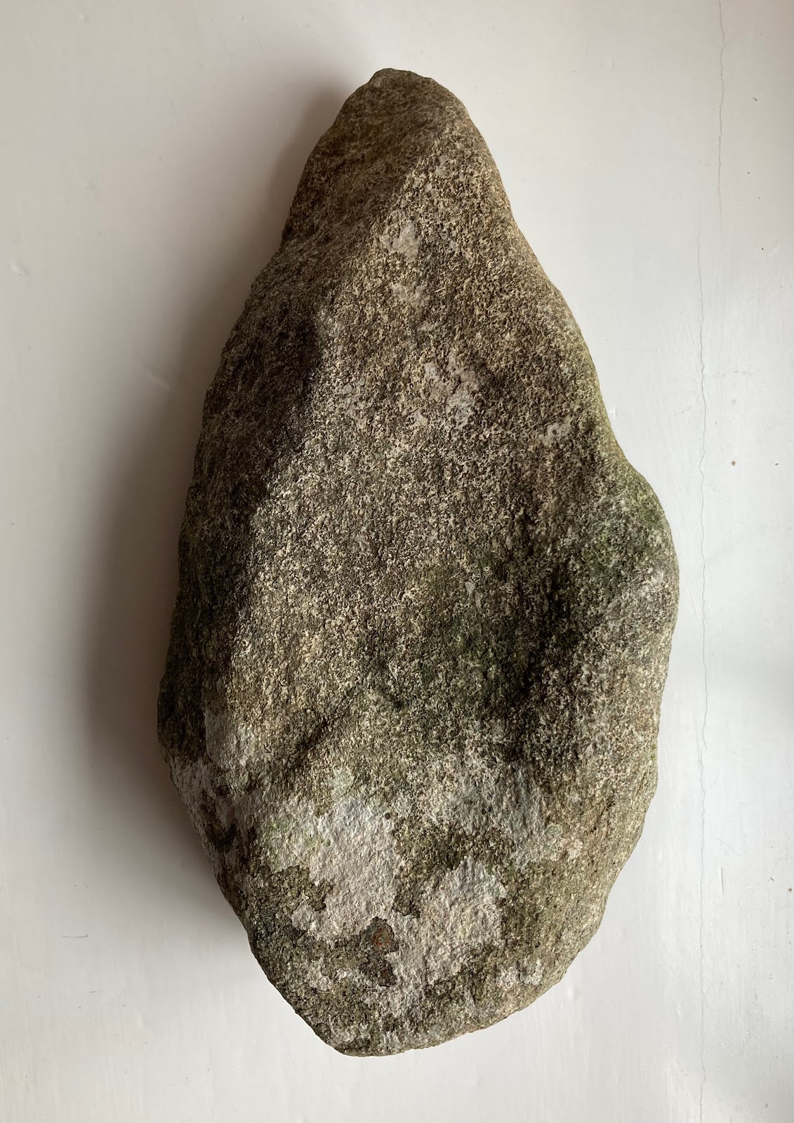
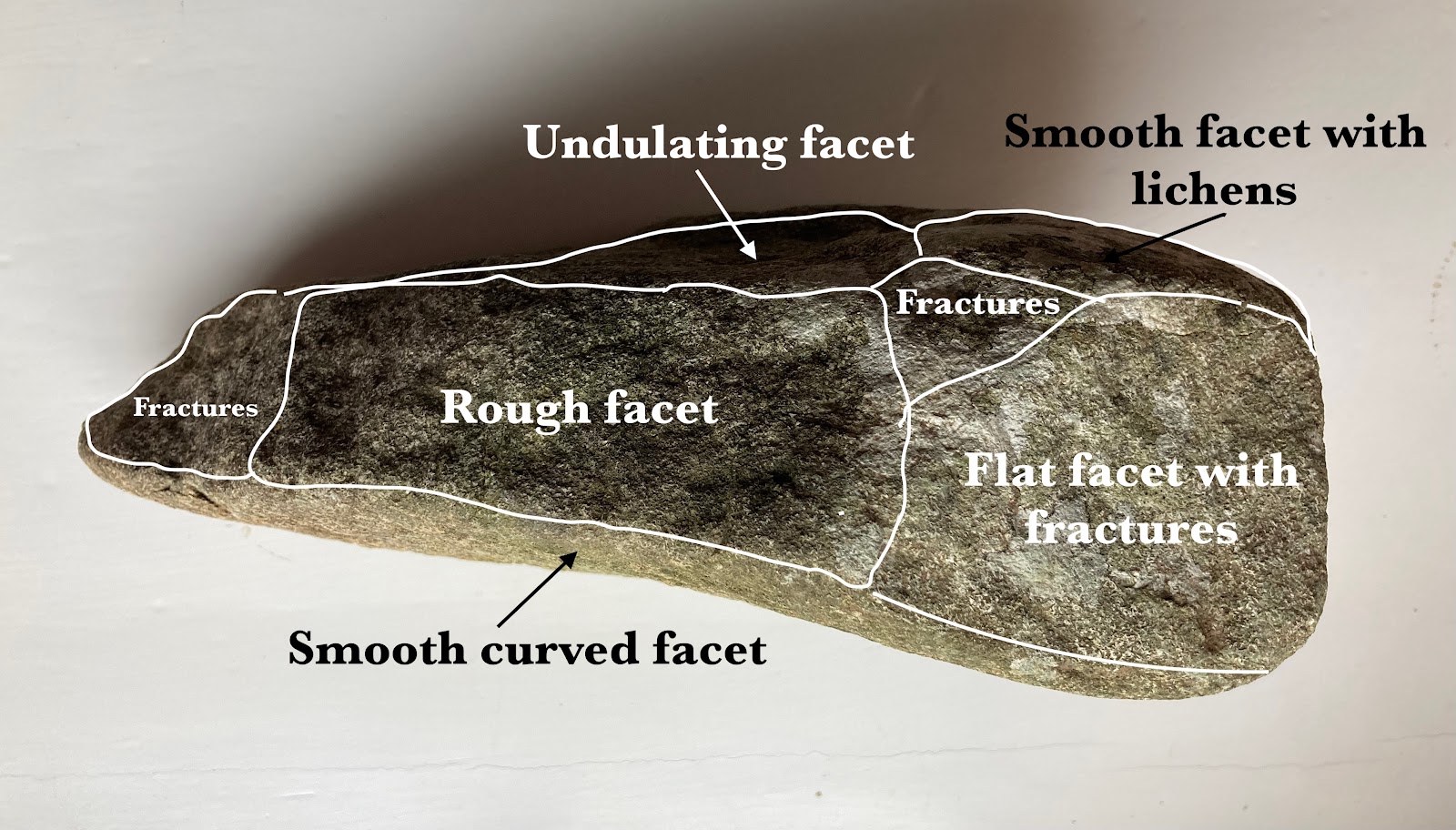
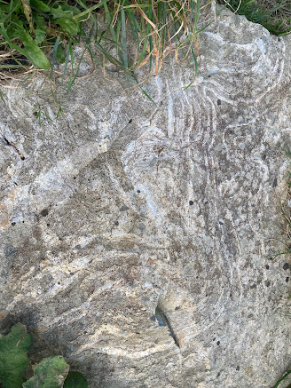
The problem with the Bristol Channel and South Wales segment of the map is that they have (I think) fed into the computer model all sorts of data that are unreliable.  I suspect that they have told the computer that there are no traces of Devensian glaciation on the coasts of Devon and Cornwall, that Lundy Island was not glaciated at the time, and that there was a strange ice-free enclave in mid and south Pembrokeshire.  My article about the latter came out too late for the BRITICE work, but my suggestion that the "enclave" did not exist appears to have been accepted by everybody working in the field -- at least, nobody has challenged either my field evidence or my conclusions!  

As suggested in my article, I am quite convinced that there are good grounds for supposing that:

(1) Lundy was completely covered by ice during the LGM
(2) the whole of Pembrokeshire was submerged beneath LGM ice, as was the whole of Gower
(3) Devensian ice from the west reached the edge of the Vale of Glamorgan, but may not have covered it completely
(4)  some of the traces of glaciation on the north coast of Devon and Cornwall may well have been left by the LGM ice of the Irish Sea Ice stream

If these suggestions are accepted by the BRITICE authors, then the modelling of the British and Irish Ice Sheet becomes a great deal easier and more realistic.  If we add the necessity of modelling the southernmost ice edge even further to the south, on the edge of the Celtic Sea continental shelf, in accordance with collected field data (published in assorted papers by James Scourse and others) we have to model for minimal ice surface gradients and lateral ice spreading.  As I have argued on this blog many times, you cannot have a narrow ice lobe pushing all the way to the shelf edge in the middle of the Celtic Sea because there is no deep channel to constrain it and no flanking uplands -- so ice MUST have spread laterally (eastwards) at least as far as the Devon and Cornwall coast and well into the Bristol Channel.  It all makes sense........

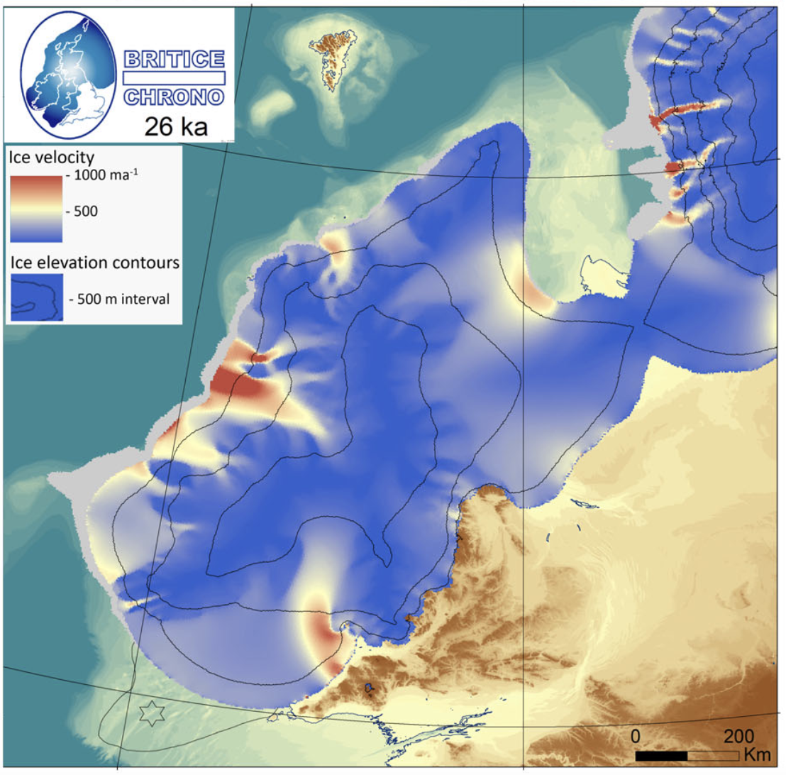
This is the map showing modelled ice velocity, showing an ice flow velocity of c 1 km per year immediately adjacent to an "ice free enclave" in Pembrokeshire.  This is nonsense.  No wonder the modellers said that they were thoroughly confused!

This (below) is the ice flow / ice edge scenario that best represents what happened around the LGM of c 26,000 yrs BP.  It is based pretty solidly on field evidence as published in the literature.


If the BRITICE modellers had used this map as part of their "ground truthing" exercise and had fed it into their magical computer, then everything would have matched up very nicely and everything would have looked more realistic.........

Brian John. 2023. Was there a Late Devensian ice-free corridor in Pembrokeshire? Quaternary Newsletter 158, pp 5-16.

https://www.researchgate.net/publication/368426571_Was_there_a_Late_Devensian_ice-free_corridor_in_Pembrokeshire

Anyway, let's see what the next generation of Devensian models looks like.  I'm still waiting for some sensible modelling of the Wolstonian and Anglian glaciations; that's when we will start to see some serious guidance as to the likely course of events in the saga of the bluestones.


Tuesday 28 November 2023

Bluestone "declassification" -- have the geologists lost the plot?


Not long ago I took the geologists to task for suggesting that the Altar Stone should be "declassified" as a bluestone because they now think it might not have come from Wales.  This is the ultimate manufactured absurdity -- maybe designed to divert attention from all the things they have got wrong over the past decade.  

The term "bluestone" is daft enough as it is, but it is just about acceptable if it is used as a shorthand label for "any stone at Stonehenge that is not a locally collected sarsen stone."  For years Ixer and Bevins have been trying to redefine the term to mean "any non-sarsen MONOLITH at Stonehenge" while getting into a frightful tangle by talking about multiple bluestone fragments that cannot be shown to have come from any monolith since there are no known close geological matches.  So imaginary or fantasy monoliths are included as bluestones as well. At the same time, they very conveniently ignore any "inconvenient" fragments of rock found at Stonehenge that do not fit into any of their designated "geological types" that are in themselves artifices. As I have said many times before, that is illogical and unscientific.  Nobody knows how many rock types there are at Stonehenge, and to some degree it depends whether you are a lumper or a splitter, but we would probably all agree that there are far more than a dozen.  Just read the literature since 1991 to confirm that........

We are never going to sort out what happened at Stonehenge unless we evaluate ALL of the foreign material at Stonehenge and try to work out how it got there.  And that includes assessments of packing stones, mauls, hammerstones, boulders (like the Newall Boulder), cobbles, axes and knock-offs, fragments and flakes.  It's intellectually lazy to simply assign all the inconvenient bits and pieces to a category called "adventitious".

Now, in this latest bizarre twist, Ixer and Bevins seem to want to assign to themselves the authority to determine what is a bluestone and what is not -- and have decided that you cannot refer to something as a bluestone unless it has come from the area within and around Mynydd Preseli.  

It's all a mess, and they know it.  


I had hoped that the ides of "bluestone declassification" was a mementary aberration, and that the geologists would promptly forget about it. But now up pops another publication, with the involvement of another team of geologists.  Quote:

"The Altar Stone is a grey-green micaceous sandstone, otherwise known as Stone 80. It is anomalous in its composition, size and weight when compared to the other bluestones. A very recent publication by a team of geologists, which included Prof. Bevins and Prof. Andò, proposes that the Altar Stone be declassified as a bluestone. Based on X-ray and Raman analysis in the laboratory on fragments of the stone using a Renishaw inVia Raman microscope, they hypothesise that the stone did not originate from the Anglo-Welsh Basin, as previously thought. Instead, there is strong correlation between the Altar Stone and sandstones in northern England or Scotland."


So it looks as if the "declassification of inconvenient Stonehenge bluestones" is going to be pushed as the next great Stonehenge debate, led by the heroic team of geologists who like to refer to themselves as "the pet rock boys".  It's even more ridiculous and sterile than some of the debates that have gone on in glacial geomorphology in the past, relating to the labelling of lithological units.   Don't get me going again on the "Penfro Till Formation" (invented by Prof David Bowen) which does not actually seem to exist, or on the labelling of certain other deposits in the glacial sequence of Southern Britain......

Friday 24 November 2023

The Saga of Breakheart Bottom


Breakheart Bottom, near Imber

Once upon a time an ice giant with frozen fingers travelled from the far west, where he lived close to the setting sun, to visit a cousin of his who lived on the chalklands close to the place where the sun rises.  He was called Dafydd and his cousin was called Cuthbert.  Anyway, Dafydd carried with him  a bag of pretty pebbles as a gift for his host, because that is the way with giants. (He thought they were pebbles, because he was a giant, but for ordinary people they were HUGE......)  When he arrived he was welcomed with open arms by his cousin, who lived in a warm and pleasant valley with not many trees.  He just loved his gift from the west, and the two giants arranged the pebbles in a nice pile where they could be admired by all who travelled that way.    They passed the time pleasantly enough, talking of other giants and the latest happenings here and there.  But then Dafydd began to feel uncomfortable because his fingers started to thaw, and he was much happier when they were frozen.  So at last he took his leave and headed back to the icy lands of the west.  Cuthbert was very proud of his collection of pebbles, but he was not very intelligent and not very attentive, and when he was out wandering one day a gang of human beings came and stole the pebbles because they wanted to arrange them in a pretty pattern to show to their friends.  They left one behind because they were in a bit of a hurry, but a human being who lived nearby (Mr Bole was his name) stole that one and buried it in the middle of a mound in his garden.  Cuthbert was distraught for a while, but soon forgot about the pebbles, because he had other pressing matters to deal with.  But after the passage of a few centuries Dafydd came on another visit, but without any pebbles this time because he was feeling his age, and anyway, pebbles had gone out of fashion.  He was welcomed warmly enough by Cuthbert, but he immediately noticed that the nice pile of pebbles had gone.  Cuthbert explained that they had been stolen by some humans, but poor Dafydd was distraught because his cousin had not looked after the pebbles better, and because of the evil ways of human beings. He broke down and wept giant tears, and ever since then the pleasant valley where Cuthbert lived has been called Breakheart Bottom...............

So there we are then.

Even if the above folk tale is not necessarily true, I am intrigued by the manner in which both Aubrey Burl and Geoff Kellaway homed in on the area around Chitterne, Heytesbury, Boles Barrow and Imber as the possible area in which the Stonehenge bluestones were deposited by ice and from which they were collected up by our heroic ancestors.  Breakheart Bottom is in the middle of that area, and around half of the territory on the map below is within the MOD firing range.  

I just wonder whether this is the area in which the truth resides, just waiting to be uncovered?


Tuesday 21 November 2023

Stonehenge in its Landscape -- free online


I have just caught up with the fact that the big (definitive?) volume edited by Ros Cleal et al is now online as a free PDF, available for download. So well done, EH and the Archaeology Data Service.

 https://archaeologydataservice.ac.uk/archiveDS/archiveDownload?t=arch-1416-1/dissemination/pdf/978-1850-746058_72.pdf

I refer to it frequently, and I really do like its cool, matter-of-fact approach in which evidence is presented methodically, analysed and assessed as to its importance -- all mercifully free from the hype and hubris that we see all too often in Stonehenge studies........

It's not perfect -- no book ever is -- but since it was published in 1995 nothing has come near it in terms of value for money.  And now it's free!  Enjoy........

Summary:

This volume represents a detailed discussion of the structural history of Stonehenge, arrived at by the integration of evidence from primary records of excavations carried out between 1901 and 1964. These major campaigns of excavation and recording include those of Prof William Gowland (1901); Lt-Col William Hawley (1919-26); Profs Stuart Piggott and Richard Atkinson with J F Stone (1950, 53-5,56,58 and 64) and some smaller, previously unpublished campaigns as well as more recent, small-scale excavations which are already published. The evidence for the use of the monument from the Middle Neolithic to the present day is discussed in terms of its landscape and social settings. The evidence for the rephasing of the monument, including artefactual and ecofactual assemblages, details of the radiocarbon dating programme, geophysical surveys, transcripts of all available field plans, sections, and stone elevations is presented together with a variety of summary lists, concordances, and a guide to the site archive. A new suite of radiocarbon determinations has been obtained which redefines our understanding of the sequence of construction and use of the monument and augments the surviving archaeological evidence.

Saturday 18 November 2023

The gullibility of the innocent.........


This image is doing the round in social media, on assorted nutty archaeology sites and Facebook pages galore.  Almost everywhere it is accompanied by serious discussions about how this mammoth was entombed in crystal clear ice and so on and so on.  It's all complete rubbish, of course.  The accompanying text was about the discovery of a baby mammoth in the permafrost  -- that's an old story anyway, now recycled -- and all regurgitated by people who skim science stories in learned journals, extract the spectacular bits and seriously misrepresent almost everything because of the obsesssion with "impact."  To hell with ethics.  The image has been created by somebody having fun with AI technology, which is contributing -- faster than any of us thought possible -- to the death of science.  It's now almost impossible to separate out the real images from the manufactured ones....... 

In reality, the remains of mammoths found in the permafrost are always scruffy, squashed and very dirty.  Permafrost ice does not look like crystal clear glacier ice or lake ice.  And when animals die in Arctic bogs they do tend to fall over in the process.....

Sounds familiar?  For years we have had nonsense press releases flagging up the wonders of Neolithic quarries, lost stone circles and heroic stone transport expeditions, and as we speak people are probably working on "photographs" of precisely what is supposed to have been going on.

Here is my contribution.  This, by the way, is a real, undoctored photo from Antarctica.


Breaking news!  Just discovered in Antarctica -- a pyramid which is far larger than the Great Pyramid of Giza, and next to it a smaller pyramid is just emerging from the melting ice cap.  This proves that Ancient Egyptians discovered Antarctica and developed an advanced civilisation, well before the start of the Ice Age.  This of course transforms our understanding of the ancient world, and the history of the world must now be re-written.


Wednesday 15 November 2023

Bullet-shaped clasts


I'm still rather intrigued by the Newall Boulder, also somewhat prosaically known as RSN18.  The top photo was taken by Tony H when we were in Salisbury Museum last year, and the other is from my study today, showing the boulder found in the garden the other day.

Regardless of how the boulders were shaped, and how they travelled from A to B, the similarities are striking -- bullet shape, weathering crust, clearly defined facets, rounded off or abraded edges, and what appear to be pressure fractures on what are otherwise abraded surfaces.  The bullet shape, with one pointed upglacier end and one blunt downglacier end where the rock surface is rougher, is typical of glacially transported clasts.

The Newall Boulder is a welded tuff referred to by some as a rhyolite; the Trefelin Boulder is an unspotted dolerite.  The Newall Boulder, relatively fine-grained, does have some features which I think are striations -- the other boulder has none.

The biggest difference between the two boulders relates to prehistoric and recent damage done by human beings.  The Trefelin Boulder is in pristine condition; but the Newall Boulder has had a hard time of it.  Both the tip and the back end of the clast are missing, and I agree with Kellaway that some of the damage has been done by our  prehistoric ancestors who were maybe thinking of making some stone tools.  The most recent damage (well documented by Bevins et al, 2023) has involved cutting out or knocking off at least five samples for geochemical and petrographic analysis, and the slicing of thin sections.  Vandalism, or necessary sampling in the cause of science?  I wonder whether it was necessary to destroy the boulder quite so comprehensively?


Sunday 12 November 2023

Another bullet-shaped glacial erratic clast


I was mending one of my stone walls yesterday when I happened upon a rather fine small boulder which was virtually a mirror image of the famous "Newall Boulder" which sits in Salisbury Museum.  It's almost spooky -- but this one has not had chunks knocked off it, and it has not lost large slices to geological sampling.....

This one is made of dolerite, not rhyolite, and its dimensions are c 27 cm x 15 cm x 10 cm.  It weighs 5 kg, which is approx what the Newall Boulder will have weighed before human beings started messing about with it.  It has a weathered surface, with some facets more weathered than others.  It has 8 main facets and 4 smaller ones -- some flat and others curved or undulating, and there are variations in surface micro-morphology as well.  There are no striations (dolerite surfaces seldom hold striations because of the coarse graining) but there are several small but distinct pressure fractures.  There are no calcium carbonate concretions or nodules (this is an acid water environment), but parts of the boulder surface are covered with patches of whitish lichen.

I am in do doubt at all that this is a glacially transported clast, found in Devensian glacial deposits in the immediate vicinity and used in the construction of my stone wall.  We'll call it the "Trefelin Boulder". It has probably travelled 2 km at the most, from outcrops to the N or NW.  But boulders like this can be carried hundreds of kilometres -- sometimes with ongoing modification but sometimes unchanged after carriage in a "protective environment."  The interesting thing is that each facet has a different micro-morphology and therefore a different history.

I will describe this boulder in more detail in another post, which I hope will be instructive for those who think that the Newall Boulder is just the broken off tip of a monolith transported by our heroic Neolithic ancestors from the so-called quarry at Craig Rhosyfelin........


"Side on" view of the boulder, showing 7 of the 12 facets created by subglacial or 
englacial fracturing and abrasion.

For comparison, here are a couple of photos of the Newall Boulder:


Suggested original shape of the boulder -- before prehistoric and modern modification


The extent of the damage on the lee (blunt) end and on the flank

In the case of the Newall Boulder, the nose (pointed end, up-glacier) has been broken or sheared off, as has the blunt end (down-glacier), leaving us with perhaps 70% of what was there originally.......


Banded rhyolite, Newport, Pembs


Three huge chunks of banded rhyolite have been used on the Parrog in Newport as a memorial for Brian Watts, who died in 2005.  They are pretty spectacular -- the larger of the three probably weighs ten tonnes.  I don't think they are glacial erratics -- from their sharp edges, I think they have been quarried from a rock outcrop somewhere in the neighbourhood.  There are a number of rhyolite outcrops on the northern flank of Carningli.   I am trying to discover the provenance........

Text-book examples of contorted flow banding, created by flowing lava and picked out by layers of quartz (?) crystals......  Click to enlarge.


PS.  The provenance will remain a mystery.  Apparently Glyn Rees, the landlord of the Golden Lion in Newport, "obtained" it from a secret location in the year 2000, as a Millennium commemoration stone, and never divulged where it came from.  So the secret went to the grave with him when he died.......

New Altar Stone paper -- professional scrutiny from Dr Richard Thomas

Exposed beneath a big fallen sarsen stone -- the Altar Stone. From Orkney?  
From the sublime to the absurd?


Scientific papers are worthless without scrutiny, as I have said many times on this blog. I have already expressed my reservations about the paper that purportedly demonstrates that "The Altar Stone has not come from Wales".  I was not convinced:

Anyway, I am not alone in having serious reservations.  Here is another professional opinion.  Grateful thanks to Dr Richard Thomas, who knows a thing or two about the ORS:

Altar Stone paper
"The Stonehenge Altar Stone was probably not sourced from the Old Red Sandstone of the Anglo-Welsh Basin: Time to broaden our geographic and stratigraphic horizons?” by Richard E. Bevins, Nick J.G. Pearce, Rob A. Ixer, Duncan Pirrie, Sergio Ando, Stephen Hillier, Peter Turner, Matthew Power.
Journal of Archaeological Science: Reports 51 (2023) 104215


Comments from Dr Richard Thomas

Background:

In 1923, H.H. Thomas (p. 245) wrote: “From general considerations, however, the type of heavy [mineral] residue and the lithology of the rock as a whole are sufficient to make the identification of the altar-stone with the Old Red Sandstone of South Wales almost a matter of certainty.” It’s been 50 years since I knelt by the Altar Stone to take some photos and was greatly amused to hear two ladies behind me say: “what’s ee doin’?” … “ee’s takin’ a picture of a ten-pence piece.” My immediate impression at that time was to wholeheartedly agree with Thomas’s assessment of the Altar Stone’s probable provenance, and nothing in this latest publication leads me to change my opinion.

Comments:

1. The presentation, superficially at least, appears to be authoritative. The element concentrations are what they are. Using ternary plots of 3 elements or element ratios is a well-established and effective procedure for discriminating between, or correlating, igneous units such as lavas and volcanic ashes. The problem I have with them using such an approach for sandstones is that there are many variables that contribute to the initial composition of a fluvial sand body when deposited, and many more that affect its diagenetic history and hence, its ultimate composition (e.g., mineral dissolution and replacement, etc.). It would be interesting to compare and contrast other detailed studies attempting to correlate sandstones on the basis of their geochemical composition.

2. Another issue I have is that the heavier elements they use in their diagrams (e.g., Nb, Th and Zr) are concentrated within the sandstones' heavy mineral fraction (such as in zircons, tourmalines and rutiles = ZTR). The more mature your sandstone is (i.e., well sorted and composed of more resistant minerals), the more likely it is that the heavy mineral fraction will be ZTR dominated. As a result, you have to compare apples with apples -- i.e., sandstones with similar grain sizes and levels of textural and mineralogical maturity. Have the authors done this? I don't know because I haven't seen their sample site table, but I suspect not.

3. As far as I know, there has been no recent sampling of the Altar Stone itself – apparently, English Heritage will not permit it. In my view, unless such sampling occurs (e.g., a 25cm x 2.5 cm diameter core drilled from the underside of the Altar Stone), the provenance of the Altar Stone can never be conclusively proven. This lack of unequivocal Altar Stone samples is one reason for Bevins et al.’s heavy reliance upon high-tech analytical methods.

4. Unfortunately, I don’t have access to their Supplementary Table 1 which lists the site details for the 58 samples they analysed from the ORS of the Anglo-Welsh Basin, nor the 2006 paper by S. Hillier et al. whose sample set they draw upon extensively.

5. Bevins et al. frequently state they have “proven” (or “confirmed”) that various debitage samples were derived from the Altar Stone. Key amongst such samples is ‘Wilts 277’ (a.k.a. 2010 K 240) which they state is a thin section collected from the underside of the Altar Stone in 1844. They base this “proof” on comparisons between their portable XRF analyses from the weathered surface of the Altar Stone with SEM-EDS data from Wilts 277. They place great emphasis on the ‘high’ Ba content of the Altar Stone (to which we’ll return).

6. Rob Ixer has told me that he and Richard B do not think H.H. Thomas examined thin sections taken from the Altar Stone. I do not know the reason they believe this but, from my reading of the latter’s paper, I disagree.

7. Thomas (1923, p. 244) states that “the Altar Stone is exceedingly rich in garnet of small dimensions”. In addition, the upper surface of the Altar Stone, which is small-scale trough cross-laminated, is highly micaceous (with muscovite the dominant species). In 2010, I examined thin section Wilts 277 and told Rob and Richard that I thought it couldn’t be a specimen of the Altar Stone because it did not contain sufficient muscovite or garnet.

8. In my opinion, since sandstone composition (especially in fluvial sandstone bodies) varies both laterally and vertically, and with distance from source, due to textural differences and the influence of hydraulic equivalence, the use of whole-rock geochemical results (and primarily, in this case, the concentrations of one element) is not a viable provenance matching method for most sandstones.

9. The use of SEM-EDS analysis to generate modal compositional data for sandstones is also problematic because a “stepping interval” of 10 microns (as used by Bevins et al.) means that you sample individual grains within rock fragments and inclusions within mineral grains, etc.

10. Subjectively, I feel that Bevins et al. are tackling the analysis of sandstones almost as if they were igneous rocks (e.g., page 4: [Zr, Nb and Th] “will reside in accessory phases in the sandstones” – presumably they mean within heavy minerals.

11. Muscovite abundance is one of the Altar Stone’s definitive features, and yet Bevins et al. (page 5) state that it is not “a critical characteristic discriminator in terms of comparison between known Altar Stone and questioned ORS samples.”

12. We need more information about the Anglo-Welsh ORS – after all, most ORS sandstones are red – and the authors have not stressed the importance of the (primary) grey-green colour of the Altar Stone from a provenance perspective.

13. For example, they have invested a great deal of effort in comparing Wilts 277 with their WM 6 sample – because of the latter’s ‘elevated’ Ba content. Surely, in sandstone provenance studies the idea is to compare like with like, whereas WM 6 is red and coarser grained than Wilts 277 and so it’s hardly a surprise that they are not a match.

14. Based on their previous work, Bevins et al. have started their Altar Stone provenance study at the microscopic level. For example, they base their heavy mineral analysis of sample MS-1 on 0.1973g of material – which seems unlikely to constitute a statistically representative sample.

15. I believe such a study should instead begin with the ‘big picture’ (basin-wide outcrop) level before homing in on candidate sandstones’ microscopic characteristics. In terms of the latter, thin sections offer a wealth of provenance-matching information that Bevins et al. ignore or barely mention.

16. I haven’t kept up with the literature, but I don’t think there have been any modern, detailed studies of the petrography and diagenetic histories of grey-green L. ORS sandstones across the A-W Basin, have there?

17. From personal observations I know that grey-green sandstones within the Senni (Beds) Fm. vary considerably from west to east in terms of their detrital compositions and dominant cements (cf. Heol Senni, Brecon Beacons and Primrose Hill, etc. quarries).

18. While Bevins et al.’s discovery of relatively ‘high’ baryte concentrations in the Altar Stone is certainly interesting, it should be regarded as the ‘icing on the cake’ (to confirm or dismiss potential provenance matches for the Altar Stone) rather than the primary investigative tool.

19. Bevins et al. also make a big deal about the relative lack of high Ba concentrations in stream sediments on the A-W ORS. I don’t find this to be a concern. What was the spacing between samples? Look at the relative sizes of the outcrop areas of the ‘Red Marls’ and Brownstones versus that of the Senni (Beds) Fm.

20. I think Bevins et al. are barking up the wrong tree(s) but support them in their desire to solve the mystery.

===================================

Saturday 11 November 2023

The EH version of Stonehenge geology


Here we go again.  Somewhat belatedly, the Independent has picked up on the latest press release from Bevins, Ixer & Co on the origin of the Altar Stone:

New mystery over origins of Stonehenge after remarkable discovery

For the past 100 years, the Altar Stone at Stonehenge was thought to come from south Wales - but new research provided a new theory 

Alex Ross

Remarkable discovery? Well, however Richard Bevins spins it in his quote for the media, the geologists have NOT discovered that the Altar Stone did not come from Wales, as I have explained in my scrutiny of the paper:

They have hypothesised that the Altar Stone might not have come from any of the locations that they happen to have sampled -- while acknowledging that there are huge variations in the ORS strata which mean that even sampled locations my not be reliably represented in the data base. Sophisticated analytical techniques and impressive diagrams in learned papers cannot compensate for sampling shortcomings.  They may or may not be right in what they say, but this is a speculation, not a discovery.

Then we see this in the press report:

“It’s broadened our horizons,” said Dr Jennifer Wexler, from English Heritage. “We’ve gone from believing we had two types of stone [bluestone and sarsen], now we have three from different places. This opens up a whole new exciting look at the origins of Stonehenge and possibly new connections to other regions of Britain.

“During the late Neolithic age people were coming from places, some a long distance away, and were bringing things from places which were important to them. Now we are looking at a new area people brought stones to Stonehenge from.

“The new study offers a ‘fingerprint’ from the Altar Stone which teams will now look to match with somewhere in the country, it is like a big detective job.”

The stones brought to Stonehenge were believed to have been pulled over sledges and trackways probably sing large teams of people, or potentially even using animals such as oxen and cattle, said Dr Wexler.

Even by the debased standards of the printed media, this is pretty appalling nonsense.  There are not two "types of stone" from two different places. According to the geologists, even the sarsens are quite variable, having almost certainly come from several different locations.  And as for the bluestones, no matter whether you are a geological "lumper" or "splitter", you have to agree that they have come from around 46 different locations (if you count all the foreign clasts of all sizes from the Stonehenge landscape) or around 22 different locations (if you count just the monoliths and the related debris). 

And the stones "brought to Stonehenge" ??  Oh dear oh dear -- don't get me going on that one.......... and don't get me going either on the question "When is a bluestone not a bluestone?"..........

Wednesday 8 November 2023

More on the Nevern Estuary washed till


 I have discussed (on several occasions) the exposure of till in the Nevern Estuary -- sometimes nicely exposed in the inside of the coastal dune belt.  I have also speculated on the possibility that the last active ice in this area might have been Welsh Ice, not Irish Sea Ice.........

On our walk today I noticed a distinct gradation in the washed till / pebble accumulations on the tidal shoe on the inside of the dune belt.  This is all very unscientific, since I have done no pebble collecting or counting, but I think there is a far greater range of rock types represented on the washed till surface towards the southern end of the exposure, and a far greater percentage of grey and brown gritstones, sandstones and shales (typical of the rock types exposed in Ceredigion) towards the north.  If we take igneous pebbles as a proxy for debris derived from Irish Sea till, they are far more numerous in the south and diminish in frequency northwards over a distance of c 100m.

So was there a contact zone between Irish Sea Ice and Welsh Ice during the Late Devensian here in the Nevern Valley?  It's quite possible.......

Southern exposure of pebbles washed out of till -- with abundant quartz and igneous materials including lavas and tuffs 


Northern exposure with a much greater concentration of grits, sandstones and shales (from the Ceredigion coastal strip?)


Monday 6 November 2023

Saturday 4 November 2023

"Follow the science" is a meaningless mantra


I've gone on about this before, but it was good to see Tory MP Esther McVey having a go at the phrases "follow the science" and "follow the evidence" in a recent speech in the house about Covid vaccines.   I have no wish to talk here about either Covid or the vaccines, but to hear somebody like McVey addressing the issue of scientific practice and reliability is actually quite refreshing.  I agree with her.  There is no such thing as THE science, and anybody who claims that is either a fool or a charlatan.  Yet we heard the phrase over and again -- almost on a daily basis -- in the TV briefings from Johnson, Hancock and their tame "scientific experts" during the course of the pandemic.  Just to re-iterate.  There is strong evidence and there is weak evidence -- some of it withstands scrutiny, and some doesn't. There MUST be scrutiny.  And there is good science and bad science, some of it produced by good scientists and some by people who are not scientists at all but who use technology and pretend that they are being scientific.  Science is all about knowledgeable questioning and about debate, and those scientists who pretend that their views are representations of the truth, or that their views are undisputed by others, are not just deluded but dangerous. 

 https://www.youtube.com/watch?v=gdeYzaTZsOA