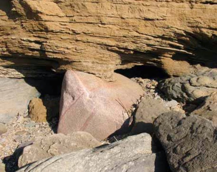
We are all lost in the fog, looking down into the murky depths of the Bristol Channel and trying to navigate around ice floes bearing giant erratics..........
Things are very murky indeed, and I suspect that all of us who have been involved in the discussions about the Bristol Channel (James Scourse, Nick Pearce, Rob Ixer, Chris Rolfe, Richard Bevins, Phil Gibbard, Olwen Williams-Thorpe, John Hiemstra, Danny McCarroll, Ed Lockhart and myself, to mention just a few) are more than a little confused, because we don't really know what to make of the evidence. So in the mix we find field observations, assumptions and speculations relating to ice rafting, the positions of giant erratics, isostatic and eustatic interactions, tectonic uplift, ice edge positions, glaciological and climatic factors, the reliability of OSL and other dating methods, and much else besides.
Part of the difficulty that we all face arises from the conflation of a number of different issues. So arguments about ice rafting and relative sea level (RSL) positions and the interpretations of sea floor sediments have got tangled up in arguments about the likelihood of expansive glaciation in the Early and Mid Devensian (MIS 3 - MIS 4). Yes, these things are interrelated, but the "Devensian debate" is a hugely complex one, and it is made much more complicated than it needs to be by the obesssion that some people seem to have with the ice rafting of big erratics and the necessity of working out a mechanism for big dirty icebergs to afflict the Devon and Cornwall coasts with RSL more or less where it is today.
This, if I may say so, is a sterile debate because it is completely unnecessary unless you are intent on denying that glacier ice has, on one occasion or more, come into contact with the southern shores of the Bristol Channel. Following the publication of the latest comprehensive study by Bennett et al (2024), it is incontrovertible that the ice of the Irish Sea Ice Stream has come into contact with the cliffline and pressed inland into embayments, all the way from the Bristol Avon to Land's End. As James Scourse has said, some of the field evidence is unequivocal and some is equivocal. That's no big deal, and it can also be said of all of the coasts of Wales. Large stretches of the coastline of western Pembrokeshire are apparently devoid of evidence of glaciation, and the best evidence of Quaternary sedimentation is found in embayments and coastal valleys protected from the effects of coastal erosion and cliffline retreat in a high energy storm wave environment. This does not mean that just a few isolated parts of the coastline were overridden by glacier ice or affected by lobes of ice projecting beyond the position of the glacier front. Lobes only exist where there are channels and topographical constraints.
Common sense (and glaciology) dictates that if Lundy and Flatholm were overridden by streaming ice, and if the Isles of Scilly were similarly affected, the west-facing and north-facing clifflines of Cornwall, Devon and Somerset must have presented a massive barrier which prevented the ice from moving far inland. Of course, at the time this coastal tract was far above RSL, and the cliffs must have been partly buried by banks of scree and landslide debris -- but they must still have been high enough to hinder ice ingress towards Exmoor and the uplands of Cornwall.
The simplest explanation of the "giant erratics" resting on the coastal rock platform and also at higher altitudes is that they are glacially transported and that they are exposed by washing processes up to, and some way above, high water spring tides (HWST). At higher altitudes (maybe up to 100m in places) the erratics are sometimes exposed at the surface but are still, for the most part, buried in till and slope deposits. This is exactly the situation in the Fremington - Croyde - Saunton area.
Some of the boulders are sealed beneath possible Ipswichian and probable Devensian deposits, and so they must have been transported and emplaced by Wolstonian or earlier glaciers. Other boulders which have no stratigraphic context (like the Limeslade boulder or the Flatholm pink granite boulder) might just have been carried by Devensian ice........
If one sees some merit in Occam's Razor and accepts the above narrative, discussions about tectonics, isostatic loading effects and RSL positions become immaterial, and we can move on.
=========
So -- what about an Early and Mid Devensian glaciation? Ah, that is another matter entirely, which deserves another post.....


No comments:
Post a Comment
Please leave your message here