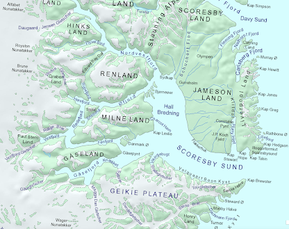
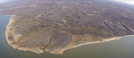
Jameson Land in East Greenland is a tilted peneplain of Triassic and Jurassic sediments, to the east of the Scoresbysund fjord system. It's sometimes referred to as a "sedimentary basin" -- but it's rather more complex than that, with some upland areas (especially in the east) with high cliffs and deep valleys. But it's dominated by fluvial features, and apart from the ice caps and small semi-permanent icefields in the Olympen area, dramatic glacial features are absent from the landscape. For that reason, Jameson Land was referred to as "unglaciated" until field research revealed quite extensive areas with erratic boulders and patches of glacial deposits.
I have made many mentions of Jameson Land on this blog, such as this one:
I'm interested in Jameson Land (as I am interested in the Aubrac region of France) because of what it can tell us about the glaciation of relatively low-lying or plateau areas which are devoid of roches moutonnees, troughs or cirques, and where ice may have been so thin that it played a mostly protective, rather than erosive, role in the evolution of the landscape.........


No comments:
Post a Comment
Please leave your message here