Pages

Sunday, 29 June 2014

Hutton and broken stones


 Rob Ixer, fallen sarsen and recumbent Altar Stone

From the latest Stonehenge sensationalist story, as featured in the world's media from Nairobi to Chipping Camden to Honolulu to Lhasa.....

Ronald Hutton:  ‘When they put up one of those great sandstone blocks in the outer circle, it slipped when it was being put in its hole, fell over and broke in half............They put one broken bit on top of the other broken bit, jammed a lintel on top and hoped they’d stay together. They didn’t, they fell over quite soon after.'

".........they built a trilithon – two massive upright stones with a lintel on top – but one of the uprights was not rooted deeply enough in the ground. ‘At some time, that stone skidded out,’ said the professor.  ‘It fell headlong across the altar stone, knocking the altar stone to the ground and breaking in half itself. That massive lintel tumbled down and still lies where it fell. They never tried to fix it."

I'm quite intrigued by these comments -- we have the old one about the Altar Stone having once been a standing stone which was then knocked over...... (Aubrey Burl thought it always was a LYING STONE rather than a standing stone.... and we have had big discussions about whether it might have been the original stone at Stonehenge around which all the others were placed while it was left in its recumbent position.)

Then the bit about one bit of a broken sarsen stone being placed on top of another..... is that pure fantasy?  Which sarsen is he talking about?

Saturday, 28 June 2014

More about that old jerry-built shambles...


Followers of this blog will be familiar with the idea -- articulated by Rob Ixer and myself, among others -- that Stonehenge was a bit of a shambles, built by people whose ambitions or aspirations were truly spectacular, but whose surveying and building skills were questionable.  See the following:

http://brian-mountainman.blogspot.se/2012/01/stonehenge-and-importance-of-heroic.html

http://brian-mountainman.blogspot.se/2013/08/stonehenge-complete-or-incomplete.html

https://www.youtube.com/watch?v=-f4c3F9iEaY

http://brian-mountainman.blogspot.se/2013/03/how-smart-were-our-neolithic-ancestors.html

http://www.thedolectures.com/brian-john-dispelling-the-stonehenge-myth/#.U66JR6jT_LI

http://brian-mountainman.blogspot.se/2012/01/stonehenge-breeding-ground-for.html

http://brian-mountainman.blogspot.se/2009/11/stonehenge-disloyalty.html

https://www.youtube.com/watch?v=7wEvLWkTBEc&feature=channel

I have also questioned other assumptions about the skill of the Stonehenge builders in my book, which, to the eternal credit of EH, seems to sell quite well at the visitor centre. On the other hand, the archaeology establishment has so vigorously promoted the idea of the "immaculate Stonehenge" and the extraordinary skills of our ancestors that it's rather difficult for them to change direction so soon after the completion of all those wonderful new displays and PR materials.


So it's refreshing to see that Prof Ronald Hutton, in a lecture the other day at the Chalke Valley History Festival, agreed with the line that Stonehenge was and is a bit of a shambles.  The Western Daily Press picked up the story, and now the mainstream media are onto it as well -- today there is coverage in the Daily Mail and the Bangalore Mirror (I kid you not!), not to mention other papers as well.  Here is the Daily Mail piece:

=========================================

'Stonehenge was a botched job by cowboy builders': Leading historian claims landmark is only half finished - but is still a triumph

• Professor Ronald Hutton: It was 'unique and possibly failed experiment'
• Builders 'insane enough to work enormous stones as if they were wood'
• Professor claims they put 'one broken bit on top of the other broken bit'
• He was speaking about it at the Daily Mail Chalke Valley History Festival

By David Wilkes

27 June 2014
Cowboy builders botched Stonehenge and may have never even finished it, according to a leading historian.

Professor Ronald Hutton described the prehistoric wonder on Salisbury Plain, Wiltshire, as ‘a unique and possibly failed experiment – as much a triumph as a disaster’ in a talk at the Daily Mail Chalke Valley History Festival.

It is a triumph, he said, ‘because the darned thing’s still there and it’s the most famous prehistoric monument in the entire world’ built by somebody who was ‘insane enough to want to try the experiment of working enormous stones as if they were wood’.

‘They pulled it off but they had some bad times along the way,’ said Professor Hutton, an expert on paganism from Bristol University.

‘When they put up one of those great sandstone blocks in the outer circle, it slipped when it was being put in its hole, fell over and broke in half.

‘If you were a decent bunch of builders what you’d do then is, after a great deal of screaming and complaining, chuck the two broken bits away and bring another one intact and do it properly.

‘They didn’t. They put one broken bit on top of the other broken bit, jammed a lintel on top and hoped they’d stay together. They didn’t, they fell over quite soon after.

‘So these people are working under pressure, they don’t have the resources or the time to get another stone. This is the heart of the disaster that Stonehenge ended up being.

The avenue that leads into Stonehenge is aligned directly on the mid-summer sunrise so that two of the stones frame the sunrise ‘like the sights of a camera or gun’.

But Professor Hutton said the ‘even more stunning effect’ at the mid-winter sunset was lost – because of another mistake by the builders.

He said they built a trilithon – two massive upright stones with a lintel on top – but one of the uprights was not rooted deeply enough in the ground.

‘At some time, that stone skidded out,’ said the professor.

‘It fell headlong across the altar stone, knocking the altar stone to the ground and breaking in half itself. That massive lintel tumbled down and still lies where it fell. They never tried to fix it.

‘So Stonehenge was built by cowboys. It is on the one hand one of the greatest building successes in the story of the human race and from another point of view one of the greatest catastrophes.’
===========================

http://www.dailymail.co.uk/sciencetech/article-2671664/Stonehenge-built-cowboys-lasted-well.html#ixzz35vIIym1Z

=============================


So have we seen the last of this sort of thing?  Somehow I doubt it....


Friday, 27 June 2014

The Millennium Stone Fiasco


Having had a lot of interest in this sad tale, I decided to make it into a Scribd document, so that more people could read it online.  Here it is:

http://www.scribd.com/doc/231584137/The-Millennium-Stone-Fiasco

By the way, who are those two slackers sleeping in the hedge on the left edge of the photo while others struggle with that blasted stone??  Such indolence and disinterest would not have been allowed back in the good old days.......

Pembrokeshire proto-Stonehenge -- a con after all...


Thanks to Helen for alerting us to this.  On the Magalithic Portal, Andy Burnham has revealed that there is no new site near Newport in Pembrokeshire.  Robin has apparently discovered nothing we didn't know about already.  What he has done is to "discover" some new triangles and alignments which he chooses to refer to as a "previously unknown megalithic complex."  So as we expected, a con.  Or maybe we should refer to it as a smart piece of marketing?  Robin will probably sell a few books, and that will make him very happy.

Quote from the author's press release:
"In the summer of 2013 he (Robin Heath) discovered a previously unknown megalithic complex, a Proto Stonehenge, forging a second link has been forged between the Preseli region of Wales and Stonehenge. This discovery, duly surveyed with modern theodolites , GPS and satellite imagery, reveals that Stonehenge was the end result of a long project undertaken over several centuries. The goal was to develop a Neolithic technology capable of accurately measuring and recording time and space. Breathtakingly accurate, what has been discovered is a work of creative genius, completely lost until now and totally absent from our history books. Once understood, it allows us to lift the capabilities of Neolithic culture to a new level and reveals a practicalprehistoric science with which to integrate the rhythms and cycles of the sky with those experienced on earth."

Tuesday, 24 June 2014

Enigmatic structure discovered in Stockholm Archipelago

An enigmatic ancient structure has been discovered by archaeologists at a secret location in the outer reaches of the Stockholm Archipelago in Sweden.  It is extremely primitive in its construction, but it has similarities with other structures seen in the neighbourhood.

The discovery was made by a research team led by Prof Axel Dumpelson of Stockholm University, during a survey of remote territories undertaken by the Stockholm Cultural Archaeological Mission (SCAM) 2014. 

In response to questions from science journalists, Prof Dumpelson stated that the age of the structure is unknown, but should be revealed when radiocarbon dating results are collated.  The structure is basically made of timber -- logs and driftwood presumably collected from the vicinity, and crudely fashioned with some sharp implement.  The planking on the upper surface of the structure is generally irregular, but some of it seems to have been imported from neighbouring communities which enjoyed a more advanced level of technology.  "We believe that these cut planks may have been acquired as a result of barter or other trading activities," said Prof Dumpelson.  "So the makers of the structure must have had some means of transport between their home area and the islands occupied by rival tribes.  This implies peaceful coexistence, and even friendly cooperation, and we can assume that this structure and others like it must have been symbols of the first great political unification of Scandinavia."

The internal parts of the structure are made of  hundreds of boulders and stones of all shapes and sizes,  including some that are clearly not from the immediate neighbourhood.  This means that they were imported from far distant territories in which they must have have been accorded great spiritual, mystical or economic value.  At least three of the boulders are made of red granite, which is also common in the archipelago of Aland, about 100 km to the north-east.  Prof Dumpelson confirmed that he and his colleagues have now prepared a SEK10 million research grant application to the Swedish Cultural Fund, which will be used in the 2015 field season to discover the quarry from which these stones must have been laboriously extracted.

As for the meaning of the structure, Prof Dumpelson stated that this was a matter of heated debate in academic circles.  "It is clearly not connected with shipping or trading activities," he said, "because the water is here only about 20 cm deep -- not sufficient for trading vessels capable of reaching Mariehamn or even Stockholm.  At present we think it might have been for some ritual purpose, or maybe even a boundary marker of some kind.  Analyses of ancient maps reveal that the structure does indeed lie on the boundary between two territories with different owners.  On the other hand it also points towards the rising of the sun on the distant horizon at the time of the spring equinox, suggesting that the builders were fully aware of the movements of celestial bodies."

Prod Dumpelson suggested that several decades of research lie ahead for the archaeological community before this enigmatic structure will be fully understood.  In the meantime, it is understood that a film contract has recently been signed with the National Geographic Society for a three-hour documentary (with dramatic reconstructions) which will be screened at Christmas time in 2015.

Monday, 23 June 2014

Scoresby Sund dawn


Posting this for no other reason than that it is a fantastic image.  Taken by photographer Janet Little in the inner reaches of Scoresby Sund, East Greenland, in 2012.

More about what ice can do -- western Norway

Preikestolen, Lysefjord, Norway.

Trollveggen, Romsdal

Two famous locations in western Norway -- the Pulpit Rock (top) and the Troll Wall (bottom).  Both attest to the incredible power of glacial erosion when channeled within a trough which concentrates glacial erosional processes.

The Troll Wall (Trollveggen) in Trolltindene (Romsdal) is 1100m high, and parts of it are overhanging.   What we have here is a deeply glaciated and scoured landscape to the right, which has been chopped in half by concentrated glacial erosion.

Pulpit Rock is on top of a massive cliff 604 metres (1982 feet) above Lysefjorden, opposite the Kjerag plateau, in Forsand, Ryfylke.  It is now one of the most popular tourist destinations in the country. Look beyond the pulpit to the fjordsides beyond -- the extent and intensity of glacial scouring is rather impressive.....

Musical monoliths -- again


Nice little cartoon, commenting on yet more coverage of the musical stones fantasy -- this time in the Guardian, presumably because they were short of news last week.....

Well, doesn't do much for science, but it keeps us entertained....

We wait breathlessly..... Proto Stonehenge finally revealed?


Well, you can't fault Robin's devotion to the Great God of news management -- info all over the place, including assorted blogs and web sites -- and even that learned publication the Western Telegraph (northern edition) -- about the launch event, the background, and the great new discovery of Proto Stonehenge.  Everything but the location and the details relating to the site........

The launch event was yesterday.  If anybody now has any info about WHERE this amazing site is located,  I'll be happy to post it on this blog.

Sunday, 22 June 2014

The great overhang at Sron Uladal, North Harris

While we are on about the Outer Hebrides, it's worth making mention of the one of the grestest natural wonders in the UK, namely the great overhanging cliff at Sron Uladal (note:  many different spellings) on the Isle of North Harris.  Below I reproduce a series of photos of the overhang, made famous by a filmed climb by some maniacs who climbed up it -- while presumably avoiding the actual overhanging bit.........


The great cliff is seen at the centre of this map, just to the south of the lake.  It can only be reached by a long walk from the B877 road to Hushinish.  When you get there this is what you see:

 The above images are from the west side of the spur end

This image is from the east side of the spur end

This one looks at the spur head-on (from the north)

This one was taken from high on the valley side, across the trough which runs northwards on the west side of the precipice

This is in some ways the most extraordinary image of all, from Google Earth.  It effectively gives us a 3D impression of the end of the spur, seen from the north across the waters of Loch Uladal.....

So why was this overhanging, undercut feature created?  There must be extraordinary coherence in the rock on and above the overhang -- although of course it will one day come crashing down.  The overhanging section is about 50m high.  One would normally expect overhanging sections like this to be created on the outside of bends in deep glacial troughs, where erosive forces are concentrated.  But here  the undercutting has been done at the confluence of two very active glaciers coming together at the position of a truncated spur.  The western valley in which the footpath lies is a spectacular one,  but the eastern valley is not at all so spectacular -- and one might speculate that it carried a powerful glacier which had its origins in the high mountains of North Harris further to the east.

Glaciation and Callanish: knock and lochan

 Map of classic "knock and lochan" topography just to the south of Callanish, Isle of Lewis.  This map, from Google Earth, just shows land  (the knocks or knolls) and the lochans (the small lakes).  You can pick uop a rough rectilinear pattern, attributable to the fracture pattern in the Lewisian Gneiss bedrock

Part of the same area, from the satellite image.  The lochans stand out very clearly, and colours have been enhanced so that the vegetated peaty patches show up as light-coloured areas and the bare (scoured) bedrock shows up with the brown colouring.

For those who are interested in the idea that the rocky ridges used for the Callanish stone settings are special in some way, and can be referred to as "crag and tail" features, I reproduce below an interesting description of the glacial landscape features of Harris and Lewis.  As I have mentioned before, there is nothing special about the ridges used for the stone settings, and indeed they are less prominent than many other ridges in this landscape -- this is really a textbook example of knock and lochan topography, with Callanish located on the coastal edge of this deeply scoured landscape.

See also:
http://www.landforms.eu/shetland/Knock%20and%20lochan.htm

The Geodiversity of the Isle of Harris:
Statement of Significance and Identification of Opportunities
Geology and Landscape (Northern Britain) Programme Report CR/07/032N
http://nora.nerc.ac.uk/7490/

2 The Geological History of the Isle of Harris (extract)

Although the rocks that form the Isle of Harris have not changed since 55 million years ago, the shape of the landscape has undergone considerable modification over the last 2.6 million years. During this time northern Europe has been subjected to a series of climatic cycles, represented by alternating glacial and interglacial conditions. The glacial episodes are characterised by cold, unstable climate, and growth of large ice-sheets in the high and mid latitudes. In contrast, interglacials (such as the current Holocene period which began approximately 11,500 years ago) experience a warmer, more stable climate, with more restricted ice cover.

The first evidence for Harris being ice-covered comes from glacial sediments offshore, demonstrating that an extensive ice sheet covered Scotland about 440,000 years ago, terminating at the margin of the continental shelf. At this time, it is likely that there was full ice cover over Harris and the rest of the Western Isles. It is not clear whether Harris was overwhelmed by ice flowing from the Scottish mainland or if it supported an independent ice cap during this early glaciation. It has been suggested that the numerous sea-filled channels of the Western Isles, such as the Sound of Harris, represent glacially carved through-valleys from a period of lower sea- level. Glacially transported rocks originating from the Scottish mainland have been found, as ‘erratics’, in the northern and southern extremities of the Western Isles, lending some support to this idea.

The most recent major glaciation in Scotland (known as the Main Late Devensian glaciation) reached its maximum extent about 22,000 years ago. At this time the Western Isles supported an independent ice cap with a central dome forming over the mountains of North Harris. Ice flowed outwards from the dome (which reached a maximum surface altitude of about 700 metres) down towards the coast moulding and smoothing the lower-lying rock. Ice flowing east from Harris combined with mainland glaciers to feed a large, fast-flowing ice-stream in the Minch (much like the ice-streams operating today in Antarctica).

A period of warming had melted much of the ice cover over Harris by about 14,000 years ago, but some glaciers may have persisted in favourable locations in North Harris. Smaller valley and corrie glaciers probably re-developed in the mountains of North Harris during a subsequent,
short-lived cold spell 12,500 to 11,500 years ago, known as the Loch Lomond Stadial. During this period low temperatures would have promoted freeze-thaw activity on exposed ground, shattering rocks and giving rise to downslope creep of soil and scree.

At the end of the cold spell, as the final remnants of ice melted away, Harris would have supported open grassland vegetation, similar to some parts of northern Canada today. However, as temperatures warmed and soils matured, birch, hazel and oak migrated into the Western Isles, becoming established by about 8,000 years ago. Shortly afterwards, woodland began to decline and was replaced by acid grass and heathland communities. This decline may have been associated with the climate becoming slightly cooler and wetter some 6000 years ago. The occurrence of microscopic charcoal of the same age in peat bog records from South Uist, however, suggests that deforestation by Mesolithic Man may also have contributed.

3 Geology and Landscape of the Isle of Harris

Most descriptions of the Isle of Harris use the words ‘rugged’, ‘rocky’ and ‘mountainous’ to describe the east coast and the interior of the island, and contrast these with the machair and the miles of white sand beaches along the west coast. This landscape is truly a product of the underlying geology. The Lewisian gneisses are hard and unyielding rocks which are not easily eroded, and thus most of the island is very rugged, with abundant rock outcrops. Parts of the interior of Harris are characterised by ‘cnoc-and-lochan’ topography, with low rocky knolls separated by hollows, and this type of landscape is also typical of Lewisian gneiss terrain on the mainland.

Because most of North Harris is made up of similar gneisses, variation in the type of landscape across this part of the island is relatively limited. This contrasts with the clear landscape control exerted by the different rocks of South Harris Complex. The peak of Roineabhal is largely made up of anorthosite – a rock almost entirely composed of plagioclase feldspar - that weathers to a pale grey to white colour, and stands out when compared to the darker-coloured gneisses across the rest of the island. The diorites and tonalites form the more rounded hills around Bleabhal, whilst the metamorphosed sedimentary rocks generally underlie lower ground. The Langavat Belt in particular forms a clear zone of weakness, which has been eroded to create a valley that stretches across the island. The variation of the bedrock geology across the island also manifests itself in smaller-scale landscape features: well-known examples of this are the pegmatite sheet on Ceapabhal, which stands out as a distinct ridge of rock running across the slope above Tràigh an Taobh Tuath; or the metamorphosed limestones around St Clement’s Church at Roghadal.

The faults that developed prior to the opening of the North Atlantic form zones that can be easily eroded; the rocks are relatively soft after being ground down as they moved against each other along the fault. These faults underlie some of the most distinctive valleys of Harris, including Gleann Crabhadail and the glens leading into Loch Stocinis. These valleys probably began to form many millions of years ago, and have then been gouged out to their present depths by the movements of glaciers.

The mountainous terrain of north Harris was an ice cap accumulation centre during the last major glaciation. Higher summits such as An Cliseam, Uisgneabhal Mór and Oireabhal would have protruded above the ice surface, like nunataks do today in Greenland. These exposed peaks were subjected to severe frost-shattering, while terrain lying beneath the ice was smoothed and moulded.    Examples of the boundaries between these two types of terrain, called ‘trimlines’, can be clearly seen on the northwest spur of Uisgneabhal Mór at about 580 metres and the southeast spur of Tiorga Mór at about 500 metres.

Vigorous glacial erosion affected the lower lying terrain in south Harris, creating the ‘cnoc-and- lochan’ landscape. Here, rock hillocks have been smoothed by ice, generating ‘whaleback’ landforms, with the intervening depressions becoming water-filled following ice retreat. The ‘cnoc-and-lochan’ topography is well developed on the south-east of the island and can be viewed from the coastal road between Aird Mhighe and Roghadal. In the mountainous areas of North Harris, glacial erosion was concentrated along existing valleys. Ridges at the margins of these valleys were eroded by the glaciers to form truncated spurs; the most well-known example is Sròn Uladal, reputed to have the highest overhanging cliff in Britain. Rockfalls, following the retreat of the ice, have steepened this cliff to its present shape.

Numerous boulder-strewn mounds and ridges can be seen in the corries and glaciated valleys of North Harris. These ridges formed when sediment was deposited at the margins of glaciers as moraines, probably during the short-lived Loch Lomond Stadial 12,500 to 11,500 years ago. The moraines are particularly well developed around the southern end of Loch Langabhat and around Loch Bhoisimid, and are comparable in shape and size to those forming at the margins of some Icelandic glaciers today. In Glen Skeaudale, some of these moraine ridges have streamlined features, known as flutes, superimposed on their up-valley side. As flutes form underneath glaciers, their presence suggests that the moraines were partly overridden by small glacier re-advances.

One of the key elements of the Harris landscape is the machair of the west coast. The geology of the island has played its part in the formation of the machair, because the lack of easily eroded rock means that only small amounts of sediment are carried by rivers flowing to the coast, and thus the sands of the west coast have a high percentage of offshore-derived shelly material. This sand composition is an integral part of the machair system. Machair systems form a gently sloping coastal plain, with coastal sand dunes backed by grassy plains that support a wide variety of wild flowers. Bogs and lochans, which are typically associated with these machair areas, provide habitats for a wide range of birds and other animals.

In many areas, the machair is slowly being eroded, due to a combination of factors that include less sediment supply from offshore, increased storminess leading to more wave erosion, and, in some places, sand removal by humans. However, the machair can still be enjoyed at many places on Harris, including Taobh Tuath, Horgabost and Seilebost.

Saturday, 21 June 2014

Stonehenge: Will Self is not amused....


An interesting -- and very long -- article by Will Self about the new "visitor experience" at Stonehenge.  English Heritage and Simon Thurley do not come out of it well.  OK, Will Self is well known for being highly opinionated and even pompous, and you might not agree with everything he says, but I suspect that much of this article will resonate with many people.

http://www.theguardian.com/books/2014/jun/21/from-heritage-to-heretics-stonehenge-making-history

Here is an extract (because he's just a journalist you have to forgive such pieces of nonsense as "the 11 bluestones" and "retreating glaciations"):

Archaeologists are paradoxical figures, I think – and increasingly so. Reading Pitts's writing, and that of other diggers and delvers, I'm always struck by the disparity between the sketchy nature of the evidence they present and the way the narratives they construct on its basis seem to bear down on their imaginations – and ours as well. Stonehenge, because of its unprecedented size – and more importantly, weight – has attracted hyperbole the way magnets do iron filings: the place positively bristles with explanations and always has. Rosemary Hill's fine book Stonehenge gathers together all of the tales that have been spun around the stones since its first appearance in the annals. Reading it, I was struck by how there are two main historical timelines at Stonehenge, the history of the monument itself and the history of these explanations of it; and that it's in the interaction between the two that our culture has given birth to its own peculiar theology of deep time, for each era cannot help but seek out a past that it finds inspiring – or at least congenial.

Stonehenge seems so much more enigmatic than other Neolithic structures because these two timelines have been so oddly discontinuous; the problem isn't simply that our science cannot furnish a definitive explanation as to why or how the stones were raised – after all, how could it? – but that the narrative is itself so fragmentary and incomplete. Work at the site ceased, we believe, around 1600BCE, but the monument doesn't appear at all in the historical record – apart from being noted as a boundary marker in a property deed dated CE937 – until it's mentioned in Henry of Huntingdon's Historia Anglorum of around 1130. Henry says of "Staneges" that it is one of the wonders of the country, but that "no one can conceive … how such great stones have been so raised aloft, or why they were built there." We aren't surprised that the Romans had nothing to say about, say, the nearby Avebury stone circle, because it's far less manifest than Stonehenge – and by extension, the oblivion of time that blankets scores of British Neolithic and bronze age sites is in keeping with our current ignorance: to this day, so few people visit them that their enigmatic character is itself underimagined.

But Stonehenge was hiding for all those centuries in plain view, standing proud of a landscape of closely cropped turf, in an area where we now believe settled agriculture was being practised at the same time as its construction. It is, I think, the sense we have of Stonehenge being ever-present to the minds of scores of successive generations that has propagated this strange faith: if only we could accurately interrogate this millennia-long memory, we would somehow discover what the monument truly is and, in the process, find out who we, the English, are. Certainly, the way Stonehenge becomes rapidly incorporated into myths of origin supports this notion. For Henry of Huntingdon's contemporary, Geoffrey of Monmouth, Stonehenge was the burial place of King Arthur's father, Uther Pendragon, although it was originally built by Pendragon's brother, King Aurelius, as a monument to Britons who were murdered at the site by the treacherous Saxon invader Hengist. This foundational tale is given not one but two supernatural dimensions by Geoffrey: first, he conjures the wizard Merlin as Aurelius's contractor; Merlin, we are told, magically transported the great stones from Ireland; and second, he, together with other early medieval chroniclers, mixes the Arthurian legends with Christian mythology so as to put Joseph of Arimathea, the 12 apostles and the holy grail in the frame.

We can track the development of our own polity through these ideas about Stonehenge: from the Hanoverian period when the identification of the monarch with the embattled King Solomon led to the stones being viewed – at least figuratively – as an outpost of the Holy Land, to the contemporary era when the business of government is no longer to enforce God's rule on Earth, but to raise the finance necessary to dig that earth up and establish scientific truths about our origins. Thurley was keen to emphasise that the £27m that's been spent on the new visitor centre and grassing over a section of the A344 was financed by the Heritage Lottery Fund, English Heritage's own commercial income and philanthropic donations. This means the new landscape of Stonehenge embodies modern Mammon's triumvirate of commoditisation, gambling and charity, just as it once did Trinitarian ideas of transcendence and immanence.

As late as the early 20th century, perfectly reputable archaeologists were still proposing mysterious foreign artificers for the stones. The monument has been variously attributed to Greeks, Romans, Phoenicians and the Jews. The discovery that the 11 bluestones of Stonehenge originated in the Presili Hills, 160 miles away in Pembrokeshire, gave strong impetus to the idea that its construction was deeply mysterious, and required the intervention either of magical beings or an alien and advanced civilisation. Even today, scientific opinion remains divided over whether they were hewn, dragged and possibly floated to the site, or were merely left lying there in the wake of retreating glaciations; while, as for the still larger sarsen stones, as far as I'm aware there's no specific separate explanation for how they got to Stonehenge from the Marlborough Downs, which are by no means as far as Wales but still a significant drag away. In recent decades the pushing back of the dates for the various phases of Stonehenge's construction, together with extensive new evidence from digs at the nearby massive earthen henge at Durrington Walls, have contributed to a different sort of a narrative; and there's general archaeological consensus that this entire part of Wiltshire, from the huge earthworks at Avebury and Silbury Hill, stretching down the Avon to Woodhenge and Durrington Walls, and taking in the strange features known as the cursus and the Stonehenge Avenue (parallel earthwork ridges running for several kilometres) as well as scores of barrows (or burial mounds) constituted an integrated "sacred landscape".

Here is another extract:

"For Thurley, as the guardian of Stonehenge, his priorities were self-evident: to protect the nation's archaeology and to provide what he termed "a holiday experience". Later, he was still more specific about the nature of this experience: it was English Heritage's job, he told me, to provide "entertainment" for the million-plus visitors who descend on the site every year, visitors who – as he put it – mostly "want a selfie with the trilithon". For while Thurley is keen to enhance our understanding of the Neolithic, he doesn't want to be a po‑faced purveyor of education; rather, he wishes to preserve the enigma of Stonehenge, an enigma he considers to be "the goose" that lays the gold-paying – and frequently ovoid – visitors."

Very interesting , and completely in tune with my thought that Stonehenge is no longer a place of serious scientific investigation but a "holiday experience", a national icon and a very important money-spinner.  It would never do for it to be investigated too thoroughly, since it has to be preserved as an enigma -- but that in itself is very strange, since enigmatic things have to have a number of alternative explanations, and the only explanation for stone transport that EH seems to consider orthodox enough to be given any thought or exhibition space is one that omits any mention of natural processes.  But then, as we have often observed on this blog, Stonehenge makes all men mad, and rational thought processes and the works of nature are not very welcome to the powers that be.......
 

Friday, 20 June 2014

The Battle for Stonehenge

 Latest BBC prog on Stonehenge.  Tomorrow on the Culture Show -- looks as if it is about the politics / religion / planning / ownership issues.  But could be interesting.......  here is the link.

http://www.bbc.co.uk/programmes/p02169ws

Wednesday, 18 June 2014

Building the Great Stone Circles of the North

Colin Richards (Editor)
£39.95
ISBN: 9781909686120 | Published by: Windgather Press | Year of Publication: 2013 | Language: English 320p, H246 x W185 (mm) b/w and col. illus
Here is the publisher's info about the new book edited by Colin Richards.  Some very big words in those chapter headings, and a good deal of sanctity by the look of it, but if anybody feels like shelling out forty quid, I'm always happy to paste up a review.


Building the Great Stone Circles of the North

Details

Of all prehistoric monuments, few are more emotive than the great stone circles that were built throughout Britain and Ireland. From the tall, elegant, pointed monoliths of the Stones of Stenness to the grandeur of Stonehenge and the sarsen blocks at Avebury, circles of stone exert a magnetic fascination to those who venture into their sphere. In Britain today, more people visit these structures than any other form of prehistoric monument and visitors stand in awe at their scale and question how and why they were erected. Building the Great Stone Circles of the North looks at the enigmatic stone structures of Scotland and investigates the background of their construction and their cultural significance. Beginning with a consideration of how the stone structures of Western Scotland can be interpreted, the volume looks in detail at the context of the circles and cairns from Orkney and the Outer Hebrides – from quarrying the raw material to their symbolic role within the landscape – before widening out into a consideration of the societies who built and used them and the myth and folklore that is now embedded within these megaliths.

Table of Contents

Part 1 Building the great stone circles of the North 1. Interpreting Stone Circles (Colin Richards) 2. Monuments in the making: the stone circles of Western Scotland (Colin Richards & Joanna Wright)

Part 2 Stone circles in Orkney 3. Wrapping the hearth: constructing house societies and the tall Stones of Stenness, Orkney (Colin Richards) 4. Investigating the great Ring of Brodgar, Orkney (Jane Downes, Colin Richards, John Brown, A. J. Cresswell, R. Ellen, A.D. Davies, Allan Hall, Robert McCulloch, David C. W. Sanderson & Ian A. Simpson)
5. Monumental risk: megalithic quarrying at Staneyhill and Vestra Fiold, Mainland, Orkney (Colin Richards, John Brown, Siân Jones, Allan & Tom Muir)
6. Surface over substance: the Vestra Fiold horned cairn, Mainland, Setter cairn, Eday, and a reappraisal of late Neolithic funerary architecture (Colin Richards, Jane Downes, Ellen Hambleton, Rick Perterson, and Joshua Pollard) 

Part 3 Stone circles in the Outer Hebrides 7. The peristalith and the context of Calanais: transformational architecture in the Hebridean early Neolithic (Vicki Cummings & Colin Richards) 8. Erecting stone circles in a Hebridean landscape (Colin Richards, Adrian Challands & Kate Welham) 9. Expedient monumentality: Na Dromannan and the high stone circles of Calanais, Lewis (Colin Richards, George Demetri, Charles French, Robert Nunn, Rebecca Rennell, Mairi Robertson & Lee Wellerman) 10. The sanctity of crags: mythopraxis, transformation and the Calanais low circles (Colin Richards) 11. A time for stone circles, a time for new people (Colin Richards & Seren Griffiths) 12. Constructing through discourse: the folklore of stone circles and standing stones (Tom Muir & Colin Richards)

[Not sure if this post is readable on all platforms -- let me know if there is a problem, particularly re the pic of the book jacket.] 

Tuesday, 17 June 2014

Stonehenge: warm pools and congregating animals?


 At last!  The truth about Stonehenge.  Typical lead sentence:  The age-old secret of why Stonehenge was built where it was can now be revealed, according to historians.  How many times have we read that?


Here is an earlier post on the possible link between Stonehenge and an aurochs migration route:
http://brian-mountainman.blogspot.se/2013/04/stonehenge-and-aurochs-migration-route.html

But I seem to have missed this one, from the Daily Mail (it's a journal from which I seek to remain as far away as possible.......).  It suggests that the warm springs at Amesbury, which feed into the River Avon, might have enabled warm water pools to remain ice-free during very cold winters, leading large numbers of wild animals to congregate around them -- leading, in turn, to good hunting and to a desirable settlement site for Mesolithic hunters.    Mesolithic settlers first, and Neolithic settlers later, in this rather unauspicious landscape.  Well, that doesn't sound as daft as some of the other things we have discussed on this blog...... and it's a good deal more sensible than the periglacial stripes theory.....

'Stonehenge's secret revealed at last': Ice Age man was drawn to nearby pools which never froze over

Warm spring is just walking distance from the stones.  It explains why Mesolithic settlers were in the area.  Post ice-age wildlife would have flocked to the water

By Aaron Sharp

http://www.dailymail.co.uk/news/article-2467237/Stonehenges-secret-revealed-Ice-Age-man-drawn-pools-near-famous-site-froze-over.html 
Published: 19 October 2013

The age-old secret of why Stonehenge was built where it was can now be revealed, according to historians.
The reason for the stone monument's location has remained one of the great unsolved mysteries of British prehistory, with no one theory accepted as correct.

But now a team of scientists working in Amesbury, a short distance from where the landmark sits on a hillside, believe the discovery of a warm water spring could be the key to solving the riddle.
A small series of shallow pools close to Stonehenge have remained undisturbed for tens of thousands of years.
Hidden in a private estate and s
urrounded by trees, the inconspicuous plot which sits alongside the A303 in Amesbury, is believed to be a mesolithic landscape dating back to 7,596BC.
It is fed by a spring which keeps the pools warm at a constant 11 degrees, even during the depths of winter.
Scientists visited the site in 2010 when temperatures were sub-zero and found that the water remained unaffected by the surrounding snow.
This gave them reason to believe that the area may have been one of great importance during and immediately after the ice age.
The warm water, it is claimed, would have been irresistible to passing wildlife who migrated north as the ice, which had previously dominated much of the earth's surface, retreated to the poles.
Andy Rhind-Tutt, chairman of the Amesbury Museum and Heritage Trust, who has surveyed the site over years, believes the springs are a vital to unlocking the mystery of Stonehenge.
He told The Times:  'The belief has always been that Stonehenge would not have been built here without there being something special about the area.
'We believe the answer lies in the springs which feed the River Avon. We came here in January when it was -10 degrees and the water was still tepid.
'The pools were surrounded by green grass when everywhere else was frozen.'
The discovery of water close to the neolithic monument also gave archeologists a candid look at pre-historic diets.

Archeologists from the University of Buckingham discovered fragments of an 8,000 year-old charred toad leg nearby.
The remains which were found alongside fish bones at the site are the earliest evidence of a cooked toad or frog anywhere in the world, scientists say.
Archaeologists unearthed the leg alongside small fish vertebrate bones of trout or salmon as well as burnt aurochs' bones (the predecessors of cows).
David Jacques, senior research fellow in archaeology at the University of Buckingham, said: 'It would appear that thousands of years ago people were eating a Heston Blumenthal-style menu on this site, one-and-a-quarter miles from Stonehenge, consisting of toads' legs, aurochs, wild boar and red deer with hazelnuts for main, another course of salmon and trout and finishing off with blackberries.
'This is significant for our understanding of the way people were living around 5,000 years before the building of Stonehenge and it begs the question - where are the frogs now?'

Short-term high-intensity events -- Isle of Lewis


Those winter storms again..... last winter, as we all know, Britain was battered by some pretty exceptional storms.  Some of the worst were in the month of January.  At that time of year the Isle of Lewis gets 15m swells coming in from the west, but this year the storm waves must have been incredible.......  windspeeds of over 120 mph were recorded.

The two photos above (both from the NW coast of Lewis) show what these storms have done to the landscape, in addirion to many rockfalls and rearrangements of the cliffs.

The top photo shows clifftop damage about 25m above sea level.  Waves have come over the top here, and have stripped away the turf, exposing gravelly sediments beneath.  This damage was not just done by salt spray, but by powerful cascades of water.

The lower photo shows the top of a storm beach in a little embayment, with fresh erosion into a fill of glacial sediments.  The most interesting thing is the large boulder in the centre of the photo -- almost a tonne in weight, and resting on the turf.  That was some wave, strong enough to pick it up and roll it over the clifftop.....  On the right of the photo you can see more serious damage, where the waves have stripped away the turf.

Glacial scouring, Isle of Harris


The landscape on the flanks of the hills on the Isle of Harris is truly spectacular -- and I have seldom seen such a deeply scoured landscape.   All of the bedrock hills and knolls have been smoothed and cleaned -- and shaped into whaleback / streamlind forms fine enough to grace the pages of any geomorphology text-book.  The bulk of the scouring may well have been done in earlier glaciations, but in the Devensian there was thick ice from the Scottish mainland streaming across this area.  When that ice melted, it seems that there was a small ice cap centred on the Harris uplands -- which might have survived until 16,000 years BP.

The upper photo was taken during the ferry approach to the little port of Tarbert.  The lower photo was taken near Hushinish, with the tip of the island of Scarp in the middle distance.

Monday, 16 June 2014

Colin Richards -- can we please have some evidence?


 Two young ladies placing themselves in extreme danger by sitting on the sacred knoll at the southern end of the ridge on which Callanish One was built.  The knoll has been smoothed by overriding ice, and on its western flank there are visible fractures and overhangs where Lewisian gneiss slabs have broken off -- ready for gathering up by the builders of the stone settings.

Now that I have been to Callanish and taken a quick look at three of the stone settings (Callanish 1, 2 and 3) I have taken another look at Colin's paper on the "great stone circles" of NW Britain.
http://www.orkneyjar.com/archaeology/dhl/papers/cr/index.html

See my previous post, dated 28 May:
http://brian-mountainman.blogspot.se/2014/05/callanish-quarried-slabs-or-erratics.html

I am a good deal less impressed now than I was when I first read the article in question.  Statement after statement needs careful scrutiny.  For example, with reference to Na Dromannan: 

"After initial inspection of the 'ruined circle' there remained a possibility that the angled stones projecting through the peat were actually stones propped up for removal after being quarried from outcropping on the spine and southern end of the ridge. Also a monolith designated as a 'standing stone' lying on a parallel ridge, 150 metres east of Na Dromannan, was clearly a monolith wedged on its side; presumably for future transportation that never occurred (Fig. 7)."


THE ruined circle?  Which ruined circle?  Colin tells us that there is one, without giving us any evidence on which we can either agree with him or disagree. Stones propped up conveniently by human beings?  Don't believe a word of it.  Please show us the colour of your evidence if you want to convince us that these are not just broken bedrock slabs resting on stony glacial detritus.  The monolith designated as a standing stone?  Show us, don't tell us -- it looks like a perfectly normal erratic to me.  And why would a monolith be "wedged on its side"?  It is what it is -- a largish stone left behind by the ice, and still there, where it came to rest.


Then this:


"When the peat was removed it immediately became clear that the reason for the tilt of the recumbent monoliths was that each stone rested on the slope of a pile of large packing-stones which resembled small cairns.  While some stone blocks were clearly displaced others resembled the packing stones commonly seen surrounding the bases of standing monoliths; supporting and stabilizing the standing stones within their sockets (Fig. 8).  The interpretation that the stones had all originally stood upright was quickly confirmed when a number of broken upper sections of the monoliths were revealed beneath the peat. Clearly, these had snapped when the stones had fallen onto the hard bedrock."

Recumbent monoliths?  Packing stones?  Some stone blocks were clearly displaced?  Broken upper sections of monoliths?  Now some of this may be reliable, but it may equally well all be nonsense -- and I think the reader should be entrusted with some evidence, and not just interpretations and conclusions.

Then this:

".........each circle assumes an intermediate position in relation to a large glacial knoll at the end of the ridge. "  

What is a glacial knoll?  As indicated in my other posts about Callanish, the whole landscape is made up of heavily eroded and streamlined rock knolls and depressions -- there is nothing special about any of the knolls close to Callanish 1,2 and 3, and Na Dromannan, with a common factor being the availability of broken slabs for use by the builders of the monuments.  Intermediate position?  Intermediate between what objects?

Then this:

"In Lewis it seems as if the actual location of each circle is paramount in its understanding. In being positioned at an intermediate point along a narrow ridge, with a large natural knoll at the end, each circle constitutes an 'in-between' or transitional point within a pathway leading to the knoll (Fig. 9).
This passage along the spine of the ridge is formalised within the main Callanish circle by the presence of an impressive avenue (Fig. 5). Under these circumstances it is the natural knoll that provides the main focus of attention and to which the monumentality will constantly be referenced.
"


Now we are seriously into fantasy land.  So this is all about locations, not stone monuments, about ridges and knolls being special, about "transitional points" and "monumentality"?  Forget the rather pretentious language for the moment.  Colin seems to be suggesting that the key activities here at Callanish and Na Dromannan were the quarrying and transport of the stones, and the procession of people along ridge pathways towards the sacred knolls -- and in the case of Callanish One a procession along the Avenue.  I wonder what went on at the sacred knolls?  Sacrifices of virgins? Maybe that's all in Colin's latest book.....


Fantasy, fantasy and more fantasy, and virtually no EVIDENCE on which we, the humble readers of these sacred words, can come to an informed view of our own........


Colin, if you read this, and if the hard evidence is written down somewhere, please point us towards it, and if I have to eat my words, I'll gladly do so.


Sunday, 15 June 2014

Erratics and packing stones.......


I have been looking again at Colin Richards's article called: "Rethinking the great stone circles of Northwest Britain" and am struck once again by his willingness to interpret large stones with other (smaller) stones beneath them as monoliths intended for use in standing stone settings.  The following is one example, from Na Dromannan (Callanish X):
 

Figure 7. The monolith wedged on its side for later removal. (Colin Richards's words, not mine)

Quote:  "When the peat was removed it immediately became clear that the reason for the tilt of the recumbent monoliths was that each stone rested on the slope of a pile of large packing-stones which resembled small cairns..............While some stone blocks were clearly displaced others resembled the packing stones commonly seen surrounding the bases of standing monoliths; supporting and stabilizing the standing stones within their sockets (Fig. 8)."

Once again we see the tendency of archaeologists to interpret entirely natural phenomena as man-made.  In some cases, I accept that a leaning or recumbent monolith may be found with packing stones around its base.  But if Colin was to wander about in the Callanish area,  as I did, he would discover in the course of a single afternoon twenty or thirty beautiful glacial erratics with stones wedged underneath them, just as they were dumped by the ice at the end of the last glaciation.  In most cases the fine material -- till and fluvio-glacial sediments -- has been washed away during the ice wastage process.  But sometimes patches of sediments remain beneath the erratics which can be the size of houses.  See previous Callanish posts.

This "packing stone" idea involves very sloppy thinking -- and we see it too at Rhosyfelin, where the presence of "packing stones" beneath the famous "forgotten monolith" has been interpreted as unequivocal evidence of human quarrying at the site.  If I may be so bold, that is total nonsense.  In the case of Rhosyfelin, the monolith has fallen onto a bank of rockfall debris and scree.  Perhaps a course in geomorphology should be compulsory for all archaeologists?


Too fragile to be erratics?


These are three of the standing stones at Callanish.  The top two are at Callanish One, and the lower photo was taken at Callanish Two.  They are all taken side-on, showing the thinnest face.  They are in reality elongated flattish slabs.  And they are very delicate indeed -- I cannot see these as having been transported over a great distance by glacier ice, either in the glacier or on its surface.  So I would not call them erratics, and prefer to think that they have been collected by the builders of the stone monuments from the broken rock outcrops in the vicinity.  Other more chunky rocks (of which there are many at the three Callanish monuments which I visited) could well have been partly moved by ice, and may have been picked up by the Neolithic builders very close to the sites where they were used.

Broken erratics on the Isle of Lewis


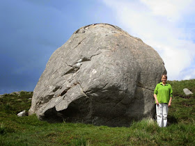
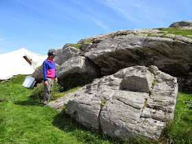
Three very large erratics that have been broken up into several segments either during glacial transport, or during the process of deposition.  Origins unknown.   All three probably were emplaced at the end of the Devensian Glaciation.  Photos from the Isle of Lewis, June 2014.

Callanish and its standing stones


Not everybody likes looking at old rocks stuck in the ground......


Observations from a flying visit on 7th June 2014


 Introduction

Colin Richards:  The end product -- the circle or the stone setting -- may not be the prime focus.  We should concentrate more on "the immediate and socially significant acts of quarrying and dragging individual stones" (In "Rethinking the great stone circles of Northwest Britain.") Richards does not like the idea that monoliths are always obtained from the most convenient source (because the final form was assumed to be of prime concern).  Rather, he wants the emphasis to be on the ritual acts of quarrying and transportation, and argues that there would be a preference for the use of stones from many different "special" sources. Quote: "This importantly shifts attention away from the circles and back to the location of the megalithic quarry sites."  Quote: "....  construction was a social process as much as a feat of engineering......."   Quote:  "........the discovery and investigation of quarries may reveal them to be special places, possibly already having sacred qualities."

The Lewisian Gneiss complex of NW Scotland

"The crust of NW Scotland, together with parts of Greenland and North America that make up the ancient continent of Laurentia, was built up mainly from igneous rocks that crystallized around 2900 to 2700 million years ago. At that time, the rocks we now see were deep in the Earth's crust. They were deformed and metamorphosed at very high temperatures, producing gneisses with a folded layering. Actually, there were two periods of deformation and metamorphism (named the Scourian and Laxfordian events), separated by a stable period when the crust fractured and allowed in basic magma that crystallized as a set of dykes."
http://www.earth.ox.ac.uk/~oesis/nws/nws-geolhist.html


Smashed-up coastline of highly contorted, fractured and foliated Lewisian gneiss on the Isle of Lewis, north of Callanish.  Inland from the cliffline the land surface is smoothed and streamlined as a result of intensive erosion beneath the Scottish part of the British and Irish Ice Sheet.

"Lewisian Gneiss is metamorphic, in that volcanic heat and pressure has altered its structure somewhat, originally the rocks were like granite which changed as the Earth's crust became molten and they solidified, which is the reason you can see great variations in the way the layers are displayed, ranging from the white, to pale grey and even then the really dark grey.The rock is mainly grey with coarse bands of white and dark minerals through it. The pale bands contain quartz and feldspar, whilst the darker bands are dense minerals , like maybe biotite mica and hornblend."
http://www.virtualheb.co.uk/lewisian-gneiss-rocks-of-the-isle-of-lewis-and-harris-western-isles-geology.html

For the most part the rocks exposed at the ground surface and in the cliffs of NW Lewis are felsic gneisses, which are rich in light-coloured minerals like feldspar and quartz. There are abundant masses of white quartz exposed in and near the coastline.  In places the whitish rocks could be mistaken, from a distance, for limestones......


A chunk of highly contorted Lewisian gneiss, left as a stranded erratic on a dark-coloured ice-smoothed dedrock slab.  Near Gearrannan, NW Lewis.

The Callanish landscape

The landscape around Callanish is deeply scoured by overriding ice, with abundant small knolls of Lewisian gneiss (and other ancient rocks including altered granites, pegmatites, dolerites, gabbros, schists and basalts) exposing many glaciated slabs, whaleback / streamlined forms and roches moutonnes.  It appears that the last direction of powerful ice movement might have been from the south-east towards the north-west, but there is little evidence of striations at Callanish to support this since the local rock is unsuitable -- so many of the glaciated forms might be inherited from earlier glacial phases.  There are, however, fresh striations on the outer coast and on slabs of suitable rock including basalt -- suggesting the the last ice flowed more or less S-N.  These observations are in line with the latest ice modelling which shows that there might have been a local ice cap centred in the highlands of Harris around 18,000 -16,000 years ago. (Clark et al, 2010)  It's reasonable to hypothesise that the ice from this ice cap flowed northwards across the site of Callanish, leaving behind striated bedrock and fresh glacial deposits.


Striated bedrock slabs on the coast north of Callanish.  The striations run approx south - north.


The landscape of smoothed rocky knolls and intervening depressions is very beautiful, having been determined above all else by the highly convoluted and fractured nature of the Lewisian gneiss which has allowed deep erosion in the most fractured areas and the survival of hillocks in areas where rocks are less fractured or more resistant on account of lithological differences.  In many areas it appears that meltwater has had a powerful role in landscape formation, with survivals of short sections of meltwater channels and in some cases longer deeply cut channels which appear to have been major meltwater routes.  Again, it is almost inevitable that these channels are of many different ages, with the freshest dating from the Devensian and others being of great age, periodically re-used and freshened up during the Ice Age.  In the depressions there are accumulations of till and mixed deposits incorporating fluvio-glacial materials and some periglacial or slope deposits.  Scree and rockfall deposits are rare, except beneath crags and short lengths of inland cliffs.  At the coast there is abundant evidence of rockfalls in a highly complex "high energy" coastal environment which includes collapsed caves, stacks, arches and coves containing storm beaches.

One feature makes the environment around Callanish very suitable for "stone gathering"  -- and that is the extent to which the bedrock surface has been washed by meltwater derived from the dissipating Devensian ice and maybe also from extensive snowfields at the end of the last glacial episode.  I would guess that there were many centuries of heavy snowfalls and rapid thaws in this highly dynamic western environment characterised by strong seasonal variations.  The washed surfaces are almost as spectacular as those of the Stockholm Archipelago where the coast is still recovering isostatically and is emerging from the sea; but this comparison cannot be taken too far, since there is no trace of raised shorelines here on Harris.  (There must have been considerable isostatic uplift here, so glacier ice must have survived until a late stage in the isostatic recovery process.)


Glacially streamlined whaleback forms near the coast north of Callanish.  The ice was flowing towards the N or NW.  The surfaces are washed clean by glacial meltwater and snowmelt.

In addition to the evidence of deep scouring, we see signs of cliffed sections on the western flanks of many of the knolls, where broken boulders and slabs have accumulated.  Some of these  rocks are elongated and flattened (ie similar shapes to the elongated slabs built into the Callanish monument) and are already detached from the bedrock.  Other slabs are exposed via elongated fractures parallel (and in some cases not parallel) with the foliations in the gneiss;  they are still part of the bedrock, but could be separated from it without too much difficulty through the use of wedges and levers by just a few men.   One of these cliffed faces is within 50m of the standing stones, on the W side of the rocky knoll called Cnoc an Tursa, between the standing stones and the visitor centre.  Some of the standing stones are so thin that they cannot have survived long distance transport either by ice or human agency.  So they must have come from the immediate locality -- probably within 50m - 100m of the sites where they were used. This "stone gathering" of very local stones is assumed in the bulk of the literature about Callanish. (I prefer the term "stone gathering" to the term "quarrying" since in truth virtually no technology would have been involved in the sourcing of the utilised monoliths.)


The up-glacier (SE) side of the rocky hillock at Callanish, showing heavily scoured and eroded glaciated bedrock surfaces with no remaining "litter" of erratics.  Were there any, and have they been incorporated into the stone settings?


Prof David Sugden looking at some rocks.  This is the down-glacier (SE) or lee side of the rocky knoll at Callanish, showing evidence of plucking or block loosening through pressure release at the time of ice melting, or maybe later.  There are some blocks still lying around.  Flattened slabs have fallen from the overhang -- maybe naturally, and maybe with human assistance.  These slabs have probably been incorporated into the stone settings.


Ice-smoothed slabs of Lewisian gneiss running under the wall of the Carloway Broch, some miles north of Callanish.  Note the fractures coinciding with the foliations, and note how many of the gneisses in this area break down into elongated flattened slabs.


Another exposure of Lewisian gneiss near the coast to the north of Callanish.  Note how the fractures in the rock lead to the creation of elongated flattish slabs.  They are lying about all over the place -- no need for quarrying......

What was the natural mechanism for block removal from the bedrock?  In some cases (as on the down-glacier flanks of roche moutonnees) there must have been direct plucking or dragging away of blocks by thin active glacier ice -- probably around 20,000 - 18,000 years ago.  Other blocks and elongated slabs on the flanks of glaciated ridges and knolls might have occurred by rock bursting or pressure release, possibly assisted by periglacial processes following ice wastage. This probably loosened elongated slabs and made them easily available.

The rocks used in the standing stone settings all appear to have come from the "native rock"  -- all within 100m of the places where they were set into the ground as vertical monoliths.  The coarse foliated Lewisian gneisses -- white and grey in colour -- may in some cases have been moved by ice, but not very far.  So it would not be a good idea to call them glacial erratics.    This is true of Callanish 2 and 3 as well -- in each case the stones have come for the most part from nearby crags with broken detached blocks and slabs lying about beneath them. (Mostly the source cliffs are west-facing, suggesting an easterly flow of ice maybe close to the Devensian glacial maximum?)  Some "suitable" stones are still to be seen lying around partly covered by turf.  Colin Richards has suggested that many of the flattened elongated slabs used at Callanish have one face that is more weathered than the other, suggested that the slabs were recumbent and that some faces were exposed (and affected by overriding ice) while the lower faces were protected until the slabs were levered upward by Neolithic quarrymen.  On my visit I did not notice any great difference between "fresh" and "old" stone faces, given that for the past 5,000 years or so the west-facing stone surfaces of the standing stones have received a much greater battering from the weather than the east-facing surfaces, and that north-facing surfaces have spent most of their time in shadow while south-facing surfaces have been drier and sunnier.

At Callanish 3 all the stones except two are "normal" Lewisian gneiss.  These other two are of a darker rock type-- more like dolerite.  There seems to be an exposure of it near the road about 100m away -- in the place where a boat is parked.  The outcrops here have a quite different colour from all the other rocks in the area, and a different surface patina. (I did not have time to investigate properly.)  One of the darker standing stones has a groove on its surface which looks as if it might have resulted from glacial erosion -- but I would not stake my reputation on it.  Another source of confusion arises from the fact that for the greater part of 5,000 years  the Callanish stones have had their lower parts buried in an extensive "protective" cover of blanket bog.  When the stones were excavated, this layer of peat was stripped away, and records show that it was in places 5 feet thick.  

Conclusion

The 3 Callanish monuments were built here because this is where elongated slabs were available in some abundance.  For the most part the stones would have simply been available as litter on the flanks of some of the glaciated knolls in the Callanish area.  One cannot discount the theory that some slabs might have been  forced from the rock face, but this sort of human intervention would generally have been unnecessary, since there must have been an abundant litter of slabs available on a relatively clean rock surface in Neolithic times.  Indeed, many slabs and pillars are still available, lying about in the landscape, and either unused or rejected as being unsuitable (too heavy, not elongated enough etc). Many of these remaining stones are buried or partly buried in the turf.   I can see no evidence of serious quarrying.  Neither do I see any evidence that the stone settings were put up in predetermined "auspicious places" (related to astronomical alignments etc) and that the builders travelled far to find stones to fit what they were intent upon doing.  Callanish 1 is in quite a prominent position, on a ridge, so it might have been put there as a sign of status, or to impress neighbouring tribes etc.  But to claim anything else would be fanciful.  Callanish 2 and 3 are not in very prominent positions at all -- but they are very close to potential rock sources. 

So was there a huge and deliberate quarrying exercise designed to provide stones for a group of stone monuments in predetermined auspicious locations related to astronomical alignments?  No -- the evidence on the ground does not support this.

(My thanks to my colleague Prof David Sugden, in whose company I visited the site and whose observations and suggestions are incorporated in these notes.)

==============