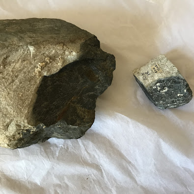
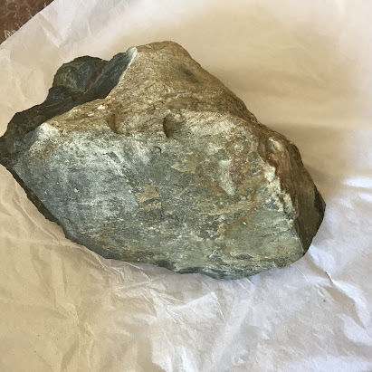
Pages

Wednesday, 27 July 2022

Waun Mawn study has 5,000 reads


I have noticed that my Waun Mawn study has now reached 5,000 reads on Researchgate.  That makes it one of my most popular articles -- and it's particularly gratifying because this is a sober study which takes a careful look at the evidence in the ground and seeks to explain it in the most rational way possible.

In the article I also take a look at the three seasons of fieldwork by Mike Parker Pearson and his team, and examine some of the claims made in various publications.

I have updated the article occasionally, and we are now on the ninth version, with changes made in response to new developments and evidence, and comments received from readers.  That's the beauty of "working papers", as distinct from journal papers that are frozen in time and that are out of date effectively as soon as they are published.  Now I will have to do a tenth version, in response to the recent papers which demonstrate that I have been right all along, that there are no links between Waun Mawn and the fantastical "bluestone quarries", that there is no "lost circle",  and that there is nothing here showing any association with Stonehenge..

https://www.researchgate.net/publication/345177590_Waun_Mawn_and_the_search_for_Proto-_Stonehenge 

All in all, it's nice to see that there are readers out there who want to see sound fieldwork and scientific scrutiny instead of the latest version of bluestone mythology.


Saturday, 23 July 2022

Waun Mawn -- tis but a scratch!


With the appearance of the new Waun Mawn paper and the demise of the fantasy that MPP and his colleagues have been flagging up for a decade or more, it's worth reflecting for a moment on what the authors have NOT done.

1.  They have not apologised for a vanity project (as Tony rightly calls it) or for a vast piece of interpretative inflation which has misled many thousands of people who love Stonehenge and its story.

2.  They have not acknowledged that there were dissenting voices from the beginning, with many of us warning them that the evidence just did not stack up.

3.  They have not cited my major contribution to the Waun Mawn debate - namely the article called "Waun Mawn and the search for proto-Stonehenge" published almost 18 months ago on Researchgate and now read by almost 5,000 people.  (They will probably argue that they only cite peer-reviewed material and will ignore the fact that they frequently cite references which are not in standard learned journals.)

4.  They have not retracted their belief in a "giant lost circle" at Waun Mawn, and refer several times to eight missing stones in spite of the scepticism expressed by Pitts, Darvill and others.

5.  They have still not studied the geology of the Waun Mawn area, and in searching for the provenance of the Waun Mawn stones and fragments they have sampled only tors and smaller crags from which stones might have been fetched.  This is a somewhat bizarre and unscientific assumption.

6.  They have not changed their views on the "bluestone quarries" at Rhosyfelin and Carn Goedog, and insist in referring to them as established facts while failing to mention that they too are disputed.

7.  They have not accepted that their radiocarbon dating evidence from the investigated sites is so poor that it falsifies their hypotheses rather than supporting them -- and they pretend that they have sound radiocarbon evidence for a "quarrying episode".  

8.  By concentrating on a few unspotted dolerite fragments from site 91 in the Waun Mawn excavations, and pretending that these are somehow exceptional, they  fail to acknowledge that the whole landscape and its superficial deposits are littered with bits and pieces of locally derived unspotted dolerite.  This has been pointed out to them over and again, but they do not pay attention.......

9.  The authors have demonstrated in this article that they have just not done enough local fieldwork to do justice to a project on this scale.  That might sound strange, given the manpower thrown at three seasons of digging and at many sampling trips for geological analyses, but it is blatantly obvious from this paper.  

10.  And finally, the authors do not acknowledge any role for natural processes either in the shaping of the Waun Mawn landscape, in the formation of the local sediment sequence, or indeed in the moving of lumps of stone.  Their naivety in matters geomorphological explains some of the spectacular errors they have made in their bluestone provenancing work.

All in all, I am not very impressed.  This is yet another paper that is technically skilled but very unscientific.  As usual, it is packed with unsupported and unsupportable assumptions which should have been picked up in any decent refereeing process.

=========

PS.  Here is my somewhat more sober (and scientific) assessment of what  the evidence on the ground at Waun Mawn actually shows:

https://www.researchgate.net/publication/345177590_Waun_Mawn_and_the_search_for_Proto-_Stonehenge


Friday, 22 July 2022

The stones are made of blue cheese.......


You should cry, I suppose, but you might as well laugh.  I have been looking at some of the social media reactions to the latest paper from the MPP team, on Waun Mawn, released recently with no media fanfare whatsoever.  That latter point is interesting in itself.......

Anyway, while most of the comments have been from people who are distinctly unimpressed with the Waun Mawn pantomime, there are a few who think it is all perfectly wonderful, demonstrating commendable "open mindedness" on the part of the research team, and showing an ability for "self correction."

It's as if Parker Pearson, Bevins, Ixer and the rest of them had come up with an amazing and radical theory that the Stonehenge bluestones are made of blue stilton cheese, with the theory published in a learned journal and  accompanied by carefully-planned saturation media coverage.  Alice does a wacky TV programme featuring MPP in the pouring rain, persisting with the "astonishing" theory in spite of the scepticism of lesser mortals. Public acclamation follows, with nobody daring to say that the theory is nonsense, out of deference to the reputations of the researchers.  Eventually, with the researchers becoming aware that the public is getting restless, they embark upon an ambitious and expensive project which results in the publication of a wondrous learned article in a reputable journal, with highly complex graphics and tables, which proves that the bluestones are actually made of stone.  This results in further acclamation from near and far, with commentators remarking on the open mindedness of the researchers who have been so willing to scrutinise their old theory and to find it wanting........ "Great work!" they say. "Science at its best!  Hypothesis testing as it should be done!"  And so on......

Funny old world......

And if you think this team is open minded, think again.  MPP, Bevins and Ixer (and various others) have put forward wildly eccentric theories concerning bluestone quarrying, lost circles and so forth which have been heavily criticised by myself and others -- but they have steadfastly refused to acknowledge any dispute and have ignored and refused to cite any evidence (even that contained in peer reviewed journals) which happens to be inconvenient.   Those are signs of closed minds, not open ones.

And as for the "self correction" bit, the Parker Pearson "lost circle" was questioned and heavily criticised by me and other people in journals and in social media, and my working paper about Waun Mawn was published on Researchgate back in March 2021.  This laid out in great detail the evidence on the ground and questioned many of the assumptions and interpretations of MPP and his research team.

Even in the new paper, Bevins et al refuse to acknowledge any of the dissenting voices, and pretend that they themselves have initiated a re-examination of their original very silly theory without any prompting from anybodys else.  In reality, they had no option other than to do this expensive and time-consuming research because they have remained inside their tight little bubble and have been impervious to the advice given to them by others. This was their last-ditch attempt to find some evidence that would stand up in court, and of course it was a miserable failure.  Sad, and more than a little pathetic.

If you want to find out how NOT to do research, look no further.


Thursday, 21 July 2022

The collapse of the Waun Mawn fantasy


Reproduced from the article.  Key locations in the fanciful Waun Mawn narrative.  There are many more rocky outcrops than those shown.  Note that there were no sampling points close to Waun Mawn -- a serious research defect.


Well, it's always nice to be vindicated.  I said from the beginning that the Waun Mawn narrative developed by Parker Pearson et al was not far short of being an elaborate hoax, and so it has proved.  Virtually everything that I said in my Waun Mawn article  (now read by almost 5,000  people) has been proved correct, by the very same people who have promoted the "lost circle" fantasy so energetically over the past few years.    Just a reminder of what I said, on the basis of hard evidence on the ground and a knowledge of the local topography and geology:

https://www.researchgate.net/publication/345177590_Waun_Mawn_and_the_search_for_Proto-_Stonehenge


Anyway, a new article has appeared on Researchgate over the last few days -- it is due to be published in October 2022.  It is one of the most futile and bizarre papers I have ever seen in a learned journal.   It is nonetheless a very important paper, not because it contains anything unexpected, but because it finally demonstrates that the Waun Mawn "proto-Stonehenge" fantasy is dead and buried, with not a shred of evidence to support it.  That is in spite of the frantic efforts of the people who wrote this paper.  It is a highly complex and technical piece of work, but its findings are essentially very simple indeed.

First, the details:

Bevins, R.E., Pearce, N.J.G., Parker Pearson, M., Ixer, R.A., 2022. Identification of the source of dolerites used at the Waun Mawn stone circle in the Mynydd Preseli, west Wales and implications for the proposed link with Stonehenge. Journal of Archaeological Science: Reports 45 (2022) 103556.

Abstract

A Neolithic stone circle at Waun Mawn, in the Mynydd Preseli, west Wales, has been proposed as the original location of some dolerite megaliths at Stonehenge, including one known as Stone 62. To investigate this hypothesis, in-situ analyses, using a portable XRF, have been obtained for four extant non-spotted doleritic monoliths at Waun Mawn, along with two weathered doleritic fragments from a stonehole (number 91). The data obtained have been compared to data from spotted and non-spotted dolerite outcrops across the Mynydd Preseli, an area known to be the source of some Stonehenge doleritic bluestones, as well as data from i11-sint analysis of Stone 62 (non-spotted dolerite) and ex-situ analysis of a core taken from Stone 62 in the late 1980's.
Recently, Stone 62 has been identified as coming from Garn Ddu Fach, an outcrop some 6.79 km to the east­ southeast of Waun Mawn. None of the four dolerite monoliths at Waun Mawn have compositions which march (sic) Stonehenge Stone 62, and neither do the weathered fragments from stonehole 91. Rather the data show that the Waun Mawn monoliths, and most probably the weathered stonehole fragments, can be sourced to Cerrig Lladron, 2.37 km southwest of Waun Mawn, suggesting that a very local stone source was used in construction of the Waun Mawn stone circle. It is noted that there is evidence that at least eight stones had been erected and subsequently removed from the Waun Mawn circle but probability analysis suggests strongly that the missing stones were also derived, at least largely, from Cerrig Lladron.

-----------------------

Note, at the outset, that the authors assume there was a Neolithic stone circle at Waun Mawn. They blame others for identifying it as a lost circle, even though the majority view in the older literature is that there was no stone circle here. The pretence is pretty outrageous, and confusing too, since MPP himself has admitted that there probably never was a stone circle there, although our heroic ancestors might well have "intended to build one."  


As I have pointed out over and again, there is just no evidence of sockets deep enough to have held standing stones, and for the authors to pretend, in his new paper, that a Waun Mawn stone circle is an established fact is disingenuous.

Another shameless stunt pulled by the authors is the pretence that the media are responsible for the wildly exagerrated claims made about Waun Mawn.  The inflated claims made about the site are owned by Parker Pearson and his cronies, and there is no way that they can avoid responsibility for the hype and the other nonsense disseminated by TV programmes and in the press.

Anyway, back to work.  Our heroic researchers set out to find out where the four stones at Waun Mawn have come from, and whether any link can be established with Stonehenge. Using portable X-ray equipment they analysed a clutch of samples from Waun Mawn and from outcrops of unspotted dolerite which might have been sources for the present and assumed missing monoliths.  After protracted and convoluted studies (which make up the bulk of this paper), and with very splendid graphics, they conclude that none of the preferred candidate outcrops has any link with Waun Mawn, but that the Waun Mawn stones and unspotted dolerite fragments have most likely come from Cerrig Lladron.  Strangely, they only chose prominent tors and smaller crags as their sampling points, and omitted to test any of the dolerite outcrops in the vicinity of Waun Mawn itself.  That is a serious error, and I do not think that the evidence presented shows any firm link at all with Cerrig Lladron;  all the researchers have shown is that the unspotted dolerites at the site of the fantastical stone circle have probably come from western Preseli and most probably from within a stone's throw, which is what I have been telling them all the time.  I am amazed that experienced geologists can have been so ignorant of the local geology and so blind to the blindingly obvious.

There is a digression to consider a possible link with Stonehenge stone 62 -- there is another paper on that, which we have already considered on this blog.  There was no link between stone 62 and Waun Mawn, but  MPP is obviously reluctant to let the matter go.  Much ado about nothing, in that paper already published, and in this paper too.......


A huge amount of work has gone into the analyses of the Waun Mawn and rock outcrop surfaces, and I feel rather sorry for those who have spent thousands of pounds and wasted hundreds of hours in desperately seeking to prove what was always a crazy and thoroughly unscientific ruling hypothesis. Most readers of this paper will be superficially impressed by the complex graphs and graphics -- until they try and work out what they all mean.

There is one final twist.   At the end of the paper the authors embark on a convoluted "statistical analysis" designed to determine the probability of our heroic ancestors hauling away all of the valuable stones to Stonehenge or some other convenient place, while leaving behind the four rather boring local stones made of unspotted dolerite. Talk about clutching at straws!  This section comes over as more than a little pathetic, and the editor of the journal should have spared the authors' blushes by cutting it out.

So there we are then, as we say in Wales. The "astonishing" story of the lost circle of Waun Mawn, so lauded by Alice Roberts and much of the media, is dead and buried -- finally shown by the storytellers themselves to be unsupported by a single shred of evidence.

In spite of this gigantic loss of scientific credibility, the authors still insist, at the end of the paper, that there was a giant circle of stones at Waun Mawn, and that at least eight monoliths have been removed.  They still insist that there were bluestone quarries that supplied monoliths to Stonehenge, and they still pretend that there is radiocarbon evidence at Rhosyfelin and  Carn Goedog that supports the quarrying hypothesis.  Shame on them.  Shame on them too, for refusing to admit anywhere in this article that their ideas are disputed, and for refusing to cite my comprehensive Waun Mawn article published and heavily scrutinised on Researchgate.  Sadly, we are looking at the work of a group of academics who live in a permanent fantasy world in which everything inconvenient is simply denied or ignored.

Where does this leave Parker Pearson and his merry band?  I wouldn't mind betting that as we speak, they are dreaming up their next fairy tale...........

==========

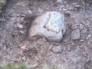
PS.  When the "lost circle" fantasy was unleashed on the world in February 2021 with a massive media blitz coordinated with the journal publishers, I responded with a review of the multi-authored article on the Academia web site.  This is what I said:


Tuesday, 12 July 2022

Short paper: A glacially transported clast at Stonehenge


I have now prepared a draft paper which will be submitted to a journal for publication.  It is uploaded to Researchgate where most people will be able to access it.

I emphasise that this is an interim report based on a very rapid examination of the boulder, and some of my observations will inevitably be found to be unreliable.  I have done my best!  But I stress that what we now need is a full autopsy by forensic scientists who are familiar with geological processes, petrology and provenencing, volcanic rocks, weathering processes, and glacial entrainment and transport.  And the boulder needs to have its surfaces dated too!  

I am sure that Salisbury Museum will be happy to cooperate in this enterprise.

This little boulder could prove to be a goldmine with regard to the information that it will yield.......

https://www.researchgate.net/publication/361939331_A_glacially-transported_clast_at_Stonehenge


Saturday, 9 July 2022

The Newall Boulder -- more and more interesting

The broken surface of the boulder, showing the lithology and veining in some detail.  (Courtesy Salisbury Museum)

I have been in touch with Prof Peter Kokelaar, whose knowledge of the igneous rocks of N and NW Pembrokeshire is second to none.  He has kindly provided some advice based on my photos of the boulder -- with the proviso, of course, that there is really no substitute for the close examination of the boulder itself and of thin sections taken from it.

Anyway, he advises as follows:

1.  On possible provenance.  

He suggests that the initial IGS suggestion of a North Wales provenence for the rock was possibly based on a degree of bias, since in the 1970's a lot or work was being done in N Wales, and the IGS geologists were more familiar with the igneous rocks of Snowdonia than they were with those of N and NW Pembrokeshire.  He describes the rock as follows -- from the photos:  

Problem is that lavas commonly have various vesiculation bands that collapse and look vitroclastic and welded. I’d buy into the petrographer’s interpretation of welded igneous rock. One pic appears to contain a xenolith so that the streaky fabric perhaps on balance is welded pyroclastic, but then lavas contain xenoliths too. I suppose my main point for your purpose is it could well be of one of the minor Ordovician rhyolite sheets of north Pembs.

The source could well be Ramsey, especially Trwyn Llundain, the westernmost headland. There is moderately abundant petrographically distinct Cader Rhwydog Ignimbrite in reworked Anglian till here on Gower (Ram Grove), so no doubt the ice was collecting from Ramsey Island. Rather tantalising in my write-up of the Trwyn Llundain rhyolite (1985 paper, p 610) I note incorporated xenoliths that are rhyolite pebbles. It’s hard to tell from the photo, but that’s a possibility for your sample (picture below).

So, no question in my mind with the data available to me that the Newall stone can have originated in North Pembs. I’ve seen so much Ramsey erratic rock on Gower that Ramsey is a prime candidate, but there are numerous other Ordovician rhyolite sheet possibilities. Given that we know for certain Pembs supplied volcanic (and dolerite, and Skomer, and St Davids Head) erratics at least as far as Gower, it becomes an exceptional plea to have it come from Snowdonia.


So let's see what transpires when the rock is properly analysed........


Slickensiding features on the "bottom" of the boulder.  This face almost certainly coincides with a fault plane, and the streamlining probably has nothing to do with glacial processes. (Courtesy Salisbury Museum)


2. On slickensiding.

I have been thinking, since I saw the boulder 3 weeks ago, that one face shows all the signs of slickensiding on a fault plane. So I asked Peter about this, and he confirms that this does indeed seem to be a part of the "boulder story".   He says -- again just on the evidence of the photos:

In my book the surface shows quartz-mineral ribbon/fibre growth slickensiding. Top right the transverse bands are growth increments, where movement is missing-part down to left. The ribbons have stepped ends down-left where missing counterpart broke away.


The other photo shows layers of fibres with some changes of growth direction. Beneath a capping vein (white patch), part the fibres on the left are NW-SE, then middle W-E, then NW-SE again. Evidently part of a fault zone....


So that's pretty conclusive, and we can safely say that one of the faces on the boulder is a fault face, with its morphology and mineral characteristics fashioned or influenced by the movement of one rock face across another. There are plenty of examples in the literature:


On this basis we can, I think, rule out these striated or streamlined features as glacial features, and must attribute them to faulting instead, with the fault line acting as an obvious line of weakness in the rock, in turn facilitating glacial entrainment when the source area was deeply inundated by ice.

The other slight striations / scratches on other faces of the boulder may still of course have a glacial origin.


Grateful thanks to Peter for his comments.


The story of the boulder gets more and more interesting........


Wednesday, 6 July 2022

The lost boulder and the mice in the attic.......


It's a pretty extraordinary story and many might be inclined not to believe it......... but it is all rather entertaining......

In 1924 William Hawley and his diggers found a small boulder in his Stonehenge dig (and three others as well) in a layer of "rubbish" and chalk rubble 64 cm beneath the present ground surface.  It was clearly not a "knock-off" from one of the bluestone monoliths, and was made of a rock type that nobody recognized. Some bits of it had been knocked off by a Stonehenge axe-maker, but he (presumably it was a "he") had given up in disgust when, having picked it up somewhere nearby,  he discovered that the stone did not fracture conchoidally.  He had thrown it away onto a pile of accumulating chalk rubble around the time that the monoliths were being erected.  There it had remained for 5,000 years or so.

Because it was not classifiable as an authentic implement, or even a crude "rough out", Hawley wanted to throw it away again -- but one of his colleagues, Robert Newall, suspected that it might be important, and because there was a shortage of storage space at Stonehenge he took it to his home in Lower Woodford and stored it in his attic, together with lots of other samples.  There it remained for 46 years......

Around 1970 geologist Geoffrey Kallaway found a reference to the boulder in Hawley's report on the 1924 dig, and asked Newall if he knew of its whereabouts.  Newall confirmed that he had it, and passed it over (with 15 other erratic fragments) for detailed geological examination by Kellaway and his colleagues in the IGS.  They took various samples, knocked a few more bits off the boulder, and discussed at length what its significance might be.  But no major publication followed, and although Kellaway thought the boulder might be a glacial erratic (because it was striated) the consensus was that glacier ice could not possibly have reached Stonehenge, and the boulder was handed back to Newall.   It went back into the attic.

But Newall was feeling his age,  and decided to clear his attic.  He passed over the boulder and many of his other Stonehenge samples to Salisbury Museum in 1976.  As they tried to sort out the material there was an entertaining exchange of letters between Capt Banks and staff and Mr Newall, who had to admit that many of his notes relating to the samples had been eaten by mice!  The larger fragments of rock had no identification labels at all.    So when the material was finally added to the museum collection there was some confusion over what was what.  Luckily the "Newall Boulder" (RSN-18) was distinctive enough not to get confused with anything else, and it was given the acquisition number 1978.16.  Newall died in the same year.  Then the boulder was put into a cupboard and forgotten about once again.........

All the correspondence held in the Kellaway Archive in the University of Bath, and two IGS photographs, confirm the provenence of the erratic ignimbrite boulder.  Thanks to the help of Lizzie Richmond, I have copies of all the IGS and other letters and documents on the file.

It's interesting that among the professional geologists there seems to have been a consensus that the boulder had come not from North Pembrokeshire but from Snowdonia -- most likely the Capel Curig area.

So since its discovery almost a century ago, this boulder has been stored away, out of sight and out of mind, for more than 90 years.  All the attention, over the years, has been lavished on the "Boles Barrow Bluestone", whose provenance and post-discovery history is a matter of vast disagreement -- but this little boulder could turn out to be MUCH more important.


Monday, 4 July 2022

The expropriation of Stonehenge

There'a  NEW Article from Gordon Barclay and Kenny Brophy, this time in response to the silly stunt of using Stonehenge as a projection screen for images of the Queen.  Here is what they have to say:

 https://www.sapiens.org/archaeology/stonehenge-nationalism/?fbclid=IwAR2dFrVXjTTetvePyyfgQVhJZLZN_y6ujGdjLnqKzbkES5v54RaRcJjg6x4&fs=e&s=cl

"Stop Projecting Nationalism Onto Stonehenge"
By Gordon Barclay and Kenny Brophy, Sapiens magazine, 20 JUN 2022

Two archaeologists respond to the portraits of Queen Elizabeth II that were beamed onto Stonehenge.

This was the latest attempt to appropriate the monument for nationalist / royalist / monarchist messages.  The authors make familiar points, including a critique of the absurdity of referring to Stonehenge as a sort of nationalist icon -- English rather than British -- and of using the old ruin as part of a Brexit promotion exercise.  Although they are too polite to mention Mike Parker Pearson by name, they have a go at some of the weird ideas promoted in his 2012 book.

I agree with them. The whole stunt was unspeakably vulgar, and did no service to the Queen or to Stonehenge.  The EH staff responsible should be ashamed of themselves.


Sunday, 3 July 2022

The Newall Boulder: photo gallery


Here are some of the photos taken on 14th June -  all reproduced here courtesy Salisbury Museum.  I am happy to see them used by others for research / education / discussion, but please mention me as the photographer and acknowledge the kindness of Salisbury Museum in facilitating their use. 

Click to enlarge -- you should be able to see the photos in high definition.


These pics show the overall shape and surface characteristics of the boulder, concentrating on its natural characteristics.  I'll publish another gallery showing the extent of "human damage" by Neolithic stone bashing and geological sample taking.......


Saturday, 2 July 2022

Nothing new under the sun.......


Tony holding the "Newall Boulder".  Courtesy Salisbury Museum.

 What with all this interest in smallish bullet-shaped clasts transported subglacially, I have been finding them all over the place!  Above are two photos of clasts found on the shoreline of Blido in washed glacial deposits, and below we see Tony holding the Newall Boulder in Salisbury Museum.  All three are approx the same size and weight.  The Swedish clasts are made of Precambrian gneiss, and the Newall boulder is made (we reckon) of Ordovician welded tuff and lava.  The Swedish clasts are in pristine condition, with no weathering crust; but they are heavily abraded on faces and edges, with multiple facets and with substantial fracture scars at the lee end.  The fracture scars are old --  they have been somewhat smoothed off either subglacially or by running water.   There are no visible striations; this gneiss hardly ever displays them, even on eroded bedrock surfaces.  In contrast, the Newall boulder has been seriously damaged by percussion, grinding and cutting, as we can see from the dark blue faces on the flanks and ends of the clast.  Maybe we should refer to it as a "failed artefact" -- but there is quite enough of the original boulder left for us to get a pretty good handle on what it was like, where it came from,  and how it was shaped by the forces of nature.........

A glacial clast from Stonehenge: Newall's Erratic Boulder


The Newall Boulder: a multi-faceted glacial clast with post-emplacement prehistoric and recent human damage. (Courtesy  Salisbury Museum) 

Newall’s Glacial Erratic Boulder

Notes following a preliminary examination of the boulder recently "rediscovered" in Salisbury Museum 

Observations

1. It is a coherent small boulder which hasn’t been knocked off a bluestone monolith either here or anywhere else. Shape — an elongated, tapering and flattened small boulder, c 22 cms x 15 cms x 10 cms. Approximately the same shape and size as a human face. Weight - not measured but estimated at over 5 kg.

2. The lithology appears to be quite unlike anything else previously recorded for a boulder at Stonehenge —it is a dense and heavy welded tuff, dark blue-black in colour. It is nothing like the Preseli spotted and unspotted dolerites, the foliated rhyolites or Lower Palaeozoic sandstones. Grain size is very small. There are many intersecting small fractures and veins marked by whitish crystal concentrations — and some lumps of what appear to be quartz crystals.  Petrologist RK Harrison of the IGS said: “This large, dark blue-grey, hard, flinty (? partly worked artifact) shows a white weathered crust up to 5 mm thick. The thin section shows a complex structure of very finely banded welded tuff (compressed foliated shards cemented by fine silica) with composite quartz grains and strings of dusty leucoxene, separated by patches of much finer grained, finely fluxioned glassy lava with patches of granular quartz. This specimen appears to represent a complex of originally viscous glassy lava and welded vitric tuff, all presumably of rhyolitic composition.” In correspondence, there was agreement in 1971-2 among IGS geologists that this rock has probably come from North Wales, possibly from the Capel Curig area, although I think there is a chance that it has come from the Strumble Head - Fishguard area. Work is under way by geologists Ixer and Bevins, with a view to an accurate description of the petrology and a suggested provenance. It does not much matter where the stone has come from, but nonetheless we look forward to seeing the eventual report and to discovering whether this boulder might be related to one or more of the bluestones 38, 40, 46 and 48 in the bluestone circle at Stonehenge -- all classified as "dacitic ash-flow tuffs" or as rhyolite / ignimbrite.  The dacites have recently been studied -- but they seem different too.  


Fresh damage reveals a dark blue flinty welded tuff / lava with multiple veins of white minerals.  It is completely different from the rhyolites and dolerites exposed on Mynydd Preseli, but might be related to a group of samples of "ignimbrites" and ash-flow tuffs.  Source currently unknown.(Courtesy  Salisbury Museum) 

3.  There are 5 main natural facets or faces, possibly influenced by the veins that run through the boulder. One of the facets has quartz (?) remnants sticking to it, which seem to be streamlined or slickensided. There is one quite prominent yellowish nodule about one cm thick. There is some iron-staining also, including a patina on some of the Neolithic (?) fracture scars which have been determined by vein positions. This is another typical feature of glacial erratics.

4.   Clast morphology: it is crudely bullet-shaped, with multiple facets and fracture scars and highly variable surface characteristics and patina. There are micro-features suggestive of ice-related damage. These features have not been modified in a glaciofluvial environment. The boulder clearly has has a complicated life, through several distinct phases. 

5.  In essence this is a small boulder modified and shaped in subglacial transport. This is the consensus — from the photographic evidence, 11 out of 12 senior geomorphologists agree (see Appendix 1). The other expert suggests a glaciofluvial origin; I disagree with that. There are too many fresh micro surface features that would have been removed if there has been any water transport or modification. The surface characteristics also preclude an origin as a “quarried block” deliberately taken from a favoured rock outcrop. 

https://www.blogger.com/blog/post/edit/1228690739485734684/2700580815420234125

6.  After close examination of slight scratches on the boulder surface — in several places — I am convinced that they are crossing glacial striae. There is one distinct patch of scratches, c 5 cm x 5 cm. They are very shallow, and I am prepared for others to take a different view of their origin — but they do NOT seem to tie in with foliations or other features related to the lithology or internal structure of the rock. On another face there are traces of parallel scratches, again unrelated to visible veins in the rock.  We should remember that Engleheart and Dale both said in 1921 that they had seen striated glacial erratics at Stonehenge, and according to Hawley four more small erratics (including the Newall boulder) were discovered in the 1924 dig. 


Faint crossing scratches (glacial striations?) on the flat face of the boulder. (Courtesy  Salisbury Museum) 


Other faint parallel scratches on the weathered face of the boulder.  These do not appear to be related to its internal structure. (Courtesy  Salisbury Museum) 

7.   I would also agree that it is a rejected “artefact” in the sense that somebody has tried at some stage (Neolithic?) to use the boulder either as a maul or (more likely) as the raw material for a large stone axe. This attempt at "dressing" was not successful — the rock does not fracture conchoidally, and when several chunks had been knocked off both the lee (downglacier) end and the stoss (upglacier) end the attempt was abandoned and the stone was thrown away. It has also been damaged in several different places by the geologists who examined it in 1970 -1972 and in 1978 — there are traces of cutting and grinding and there are several new percussion scars in a row near the stoss end of the clast. 


Six percussion scars on the edge of a fresh (?) facet near the tip (stoss end) of the boulder.  Has a powder sample also been taken from here by mechanical grinding? (Courtesy  Salisbury Museum) 


Unweathered facet with remnants of a quartz (?) vein which has influenced the alignment and form of the fracture.  Note the apparent streamlining parallel with the long axis. This might be slickensiding on a faulted rock surface.  (Courtesy  Salisbury Museum) 


Quartz (?) nodule near the pointed end of the bullet-shaped boulder, on the edge of a "fresh" facet.  Note also the encrustations identified as tufa by IGS geologists -- consistent with the boulder being embedded in a calcium-rich environment.(Courtesy  Salisbury Museum) 

8. There are abundant rough fracture scars, especially on the lee end. In these scars, the rock surface is very fresh, and edges are sharp ansd unabraded. Some scars seem to have been present before the axe-maker got to work on it. The two fracture scars on the flanks of the boulder also seem to be older and are slightly stained. These may be natural or partly so. 

9. The tip of the bullet-shape (at the stoss end) has been knocked off or cut off. This looks suspicious — was this done by the geologists when attempting to take samples? There is a flat, smooth face which looks as if it has been ground down in the collection of a rock powder sample.

10. We can identify a “top surface” and a “bottom surface” of the boulder. The curving and irregular top surface — including the place from which the sample RSN18 was taken — has a whitish surface colouring and a distinct weathering crust up to 5 mm thick. The “bottom surface” is flatter, and has a patina but no weathering crust. This is a crucial piece of evidence relating to the history of the boulder. We can interpret a “ground surface” position as revealed on the boulder itself; the top was clearly exposed to surface weathering over a very long period, while the rest was buried and protected. 


IGS photo showing two apparent crescentic gouges / fracture scars on the edge of the weathered facet.


IGS photo showing the weathered ("top") facet and the bullet shape of the clast.  Note the location of the cut sample numbered RSN18.


My photo of the "top" of the boulder, with the sample positioned at the edge from which it was originally cut. (Courtesy  Salisbury Museum) 

11. In several places beneath “ground level” there is a crusty tufa deposit up to c 4 mm thick. This suggests burial in a calcium-rich environment — probaby on Salisbury Plain.  Some white crusty deposits of tufa occur on ALL faces (including Neolithic (?) percussion fractures— this suggests further slight precipitation of calcium carbonate following the rejection by the axe maker and burial in chalk rubble.

12. We can be certain that this is not the only striated small boulder found at Stonehenge, as confirmed by Hawley, Newall, Engleheart and Dale. Some appear to have been found in 1920. They were all treated as rubbish and thrown away because they were not “worked”— and only worked stones and monolith remnants were of interest to Hawley. They are probably in the trenches used for waste from the excavations. Hawley and Newall were clearly heavily influenced by the forceful views of HH Thomas — and there may well have been something of a “conspiracy” after 1923 to bury (quite literally) anything that was inconvenient and likely to upset the human transport hypothesis.

===================

Suggested history of the boulder:

1. Following entrainment the boulder was reduced in size and heavily modified during glacial transport, for much of the time on the bed of a glacier.

2. It was eventually dumped on the chalklands of Salisbury Plain, probably at or near Stonehenge.

3. The top of the boulder projected above the ground surface, and was subjected to subaerial weathering over a protracted period. In this calcium-rich environment a crust of tufa was deposited on some of the buried surfaces of the boulder. 


Dolerite erratics embedded in turf near Crosswel, Pembs.  It is suggested that the Newall boulder was similarly embedded in the turf, with its "top" exposed, when it was found by one of our Neolithic ancestors.


One of the igneous boulders exposed during the digs at Waun Mawn.  The weathered top was previously exposed above the turf layer, and the old ground level can be traced -- as on Newalls' Boulder.

4. It was dug up and collected by an axe-maker on the basis that it was the right shape and size for a hand axe. He tried to shape it by percussion, particularly on the lee end, taking advantage of existing fracture scars acquired during glacial transport. Some attempts were also made to shape the pointed or stoss end. The enterprise failed because the stone did not fracture conchoidally or predictably.

5. The stone was thrown away into a pile of accumulating chalk rubble in connection with the Neolithic erection of standing stones at Stonehenge.

6. It was gradually buried to a depth of 64 cms and over time further nodules and crusts of tufa were formed on all surfaces, including the “fresh” man-made surfaces.

7. Following its discovery (probably in 1924) by Hawley and his co-workers, Hawley treated it as “rubbish” and wanted to throw it out— but Newall took it home together with other foreign stones and they remained in his attic for the next 46 years.

8. When geologist Geoffrey Kellaway was preparing his 1971 “Nature” article he found the mention in Hawley’s interim report published in 1926, and contacted Newall about the whereabouts of the boulder. Newall passed the boulder (and other rock fragments) over to Kellaway and the IGS, and Kellaway arranged for it to be sampled and examined by some of his specialist colleagues including Harrison. In 1971-72 they did considerable damage it because they too presumably treated it as a “rubbish stone”. They had no knowledge of the processes involved in the shaping of glacial clasts — but they did know about the potential significance of striations. Newall handed the boulder (together with other bluestone fragments) to Salisbury Museum on 24 November 1976, when it was put into storage. There it remained without anybody being aware of its significance for another 46 years. 


Geoffrey Kellaway, who was instrumental in "recovering" the boulder from Newall's attic and in the geological investigation of the boulder by IGS geologists.

9. This is where it gets confusing! In 1989 the OU team (including Olwen Williams-Thorpe and Rob Ixer) examined as many bluestone fragments as they could find, including one that they referred to as RSN18 - ENQ2305. They renamed it OU2 and the analysis showed it to be a typical blue-grey rhyolite from the north slopes of Mynydd Preseli. However, they list the sampled rock fragment as having dimensions 10 cm x 7 cm x 3.4 cm and a weight of 244 g. The Newall erratic boulder with which we are concerned does not have those dimensions and it is certainly not a blue-grey rhyolite. The boulder dimensions are c 22 cm x 15 cms x 10m cms, and I guess its weight as being around 5 kg. The OU team did not examine the cut IGS boulder sample either, since that has dimensions c 8 cms x 4 cms x 6 cms — ie considerably smaller. We know that the IGS staff examined many samples / thin sections from the Newall collection, since there are notes in the Kellaway Archive about acid welded tuff samples S50, S51, S52, S65, S66 and S67. Malcolm Howells and Mike Nutt were among the specialists consulted. We also know that the record keeping was somewhat chaotic, and in one letter to Kellaway Newall referred to his notes and labels being eaten by mice while the samples were stored in his attic…….. But then the mystery gets even deeper, since there is a mark on the flank of the boulder that says "36/1978" and signs of another slice of rock being cut off.  This slice was about the same size as ENQ-2305. However, Museum Director Adrian Green confirms that the number is simply the acquisition number, now expressed as "1978.36".  If there was another sample taken from this position, it must have been taken earlier, by the IGS geologists.

10. It seems that the geological samples of ignimbrites and "acid vitric welded tuffs" were retained by the IGS (to become the BGS). Some of them might have been examined by the OU team in 1989 and by geologists Rob Ixer and Richard Bevins in 2015 when they were analysing Volcanic Group B samples. Confirmation is needed on this. Information gratefully received!

11. Following a blog post in May 2022 by Tim Daw, citing material from newly accessible interim excavation reports, I followed with blog posts of my own, and the boulder was “rediscovered” by Director Adrian Green in the Salisbury Museum collection. I was given permission to examine it in the company of Tony Hinchliffe on 14th June 2022. 

====================

Discussion

This boulder is a discrete erratic that has been transported for a considerable distance by glacier ice, for much if not all of the time in a subglacial position. Its characteristics all point in the same direction, and although the presence of striations on the boulder surface might be open to debate, that is the least significant of the “glacial” diagnostic features used by glacial geomorphologists. 

In summary, the diagnostic features are these:

**  a crude bullet shape

**  at least five major facets and several smaller ones

**  abraded surfaces and edges

**  fracture scars on the flanks and especially at the lee end

**  apparent streamlining prominent on one facet

**  faint crossing striae on one facet and other parallel striae on another

** minor crescentic gouges and micro features (chip marks) attributed to pressure from glacial "tools"

These features are all independent of the substantial damage done by a Neolithic axe maker and by geologists who have taken samples from at least three different sites on the boulder surface.

The boulder seems to have been deposited “fresh” — ie without any subsequent modification by glaciofluvial or other processes. There is no reason to assume that the boulder was deposited anywhere other than on Salisbury Plain, at or very near Stonehenge. Following on from the comments of Judd in 1903, Engleheart and Dale in 1921, Kellaway (1991) argued convincingly that no Neolithic or Bronze Age tribesman or axe maker would carry a stone of this size all the way to Stonehenge just to try and make an axe out of it, and then to reject it when he discovered that its characteristics were unsuitable. This also argues for the stone not having any sacred or ritual significance. 


The weathered upper surface of the boulder is also convincing evidence that it was only partly buried in the ground; and the patchy tufa crust on the lowert part suggests that the erratic spent many thousands of years embedded in the ground in a calcium-rich environment such as the chalklands of Salisbury Plain. RK Harrison, in his report to Kellaway (1991), suggested that the boulder had spent time in an area of acidic groundwater, but I do not think that argument is well supported, and the geologists did not notice that the weathering crust is only present on the “top” of the boulder. I therefore think that the weathering was a result of prolonged exposure to atmospheric processes and maybe humic acid derived from the vegetation cover.

It's interesting that in 1903 Gowland noted that many "chippings" of an unknown hard and compact rock were found in his excavation at Stonehenge, with many "cemented together" by "incrustation".

In his discussion of the weathering crust on the Newall boulder, Kellaway (1991) suggests that it might have been created prior to glacial transport. I do not agree with that; although it is known that some glacial erratics carry ”inherited cosmogenic exposure ages” it would be exceedingly rare for a heavily abraded and faceted erratic boulder to display “pre-glacial” weathering traces, since those would be the first to be removed during a long and stressful journey. This dilemma can of course be resolved by cosmogenic dating. The fact that the weathering crust only exists on part of the boulder argues for the operation of weathering processes post-deposition.

It should be pointed out (yet again) that most of the 43 bluestone "monoliths" at Stonehenge are not elongated elegant pillars but heavily abraded  boulders and elongated slabs.  They would not be out of place in the morainic accumulations around any glacier snout in the world.  They look like glacial erratics, but they are heavily weathered and therefore ancient.  


The present author has argued many times that Stonehenge was probably built where the stones were found; and this suggestion is now supported by the preliminary analysis of the Newall Boulder.  This, after all, was what William Judd said in 1903.


Conclusion 

This preliminary investigation (which must be followed and corrected by more detailed research by experts in a number of fields) strongly suggests that glacially deposited materials and far-travelled erratics unrelated to the bluestone monoliths do exist at Stonehenge. This is what has been suspected for many years since the days of Gowland and Judd, and proposed more recently by Kellaway (1971, 1991), Thorpe et al (1991) and by this author in a number of publications. In turn, this means that the assertions made by HH Thomas in 1923 and repeated ad infinitum by scores of other Stonehenge experts and commentators about the “impossibility” of bluestone monolith transport by ice are shown to be incorrect. 

We must also now question the assumptions that have underpinned the multiple geological studies of Ixer and Bevins, namely that the bluestone fragments and small clasts at Stonehenge must have been transported by human beings from Pembrokeshire and that they must be related to the known (and unknown) bluestone monoliths in the stone settings.

Finally,  the elaborate narrative concerning the Stonehenge bluestones, involving bluestone quarries at Craig Rhosyfelin and Carn Goedog and a "lost stone circle" at Waun Mawn,  is brought into question. This narrative, developed by Parker Pearson and his team over the last decade, has never been underpinned by evidence that withstands scrutiny, and must now be replaced with another, no less appealing story in which natural processes are accorded a modicum of respect.

Thanks

Thanks to Adrian Green for permission to examine the boulder in Salisbury Museum. I’m grateful to Lizzie Richmond of the Bath University Archive for unearthing a number of important items from the Kellaway Collection. Thanks also to Tony Hinchliffe for taking notes during our examination of the boulder on 14th June 2022. 


(Courtesy  Salisbury Museum) 

Appendix 1

Comments from 12 senior glacial geomorphologists who have examined the photos featured in the article by Kellaway in 1991. I told them nothing about the boulder and simply asked them for their opinions on how it might have been shaped and what its mode of transport might have been.

1. If I had been doing a Reichelt shape classification I would have classed this as sub angular and typical of igneous clasts that have been dragged along the glacier bed.

2. I would say it has been glacially transported. That could account for the relatively smooth (abraded) surface and the other sub-angular surface and edges. There could even be some grooves on the abraded surface (upper image).

3. I would not be surprised if it is glacially transported. It looks to be the result of physical processes rather than chemkcal weathering. The light parts look hard and fresh and one side is flat. Corners and edges are neither sharp nor rounded. I could have picked it from a till in Bergen.

4. I am a bit less convinced. Looking at the right side of the first image the facets might be where cooling joints meet. That end is almost hexagonal. It is quite bullet-shaped though.

5. I would agree with my esteemed colleagues and say that there is certainly evidence for a possible faceted surface but difficult to say much more based on the photos.

6. In addition to the facets and chip marks that jumped out at first glance, the lower image to me has a slight bullet shape to it. Nothing definite from photos alone, and perhaps especially not from these two angles, but my very careful guess would agree with a subglacial transport path. Striae rarely preserve well (and on many lithologies don’t even form). Having said that, the clasts seem pretty weathered and battered.

7. Although quite hard to get a complete picture from just these two images, I’d say they seem to show a subrounded cobble/small boulder that is faceted, and has a shape that some people might say approaches a bullet-shape. I can also see some – what look like - chipmarks on some of its edges, the arrangement of which could indicate a responsible force from a single direction. From behind my wall of disclaimers and from within my cloud of speculation, I would probably guess that this boulder was subglacially transported. Striations on the faces would perhaps clinch it for me, but I could not see those in the images.

8. It's not possible to be definitive on the basis of these pictures alone. However, the presence of planar facets is consistent with subglacial transport. It would help if there were additional characters that might corroborate this, such as a stops-lee or double stoss-lee form. I guess there are no striations, or you would have mentioned them. Also rhyolite doesn't tend to striate.

9. My guess would be glacial. Not overly far travelled I’d say, but there does appear to be edge rounding and also chipping, with potential flat-iron faces. Looks like a lot of igneous clasts in tills in the north of Ireland.

10. I agree that this could be interpreted as subglacially transported boulder. Some rounding of the corners, but the facetted surface is not the best I have seen…if it has striations I would of course be 100% convinced.

11. Looks like a fluvioglacial clast. Definitely been in a fluvial system but only for short time as the degree of rounding is limited. The pic maybe misleading but I can see parallel lines -? Striations.

12. It looks partially faceted, edge rounded and abraded. The surfaces even appear to have some crude chattermarks/flip-outs. I cannot see any definitive striations but the lower image has an interesting set of linear marks that warrant a better image, though they may well be structural. I would say definitely glacially transported.

Experts consulted, in no particular order:  Prof Neil Glasser, Prof Peter Worsley, Prof David Sugen, Prof Doug Benn, Prof Dave Evans, Prof Dave Roberts, Prof Jim Rose, Prof John Hiemstra, Prof Danny McCarroll, Prof Sven Lukas, Prof Jan Mangerud, Prof Steve McCarron.  Some have indicated a willingness to be involved in future research on the boulder.


=============


.

Friday, 1 July 2022

Middle England: three glaciations.


The suggested maximal glaciation limit for southern England.  The white line represents the Anglian (MIS-12) limit usually accepted as the maximum -- but scattered erratics occur all the way to the blue line in a landscape much altered by denudation.

Something new from Jim Rose and his colleagues.  This is a highly complex and somewhat intimidating paper describing a site (Clipsham) in the East Midlands where there are two tills separated by a weathered horizon with organic materials.  So -- evidence of two glacial episodes separated by an interglacial.  But the really interesting thing, from our point of view, is the conclusion that there was an even earlier glaciation of unknown extent -- in which the ice margin might have extended south of the "accepted" glacial maximum in Anglian (MIS-12) times.

Quote:
"Clipsham provides evidence for the presence of three glacial episodes across this part of eastern Midland England. The first is inferred from the traces of erratic material in the periglacial Pickworth Gravels. The low frequency of such material suggests that the glacial deposits, with the exception of a few residual clasts, had been stripped from the landscape before the erosion of the now buried channel and deposition of the Pickworth Gravels. All that can be said is that lowland Midland England was glaciated and subsequently eroded before the glaciation that deposited the Bozeat Till (the second glacial episode). The third glacial episode is represented by the Oadby Till."


Organic and soil material between tills in east-midland England – direct evidence for two episodes of lowland glaciation in Britain during the Middle Pleistocene
James Rose, Jenni Turner, Elaine Turton, James B. Riding, Adrian Palmer, John K. Wright, Jonathan R. Lee, Nicholas S. J. Q. Bullimore.  2021. Jnl Quat Science.
First published: 18 May 2021
https://doi.org/10.1002/jqs.3307

Here is the abstract:

ABSTRACT

This paper provides a record and analysis of a site in east-midland England, at which organic and soil material are found between two Middle Pleistocene tills. This is the first discovery of its kind in the area, and demonstrates unequivocally that the region was glaciated on two separate occasions, something that has long been inferred and articulated, but not actually demonstrated. The landforms, sediments and soils are studied with respect to their geomorphological, lithological, pedological, palaeobotanical and structural properties. The organic and soil material along with soil structures indicate, sequentially, a periglacial climate, a long period of warm temperate weathering and a cool temperate climate. Evaluation of this evidence in terms of existing published work identifies a number of problems with existing models and suggests that the most likely model for the glacial history of this part of midland England is an early Middle Pleistocene glaciation which is represented only by trace erratics, a Marine Isotope Stage (MIS) 12 age glaciation which moved across the area from the NW and deposited a chalk-free till, and an MIS 8 age glaciation that transported and deposited an upper chalky till from the NE.

We can set this paper alongside others relating to the glaciations of  Eastern England and the Midlands, as mentioned in this post:


and this one:


As I have said earlier, within the Anglian glacial limit, most of the older deposits or free erratics left lying about would have been incorporated into the deposits attributed to the Anglian Glaciation (MIS-12) -- but outside that limit there would just be "a few residual clasts" that survived hundreds of thousands of years of  denudation and destruction -- probably from the MIS-16 glacial episode.  For example, we can cite the clasts and boulders found on Salisbury Plain........

PS.  In the literature there are occasional references to a "Stonehenge moraine" -- I have mentioned this on this blog.  In 1903 William Judd wrote, concerning the ancient glaciation of Salisbury Plain:  "Many tracts where the boulder clay was thin have probably been swept quite bare of the formation, except for the large boulders that would be left behind."  He also suggested that Stonehenge was built where there was a mix of sarsens and bluestones scattered across the landscape.  He said that the combination of shapes, colours and textures to some degree decided the site and "suggested the architectural features of the noble structure....."